
More Related Content
What's hot
What's hot (20)
Viewers also liked
Viewers also liked (20)
Similar to GIS in Geography
Similar to GIS in Geography (20)
More from aatkinson7
More from aatkinson7 (20)
Recently uploaded
Recently uploaded (20)
GIS in Geography
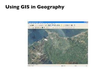
- 1. Using GIS in Geography
- 2. GIS allows us to view, understand, question, interpret, and visualize data in many ways that reveal relationships, patterns, and trends in the form of maps, globes, reports, and charts.
- 3. GIS is a changeable map!! It is a series of complex geographical data and is simply a route by which this data can be analysed and explored.
- 4. GIS allows us to overlay different types of information onto maps of the same area. This is just like using tracing paper or transparent overlays. With GIS we can link map data with information that is not shown on maps. This linked information can be anything! However, as the data is digital these overlays can be created using lots of data and then manipulated to produce original maps and help us make informed geographical decisions.
- 5. GIS is everywhere! For example: Emergency services such as the Fire Brigade, Police and Ambulance service have all used GIS to speed up response times to accidents and emergencies thus saving lives. Even pizza companies utilise GIS to ensure that deliveries reach households efficiently!
- 6. A GIS helps you answer questions and solve problems by looking at your data in a way that is quickly understood and easily shared
- 7. Advantages of GIS The key advantage of GIS is that all the functionality for working with multiple sets of geographic information are embedded into one piece of software and it is quick and efficient. For example it can:
- 8. Advantages of GIS The key advantage of GIS is that all the functionality for working with multiple sets of geographic information are embedded into one piece of software and it is quick and efficient. For example it can: •Cover large areas
- 9. Advantages of GIS The key advantage of GIS is that all the functionality for working with multiple sets of geographic information are embedded into one piece of software and it is quick and efficient. For example it can: •Cover large areas •Cope with large amounts of data
- 10. Advantages of GIS The key advantage of GIS is that all the functionality for working with multiple sets of geographic information are embedded into one piece of software and it is quick and efficient. For example it can: •Cover large areas •Cope with large amounts of data •Cope with unlimited and frequent editing/ changing
- 11. Advantages of GIS The key advantage of GIS is that all the functionality for working with multiple sets of geographic information are embedded into one piece of software and it is quick and efficient. For example it can: •Cover large areas •Cope with large amounts of data •Cope with unlimited and frequent editing/ changing •Select any sub-study area
- 12. Advantages of GIS The key advantage of GIS is that all the functionality for working with multiple sets of geographic information are embedded into one piece of software and it is quick and efficient. For example it can: •Cover large areas •Cope with large amounts of data •Cope with unlimited and frequent editing/ changing •Select any sub-study area •Act faster and more efficiently than manual approaches
- 13. What GIS does GIS has a number of functions including:
- 14. What GIS does GIS has a number of functions including: Distance: calculate distance between features
- 15. What GIS does GIS has a number of functions including: Distance: calculate distance between features Overlay: display multiple layers of information
- 16. What GIS does GIS has a number of functions including: Distance: calculate distance between features Overlay: display multiple layers of information Merge: combines multiple layers into one layer
- 17. What GIS does GIS has a number of functions including: Distance: calculate distance between features Overlay: display multiple layers of information Merge: combines multiple layers into one layer 3D: data can be viewed in 3 – dimensions
- 18. What GIS does GIS has a number of functions including: Distance: calculate distance between features Overlay: display multiple layers of information Merge: combines multiple layers into one layer 3D: data can be viewed in 3 – dimensions Select: identify features and their attributes
- 19. What GIS does GIS has a number of functions including: Distance: calculate distance between features Overlay: display multiple layers of information Merge: combines multiple layers into one layer 3D: data can be viewed in 3 – dimensions Select: identify features and their attributes Query: ask questions such as where is? What is the nearest?
- 20. What GIS does GIS has a number of functions including: Distance: calculate distance between features Overlay: display multiple layers of information Merge: combines multiple layers into one layer 3D: data can be viewed in 3 – dimensions Select: identify features and their attributes Query: ask questions such as where is? What is the nearest? Mapping and Cartography: create an output map
- 22. Some more GIS uses:
- 23. Some more GIS uses: Palm tops can be used in the field to measure and record information.
- 24. Some more GIS uses: Palm tops can be used in the field to measure and record information. Measuring distance in a straight line.
- 25. Some more GIS uses: Palm tops can be used in the field to measure and record information. Measuring distance in a straight line. Secondary data can be used from a number of sites such as census returns.
- 26. Some more GIS uses: Palm tops can be used in the field to measure and record information. Measuring distance in a straight line. Secondary data can be used from a number of sites such as census returns. Aerial photos can be secondary data.
- 28. Data can be displayed on the map.
- 29. Data can be displayed on the map. Data can be visualised. It is possible to manipulate and edit the data with colours.
- 30. Data can be displayed on the map. Data can be visualised. It is possible to manipulate and edit the data with colours. Dimensions can give a powerful visual impact.
- 31. Data can be displayed on the map. Data can be visualised. It is possible to manipulate and edit the data with colours. Dimensions can give a powerful visual impact. Data can be overlaid to enable comparisons.
- 32. Data can be displayed on the map. Data can be visualised. It is possible to manipulate and edit the data with colours. Dimensions can give a powerful visual impact. Data can be overlaid to enable comparisons. It is easy to change the data so patterns can be seen clearly.
- 34. GIS allows the ability to ask Where is......... What's the nearest............
- 35. GIS allows the ability to ask Where is......... What's the nearest............ GIS allows the researcher to show certain features...
- 36. Common use of GIS
- 37. Modelling and Simulation See GoogleEarth!