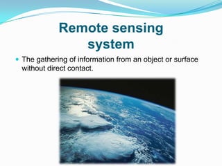
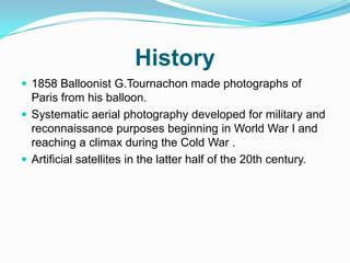
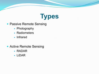
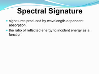
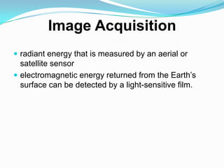
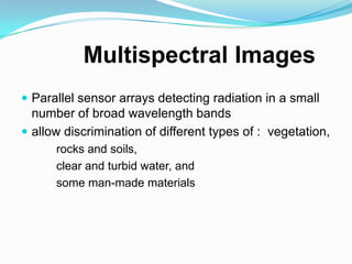
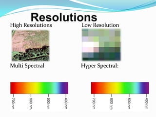
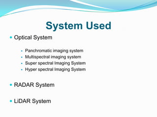
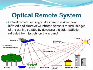
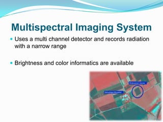
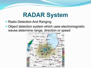
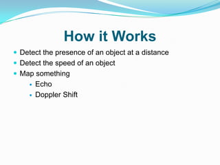
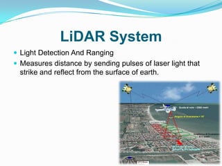
INTRODUCTION
Remote sensing
                system
 The gathering of information from an object or surface
  without direct contact.
History
 1858 Balloonist G.Tournachon made photographs of
  Paris from his balloon.
 Systematic aerial photography developed for military and
  reconnaissance purposes beginning in World War I and
  reaching a climax during the Cold War .
 Artificial satellites in the latter half of the 20th century.
Types
 Passive Remote Sensing
     Photography

     Radiometers

     Infrared


 Active Remote Sensing
     RADAR

     LiDAR
Applications
 Forestry


 Agriculture


 Hydrology


 Sea Ice


 Land Cover & Land Use
Techniques
 Spectral Signatures

 Image Acquisition

 Spatial Resolution

 Spectral Resolution

 Multispectral Images

 Radiometric Resolution
 signatures produced by wavelength-dependent
  absorption.
 the ratio of reflected energy to incident energy as a
  function.
 radiant energy that is measured by an aerial or
  satellite sensor
 electromagnetic energy returned from the Earth’s
  surface can be detected by a light-sensitive film.
 a function of the design of the sensor
 detectors in a remote sensor measures energy received
 from a finite patch of the ground surface
 Parallel sensor arrays detecting radiation in a small
  number of broad wavelength bands
 allow discrimination of different types of : vegetation,
      rocks and soils,
      clear and turbid water, and
      some man-made materials
 Quantized incoming energy
 analyze the numerical values in the bands of a
 multispectral image
High Resolutions   Low Resolution


Multi Spectral     Hyper Spectral:
System Used
 Optical System

       Panchromatic imaging system
       Multispectral imaging system
       Super spectral Imaging System
       Hyper spectral Imaging System


 RADAR System


 LiDAR System
Optical Remote System
 Optical remote sensing makes use of visible, near
 infrared and short-wave infrared sensors to form images
 of the earth's surface by detecting the solar radiation
 reflected from targets on the ground.
Panchromatic Imaging System
 A single channel sensor is used to detect radiation
 If range of wavelength and the visible range become
  same then the imagery will appear as a black and white
  photograph taken from space
Multispectral Imaging System
 Uses a multi channel detector and records radiation
 with a narrow range

 Brightness and color informatics are available
Super Spectral Imaging System
 Finer spectral feature that capture by the sensors.
RADAR System
 Radio Detection And Ranging
 Object detection system which uses electromagnetic
 waves determine range, direction or speed
How it Works
 Detect the presence of an object at a distance
 Detect the speed of an object
 Map something
       Echo
       Doppler Shift
LiDAR System
 Light Detection And Ranging
 Measures distance by sending pulses of laser light that
  strike and reflect from the surface of earth.
REFERENCES
 http://www.howstuffworks.com/radar.htm
 http://www.physicalgeography.net/fundamentals/
  2e.html
 www.howstuffworks.com
 www.remotesearch.in
 http://www.tutavivito.com
Ppt on remote sensing system

Ppt on remote sensing system

  • 2.
  • 3.
    Remote sensing system  The gathering of information from an object or surface without direct contact.
  • 4.
    History  1858 BalloonistG.Tournachon made photographs of Paris from his balloon.  Systematic aerial photography developed for military and reconnaissance purposes beginning in World War I and reaching a climax during the Cold War .  Artificial satellites in the latter half of the 20th century.
  • 5.
    Types  Passive RemoteSensing  Photography  Radiometers  Infrared  Active Remote Sensing  RADAR  LiDAR
  • 6.
    Applications  Forestry  Agriculture Hydrology  Sea Ice  Land Cover & Land Use
  • 7.
    Techniques  Spectral Signatures Image Acquisition  Spatial Resolution  Spectral Resolution  Multispectral Images  Radiometric Resolution
  • 8.
     signatures producedby wavelength-dependent absorption.  the ratio of reflected energy to incident energy as a function.
  • 9.
     radiant energythat is measured by an aerial or satellite sensor  electromagnetic energy returned from the Earth’s surface can be detected by a light-sensitive film.
  • 10.
     a functionof the design of the sensor  detectors in a remote sensor measures energy received from a finite patch of the ground surface
  • 11.
     Parallel sensorarrays detecting radiation in a small number of broad wavelength bands  allow discrimination of different types of : vegetation, rocks and soils, clear and turbid water, and some man-made materials
  • 12.
     Quantized incomingenergy  analyze the numerical values in the bands of a multispectral image
  • 13.
    High Resolutions Low Resolution Multi Spectral Hyper Spectral:
  • 14.
    System Used  OpticalSystem  Panchromatic imaging system  Multispectral imaging system  Super spectral Imaging System  Hyper spectral Imaging System  RADAR System  LiDAR System
  • 15.
    Optical Remote System Optical remote sensing makes use of visible, near infrared and short-wave infrared sensors to form images of the earth's surface by detecting the solar radiation reflected from targets on the ground.
  • 16.
    Panchromatic Imaging System A single channel sensor is used to detect radiation  If range of wavelength and the visible range become same then the imagery will appear as a black and white photograph taken from space
  • 17.
    Multispectral Imaging System Uses a multi channel detector and records radiation with a narrow range  Brightness and color informatics are available
  • 18.
    Super Spectral ImagingSystem  Finer spectral feature that capture by the sensors.
  • 19.
    RADAR System  RadioDetection And Ranging  Object detection system which uses electromagnetic waves determine range, direction or speed
  • 20.
    How it Works Detect the presence of an object at a distance  Detect the speed of an object  Map something  Echo  Doppler Shift
  • 21.
    LiDAR System  LightDetection And Ranging  Measures distance by sending pulses of laser light that strike and reflect from the surface of earth.
  • 22.
    REFERENCES  http://www.howstuffworks.com/radar.htm  http://www.physicalgeography.net/fundamentals/ 2e.html  www.howstuffworks.com  www.remotesearch.in  http://www.tutavivito.com