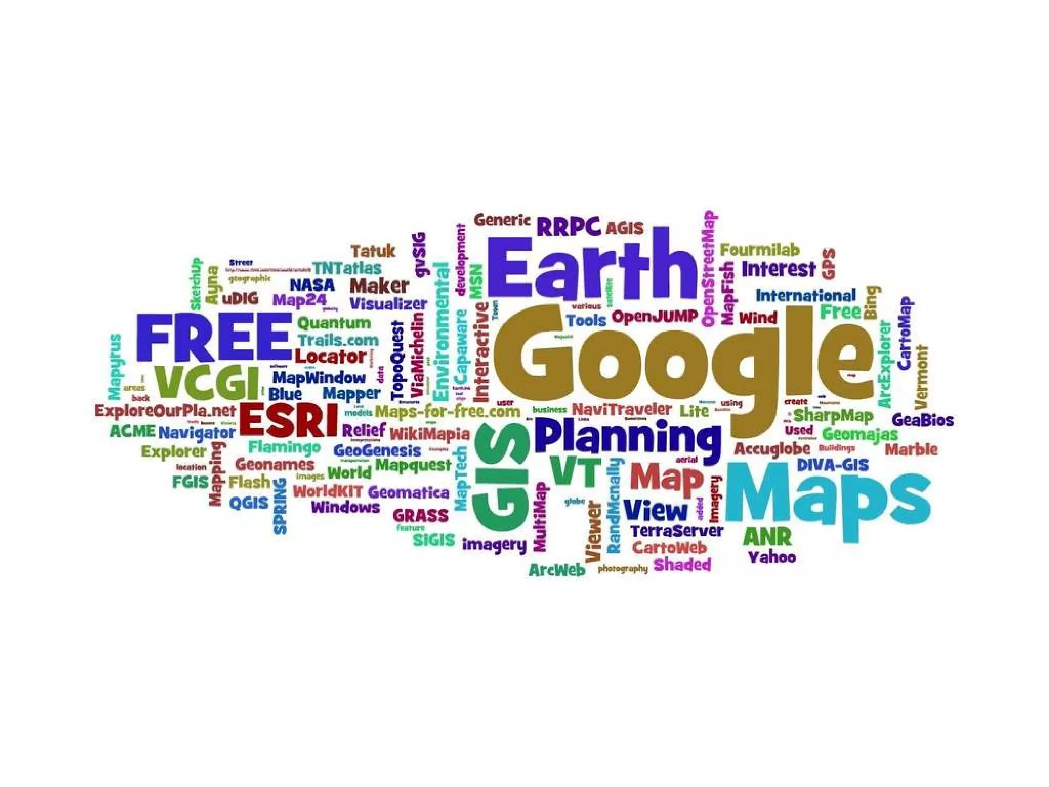
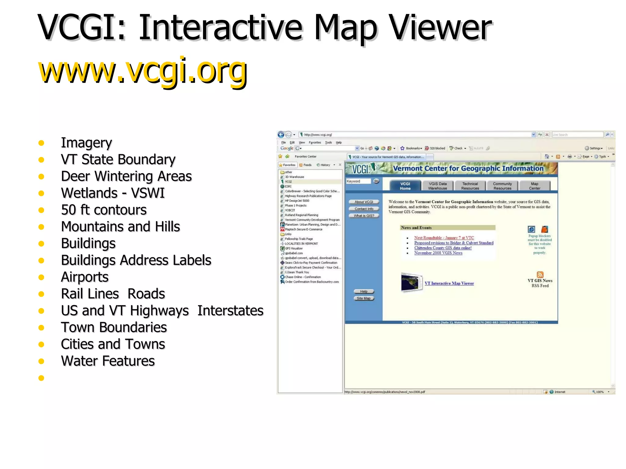
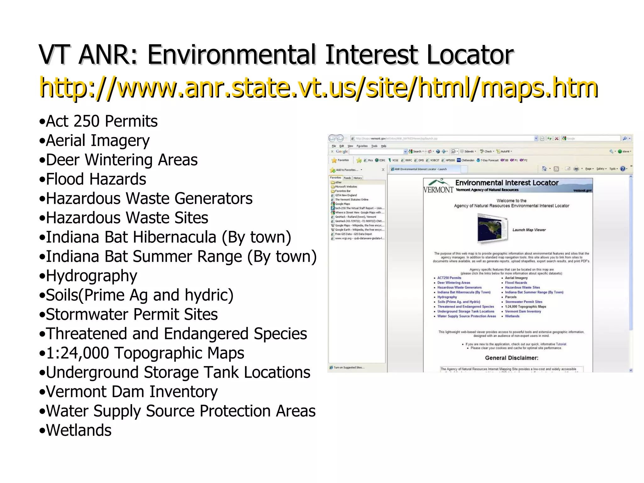
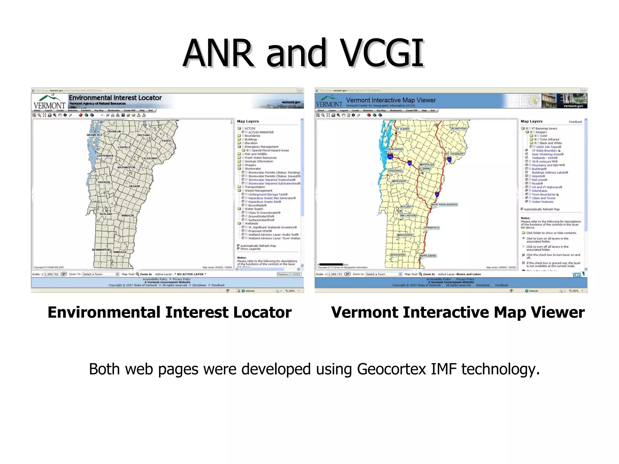
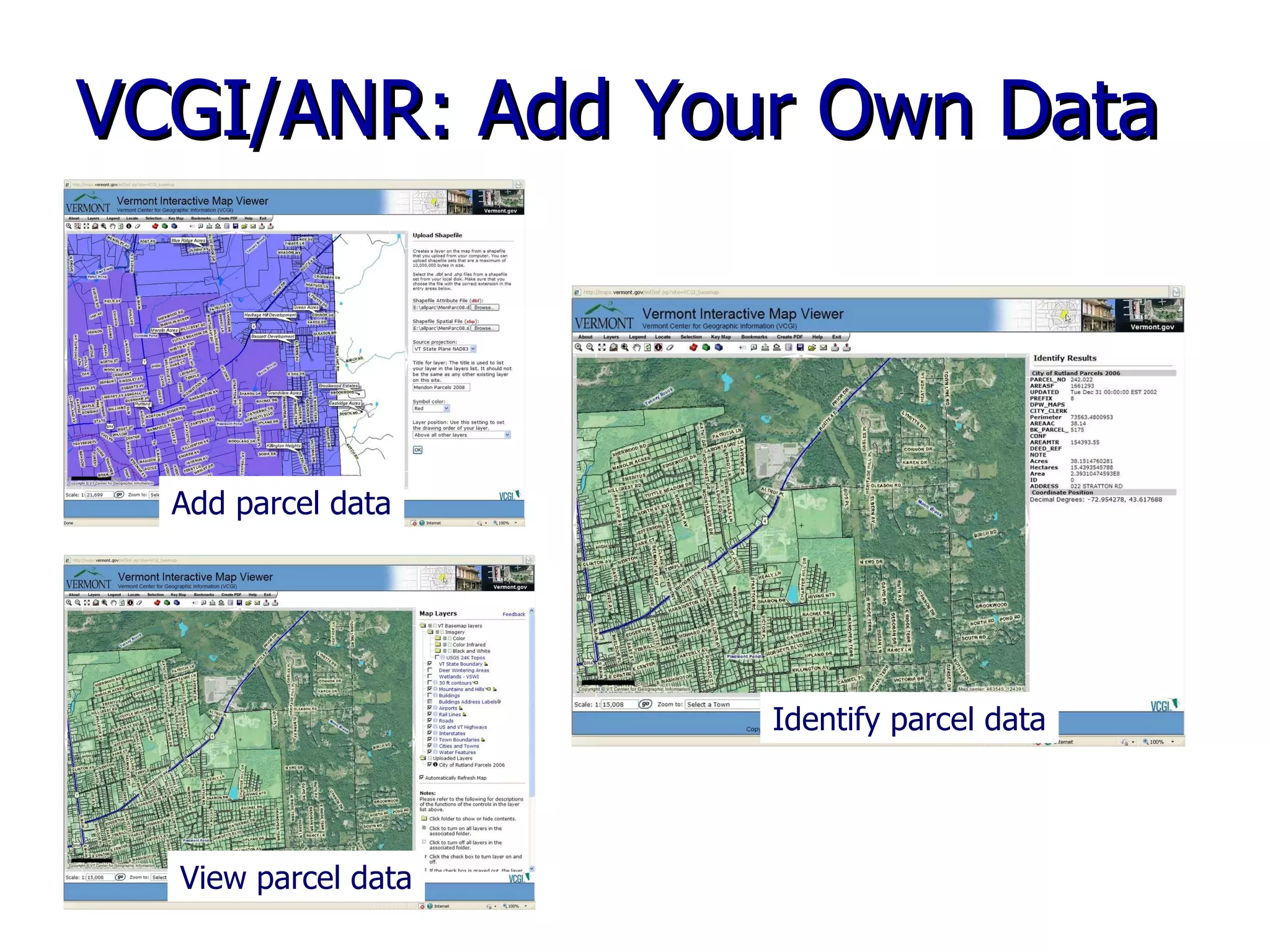
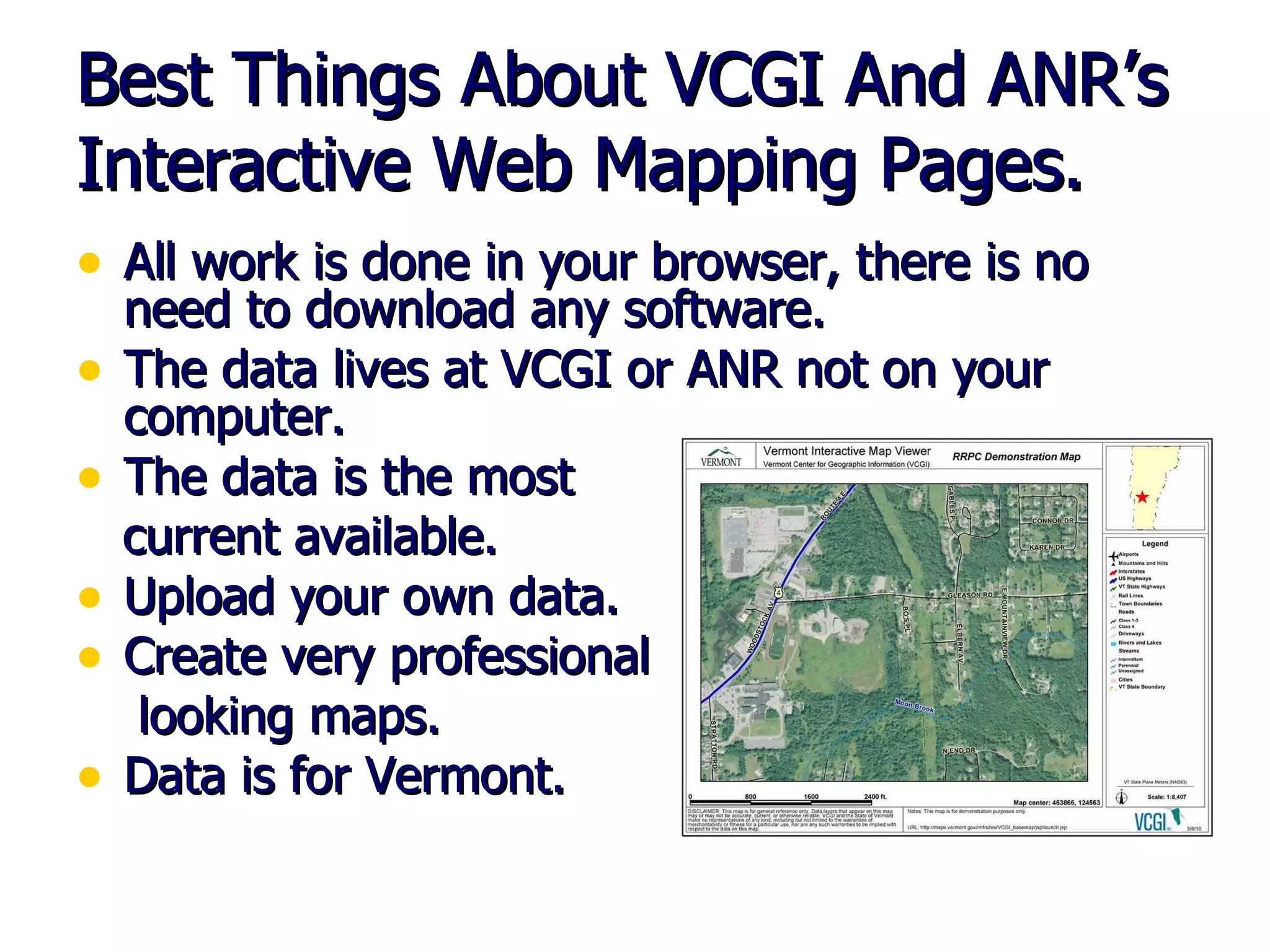
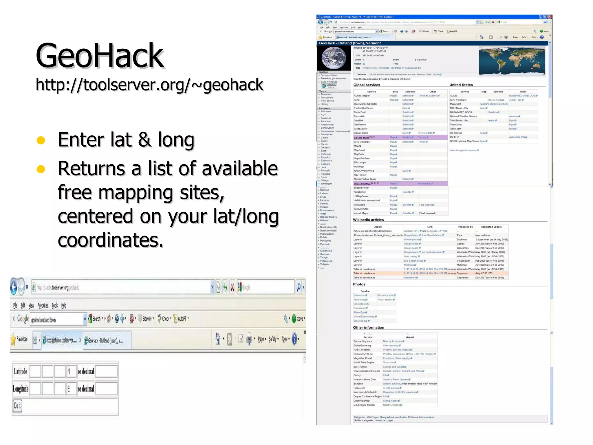
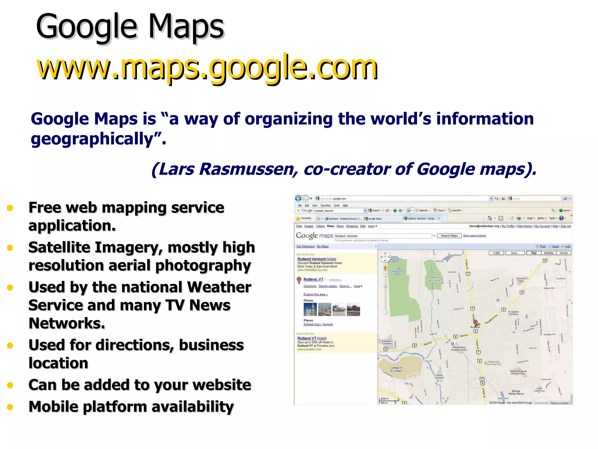
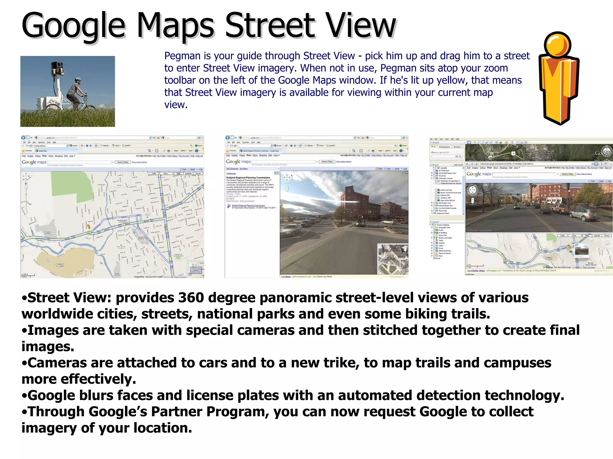
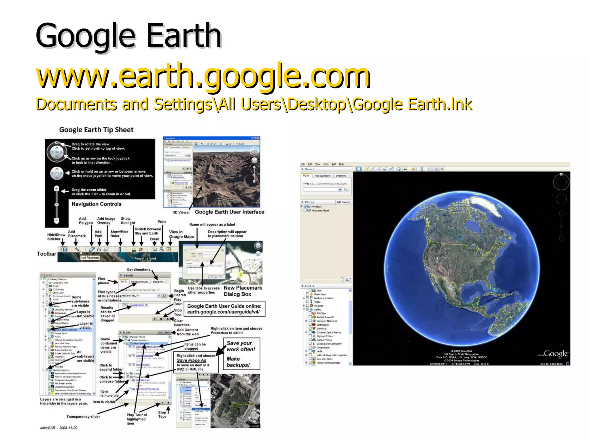
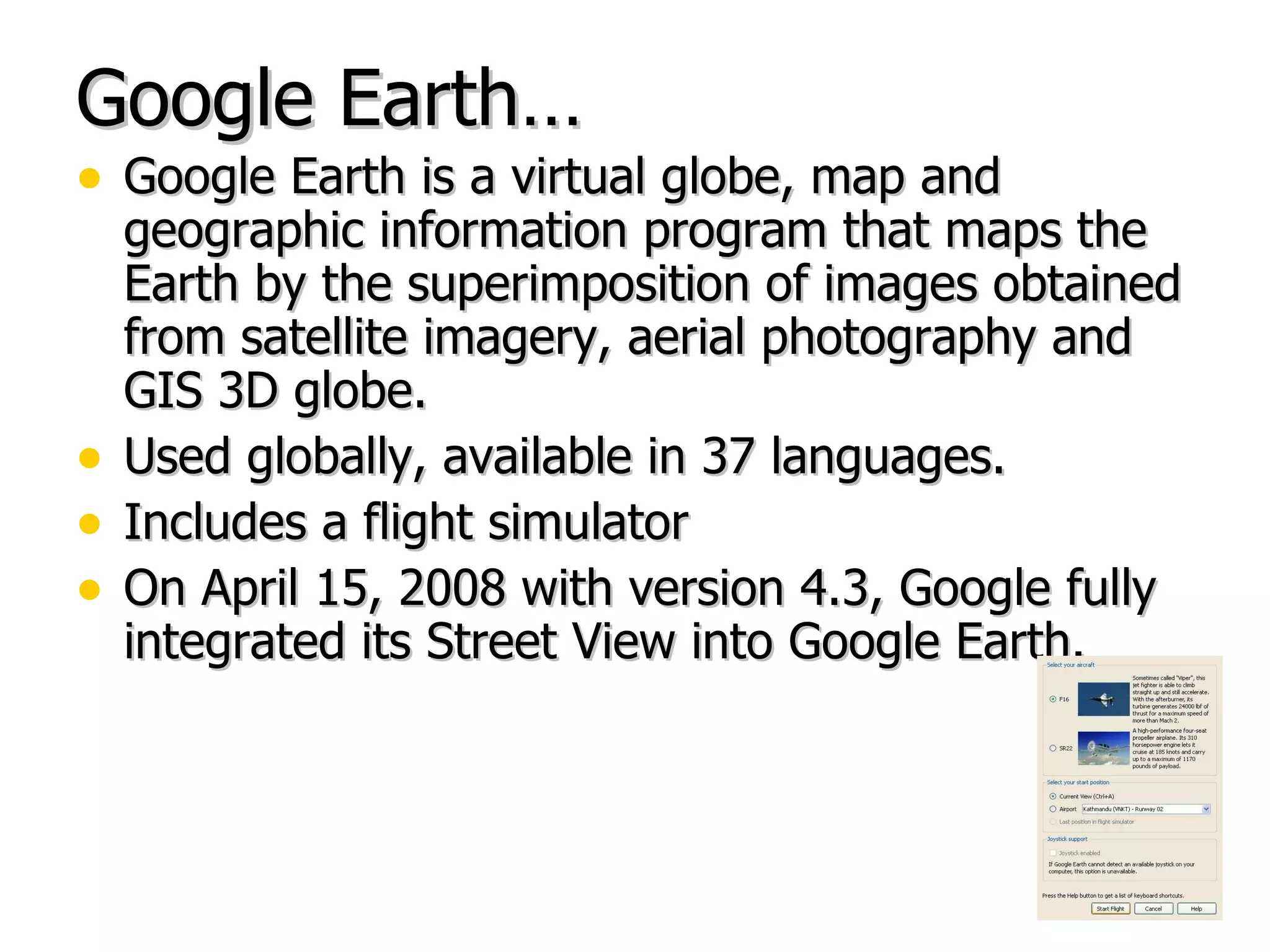
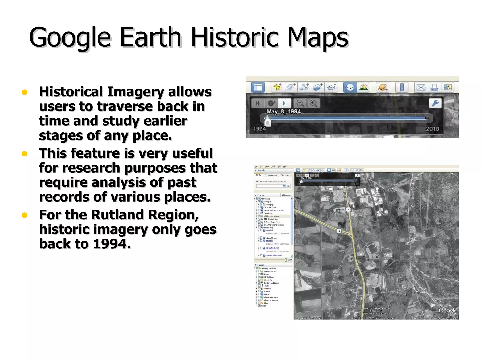
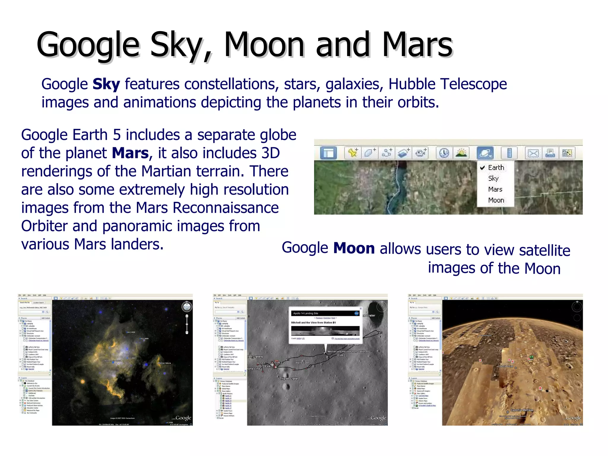
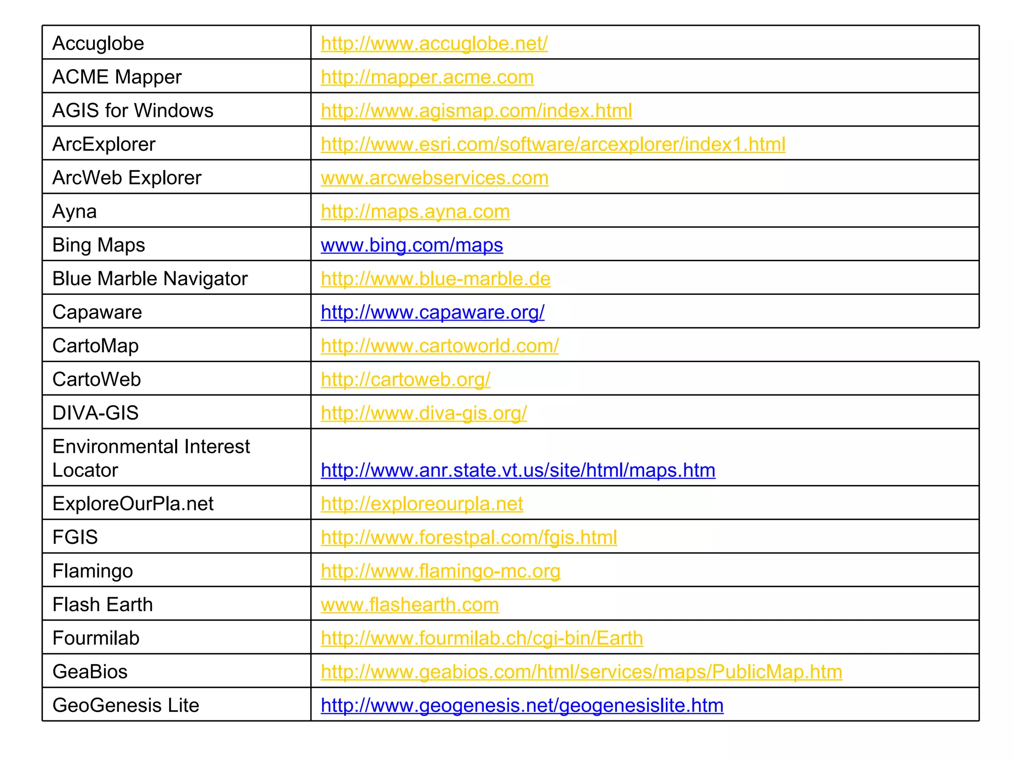
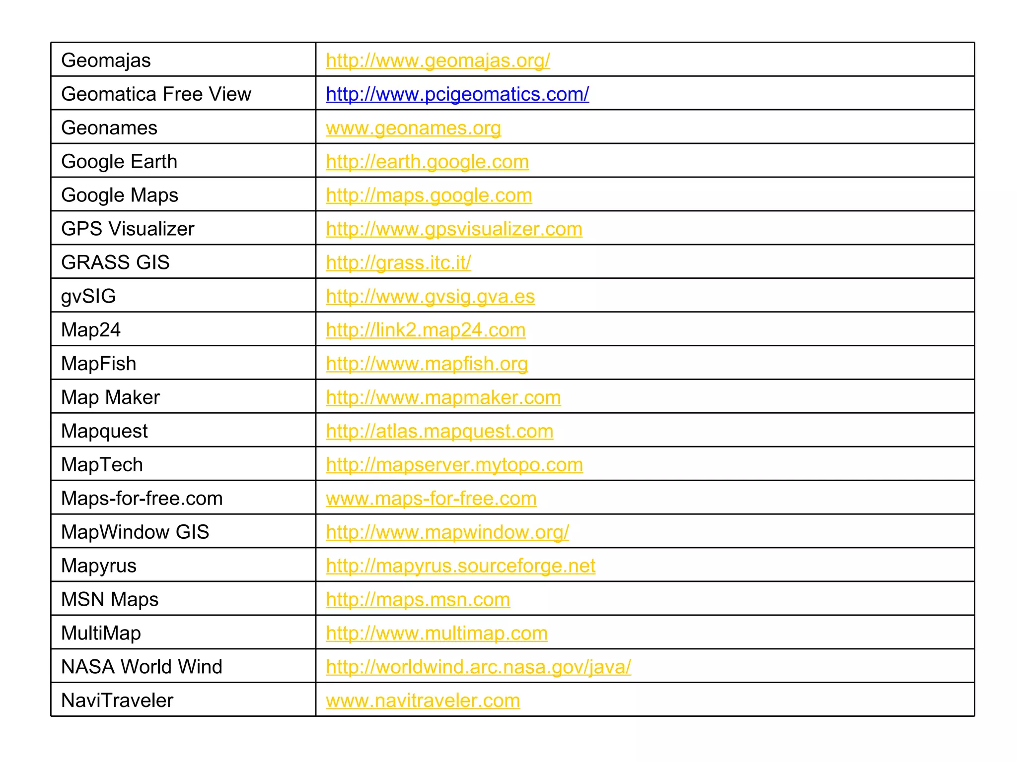
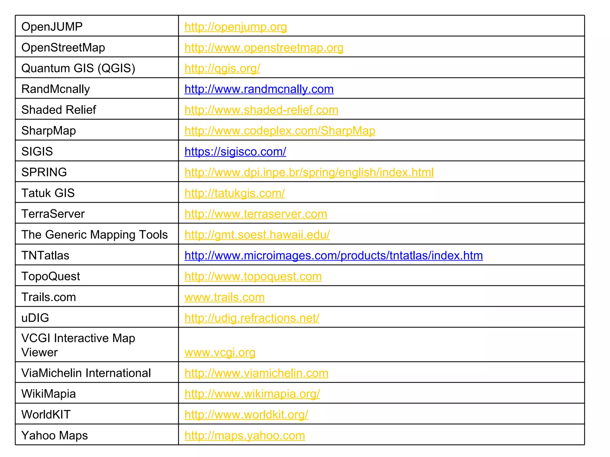
The document outlines various interactive mapping resources and tools available for comprehensive planning in Vermont, highlighting platforms such as the Vermont Center for Geographic Information and Google Maps. It details features ranging from environmental interest locators to street view capabilities, including information on GIS technology and its applications. Additionally, it presents a variety of free geo viewers and GIS software options that can be useful for town planning and analysis.
![“ There seem at present to be two distinct groups of humanitarian practitioners: those who are already, albeit tentatively, exploiting Google Earth and related geospatial methods in their work, and those who will be, as soon as they see their first demonstration of its potential.” (MapAction, 2008:9) Steve Schild Rutland Regional Planning Commission [email_address] 775-0871, ext. 206 www.rutlandrpc.org THANK YOU!](https://image.slidesharecdn.com/steveschild-freegis-101213144532-phpapp02/75/Free-GIS-Resources-27-2048.jpg)