Download to read offline
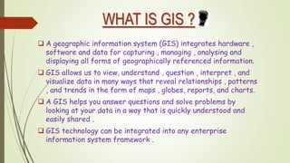
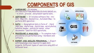
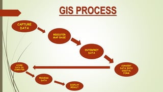
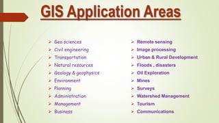

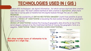
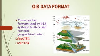
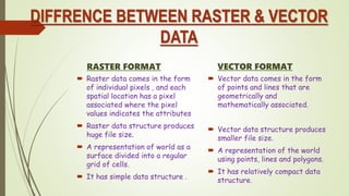
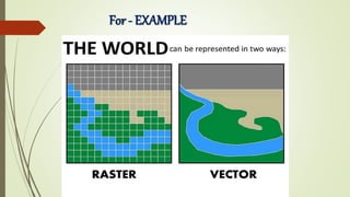

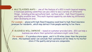


This document provides an overview of geographic information systems (GIS). It begins with a definition of GIS as a system that integrates hardware, software, and data to capture, store, analyze and display spatially referenced information. The document then outlines the historical background of GIS, the key components including hardware, software, data, procedures and personnel. It also describes the GIS process, common application areas, what makes GIS unique in its ability to handle spatial information, technologies used in GIS like digitization, and the two main data formats of raster and vector. Finally, it discusses the importance of GIS for urban planning by allowing layered maps and helping businesses target customers.


![[Deck] What's New in Spark-Iceberg Integration via DSV2.pptx](https://cdn.slidesharecdn.com/ss_thumbnails/deckwhatsnewinspark-icebergintegrationviadsv2-260210005337-25955b12-thumbnail.jpg?width=640&height=640&fit=bounds)


