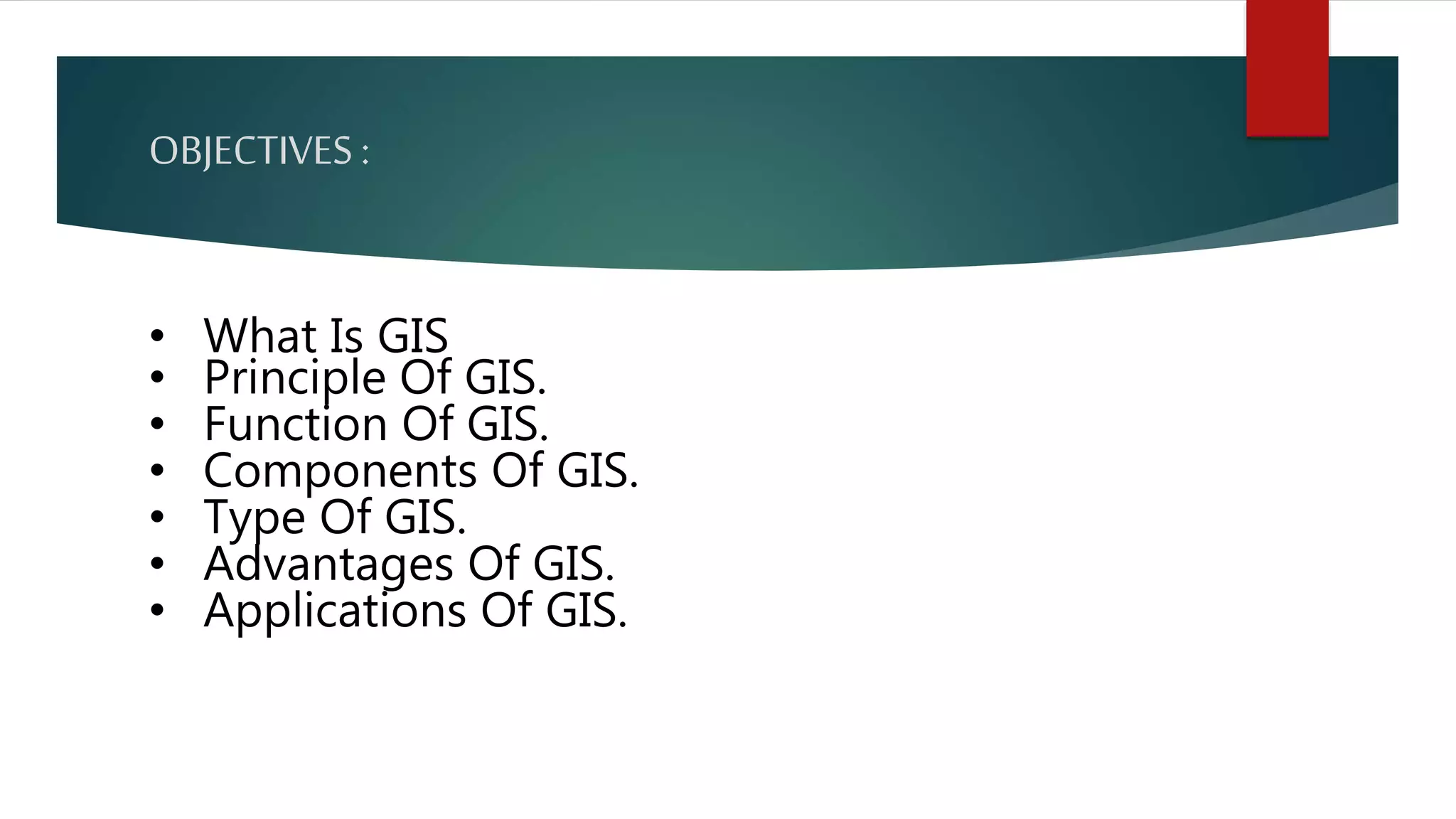
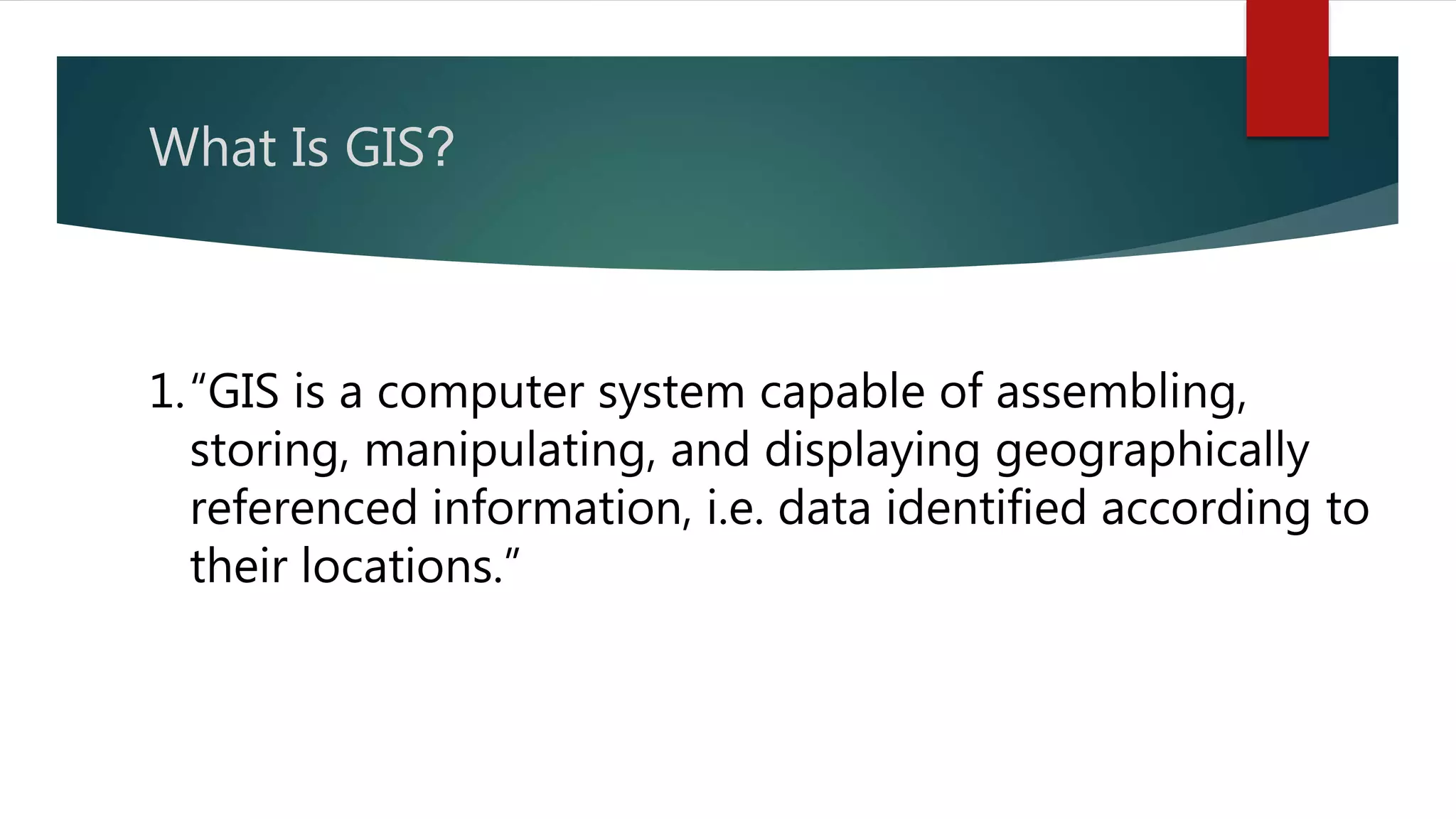
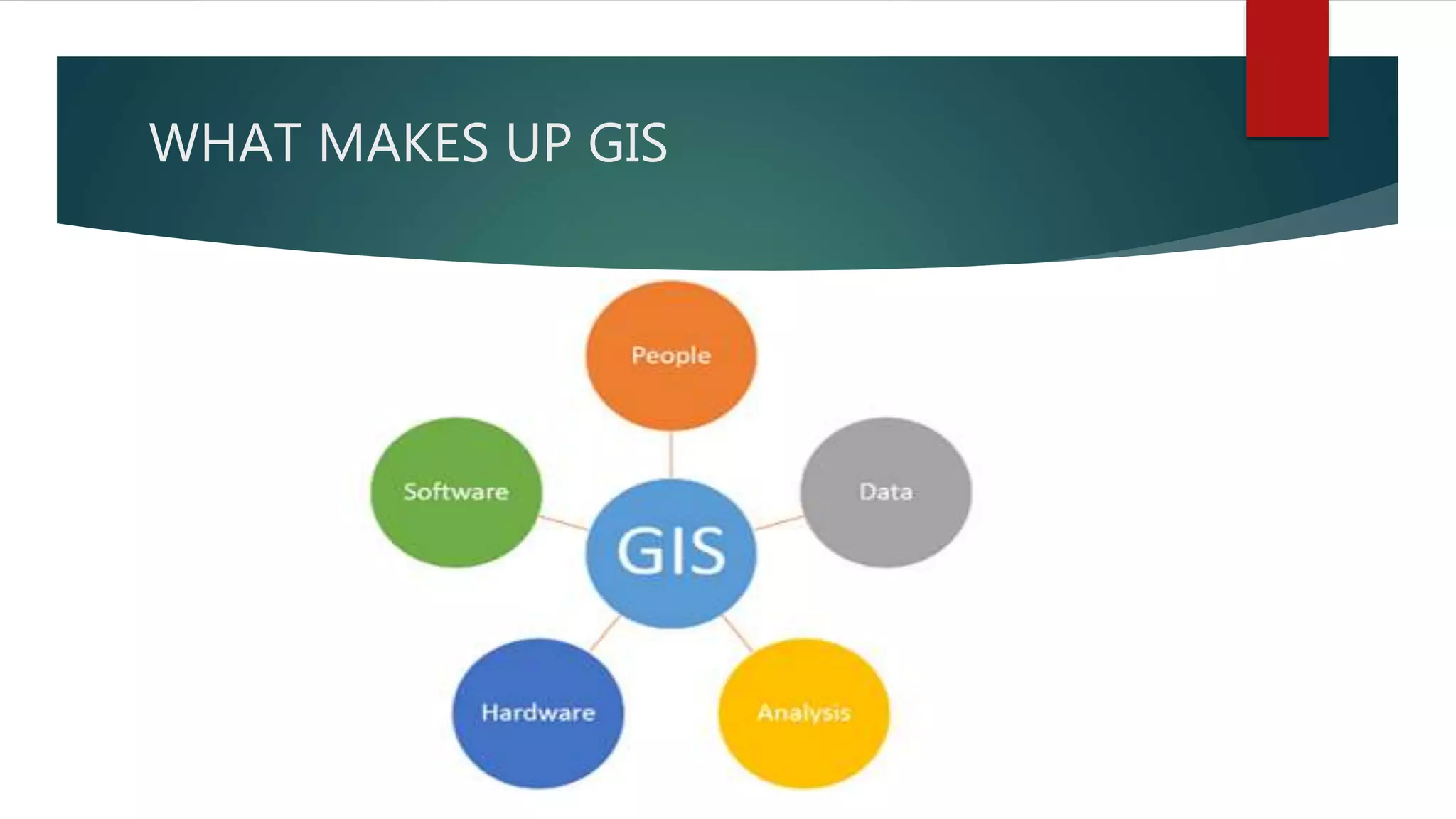
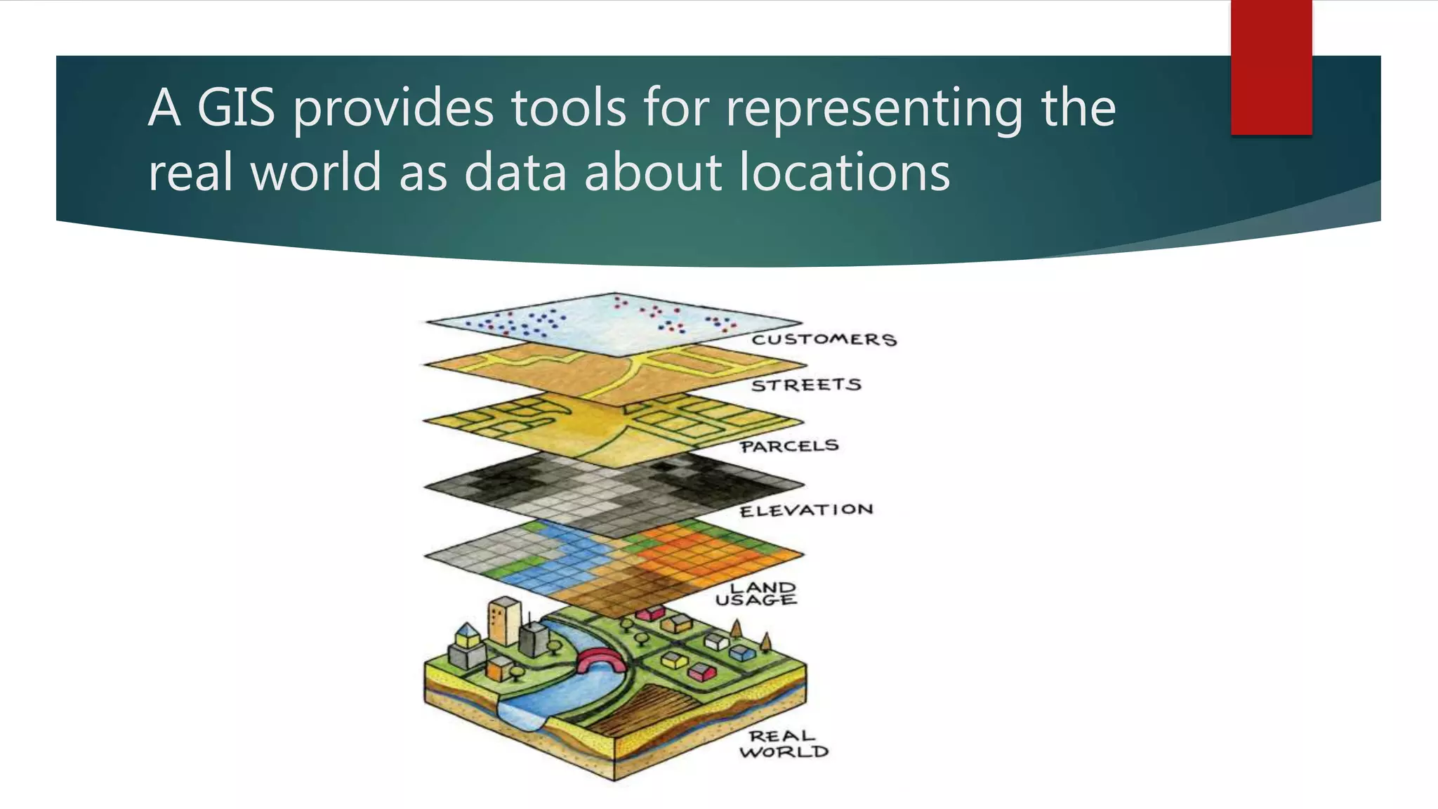
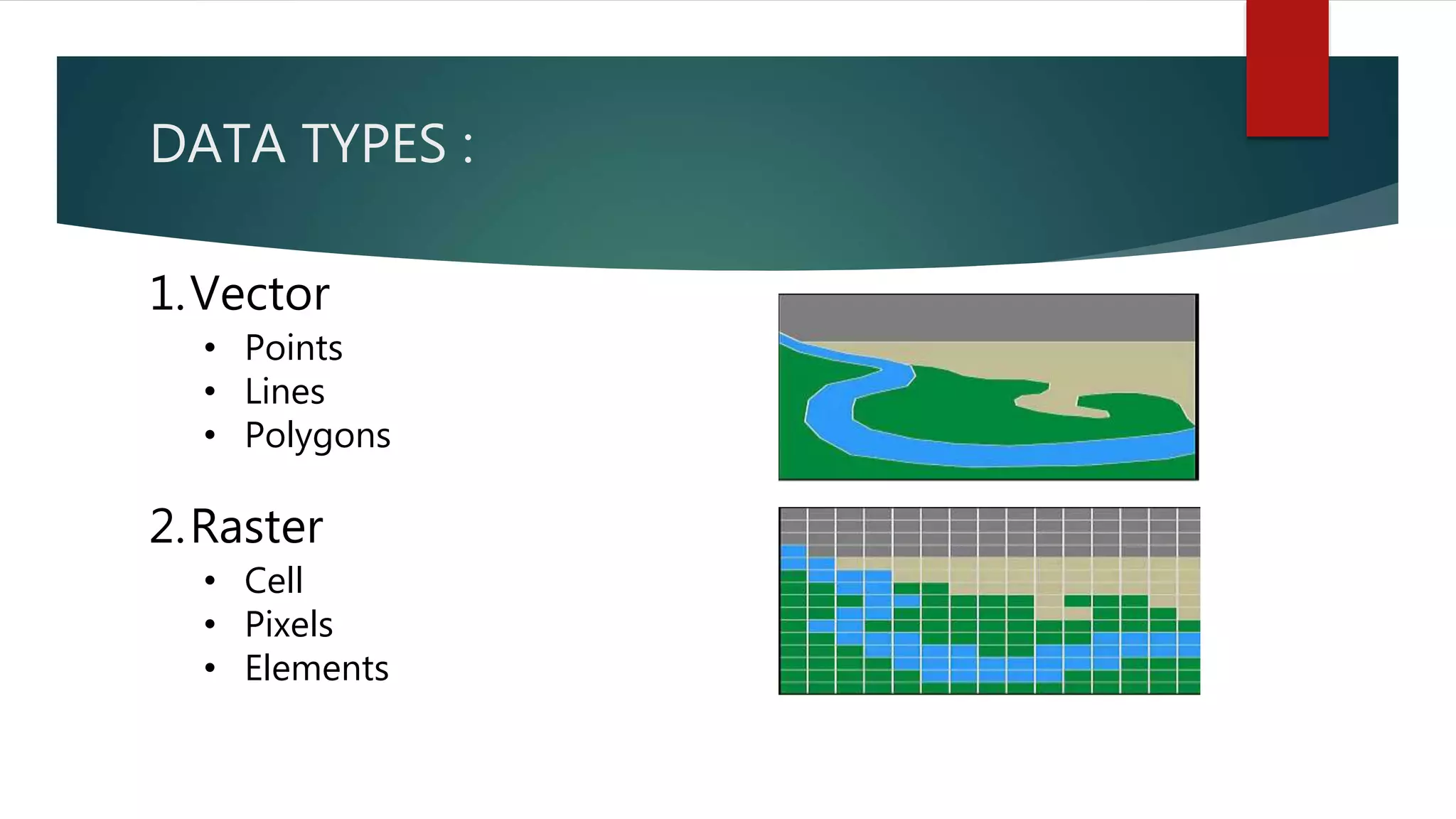
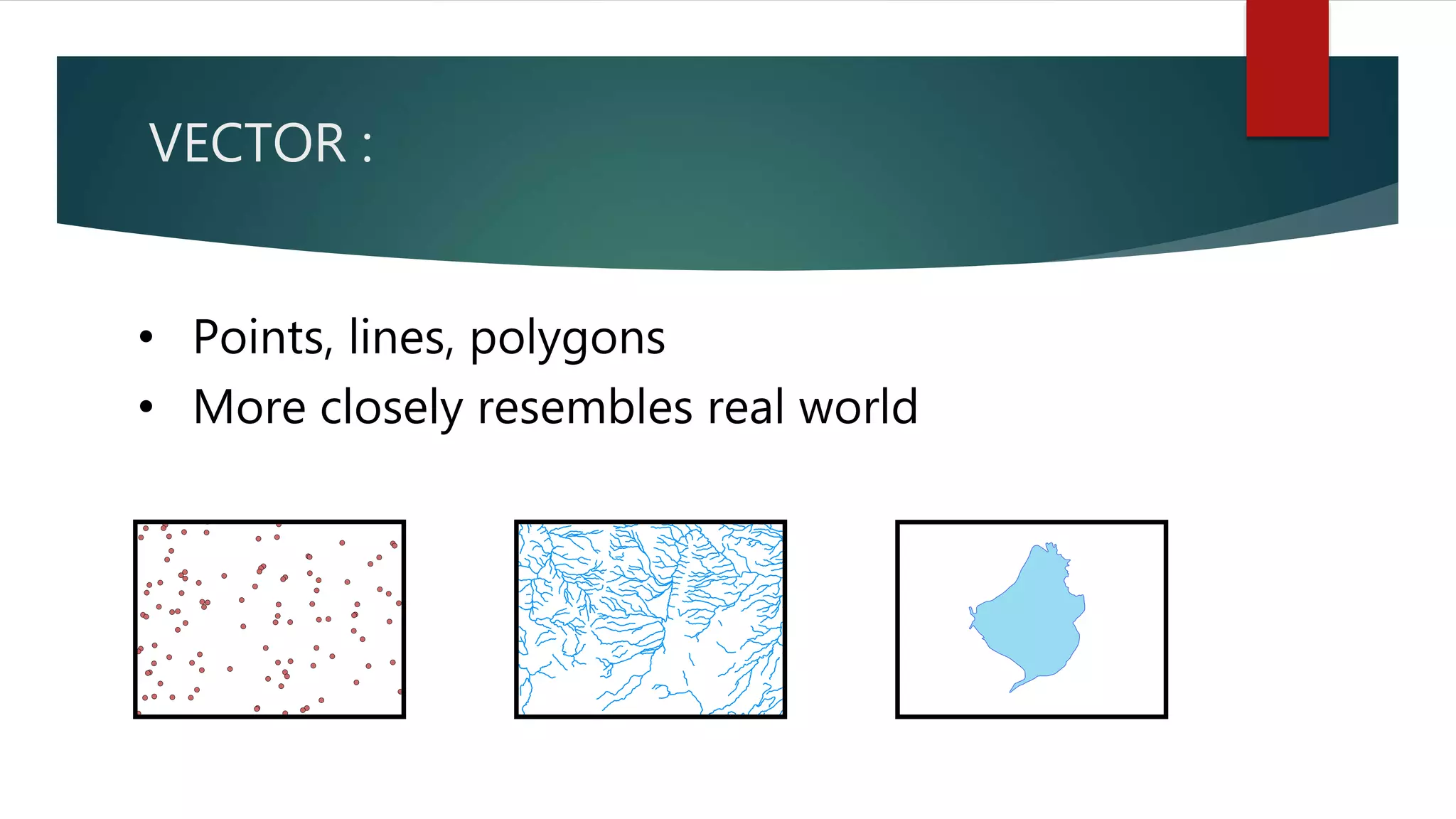
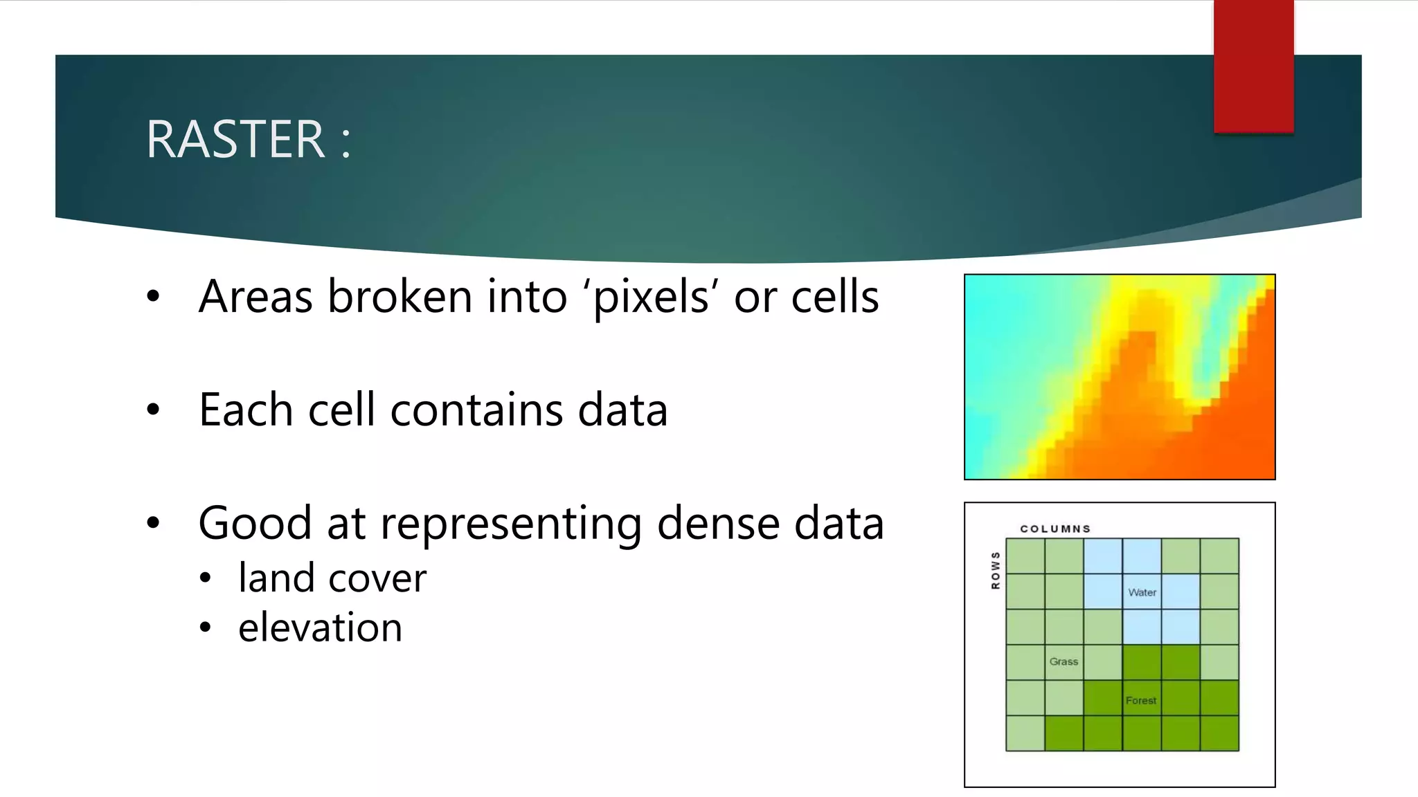
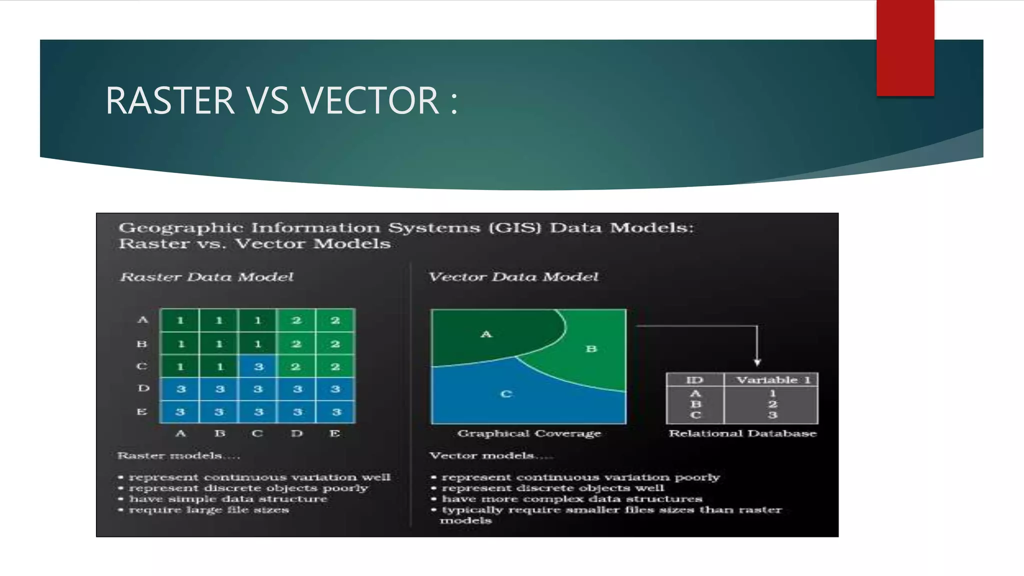
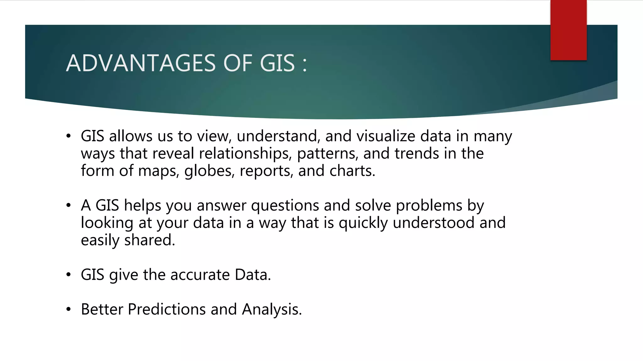
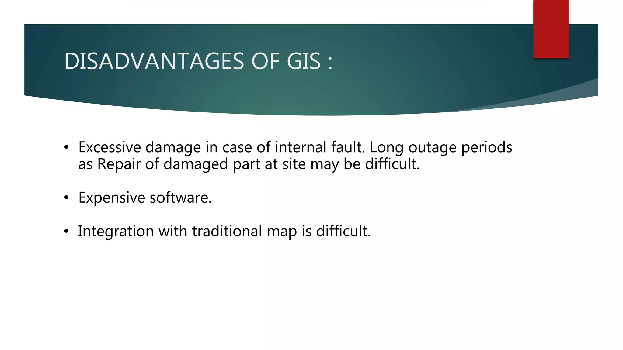
SlideShare a Scribd company logo
1 of 23
GIS
GEOGRAPHICAL INFORMATIONSYSTEM
UNIVERSITY OF SINDH
GROUP MEMBERS
• Name Roll#
• M.HAMZA KHAN 97
• MUHAMMAD MANAL 100
• SHAHZAIB ALI 146
• ZOHAIB HASSAN 194
• TALHA KHAN 161
OBJECTIVES :
• What Is GIS
• Principle Of GIS.
• Function Of GIS.
• Components Of GIS.
• Type Of GIS.
• Advantages Of GIS.
• Applications Of GIS.
What Is GIS?
1.“GIS is a computer system capable of assembling,
storing, manipulating, and displaying geographically
referenced information, i.e. data identified according to
their locations.”
What Is GIS?
2. “A GIS is an organized collection of computer
hardware, software, geographic data, and personnel to
efficiently capture, store, update, manipulate, analyze,
and display all forms of geographically referenced
information.”
WHAT MAKES UP GIS
A GIS provides tools for representing the
real world as data about locations
PRINCIPLE :
1. Data Capture
• Data sources are mainly obtained from manual digitization and
scanning of aerial photographs, paper maps, and existing digital data
sets.
2. Database Management and Update
• data security, data integrity, and data storage and retrieval, and data
maintenance abilities
PRINCIPLE :
3. Geographic Analysis
• The collected information is analyzed and interpreted qualitatively
and quantitatively.
4. Preparing Result
• One of the most exciting aspects of GIS technology is the variety of
different ways in which the information can be presented.
FUNCTIONS :
1. Data Capture
• The input of data into a GIS can be achieved through many different
methods of gathering. For example, aerial photography, scanning,
digitizing, GPS or global positioning system is just a few of the ways a
GIS user could obtain data.
2. Data Storage
• Some data is stored such as a map in a drawer, while others, such as
digital data, can be as a hardcopy, stored on CD or on your hard drive
FUNCTIONS :
3. Data Manipulation
• The digital geographical data can be edited, this allows for many
attribute to be added, edited, or deleted to the specification of the
project.
4. Query And Analysis
• GIS was used widely in decision making process for the new
commission districts. We use population data to help establish an
equal representation of population to area for each district.
5. Visualization
• This represents the ability to display your data, your maps, and
information.
COMPONENTS :
1. Hardware
• Computer System, Scanner, Printer, Plotter, Flat Board
2. Software
• GIS software in use are MapInfo, ARC/Info, AutoCAD Map, etc. The
software available can be said to be application specific.
3. Data
• A GIS will integrate spatial data with other data resources and can
even use a DBMS, used by most organization to maintain their data,
to manage spatial data.
• Geographic data and related tabular data can be collected in-house
or purchased from a commercial data provider.
COMPONENTS :
4. People
• GIS users range from technical specialists who design and
maintain.
5. Method
• The map creation can either be automated raster to
vector creator or it can be manually victories using the
scanned images
DATA TYPES :
1.Vector
• Points
• Lines
• Polygons
2.Raster
• Cell
• Pixels
• Elements
VECTOR :
• Points, lines, polygons
• More closely resembles real world
RASTER :
• Areas broken into ‘pixels’ or cells
• Each cell contains data
• Good at representing dense data
• land cover
• elevation
RASTER VS VECTOR :
VECTOR :
• ADVANTAGES
 Good Representation of data.
 Use small File Size.
 Accurate map output.
• DISADVANTAGES
 Complex Data Structure.
 Expensive Technology.
 Analysis is Complex.
RASTER :
• ADVANTAGES
 Simple Data Structure.
 Cheap Technology.
 Analysis is Simple.
 Same grid cell for several attributes
• DISADVANTAGES
 Large Data Volume.
 Inefficient use of computer storage.
 Difficult network analysis.
 Less accurate or attractive maps.
 Loss of information when using large
cells
ADVANTAGES OF GIS :
• GIS allows us to view, understand, and visualize data in many
ways that reveal relationships, patterns, and trends in the
form of maps, globes, reports, and charts.
• A GIS helps you answer questions and solve problems by
looking at your data in a way that is quickly understood and
easily shared.
• GIS give the accurate Data.
• Better Predictions and Analysis.
DISADVANTAGES OF GIS :
• Excessive damage in case of internal fault. Long outage periods
as Repair of damaged part at site may be difficult.
• Expensive software.
• Integration with traditional map is difficult.
THANK YOU !
Any Questions ?

More Related Content

What's hot

MODERN trends of GIS
MODERN trends of GISMODERN trends of GIS
MODERN trends of GISVAISHALI JAIN
 
GIS presentation
GIS presentationGIS presentation
GIS presentationarniontech
 
Introduction to GIS
Introduction to GISIntroduction to GIS
Introduction to GISKU Leuven
 
Raster data model
Raster data modelRaster data model
Raster data modelPramoda Raj
 
Geo referencing by Mashhood Arif
Geo referencing by Mashhood ArifGeo referencing by Mashhood Arif
Geo referencing by Mashhood ArifKU Leuven
 
GEOGRAPHICAL INFORMATION SYSTEM (GIS)
GEOGRAPHICAL INFORMATION SYSTEM (GIS)GEOGRAPHICAL INFORMATION SYSTEM (GIS)
GEOGRAPHICAL INFORMATION SYSTEM (GIS)subhashB10
 
An introduction to geographic information systems (gis) m goulbourne 2007
An introduction to geographic information systems (gis)   m goulbourne 2007An introduction to geographic information systems (gis)   m goulbourne 2007
An introduction to geographic information systems (gis) m goulbourne 2007Michelle Goulbourne @ DiaMind Health
 
Lec_6_Intro to geo-referencing
Lec_6_Intro to geo-referencingLec_6_Intro to geo-referencing
Lec_6_Intro to geo-referencingAtiqa khan
 
Image classification, remote sensing, P K MANI
Image classification, remote sensing, P K MANIImage classification, remote sensing, P K MANI
Image classification, remote sensing, P K MANIP.K. Mani
 
What is Geography Information Systems (GIS)
What is Geography Information Systems (GIS)What is Geography Information Systems (GIS)
What is Geography Information Systems (GIS)John Lanser
 

What's hot (20)

MODERN trends of GIS
MODERN trends of GISMODERN trends of GIS
MODERN trends of GIS
 
Basic Gis
Basic GisBasic Gis
Basic Gis
 
History of gis
History of gisHistory of gis
History of gis
 
Raster data and Vector data
Raster data and Vector dataRaster data and Vector data
Raster data and Vector data
 
GIS presentation
GIS presentationGIS presentation
GIS presentation
 
Introduction to GIS
Introduction to GISIntroduction to GIS
Introduction to GIS
 
GIS data structure
GIS data structureGIS data structure
GIS data structure
 
Raster data model
Raster data modelRaster data model
Raster data model
 
Geo referencing by Mashhood Arif
Geo referencing by Mashhood ArifGeo referencing by Mashhood Arif
Geo referencing by Mashhood Arif
 
GIS
GISGIS
GIS
 
GEOGRAPHICAL INFORMATION SYSTEM (GIS)
GEOGRAPHICAL INFORMATION SYSTEM (GIS)GEOGRAPHICAL INFORMATION SYSTEM (GIS)
GEOGRAPHICAL INFORMATION SYSTEM (GIS)
 
Functions of GIS
Functions of GISFunctions of GIS
Functions of GIS
 
An introduction to geographic information systems (gis) m goulbourne 2007
An introduction to geographic information systems (gis)   m goulbourne 2007An introduction to geographic information systems (gis)   m goulbourne 2007
An introduction to geographic information systems (gis) m goulbourne 2007
 
GIS PPT
GIS PPTGIS PPT
GIS PPT
 
Gis functions
Gis functionsGis functions
Gis functions
 
Lec_6_Intro to geo-referencing
Lec_6_Intro to geo-referencingLec_6_Intro to geo-referencing
Lec_6_Intro to geo-referencing
 
GIS data analysis
GIS data analysisGIS data analysis
GIS data analysis
 
Image classification, remote sensing, P K MANI
Image classification, remote sensing, P K MANIImage classification, remote sensing, P K MANI
Image classification, remote sensing, P K MANI
 
Geographical Information System
Geographical Information SystemGeographical Information System
Geographical Information System
 
What is Geography Information Systems (GIS)
What is Geography Information Systems (GIS)What is Geography Information Systems (GIS)
What is Geography Information Systems (GIS)
 

Viewers also liked

Application of GIS (Geographical information system)
Application of GIS (Geographical information system)Application of GIS (Geographical information system)
Application of GIS (Geographical information system)Fayaz Ahamed A P
 
Conception et Développement d'un Network Management System ATM Nortel
Conception et Développement d'un Network Management System ATM NortelConception et Développement d'un Network Management System ATM Nortel
Conception et Développement d'un Network Management System ATM NortelTidiane Sylla
 
GIS Training in Hyderabad | GIS Coaching insistue in Hyderabad,Ameerpet | GIS...
GIS Training in Hyderabad | GIS Coaching insistue in Hyderabad,Ameerpet | GIS...GIS Training in Hyderabad | GIS Coaching insistue in Hyderabad,Ameerpet | GIS...
GIS Training in Hyderabad | GIS Coaching insistue in Hyderabad,Ameerpet | GIS...GEOSYS ENTERPRISE PVT. LTD.
 
Geographical information system (gis)
Geographical information system (gis)Geographical information system (gis)
Geographical information system (gis)RAKESH AHIRWAR
 
Geographical information system : GIS and Social Media
Geographical information system : GIS and Social Media Geographical information system : GIS and Social Media
Geographical information system : GIS and Social Media Imran Ghaznavi
 
GEOGRAPHICAL INFORMATION SYSTEM (GIS)
GEOGRAPHICAL INFORMATION SYSTEM (GIS)GEOGRAPHICAL INFORMATION SYSTEM (GIS)
GEOGRAPHICAL INFORMATION SYSTEM (GIS)Siva Mbbs
 

Viewers also liked (8)

Application of GIS (Geographical information system)
Application of GIS (Geographical information system)Application of GIS (Geographical information system)
Application of GIS (Geographical information system)
 
Gis
Gis Gis
Gis
 
Conception et Développement d'un Network Management System ATM Nortel
Conception et Développement d'un Network Management System ATM NortelConception et Développement d'un Network Management System ATM Nortel
Conception et Développement d'un Network Management System ATM Nortel
 
GIS Training in Hyderabad | GIS Coaching insistue in Hyderabad,Ameerpet | GIS...
GIS Training in Hyderabad | GIS Coaching insistue in Hyderabad,Ameerpet | GIS...GIS Training in Hyderabad | GIS Coaching insistue in Hyderabad,Ameerpet | GIS...
GIS Training in Hyderabad | GIS Coaching insistue in Hyderabad,Ameerpet | GIS...
 
Geographical information system (gis)
Geographical information system (gis)Geographical information system (gis)
Geographical information system (gis)
 
Geographical information system : GIS and Social Media
Geographical information system : GIS and Social Media Geographical information system : GIS and Social Media
Geographical information system : GIS and Social Media
 
GEOGRAPHICAL INFORMATION SYSTEM (GIS)
GEOGRAPHICAL INFORMATION SYSTEM (GIS)GEOGRAPHICAL INFORMATION SYSTEM (GIS)
GEOGRAPHICAL INFORMATION SYSTEM (GIS)
 
Slideshare ppt
Slideshare pptSlideshare ppt
Slideshare ppt
 

Similar to GIS Geographical Information System

Geographical information systems
Geographical information systemsGeographical information systems
Geographical information systemsGift Musanza
 
Geographical information system
Geographical information systemGeographical information system
Geographical information systemBipin Karki
 
Geographical information system
Geographical information systemGeographical information system
Geographical information systemBipin Karki
 
Introduction to Geographic Information Systems (GIS).pptx
Introduction to Geographic Information Systems (GIS).pptxIntroduction to Geographic Information Systems (GIS).pptx
Introduction to Geographic Information Systems (GIS).pptxUniversity of Colombo
 
EVS G.I.S CONCEPTS OF SCIENCE PPT.pptx
EVS  G.I.S CONCEPTS  OF SCIENCE PPT.pptxEVS  G.I.S CONCEPTS  OF SCIENCE PPT.pptx
EVS G.I.S CONCEPTS OF SCIENCE PPT.pptxUMANJUNATH
 
Geographical information system
Geographical information system Geographical information system
Geographical information system Maharshi Dave
 
GIS and Remote sensing CIvil Engg by Mrunmayee
GIS and Remote sensing CIvil Engg by MrunmayeeGIS and Remote sensing CIvil Engg by Mrunmayee
GIS and Remote sensing CIvil Engg by MrunmayeeMrunmayee Manjari
 
What is GIS (Course Presentation).pdf
What is GIS (Course Presentation).pdfWhat is GIS (Course Presentation).pdf
What is GIS (Course Presentation).pdfjarriesgado
 
GEOGRAPHIC INFORMATION SYSTEM.pdf
GEOGRAPHIC INFORMATION SYSTEM.pdfGEOGRAPHIC INFORMATION SYSTEM.pdf
GEOGRAPHIC INFORMATION SYSTEM.pdfbalaramkumbhakar2
 
1_GEOGRAPHIC INFORMATION SYSTEMSTEM.pptx
1_GEOGRAPHIC INFORMATION SYSTEMSTEM.pptx1_GEOGRAPHIC INFORMATION SYSTEMSTEM.pptx
1_GEOGRAPHIC INFORMATION SYSTEMSTEM.pptxLaleanePale
 
2043213190221_Lec 1 Basics of GISRS.pptx
2043213190221_Lec 1 Basics of GISRS.pptx2043213190221_Lec 1 Basics of GISRS.pptx
2043213190221_Lec 1 Basics of GISRS.pptxHamzaZulfiqar47
 

Similar to GIS Geographical Information System (20)

Geographical information systems
Geographical information systemsGeographical information systems
Geographical information systems
 
Geographical information system
Geographical information systemGeographical information system
Geographical information system
 
Geographical information system
Geographical information systemGeographical information system
Geographical information system
 
Rs unit iii-gis--- [repaired]
Rs unit iii-gis--- [repaired]Rs unit iii-gis--- [repaired]
Rs unit iii-gis--- [repaired]
 
Rs unit iii-gis--- [repaired]
Rs unit iii-gis--- [repaired]Rs unit iii-gis--- [repaired]
Rs unit iii-gis--- [repaired]
 
Introduction to Geographic Information Systems (GIS).pptx
Introduction to Geographic Information Systems (GIS).pptxIntroduction to Geographic Information Systems (GIS).pptx
Introduction to Geographic Information Systems (GIS).pptx
 
What is gis
What is gisWhat is gis
What is gis
 
EVS G.I.S CONCEPTS OF SCIENCE PPT.pptx
EVS  G.I.S CONCEPTS  OF SCIENCE PPT.pptxEVS  G.I.S CONCEPTS  OF SCIENCE PPT.pptx
EVS G.I.S CONCEPTS OF SCIENCE PPT.pptx
 
Geographical information system
Geographical information system Geographical information system
Geographical information system
 
Q GIS Training Presentation
Q GIS Training PresentationQ GIS Training Presentation
Q GIS Training Presentation
 
gis.pdf
gis.pdfgis.pdf
gis.pdf
 
GIS and Remote sensing CIvil Engg by Mrunmayee
GIS and Remote sensing CIvil Engg by MrunmayeeGIS and Remote sensing CIvil Engg by Mrunmayee
GIS and Remote sensing CIvil Engg by Mrunmayee
 
What is GIS (Course Presentation).pdf
What is GIS (Course Presentation).pdfWhat is GIS (Course Presentation).pdf
What is GIS (Course Presentation).pdf
 
lecture03.ppt
lecture03.pptlecture03.ppt
lecture03.ppt
 
GEOGRAPHIC INFORMATION SYSTEM.pdf
GEOGRAPHIC INFORMATION SYSTEM.pdfGEOGRAPHIC INFORMATION SYSTEM.pdf
GEOGRAPHIC INFORMATION SYSTEM.pdf
 
1_GEOGRAPHIC INFORMATION SYSTEMSTEM.pptx
1_GEOGRAPHIC INFORMATION SYSTEMSTEM.pptx1_GEOGRAPHIC INFORMATION SYSTEMSTEM.pptx
1_GEOGRAPHIC INFORMATION SYSTEMSTEM.pptx
 
2043213190221_Lec 1 Basics of GISRS.pptx
2043213190221_Lec 1 Basics of GISRS.pptx2043213190221_Lec 1 Basics of GISRS.pptx
2043213190221_Lec 1 Basics of GISRS.pptx
 
Concept, approach, history, trend
Concept, approach, history, trendConcept, approach, history, trend
Concept, approach, history, trend
 
Lodha govardhan
Lodha govardhanLodha govardhan
Lodha govardhan
 
Geographical Information System.ppt
Geographical Information System.pptGeographical Information System.ppt
Geographical Information System.ppt
 

Recently uploaded

Historical philosophical, theoretical, and legal foundations of special and i...
Historical philosophical, theoretical, and legal foundations of special and i...Historical philosophical, theoretical, and legal foundations of special and i...
Historical philosophical, theoretical, and legal foundations of special and i...jaredbarbolino94
 
Proudly South Africa powerpoint Thorisha.pptx
Proudly South Africa powerpoint Thorisha.pptxProudly South Africa powerpoint Thorisha.pptx
Proudly South Africa powerpoint Thorisha.pptxthorishapillay1
 
call girls in Kamla Market (DELHI) 🔝 >༒9953330565🔝 genuine Escort Service 🔝✔️✔️
call girls in Kamla Market (DELHI) 🔝 >༒9953330565🔝 genuine Escort Service 🔝✔️✔️call girls in Kamla Market (DELHI) 🔝 >༒9953330565🔝 genuine Escort Service 🔝✔️✔️
call girls in Kamla Market (DELHI) 🔝 >༒9953330565🔝 genuine Escort Service 🔝✔️✔️9953056974 Low Rate Call Girls In Saket, Delhi NCR
 
What is Model Inheritance in Odoo 17 ERP
What is Model Inheritance in Odoo 17 ERPWhat is Model Inheritance in Odoo 17 ERP
What is Model Inheritance in Odoo 17 ERPCeline George
 
Difference Between Search & Browse Methods in Odoo 17
Difference Between Search & Browse Methods in Odoo 17Difference Between Search & Browse Methods in Odoo 17
Difference Between Search & Browse Methods in Odoo 17Celine George
 
Full Stack Web Development Course for Beginners
Full Stack Web Development Course  for BeginnersFull Stack Web Development Course  for Beginners
Full Stack Web Development Course for BeginnersSabitha Banu
 
How to Make a Pirate ship Primary Education.pptx
How to Make a Pirate ship Primary Education.pptxHow to Make a Pirate ship Primary Education.pptx
How to Make a Pirate ship Primary Education.pptxmanuelaromero2013
 
Pharmacognosy Flower 3. Compositae 2023.pdf
Pharmacognosy Flower 3. Compositae 2023.pdfPharmacognosy Flower 3. Compositae 2023.pdf
Pharmacognosy Flower 3. Compositae 2023.pdfMahmoud M. Sallam
 
AmericanHighSchoolsprezentacijaoskolama.
AmericanHighSchoolsprezentacijaoskolama.AmericanHighSchoolsprezentacijaoskolama.
AmericanHighSchoolsprezentacijaoskolama.arsicmarija21
 
Meghan Sutherland In Media Res Media Component
Meghan Sutherland In Media Res Media ComponentMeghan Sutherland In Media Res Media Component
Meghan Sutherland In Media Res Media ComponentInMediaRes1
 
EPANDING THE CONTENT OF AN OUTLINE using notes.pptx
EPANDING THE CONTENT OF AN OUTLINE using notes.pptxEPANDING THE CONTENT OF AN OUTLINE using notes.pptx
EPANDING THE CONTENT OF AN OUTLINE using notes.pptxRaymartEstabillo3
 
Capitol Tech U Doctoral Presentation - April 2024.pptx
Capitol Tech U Doctoral Presentation - April 2024.pptxCapitol Tech U Doctoral Presentation - April 2024.pptx
Capitol Tech U Doctoral Presentation - April 2024.pptxCapitolTechU
 
POINT- BIOCHEMISTRY SEM 2 ENZYMES UNIT 5.pptx
POINT- BIOCHEMISTRY SEM 2 ENZYMES UNIT 5.pptxPOINT- BIOCHEMISTRY SEM 2 ENZYMES UNIT 5.pptx
POINT- BIOCHEMISTRY SEM 2 ENZYMES UNIT 5.pptxSayali Powar
 
“Oh GOSH! Reflecting on Hackteria's Collaborative Practices in a Global Do-It...
“Oh GOSH! Reflecting on Hackteria's Collaborative Practices in a Global Do-It...“Oh GOSH! Reflecting on Hackteria's Collaborative Practices in a Global Do-It...
“Oh GOSH! Reflecting on Hackteria's Collaborative Practices in a Global Do-It...Marc Dusseiller Dusjagr
 
ECONOMIC CONTEXT - LONG FORM TV DRAMA - PPT
ECONOMIC CONTEXT - LONG FORM TV DRAMA - PPTECONOMIC CONTEXT - LONG FORM TV DRAMA - PPT
ECONOMIC CONTEXT - LONG FORM TV DRAMA - PPTiammrhaywood
 
Painted Grey Ware.pptx, PGW Culture of India
Painted Grey Ware.pptx, PGW Culture of IndiaPainted Grey Ware.pptx, PGW Culture of India
Painted Grey Ware.pptx, PGW Culture of IndiaVirag Sontakke
 
ENGLISH 7_Q4_LESSON 2_ Employing a Variety of Strategies for Effective Interp...
ENGLISH 7_Q4_LESSON 2_ Employing a Variety of Strategies for Effective Interp...ENGLISH 7_Q4_LESSON 2_ Employing a Variety of Strategies for Effective Interp...
ENGLISH 7_Q4_LESSON 2_ Employing a Variety of Strategies for Effective Interp...JhezDiaz1
 
Alper Gobel In Media Res Media Component
Alper Gobel In Media Res Media ComponentAlper Gobel In Media Res Media Component
Alper Gobel In Media Res Media ComponentInMediaRes1
 

Recently uploaded (20)

Historical philosophical, theoretical, and legal foundations of special and i...
Historical philosophical, theoretical, and legal foundations of special and i...Historical philosophical, theoretical, and legal foundations of special and i...
Historical philosophical, theoretical, and legal foundations of special and i...
 
Proudly South Africa powerpoint Thorisha.pptx
Proudly South Africa powerpoint Thorisha.pptxProudly South Africa powerpoint Thorisha.pptx
Proudly South Africa powerpoint Thorisha.pptx
 
call girls in Kamla Market (DELHI) 🔝 >༒9953330565🔝 genuine Escort Service 🔝✔️✔️
call girls in Kamla Market (DELHI) 🔝 >༒9953330565🔝 genuine Escort Service 🔝✔️✔️call girls in Kamla Market (DELHI) 🔝 >༒9953330565🔝 genuine Escort Service 🔝✔️✔️
call girls in Kamla Market (DELHI) 🔝 >༒9953330565🔝 genuine Escort Service 🔝✔️✔️
 
What is Model Inheritance in Odoo 17 ERP
What is Model Inheritance in Odoo 17 ERPWhat is Model Inheritance in Odoo 17 ERP
What is Model Inheritance in Odoo 17 ERP
 
Difference Between Search & Browse Methods in Odoo 17
Difference Between Search & Browse Methods in Odoo 17Difference Between Search & Browse Methods in Odoo 17
Difference Between Search & Browse Methods in Odoo 17
 
Full Stack Web Development Course for Beginners
Full Stack Web Development Course  for BeginnersFull Stack Web Development Course  for Beginners
Full Stack Web Development Course for Beginners
 
How to Make a Pirate ship Primary Education.pptx
How to Make a Pirate ship Primary Education.pptxHow to Make a Pirate ship Primary Education.pptx
How to Make a Pirate ship Primary Education.pptx
 
Pharmacognosy Flower 3. Compositae 2023.pdf
Pharmacognosy Flower 3. Compositae 2023.pdfPharmacognosy Flower 3. Compositae 2023.pdf
Pharmacognosy Flower 3. Compositae 2023.pdf
 
AmericanHighSchoolsprezentacijaoskolama.
AmericanHighSchoolsprezentacijaoskolama.AmericanHighSchoolsprezentacijaoskolama.
AmericanHighSchoolsprezentacijaoskolama.
 
Meghan Sutherland In Media Res Media Component
Meghan Sutherland In Media Res Media ComponentMeghan Sutherland In Media Res Media Component
Meghan Sutherland In Media Res Media Component
 
EPANDING THE CONTENT OF AN OUTLINE using notes.pptx
EPANDING THE CONTENT OF AN OUTLINE using notes.pptxEPANDING THE CONTENT OF AN OUTLINE using notes.pptx
EPANDING THE CONTENT OF AN OUTLINE using notes.pptx
 
Capitol Tech U Doctoral Presentation - April 2024.pptx
Capitol Tech U Doctoral Presentation - April 2024.pptxCapitol Tech U Doctoral Presentation - April 2024.pptx
Capitol Tech U Doctoral Presentation - April 2024.pptx
 
POINT- BIOCHEMISTRY SEM 2 ENZYMES UNIT 5.pptx
POINT- BIOCHEMISTRY SEM 2 ENZYMES UNIT 5.pptxPOINT- BIOCHEMISTRY SEM 2 ENZYMES UNIT 5.pptx
POINT- BIOCHEMISTRY SEM 2 ENZYMES UNIT 5.pptx
 
“Oh GOSH! Reflecting on Hackteria's Collaborative Practices in a Global Do-It...
“Oh GOSH! Reflecting on Hackteria's Collaborative Practices in a Global Do-It...“Oh GOSH! Reflecting on Hackteria's Collaborative Practices in a Global Do-It...
“Oh GOSH! Reflecting on Hackteria's Collaborative Practices in a Global Do-It...
 
ECONOMIC CONTEXT - LONG FORM TV DRAMA - PPT
ECONOMIC CONTEXT - LONG FORM TV DRAMA - PPTECONOMIC CONTEXT - LONG FORM TV DRAMA - PPT
ECONOMIC CONTEXT - LONG FORM TV DRAMA - PPT
 
Painted Grey Ware.pptx, PGW Culture of India
Painted Grey Ware.pptx, PGW Culture of IndiaPainted Grey Ware.pptx, PGW Culture of India
Painted Grey Ware.pptx, PGW Culture of India
 
ENGLISH 7_Q4_LESSON 2_ Employing a Variety of Strategies for Effective Interp...
ENGLISH 7_Q4_LESSON 2_ Employing a Variety of Strategies for Effective Interp...ENGLISH 7_Q4_LESSON 2_ Employing a Variety of Strategies for Effective Interp...
ENGLISH 7_Q4_LESSON 2_ Employing a Variety of Strategies for Effective Interp...
 
Model Call Girl in Tilak Nagar Delhi reach out to us at 🔝9953056974🔝
Model Call Girl in Tilak Nagar Delhi reach out to us at 🔝9953056974🔝Model Call Girl in Tilak Nagar Delhi reach out to us at 🔝9953056974🔝
Model Call Girl in Tilak Nagar Delhi reach out to us at 🔝9953056974🔝
 
9953330565 Low Rate Call Girls In Rohini Delhi NCR
9953330565 Low Rate Call Girls In Rohini  Delhi NCR9953330565 Low Rate Call Girls In Rohini  Delhi NCR
9953330565 Low Rate Call Girls In Rohini Delhi NCR
 
Alper Gobel In Media Res Media Component
Alper Gobel In Media Res Media ComponentAlper Gobel In Media Res Media Component
Alper Gobel In Media Res Media Component
 

GIS Geographical Information System

  • 3. GROUP MEMBERS • Name Roll# • M.HAMZA KHAN 97 • MUHAMMAD MANAL 100 • SHAHZAIB ALI 146 • ZOHAIB HASSAN 194 • TALHA KHAN 161
  • 4. OBJECTIVES : • What Is GIS • Principle Of GIS. • Function Of GIS. • Components Of GIS. • Type Of GIS. • Advantages Of GIS. • Applications Of GIS.
  • 5. What Is GIS? 1.“GIS is a computer system capable of assembling, storing, manipulating, and displaying geographically referenced information, i.e. data identified according to their locations.”
  • 6. What Is GIS? 2. “A GIS is an organized collection of computer hardware, software, geographic data, and personnel to efficiently capture, store, update, manipulate, analyze, and display all forms of geographically referenced information.”
  • 8. A GIS provides tools for representing the real world as data about locations
  • 9. PRINCIPLE : 1. Data Capture • Data sources are mainly obtained from manual digitization and scanning of aerial photographs, paper maps, and existing digital data sets. 2. Database Management and Update • data security, data integrity, and data storage and retrieval, and data maintenance abilities
  • 10. PRINCIPLE : 3. Geographic Analysis • The collected information is analyzed and interpreted qualitatively and quantitatively. 4. Preparing Result • One of the most exciting aspects of GIS technology is the variety of different ways in which the information can be presented.
  • 11. FUNCTIONS : 1. Data Capture • The input of data into a GIS can be achieved through many different methods of gathering. For example, aerial photography, scanning, digitizing, GPS or global positioning system is just a few of the ways a GIS user could obtain data. 2. Data Storage • Some data is stored such as a map in a drawer, while others, such as digital data, can be as a hardcopy, stored on CD or on your hard drive
  • 12. FUNCTIONS : 3. Data Manipulation • The digital geographical data can be edited, this allows for many attribute to be added, edited, or deleted to the specification of the project. 4. Query And Analysis • GIS was used widely in decision making process for the new commission districts. We use population data to help establish an equal representation of population to area for each district. 5. Visualization • This represents the ability to display your data, your maps, and information.
  • 13. COMPONENTS : 1. Hardware • Computer System, Scanner, Printer, Plotter, Flat Board 2. Software • GIS software in use are MapInfo, ARC/Info, AutoCAD Map, etc. The software available can be said to be application specific. 3. Data • A GIS will integrate spatial data with other data resources and can even use a DBMS, used by most organization to maintain their data, to manage spatial data. • Geographic data and related tabular data can be collected in-house or purchased from a commercial data provider.
  • 14. COMPONENTS : 4. People • GIS users range from technical specialists who design and maintain. 5. Method • The map creation can either be automated raster to vector creator or it can be manually victories using the scanned images
  • 15. DATA TYPES : 1.Vector • Points • Lines • Polygons 2.Raster • Cell • Pixels • Elements
  • 16. VECTOR : • Points, lines, polygons • More closely resembles real world
  • 17. RASTER : • Areas broken into ‘pixels’ or cells • Each cell contains data • Good at representing dense data • land cover • elevation
  • 19. VECTOR : • ADVANTAGES  Good Representation of data.  Use small File Size.  Accurate map output. • DISADVANTAGES  Complex Data Structure.  Expensive Technology.  Analysis is Complex.
  • 20. RASTER : • ADVANTAGES  Simple Data Structure.  Cheap Technology.  Analysis is Simple.  Same grid cell for several attributes • DISADVANTAGES  Large Data Volume.  Inefficient use of computer storage.  Difficult network analysis.  Less accurate or attractive maps.  Loss of information when using large cells
  • 21. ADVANTAGES OF GIS : • GIS allows us to view, understand, and visualize data in many ways that reveal relationships, patterns, and trends in the form of maps, globes, reports, and charts. • A GIS helps you answer questions and solve problems by looking at your data in a way that is quickly understood and easily shared. • GIS give the accurate Data. • Better Predictions and Analysis.
  • 22. DISADVANTAGES OF GIS : • Excessive damage in case of internal fault. Long outage periods as Repair of damaged part at site may be difficult. • Expensive software. • Integration with traditional map is difficult.
  • 23. THANK YOU ! Any Questions ?