This document provides an overview of geographic information systems (GIS). It discusses key concepts such as how GIS integrates remote sensing, mapping, GPS and other technologies to analyze spatial data. It describes the potential of GIS for applications in natural resource management, infrastructure development and other fields. Finally, it discusses GIS software, hardware requirements and the size of the GIS market in India.
Introduction to the presentation and the speaker, P.L.N. Raju, from the Indian Institute of Remote Sensing.
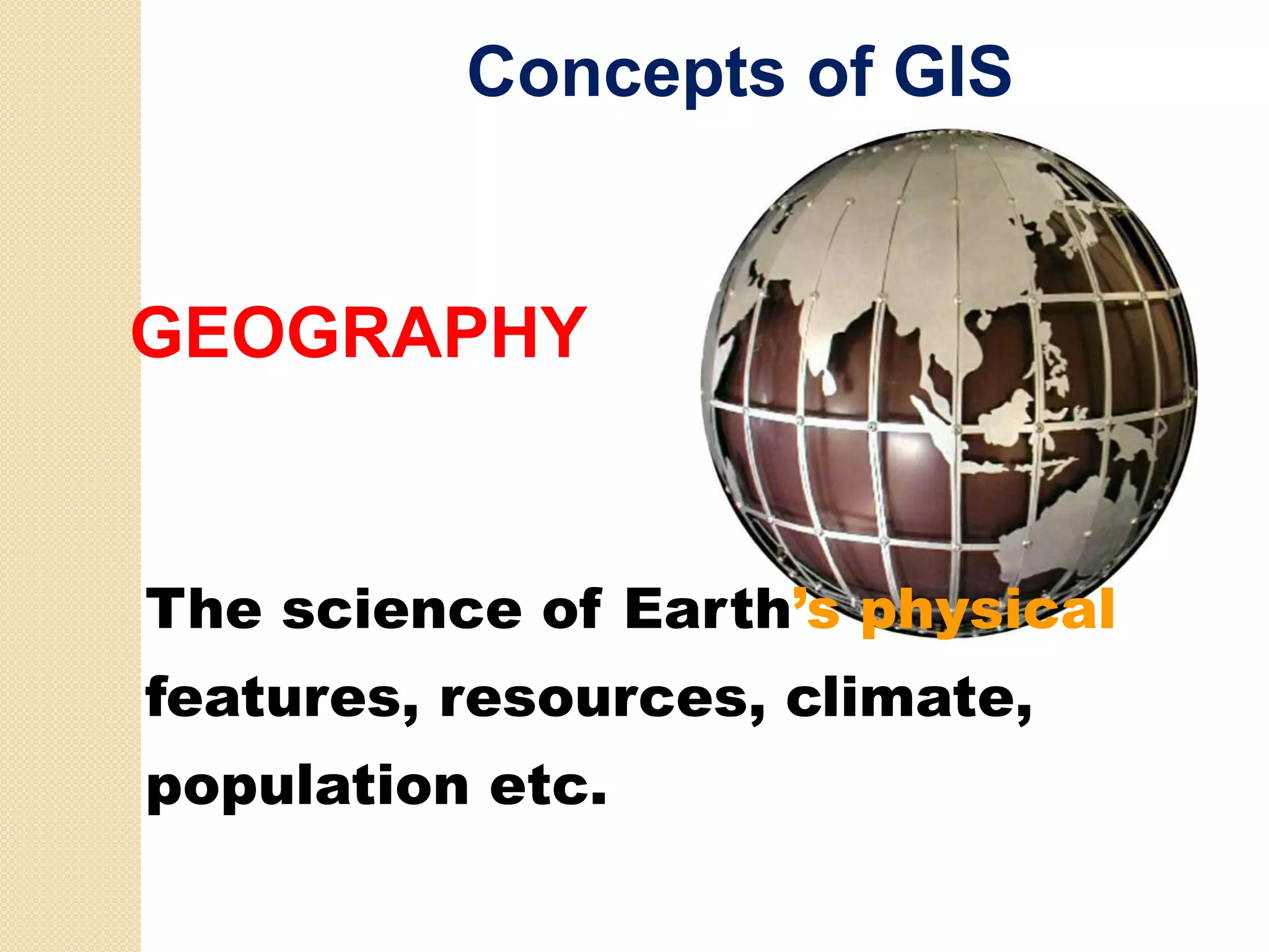
Exploration of GIS concepts, including map reading, remote sensing, GPS relation, and model integrations.
Potential applications of GIS, including identification of locations, optimum paths, and trends in real-world problems.Description of GIS functionalities, integrating technologies, decision-making tools and the importance of location.
Components of GIS including hardware, software, data ware, and its function in capturing and analyzing geographical data.
Discussion on errors in GIS data, lineage, temporal accuracy, completeness, and the significance of quality in GIS applications.
Different analytical operations GIS can perform such as spatial querying, modeling and its applications across various sectors.
Overview of GIS developments in India, market potential, major companies, and costs associated with GIS implementations.
Timeline of GIS evolution from its origins to its current state, highlighting major milestones and software advancements.
Insights into technological trends in GIS, the shift from data to analysis, and the ongoing innovations shaping GIS services.
OVERVIEW OFGIS
P.L.N.
P L N Raju
Geoinformatics Division
Indian Institute of Remote Sensing
Indian S
I di Space R Research O
h Organisation
i ti
raju@iirs.gov.in
2.
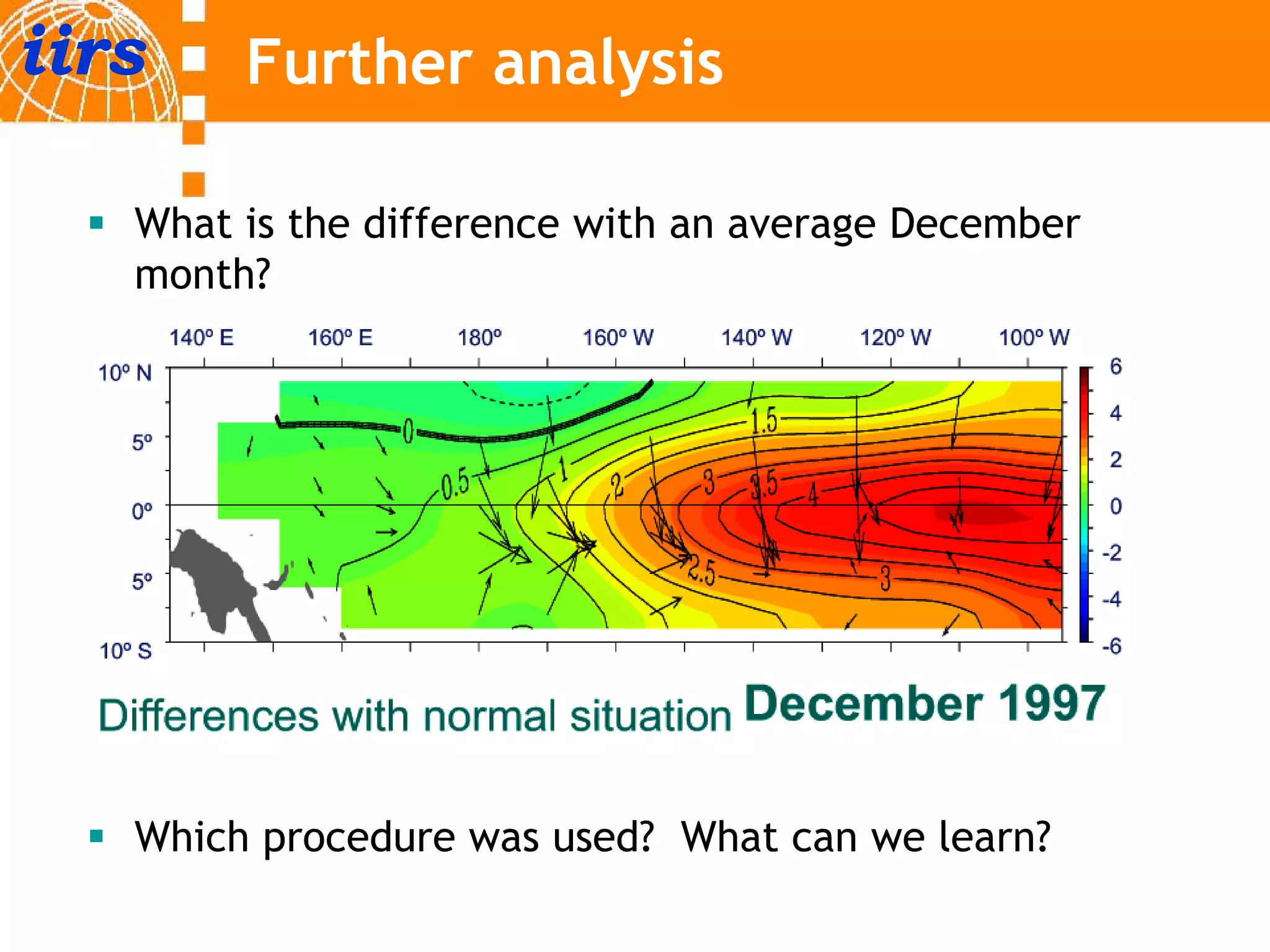
iirs Further analysis
What is the difference with an average December
month?
Which procedure was used? What can we learn?
3.
General Understanding ofGIS
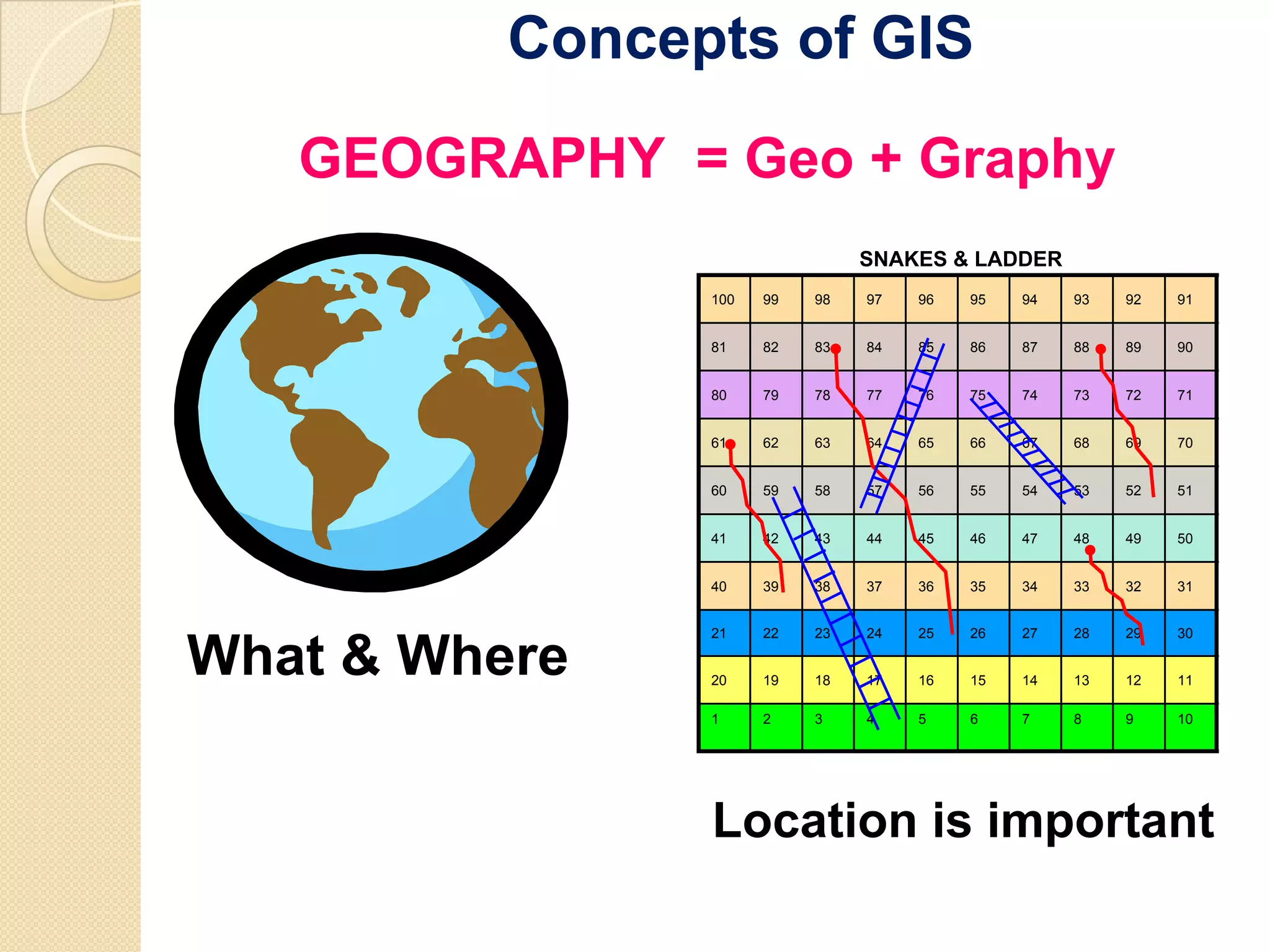
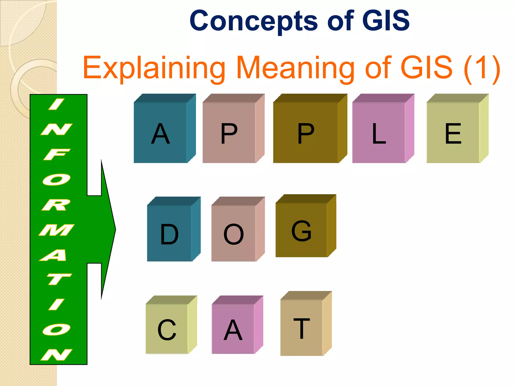
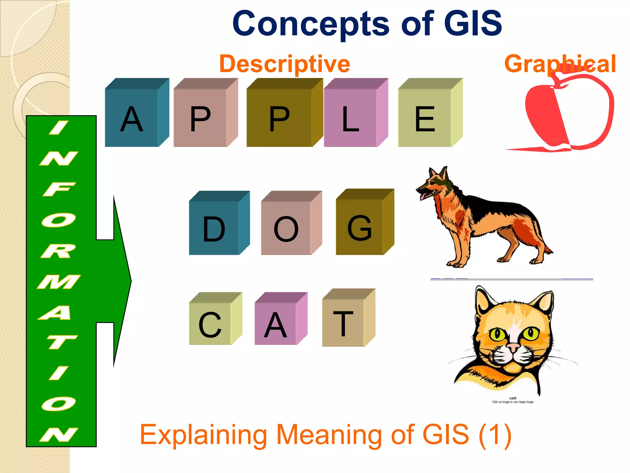
Understanding GIS (1)
U d t di
Map reading and
information – how it is
related to GIS?
◦ What you get from the
map?
◦ Can we measure and
quantify?
◦ Is it possible to find the
changes?
◦ How is it related to GIS?
4.
General Understanding ofGIS
Understanding GIS (2)
U d t di
Remote Sensing data and relation
to GIS
What we get from satellite data?
Can we find the changes and
how?
How time series helps in finding
patterns?
Can we quantify the information?
How RS is related to GIS?
5.
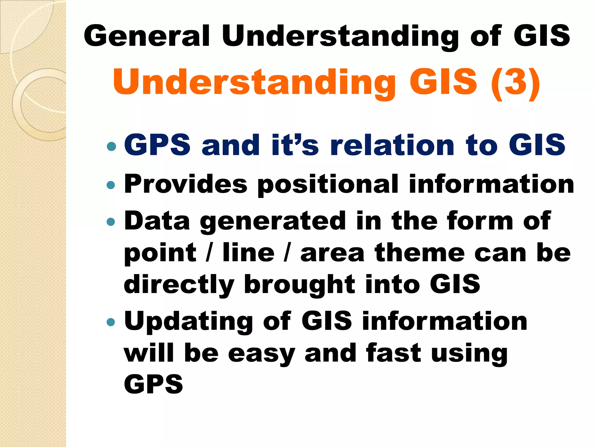
General Understanding ofGIS
Understanding GIS (3)
GPS and it’s relation to GIS
Provides positional information
Data generated in the form of
point / line / area theme can be
directly brought into GIS
Updating of GIS information
will be easy and fast using
GPS
6.
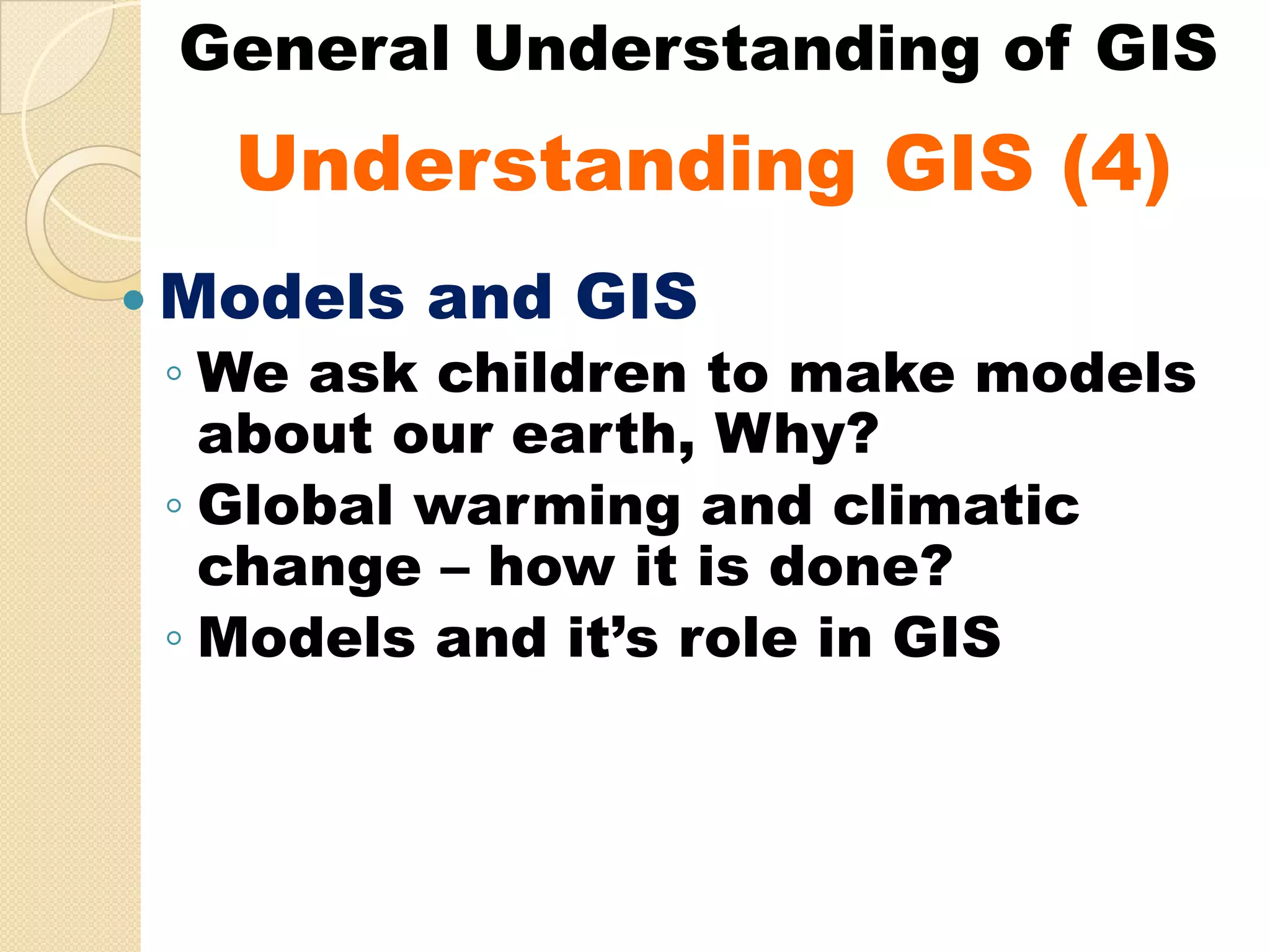
General Understanding ofGIS
Understanding GIS (4)
U d t di
Models and GIS
◦ We ask children to make models
about our earth, Why?
◦ Global warming and climatic
change – how it is done?
◦ Models and it’s role in GIS
7.
General Understanding ofGIS
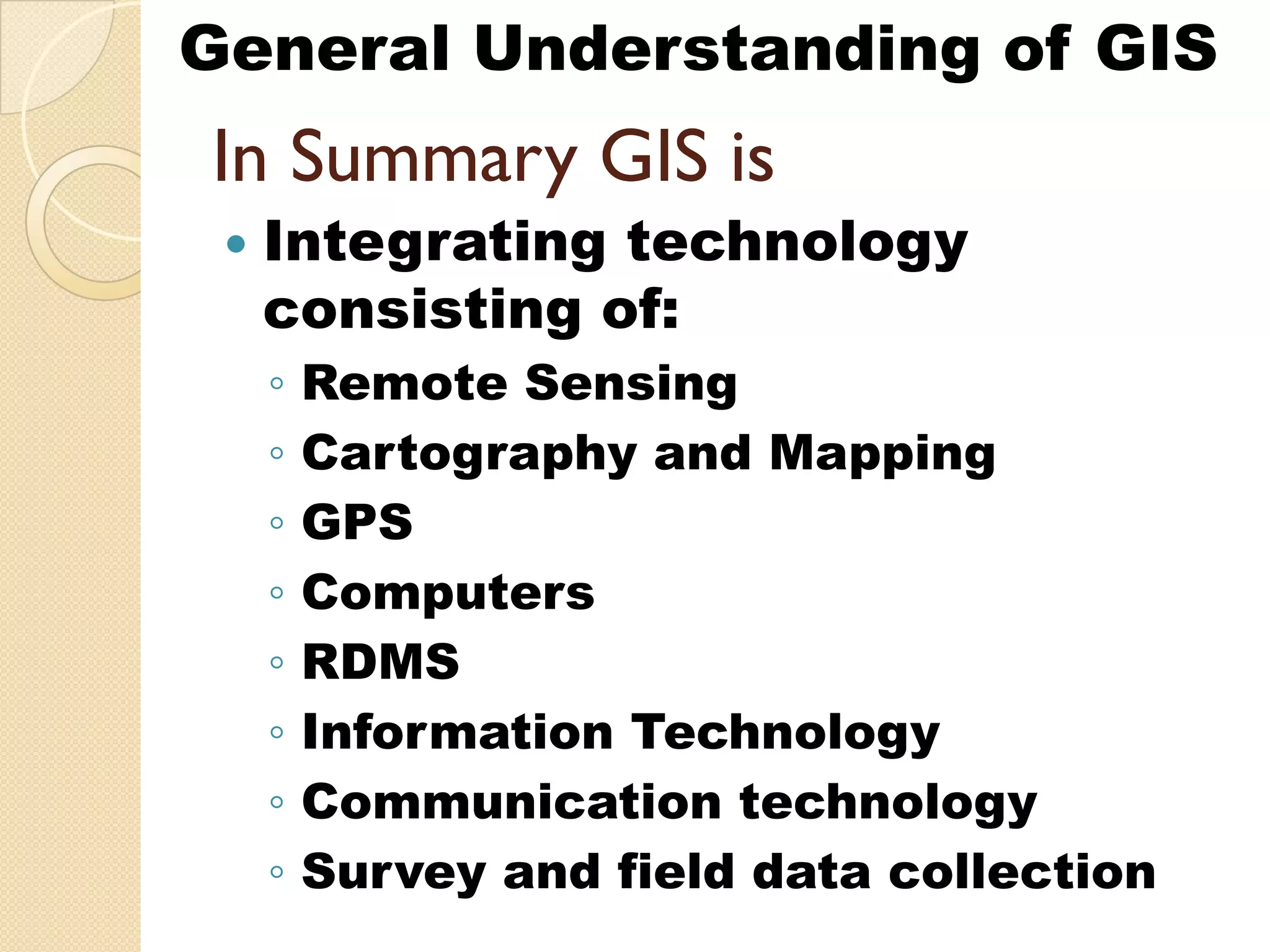
In S
I Summary GIS is
i
Integrating technology
g g gy
consisting of:
◦ Remote Sensing g
◦ Cartography and Mapping
◦ GPS
◦ Computers
◦ RDMS
◦ Information Technology
◦ Communication technology
◦ Survey and field data collection
8.
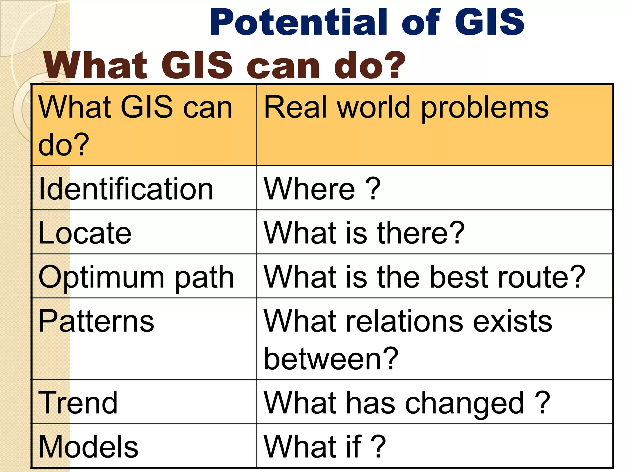
Potential of GIS
WhatGIS can do?
What GIS can Real world problems
do?
d ?
Identification Where ?
Locate What is there?
Optimum path
O ti th What i th b t
Wh t is the best route?
t ?
Patterns What relations exists
between?
Trend What has changed ?
Models What if ?
9.
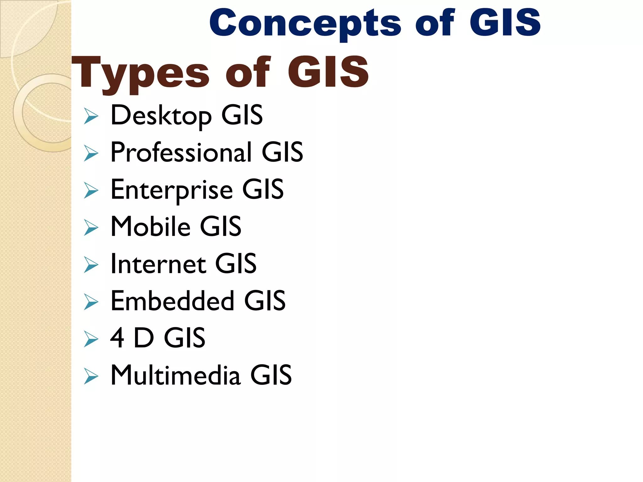
Concepts of GIS
Typesof GIS
Desktop GIS
Professional GIS
Enterprise GIS
Mobile GIS
Internet GIS
Embedded GIS
4 D GIS
Multimedia GIS
10.
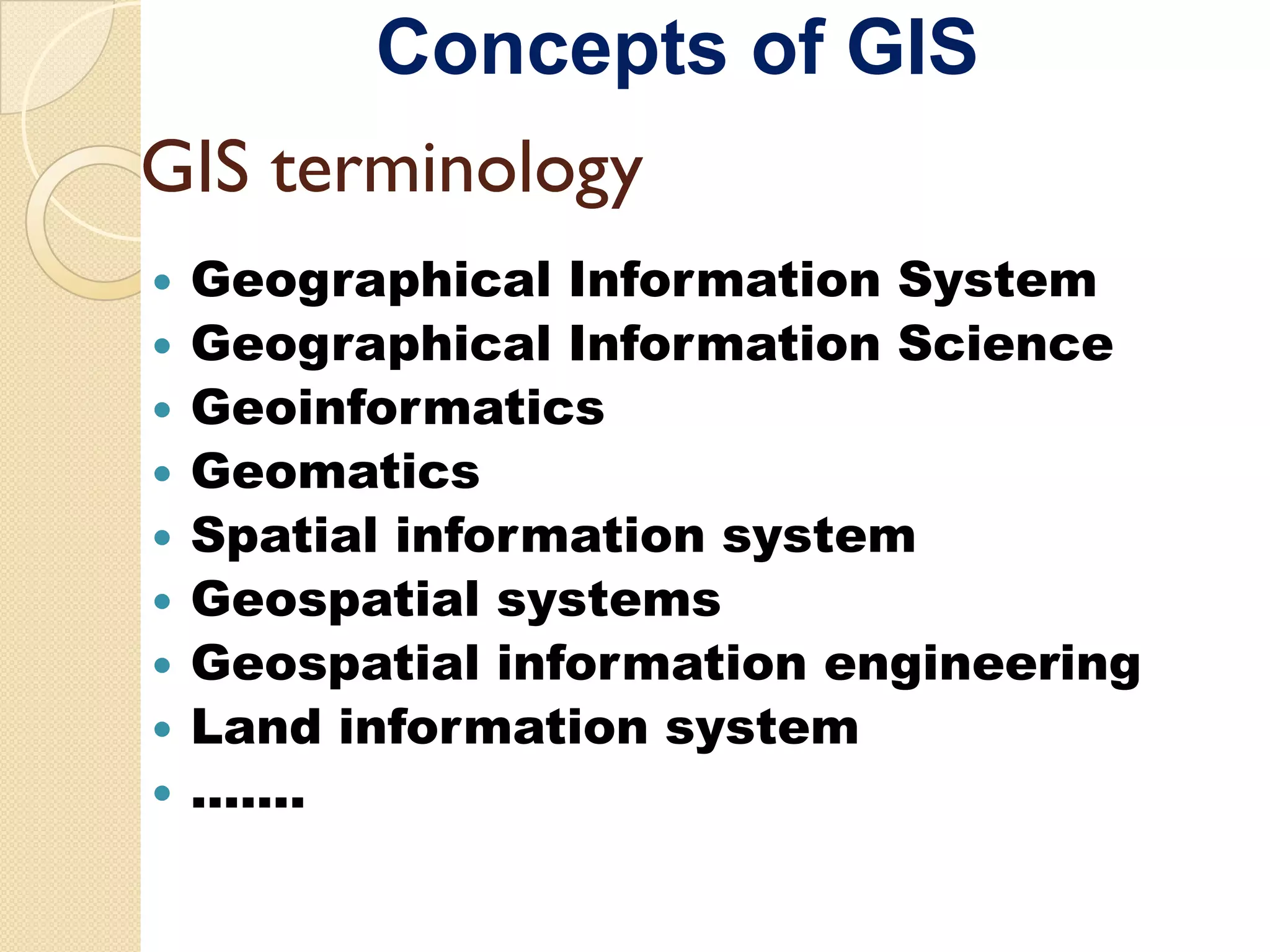
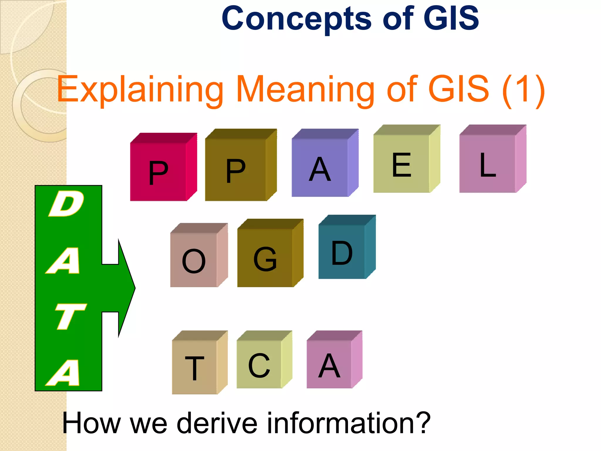
Concepts of GIS
GISterminology
Geographical Information System
Geographical Information Science
Geoinformatics
Geomatics
Spatial information system
Geospatial systems
Geospat a
Geospatial information e g ee g
o at o engineering
Land information system
…….
11.
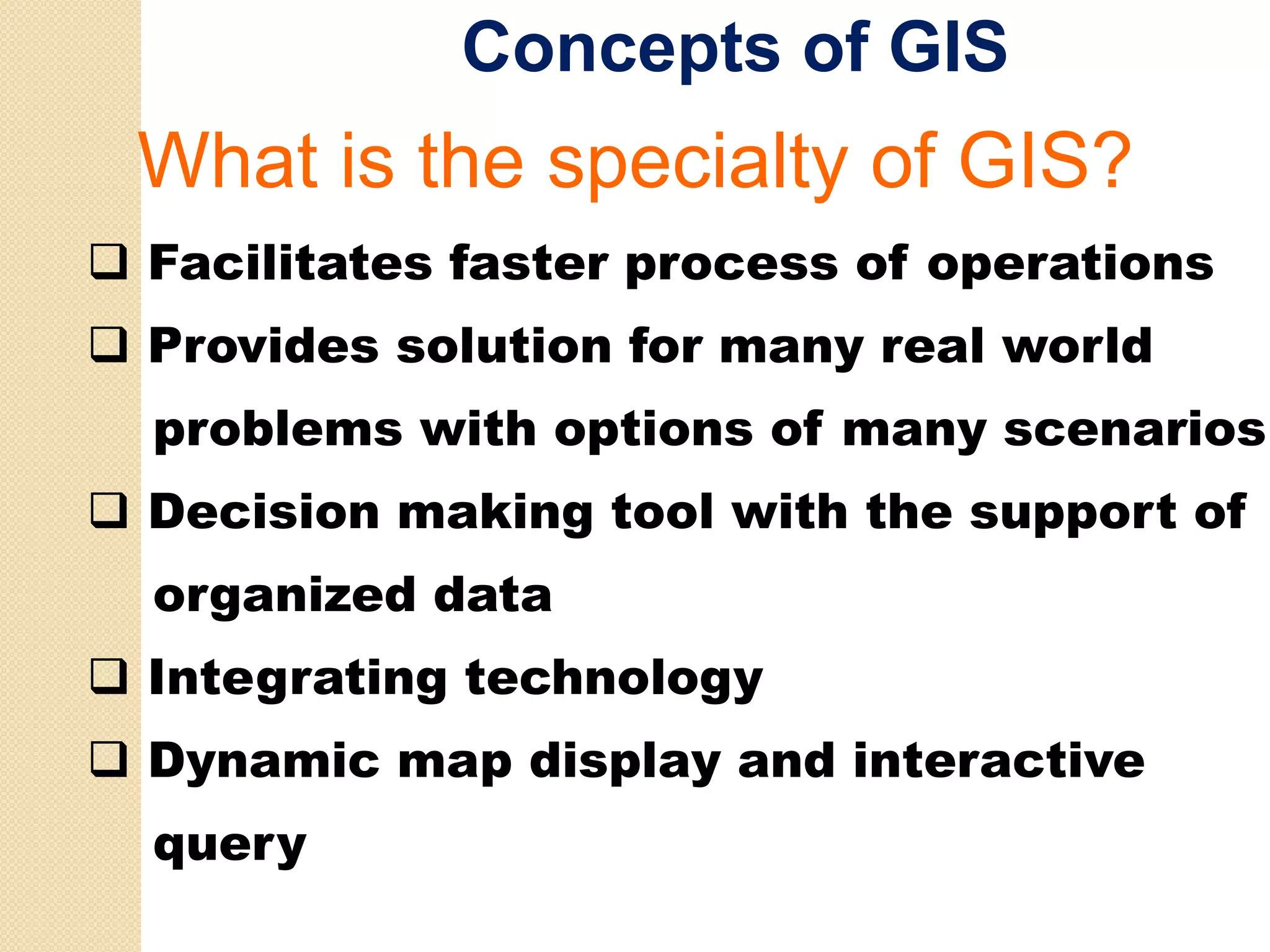
Concepts of GIS
Whati the
Wh t is th specialty of GIS?
i lt f
Facilitates faster process of operations
Provides solution for many real world
problems with options of many scenarios
Decision making tool with the support of
organized data
Integrating technology
Dynamic map display and interactive
query
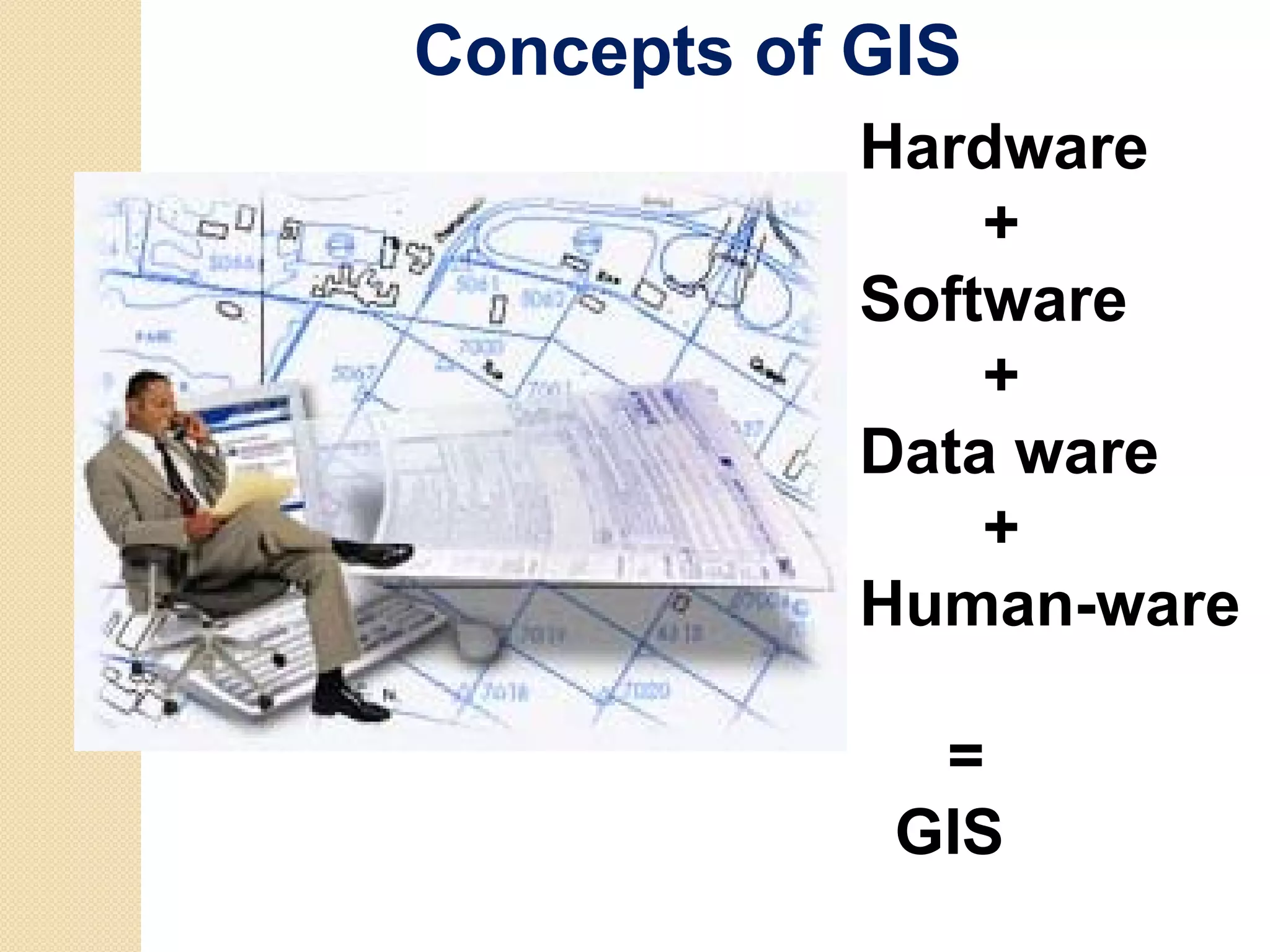
Concepts of GIS
Hardware
+
Software
+
Data ware
+
Human-ware
=
GIS
21.
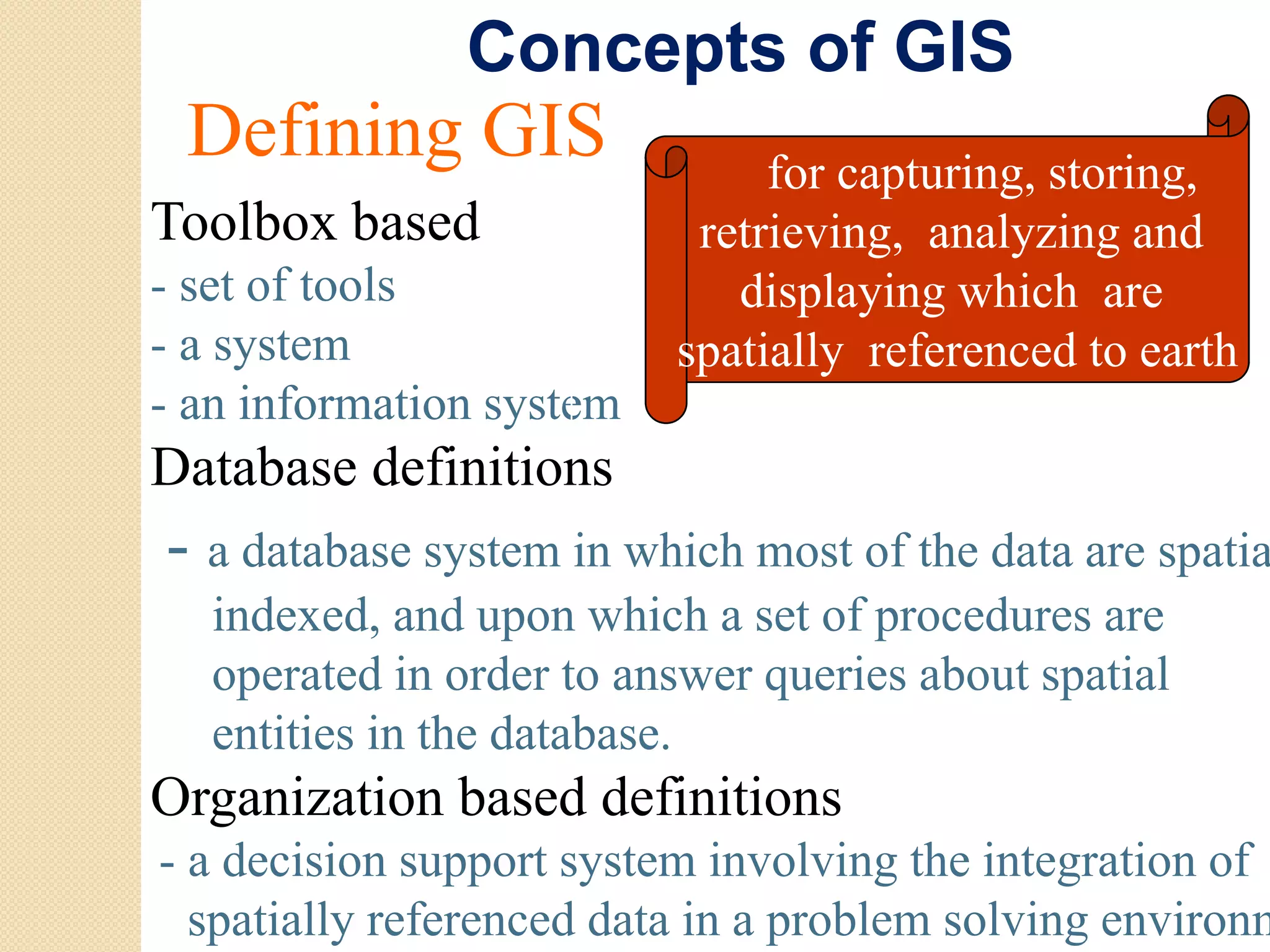
Concepts of GIS
Defining GIS for capturing, storing,
Toolbox based retrieving, analyzing and
- set of tools
t ft l displaying which are
- a system spatially referenced to earth
- an information system
Database definitions
- a database system in which most of the data are spatia
s stem hich
indexed, and upon which a set of procedures are
operated in order to answer queries about spatial
entities in the database.
Og
Organization b sed de
o based definitions
o s
- a decision support system involving the integration of
spatially referenced data in a problem solving environm
22.
Concepts of GIS
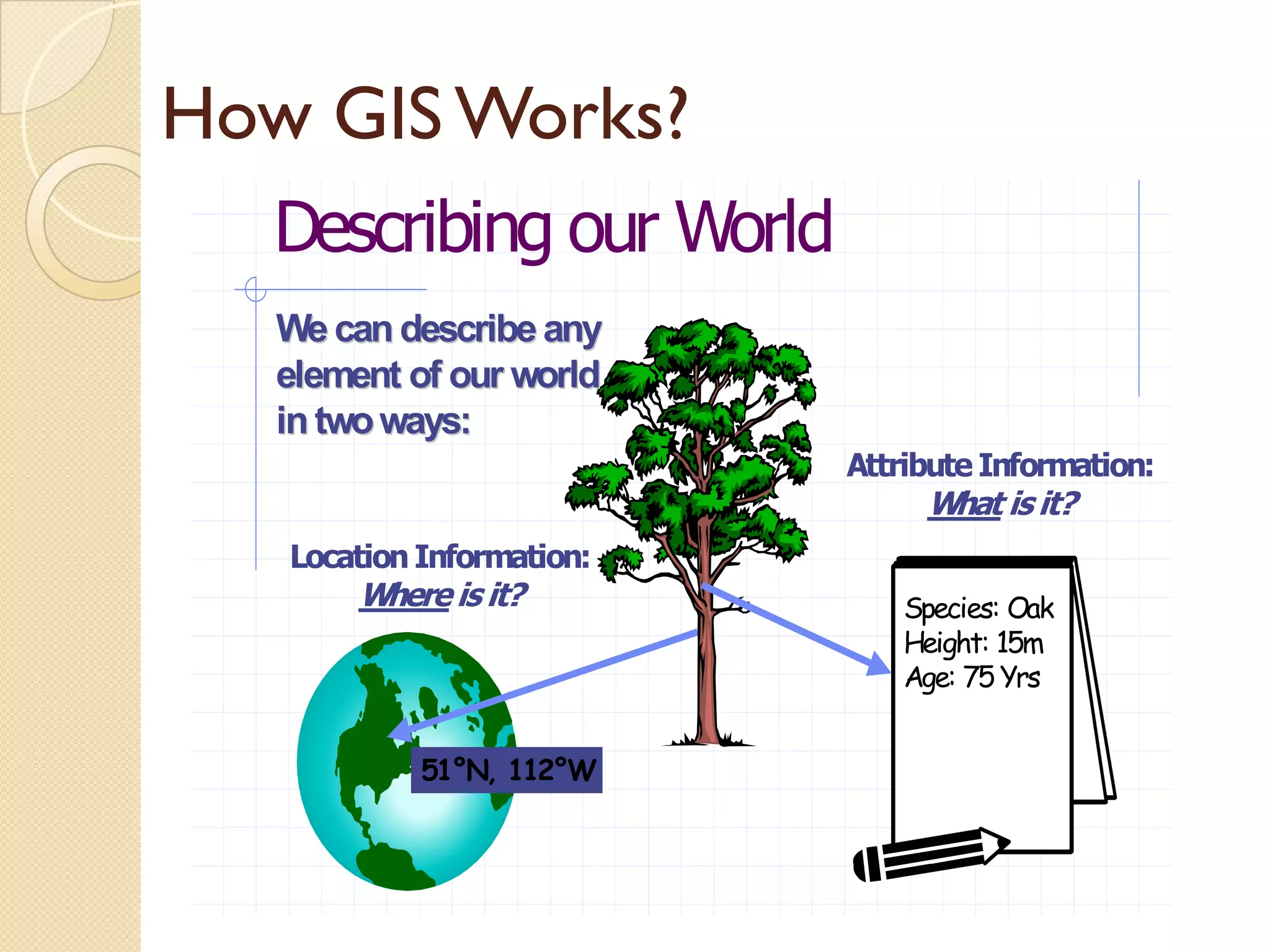
HowGIS Works?
Describing our World
We can describe any
element of our world
in t
i two ways:
Attribute Information:
What is it?
Location Information:
i f i
Where is it? Species: Oak
Height: 15m
Age: 75 Yrs
51°N, 112°W
23.
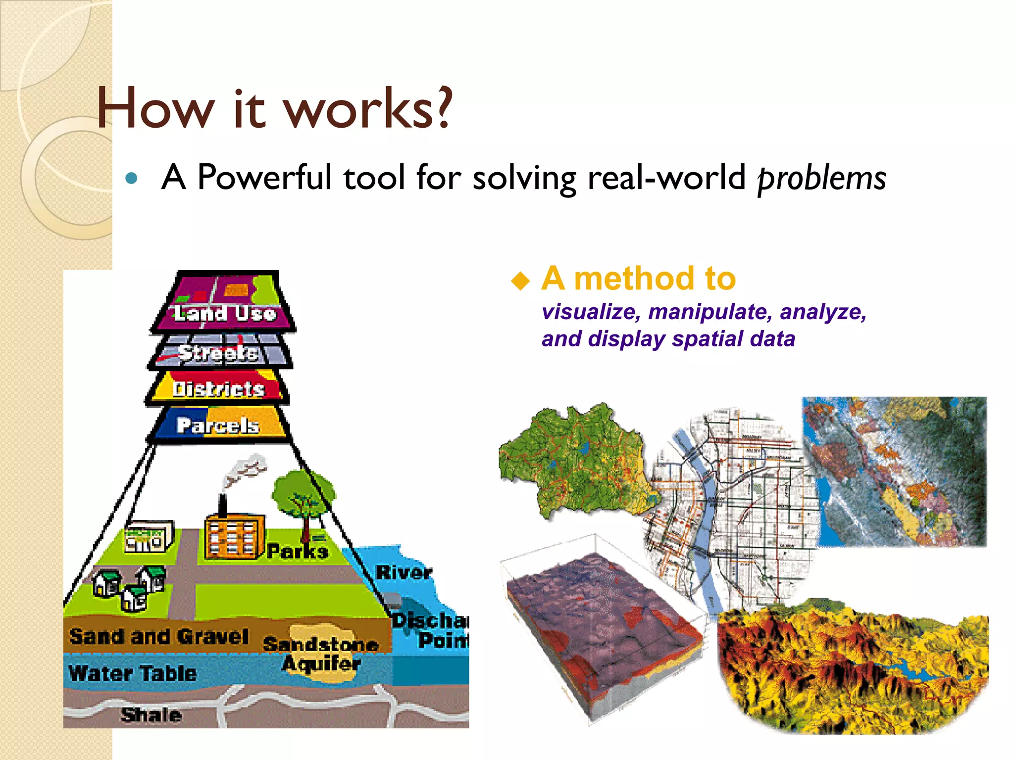
Concepts of GIS
Howit works?
A Powerful tool for solving real-world problems
A method to
visualize, manipulate, analyze,
and display spatial data
iirs Spatial data and geoinformation
There is a degree of error in Lineage – describes the
all data
data. history of a data set, source
set
In the context of a GIS we of observation or materials.
distinguish between: Temporal accuracy,
Errors in source data
o s sou ce examples changes in
p g
Processing errors landownership, deforestation
In addition the International Completeness, for spatial
Cartographic Association features and attributes
identified: Logical consistency,
Lineage (history) combination of completeness
Temporal accuracy and topological consistency
Completeness
C l t
Logical consistency
26.
iirs Spatial data and geoinformation
In a GIS a wider view of Most GIS analysis will
quality is important introduce errors.
because:
Errors are introduced
when data is put into the
GIS
Unlike a conventional
map, which is a single end
hi h i i gl d
product, a GIS contains
data from various sources
Unlike topographic or
p g p
cadastral databases,
natural resource databases
contain “uncertain” data.
27.
Potential of GIS
WhatAnalysis GIS can do?
SIMPLE QUERY
SPATIAL QUERRYING
SINGLE LAYER OPERATION
MULTIPLE- LAYER
OPERATIONS
SPATIAL MODELING
SURFACE ANALYSIS
NETWORK ANALYSIS
POINT PATTERN ANALYSIS
GRID ANALYSIS
28.
GIS Application potential
Potential of GIS
Where it i used?
Wh i is d?
Natural resource management
Infrastructure development
Utility services
Business applications
Investigation services
e-governance
29.
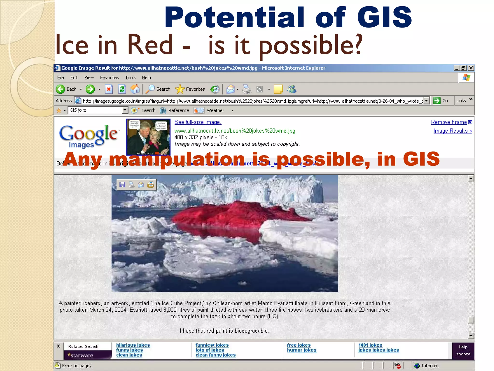
Potential of GIS
Icein Red - is it possible?
Any manipulation is possible, in GIS
possible
30.
GIS infrastructure
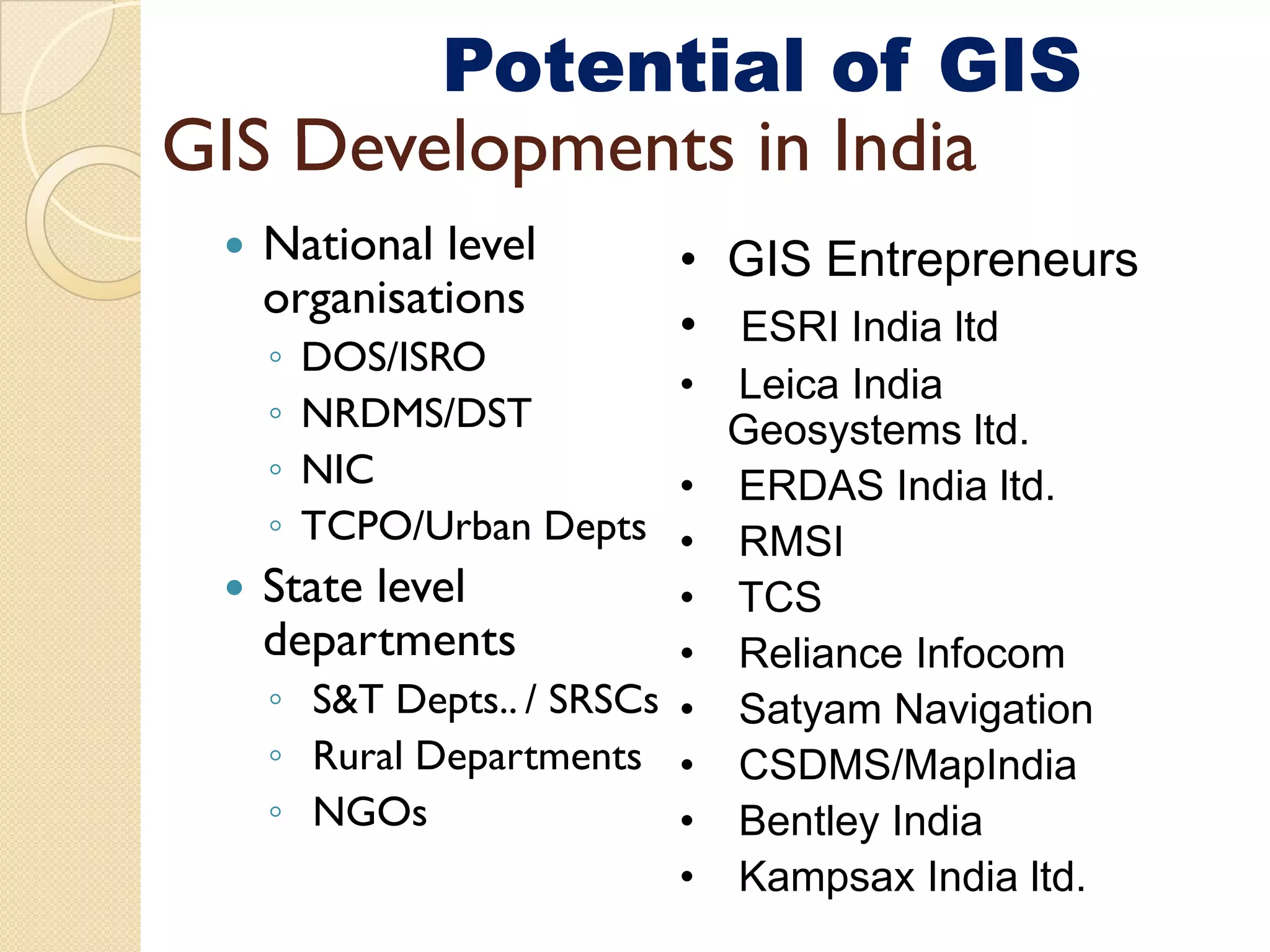
Potential of GIS
GIS De el ments in India
Developments
National level • GIS Entrepreneurs
organisations
• ESRI India ltd
◦ DOS/ISRO
• Leica India
◦ NRDMS/DST Geosystems ltd.
◦ NIC • ERDAS India ltd.
◦ p
TCPO/Urban Depts • RMSI
State level • TCS
departments • Reliance Infocom
◦ S&T Depts.. / SRSCs • Satyam Navigation
◦ Rural Departments • CSDMS/MapIndia
◦ NGOs • Bentley India
• Kampsax India ltd.
31.
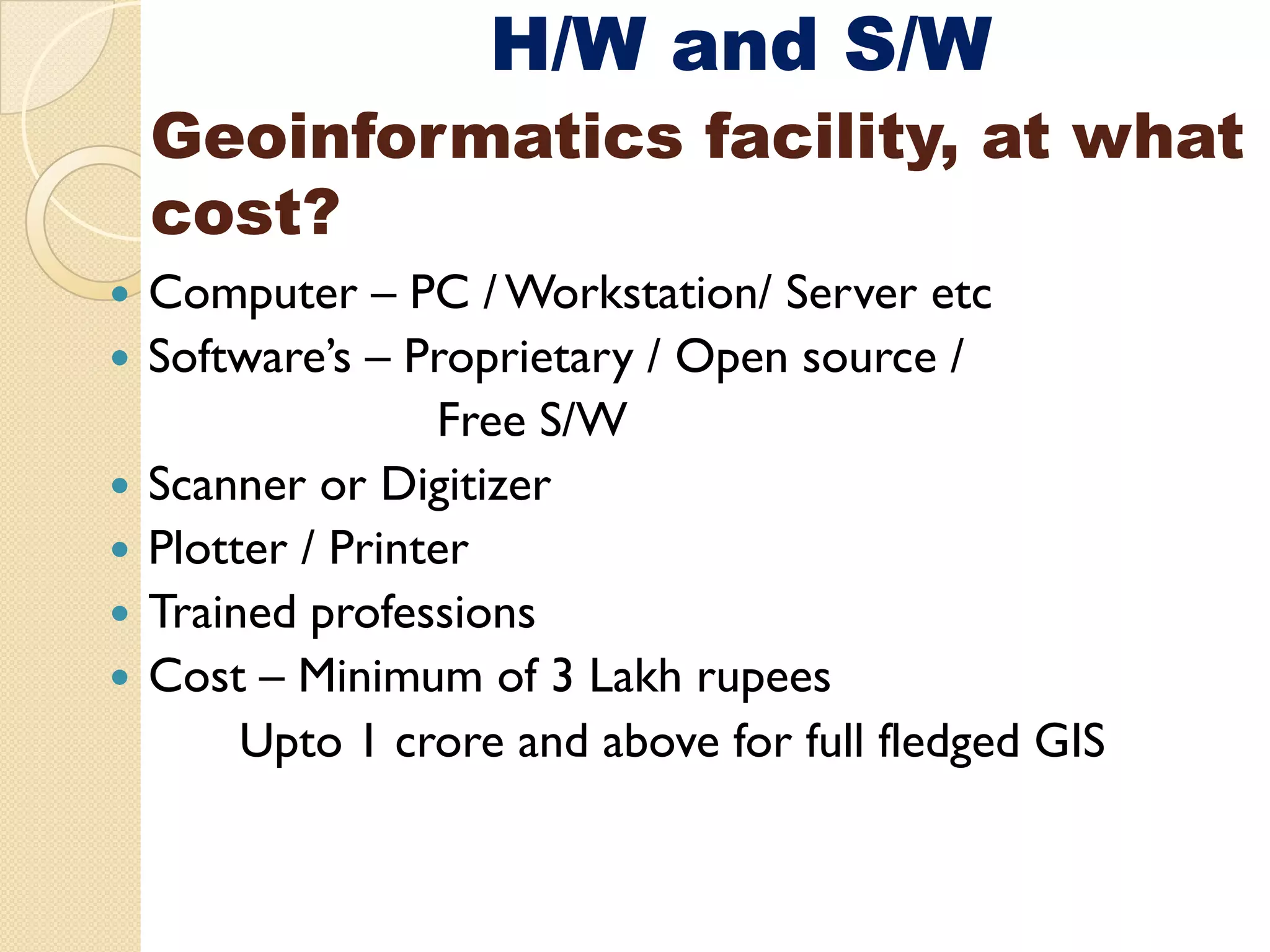
H/W and S/W
Geoinformaticsfacility at what
facility,
cost?
Computer – PC / Workstation/ Server etc
Software’s – Proprietary / Open source /
Free S/W
F
Scanner or Digitizer
Plotter / Printer
Trained professions
Cost – Minimum of 3 Lakh rupees
Upto 1 crore and above for full fledged GIS
32.
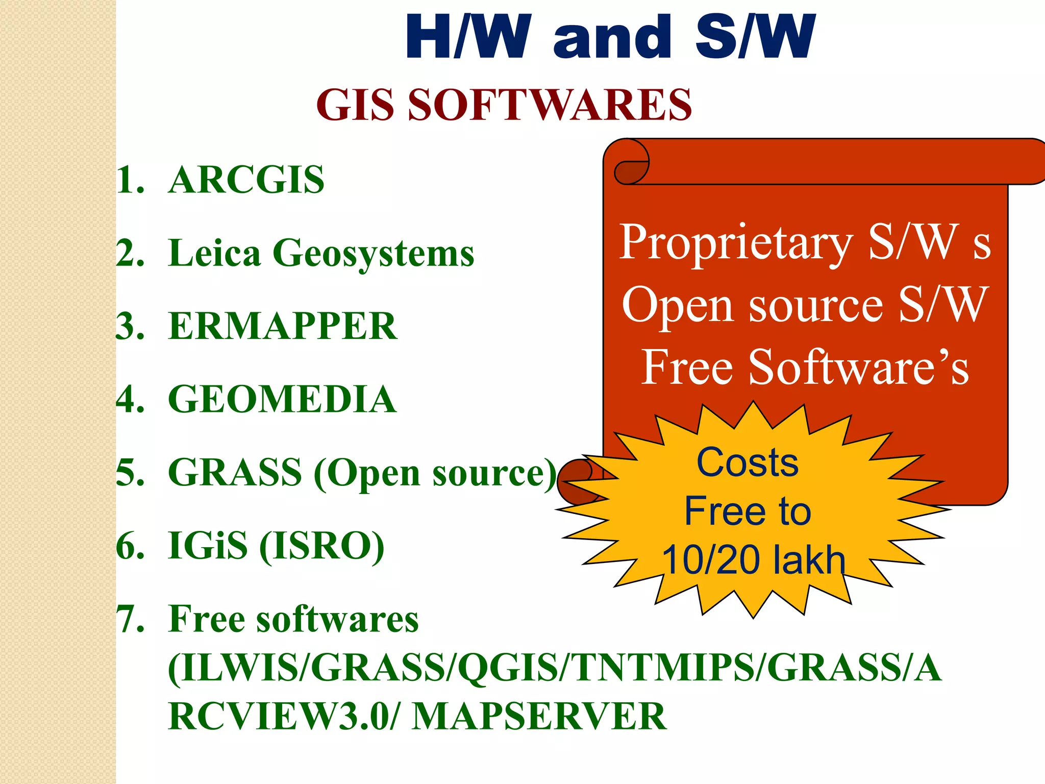
H/W and S/W
GIS SOFTWARES
1. ARCGIS
2. Leica Geosystems Proprietary S/W s
P i
3. ERMAPPER Open source S/W
Free Software’s
4. GEOMEDIA
5. GRASS (Open source) Costs
C t
Free to
6. IGiS (ISRO)
( ) 10/20 lakh
7. Free softwares
(ILWIS/GRASS/QGIS/TNTMIPS/GRASS/A
RCVIEW3.0/ MAPSERVER
33.
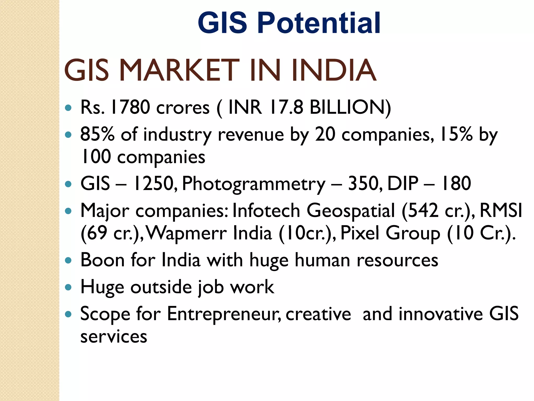
GIS Potential
GIS MARKETIN INDIA
Rs. 1780 crores ( INR 17.8 BILLION) )
85% of industry revenue by 20 companies, 15% by
100 companies
GIS – 1250, Photogrammetry – 350, DIP – 180
Major companies: Infotech Geospatial (542 cr.), RMSI
(69 cr.), W
) Wapmerr I di (10 ) Pi l G
India (10cr.), Pixel Group (10 Cr.).
C )
Boon for India with huge human resources
Huge outside job work
Scope for Entrepreneur, creative and innovative GIS
services
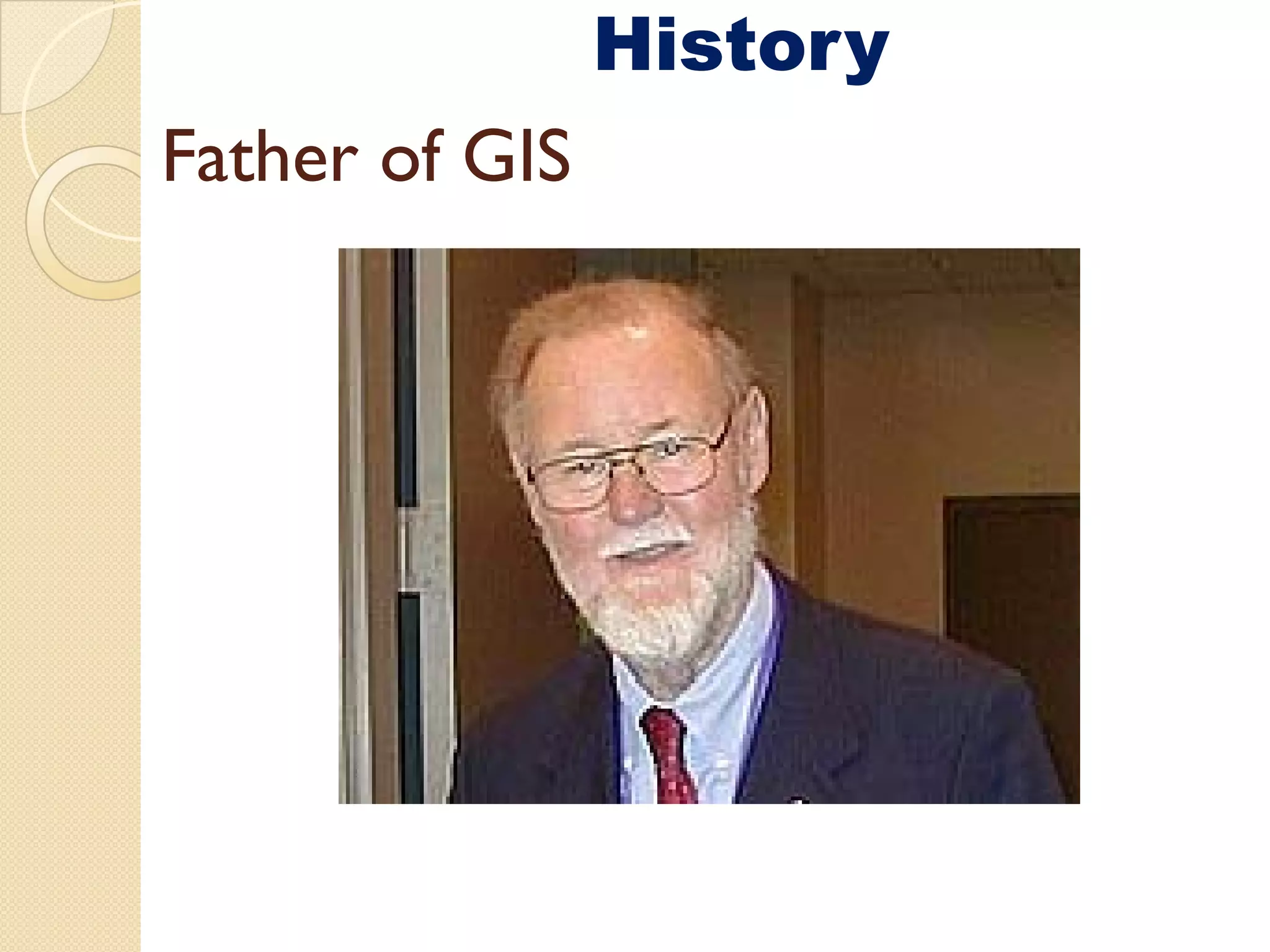
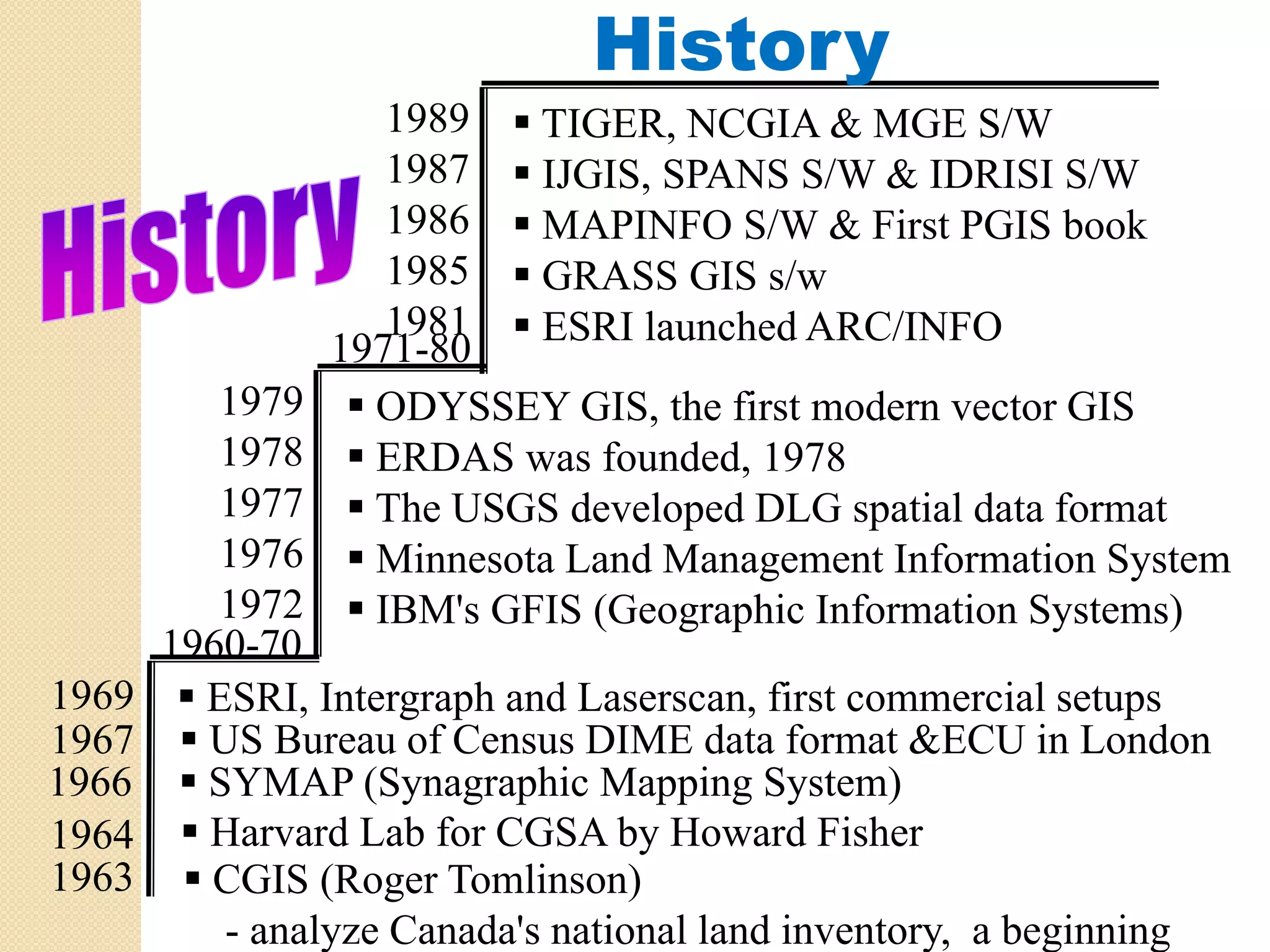
History
1989 TIGER, NCGIA & MGE S/W
1987 IJGIS, SPANS S/W & IDRISI S/W
1986 MAPINFO S/W & First PGIS book
1985 GRASS GIS s/w
1981 ESRI launched ARC/INFO
1971-80
1979 ODYSSEY GIS, the first modern vector GIS
GIS
1978 ERDAS was founded, 1978
1977 The USGS developed DLG spatial data format
1976 Minnesota Land Management Information System
i d f i
1972 IBM's GFIS (Geographic Information Systems)
1960-70
1969 ESRI, Intergraph and Laserscan, first commercial setups
1967 US Bureau of Census DIME data format &ECU in London
1966 SYMAP (Synagraphic Mapping System)
1964 Harvard Lab for CGSA by Howard Fisher
1963 CGIS (Roger Tomlinson)
- analyze Canada's national land inventory, a beginning
36.
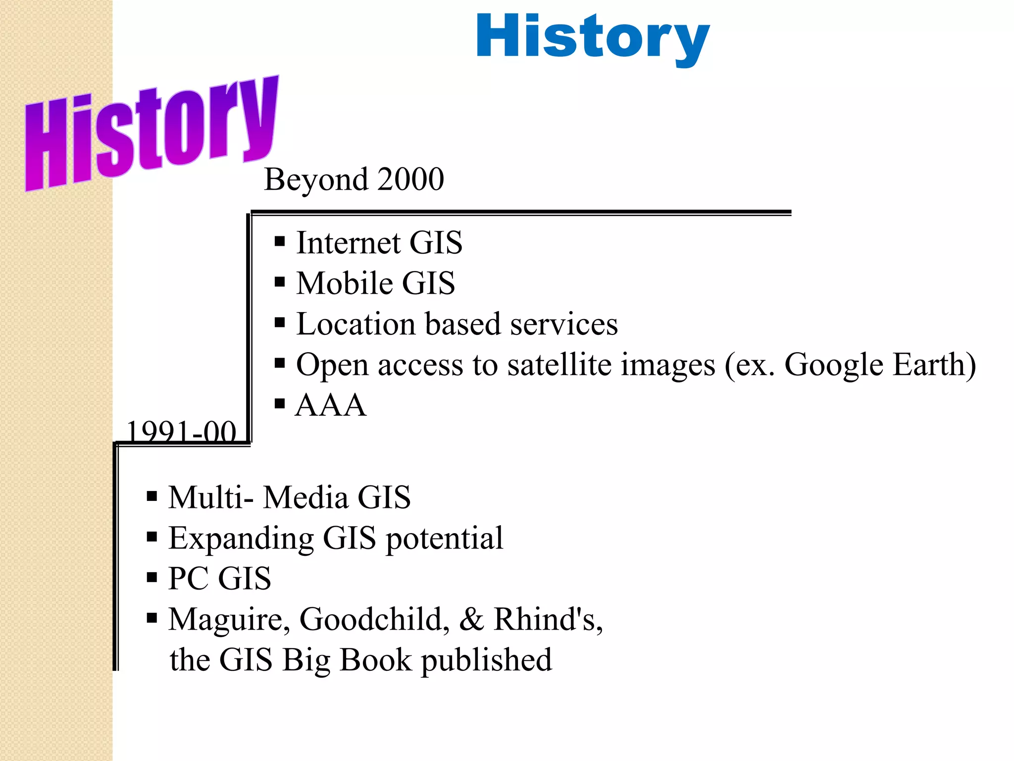
History
Beyond 2000
Internet GIS
Mobile GIS
Location based services
Open access to satellite images (ex. Google Earth)
AAA
1991-00
1991 00
Multi- Media GIS
Expanding GIS potential
PC GIS
Maguire, Goodchild, & Rhind's,
the
th GIS Bi B k published
Big Book bli h d
37.
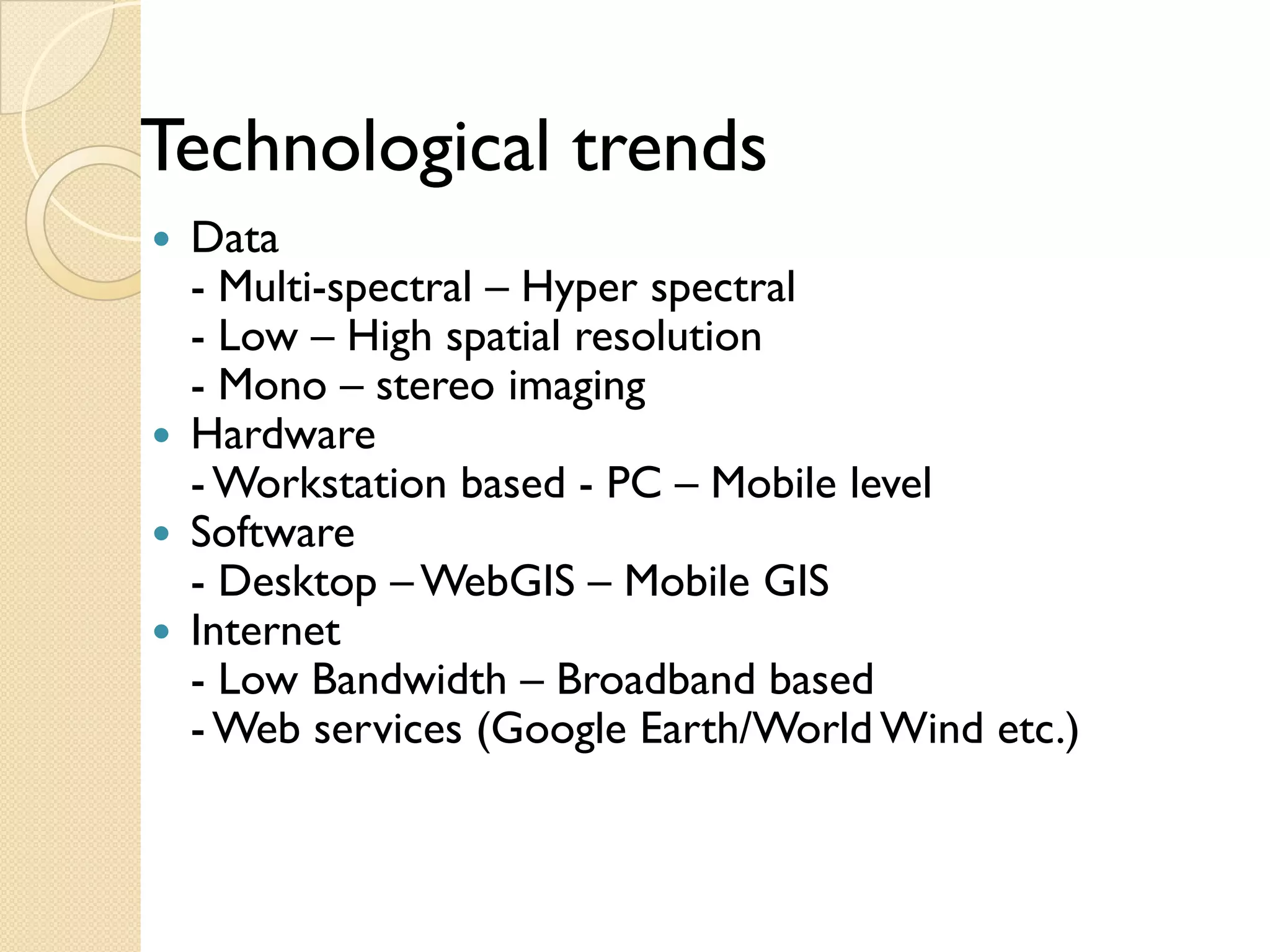
Technological
Techn l icaltrends
Data
-M l
Multi-spectral – H
l Hyper spectral l
- Low – High spatial resolution
- Mono – stereo imaging
g g
Hardware
- Workstation based - PC – Mobile level
Software
- Desktop – WebGIS – Mobile GIS
Internet
- Low Bandwidth – Broadband based
- Web services (Google Earth/World Wind etc.)
38.
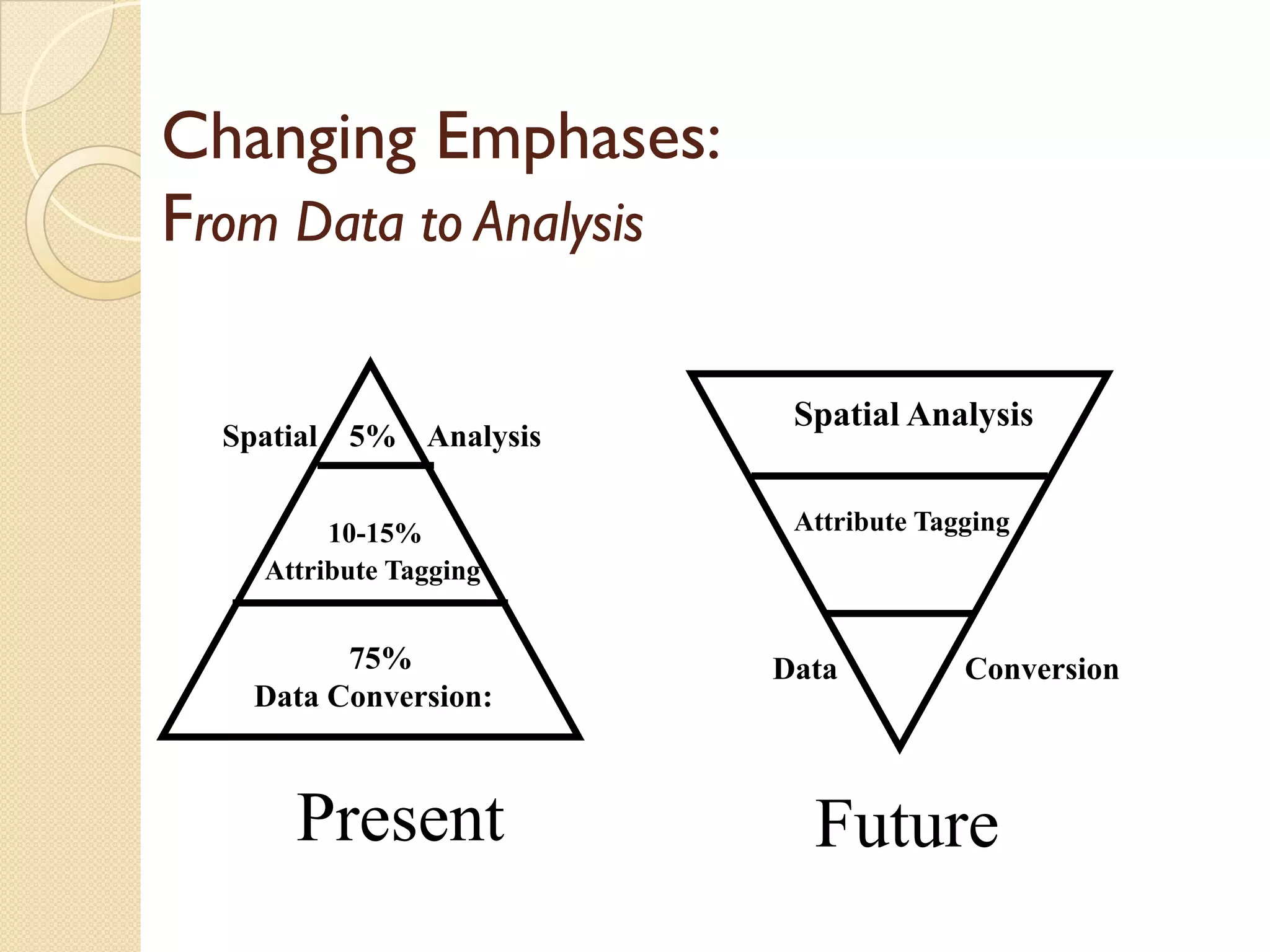
Changing Emphases:
From Datato Analysis
Spatial Analysis
S ti l A l i
Spatial 5% Analysis
10-15% Attribute Tagging
Attribute Tagging
75% Data Conversion
Data Conversion:
Present Future
39.
The
Th application ofGIS i li i d only b the
li i f is limited l by h
imagination of those who use it
~ Jack Dangermond