Download as PDF, PPTX
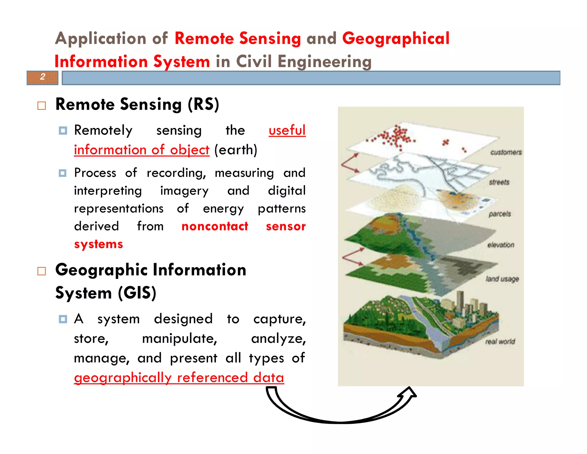
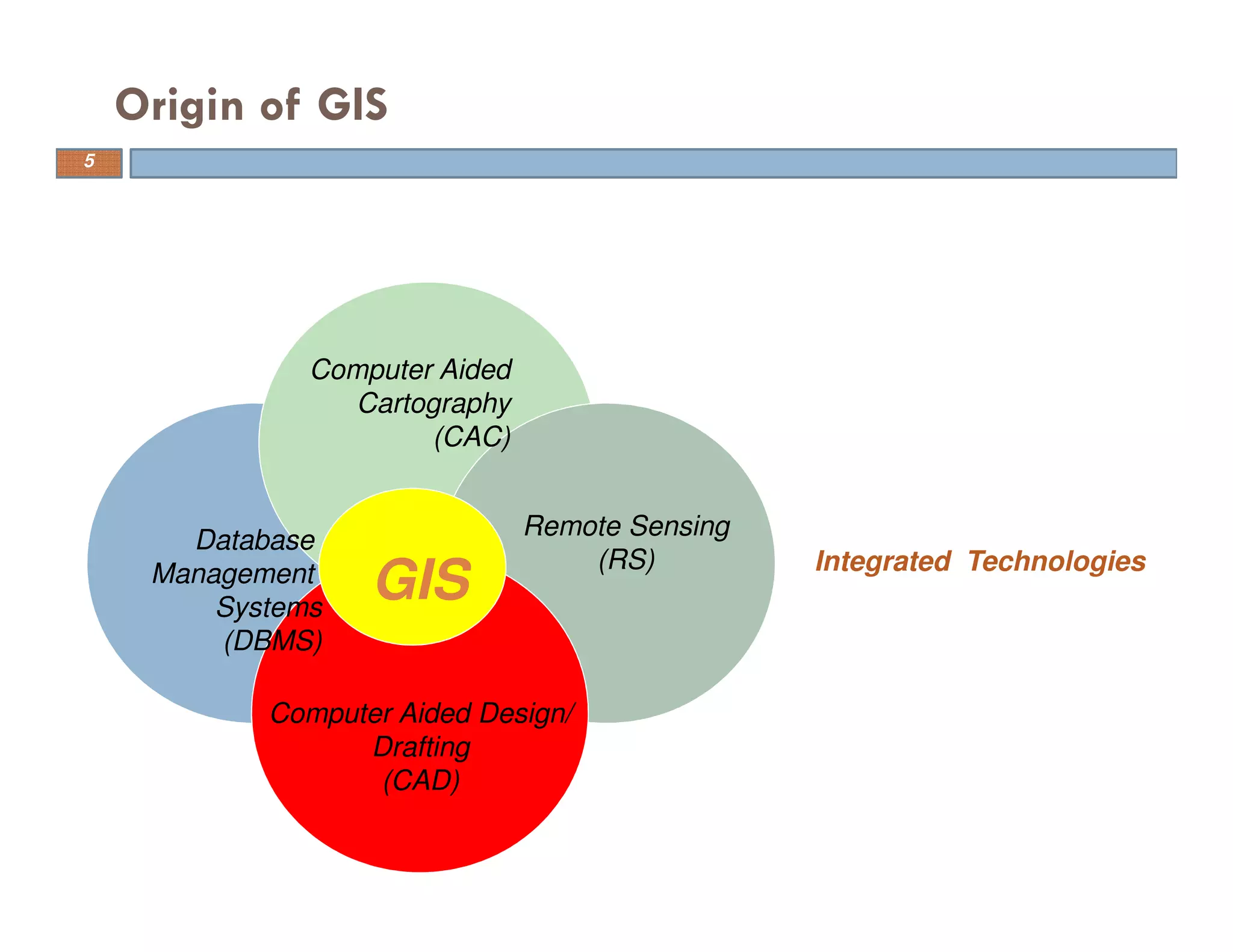
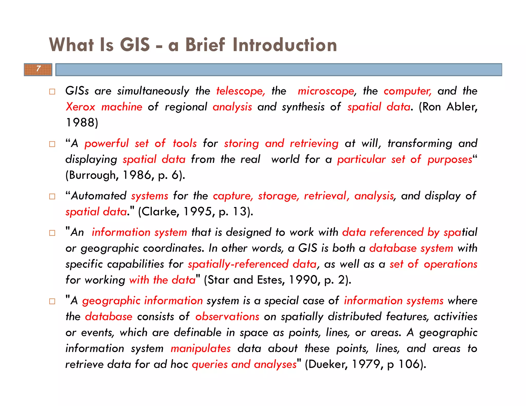
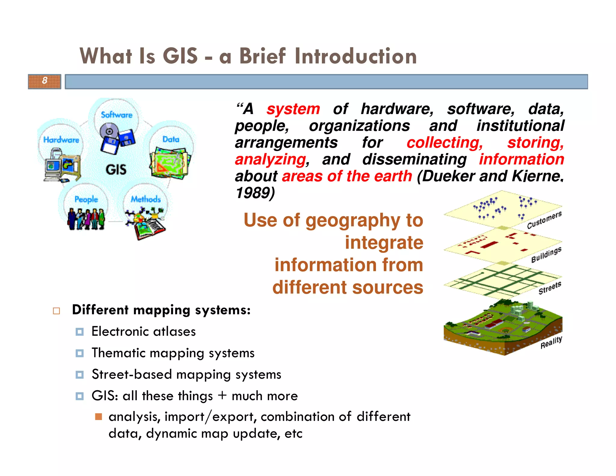
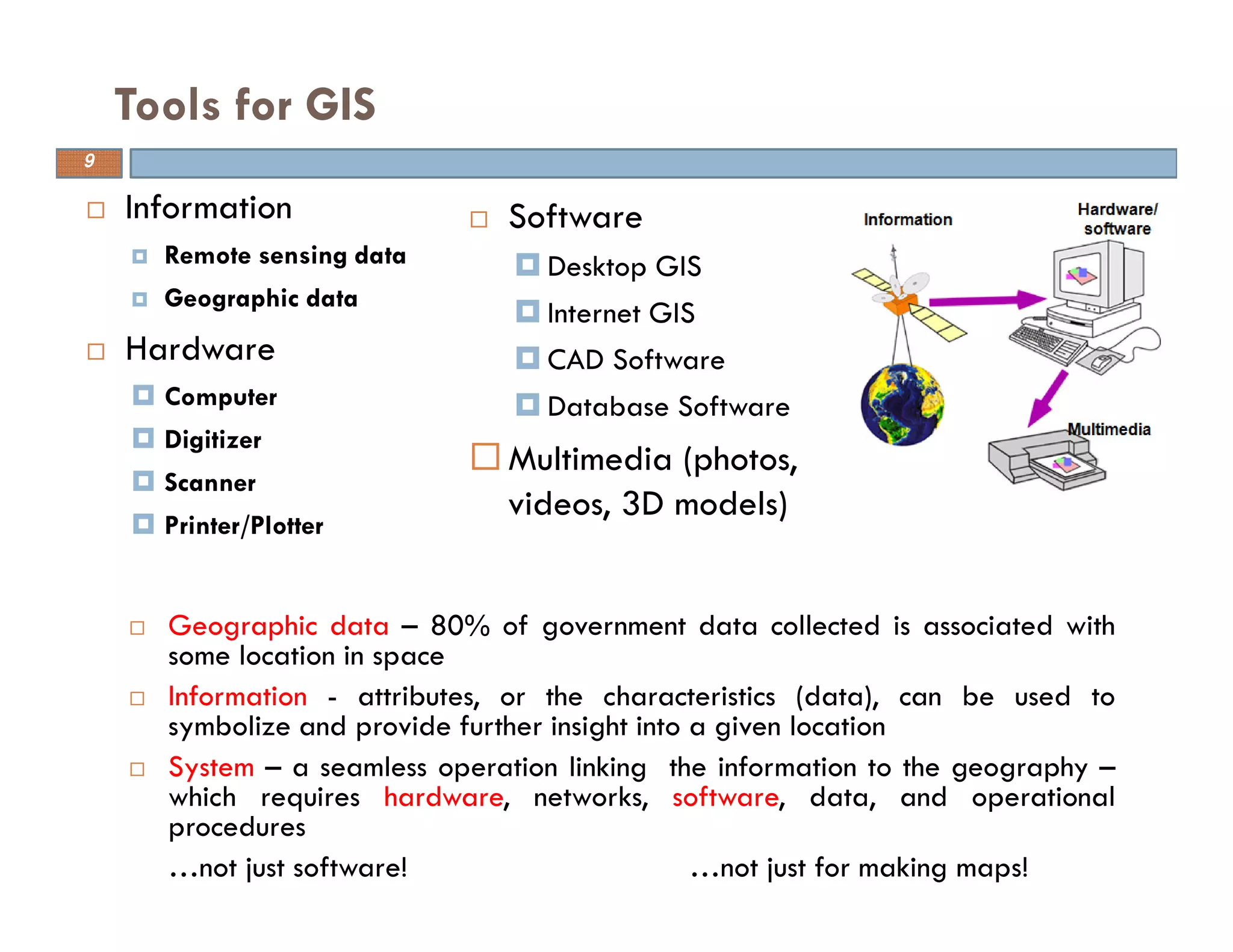
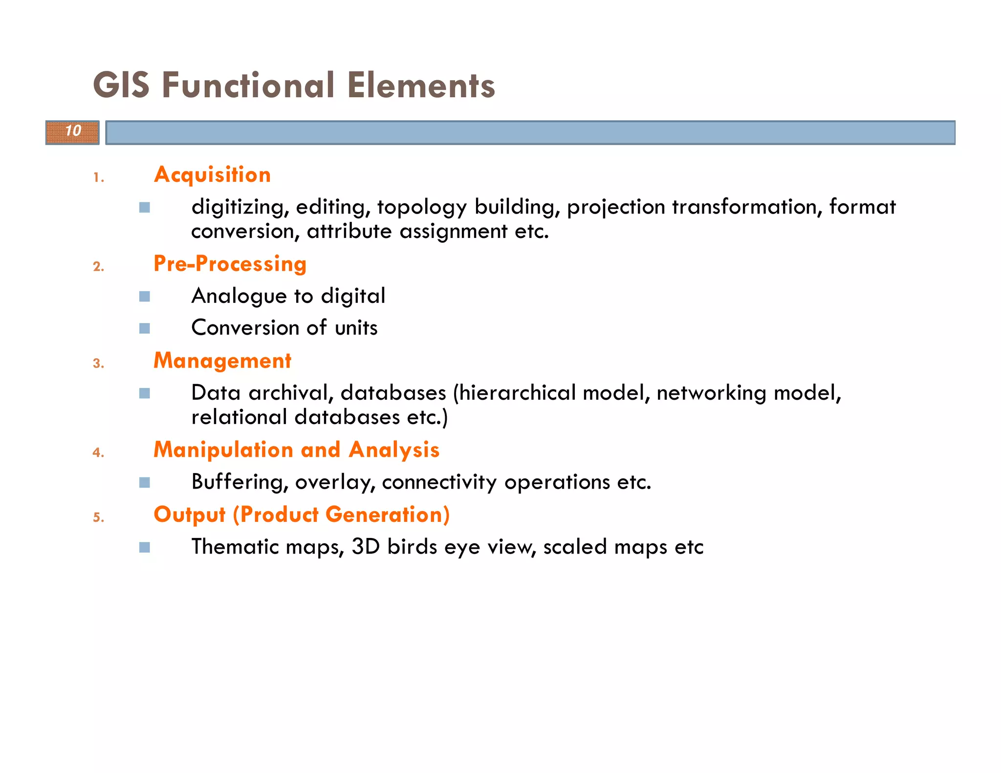
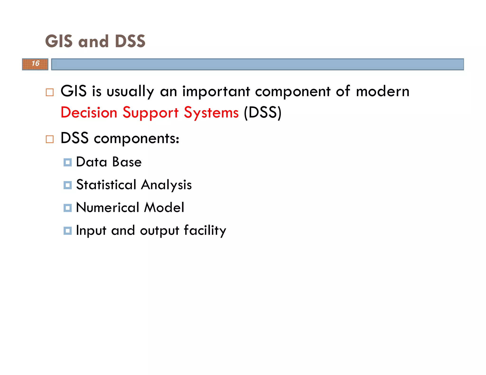
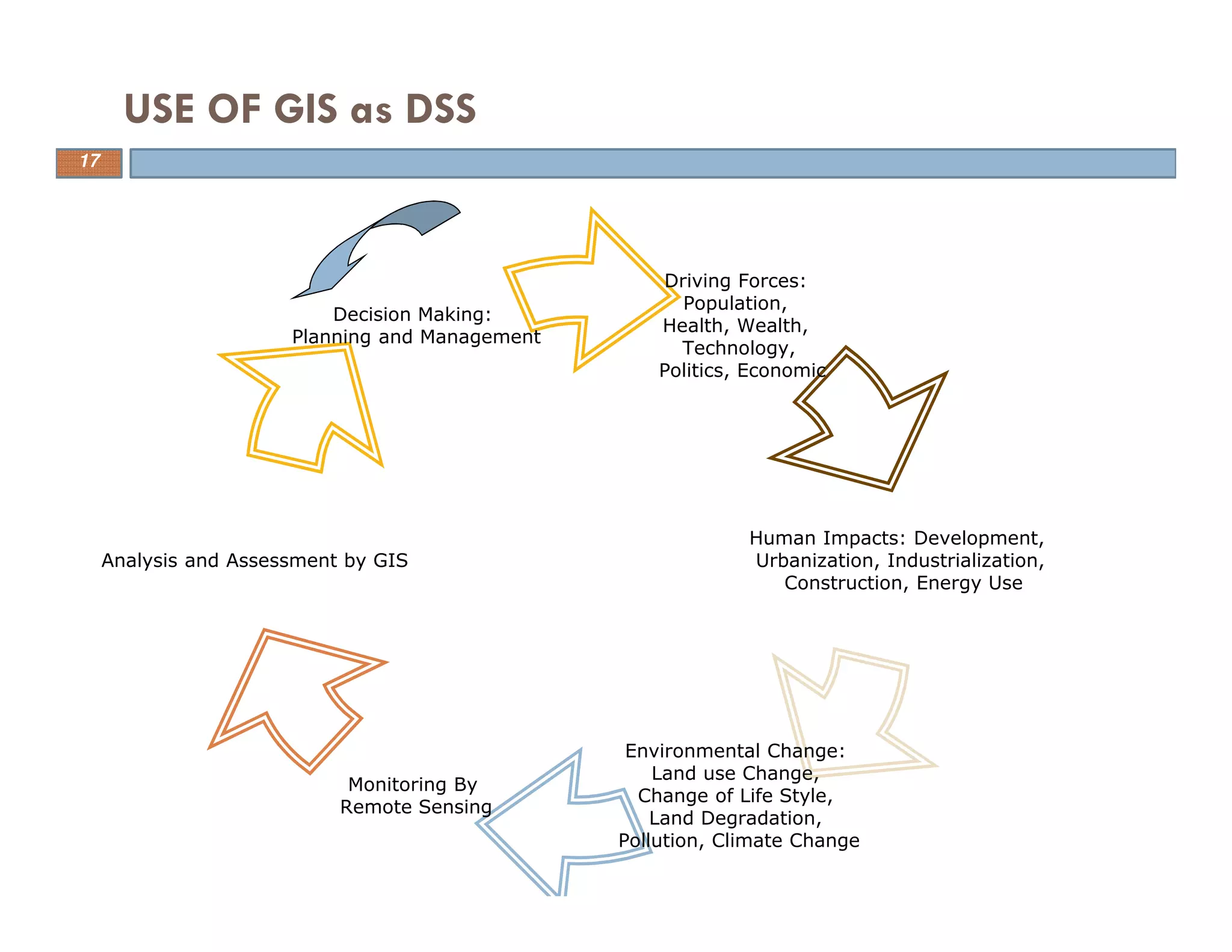
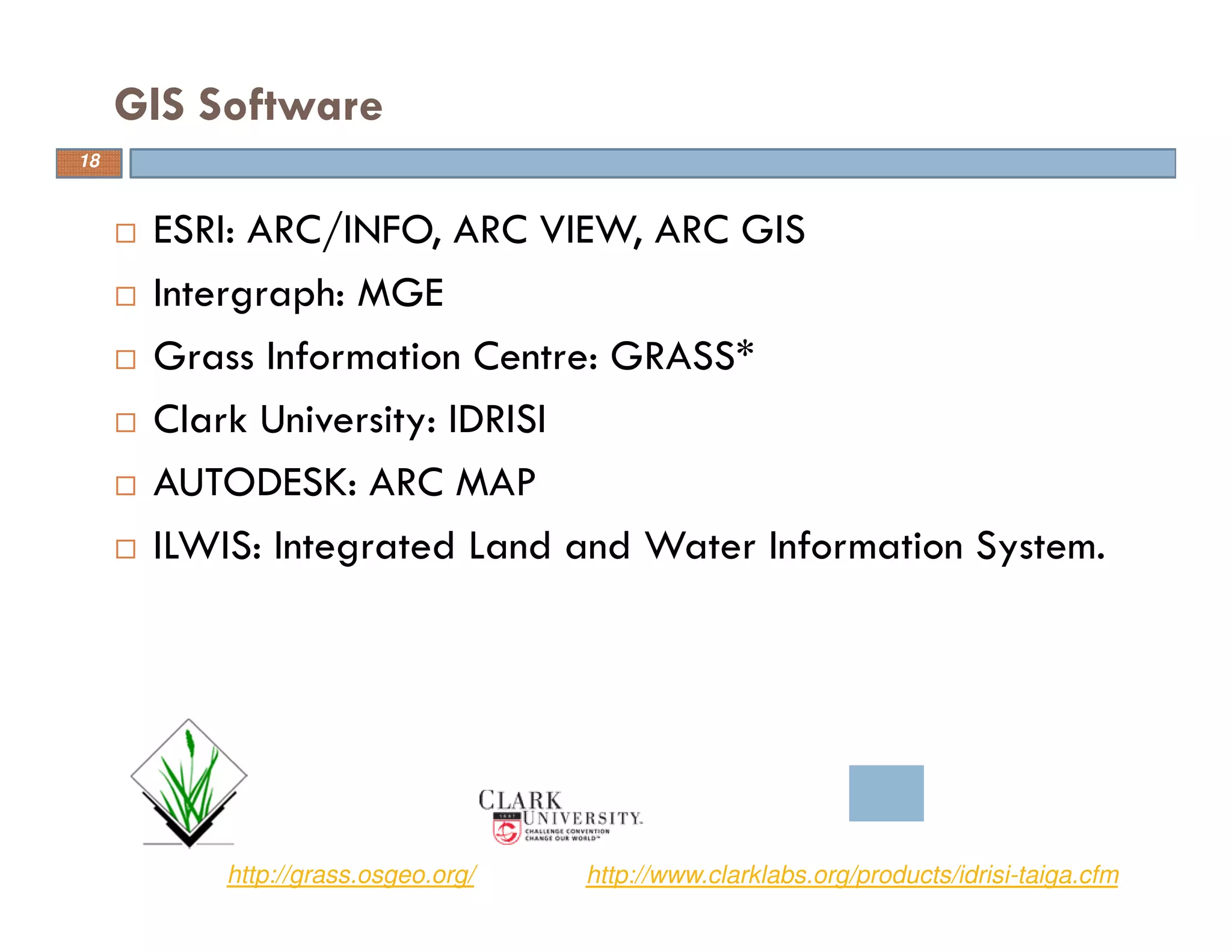
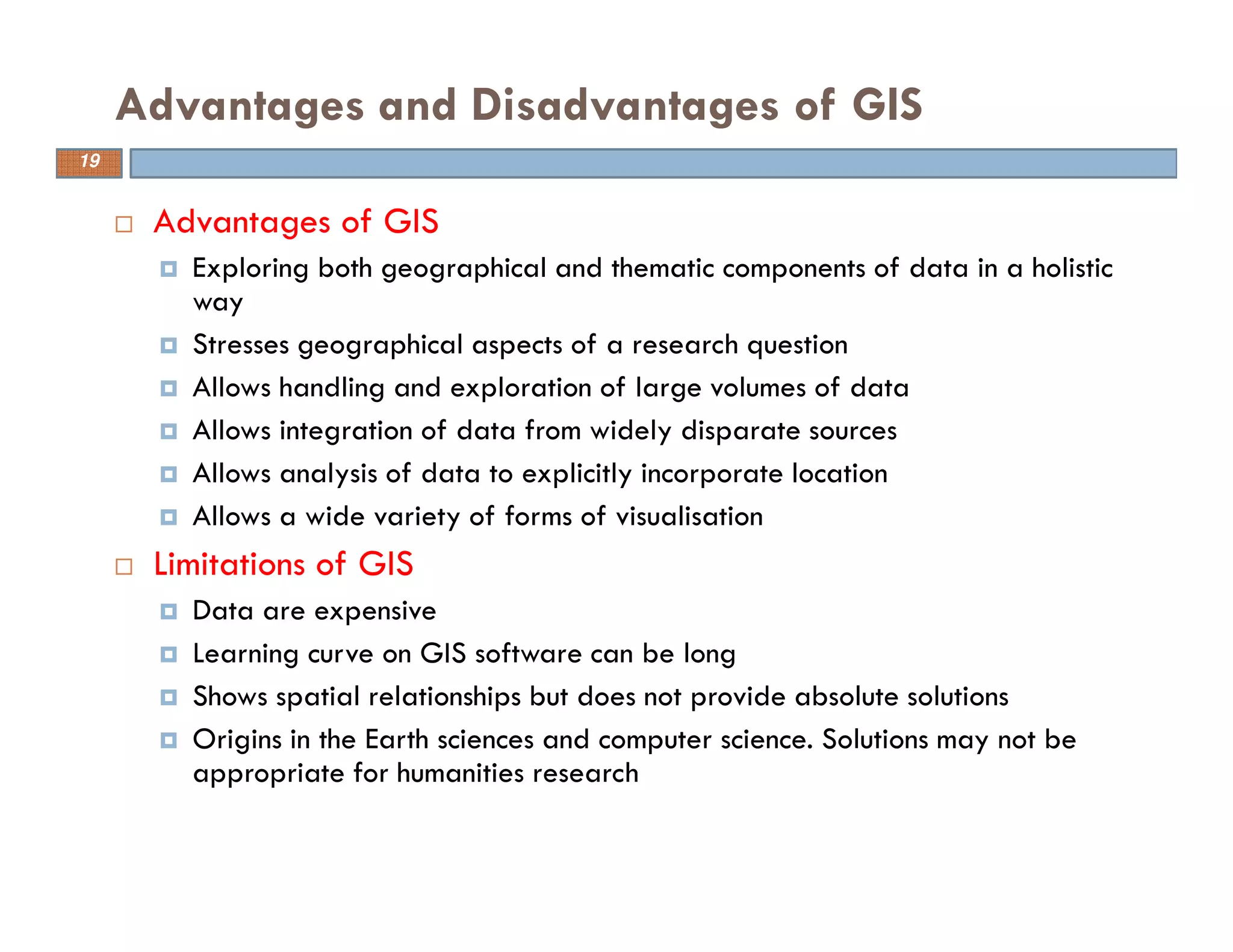
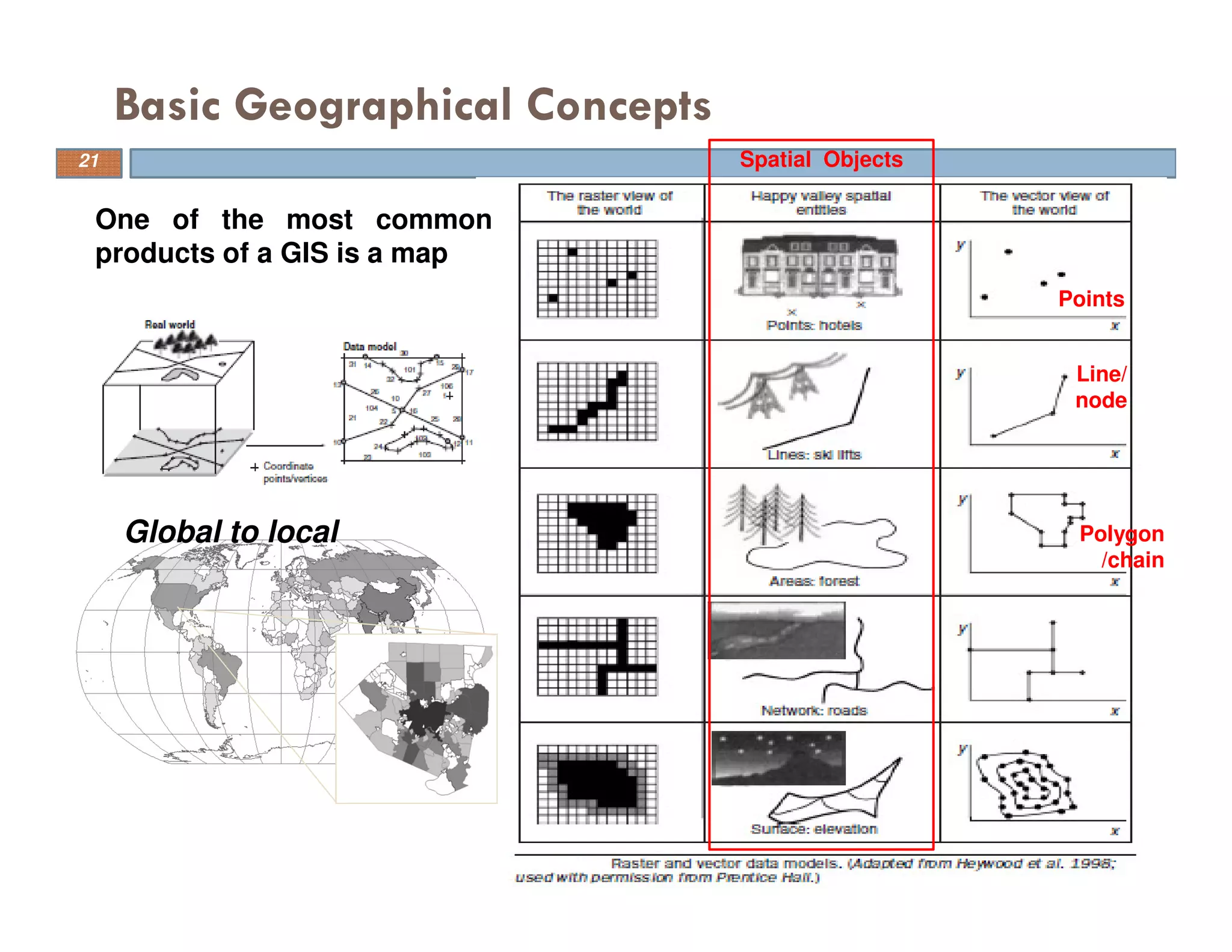
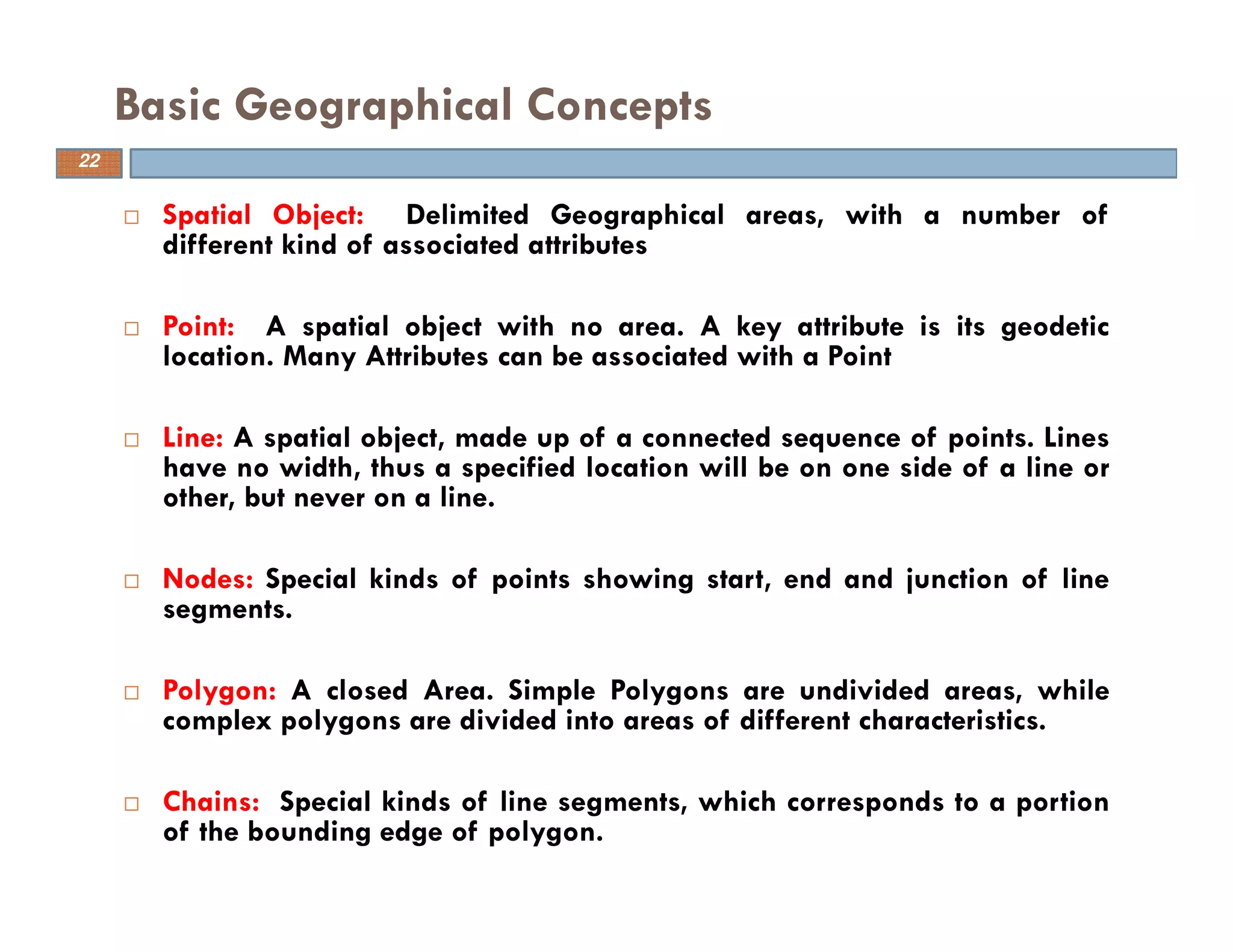
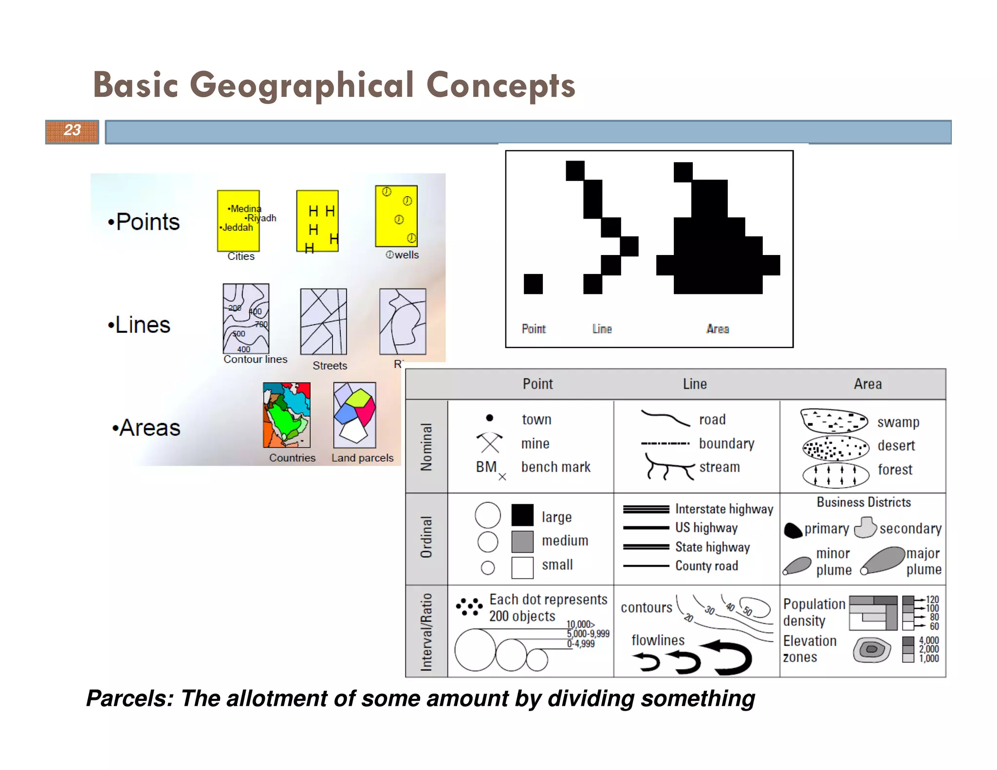
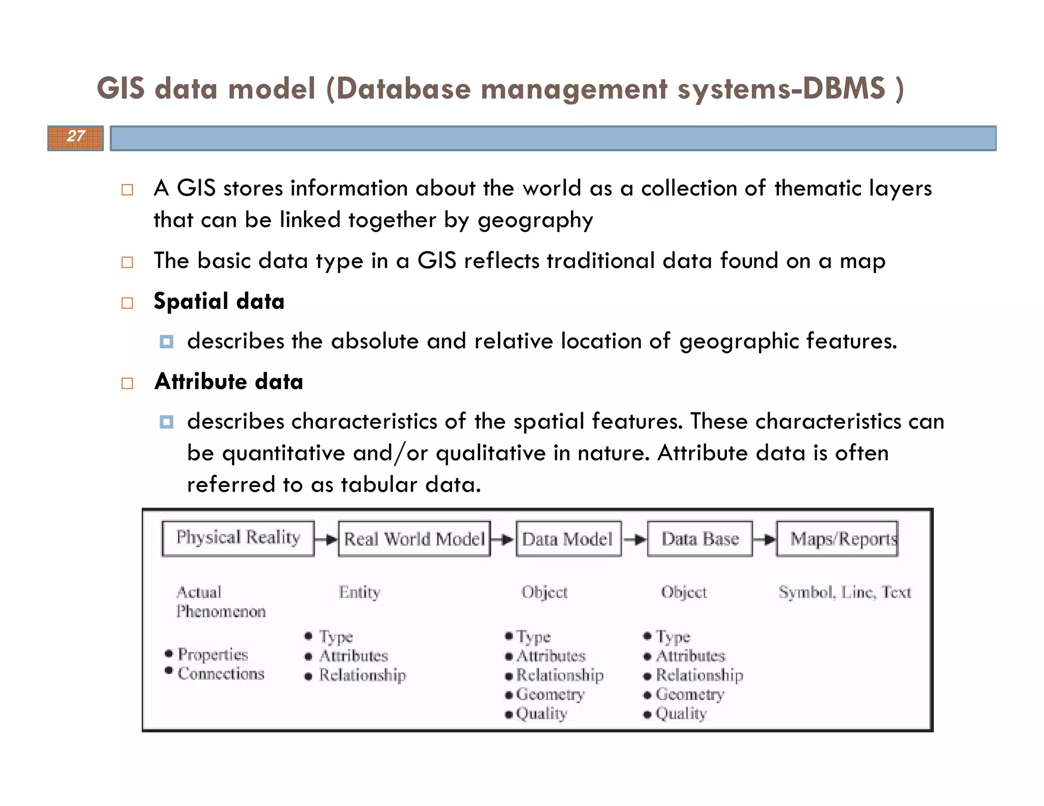
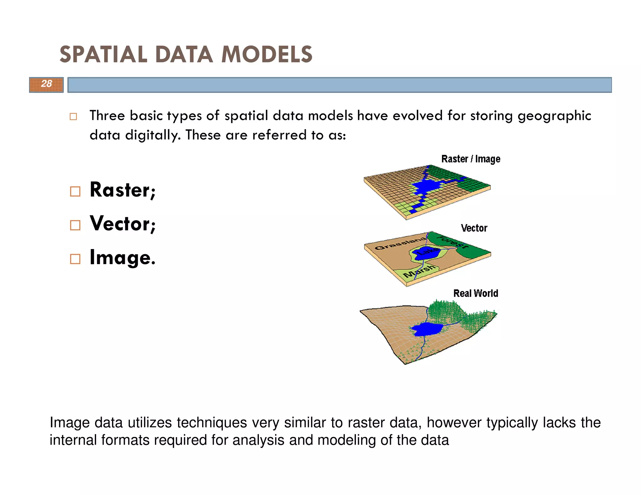
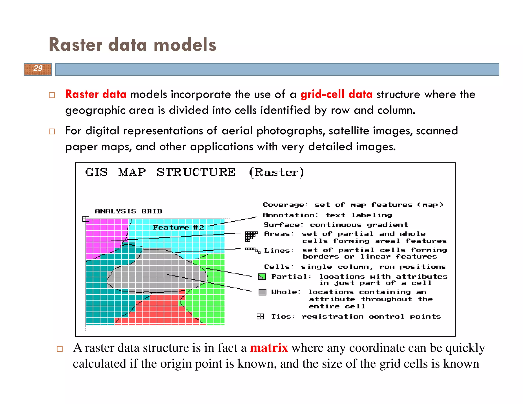
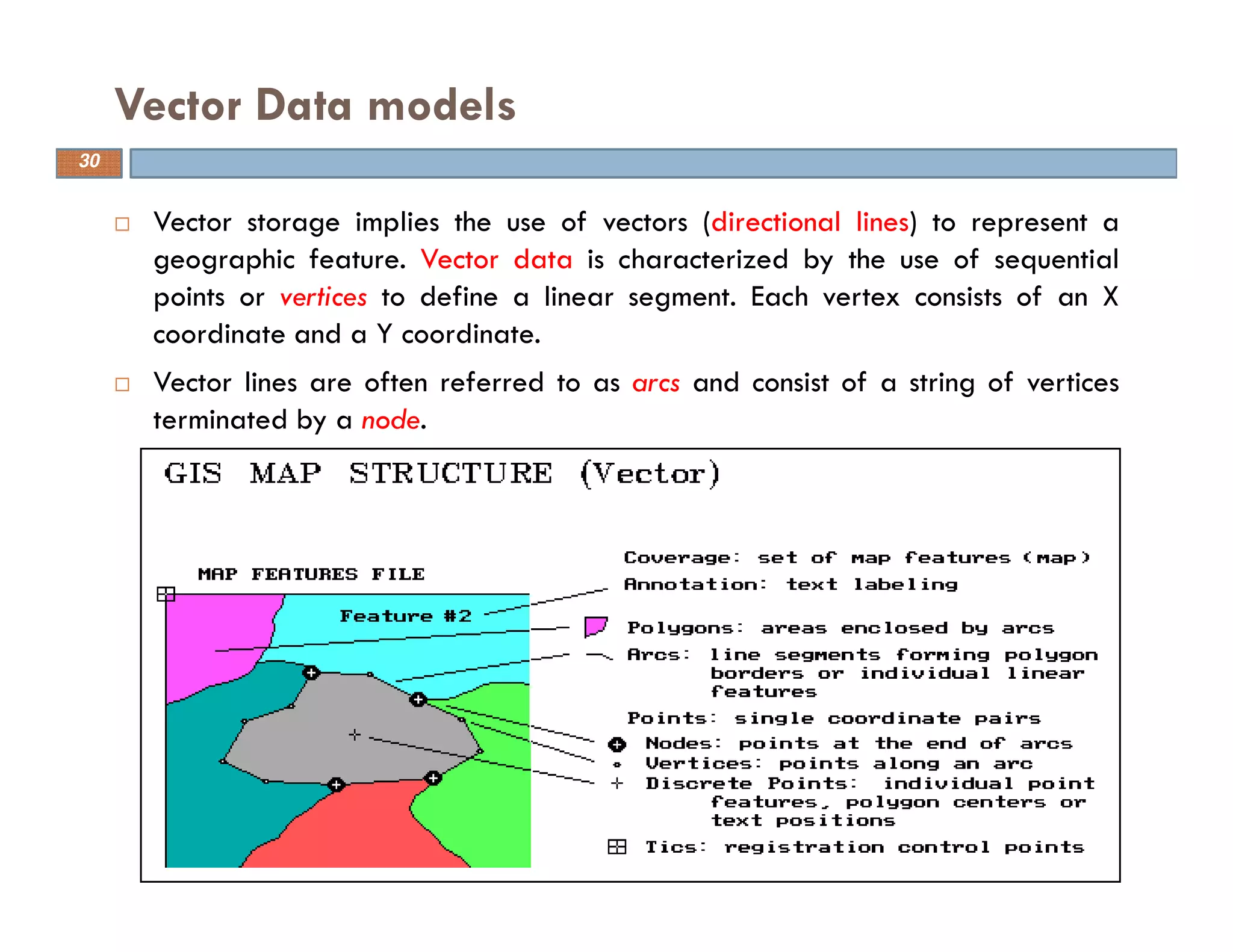
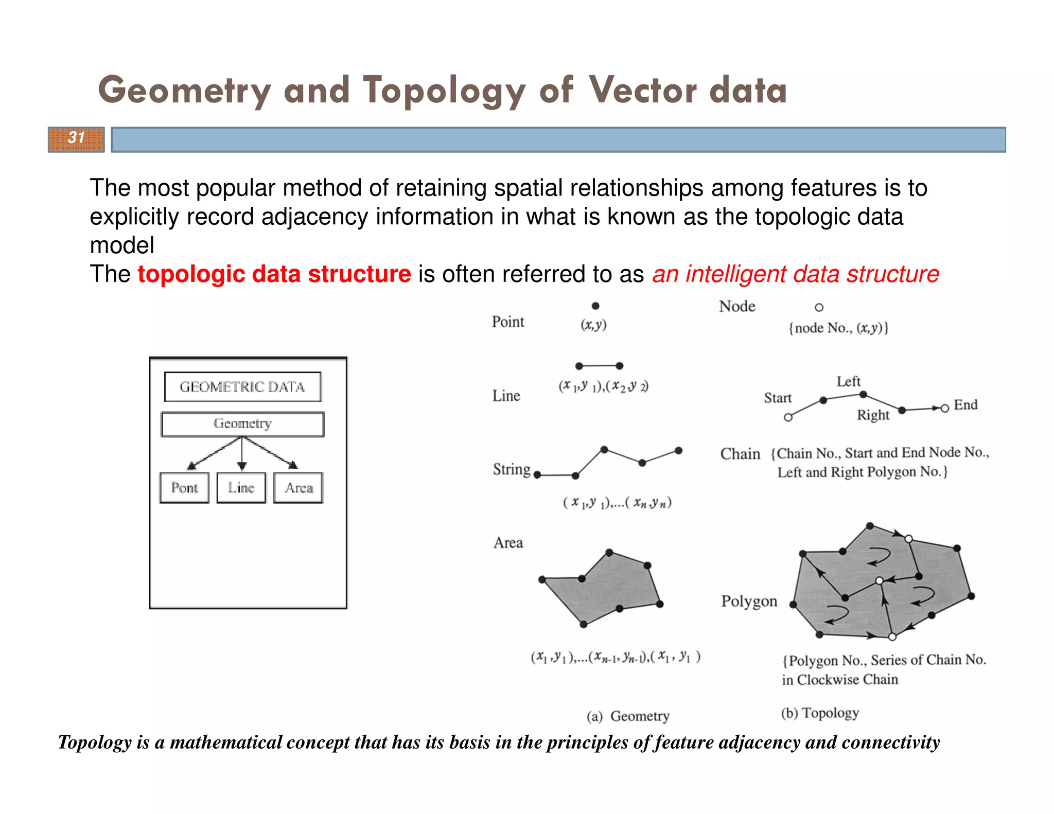
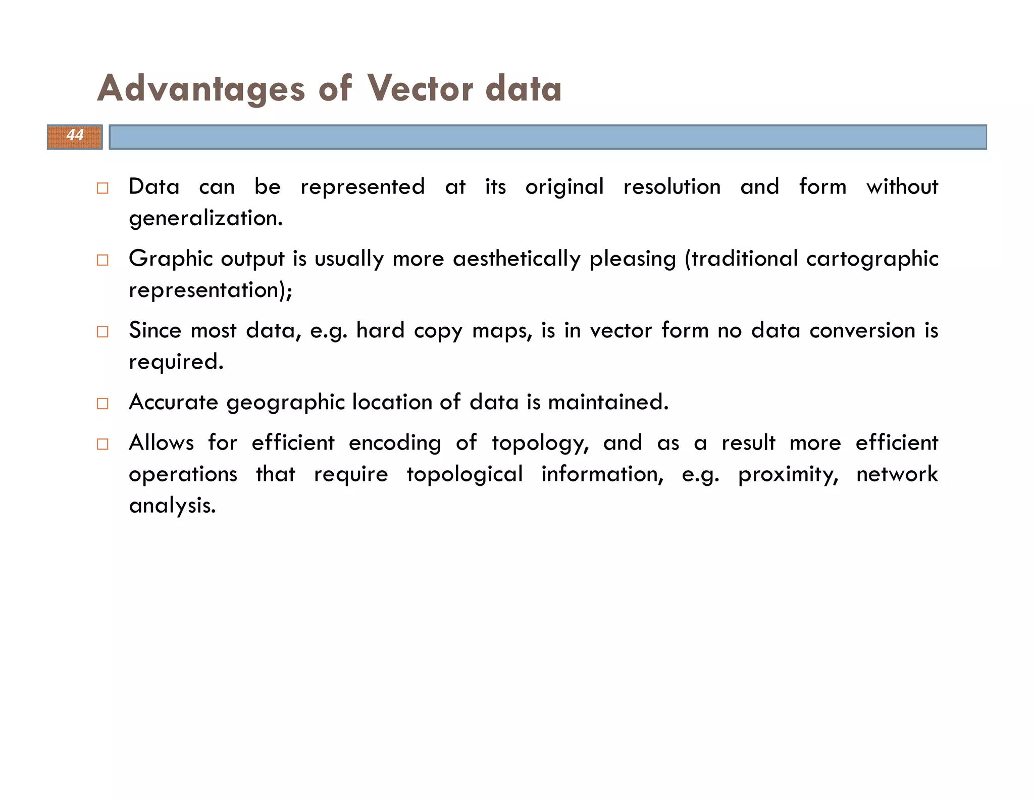
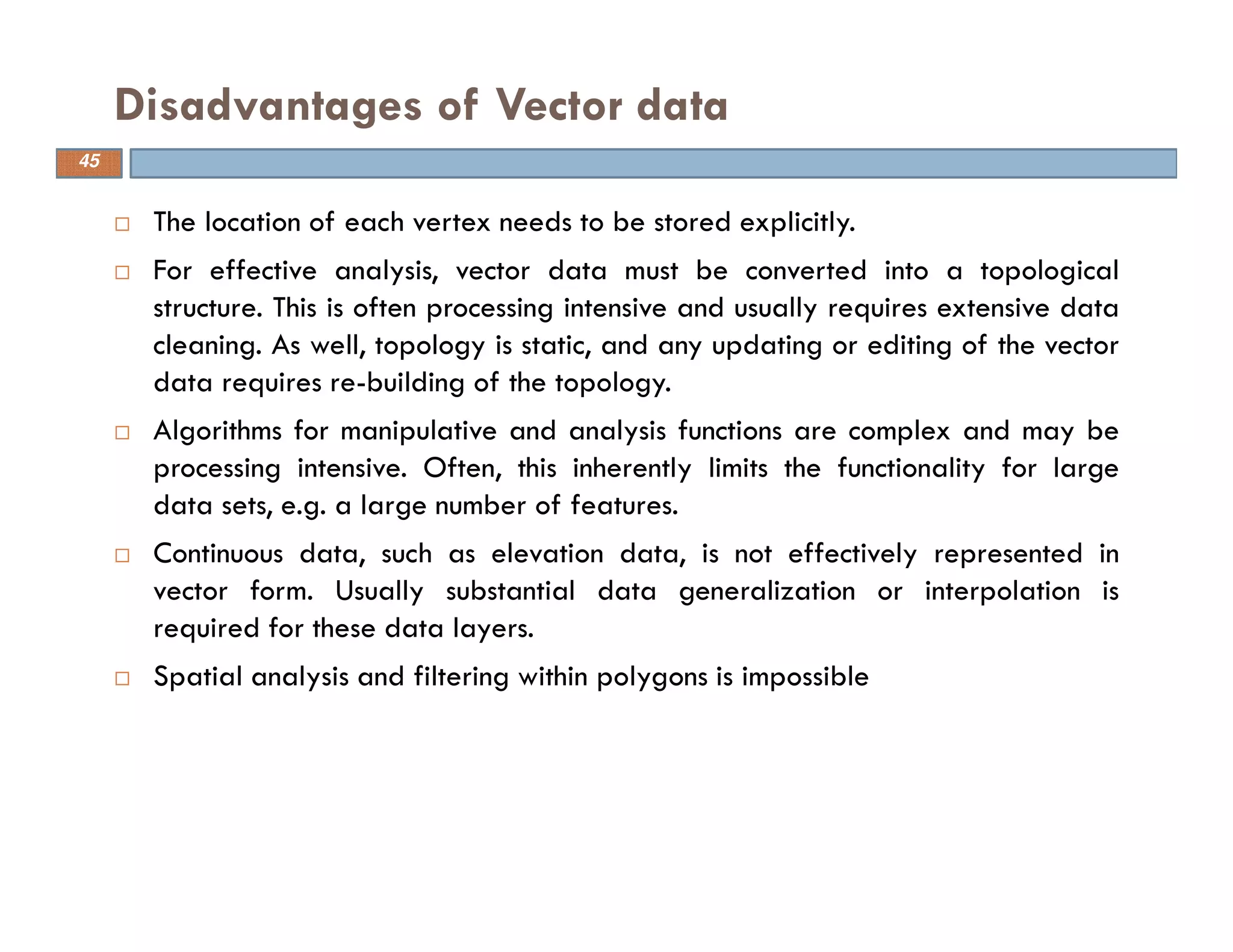
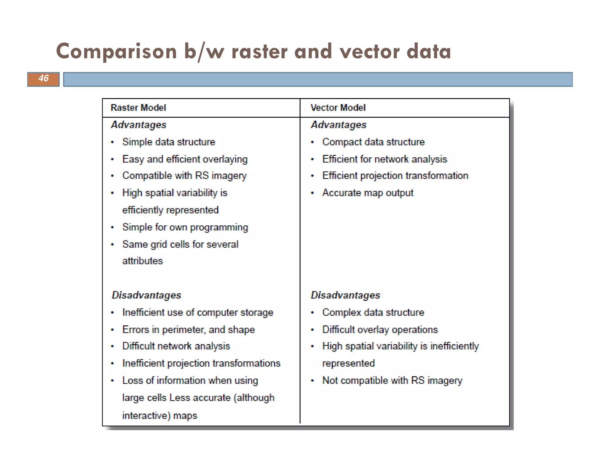

The document discusses the application of remote sensing and geographical information systems (GIS) in civil engineering. It provides definitions of remote sensing as remotely sensing objects on Earth and GIS as a system to capture, store, analyze and present geographically referenced data. The document outlines some basic concepts of GIS including its origins from technologies like computer-aided cartography and databases. It also discusses data types in GIS like spatial data, attributes and different data models. Common software, functional elements and applications of GIS in areas like facilities management and environmental planning are summarized as well.


![Engineering Economics: Solved exam problems [ch1-ch4]](https://cdn.slidesharecdn.com/ss_thumbnails/solvedexamproblemsch1-ch4-200220070043-thumbnail.jpg?width=640&height=640&fit=bounds)