Download as PDF, PPTX


![infinity-project.org
The Caruth Institute for Engineering Education
Engineering Education for today’s classroom. M.Shanmugaraj Lec/CivilVSVN POLYTECHNIC COLLEGE., VIRUDHUNAGARDEPARTMENT OF CIVIL ENGINEERINGSetting up of Total Station
Levelling the Screen:
•Press [ON] to power on
•Press [TILT]in the second page of
Measmode to display the circular level on the screen
•Center the bubble in the circular level
•Set the tilt angle to 00 using foot screws
A & B
•for the Xdirection and leveling screw Cfor Y direction](https://image.slidesharecdn.com/modernsurveyinglmp-141104111107-conversion-gate01/85/Modern-Surveying-49-320.jpg)


![infinity-project.org
The Caruth Institute for Engineering Education
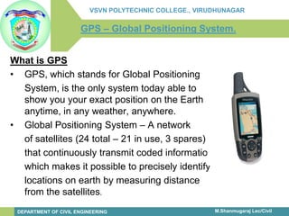
Engineering Education for today’s classroom. M.Shanmugaraj Lec/CivilVSVN POLYTECHNIC COLLEGE., VIRUDHUNAGARDEPARTMENT OF CIVIL ENGINEERINGFormat of Storage in Total Station
1.Point Id
2.Easting (x –Coordinate)
3.Northing (y –Coordinate)
4.Elevation (z-Coordinate)
5.Point code [String like
TR for tree CW for
compound wall etc]](https://image.slidesharecdn.com/modernsurveyinglmp-141104111107-conversion-gate01/85/Modern-Surveying-52-320.jpg)


![infinity-project.org
The Caruth Institute for Engineering Education
Engineering Education for today’s classroom.
M.Shanmugaraj Lec/Civil
VSVN POLYTECHNIC COLLEGE., VIRUDHUNAGAR
DEPARTMENT OF CIVIL ENGINEERINGHard wares
Total station with inbuilt programmes.
Tribrach with adopter to hold prism. [Optional]
Prism pole, prism and target.
Mini prism for setting out.
Down loading cable.
Plotter [A0]](https://image.slidesharecdn.com/modernsurveyinglmp-141104111107-conversion-gate01/85/Modern-Surveying-69-320.jpg)


The document discusses the topic of surveying. It provides an overview of the history and evolution of surveying, from its beginnings in ancient Egypt to modern techniques using tools like total stations and GPS. Some key points covered include the various types and categories of surveying work, the traditional equipment used, and how modern digital instruments like total stations integrate distance measurement and angle measurement capabilities into one device.