Downloaded 2,390 times
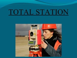

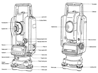
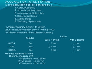
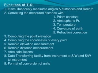
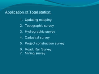


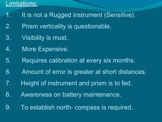


Total station is an electronic surveying instrument that combines an electronic distance meter (EDM), an electronic theodolite, and a microprocessor. It simultaneously measures horizontal and vertical angles as well as slope distances from the instrument to a particular point. Over 100 models have been released by different firms. Total stations can measure distances from 1.5 to 12 km depending on the number of prisms used, with angular accuracy ranging from 1 to 20 seconds. Applications include topographic surveys, construction layout, and mapping. Proper use requires establishing a site datum, setting up the total station, creating job files, measuring points, and post-processing data.