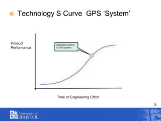
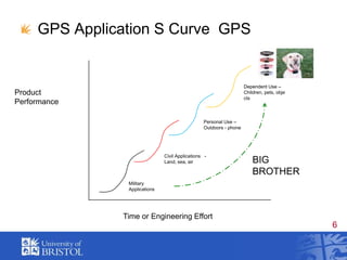
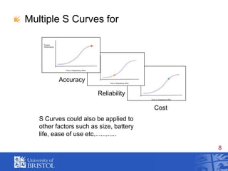
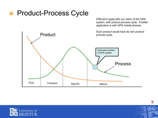
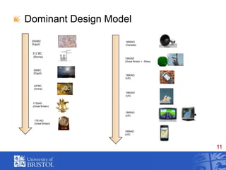
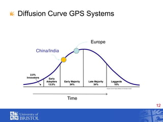
The document presents a historical overview of the Global Positioning System (GPS), detailing its development from inception in 1973 to full operational capability in 1995, with significant milestones such as its availability for civilian use in 1983. It discusses the evolution of GPS technology using various models, including S-curves, to analyze performance, accuracy, and market dynamics, highlighting challenges in applying existing models to complex systems. The conclusion emphasizes the utility of these models for discussing technology strategy while acknowledging their limitations.

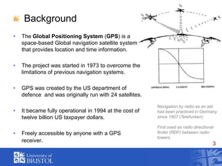
![GPS TimelineIn 1972, the US Air Force developmental flight tests of two prototype GPS receivers In 1978 the first experimental Block-I GPS satellite was launched. In 1983, civilian airliner strayed into restricted Soviet airspace due to navigational errors and shot , GPS made available for civilian use.February 14, 1989, the first modern Block-II satellite was launched. December 1993 the GPS achieved initial operational capability[51] January 17, 1994 a complete constellation of 24 satellites was in orbit. Full Operational Capability was declared by NAVSTAR in April 1995. In 1996, US declaring GPS to be a dual-use system (national asset). In 1998, two new civilian signals for enhanced user accuracy and reliability, particularly with respect to aviation safety. On May 2, 2000 "Selective Availability" was discontinued In 2004, US and European Community establishing cooperation related to Garmin GPSand Europe's planned Galileo system. November 2004, successful tests of Assisted-GPS for mobile phones.In 2005, the first modernized GPS satellite was launched and began transmitting a second civilian signal for enhanced user performance.](https://image.slidesharecdn.com/gpspresentationviie-110523102939-phpapp01/85/Global-Positioning-System-GPS-4-320.jpg)


!["GPS" Global Positioning System [PDF]](https://cdn.slidesharecdn.com/ss_thumbnails/globalpositioningsystemgpsmainpdf-101105164539-phpapp01-thumbnail.jpg?width=640&height=640&fit=bounds)


![It presentation[1][1]final](https://cdn.slidesharecdn.com/ss_thumbnails/itpresentation11final-121205041010-phpapp01-thumbnail.jpg?width=640&height=640&fit=bounds)


