Download as PDF, PPTX


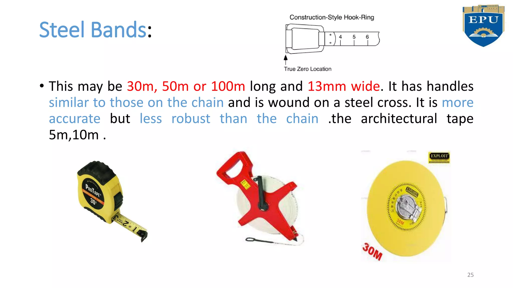


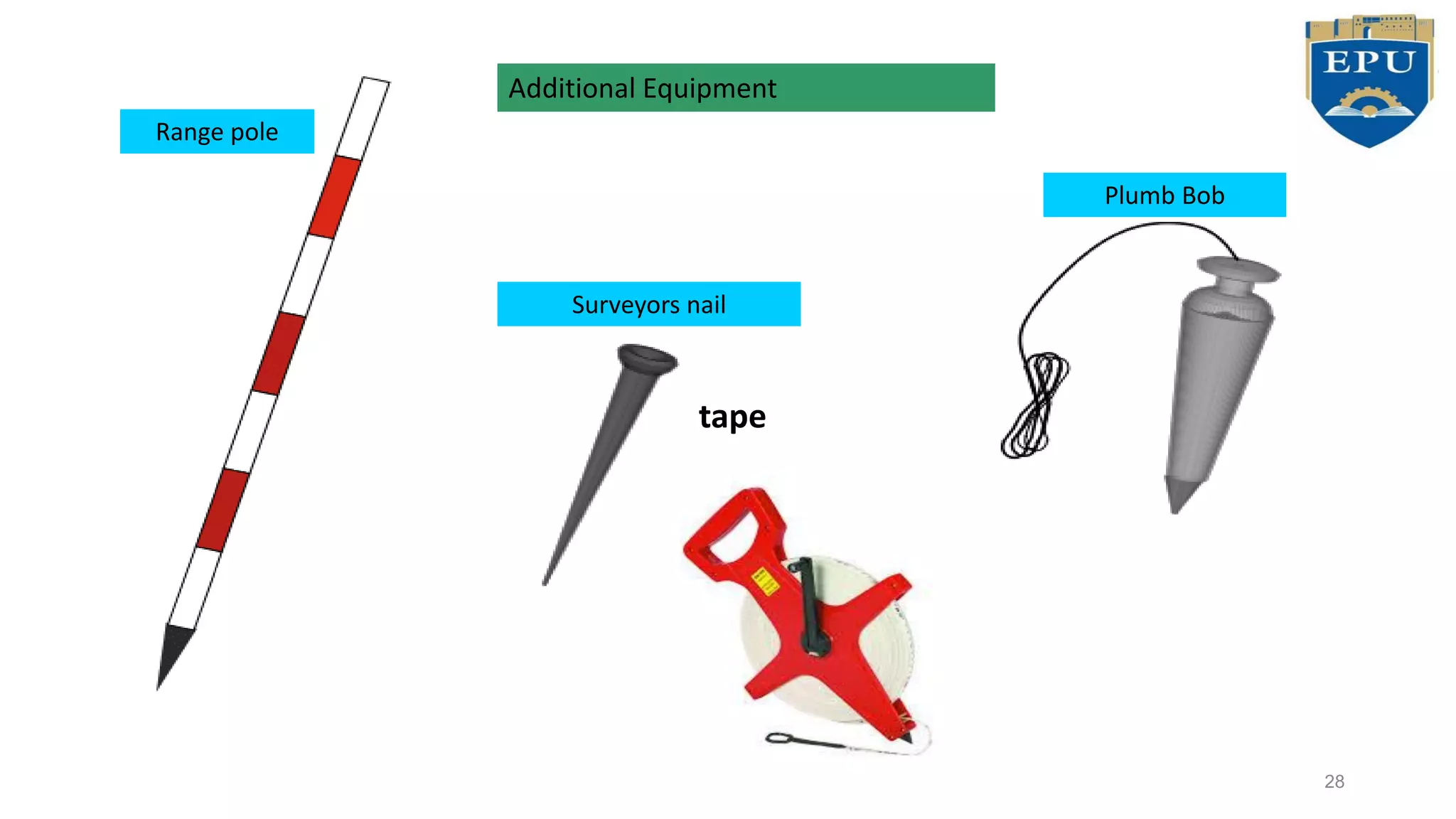


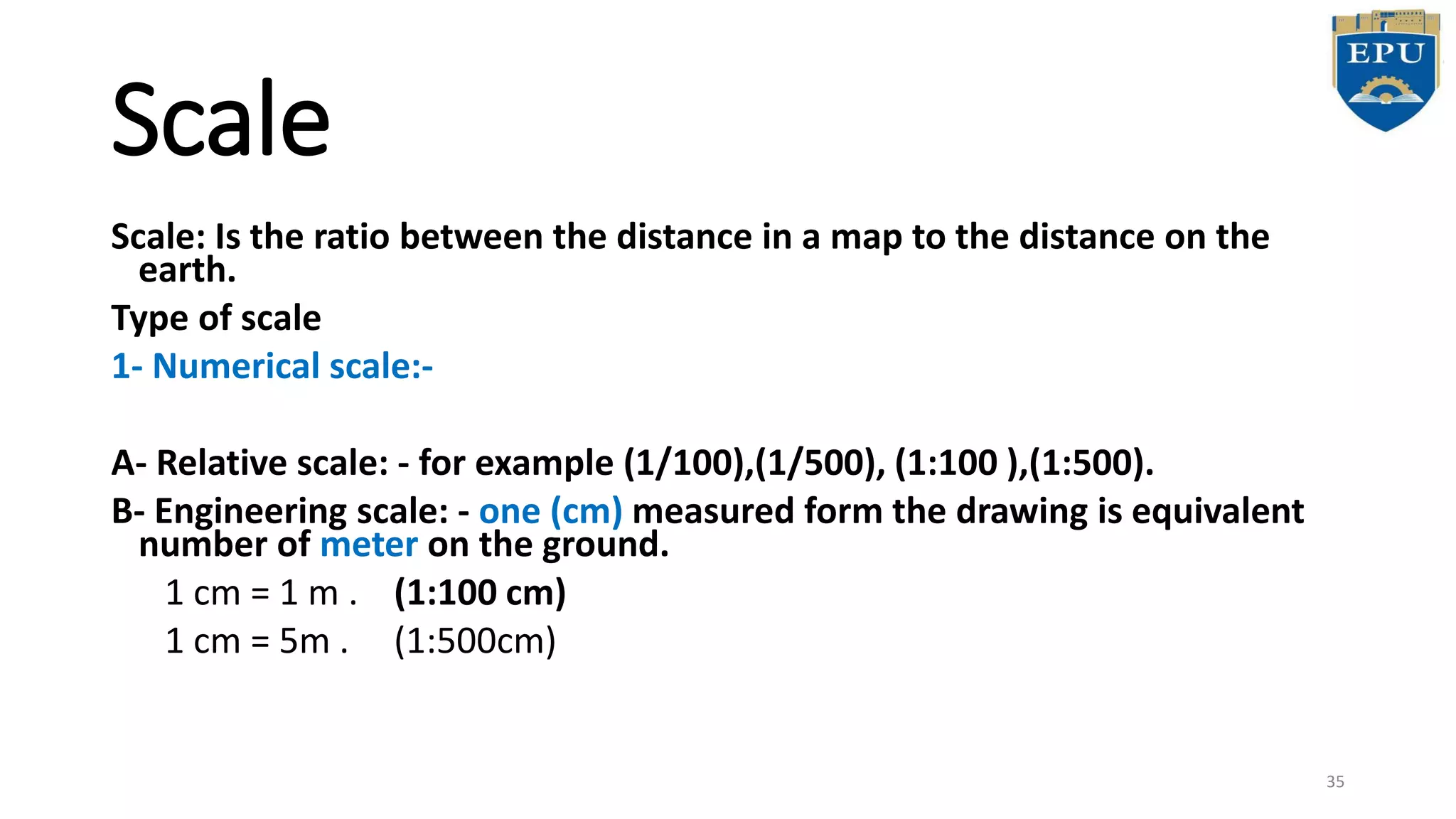

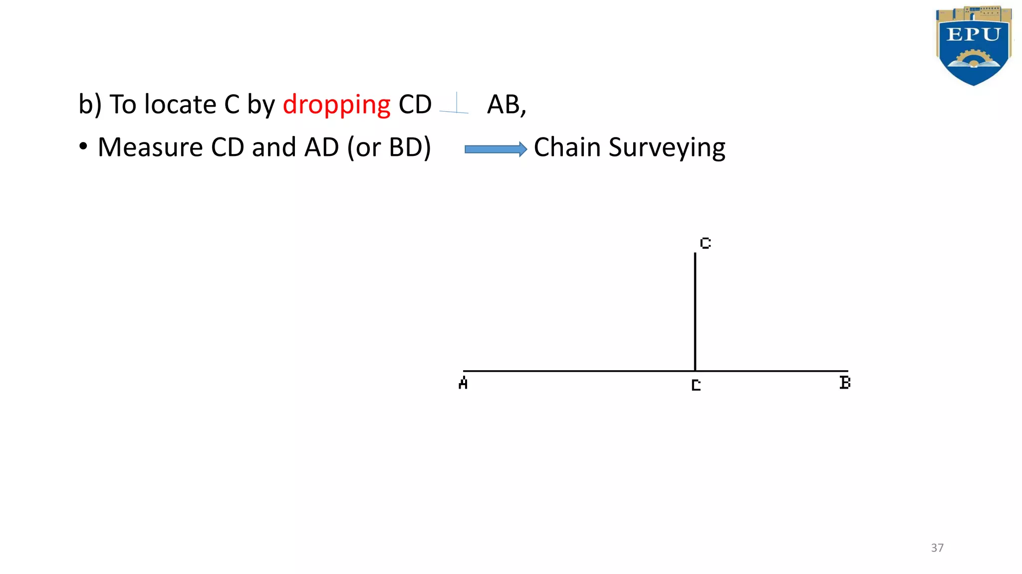


The document provides an overview of surveying, detailing definitions, classifications, types, techniques, and instruments used in civil engineering. It covers both plane and geodetic surveying, various measurement methods, and essential tools such as chains, tapes, and laser distance meters. Key topics include the principles of surveying, error types, and procedures for accurate measurements in the field.


