Downloaded 252 times
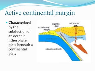
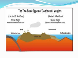

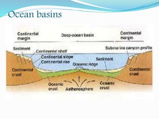
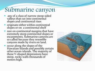
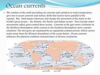
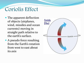
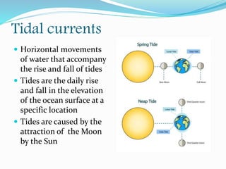
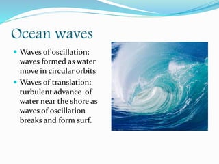

This document discusses various topics related to ocean floor topography including continental margins, oceanic divisions, submarine canyons, ocean currents, the Coriolis effect, tidal currents, ocean waves, and how waves can cause coastal erosion. It describes key features of passive and active continental margins and how the ocean floor transitions from the continental shelf to deeper ocean basins and trenches.


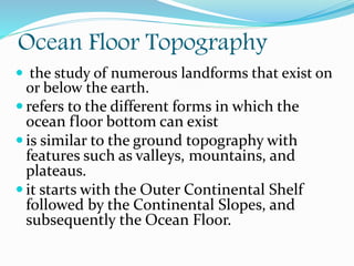
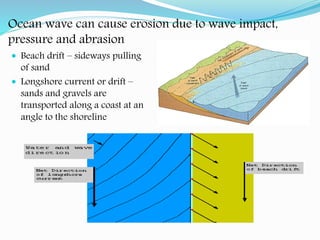
![15[1].3 Lecture](https://cdn.slidesharecdn.com/ss_thumbnails/1513-lecture-1207624870393961-9-thumbnail.jpg?width=640&height=640&fit=bounds)


