Download as PDF, PPTX

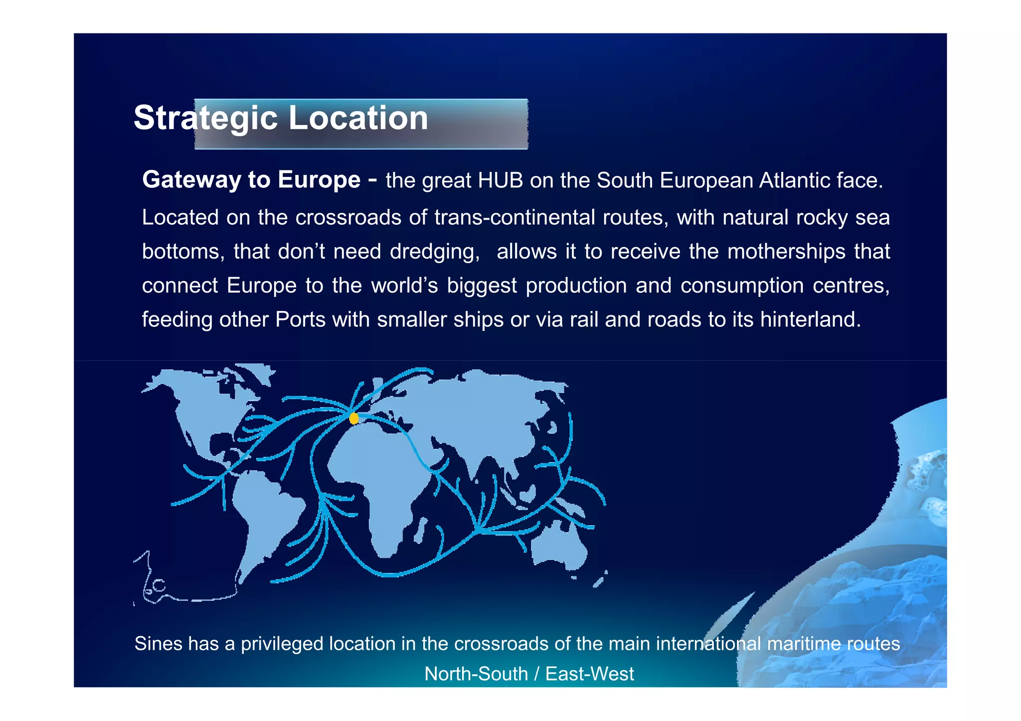
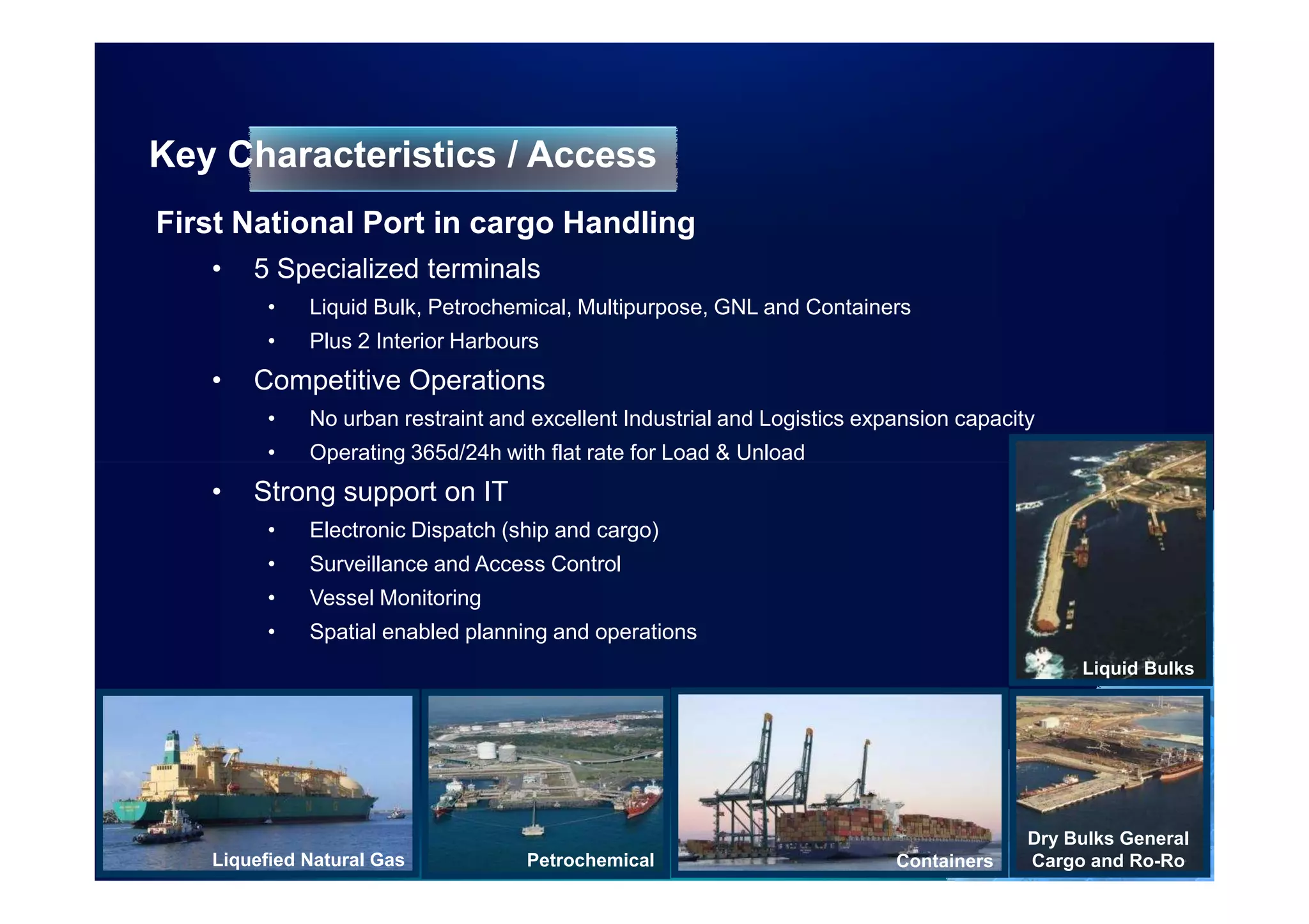
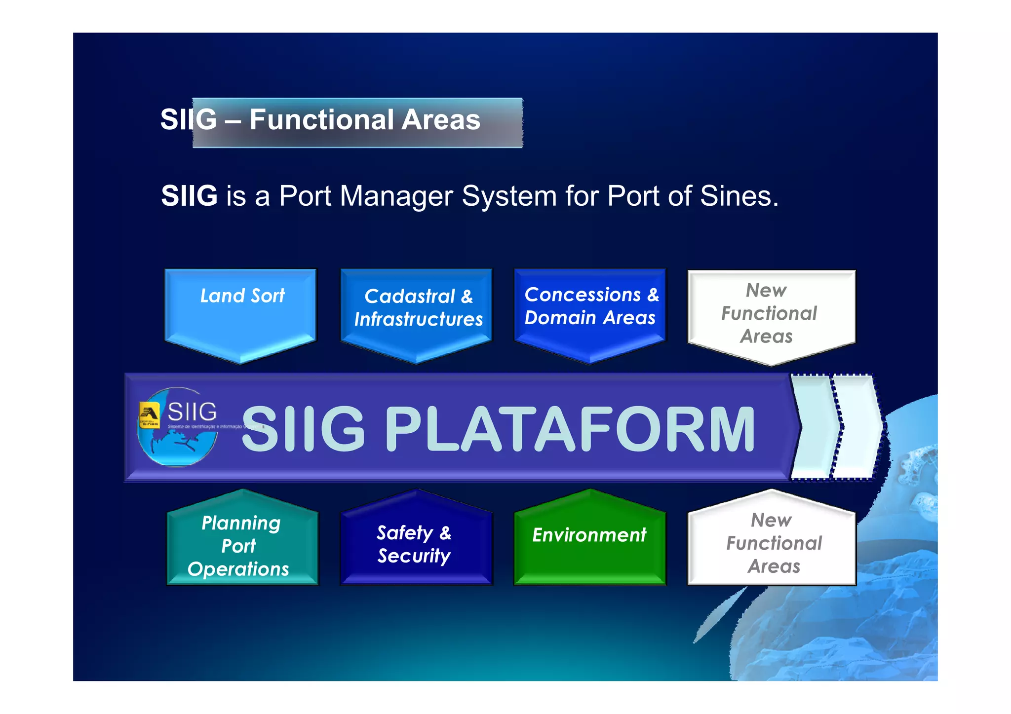
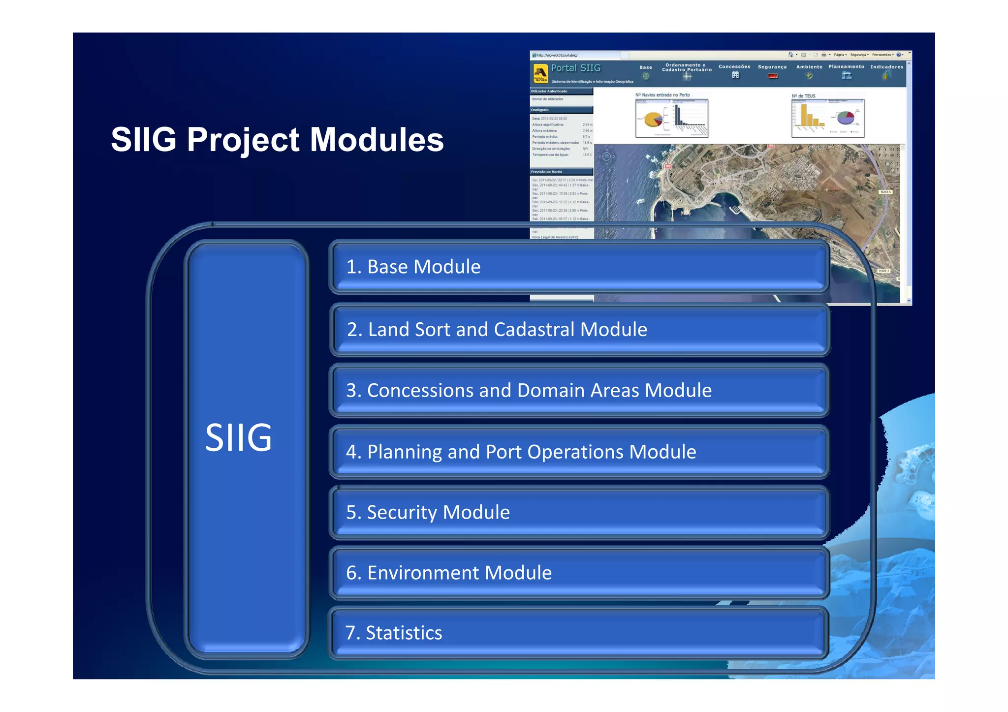
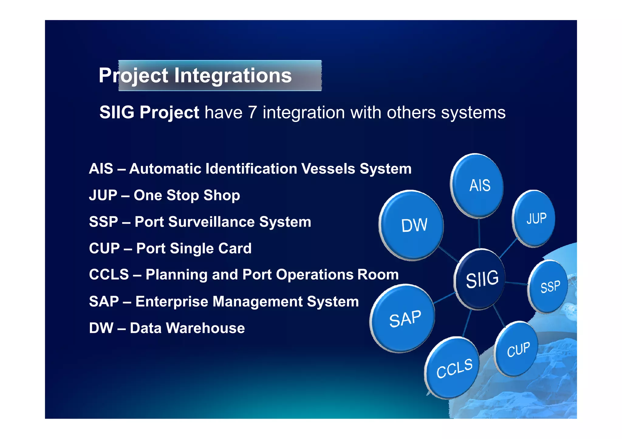
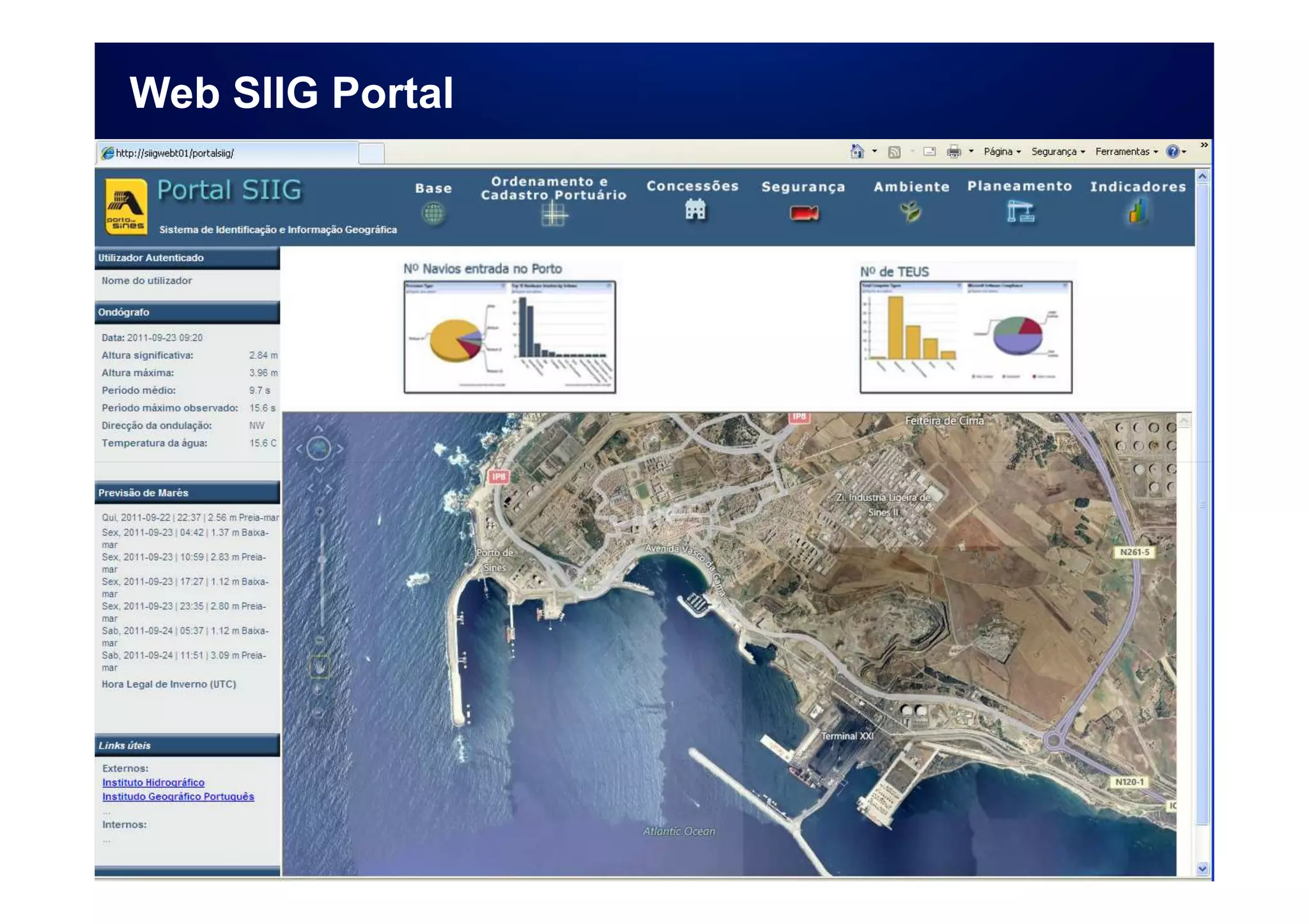
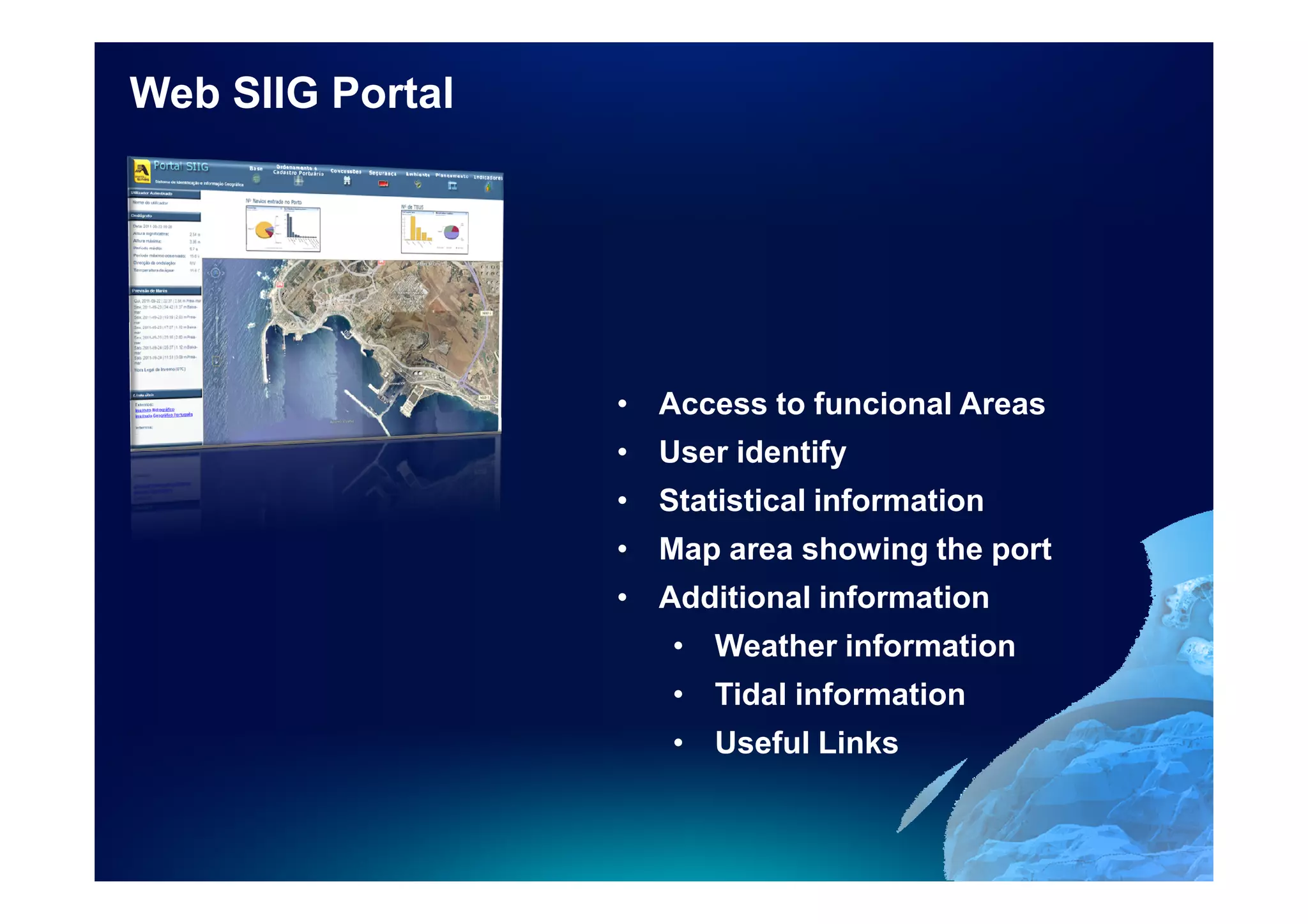
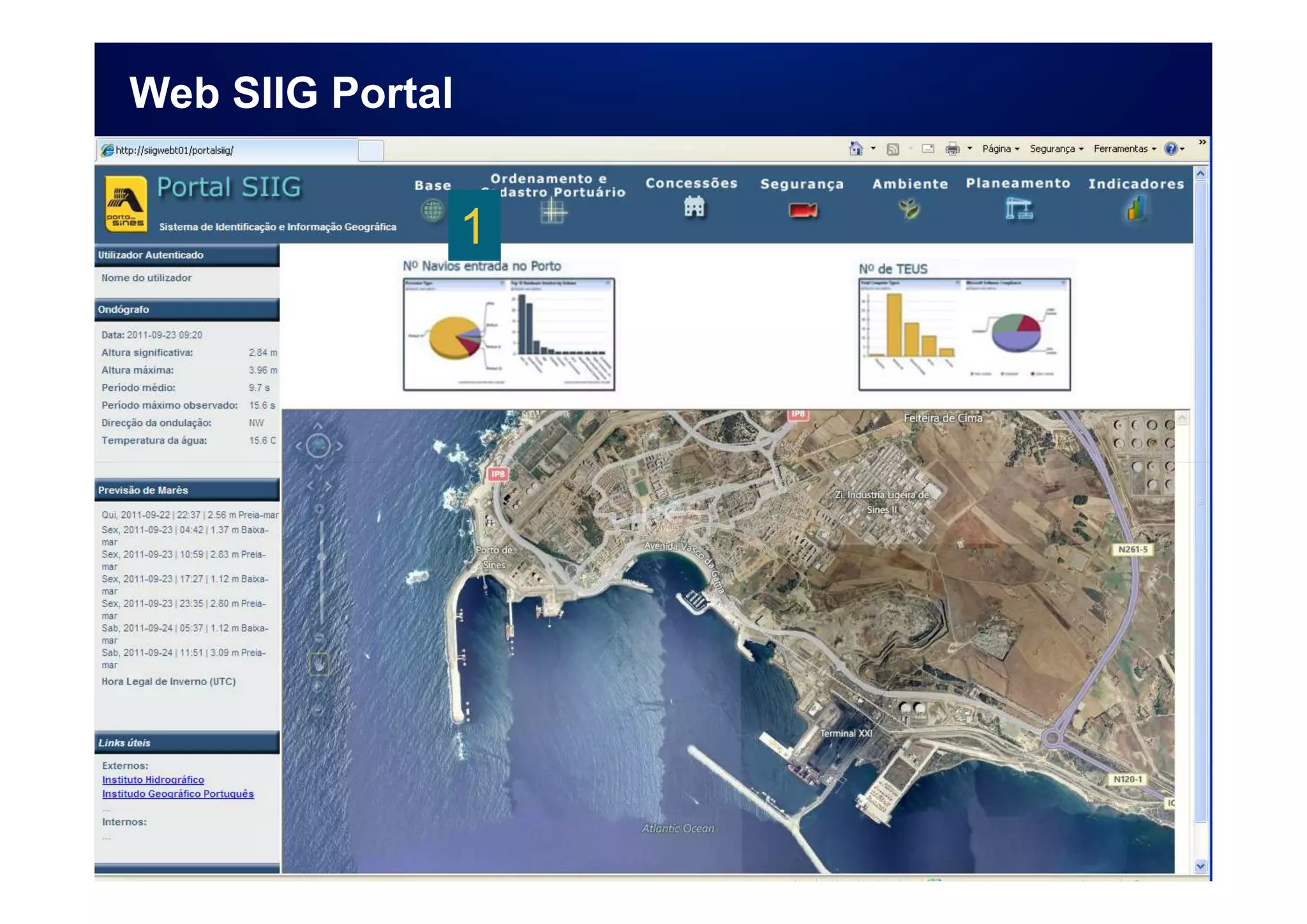
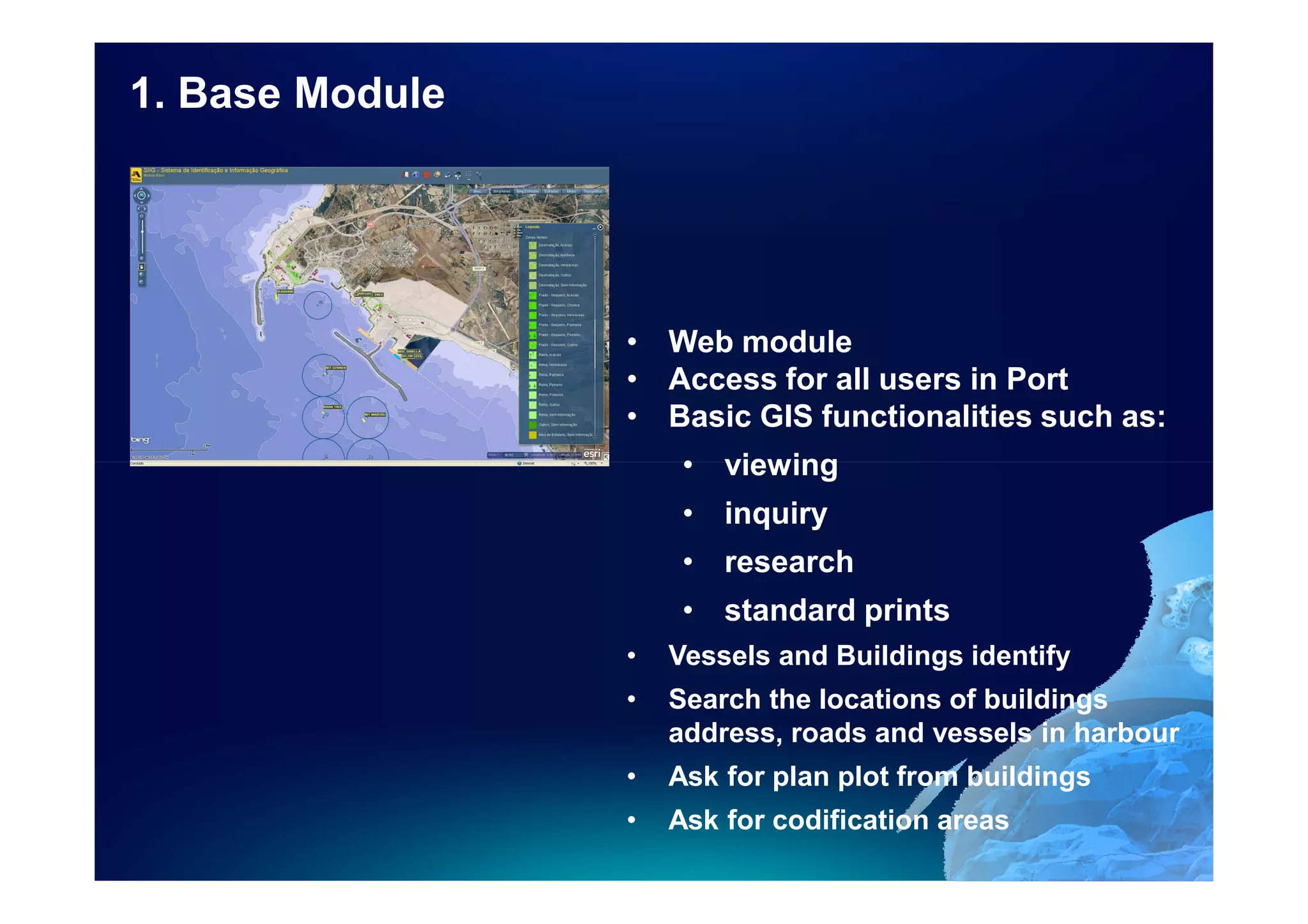

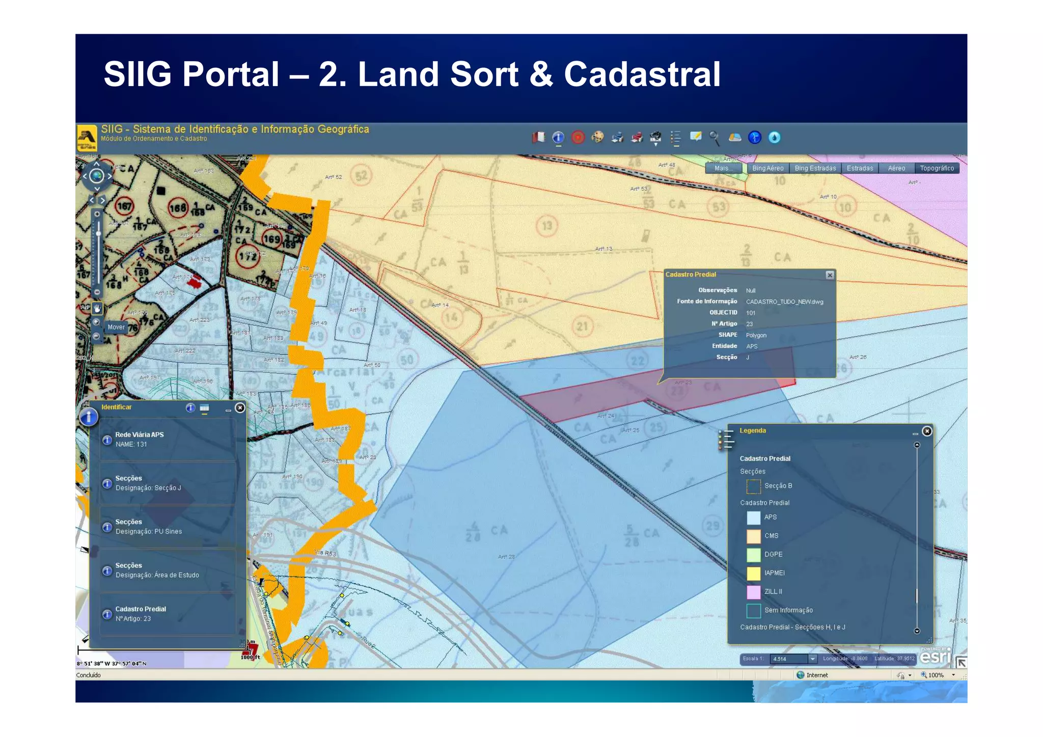
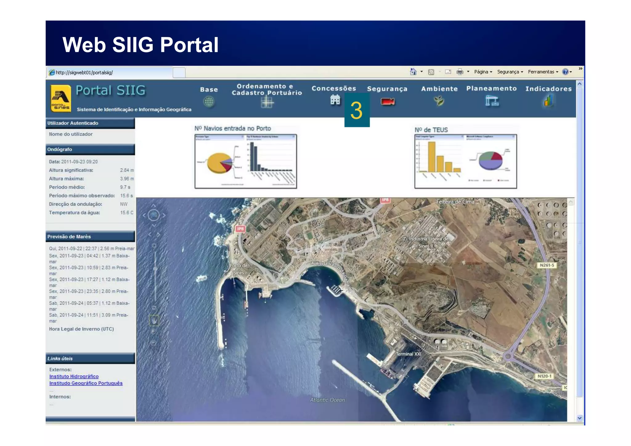
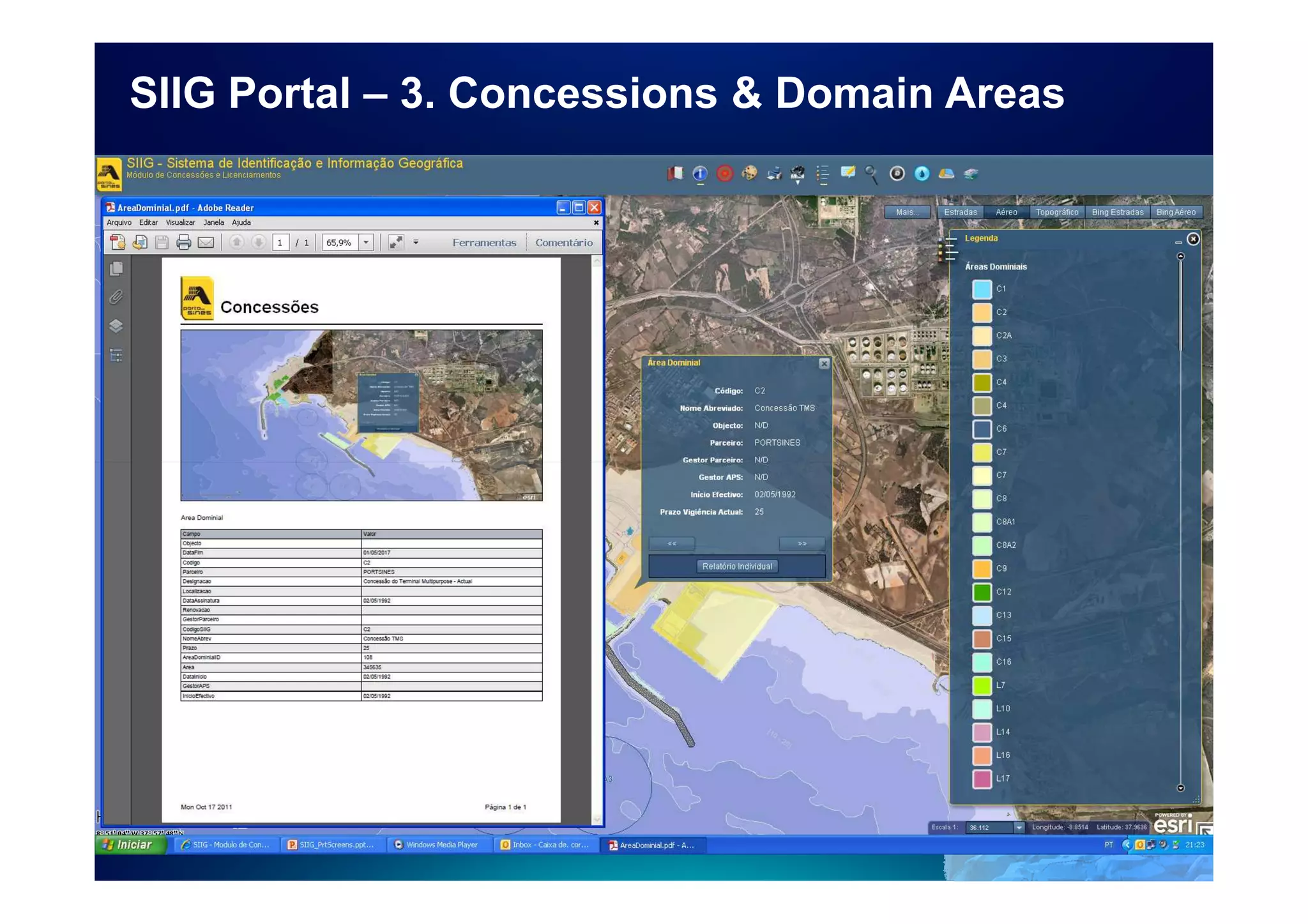

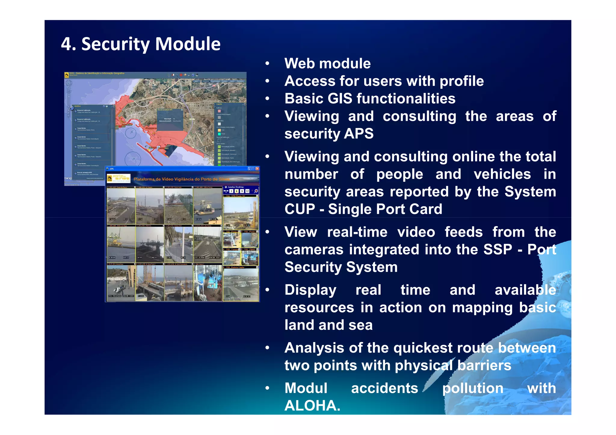
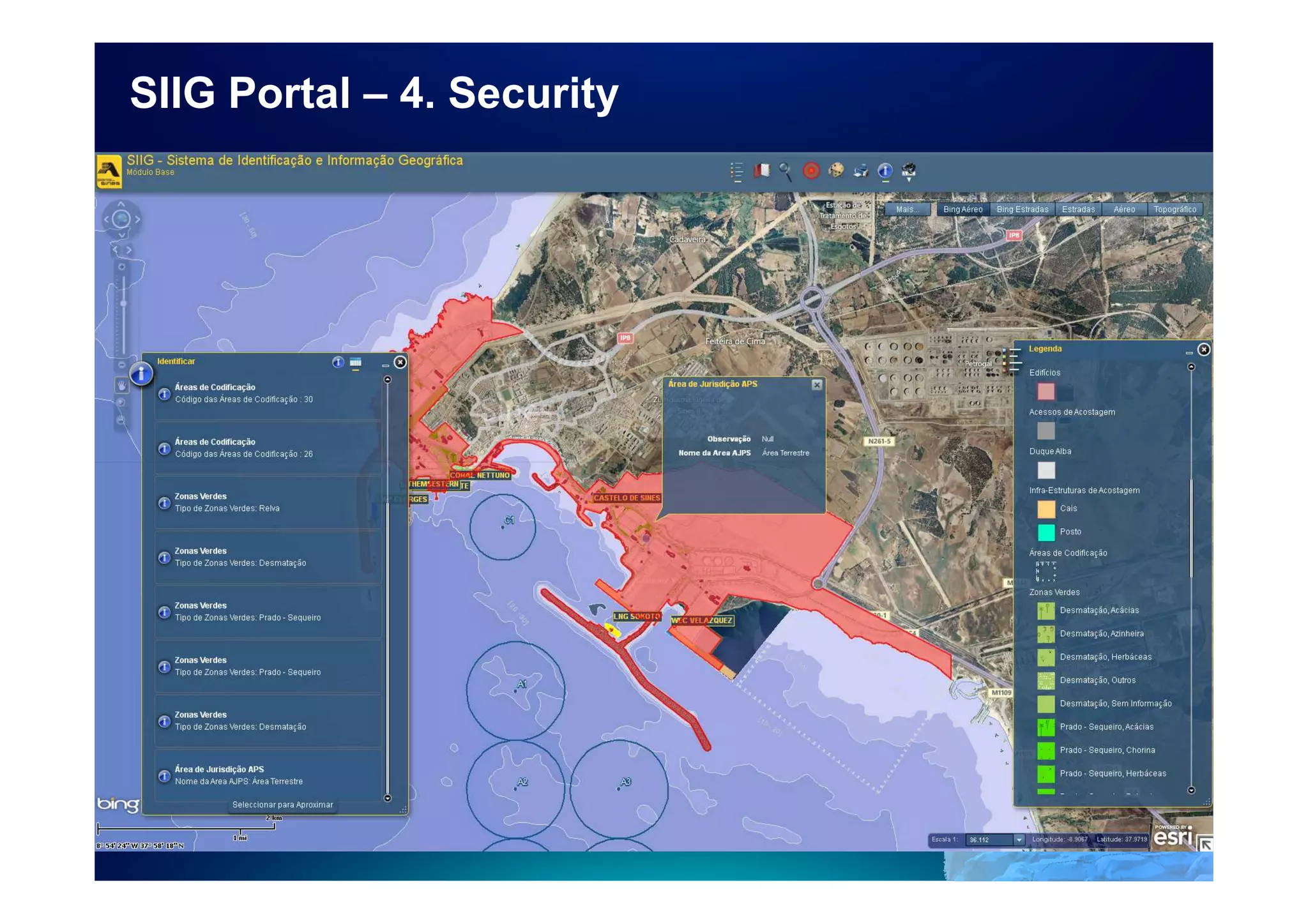

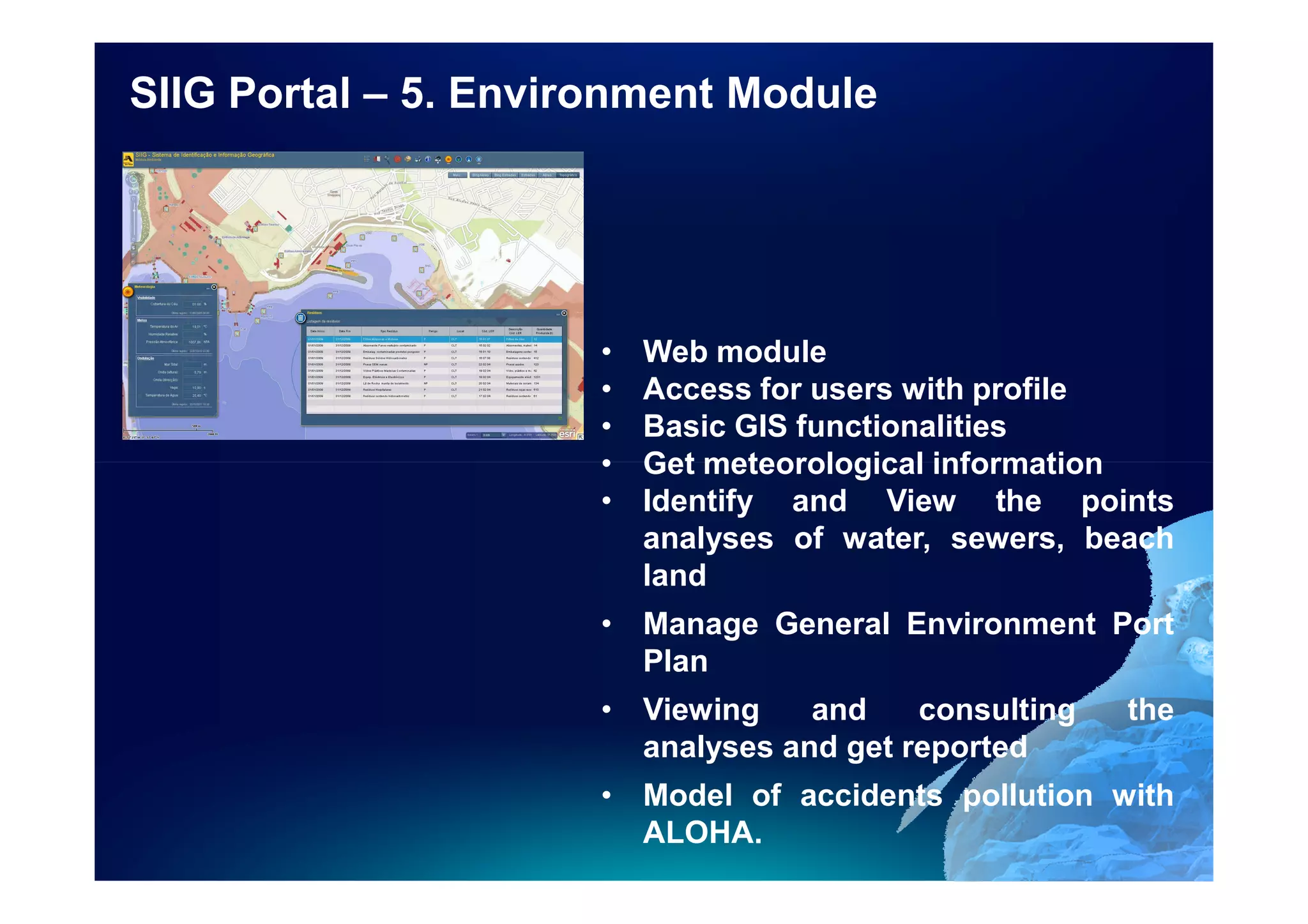
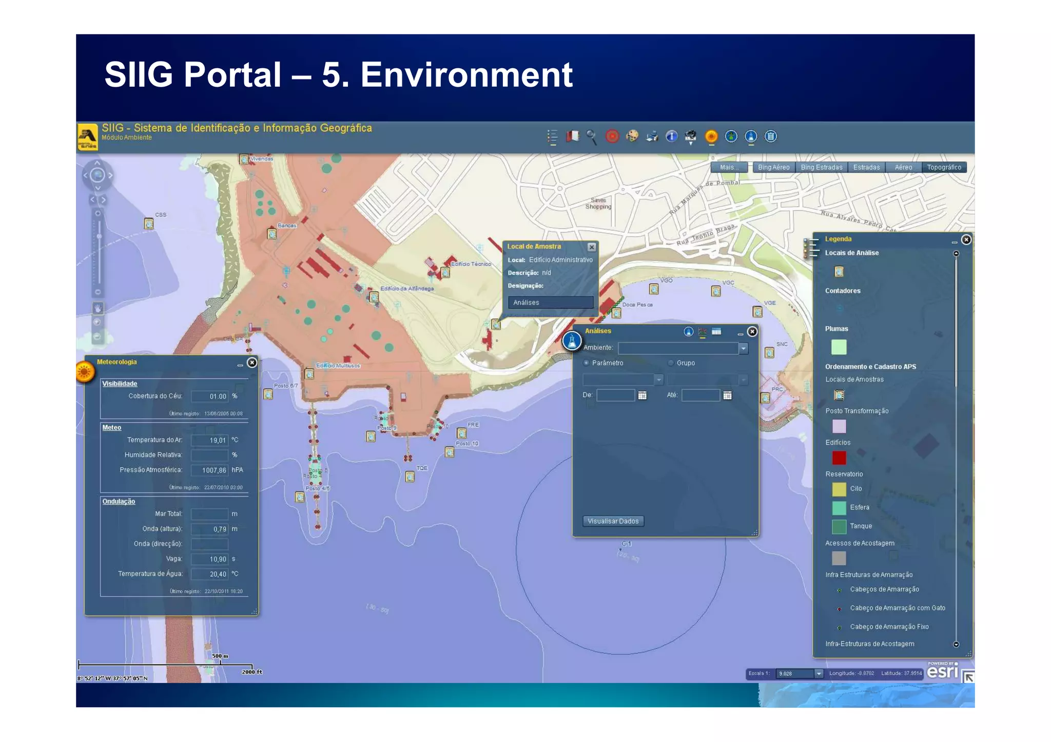
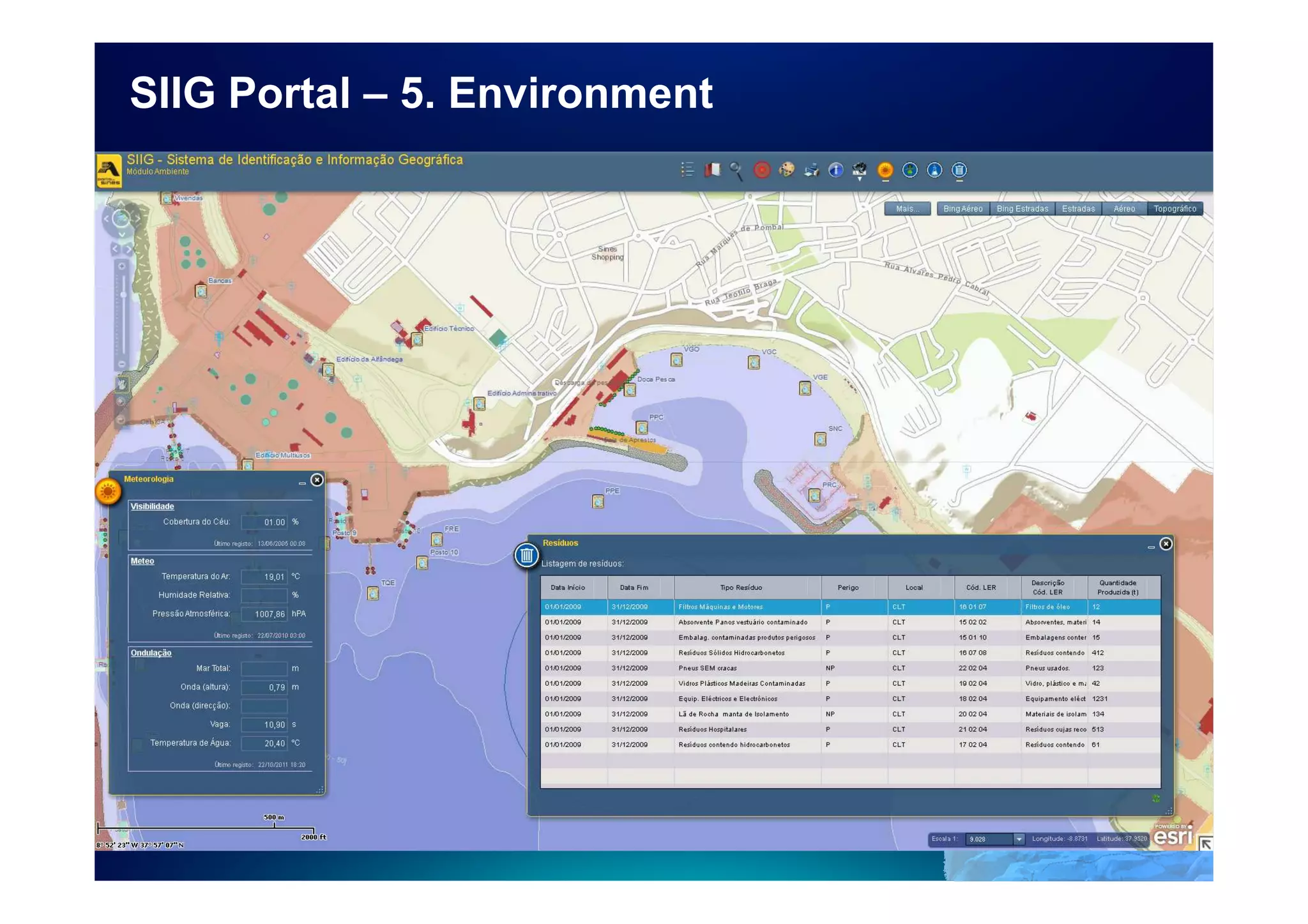

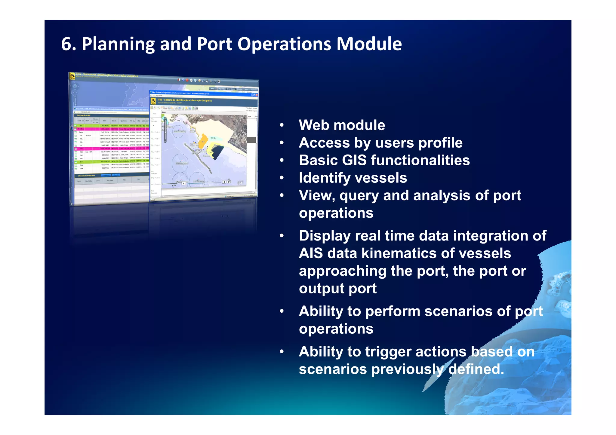

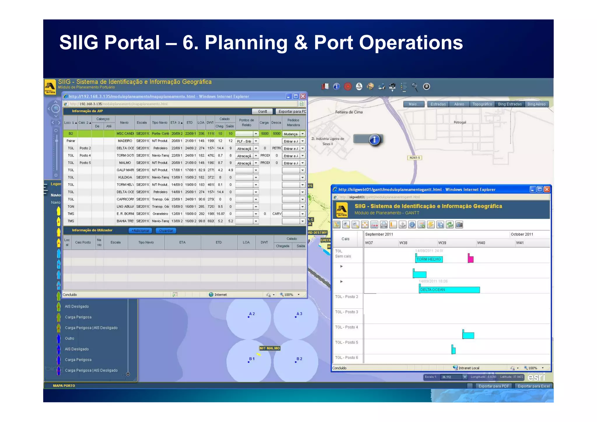
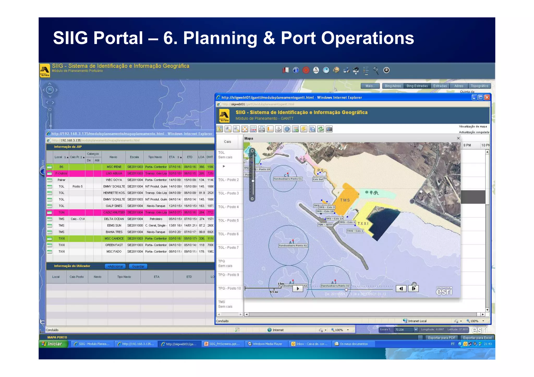
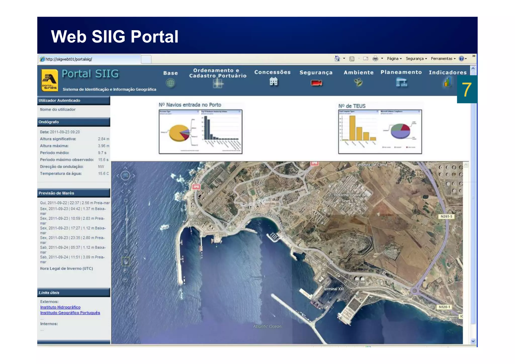
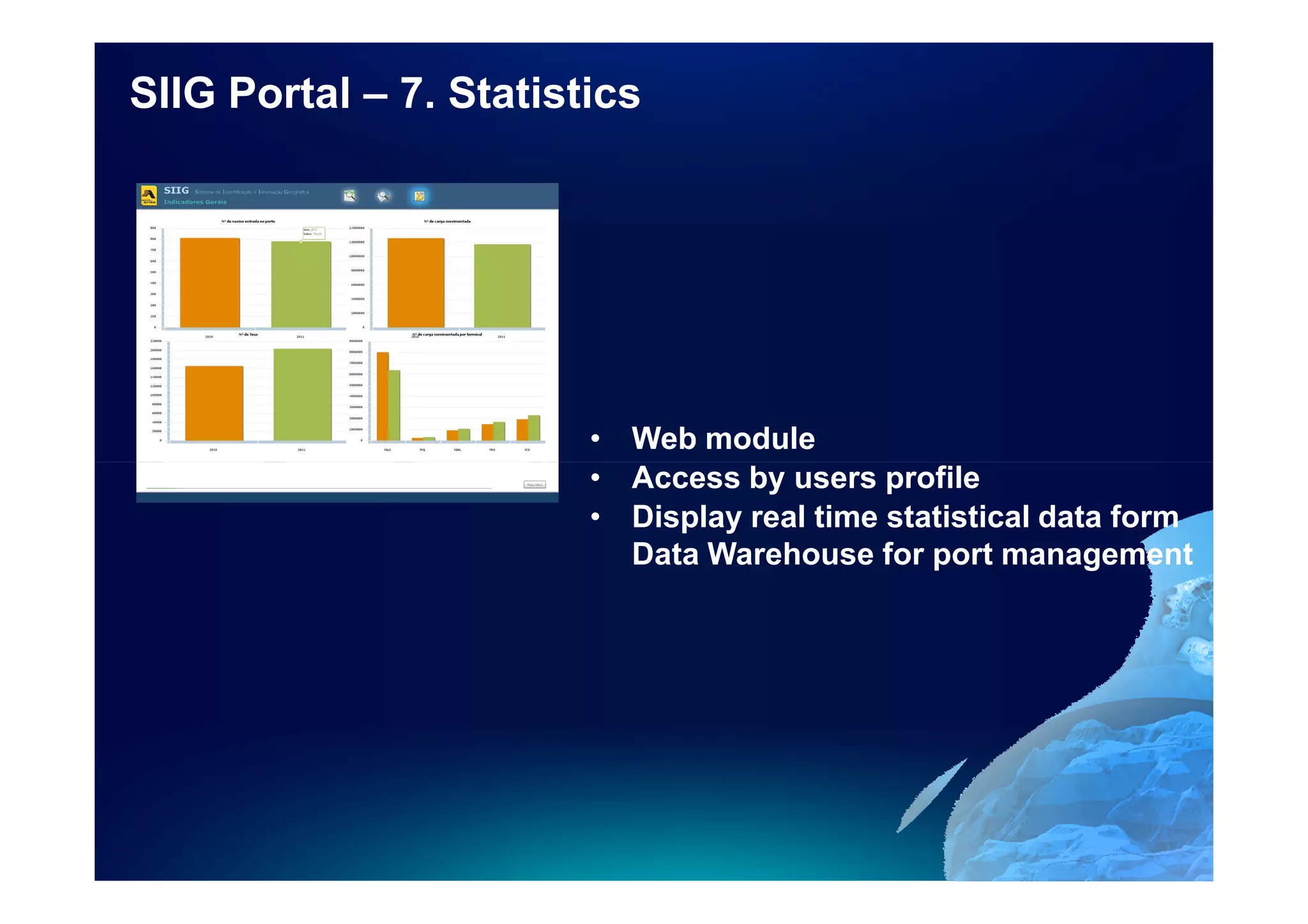
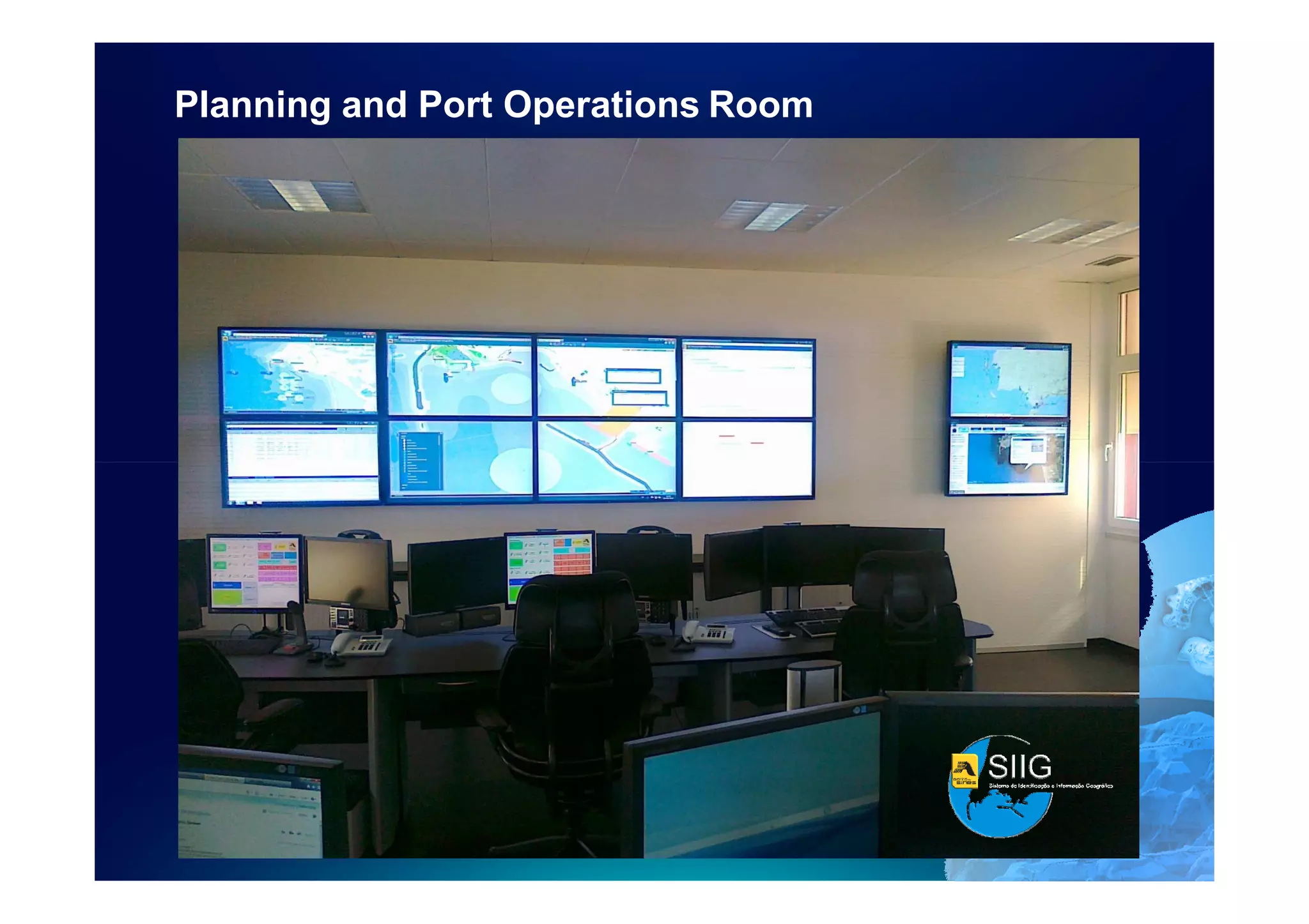

The document summarizes the Geographic Information and Identification System (SIIG) that the Port of Sines in Portugal is implementing. SIIG is a web-based system built on ArcGIS technology that integrates 7 modules to support various port operations and functions through geographic data visualization and analysis. The modules include land management, concessions, planning, security, environment, and statistics. SIIG integrates data from various port systems to provide real-time vessel tracking and optimize port operations. GIS is central to integrating all port information systems and maximizing efficiency.