Download as PDF, PPTX

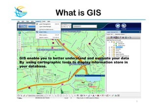
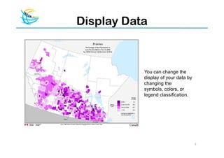
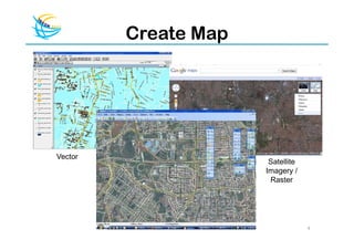
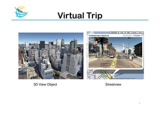
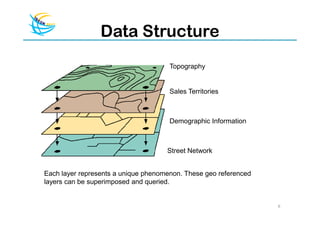
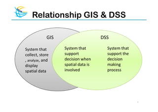
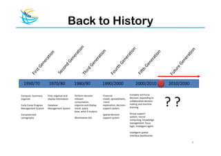
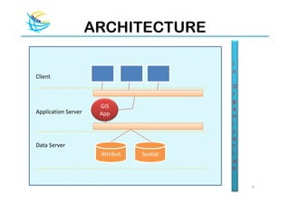
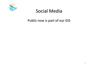
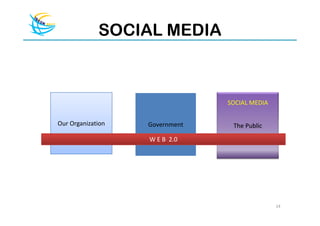
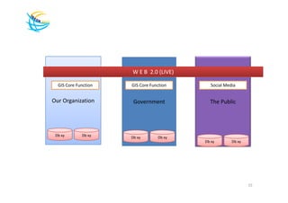
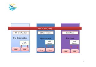
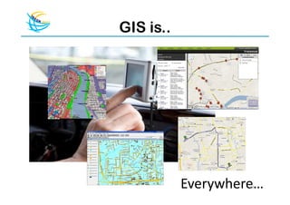
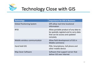
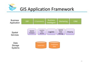
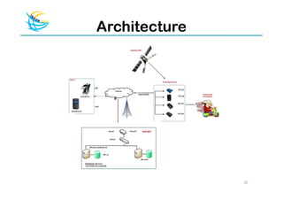
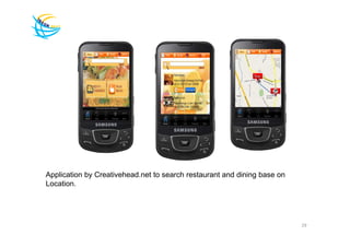


GIS enables users to better understand and evaluate their data by displaying spatial information stored in databases using cartographic tools. Users can change how data is displayed by adjusting symbols, colors, or classification schemes. GIS allows for the collection, storage, analysis, and display of spatial data through layers that can be superimposed and queried. In the future, GIS is expanding to incorporate social media and collaborative decision making through web technologies.


![[Day 3] Building Sustainable Communities](https://cdn.slidesharecdn.com/ss_thumbnails/3-7buildingsustainablecommunities-090415140540-phpapp02-thumbnail.jpg?width=640&height=640&fit=bounds)


![Social mediareport 13 juni pilgubdki [compatibility mode]](https://cdn.slidesharecdn.com/ss_thumbnails/socialmediareport13juni-pilgubdkicompatibilitymode-120614032055-phpapp02-thumbnail.jpg?width=640&height=640&fit=bounds)
![Task forse application presentation [compatibility mode]](https://cdn.slidesharecdn.com/ss_thumbnails/taskforseapplicationpresentationcompatibilitymode-111117041744-phpapp02-thumbnail.jpg?width=640&height=640&fit=bounds)


