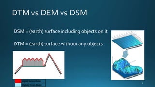
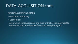
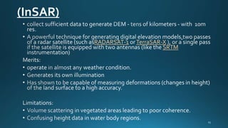
GAGANDEEP SINGH
ROLL NO.- 131861
M.TECH- RS & GIS(2013-2015)
NIT-Warangal
SET OF CONTOUR VECTORS

CONTOUR LINES
SUPERIMPOSED ON GRID DTM

RECT. GRID OF ELEVATIONS

GRID DTM TERRAIN RELIEF
REPRESENTATION

TRIANGULATED IRREGULAR
NETWORK

TIN TERRAIN RELIEF
REPRESENTATION
DSM = (earth) surface including objects on it
DTM = (earth) surface without any objects
DSM

DEM
PROCESSING

DATA
ACQUISITION

DTM

ANALYSIS

APPLICATION

VISUALIZING
DIGITAL
TERRAIN DATA
SAMPLING
SYSTEMATIC
APPROACH

ADAPTIVE
APPRAOCH
GTOPO30

arcsecond resolution
km
Advanced Spaceborne Thermal Emission
and Reflection Radiometer
Terra satellite
meter
United
States territory
Shuttle Radar Topography Mission

Elevation Dataset

National
(InSAR)
RADARSAT-1

TerraSAR-X
SRTM
calculated standard error, standard deviation and sample
variance from the topographic map and Google earth imagery
are closer to those of the total station(ground survey) than
those of the SRTM

The descriptive statistics for the spot heights as presented in
Table (2) clearly show the poor relationship of the SRTM data
source when compared to other data sources under
investigation.
VISUAL INSPECTION
Figure.10 represents the terrain of the test site better
when
compared with reality.
Figure.11 gives a poor surface representation of the test
site
Figure.12 also performs well but the differences
between Figure(12) and Figure(10) may be as a result of
erosion and human activities that have taken place from
when the topographic map was produced.
Figure(13) also performs well
• en.wikipedia.org/wiki/Digital_elevation_model
• http://www.technion.ac.il/~dalyot/docs/Intro-DTM
• http://geog.hkbu.edu.hk/geog3600
http://www.fig.net/pub/fig2011
DTM

DTM