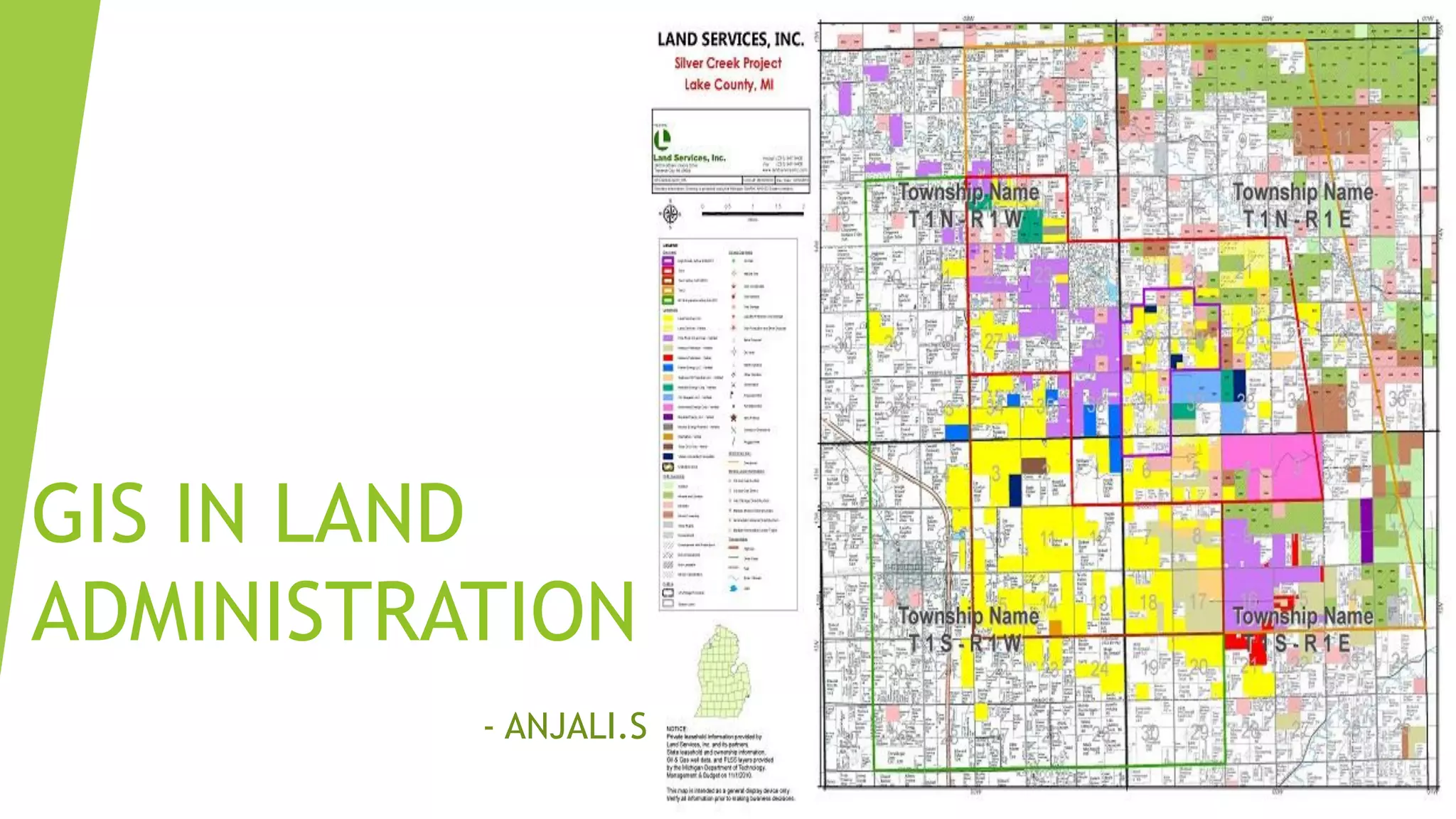
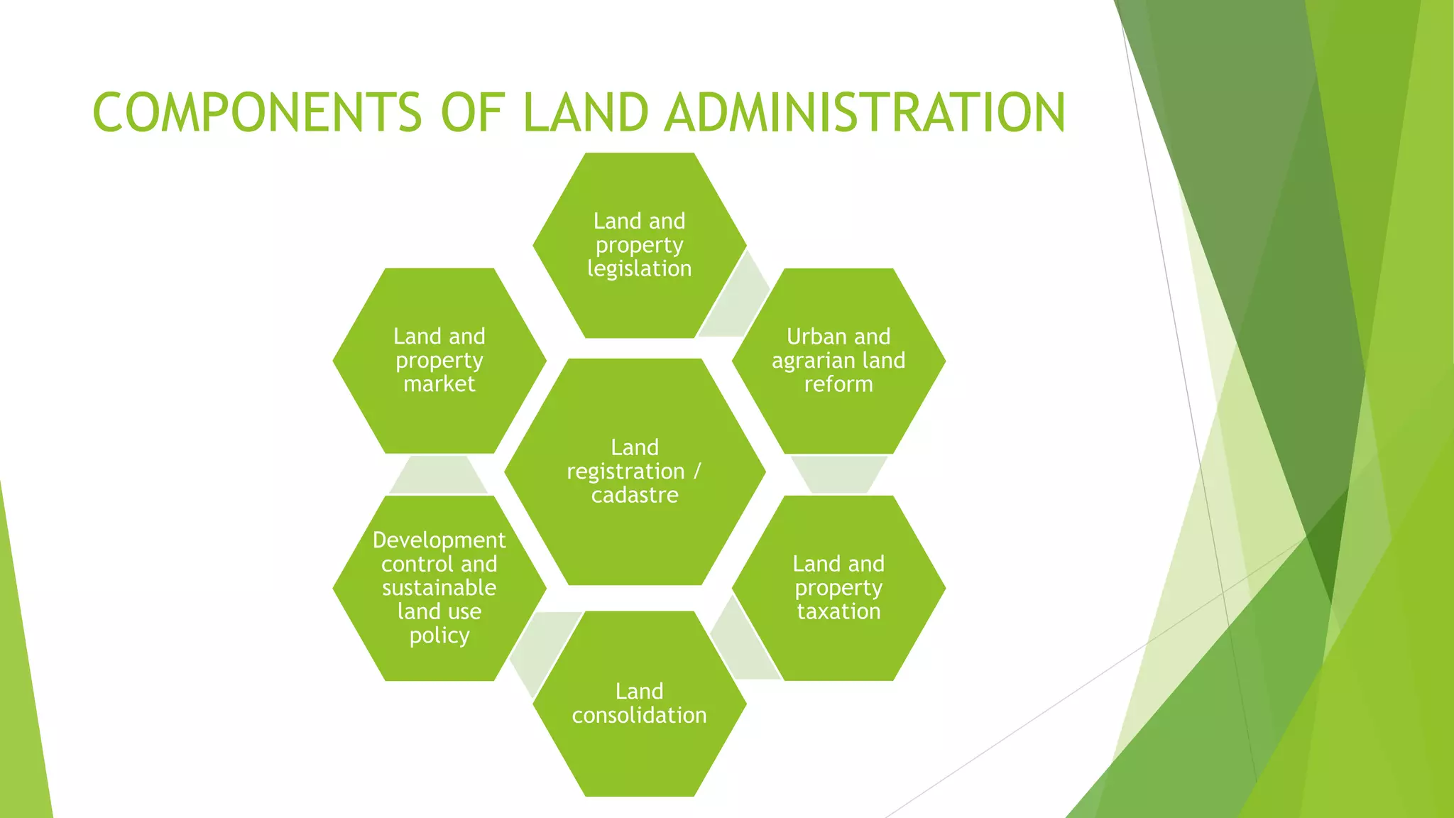
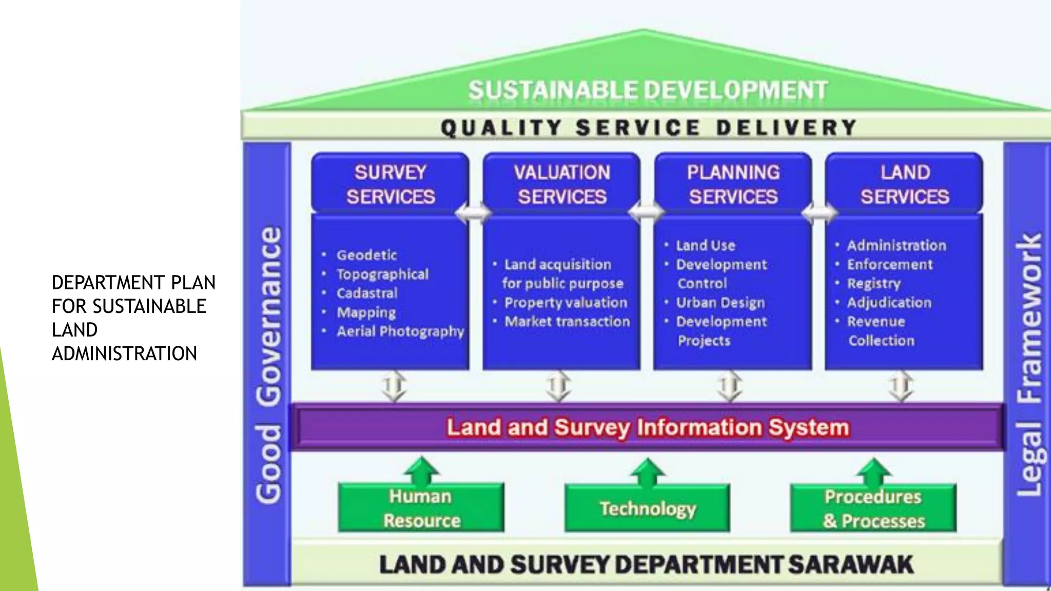
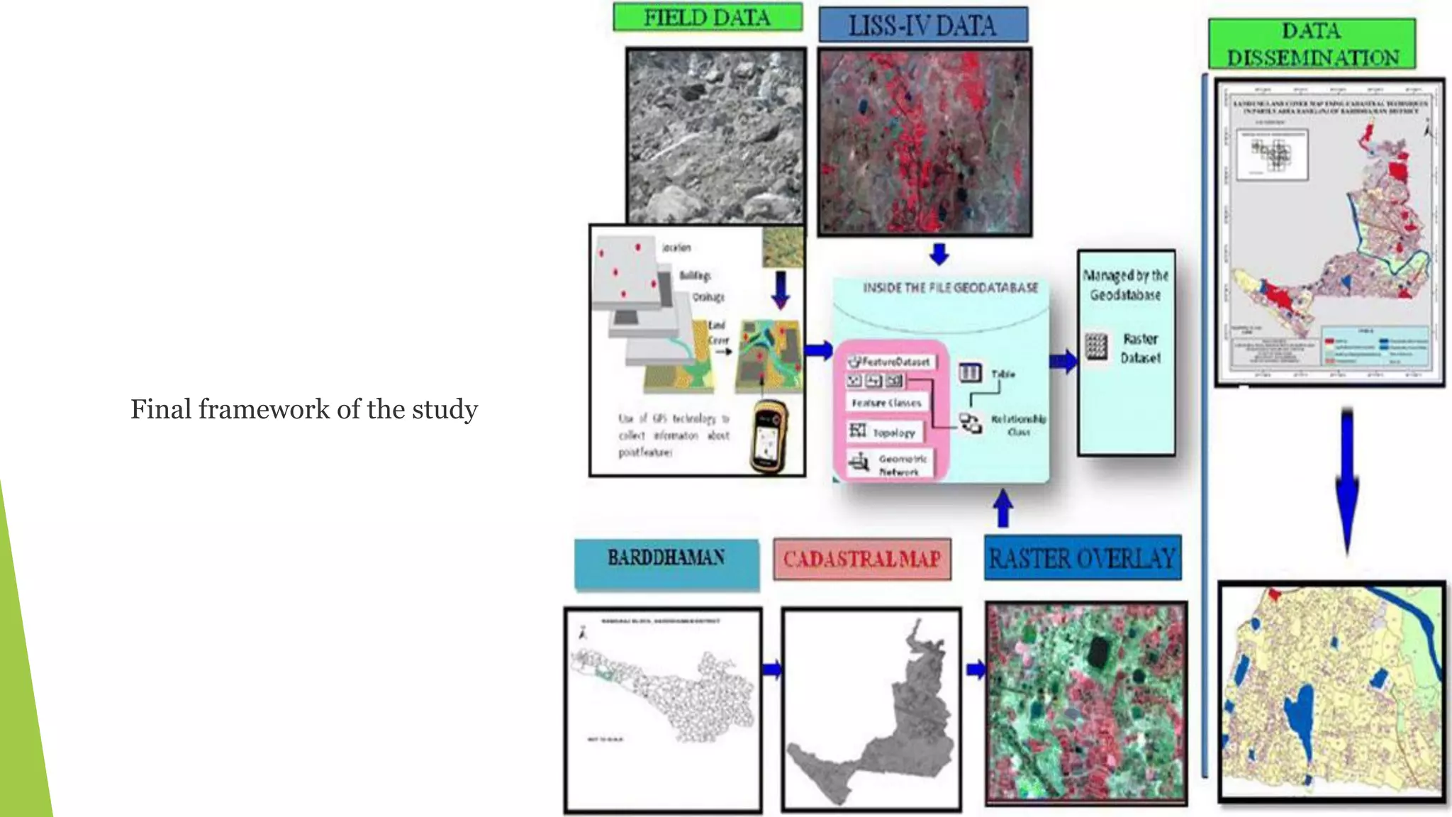
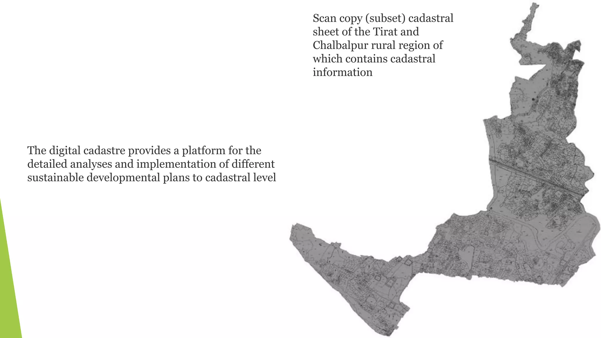
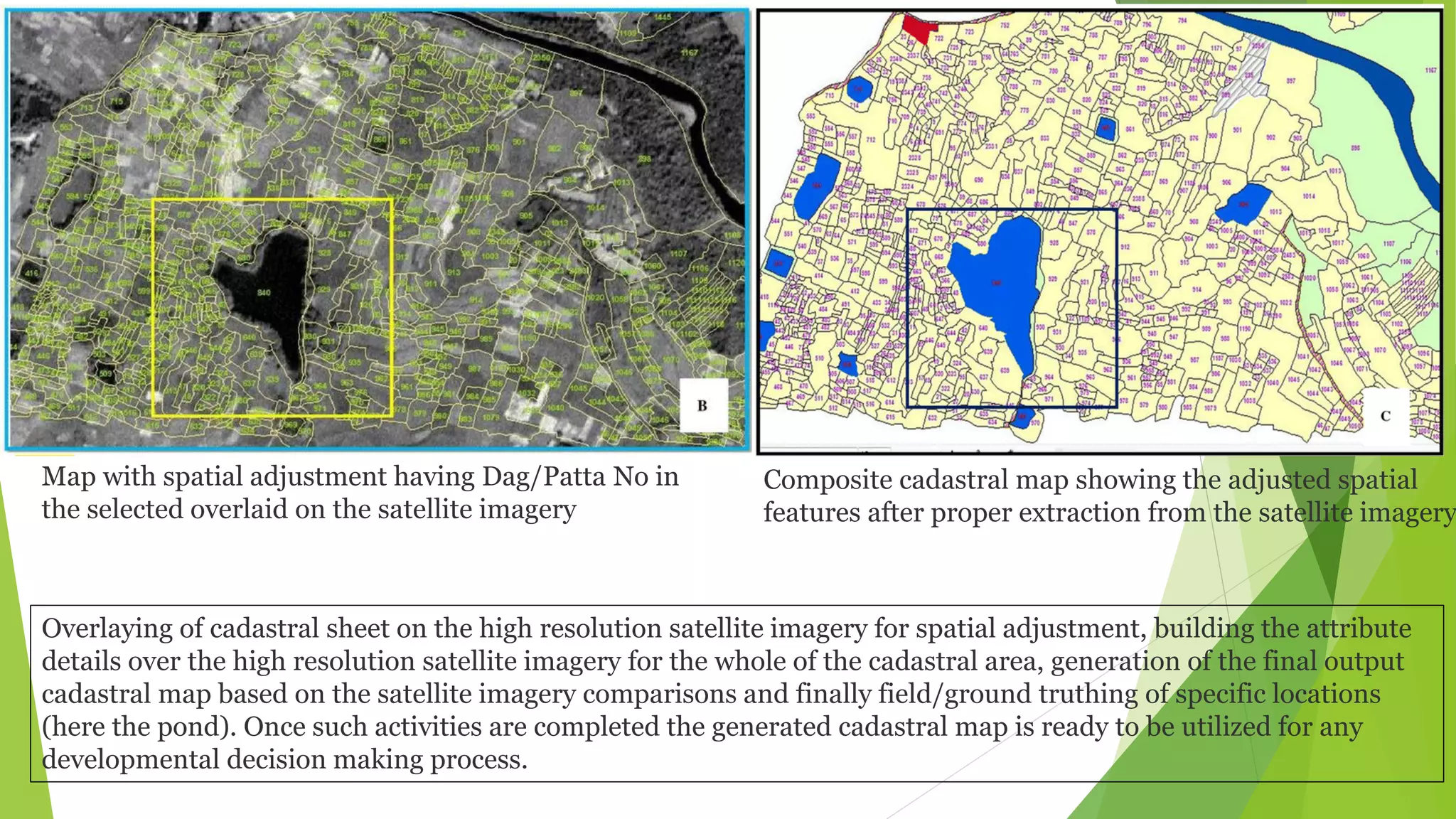
This document discusses land administration and the role of GIS. It describes how land administration involves recording ownership and other attributes of land. GIS helps with land administration by providing digital maps and data for tasks like land registration, valuation for taxation, planning, and dispute resolution. The document also presents a case study of a GIS-based land information system developed for rural areas in India, which digitized paper maps, integrated satellite imagery, and allowed for more accurate planning and management of land use.