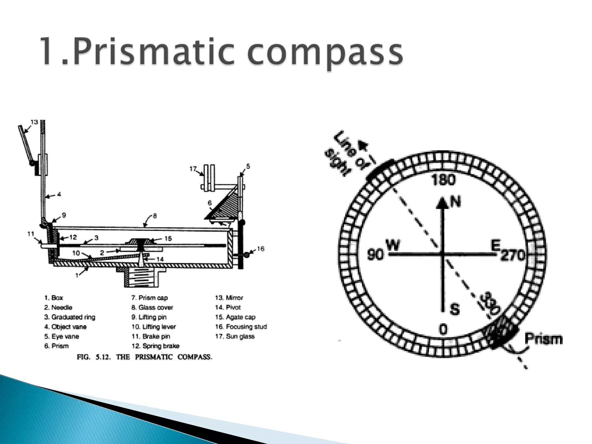
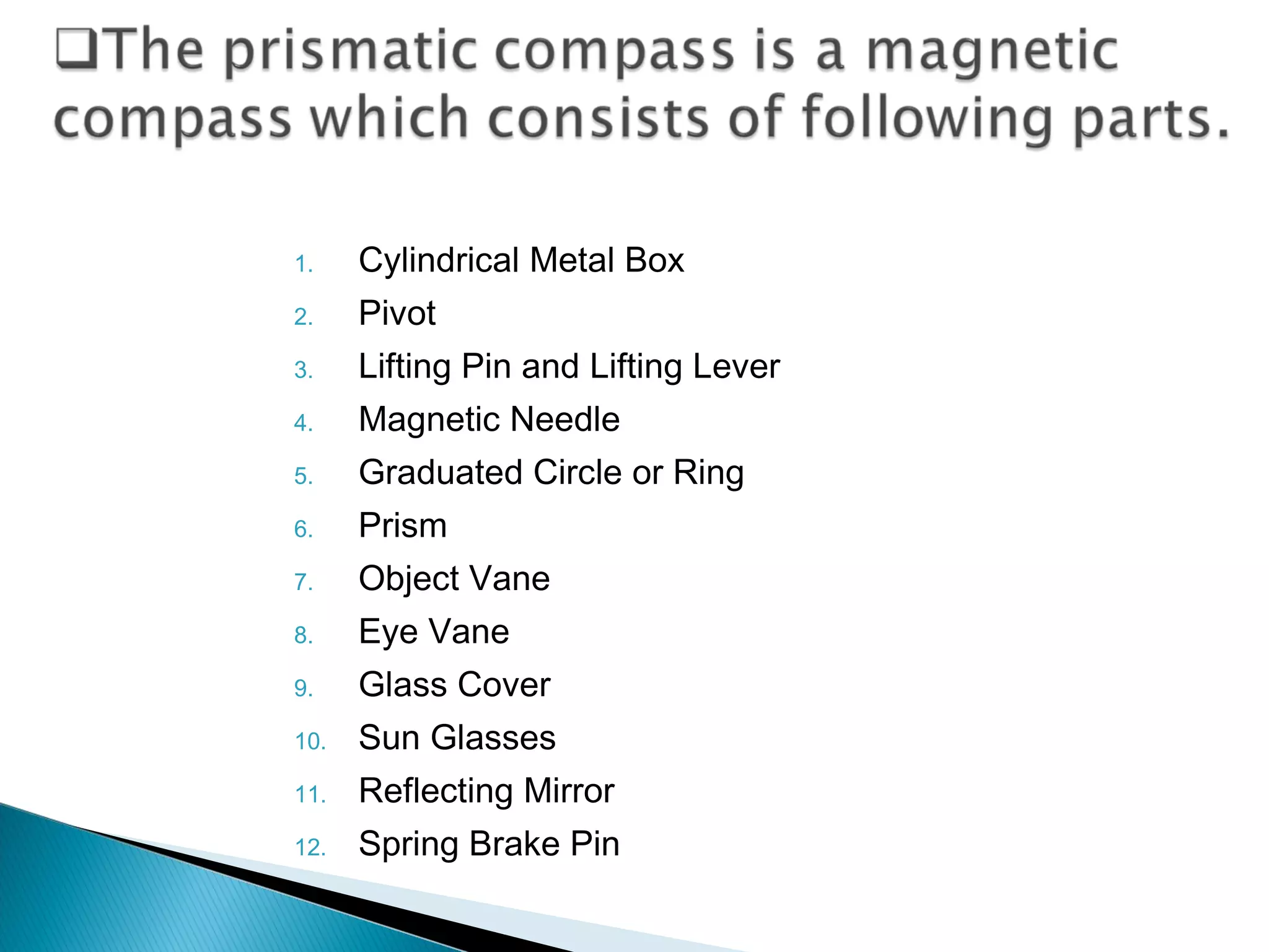
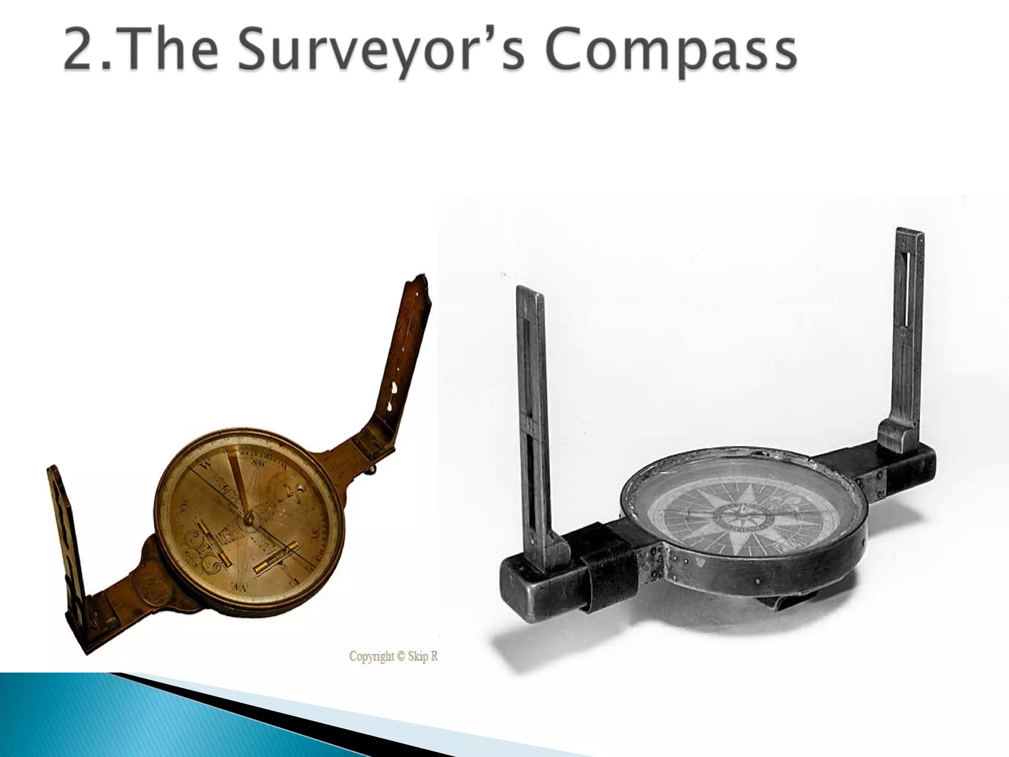
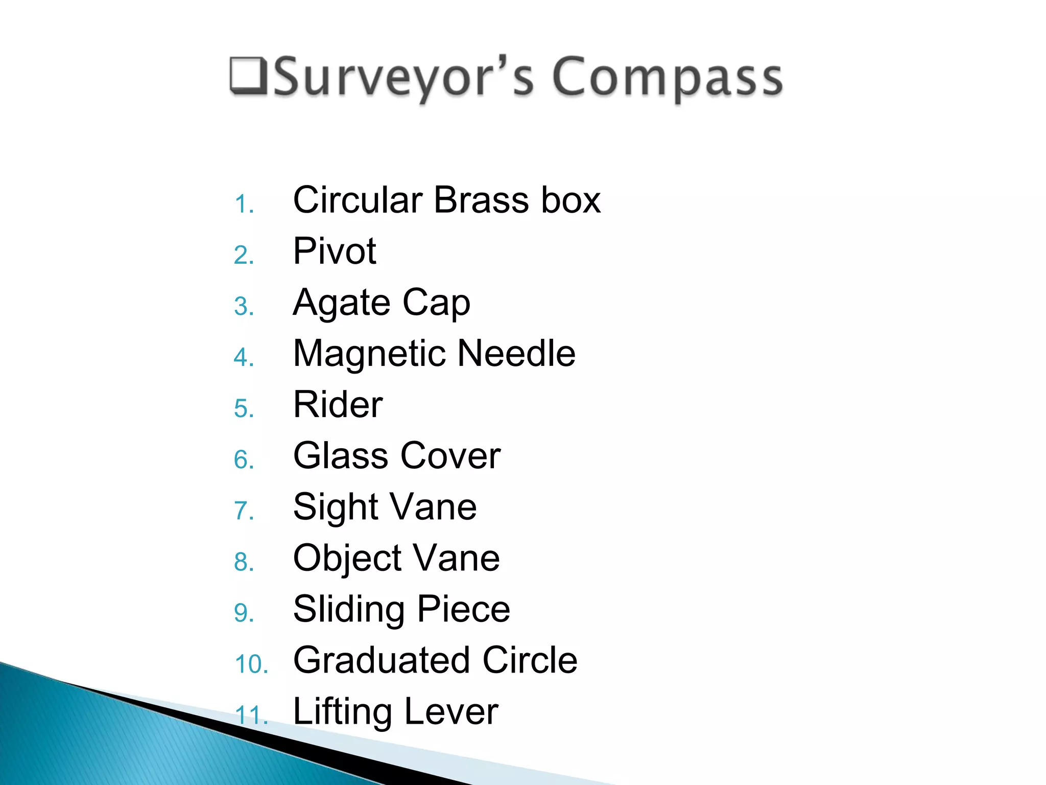
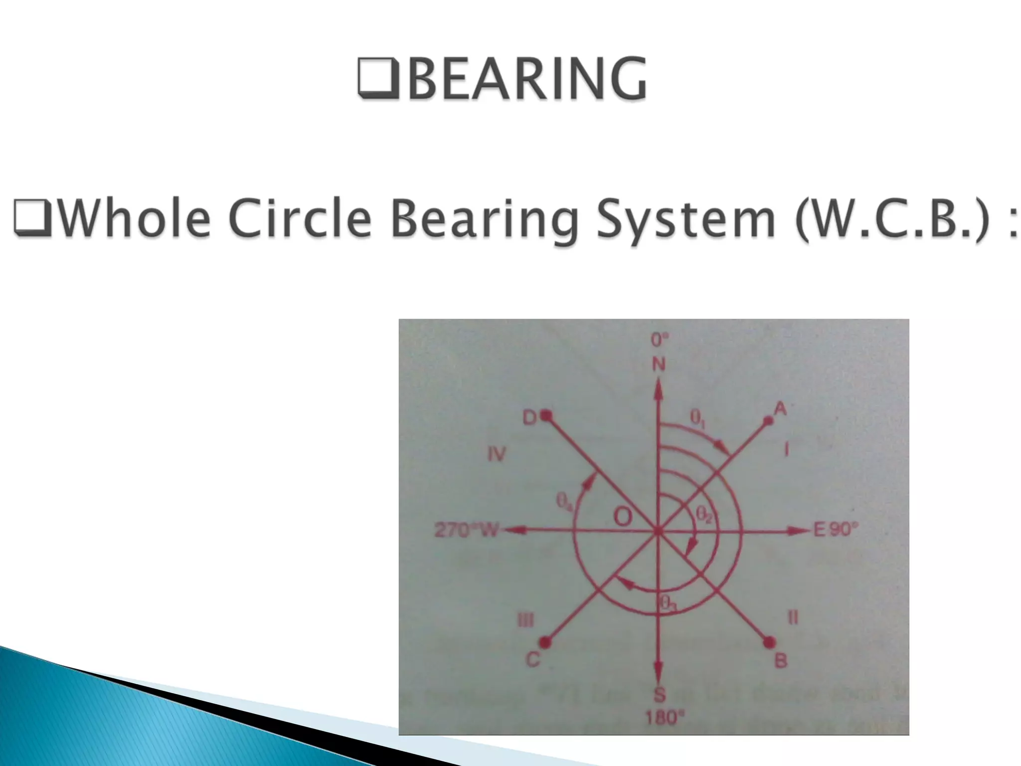
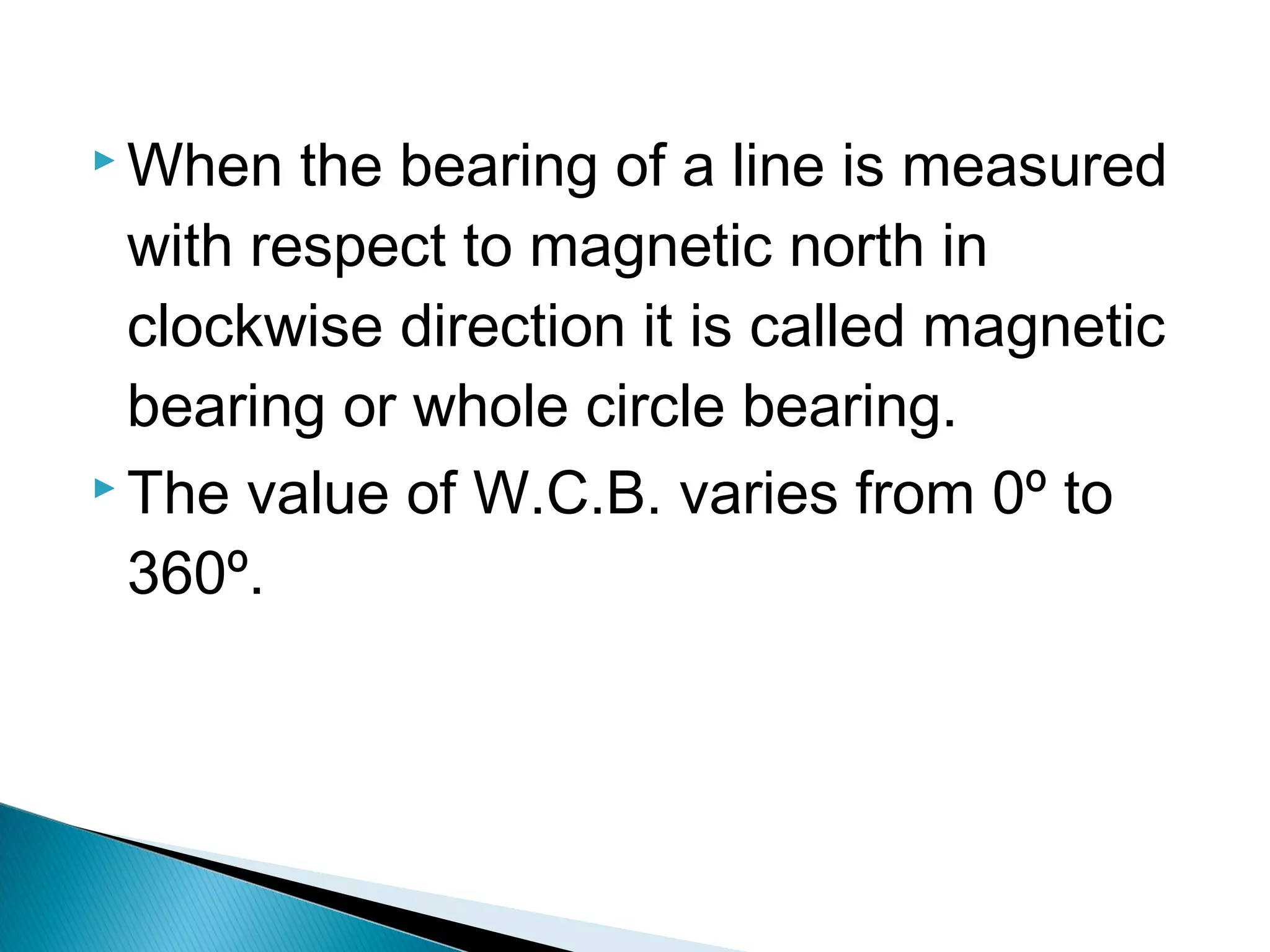
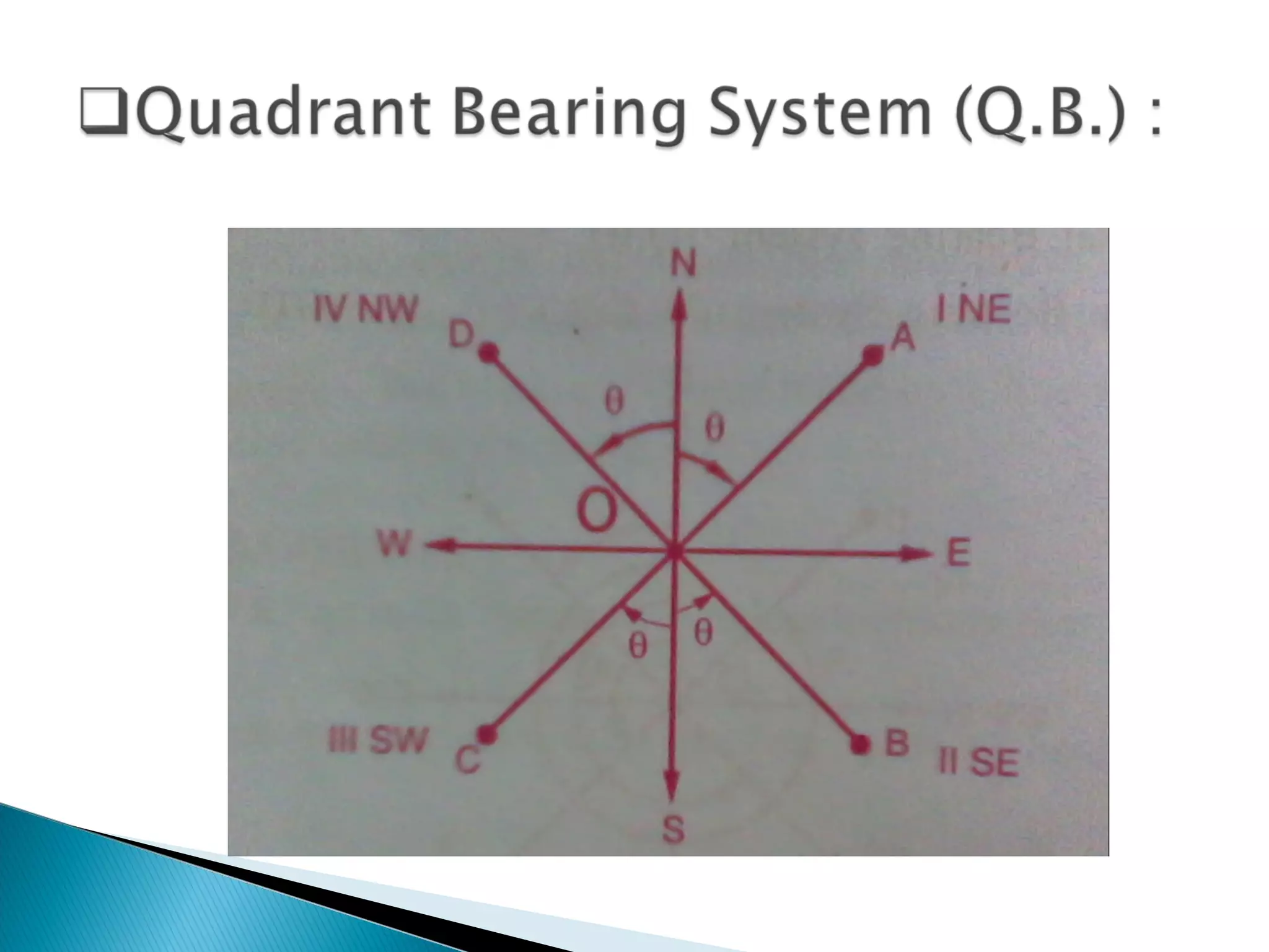
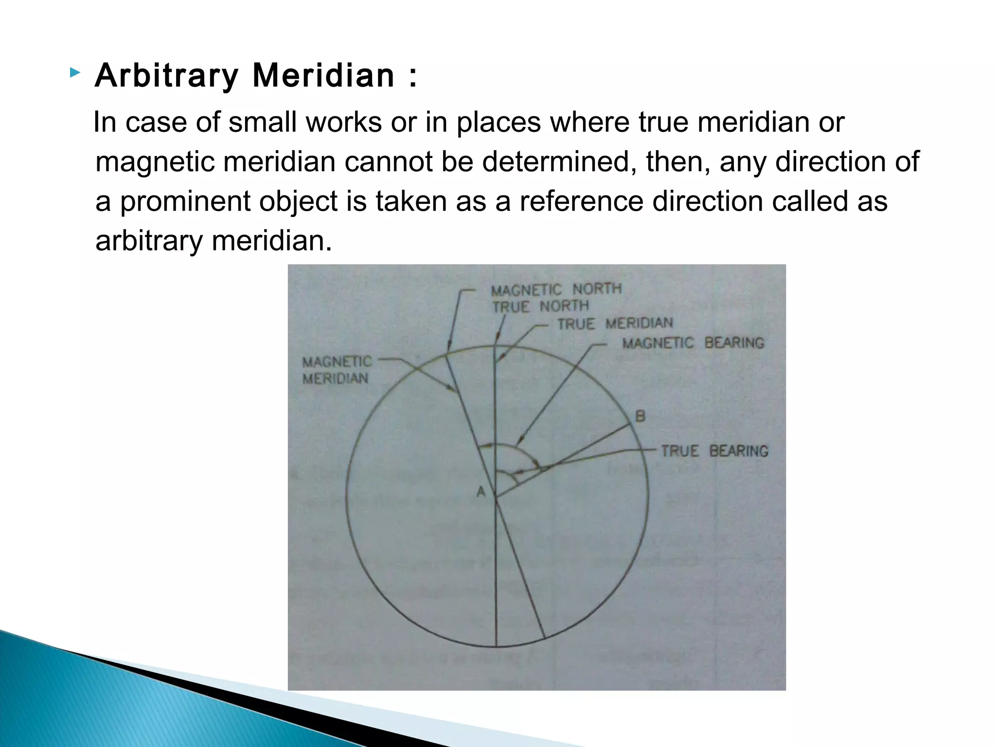
in this section the study of the various classification of the surveying. which based the surveying is classified and how many types of the surveying? all this is presented in this slide.
and that slide how it work?
in this section the study of the various classification of the surveying. which based the surveying is classified and how many types of the surveying? all this is presented in this slide.
and that slide how it work?
Metric Chain : It Consists of galvanized mild steel wire of 4mm diameter known as link.
It is available in 20m, 30m, 50m length which consists of 100 links.
Gunter’s Chain : A 66 feet long chain consists of 100 links, each of 0.66 feet, it is known as Gunter’s chain.
This chain is suitable for taking length in miles.
Engineer’s Chain : A 100 feet long chain consisting of 100 links each of 1 feet is known as engineer’s chain.
This chain is used to measure length in feet and area in sq.yard.
Revenue Chain : it is 33 feet long chain consisting of 16 links.
This chain is used for distance measurements in feet & inches for smaller areas.
Conventional and modern surveying instrumentssameedaslam
Instruments have a major importance in the field of survey. There are numerous instruments which are used in surveying.With the passage of time instruments have been modified and more accurate.
The science of today is the technology of tomorrow.
Definition of Surveying
Objects of Surveying
Uses of Surveying
Primary Divisions of Surveying
Principles of Surveying
List of Classification of Surveying
Definitions : Plan and Map, scales :Plain Scale and Diagonal Scale,
Presentation gives brief overview of Linear and angular measurements related to engineering, different types of instruments used for Linear and angular measurements such as vernier calipers ,micrometers,their types,non precision measuring instruments etc.
This ppt presentation covers compass surveying, which explains principal of compass surveying, Types of compass, Difference between compass, Bearing, Definitions related to compass surveying etc.
Upon completing the course, the students will be able to:
1. Define and state the scope of surveying and geomatics in civil engineering
2. Understand the basic principles of surveying and geomatics engineering
3. Apply the different methods of surveying and geomatics to measure the features of interest
4. Analyze the traditional and advanced methods of surveying
5. Evaluate the different techniques of surveying and geomatics in solving real world problems.
6. Design and construct solutions for real world problems related to surveying and geomatics.
Compass surveying
Bearing
Whole circle bearing and reduced bearing
Conversion of bearings
Computation of angles
Declination and dip
Local attraction
Isogonic Lines
Agonic Lines
Detecting local attraction
For detecting local attraction it is necessary to take both fore bearing and back bearing for each line.
If the difference is exactly 180°, the two stations may be considered as not affected by local
attraction.
If difference is not 180°, better to go back to the previous station and check the fore bearing. If that
reading is same as earlier, it may be concluded that there is local attraction at one or both stations.
planning for smart cities
sustainable green building,
safety, security, disaster management, economy, cyber security, Project management.
AS PER GTU 7TH SEM SYLLABUS MODULE 2
Intelligent transport systems
Smart vehicles and fuels, GIS, GPS, Navigation system, traffic safety management,
mobility services, E-ticketing
AS PER GTU 7TH SEM SYLLABUS MODULE 3
Disaster Management can be defined as the organization and management of resources and responsibilities for dealing with all humanitarian aspects of emergencies, in particular preparedness, response and recovery in order to lessen the impact of disasters.
for the subject offered in GTU, BCT, ace, cm
module 4 demolition of the structure
for the 3rd sem & also for the 6th sem subject and for the master of construction management
for the subject offered in GTU in the final year (8th semester), construction management
final year
Module:- 5 project scheduling and resource leveling
The French Revolution, which began in 1789, was a period of radical social and political upheaval in France. It marked the decline of absolute monarchies, the rise of secular and democratic republics, and the eventual rise of Napoleon Bonaparte. This revolutionary period is crucial in understanding the transition from feudalism to modernity in Europe.
For more information, visit-www.vavaclasses.com
A Strategic Approach: GenAI in EducationPeter Windle
Artificial Intelligence (AI) technologies such as Generative AI, Image Generators and Large Language Models have had a dramatic impact on teaching, learning and assessment over the past 18 months. The most immediate threat AI posed was to Academic Integrity with Higher Education Institutes (HEIs) focusing their efforts on combating the use of GenAI in assessment. Guidelines were developed for staff and students, policies put in place too. Innovative educators have forged paths in the use of Generative AI for teaching, learning and assessments leading to pockets of transformation springing up across HEIs, often with little or no top-down guidance, support or direction.
This Gasta posits a strategic approach to integrating AI into HEIs to prepare staff, students and the curriculum for an evolving world and workplace. We will highlight the advantages of working with these technologies beyond the realm of teaching, learning and assessment by considering prompt engineering skills, industry impact, curriculum changes, and the need for staff upskilling. In contrast, not engaging strategically with Generative AI poses risks, including falling behind peers, missed opportunities and failing to ensure our graduates remain employable. The rapid evolution of AI technologies necessitates a proactive and strategic approach if we are to remain relevant.
Unit 8 - Information and Communication Technology (Paper I).pdfThiyagu K
This slides describes the basic concepts of ICT, basics of Email, Emerging Technology and Digital Initiatives in Education. This presentations aligns with the UGC Paper I syllabus.
Instructions for Submissions thorugh G- Classroom.pptxJheel Barad
This presentation provides a briefing on how to upload submissions and documents in Google Classroom. It was prepared as part of an orientation for new Sainik School in-service teacher trainees. As a training officer, my goal is to ensure that you are comfortable and proficient with this essential tool for managing assignments and fostering student engagement.
Welcome to TechSoup New Member Orientation and Q&A (May 2024).pdfTechSoup
In this webinar you will learn how your organization can access TechSoup's wide variety of product discount and donation programs. From hardware to software, we'll give you a tour of the tools available to help your nonprofit with productivity, collaboration, financial management, donor tracking, security, and more.
Model Attribute Check Company Auto PropertyCeline George
In Odoo, the multi-company feature allows you to manage multiple companies within a single Odoo database instance. Each company can have its own configurations while still sharing common resources such as products, customers, and suppliers.
1. 1.Kheni Jenil V.
2.Chaudhari Bhavin R.
3.Navadiya Dharmik V.
4.Patel Kevin U.
5.Mangukiya Hardik B.
Guided By : Prof. Raval Khushbu
Prof. Falguni Soneri
3. Basic field operation performed by a surveyor
involve linear and angular measurements.
Points on the ground or on map are related to
each other through a horizontal distance and a
horizontal angle (or direction).
Horizontal angular measurement are made
between survey lines to determine the angle
between the lines.
4. A horizontal angle is the difference between two
measured directions.
Measurement of horizontal angle is required in
traverse surveying and other types of surveying.
A survey line can only be plotted if its length and
direction both are known. So, it is necessary to
measure linear measurement (length) and angular
measurement (direction or horizontal angle) of a
survey line.
5. There are two types of compass.
1. The Prismatic Compass
2. The Surveyor’s Compass
6.
7.
8. 1. Cylindrical Metal Box
2. Pivot
3. Lifting Pin and Lifting Lever
4. Magnetic Needle
5. Graduated Circle or Ring
6. Prism
7. Object Vane
8. Eye Vane
9. Glass Cover
10. Sun Glasses
11. Reflecting Mirror
12. Spring Brake Pin
9. When the needle of the compass is suspended freely, It
always points towards the north. Therefore, all the angles
measured with prismatic compass are with respect to north.
While using the compass, it is usually mounted on a light
tripod which is having vertical spindle in the ball and socket
arrangement to which the compass is screwed. Its working
involves following three steps
1.Centering
2.Levelling
3.Focusing
10.
11. 1. Circular Brass box
2. Pivot
3. Agate Cap
4. Magnetic Needle
5. Rider
6. Glass Cover
7. Sight Vane
8. Object Vane
9. Sliding Piece
10. Graduated Circle
11. Lifting Lever
12.
13. When the bearing of a line is measured
with respect to magnetic north in
clockwise direction it is called magnetic
bearing or whole circle bearing.
The value of W.C.B. varies from 0º to
360º.
14.
15. In this system, the bearing of a survey
line is measured with respect to north or
south, in clockwise or anticlockwise
direction towards east or west.
The value of Q.B. varies from 0º to 90º.
16. True Bearing :
The true bearing of a line is the
horizontal angle between the true
meridian and the survey line. The true
bearing is measured from the true north in
the clockwise direction.
Magnetic Bearing :
The magnetic bearing of a line is the
horizontal angle which the line makes with
the magnetic north.
17. Grid Bearing :
The grid bearing of a line is the
horizontal angle which the line makes with
the grid meridian.
Arbitrary Bearing :
The arbitrary bearing of a line is the
horizontal angle which the line makes with
the arbitrary meridian.
18. Magnetic Meridian :
The direction shown by a freely suspended needle which is
magnetized and balanced properly without influenced by
any other factors is known as magnetic meridian.
True Meridian :
True meridian is the which passes through the true north
and south. The direction of true meridian at any point can
be determined by either observing the bearing of the sun at
12 noon or by sun’s shadow.
19. Arbitrary Meridian :
In case of small works or in places where true meridian or
magnetic meridian cannot be determined, then, any direction of
a prominent object is taken as a reference direction called as
arbitrary meridian.