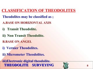
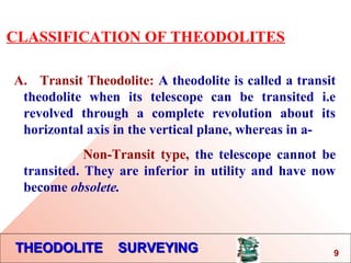
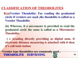
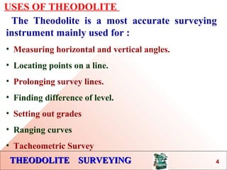
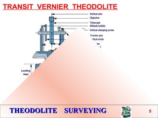
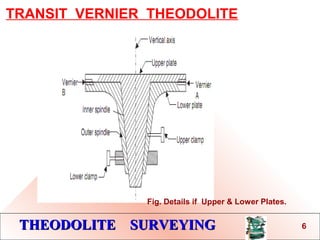
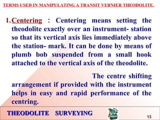
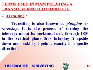
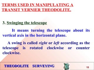
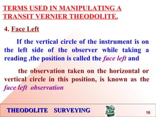
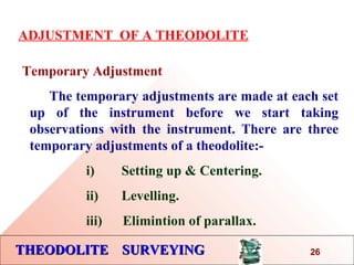
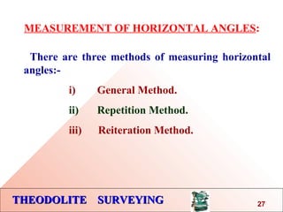
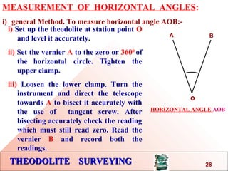
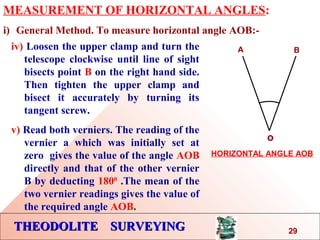
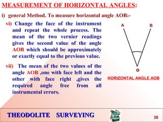
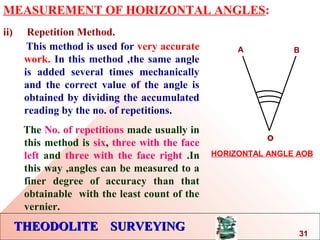
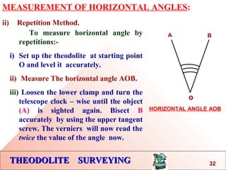
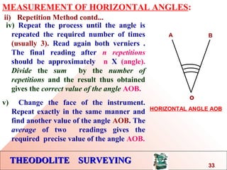
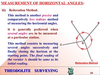
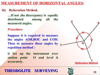
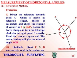
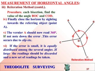
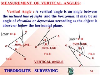
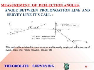
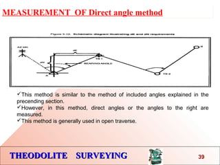
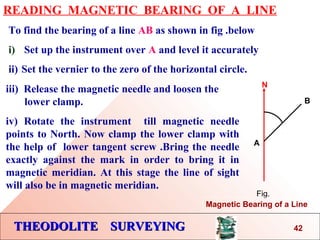
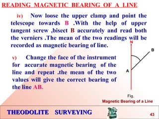
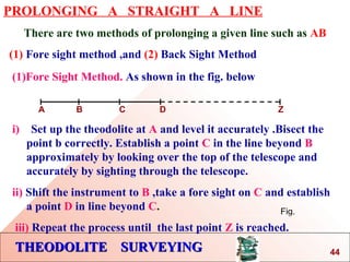
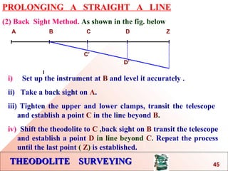
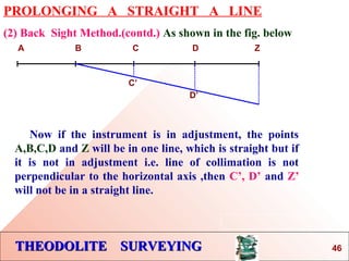
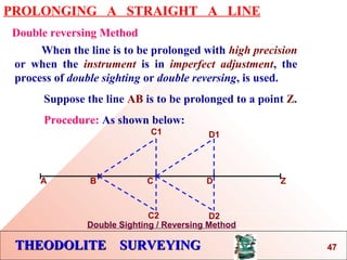
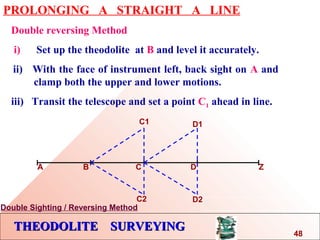
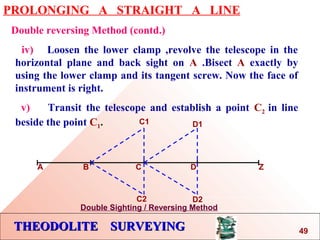
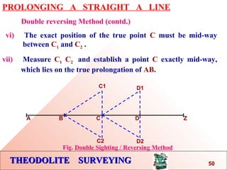
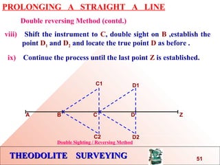
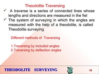
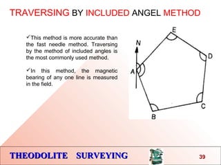
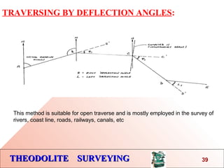
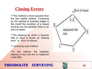
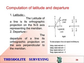
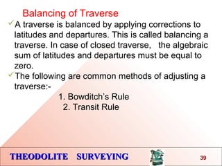
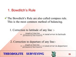
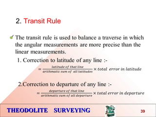
This document discusses the use of a theodolite for surveying. It begins by explaining that a theodolite is needed to precisely measure horizontal and vertical angles, unlike a compass. It then defines theodolite surveying as surveying that measures angles using a theodolite. The document goes on to classify theodolites based on their horizontal axis and method of angle measurement. It describes the basic parts of a transit vernier theodolite and explains terms used in manipulating one. Finally, it discusses methods for measuring horizontal angles, including the general, repetition, and reiteration methods.
What is a Total Station?
Capability of a Total Station
Important Operations of Total Station
Uses of Total Station
Advantages of Using Total Stations
Applications
Surveying is an important part of Civil engineering. Various part like theodolite, plane table surveying, computation of area and volume are useful for all university examination and other competitive examination
Edm is a surveying instrument used to measure the distance electronically. This Surveying Instrument is used in triangulation to measure the length of Base line because more accuracy is required to measure the length of base line.
The Global Positioning System is a satellite-based radio navigation system for determination of precise position and time, using radio signals from the satellites, in real-time or in post-processing mode.
This ppt presentation covers compass surveying, which explains principal of compass surveying, Types of compass, Difference between compass, Bearing, Definitions related to compass surveying etc.
Introduction About Theodolite Instrument Theoretical part Bahzad5
Plane and Applied Surveying -2
Theodolite Theoretical part -1
Prepared by
Asst. Prof. Salar K. Hussein
Asst. Lecturer Mr. Kamal Yaseen
Overview
v Introduction About Theodolite Instrument
v Theodolite and its classification
v Parts of Theodolite
v Theodolite Axis and conditions
v Setting up the Theodolite
v Levelling & Centring - the Theodolite
v Readings in the Theodolite
v Theodolite – Instrument Checks
v Sources of errors
Erbil Polytechnic University
Technical Engineering College
Civil Engineering Department
this is a surveying practicals work book in which different practicals are described with tables and graphs which are performed during a course of bachelors of civil engineering
Event Management System Vb Net Project Report.pdfKamal Acharya
In present era, the scopes of information technology growing with a very fast .We do not see any are untouched from this industry. The scope of information technology has become wider includes: Business and industry. Household Business, Communication, Education, Entertainment, Science, Medicine, Engineering, Distance Learning, Weather Forecasting. Carrier Searching and so on.
My project named “Event Management System” is software that store and maintained all events coordinated in college. It also helpful to print related reports. My project will help to record the events coordinated by faculties with their Name, Event subject, date & details in an efficient & effective ways.
In my system we have to make a system by which a user can record all events coordinated by a particular faculty. In our proposed system some more featured are added which differs it from the existing system such as security.
Automobile Management System Project Report.pdfKamal Acharya
The proposed project is developed to manage the automobile in the automobile dealer company. The main module in this project is login, automobile management, customer management, sales, complaints and reports. The first module is the login. The automobile showroom owner should login to the project for usage. The username and password are verified and if it is correct, next form opens. If the username and password are not correct, it shows the error message.
When a customer search for a automobile, if the automobile is available, they will be taken to a page that shows the details of the automobile including automobile name, automobile ID, quantity, price etc. “Automobile Management System” is useful for maintaining automobiles, customers effectively and hence helps for establishing good relation between customer and automobile organization. It contains various customized modules for effectively maintaining automobiles and stock information accurately and safely.
When the automobile is sold to the customer, stock will be reduced automatically. When a new purchase is made, stock will be increased automatically. While selecting automobiles for sale, the proposed software will automatically check for total number of available stock of that particular item, if the total stock of that particular item is less than 5, software will notify the user to purchase the particular item.
Also when the user tries to sale items which are not in stock, the system will prompt the user that the stock is not enough. Customers of this system can search for a automobile; can purchase a automobile easily by selecting fast. On the other hand the stock of automobiles can be maintained perfectly by the automobile shop manager overcoming the drawbacks of existing system.
Final project report on grocery store management system..pdfKamal Acharya
In today’s fast-changing business environment, it’s extremely important to be able to respond to client needs in the most effective and timely manner. If your customers wish to see your business online and have instant access to your products or services.
Online Grocery Store is an e-commerce website, which retails various grocery products. This project allows viewing various products available enables registered users to purchase desired products instantly using Paytm, UPI payment processor (Instant Pay) and also can place order by using Cash on Delivery (Pay Later) option. This project provides an easy access to Administrators and Managers to view orders placed using Pay Later and Instant Pay options.
In order to develop an e-commerce website, a number of Technologies must be studied and understood. These include multi-tiered architecture, server and client-side scripting techniques, implementation technologies, programming language (such as PHP, HTML, CSS, JavaScript) and MySQL relational databases. This is a project with the objective to develop a basic website where a consumer is provided with a shopping cart website and also to know about the technologies used to develop such a website.
This document will discuss each of the underlying technologies to create and implement an e- commerce website.
Quality defects in TMT Bars, Possible causes and Potential Solutions.PrashantGoswami42
Maintaining high-quality standards in the production of TMT bars is crucial for ensuring structural integrity in construction. Addressing common defects through careful monitoring, standardized processes, and advanced technology can significantly improve the quality of TMT bars. Continuous training and adherence to quality control measures will also play a pivotal role in minimizing these defects.
NO1 Uk best vashikaran specialist in delhi vashikaran baba near me online vas...Amil Baba Dawood bangali
Contact with Dawood Bhai Just call on +92322-6382012 and we'll help you. We'll solve all your problems within 12 to 24 hours and with 101% guarantee and with astrology systematic. If you want to take any personal or professional advice then also you can call us on +92322-6382012 , ONLINE LOVE PROBLEM & Other all types of Daily Life Problem's.Then CALL or WHATSAPP us on +92322-6382012 and Get all these problems solutions here by Amil Baba DAWOOD BANGALI
#vashikaranspecialist #astrologer #palmistry #amliyaat #taweez #manpasandshadi #horoscope #spiritual #lovelife #lovespell #marriagespell#aamilbabainpakistan #amilbabainkarachi #powerfullblackmagicspell #kalajadumantarspecialist #realamilbaba #AmilbabainPakistan #astrologerincanada #astrologerindubai #lovespellsmaster #kalajaduspecialist #lovespellsthatwork #aamilbabainlahore#blackmagicformarriage #aamilbaba #kalajadu #kalailam #taweez #wazifaexpert #jadumantar #vashikaranspecialist #astrologer #palmistry #amliyaat #taweez #manpasandshadi #horoscope #spiritual #lovelife #lovespell #marriagespell#aamilbabainpakistan #amilbabainkarachi #powerfullblackmagicspell #kalajadumantarspecialist #realamilbaba #AmilbabainPakistan #astrologerincanada #astrologerindubai #lovespellsmaster #kalajaduspecialist #lovespellsthatwork #aamilbabainlahore #blackmagicforlove #blackmagicformarriage #aamilbaba #kalajadu #kalailam #taweez #wazifaexpert #jadumantar #vashikaranspecialist #astrologer #palmistry #amliyaat #taweez #manpasandshadi #horoscope #spiritual #lovelife #lovespell #marriagespell#aamilbabainpakistan #amilbabainkarachi #powerfullblackmagicspell #kalajadumantarspecialist #realamilbaba #AmilbabainPakistan #astrologerincanada #astrologerindubai #lovespellsmaster #kalajaduspecialist #lovespellsthatwork #aamilbabainlahore #Amilbabainuk #amilbabainspain #amilbabaindubai #Amilbabainnorway #amilbabainkrachi #amilbabainlahore #amilbabaingujranwalan #amilbabainislamabad
CFD Simulation of By-pass Flow in a HRSG module by R&R Consult.pptxR&R Consult
CFD analysis is incredibly effective at solving mysteries and improving the performance of complex systems!
Here's a great example: At a large natural gas-fired power plant, where they use waste heat to generate steam and energy, they were puzzled that their boiler wasn't producing as much steam as expected.
R&R and Tetra Engineering Group Inc. were asked to solve the issue with reduced steam production.
An inspection had shown that a significant amount of hot flue gas was bypassing the boiler tubes, where the heat was supposed to be transferred.
R&R Consult conducted a CFD analysis, which revealed that 6.3% of the flue gas was bypassing the boiler tubes without transferring heat. The analysis also showed that the flue gas was instead being directed along the sides of the boiler and between the modules that were supposed to capture the heat. This was the cause of the reduced performance.
Based on our results, Tetra Engineering installed covering plates to reduce the bypass flow. This improved the boiler's performance and increased electricity production.
It is always satisfying when we can help solve complex challenges like this. Do your systems also need a check-up or optimization? Give us a call!
Work done in cooperation with James Malloy and David Moelling from Tetra Engineering.
More examples of our work https://www.r-r-consult.dk/en/cases-en/
Immunizing Image Classifiers Against Localized Adversary Attacksgerogepatton
This paper addresses the vulnerability of deep learning models, particularly convolutional neural networks
(CNN)s, to adversarial attacks and presents a proactive training technique designed to counter them. We
introduce a novel volumization algorithm, which transforms 2D images into 3D volumetric representations.
When combined with 3D convolution and deep curriculum learning optimization (CLO), itsignificantly improves
the immunity of models against localized universal attacks by up to 40%. We evaluate our proposed approach
using contemporary CNN architectures and the modified Canadian Institute for Advanced Research (CIFAR-10
and CIFAR-100) and ImageNet Large Scale Visual Recognition Challenge (ILSVRC12) datasets, showcasing
accuracy improvements over previous techniques. The results indicate that the combination of the volumetric
input and curriculum learning holds significant promise for mitigating adversarial attacks without necessitating
adversary training.
Explore the innovative world of trenchless pipe repair with our comprehensive guide, "The Benefits and Techniques of Trenchless Pipe Repair." This document delves into the modern methods of repairing underground pipes without the need for extensive excavation, highlighting the numerous advantages and the latest techniques used in the industry.
Learn about the cost savings, reduced environmental impact, and minimal disruption associated with trenchless technology. Discover detailed explanations of popular techniques such as pipe bursting, cured-in-place pipe (CIPP) lining, and directional drilling. Understand how these methods can be applied to various types of infrastructure, from residential plumbing to large-scale municipal systems.
Ideal for homeowners, contractors, engineers, and anyone interested in modern plumbing solutions, this guide provides valuable insights into why trenchless pipe repair is becoming the preferred choice for pipe rehabilitation. Stay informed about the latest advancements and best practices in the field.
Democratizing Fuzzing at Scale by Abhishek Aryaabh.arya
Presented at NUS: Fuzzing and Software Security Summer School 2024
This keynote talks about the democratization of fuzzing at scale, highlighting the collaboration between open source communities, academia, and industry to advance the field of fuzzing. It delves into the history of fuzzing, the development of scalable fuzzing platforms, and the empowerment of community-driven research. The talk will further discuss recent advancements leveraging AI/ML and offer insights into the future evolution of the fuzzing landscape.
2. THEODOLITE SURVEYING
INTRODUCTION:
So far we have been measuring
horizontal angles by using a Compass with respect to
meridian, which is less accurate and also it is not
possible to measure vertical angles with a Compass.
So when the objects are at a considerable
distance or situated at a considerable elevation or
depression ,it becomes necessary to measure horizontal
and vertical angles more precisely. So these
measurements are taken by an instrument known as a
theodolite.
2
4. THEODOLITE SURVEYINGTHEODOLITE SURVEYING
CLASSIFICATION OF THEODOLITES
Theodolites may be classified as ;
A.BASE ON HORIZONTAL AXIS
i) Transit Theodolite.
ii) Non Transit Theodolite.
B.BASE ON ANGEL
i) Vernier Theodolites.
ii) Micrometer Theodolites.
iii)Electronic digital theodolite.
8
5. THEODOLITE SURVEYINGTHEODOLITE SURVEYING
CLASSIFICATION OF THEODOLITES
A. Transit Theodolite: A theodolite is called a transit
theodolite when its telescope can be transited i.e
revolved through a complete revolution about its
horizontal axis in the vertical plane, whereas in a-
Non-Transit type, the telescope cannot be
transited. They are inferior in utility and have now
become obsolete.
9
6. THEODOLITE SURVEYINGTHEODOLITE SURVEYING
CLASSIFICATION OF THEODOLITES
B.(a)Vernier Theodolite: For reading the graduated
circle if verniers are used ,the theodolite is called as a
Vernier Theodolite
(b) Whereas, if a micrometer is provided to read the
graduated circle the same is called as a Micrometer
Theodolite.
( c )reading directly providing as digital num. if
electronic distance measuring is attached with it then
it’s call total station
Vernier type theodolites are commonly used .
10
7. THEODOLITE SURVEYINGTHEODOLITE SURVEYING
SIZE OF THEODOLITE
A theodolite is designated by diameter of the
graduated circle on the lower plate.
The common sizes are 8cm to 12 cm while 14 cm to
25 cm instrument are used for triangulation work.
Greater accuracy is achieved with larger
theodolites as they have bigger graduated circle with
larger divisions hence used where the survey works
require high degree of accuracy.
11
8. THEODOLITE SURVEYINGTHEODOLITE SURVEYING
USES OF THEODOLITE
The Theodolite is a most accurate surveying
instrument mainly used for :
• Measuring horizontal and vertical angles.
• Locating points on a line.
• Prolonging survey lines.
• Finding difference of level.
• Setting out grades
• Ranging curves
• Tacheometric Survey
4
11. THEODOLITE SURVEYINGTHEODOLITE SURVEYING
DESCRIPTION OF A
TRANSIT VERNIER THEODOLITE
A Transit vernier theodolite essentially consist of the
following :
1. Levelling Head. 6. T- Frame.
2. Lower Circular Plate. 7. Plumb –bob.
3. Upper Plate. 8. Tripod Stand.
4. Telescope.
5. Vernier Scale.
12
12. THEODOLITE SURVEYINGTHEODOLITE SURVEYING
TERMS USED IN MANIPULATING A TRANSIT VERNIER THEODOLITE.
1.Centering : Centering means setting the
theodolite exactly over an instrument- station
so that its vertical axis lies immediately above
the station- mark. It can be done by means of
plumb bob suspended from a small hook
attached to the vertical axis of the theodolite.
The centre shifting
arrangement if provided with the instrument
helps in easy and rapid performance of the
centring.
13
13. THEODOLITE SURVEYINGTHEODOLITE SURVEYING
TERMS USED IN MANIPULATING A
TRANSIT VERNIER THEODOLITE.
2. Transiting :
Transiting is also known as plunging or
reversing. It is the process of turning the
telescope about its horizontal axis through 1800
in the vertical plane thus bringing it upside
down and making it point , exactly in opposite
direction.
14
14. THEODOLITE SURVEYINGTHEODOLITE SURVEYING
TERMS USED IN MANIPULATING A
TRANSIT VERNIER THEODOLITE.
3. Swinging the telescope
It means turning the telescope about its
vertical axis in the horizontal plane.
A swing is called right or left according as the
telescope is rotated clockwise or counter
clockwise.
15
15. THEODOLITE SURVEYINGTHEODOLITE SURVEYING
TERMS USED IN MANIPULATING A
TRANSIT VERNIER THEODOLITE.
4. Face Left
If the vertical circle of the instrument is on
the left side of the observer while taking a
reading ,the position is called the face left and
the observation taken on the horizontal or
vertical circle in this position, is known as the
face left observation
16
16. THEODOLITE SURVEYINGTHEODOLITE SURVEYING
TERMS USED IN MANIPULATING A
TRANSIT VERNIER THEODOLITE.
5. Face Right
If the vertical circle of the instrument is on
the right side of the observer while taking a
reading ,the position is called the face right and
the observation taken on the horizontal or
vertical circle in this position, is known as the
face right observation.
17
17. THEODOLITE SURVEYINGTHEODOLITE SURVEYING
TERMS USED IN MANIPULATING A
TRANSIT VERNIER THEODOLITE.
6. Changing Face
It is the operation of bringing the vertical
circle to the right of the observer ,if originally it
is to the left , and vice – versa.
It is done in two steps; Firstly revolve the
telescope through 1800
in a vertical plane and
then rotate it through 1800
in the horizontal
plane i.e first transit the telescope and then
swing it through 1800
.
18
18. THEODOLITE SURVEYINGTHEODOLITE SURVEYING
TERMS USED IN MANIPULATING A
TRANSIT VERNIER THEODOLITE.
7. Line of Collimation
LINE OF
COLLIMATION
DIAPHRAGM
TELESCOPE
It is also known as the line of sight .It is an
imaginary line joining the intersection of the
cross- hairs of the diaphragm to the optical
centre of the object- glass and its continuation.
19
19. THEODOLITE SURVEYINGTHEODOLITE SURVEYING
TERMS USED IN MANIPULATING A
TRANSIT VERNIER THEODOLITE.
8. Axis of the telescope
AXIS OF THE TELESCOPE
TELESCOPE
It is also known an imaginary line joining the
optical centre of the object- glass to the centre
of eye piece.
OBJECT GLASS
.
20
20. THEODOLITE SURVEYINGTHEODOLITE SURVEYING
TERMS USED IN MANIPULATING A
TRANSIT VERNIER THEODOLITE.
9. Axis of the Level Tube
It is also called the bubble line.
It is a straight line tangential to the longitudinal
curve of the level tube at the centre of the tube.
It is horizontal when the bubble is in the centre.
21
21. THEODOLITE SURVEYINGTHEODOLITE SURVEYING
TERMS USED IN MANIPULATING A
TRANSIT VERNIER THEODOLITE.
10. Vertical Axis
It is the axis about which the telescope can be
rotated in the horizontal plane.
11. Horizontal Axis
It is the axis about which the telescope can be
rotated in the vertical plane.
It is also called the trunion axis.
22
24. THEODOLITE SURVEYINGTHEODOLITE SURVEYING
ADJUSTMENT OF A THEODOLITE
Temporary Adjustment
The temporary adjustments are made at each set
up of the instrument before we start taking
observations with the instrument. There are three
temporary adjustments of a theodolite:-
i) Setting up & Centering.
ii) Levelling.
iii) Elimintion of parallax.
26
26. THEODOLITE SURVEYINGTHEODOLITE SURVEYING
MEASUREMENT OF HORIZONTAL ANGLES:
i) general Method. To measure horizontal angle AOB:-
i) Set up the theodolite at station point O
and level it accurately.
ii) Set the vernier A to the zero or 3600
of
the horizontal circle. Tighten the
upper clamp.
iii) Loosen the lower clamp. Turn the
instrument and direct the telescope
towards A to bisect it accurately with
the use of tangent screw. After
bisecting accurately check the reading
which must still read zero. Read the
vernier B and record both the
readings.
o
A B
HORIZONTAL ANGLE AOB
28
27. THEODOLITE SURVEYINGTHEODOLITE SURVEYING
MEASUREMENT OF HORIZONTAL ANGLES:
i) General Method. To measure horizontal angle AOB:-
iv) Loosen the upper clamp and turn the
telescope clockwise until line of sight
bisects point B on the right hand side.
Then tighten the upper clamp and
bisect it accurately by turning its
tangent screw.
v) Read both verniers. The reading of the
vernier a which was initially set at
zero gives the value of the angle AOB
directly and that of the other vernier
B by deducting 1800
.The mean of the
two vernier readings gives the value of
the required angle AOB.
o
A B
HORIZONTAL ANGLE AOB
29
28. THEODOLITE SURVEYINGTHEODOLITE SURVEYING
MEASUREMENT OF HORIZONTAL ANGLES:
i) general Method. To measure horizontal angle AOB:-
vi) Change the face of the instrument
and repeat the whole process. The
mean of the two vernier readings
gives the second value of the angle
AOB which should be approximately
or exactly equal to the previous value.
vii) The mean of the two values of the
angle AOB ,one with face left and the
other with face right ,gives the
required angle free from all
instrumental errors.
o
A B
HORIZONTAL ANGLE AOB
30
29. THEODOLITE SURVEYINGTHEODOLITE SURVEYING
MEASUREMENT OF HORIZONTAL ANGLES:
ii) Repetition Method.
This method is used for very accurate
work. In this method ,the same angle
is added several times mechanically
and the correct value of the angle is
obtained by dividing the accumulated
reading by the no. of repetitions.
The No. of repetitions made usually in
this method is six, three with the face
left and three with the face right .In
this way ,angles can be measured to a
finer degree of accuracy than that
obtainable with the least count of the
vernier.
o
A B
HORIZONTAL ANGLE AOB
31
30. THEODOLITE SURVEYINGTHEODOLITE SURVEYING
MEASUREMENT OF HORIZONTAL ANGLES:
ii) Repetition Method.
To measure horizontal angle by
repetitions:-
i) Set up the theodolite at starting point
O and level it accurately.
ii) Measure The horizontal angle AOB.
iii) Loosen the lower clamp and turn the
telescope clock – wise until the object
(A) is sighted again. Bisect B
accurately by using the upper tangent
screw. The verniers will now read the
twice the value of the angle now.
o
A B
HORIZONTAL ANGLE AOB
32
31. THEODOLITE SURVEYINGTHEODOLITE SURVEYING
MEASUREMENT OF HORIZONTAL ANGLES:
ii) Repetition Method contd...
iv) Repeat the process until the angle is
repeated the required number of times
(usually 3). Read again both verniers .
The final reading after n repetitions
should be approximately n X (angle).
Divide the sum by the number of
repetitions and the result thus obtained
gives the correct value of the angle AOB.
v) Change the face of the instrument.
Repeat exactly in the same manner and
find another value of the angle AOB. The
average of two readings gives the
required precise value of the angle AOB.
o
A B
HORIZONTAL ANGLE AOB
33
32. THEODOLITE SURVEYINGTHEODOLITE SURVEYING
MEASUREMENT OF HORIZONTAL ANGLES:
iii) Reiteration Method.
o
A
B
Reiteration Method
C
D
This method is another precise and
comparatively less tedious method
of measuring the horizontal angles.
It is generally preferred when
several angles are to be measured
at a particular station.
This method consists in measuring
several angles successively and
finally closing the horizon at the
starting point. The final reading of
the vernier A should be same as its
initial reading.
34
33. THEODOLITE SURVEYINGTHEODOLITE SURVEYING
MEASUREMENT OF HORIZONTAL ANGLES:
iii) Reiteration Method.
o
A
B
Reiteration Method
C
D
…If not ,the discrepancy is equally
distributed among all the
measured angles.
Procedure
Suppose it is required to measure
the angles AOB,BOC and COD.
Then to measure these angles by
repetition method :
i) Set up the instrument over
station point O and level it
accurately.
35
34. THEODOLITE SURVEYINGTHEODOLITE SURVEYING
MEASUREMENT OF HORIZONTAL ANGLES:
iii) Reiteration Method.
o
A
B
Reiteration Method
C
D
Procedure
ii) Direct the telescope towards
point A which is known as
referring object. Bisect it
accurately and check the reading
of vernier as 0 or 3600
. Loosen the
lower clamp and turn the telescope
clockwise to sight point B exactly.
Read the verniers again and The
mean reading will give the value of
angle AOB.
iii) Similarly bisect C & D
successively, read both verniers at-
36
35. THEODOLITE SURVEYINGTHEODOLITE SURVEYING
MEASUREMENT OF HORIZONTAL ANGLES:
iii) Reiteration Method (contd.).
o
A
B
Reiteration Method
C
D
Procedure. each bisection, find the
value of the angle BOC and COD.
iv) Finally close the horizon by sighting
towards the referring object (point
A).
v) The vernier A should now read 3600
.
If not note down the error .This error
occurs due to slip etc.
vi) If the error is small, it is equally
distributed among the several angles .If
large the readings should be discarded
and a new set of readings be taken.
37
36. THEODOLITE SURVEYINGTHEODOLITE SURVEYING
MEASUREMENT OF VERTICAL ANGLES:
Vertical Angle : A vertical angle is an angle between
the inclined line of sight and the horizontal. It may be an
angle of elevation or depression according as the object is
above or below the horizontal plane.
A
B
O O
A
B
A
B
O
HORI. LINE
HORI. LINE
β
HORI. LINE
VERTICAL ANGLE
Fig.a
Fig. b Fig. c
AOB= α+ β
AOB= α - β
38
β
β
α
α
α
37. THEODOLITE SURVEYINGTHEODOLITE SURVEYING
MEASUREMENT OF VERTICAL ANGLES:
To Measure the Vertical Angle of an object A at a station O:
(i) Set up the theodolite at station point O and level it
accurately with reference to the altitude bubble.
(ii) Set the zero of vertical vernier exactly to the zero of the
vertical circle clamp and tangent screw.
(iii) Bring the bubble of the altitude level in the central position
by using clip screw. The line of sight is thus made horizontal
and vernier still reads zero.
(iv) Loosen the vertical circle clamp screw and direct the
telescope towards the object A and sight it exactly by using
the vertical circle tangent screw.
39
38. THEODOLITE SURVEYINGTHEODOLITE SURVEYING
MEASUREMENT OF VERTICAL ANGLES:
(v) Read both verniers on the vertical circle, The mean of
the two vernier readings gives the value of the required
angle.
(vi) Change the face of the instrument and repeat the
process. The mean of of the two vernier readings gives the
second value of the required angle.
(vii) The average of the two values of the angles thus
obtained, is the required value of the angle free from
instrumental errors.
40
39. THEODOLITE SURVEYINGTHEODOLITE SURVEYING
MEASUREMENT OF VERTICAL ANGLES:
For measuring Vertical Angle between two points A &B
i) Sight A as before , and take the mean of the two vernier
readings at the vertical circle. Let it be α
ii) Similarly, sight B and take the mean of the two vernier
readings at the vertical circle. Let it be
iii) The sum or difference of these dings will give the value of the
vertical angle between A and B according as one of the points is
above and the other below the horizontal plane. or both points
are on the same side of the horizontal plane Fig b & c
41
β
40. THEODOLITE SURVEYINGTHEODOLITE SURVEYING
MEASUREMENT OF DEFLECTION ANGLES:
ANGLE BETWEEN PROLONGATION LINE AND
SERVEY LINE IT’S CALL :
39
This method is suitable for open traverse and is mostly employed in the survey of
rivers, coast line, roads, railways, canals, etc
41. THEODOLITE SURVEYINGTHEODOLITE SURVEYING
MEASUREMENT OF Direct angle methodMEASUREMENT OF Direct angle method
39
This method is similar to the method of included angles explained in the
precending section.
However, in this method, direct angles or the angles to the right are
measured.
This method is generally used in open traverse.
42. THEODOLITE SURVEYINGTHEODOLITE SURVEYING
READING MAGNETIC BEARING OF A LINE
To find the bearing of a line AB as shown in fig .below
i) Set up the instrument over A and level it accurately
ii) Set the vernier to the zero of the horizontal circle.
N
A
B
Fig.
Magnetic Bearing of a Line
iii) Release the magnetic needle and loosen the
….. lower clamp.
iv) Rotate the instrument till magnetic needle
points to North. Now clamp the lower clamp with
the help of lower tangent screw .Bring the needle
exactly against the mark in order to bring it in
magnetic meridian. At this stage the line of sight
will also be in magnetic meridian.
42
43. THEODOLITE SURVEYINGTHEODOLITE SURVEYING
READING MAGNETIC BEARING OF A LINE
iv) Now loose the upper clamp and point the
telescope towards B .With the help of upper
tangent screw ,bisect B accurately and read both
the verniers .The mean of the two readings will be
recorded as magnetic bearing of line.
N
A
B
Fig.
Magnetic Bearing of a Line
v) Change the face of the instrument
for accurate magnetic bearing of the
line and repeat .the mean of the two
values will give the correct bearing of
the line AB.
43
44. THEODOLITE SURVEYINGTHEODOLITE SURVEYING
PROLONGING A STRAIGHT A LINE
There are two methods of prolonging a given line such as AB
(1) Fore sight method ,and (2) Back Sight Method
Fig.
(1)Fore Sight Method. As shown in the fig. below
A B C D Z
i) Set up the theodolite at A and level it accurately .Bisect the
point b correctly. Establish a point C in the line beyond B
approximately by looking over the top of the telescope and
accurately by sighting through the telescope.
ii) Shift the instrument to B ,take a fore sight on C and establish
a point D in line beyond C.
iii) Repeat the process until the last point Z is reached.
44
45. THEODOLITE SURVEYINGTHEODOLITE SURVEYING
PROLONGING A STRAIGHT A LINE
(2) Back Sight Method. As shown in the fig. below
A B C D Z
i) Set up the instrument at B and level it accurately .
ii) Take a back sight on A.
iii) Tighten the upper and lower clamps, transit the telescope
and establish a point C in the line beyond B.
iv) Shift the theodolite to C ,back sight on B transit the telescope
and establish a point D in line beyond C. Repeat the process
until the last point ( Z) is established.
C’
D’
45
46. THEODOLITE SURVEYINGTHEODOLITE SURVEYING
PROLONGING A STRAIGHT A LINE
(2) Back Sight Method.(contd.) As shown in the fig. below
A B C D Z
Now if the instrument is in adjustment, the points
A,B,C,D and Z will be in one line, which is straight but if
it is not in adjustment i.e. line of collimation is not
perpendicular to the horizontal axis ,then C’, D’ and Z’
will not be in a straight line.
C’
D’
46
47. THEODOLITE SURVEYINGTHEODOLITE SURVEYING
PROLONGING A STRAIGHT A LINE
Double reversing Method
A B C D Z
When the line is to be prolonged with high precision
or when the instrument is in imperfect adjustment, the
process of double sighting or double reversing, is used.
Suppose the line AB is to be prolonged to a point Z.
Procedure: As shown below:
C1
C2
D1
D2
Double Sighting / Reversing Method
47
48. THEODOLITE SURVEYINGTHEODOLITE SURVEYING
PROLONGING A STRAIGHT A LINE
Double reversing Method
i) Set up the theodolite at B and level it accurately.
ii) With the face of instrument left, back sight on A and
…. clamp both the upper and lower motions.
iii) Transit the telescope and set a point C1 ahead in line.
A B C D Z
C1
C2
D1
D2
Double Sighting / Reversing Method
48
49. THEODOLITE SURVEYINGTHEODOLITE SURVEYING
PROLONGING A STRAIGHT A LINE
Double reversing Method (contd.)
iv) Loosen the lower clamp ,revolve the telescope in the
horizontal plane and back sight on A .Bisect A exactly by
using the lower clamp and its tangent screw. Now the face of
instrument is right.
v) Transit the telescope and establish a point C2 in line
beside the point C1.
A B C D Z
C1
C2
D1
D2
Double Sighting / Reversing Method
49
50. THEODOLITE SURVEYINGTHEODOLITE SURVEYING
PROLONGING A STRAIGHT A LINE
Double reversing Method (contd.)
vi) The exact position of the true point C must be mid-way
…..between C1 and C2 .
vii) Measure C1 C2 and establish a point C exactly mid-way,
….which lies on the true prolongation of AB.
A B C D Z
C1
C2
D1
D2
Fig. Double Sighting / Reversing Method
50
51. THEODOLITE SURVEYINGTHEODOLITE SURVEYING
PROLONGING A STRAIGHT A LINE
Double reversing Method (contd.)
viii) Shift the instrument to C, double sight on B ,establish the
…..point D1 and D2 and locate the true point D as before .
ix) Continue the process until the last point Z is established.
A B C D Z
C1
C2
D1
D2
Double Sighting / Reversing Method
51
52. THEODOLITE SURVEYINGTHEODOLITE SURVEYING
Theodolite Traversing
A traverse is a series of connected lines whose
lengths and directions are measured in the fiel
The system of surveying in which the angles are
measured with the help of a theodolite, is called
Theodolite surveying
39
Different methods of Traversing
1.Traversing by included angles
2.Traversing by deflection angles
53. THEODOLITE SURVEYINGTHEODOLITE SURVEYING
TRAVERSING BY INCLUDED ANGEL METHOD
39
This method is more accurate than
the fast needle method. Traversing
by the method of included angles is
the most commonly used method.
In this method, the magnetic
bearing of any one line is measured
in the field.
54. THEODOLITE SURVEYINGTHEODOLITE SURVEYING
TRAVERSING BY DEFLECTION ANGLES:
39
This method is suitable for open traverse and is mostly employed in the survey of
rivers, coast line, roads, railways, canals, etc
55. THEODOLITE SURVEYINGTHEODOLITE SURVEYING 39
This method is more accurate than
the fast needle method. Traversing
by the method of included angles is
the mostIf the condition of a closed
traverse are not satisfied, there is an
error of closer.
The distance by which a traverse
fails to close is known as ‘Closing
error’ or ‘ Error of closure’.
commonly used method.
In this method, the magnetic
bearing of any one line is measured
in the field.
Closing Errors
56. THEODOLITE SURVEYINGTHEODOLITE SURVEYING 39
1. Latitude:-
The Latitude of
a line is its orthographic
projection on the N-S axis
representing the meridian.
2. Departure:-
The
departure of a line its
orthograohic projection on
the axis perpendicular to
the meridian.
Computation of latitude and departure
57. THEODOLITE SURVEYINGTHEODOLITE SURVEYING
Balancing of Traverse
A traverse is balanced by applying corrections to
latitudes and departures. This is called balancing a
traverse. In case of closed traverse, the algebraic
sum of latitudes and departures must be equal to
zero.
The following are common methods of adjusting a
traverse:-
1. Bowditch’s Rule
2. Transit Rule
39