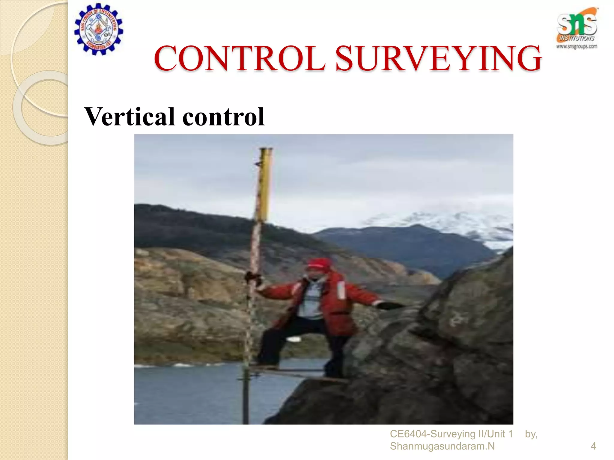
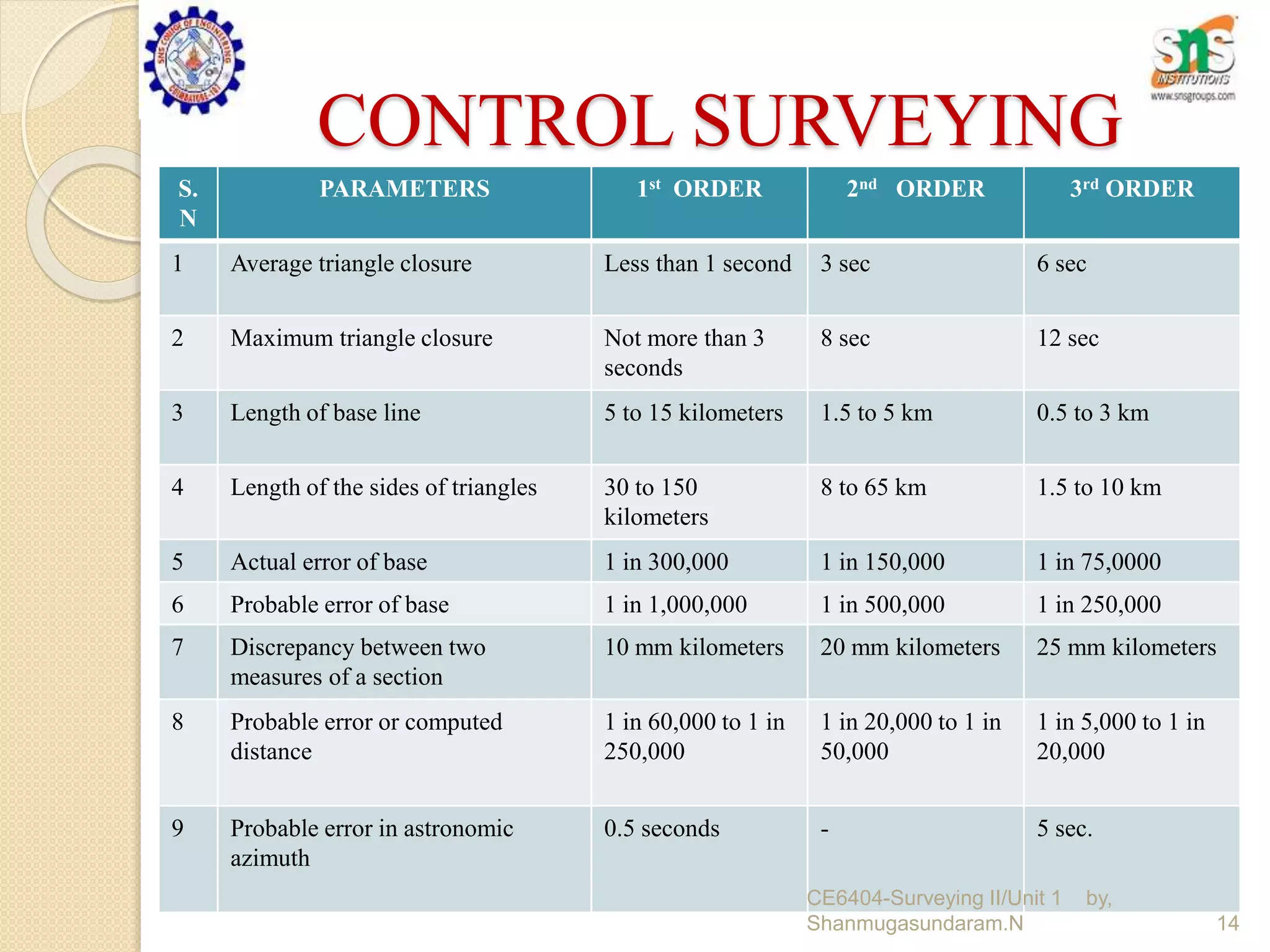
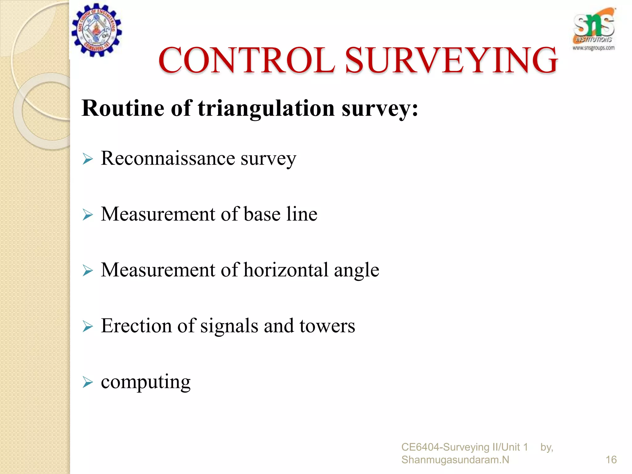
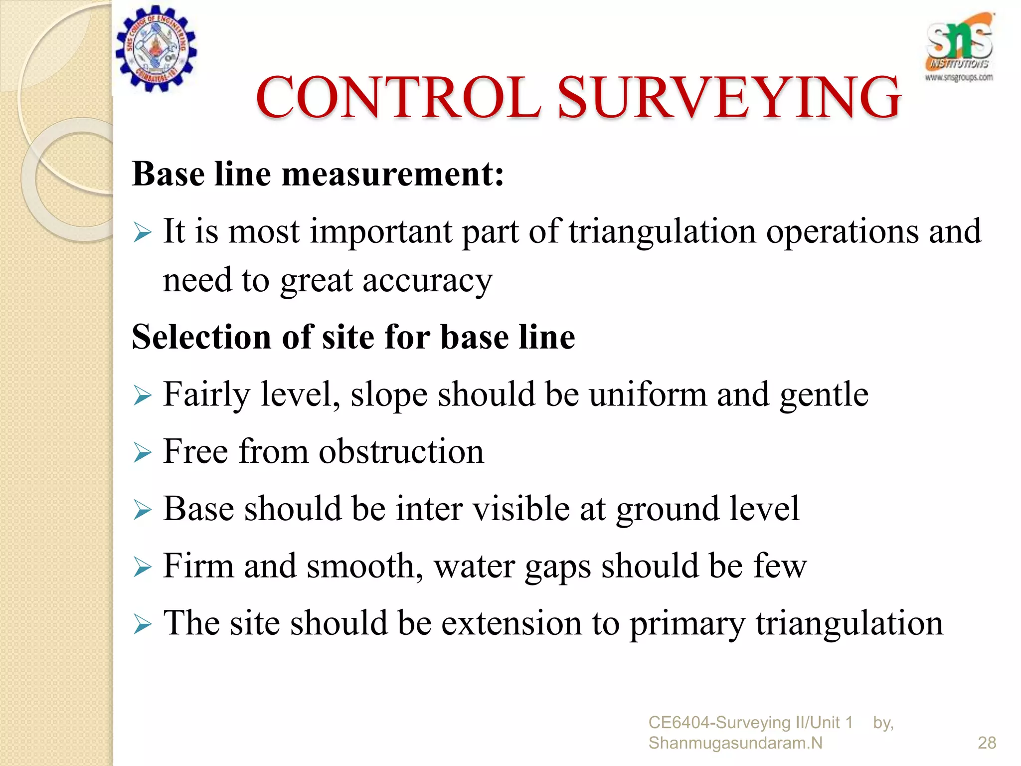
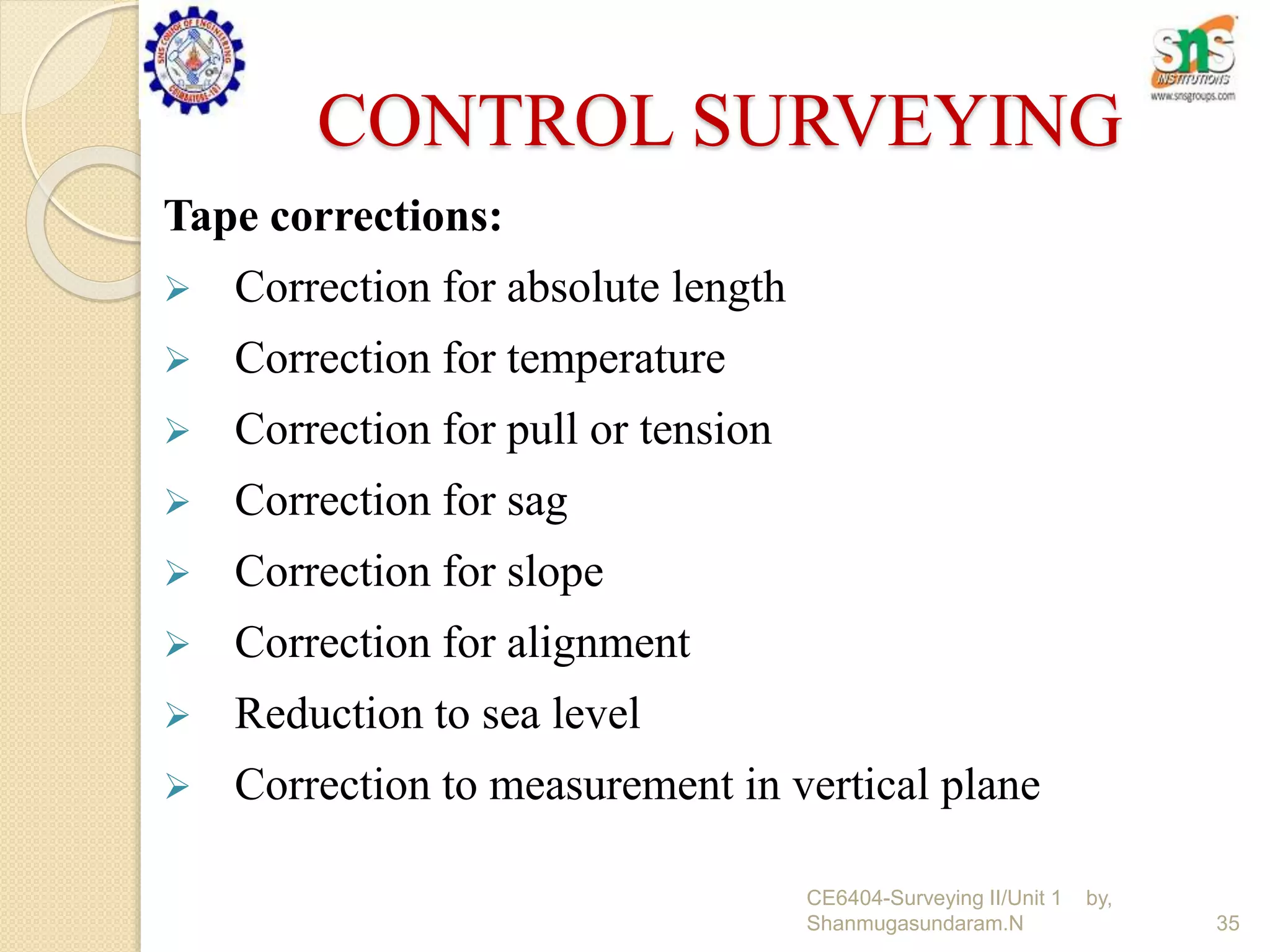
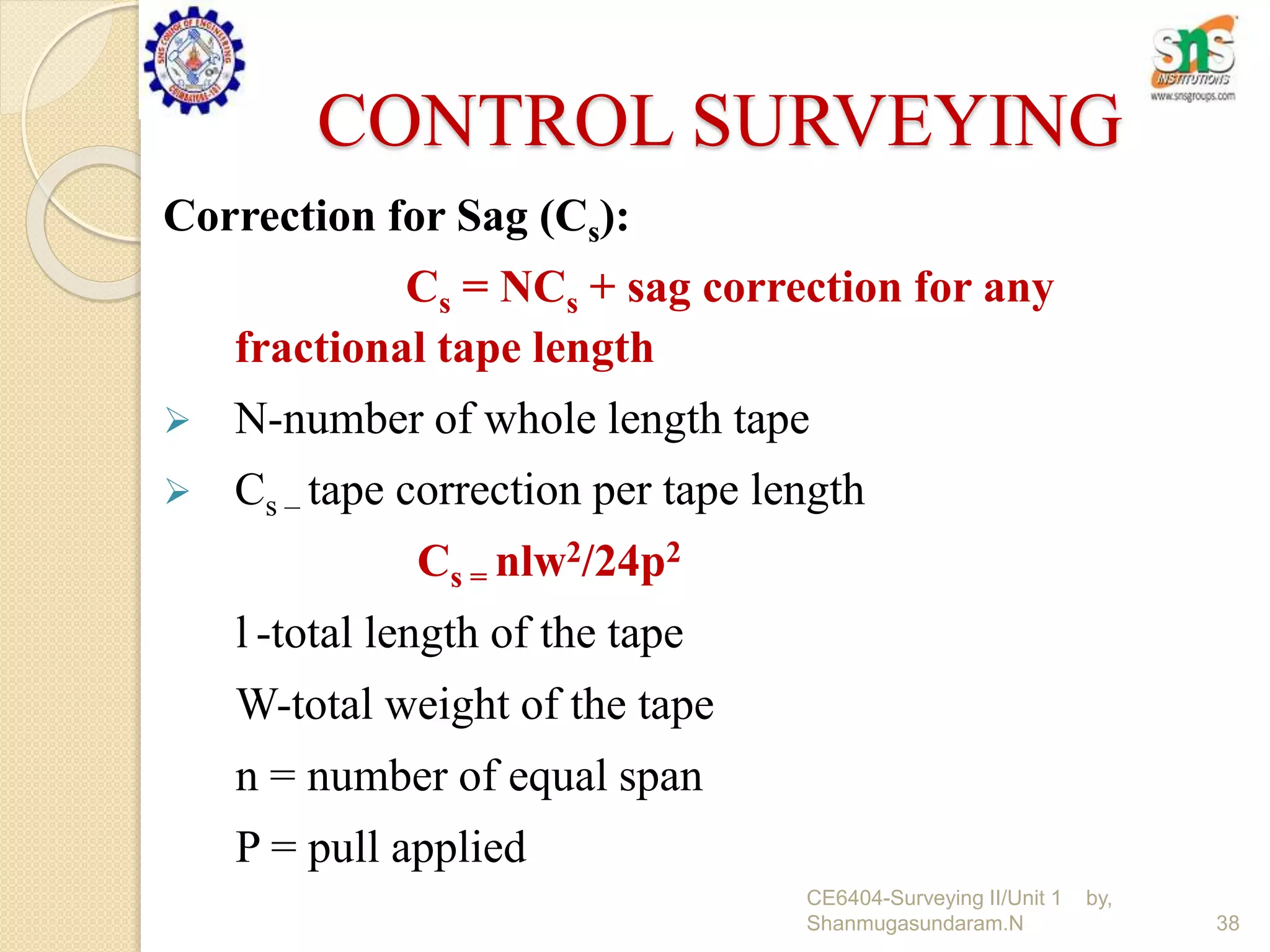
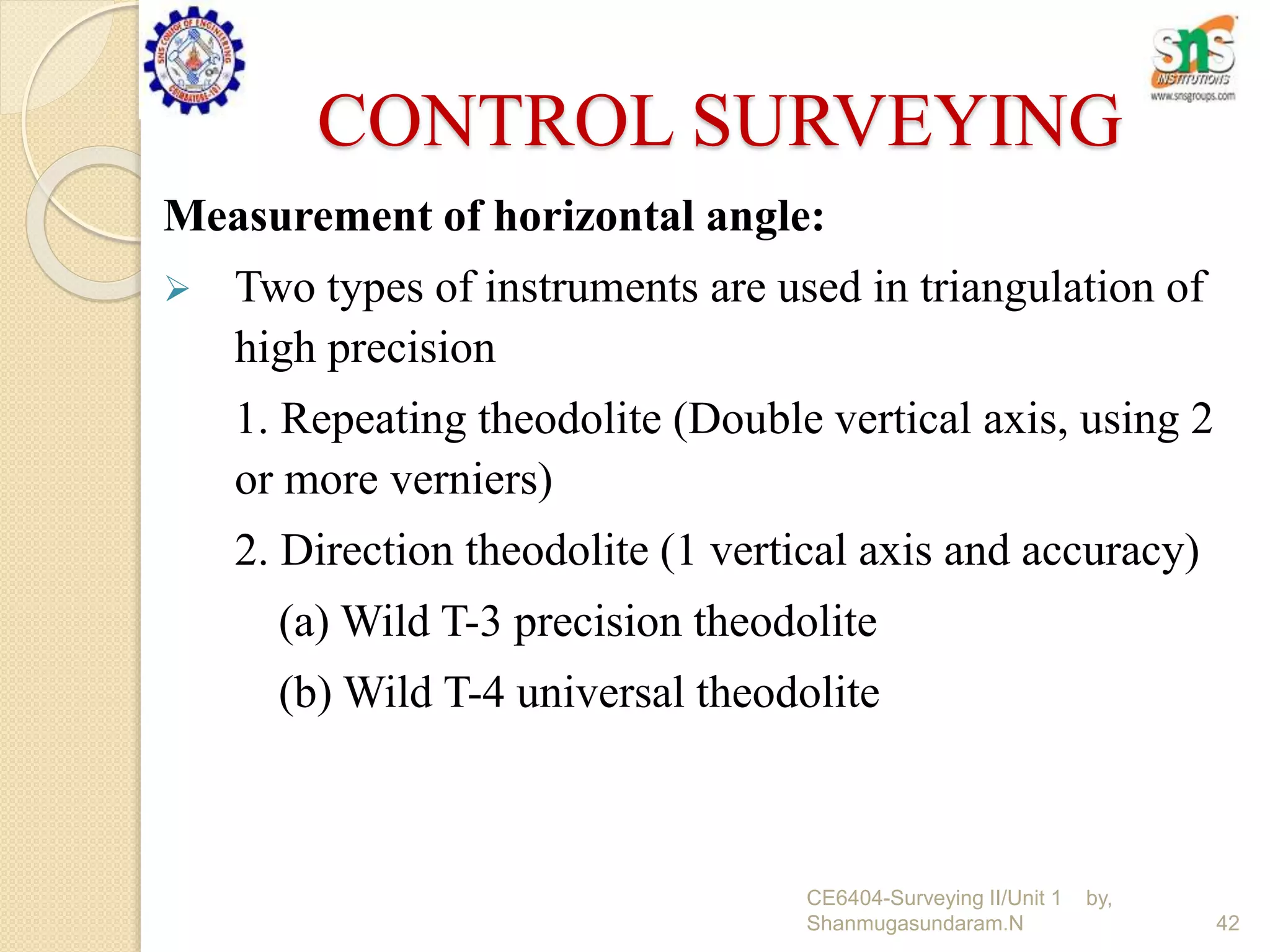
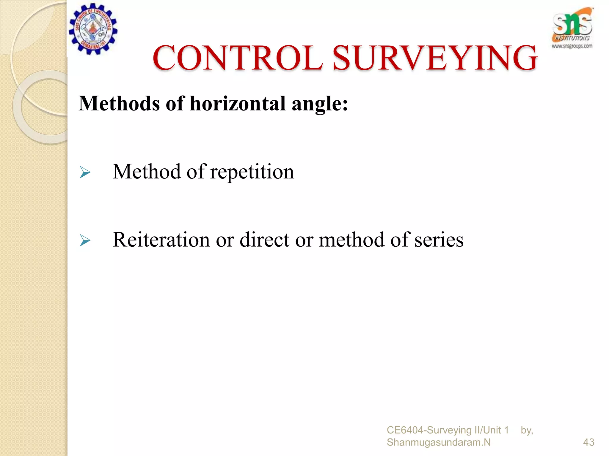
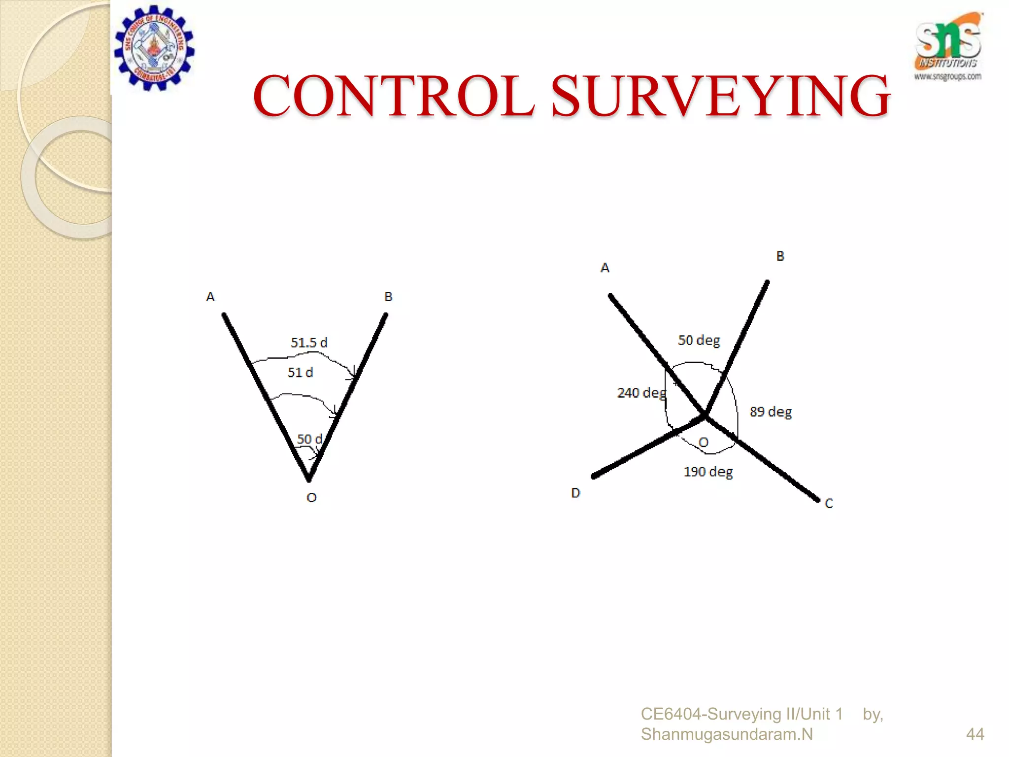
UNIT I
1
CE6404-Surveying II/Unit 1 by,
Shanmugasundaram.N
CONTROL SURVEYING
Fixing the point with respect to horizontal
and vertical control.
Using surveying instruments.
Methods
Horizontal control
Vertical control
2
CE6404-Surveying II/Unit 1 by,
Shanmugasundaram.N
CONTROL SURVEYING
Horizontal control
3
CE6404-Surveying II/Unit 1 by,
Shanmugasundaram.N
CONTROL SURVEYING
Vertical control
4
CE6404-Surveying II/Unit 1 by,
Shanmugasundaram.N
CONTROL SURVEYING
Horizontal control and its methods employed:
 Reference mark on known plan position
 Large structure primary and secondary control points are
used
 Primary control points are used in triangulation
 Secondary control points are reference to primary control
stations.
5
CE6404-Surveying II/Unit 1 by,
Shanmugasundaram.N
CONTROL SURVEYING
Reference grid:
 Used for accurate setting out of works of large magnitude
Types:
 Survey grid
 Site grid
 Structural grid
 Secondary grid
6
CE6404-Surveying II/Unit 1 by,
Shanmugasundaram.N
CONTROL SURVEYING
Survey grid:
 Drawn on survey plan from the original traverse
 Original traverse from the control points on the grid
Site grid:
 Used by the designer
 Design points are related to site grid
 Site grid should be actually the survey grid
7
CE6404-Surveying II/Unit 1 by,
Shanmugasundaram.N
CONTROL SURVEYING
Structural grid:
 Used at when the structural components are large
numbers.
 Used for accuracy
 It is set out from the site grid points
Secondary grid:
 Used for internal details of the building
 Other grids are not shown
8
CE6404-Surveying II/Unit 1 by,
Shanmugasundaram.N
CONTROL SURVEYING
Vertical control and methods:
 Determine elevation with respect to sea level
 Used to BM for other survey and high accuracy
 Also used for boundary survey, route survey, construction
and topographic surveys
 Need at lest two BM and more may be required at
depending upon the needs and complexity of the project
 Also used for construction of water, sewer system,
highways, bridges, drains and other infrastructures
9
CE6404-Surveying II/Unit 1 by,
Shanmugasundaram.N
CONTROL SURVEYING
cont.....
 Can be done in alone but after often done in conjunction
with a horizontal control survey
 Its used in NOAA ( national oceanic and atmospheric
administration)
10
CE6404-Surveying II/Unit 1 by,
Shanmugasundaram.N
CONTROL SURVEYING
Equipments:
 Boning rods and travellers (T shape)
 Sight rails (drilling to ground)
 Slope rails or batter boards (slope area)
 Profile boards (board cuts at edges)
11
CE6404-Surveying II/Unit 1 by,
Shanmugasundaram.N
CONTROL SURVEYING
Triangulation:
 The system consists of inter connected triangles in which
the length of one line called base line
 Angle of the triangles are measured very precisely
 Knowing the length of one side and three angles
 The length of other two sides are computed
Disadvantages:
 Accumulate errors and azimuth
12
CE6404-Surveying II/Unit 1 by,
Shanmugasundaram.N
CONTROL SURVEYING
Classification of Triangulation system:
 First order or primary triangulation (total whole country)
 Second order or secondary triangulation (in between frame
work)
 Third order or tertiary triangulation (within frame work)
13
CE6404-Surveying II/Unit 1 by,
Shanmugasundaram.N
CONTROL SURVEYING
14
S.
N
PARAMETERS 1st ORDER 2nd ORDER 3rd ORDER
1 Average triangle closure Less than 1 second 3 sec 6 sec
2 Maximum triangle closure Not more than 3
seconds
8 sec 12 sec
3 Length of base line 5 to 15 kilometers 1.5 to 5 km 0.5 to 3 km
4 Length of the sides of triangles 30 to 150
kilometers
8 to 65 km 1.5 to 10 km
5 Actual error of base 1 in 300,000 1 in 150,000 1 in 75,0000
6 Probable error of base 1 in 1,000,000 1 in 500,000 1 in 250,000
7 Discrepancy between two
measures of a section
10 mm kilometers 20 mm kilometers 25 mm kilometers
8 Probable error or computed
distance
1 in 60,000 to 1 in
250,000
1 in 20,000 to 1 in
50,000
1 in 5,000 to 1 in
20,000
9 Probable error in astronomic
azimuth
0.5 seconds - 5 sec.
CE6404-Surveying II/Unit 1 by,
Shanmugasundaram.N
CONTROL SURVEYING
Common figure of system:
 Single chain triangulations – not accurate
 Double chain triangulation – used to cover grater area
 Central point figures – flat countries ( pentagon and
hexagon)
 Quadrilateral – hilly countries (four side)
15
CE6404-Surveying II/Unit 1 by,
Shanmugasundaram.N
CONTROL SURVEYING
Routine of triangulation survey:
 Reconnaissance survey
 Measurement of base line
 Measurement of horizontal angle
 Erection of signals and towers
 computing
16
CE6404-Surveying II/Unit 1 by,
Shanmugasundaram.N
CONTROL SURVEYING
1.Reconnaissance survey:
Detailed survey
 Location of the site
 Characteristics of the contours
 Selection of triangulation system
17
CE6404-Surveying II/Unit 1 by,
Shanmugasundaram.N
CONTROL SURVEYING
Factors governing the selection of triangulation station:
 Easily accessible
 No obstacles
 Material available at nearer area
 Transportation facility
Important factors:
 Determination of distance b/n 2 points or stations
 Determination of elevation
 Profile of the intervening (obstacle) ground
18
CE6404-Surveying II/Unit 1 by,
Shanmugasundaram.N
WHAT IS THIS ?
19
CE6404-Surveying II/Unit 1 by,
Shanmugasundaram.N
CONTROL SURVEYING
Signals and Towers:
Towers:
 A tower is a structure erected over a station for the support
of the instrument and observing party and is provided when
the station or the signal or both are to be elevated.
 Inner tower - support the instrument only
 Outer tower- support the observer and signal
20
CE6404-Surveying II/Unit 1 by,
Shanmugasundaram.N
CONTROL SURVEYING
Towers:
 Independent to each other-masonry , timber and steel
 For small height masonry suitable otherwise uneconomical
 Timber are commonly used-50m height
 Steel towers are easily erected and dismantled also light
weight (BILBY tower 30 to 40m ht-3hours-5men-3tonnes)
21
CE6404-Surveying II/Unit 1 by,
Shanmugasundaram.N
CONTROL SURVEYING
Signals :
 A signal is a devices erected to define the exact position of
an observed station.
Classification :
 Day light or non luminous (opaque) signal
 Sun or luminous signal
 Night signal
22
CE6404-Surveying II/Unit 1 by,
Shanmugasundaram.N
CONTROL SURVEYING
Requirements of Signals :
 It should be conspicuous- clear visible against any
background
 Accurate cantered over the station mark
 It should be suitable for accurate bisection
 It should be free from phase or exhibit little phase
23
CE6404-Surveying II/Unit 1 by,
Shanmugasundaram.N
CONTROL SURVEYING
Day light or non luminous (opaque) signal:
 Consist of various type-Direct sight less then 30km
 Pole signals used for 6km
 Signal should be dark colour for visibility against the sky and should
painted white.
 Flag at top the signal
 Diameter of the signal pole in cm = 1.3D to 1.9D (D in km)
 Height of signal pole in cm = 13.3D (D in km)
24
CE6404-Surveying II/Unit 1 by,
Shanmugasundaram.N
CONTROL SURVEYING
Sun or luminous signal:
 Sun signals are those in which the sun’s rays are reflected to the
observing theodolite, either directly as from a beacon or
indirectly from a signal target.
 Used to when the length of sight exceed 30km
Instruments used:
 Heliotrope – consist of plane mirror- Direct reflected rays
 Heliograph – cantered over the station mark.
25
CE6404-Surveying II/Unit 1 by,
Shanmugasundaram.N
CONTROL SURVEYING
Night signal:
 Used in triangulation system at night time.
 Various forms of oil lamps with reflector or optical
collimators for line of sight less than 80km
 Acetylence lamp designed by captain G.T.Mccaw line of
sight up to 80km
26
CE6404-Surveying II/Unit 1 by,
Shanmugasundaram.N
CONTROL SURVEYING
Phase of signals:
 Phase signal is the error of bisection which arises from the fact
that under lateral illumination the signal is partly in light and
partly in shade.
 Observer sees only the illumination portion and bisects.
Two conditions
1. When the observation is made on the bright portion – ref fig A
2. When the observation is made on the bright line – ref fig B
27
CE6404-Surveying II/Unit 1 by,
Shanmugasundaram.N
CONTROL SURVEYING
Base line measurement:
 It is most important part of triangulation operations and
need to great accuracy
Selection of site for base line
 Fairly level, slope should be uniform and gentle
 Free from obstruction
 Base should be inter visible at ground level
 Firm and smooth, water gaps should be few
 The site should be extension to primary triangulation
28
CE6404-Surveying II/Unit 1 by,
Shanmugasundaram.N
CONTROL SURVEYING
Standard of lengths:
 Marked on meters by metals but small changes in
accuracy
a) Great britian – yard of bronze
b) The united states – meter to feet
c) India – old 10 feet bar A = 9.9999566 British feet
29
CE6404-Surveying II/Unit 1 by,
Shanmugasundaram.N
CONTROL SURVEYING
Base measuring apparatus:
 Rigid bars (before tape)
a) Contact apparatus (continue end)
b) Optical apparatus (microscope)
c) Compensating base bar (maintain length by 2
metals)
d) Bimetallic non-compensating base bars (using
thermometer)
e) Monometallic base bar ( using ice)
 Flexible apparatus
30
CE6404-Surveying II/Unit 1 by,
Shanmugasundaram.N
CONTROL SURVEYING
The Colby apparatus:
 Designed by Maj-Gen
 Eliminate the effect of change of temperature
 Linear expansion 3:5 ratio
 Steel and brass metals are using
 Brass is coated with a special preparation for steel
 Compound bar and sprite level are fixed at middle
 Consist of micro wires (cross wires)
 5 frame works (10 ft x 5 + 6 in x 5) = 52ft 6in
 This work is continued till the end of the base is
reached.
31
CE6404-Surveying II/Unit 1 by,
Shanmugasundaram.N
CONTROL SURVEYING
Flexible apparatus:
 Long length, time saving, no losses, accuracy, using
rough ground also, water gap areas, less expansive,
speed of measurements and more check bases.
1. Steel and inverted tape
2. Steel and brass wires
Steel tape
 Thermal expansion nearly 0.00000645/ºF
 Not accurate at day time, accurate at cloudy and night
time
32
CE6404-Surveying II/Unit 1 by,
Shanmugasundaram.N
CONTROL SURVEYING
Inver tape and wires:
 Steel alloy containing about 36% nickel
 The co-efficient of thermal expansion is 0.0000005/ºF
 Length is changed slowly so never used standard
Equipment for base line measurement:
 Three standardised tapes
 Straining device, marking tripod or sticks
 Six thermometers
 Accurate spring balance
33
CE6404-Surveying II/Unit 1 by,
Shanmugasundaram.N
CONTROL SURVEYING
The field work:
 The setting out party
Two surveyors and a number of parties
 The measuring party
Two observers, recorder, leveller and staff man
(accurate at 0.5 to 1km)
Methods:
1.Wheeler’s method by wheeler’s base line apparatus
2.Jaderin’s method
34
CE6404-Surveying II/Unit 1 by,
Shanmugasundaram.N
CONTROL SURVEYING
Tape corrections:
 Correction for absolute length
 Correction for temperature
 Correction for pull or tension
 Correction for sag
 Correction for slope
 Correction for alignment
 Reduction to sea level
 Correction to measurement in vertical plane
35
CE6404-Surveying II/Unit 1 by,
Shanmugasundaram.N
CONTROL SURVEYING
Correction for absolute length (Ca):
Ca = L.c/l
 Ca- correction for absolute length
 L-measure length of the line
 C-correction per tape length
 L-designed length of the tape
Correction for temperature (Ct):
Ct = α (Tm-To)L
 α- co efficient of thermal expansion
 Tm-mean temperature in the field during measurements
 To- mean temperature during standardisation of the tape
 L- measured length
36
CE6404-Surveying II/Unit 1 by,
Shanmugasundaram.N
CONTROL SURVEYING
Correction for temperature (Ct):
Jaderin’s method:
Ct (brass) = αb (Ls-Lb)/αb - αs
Ct (steel) = αs (Ls-Lb)/αb – αs
Correction for pull or tension (Cp or Ct):
Cp = (P-Po)L/AE
 P- pull applied during measurements (N)
 Po- standard pull (N)
 L-measurement length (m)
 A-cross section area of the tape (cm2)
 E-young’s modulus of elasticity (N/cm2)
 The pull applied in the field should be less than 20 times
the weight of the tape.
37
CE6404-Surveying II/Unit 1 by,
Shanmugasundaram.N
CONTROL SURVEYING
Correction for Sag (Cs):
Cs = NCs + sag correction for any
fractional tape length
 N-number of whole length tape
 Cs – tape correction per tape length
Cs = nlw2/24p2
l -total length of the tape
W-total weight of the tape
n = number of equal span
P = pull applied
38
CE6404-Surveying II/Unit 1 by,
Shanmugasundaram.N
CONTROL SURVEYING
Normal tension(Pn):
Pn = 0.204w1 √AE/√ (Pn - Po )
The value of Pn is to be determined by trial and
error method.
Correction for slope or vertical alignment:
AB = L = inclined length measured
AB1 = horizontal length
h = difference in elevation between the ends.
Cv = slope correction or correction due to vertical
alignment
39
CE6404-Surveying II/Unit 1 by,
Shanmugasundaram.N
CONTROL SURVEYING
Cv = AB- AB1 = L-√L2-h2
If the grades are uniform length L, we get total slope
correction = sum of h2 /2L
If the angle (θ) of slope is measured insted of h, the correction
is given by
Cv = L-Lcosθ = l(1-cosθ)
Cv =2Lsin2θ/2
Correction for horizontal alignment
(a) Bad ranging = Ch = d2/2L
(b) Deformation of the tape in horizontal plane = Ch =
(d2/2L1)+(d2/2L1)
(c) Broken base = Ch = (acβ2 /(a+c)) x 4.2308x10⁻⁸
40CE6404-Surveying II/Unit 1 by, Shanmugasundaram.N
CONTROL SURVEYING
Reduction to mean sea level:
Correction (Cmsl) = L-D = Lh/R
Correction to measurement in vertical plane:
Sx = gx/AE ((M+0.5m(2l-x)-po/g))
41
CE6404-Surveying II/Unit 1 by,
Shanmugasundaram.N
CONTROL SURVEYING
Measurement of horizontal angle:
 Two types of instruments are used in triangulation of
high precision
1. Repeating theodolite (Double vertical axis, using 2
or more verniers)
2. Direction theodolite (1 vertical axis and accuracy)
(a) Wild T-3 precision theodolite
(b) Wild T-4 universal theodolite
42
CE6404-Surveying II/Unit 1 by,
Shanmugasundaram.N
CONTROL SURVEYING
Methods of horizontal angle:
 Method of repetition
 Reiteration or direct or method of series
43
CE6404-Surveying II/Unit 1 by,
Shanmugasundaram.N
CONTROL SURVEYING
44
CE6404-Surveying II/Unit 1 by,
Shanmugasundaram.N
CONTROL SURVEYING
Methods of horizontal angle:
 Method of repetition
 Reiteration or direct or method of series
Satellite station : Reduction to centre:
 In order to secure well conditioned triangle or better
visibility objects such as church spires, steel post,
flag poles, towers etc..
 Sometimes selected as triangulation station, when the
observations are to taken from such a station, it is
impossible to set up an instrument over it.
45
CE6404-Surveying II/Unit 1 by,
Shanmugasundaram.N
CONTROL SURVEYING
 In such cases a subsidiary station known as satellite
station or eccentric station or false station is
selected as near to the main station.
 Observations are taken from same precision as would
have been used in the measurement of angle at the
true stations.
46
CE6404-Surveying II/Unit 1 by,
Shanmugasundaram.N
CONTROL SURVEYING
47
 Gale’s Table
CE6404-Surveying II/Unit 1 by,
Shanmugasundaram.N

Control surveying

  • 1.
    UNIT I 1 CE6404-Surveying II/Unit1 by, Shanmugasundaram.N
  • 2.
    CONTROL SURVEYING Fixing thepoint with respect to horizontal and vertical control. Using surveying instruments. Methods Horizontal control Vertical control 2 CE6404-Surveying II/Unit 1 by, Shanmugasundaram.N
  • 3.
  • 4.
  • 5.
    CONTROL SURVEYING Horizontal controland its methods employed:  Reference mark on known plan position  Large structure primary and secondary control points are used  Primary control points are used in triangulation  Secondary control points are reference to primary control stations. 5 CE6404-Surveying II/Unit 1 by, Shanmugasundaram.N
  • 6.
    CONTROL SURVEYING Reference grid: Used for accurate setting out of works of large magnitude Types:  Survey grid  Site grid  Structural grid  Secondary grid 6 CE6404-Surveying II/Unit 1 by, Shanmugasundaram.N
  • 7.
    CONTROL SURVEYING Survey grid: Drawn on survey plan from the original traverse  Original traverse from the control points on the grid Site grid:  Used by the designer  Design points are related to site grid  Site grid should be actually the survey grid 7 CE6404-Surveying II/Unit 1 by, Shanmugasundaram.N
  • 8.
    CONTROL SURVEYING Structural grid: Used at when the structural components are large numbers.  Used for accuracy  It is set out from the site grid points Secondary grid:  Used for internal details of the building  Other grids are not shown 8 CE6404-Surveying II/Unit 1 by, Shanmugasundaram.N
  • 9.
    CONTROL SURVEYING Vertical controland methods:  Determine elevation with respect to sea level  Used to BM for other survey and high accuracy  Also used for boundary survey, route survey, construction and topographic surveys  Need at lest two BM and more may be required at depending upon the needs and complexity of the project  Also used for construction of water, sewer system, highways, bridges, drains and other infrastructures 9 CE6404-Surveying II/Unit 1 by, Shanmugasundaram.N
  • 10.
    CONTROL SURVEYING cont.....  Canbe done in alone but after often done in conjunction with a horizontal control survey  Its used in NOAA ( national oceanic and atmospheric administration) 10 CE6404-Surveying II/Unit 1 by, Shanmugasundaram.N
  • 11.
    CONTROL SURVEYING Equipments:  Boningrods and travellers (T shape)  Sight rails (drilling to ground)  Slope rails or batter boards (slope area)  Profile boards (board cuts at edges) 11 CE6404-Surveying II/Unit 1 by, Shanmugasundaram.N
  • 12.
    CONTROL SURVEYING Triangulation:  Thesystem consists of inter connected triangles in which the length of one line called base line  Angle of the triangles are measured very precisely  Knowing the length of one side and three angles  The length of other two sides are computed Disadvantages:  Accumulate errors and azimuth 12 CE6404-Surveying II/Unit 1 by, Shanmugasundaram.N
  • 13.
    CONTROL SURVEYING Classification ofTriangulation system:  First order or primary triangulation (total whole country)  Second order or secondary triangulation (in between frame work)  Third order or tertiary triangulation (within frame work) 13 CE6404-Surveying II/Unit 1 by, Shanmugasundaram.N
  • 14.
    CONTROL SURVEYING 14 S. N PARAMETERS 1stORDER 2nd ORDER 3rd ORDER 1 Average triangle closure Less than 1 second 3 sec 6 sec 2 Maximum triangle closure Not more than 3 seconds 8 sec 12 sec 3 Length of base line 5 to 15 kilometers 1.5 to 5 km 0.5 to 3 km 4 Length of the sides of triangles 30 to 150 kilometers 8 to 65 km 1.5 to 10 km 5 Actual error of base 1 in 300,000 1 in 150,000 1 in 75,0000 6 Probable error of base 1 in 1,000,000 1 in 500,000 1 in 250,000 7 Discrepancy between two measures of a section 10 mm kilometers 20 mm kilometers 25 mm kilometers 8 Probable error or computed distance 1 in 60,000 to 1 in 250,000 1 in 20,000 to 1 in 50,000 1 in 5,000 to 1 in 20,000 9 Probable error in astronomic azimuth 0.5 seconds - 5 sec. CE6404-Surveying II/Unit 1 by, Shanmugasundaram.N
  • 15.
    CONTROL SURVEYING Common figureof system:  Single chain triangulations – not accurate  Double chain triangulation – used to cover grater area  Central point figures – flat countries ( pentagon and hexagon)  Quadrilateral – hilly countries (four side) 15 CE6404-Surveying II/Unit 1 by, Shanmugasundaram.N
  • 16.
    CONTROL SURVEYING Routine oftriangulation survey:  Reconnaissance survey  Measurement of base line  Measurement of horizontal angle  Erection of signals and towers  computing 16 CE6404-Surveying II/Unit 1 by, Shanmugasundaram.N
  • 17.
    CONTROL SURVEYING 1.Reconnaissance survey: Detailedsurvey  Location of the site  Characteristics of the contours  Selection of triangulation system 17 CE6404-Surveying II/Unit 1 by, Shanmugasundaram.N
  • 18.
    CONTROL SURVEYING Factors governingthe selection of triangulation station:  Easily accessible  No obstacles  Material available at nearer area  Transportation facility Important factors:  Determination of distance b/n 2 points or stations  Determination of elevation  Profile of the intervening (obstacle) ground 18 CE6404-Surveying II/Unit 1 by, Shanmugasundaram.N
  • 19.
    WHAT IS THIS? 19 CE6404-Surveying II/Unit 1 by, Shanmugasundaram.N
  • 20.
    CONTROL SURVEYING Signals andTowers: Towers:  A tower is a structure erected over a station for the support of the instrument and observing party and is provided when the station or the signal or both are to be elevated.  Inner tower - support the instrument only  Outer tower- support the observer and signal 20 CE6404-Surveying II/Unit 1 by, Shanmugasundaram.N
  • 21.
    CONTROL SURVEYING Towers:  Independentto each other-masonry , timber and steel  For small height masonry suitable otherwise uneconomical  Timber are commonly used-50m height  Steel towers are easily erected and dismantled also light weight (BILBY tower 30 to 40m ht-3hours-5men-3tonnes) 21 CE6404-Surveying II/Unit 1 by, Shanmugasundaram.N
  • 22.
    CONTROL SURVEYING Signals : A signal is a devices erected to define the exact position of an observed station. Classification :  Day light or non luminous (opaque) signal  Sun or luminous signal  Night signal 22 CE6404-Surveying II/Unit 1 by, Shanmugasundaram.N
  • 23.
    CONTROL SURVEYING Requirements ofSignals :  It should be conspicuous- clear visible against any background  Accurate cantered over the station mark  It should be suitable for accurate bisection  It should be free from phase or exhibit little phase 23 CE6404-Surveying II/Unit 1 by, Shanmugasundaram.N
  • 24.
    CONTROL SURVEYING Day lightor non luminous (opaque) signal:  Consist of various type-Direct sight less then 30km  Pole signals used for 6km  Signal should be dark colour for visibility against the sky and should painted white.  Flag at top the signal  Diameter of the signal pole in cm = 1.3D to 1.9D (D in km)  Height of signal pole in cm = 13.3D (D in km) 24 CE6404-Surveying II/Unit 1 by, Shanmugasundaram.N
  • 25.
    CONTROL SURVEYING Sun orluminous signal:  Sun signals are those in which the sun’s rays are reflected to the observing theodolite, either directly as from a beacon or indirectly from a signal target.  Used to when the length of sight exceed 30km Instruments used:  Heliotrope – consist of plane mirror- Direct reflected rays  Heliograph – cantered over the station mark. 25 CE6404-Surveying II/Unit 1 by, Shanmugasundaram.N
  • 26.
    CONTROL SURVEYING Night signal: Used in triangulation system at night time.  Various forms of oil lamps with reflector or optical collimators for line of sight less than 80km  Acetylence lamp designed by captain G.T.Mccaw line of sight up to 80km 26 CE6404-Surveying II/Unit 1 by, Shanmugasundaram.N
  • 27.
    CONTROL SURVEYING Phase ofsignals:  Phase signal is the error of bisection which arises from the fact that under lateral illumination the signal is partly in light and partly in shade.  Observer sees only the illumination portion and bisects. Two conditions 1. When the observation is made on the bright portion – ref fig A 2. When the observation is made on the bright line – ref fig B 27 CE6404-Surveying II/Unit 1 by, Shanmugasundaram.N
  • 28.
    CONTROL SURVEYING Base linemeasurement:  It is most important part of triangulation operations and need to great accuracy Selection of site for base line  Fairly level, slope should be uniform and gentle  Free from obstruction  Base should be inter visible at ground level  Firm and smooth, water gaps should be few  The site should be extension to primary triangulation 28 CE6404-Surveying II/Unit 1 by, Shanmugasundaram.N
  • 29.
    CONTROL SURVEYING Standard oflengths:  Marked on meters by metals but small changes in accuracy a) Great britian – yard of bronze b) The united states – meter to feet c) India – old 10 feet bar A = 9.9999566 British feet 29 CE6404-Surveying II/Unit 1 by, Shanmugasundaram.N
  • 30.
    CONTROL SURVEYING Base measuringapparatus:  Rigid bars (before tape) a) Contact apparatus (continue end) b) Optical apparatus (microscope) c) Compensating base bar (maintain length by 2 metals) d) Bimetallic non-compensating base bars (using thermometer) e) Monometallic base bar ( using ice)  Flexible apparatus 30 CE6404-Surveying II/Unit 1 by, Shanmugasundaram.N
  • 31.
    CONTROL SURVEYING The Colbyapparatus:  Designed by Maj-Gen  Eliminate the effect of change of temperature  Linear expansion 3:5 ratio  Steel and brass metals are using  Brass is coated with a special preparation for steel  Compound bar and sprite level are fixed at middle  Consist of micro wires (cross wires)  5 frame works (10 ft x 5 + 6 in x 5) = 52ft 6in  This work is continued till the end of the base is reached. 31 CE6404-Surveying II/Unit 1 by, Shanmugasundaram.N
  • 32.
    CONTROL SURVEYING Flexible apparatus: Long length, time saving, no losses, accuracy, using rough ground also, water gap areas, less expansive, speed of measurements and more check bases. 1. Steel and inverted tape 2. Steel and brass wires Steel tape  Thermal expansion nearly 0.00000645/ºF  Not accurate at day time, accurate at cloudy and night time 32 CE6404-Surveying II/Unit 1 by, Shanmugasundaram.N
  • 33.
    CONTROL SURVEYING Inver tapeand wires:  Steel alloy containing about 36% nickel  The co-efficient of thermal expansion is 0.0000005/ºF  Length is changed slowly so never used standard Equipment for base line measurement:  Three standardised tapes  Straining device, marking tripod or sticks  Six thermometers  Accurate spring balance 33 CE6404-Surveying II/Unit 1 by, Shanmugasundaram.N
  • 34.
    CONTROL SURVEYING The fieldwork:  The setting out party Two surveyors and a number of parties  The measuring party Two observers, recorder, leveller and staff man (accurate at 0.5 to 1km) Methods: 1.Wheeler’s method by wheeler’s base line apparatus 2.Jaderin’s method 34 CE6404-Surveying II/Unit 1 by, Shanmugasundaram.N
  • 35.
    CONTROL SURVEYING Tape corrections: Correction for absolute length  Correction for temperature  Correction for pull or tension  Correction for sag  Correction for slope  Correction for alignment  Reduction to sea level  Correction to measurement in vertical plane 35 CE6404-Surveying II/Unit 1 by, Shanmugasundaram.N
  • 36.
    CONTROL SURVEYING Correction forabsolute length (Ca): Ca = L.c/l  Ca- correction for absolute length  L-measure length of the line  C-correction per tape length  L-designed length of the tape Correction for temperature (Ct): Ct = α (Tm-To)L  α- co efficient of thermal expansion  Tm-mean temperature in the field during measurements  To- mean temperature during standardisation of the tape  L- measured length 36 CE6404-Surveying II/Unit 1 by, Shanmugasundaram.N
  • 37.
    CONTROL SURVEYING Correction fortemperature (Ct): Jaderin’s method: Ct (brass) = αb (Ls-Lb)/αb - αs Ct (steel) = αs (Ls-Lb)/αb – αs Correction for pull or tension (Cp or Ct): Cp = (P-Po)L/AE  P- pull applied during measurements (N)  Po- standard pull (N)  L-measurement length (m)  A-cross section area of the tape (cm2)  E-young’s modulus of elasticity (N/cm2)  The pull applied in the field should be less than 20 times the weight of the tape. 37 CE6404-Surveying II/Unit 1 by, Shanmugasundaram.N
  • 38.
    CONTROL SURVEYING Correction forSag (Cs): Cs = NCs + sag correction for any fractional tape length  N-number of whole length tape  Cs – tape correction per tape length Cs = nlw2/24p2 l -total length of the tape W-total weight of the tape n = number of equal span P = pull applied 38 CE6404-Surveying II/Unit 1 by, Shanmugasundaram.N
  • 39.
    CONTROL SURVEYING Normal tension(Pn): Pn= 0.204w1 √AE/√ (Pn - Po ) The value of Pn is to be determined by trial and error method. Correction for slope or vertical alignment: AB = L = inclined length measured AB1 = horizontal length h = difference in elevation between the ends. Cv = slope correction or correction due to vertical alignment 39 CE6404-Surveying II/Unit 1 by, Shanmugasundaram.N
  • 40.
    CONTROL SURVEYING Cv =AB- AB1 = L-√L2-h2 If the grades are uniform length L, we get total slope correction = sum of h2 /2L If the angle (θ) of slope is measured insted of h, the correction is given by Cv = L-Lcosθ = l(1-cosθ) Cv =2Lsin2θ/2 Correction for horizontal alignment (a) Bad ranging = Ch = d2/2L (b) Deformation of the tape in horizontal plane = Ch = (d2/2L1)+(d2/2L1) (c) Broken base = Ch = (acβ2 /(a+c)) x 4.2308x10⁻⁸ 40CE6404-Surveying II/Unit 1 by, Shanmugasundaram.N
  • 41.
    CONTROL SURVEYING Reduction tomean sea level: Correction (Cmsl) = L-D = Lh/R Correction to measurement in vertical plane: Sx = gx/AE ((M+0.5m(2l-x)-po/g)) 41 CE6404-Surveying II/Unit 1 by, Shanmugasundaram.N
  • 42.
    CONTROL SURVEYING Measurement ofhorizontal angle:  Two types of instruments are used in triangulation of high precision 1. Repeating theodolite (Double vertical axis, using 2 or more verniers) 2. Direction theodolite (1 vertical axis and accuracy) (a) Wild T-3 precision theodolite (b) Wild T-4 universal theodolite 42 CE6404-Surveying II/Unit 1 by, Shanmugasundaram.N
  • 43.
    CONTROL SURVEYING Methods ofhorizontal angle:  Method of repetition  Reiteration or direct or method of series 43 CE6404-Surveying II/Unit 1 by, Shanmugasundaram.N
  • 44.
  • 45.
    CONTROL SURVEYING Methods ofhorizontal angle:  Method of repetition  Reiteration or direct or method of series Satellite station : Reduction to centre:  In order to secure well conditioned triangle or better visibility objects such as church spires, steel post, flag poles, towers etc..  Sometimes selected as triangulation station, when the observations are to taken from such a station, it is impossible to set up an instrument over it. 45 CE6404-Surveying II/Unit 1 by, Shanmugasundaram.N
  • 46.
    CONTROL SURVEYING  Insuch cases a subsidiary station known as satellite station or eccentric station or false station is selected as near to the main station.  Observations are taken from same precision as would have been used in the measurement of angle at the true stations. 46 CE6404-Surveying II/Unit 1 by, Shanmugasundaram.N
  • 47.
    CONTROL SURVEYING 47  Gale’sTable CE6404-Surveying II/Unit 1 by, Shanmugasundaram.N