This document discusses contour mapping and surveying techniques. It contains:
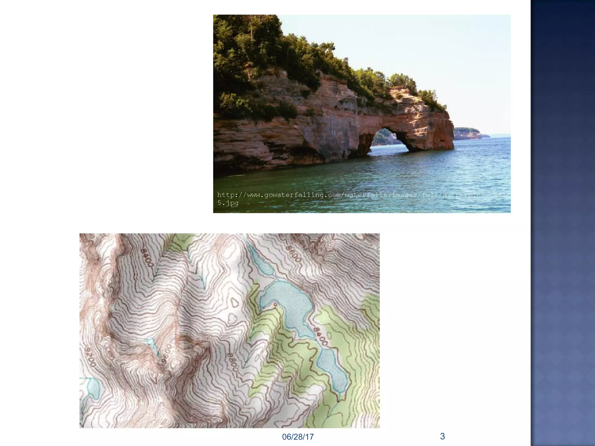
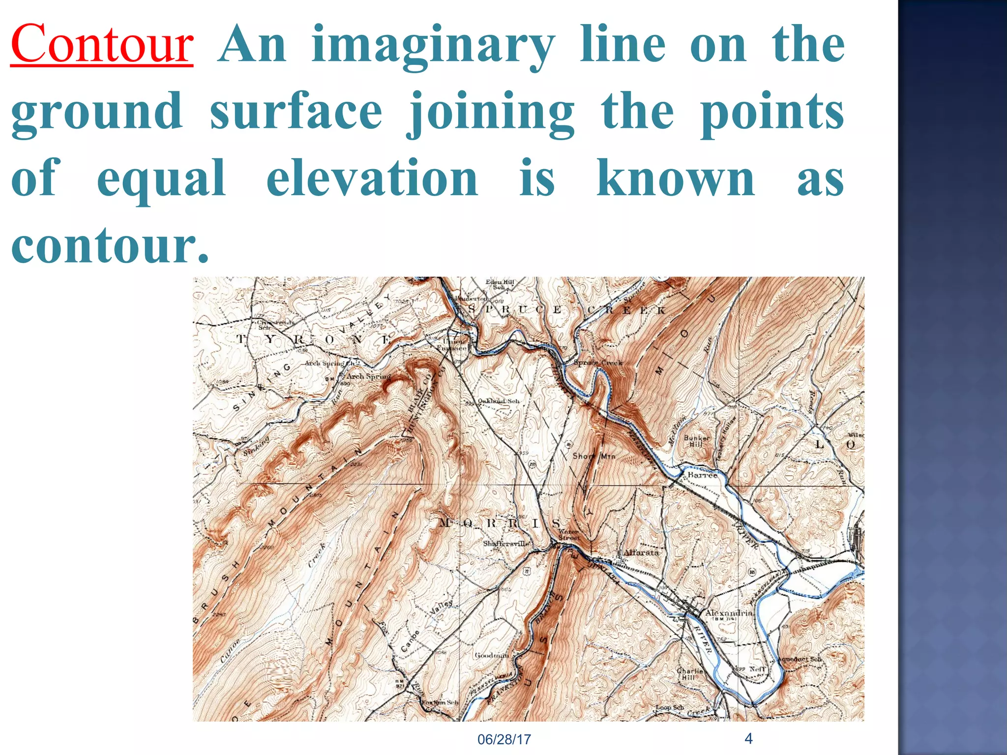
1) Definitions of key terms like contour, contour line, contour map, and contour interval.
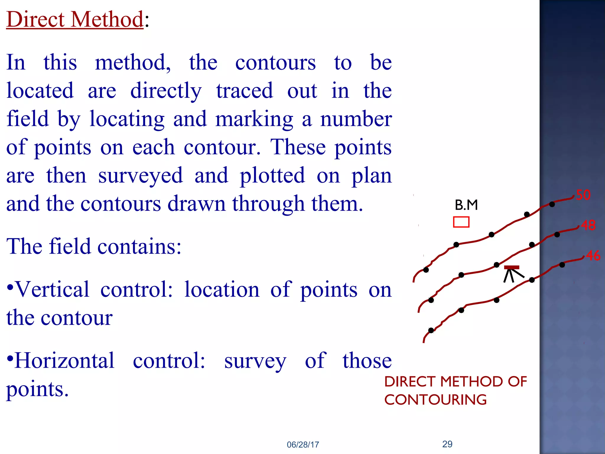
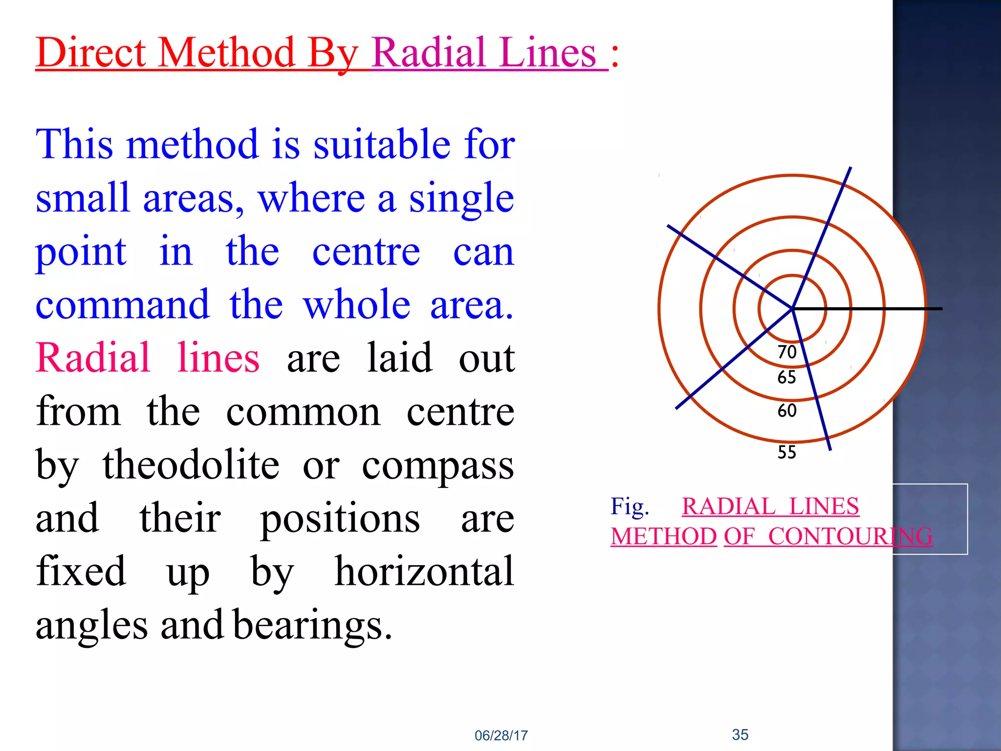
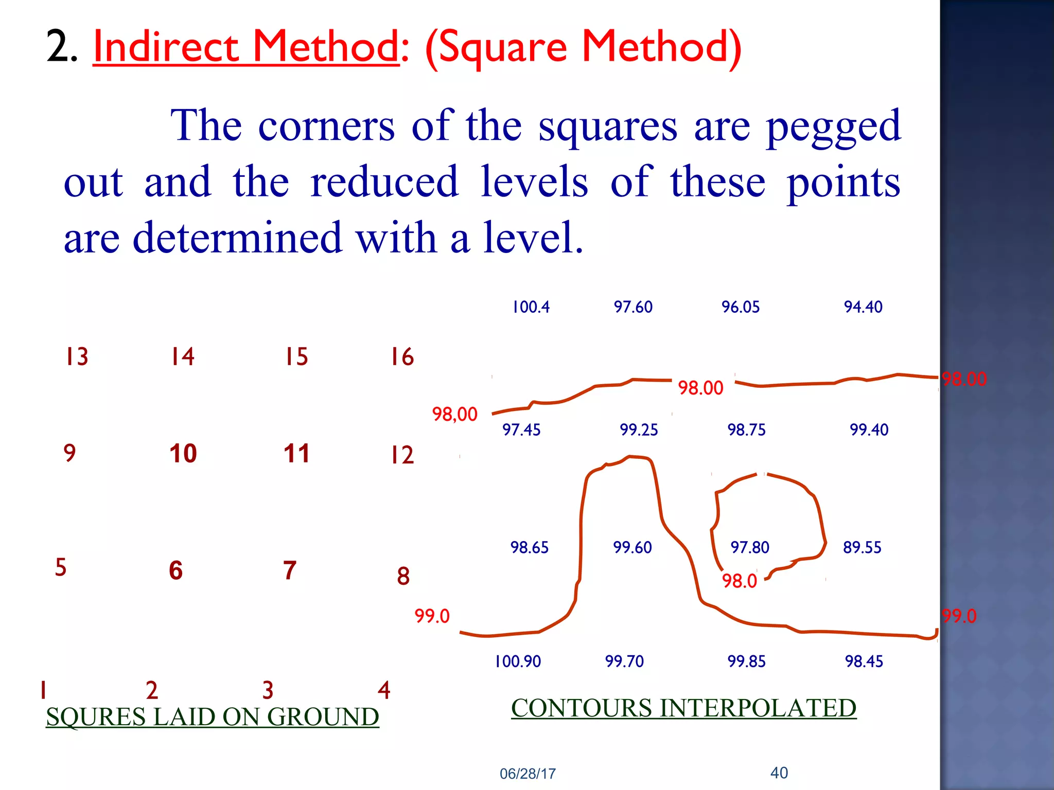
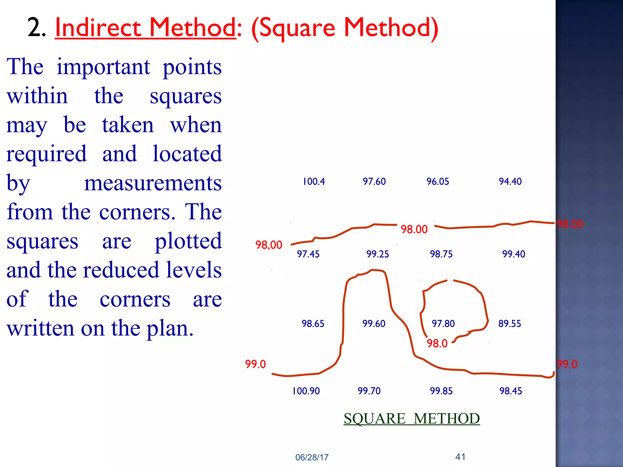
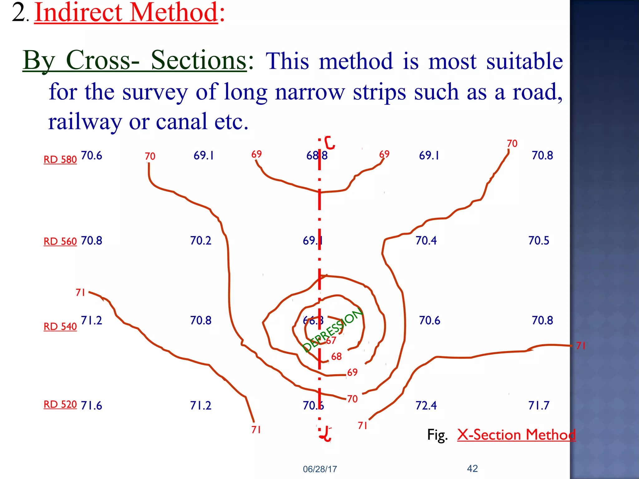
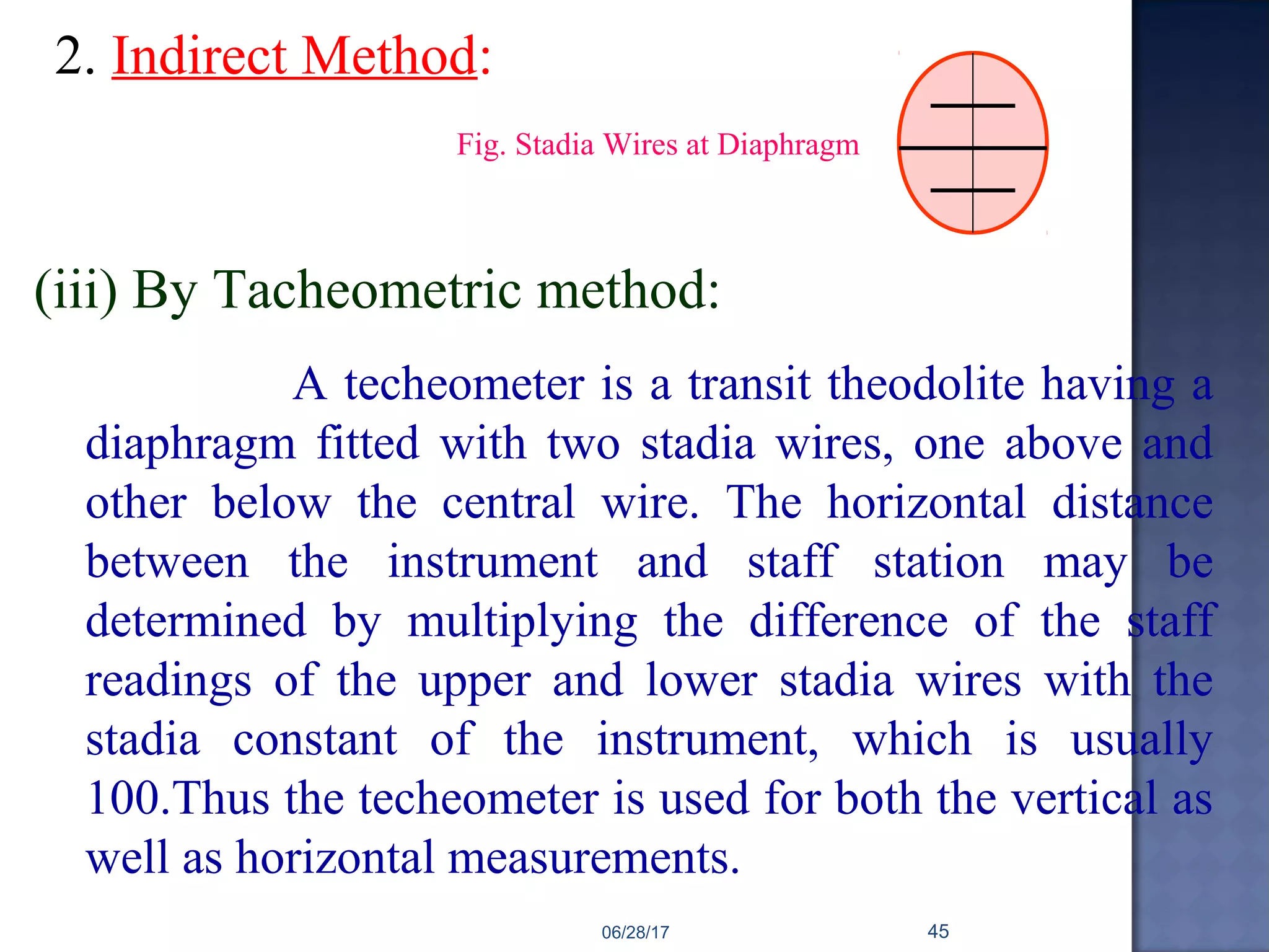
2) Descriptions of the direct and indirect methods for locating contours in the field. The direct method involves directly tracing and marking contour points, while the indirect method involves taking spot levels and interpolating the contours.
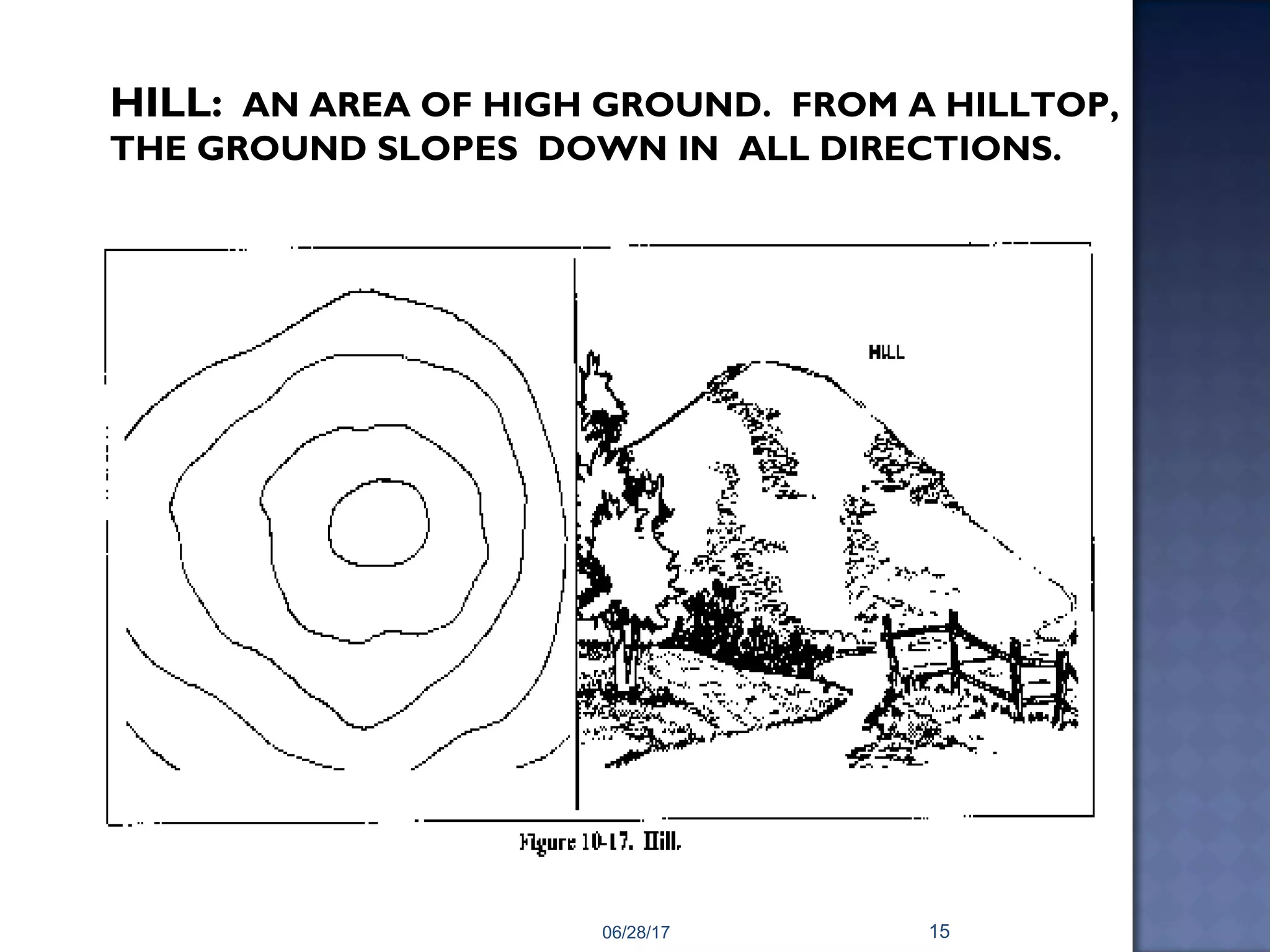
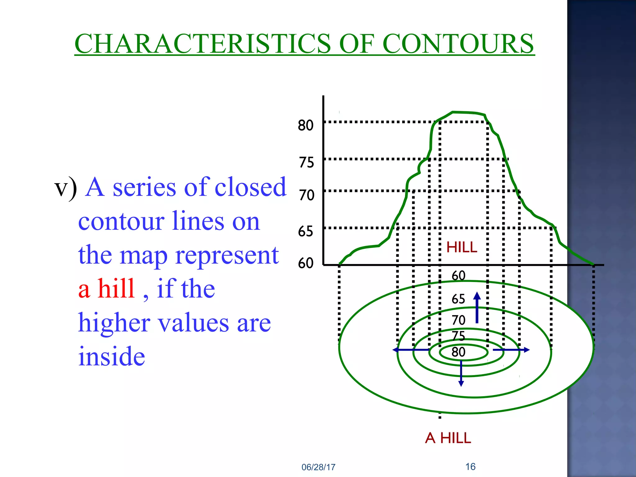
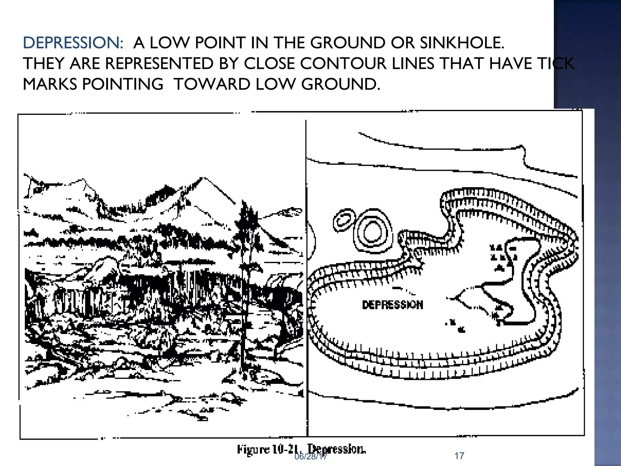
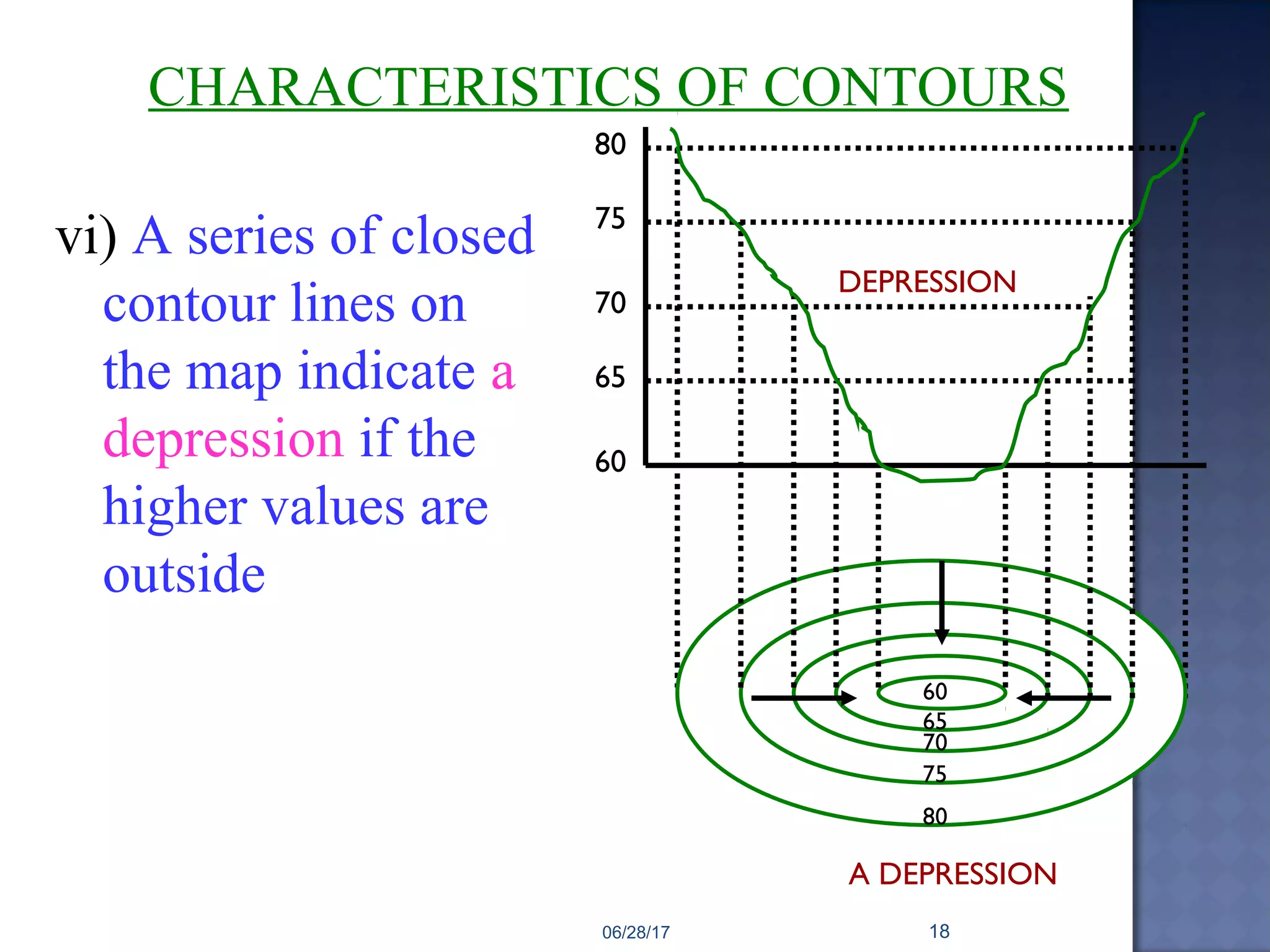
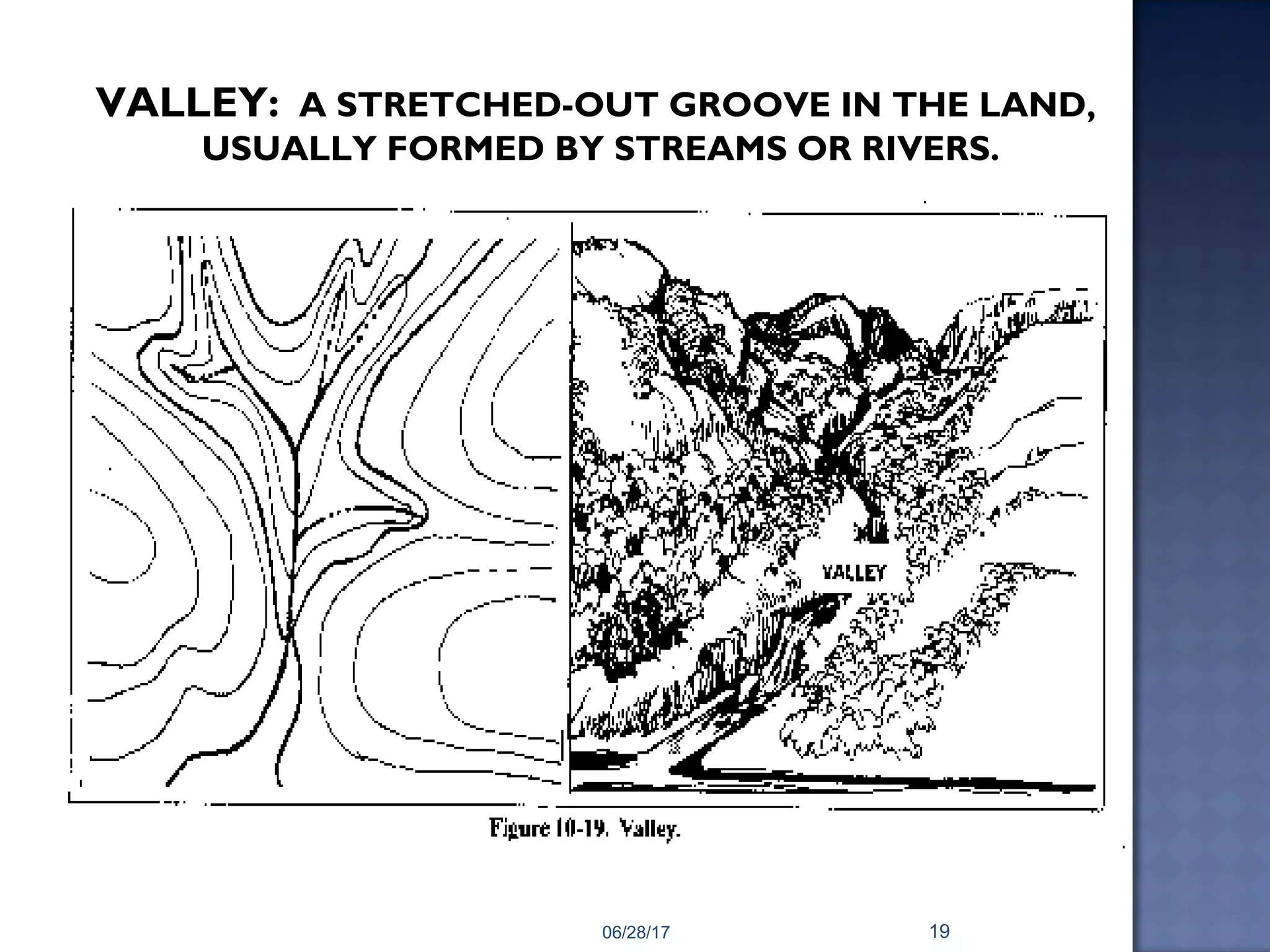
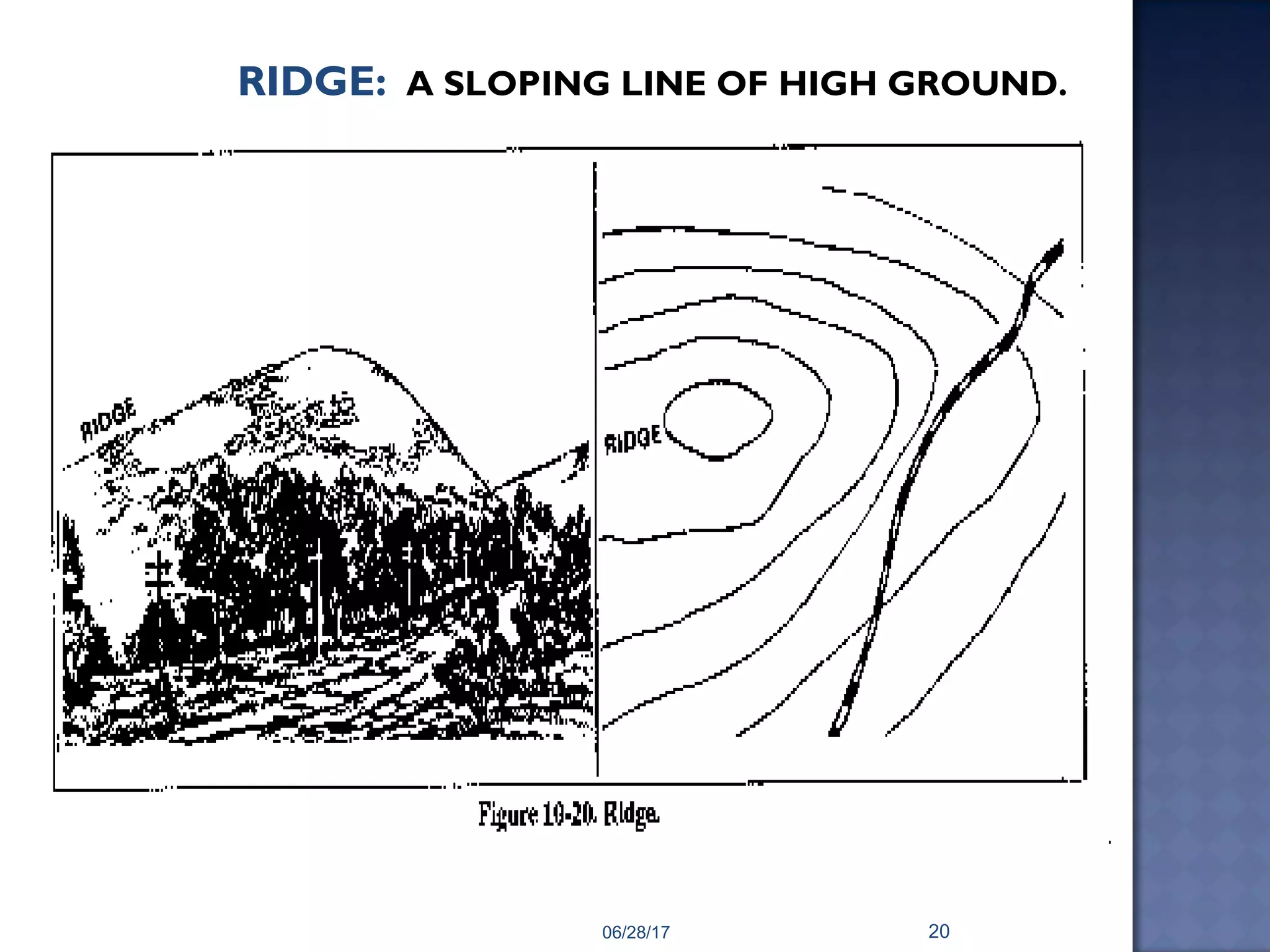
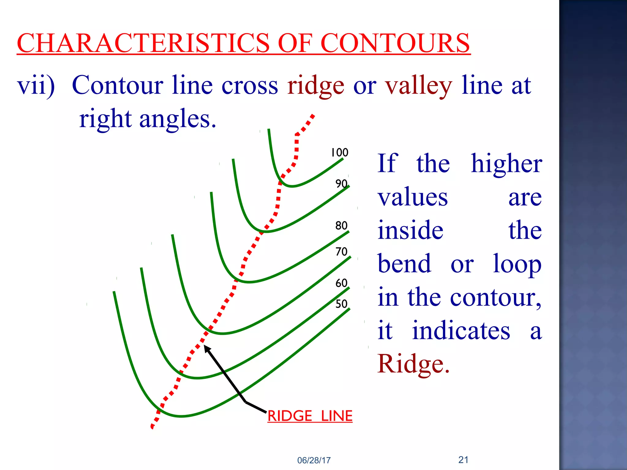
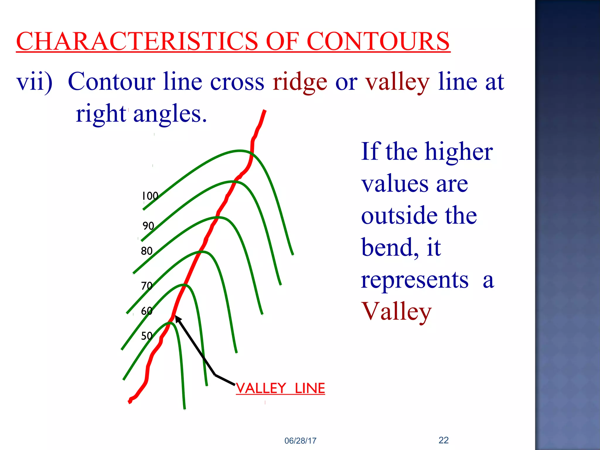
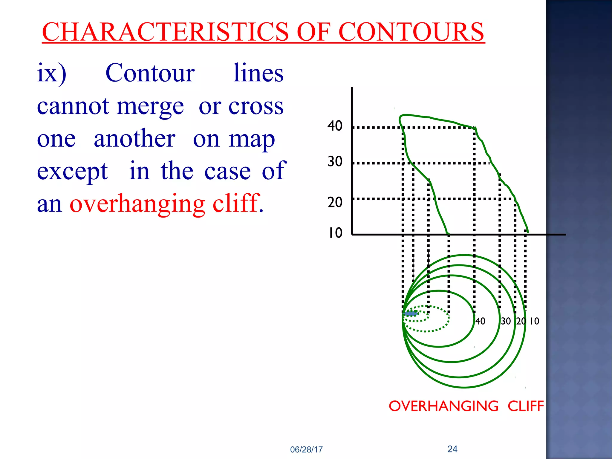
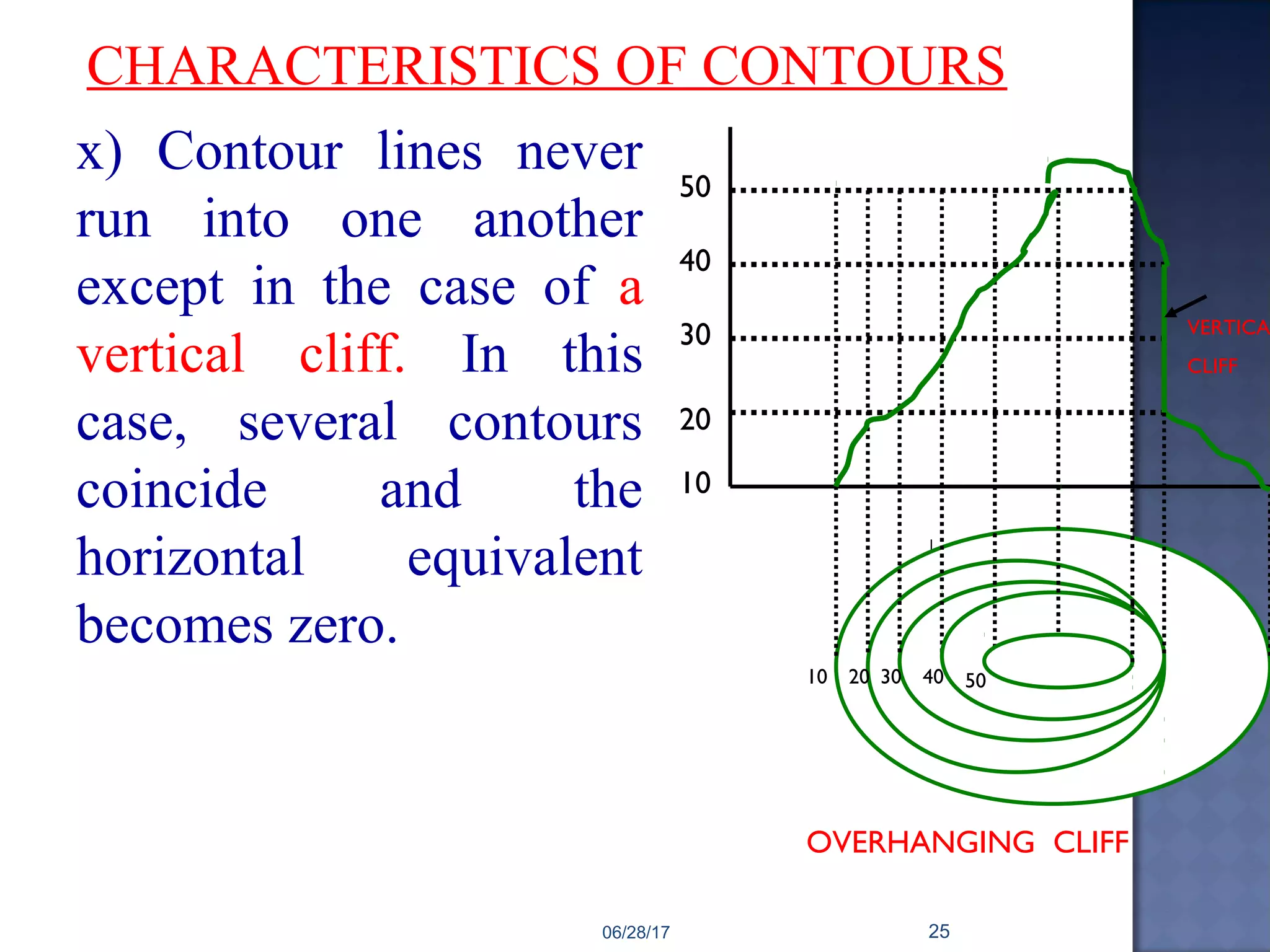
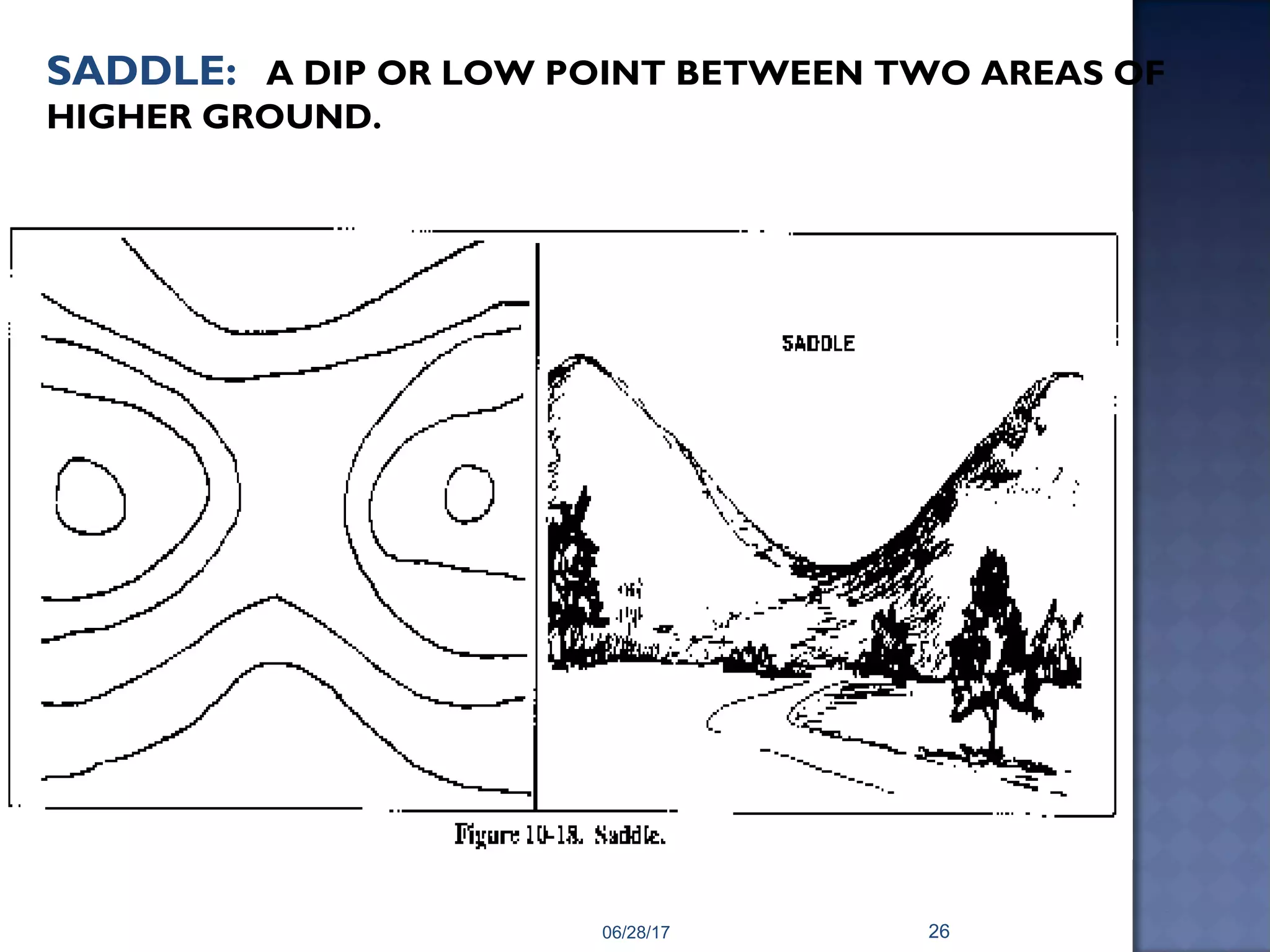
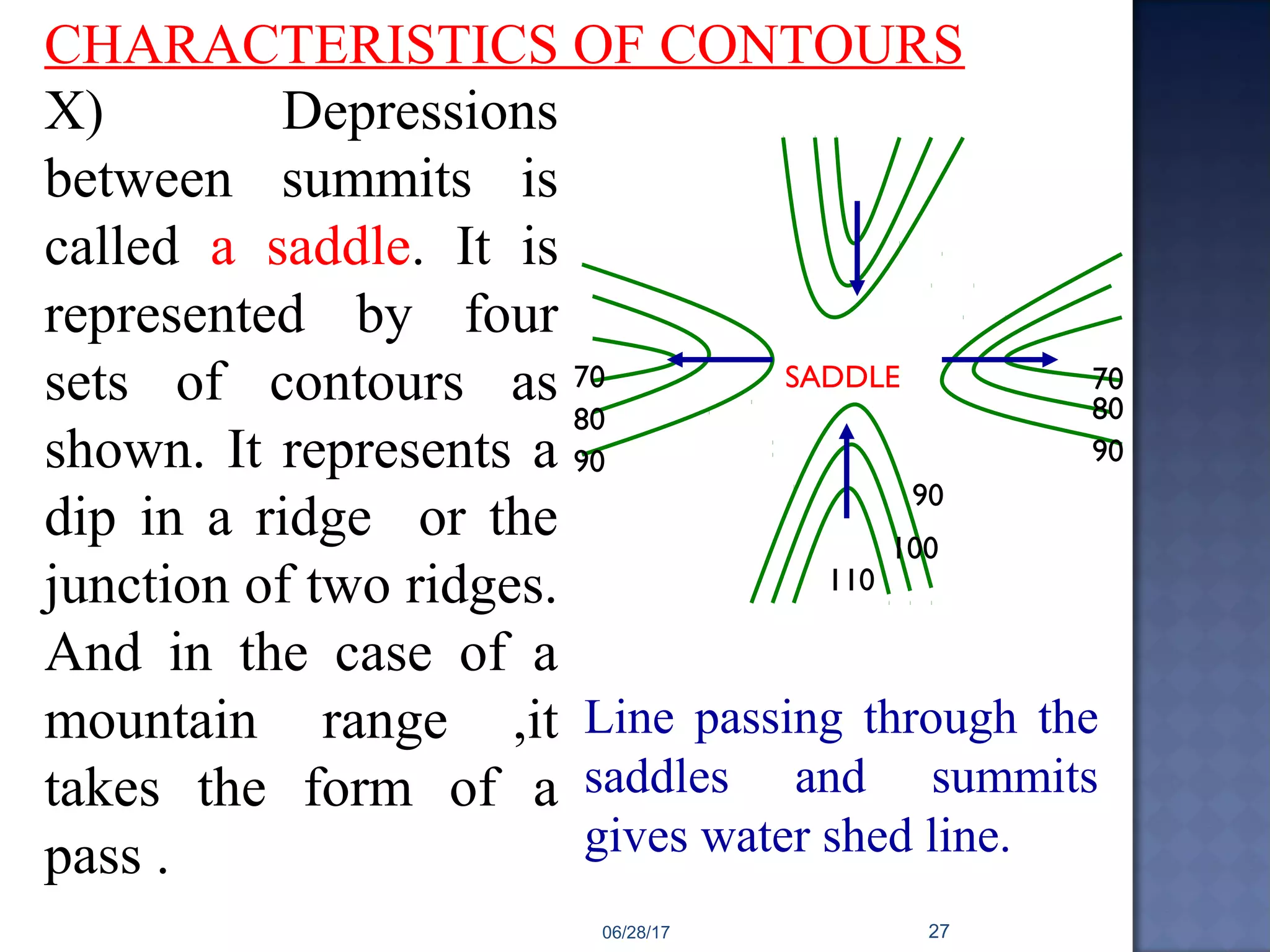
3) Characteristics used to identify topographic features like hills, depressions, ridges, and valleys from the pattern of contour lines on a map.