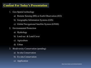
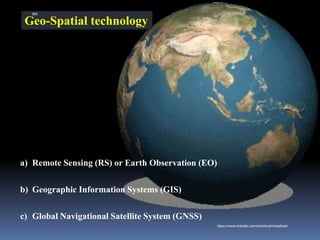
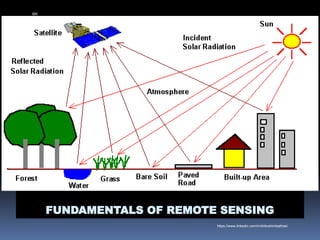
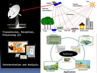
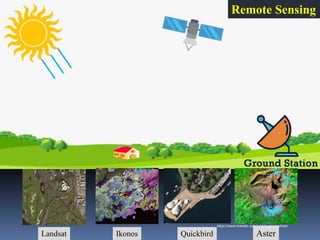
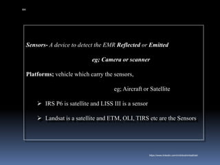
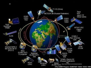
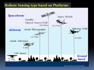
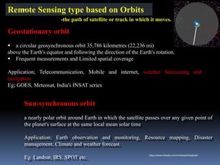
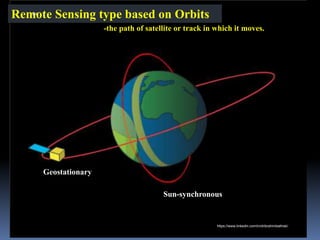
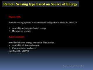
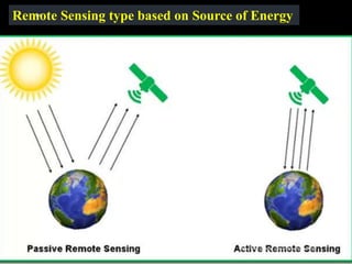
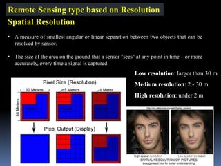
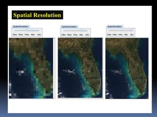
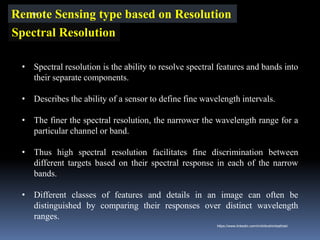
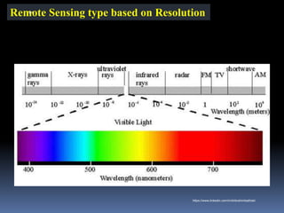
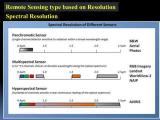
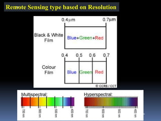
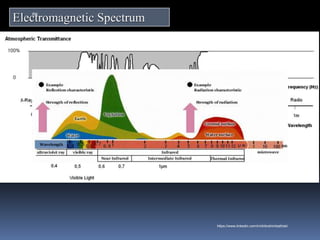
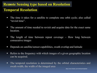
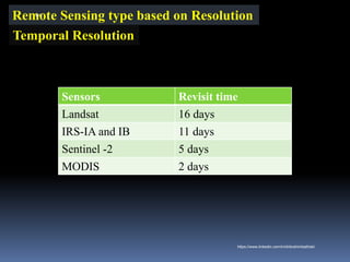
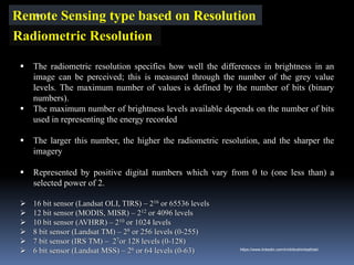
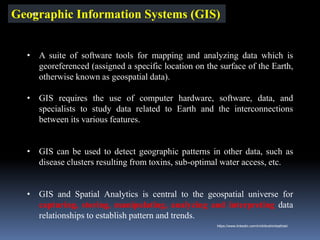
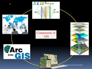
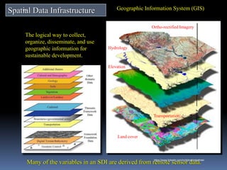
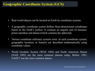
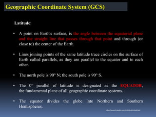
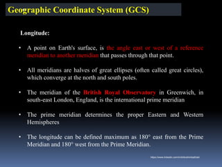
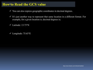
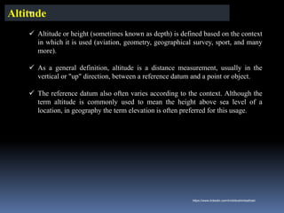
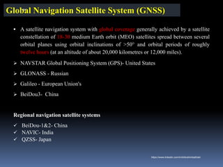
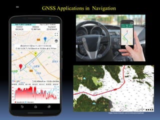
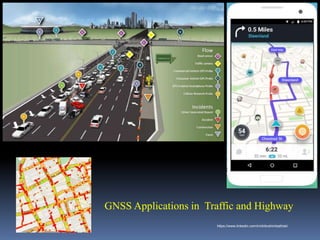
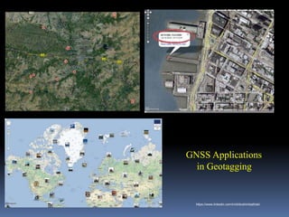
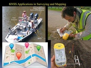
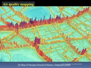
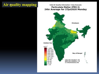
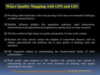
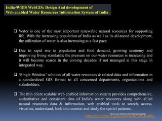
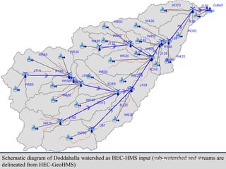
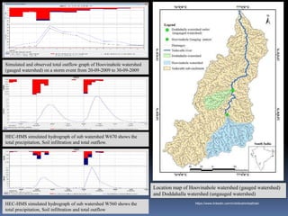
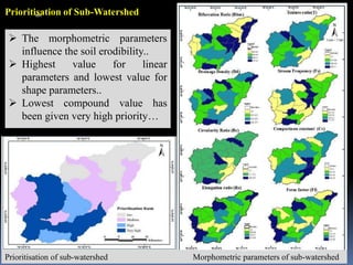
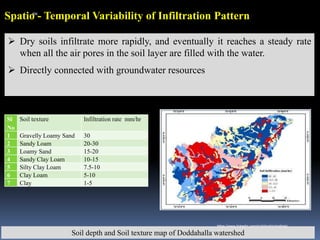
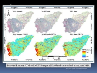
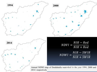
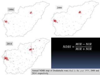
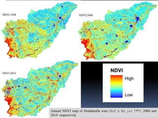
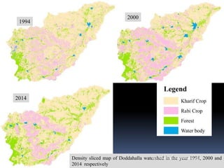
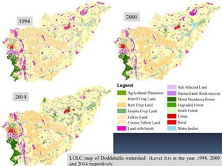
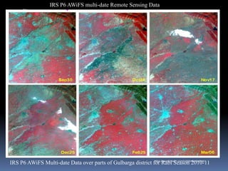
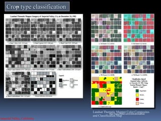
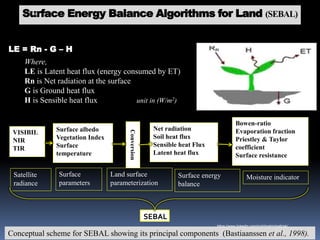
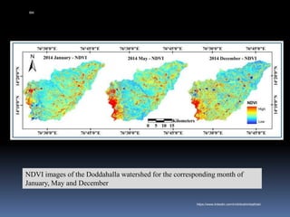
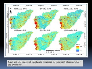
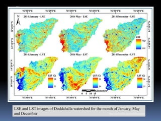
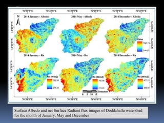
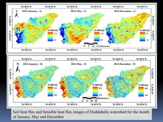
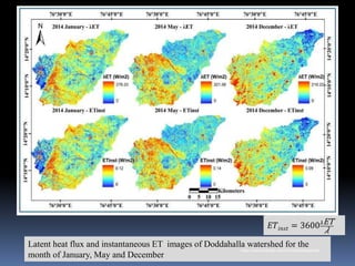
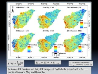
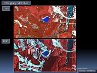
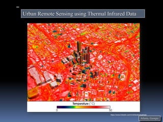
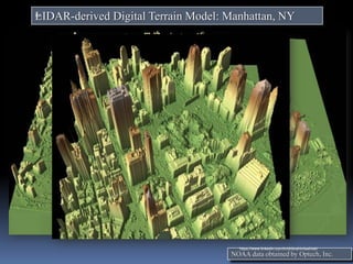
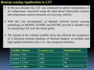
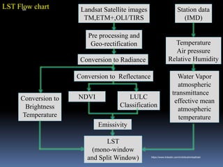
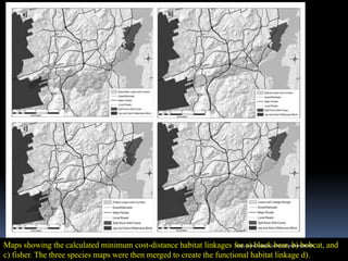
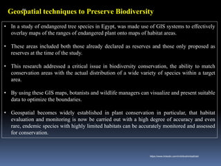
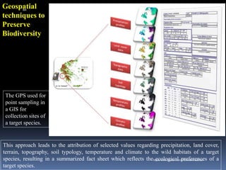
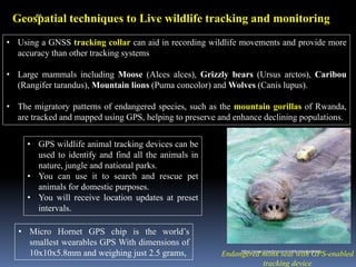
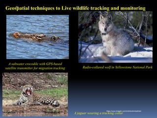
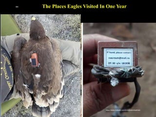
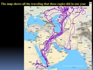
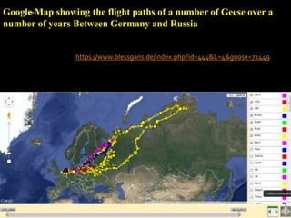
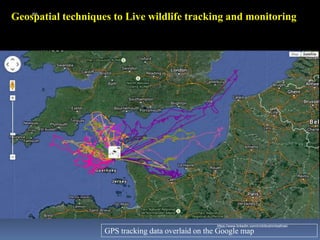
The document provides an overview of a presentation on geo-spatial technology and environmental protection given by Dr. Ibrahim Bathis K. The presentation covers three main topics: 1) geo-spatial technology including remote sensing, GIS and GNSS; 2) environmental protection applications in hydrology, land use, agriculture and urban areas; and 3) biodiversity conservation. For each topic, key concepts and applications are defined and explained.