Downloaded 99 times
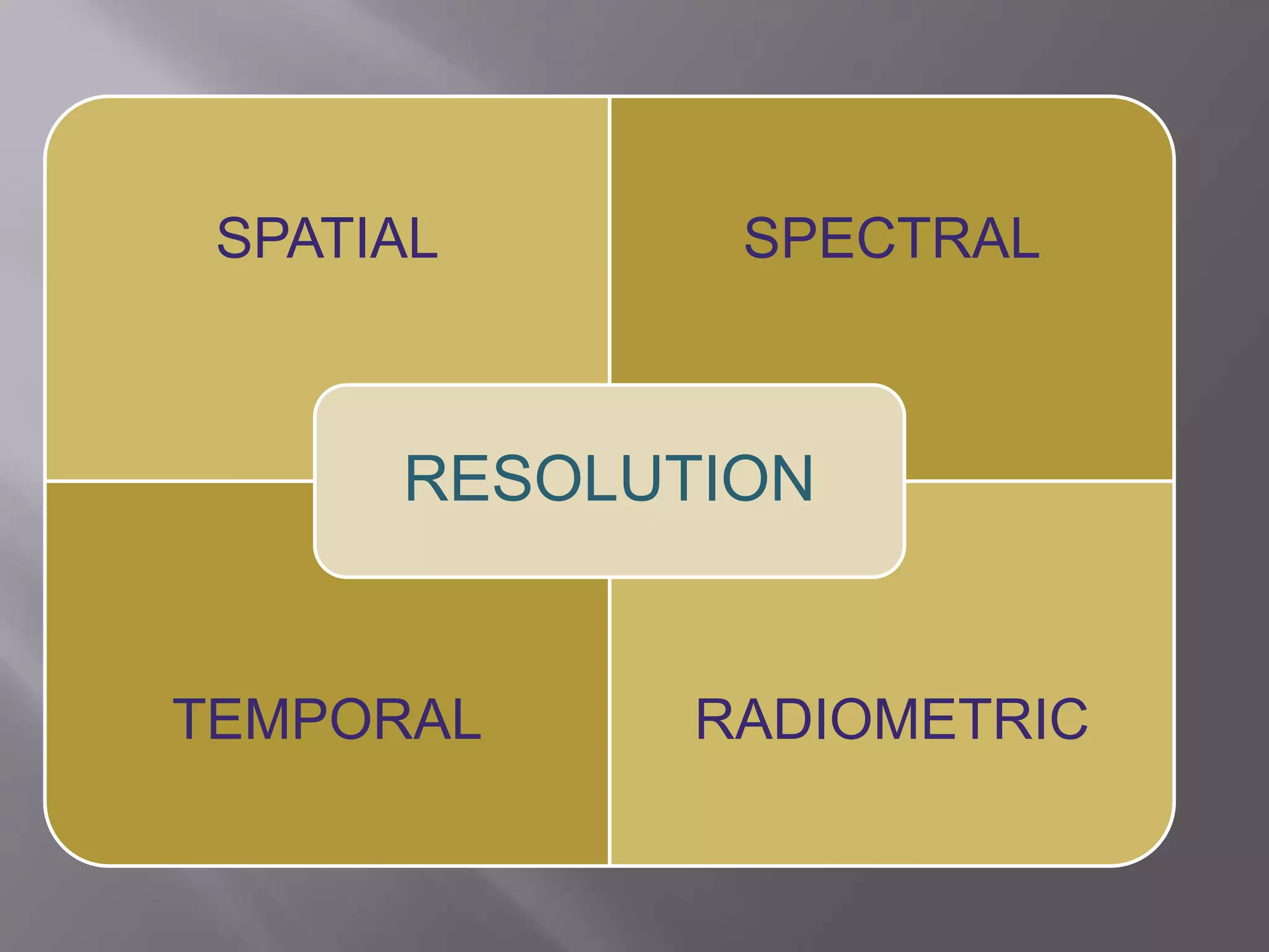

Remote sensing involves collecting data about objects from a distance by detecting electromagnetic radiation. It has several components: an energy source, atmospheric interactions, target interactions, sensor recording, data transmission and processing, interpretation and analysis, and applications. Spatial, spectral, temporal, and radiometric resolutions characterize remote sensing data. Remote sensing is used for applications like urban planning, agriculture, natural resource management, and forestry by providing information on land use, crop growth, environmental changes, and forest resources over time.
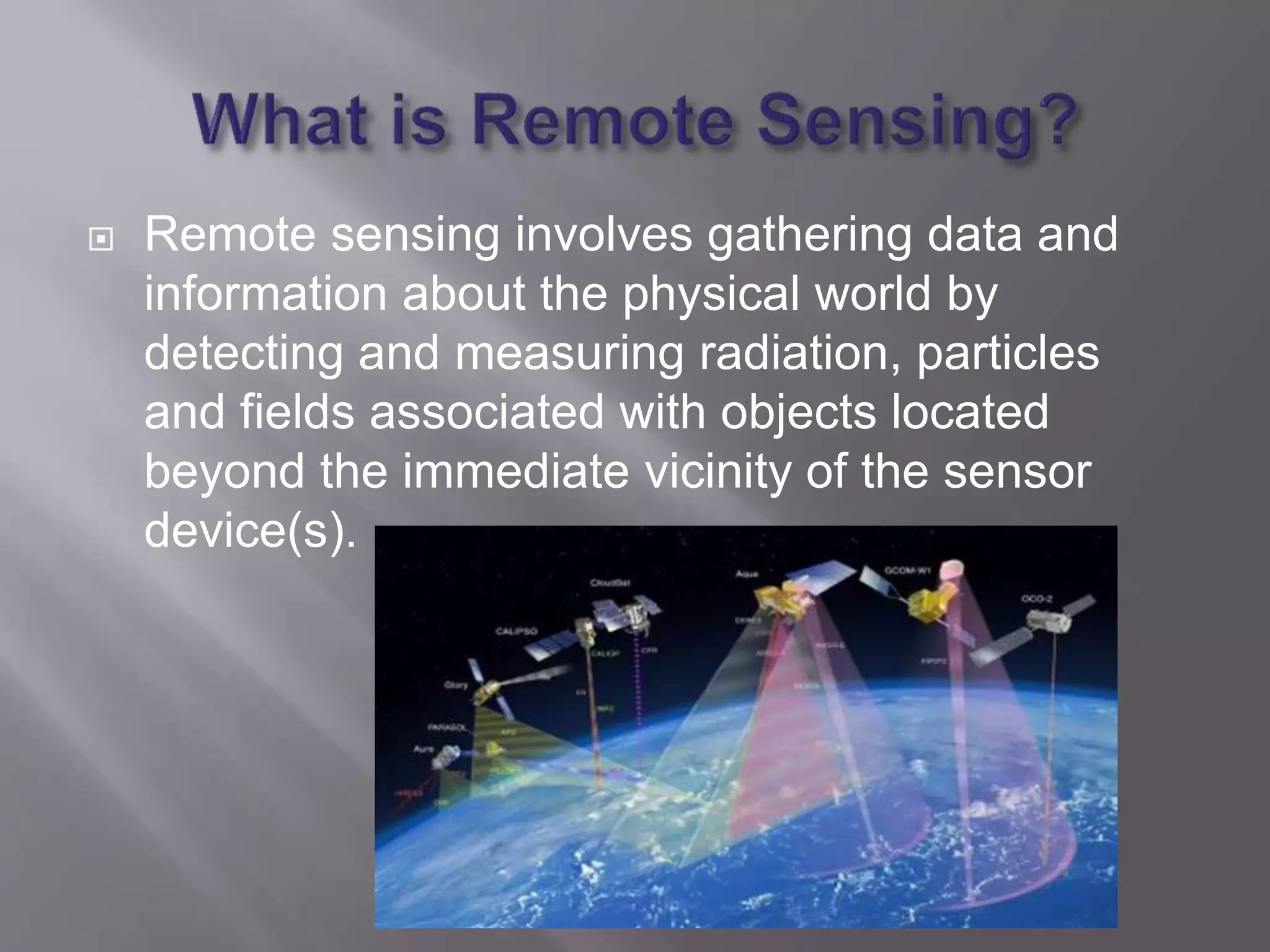
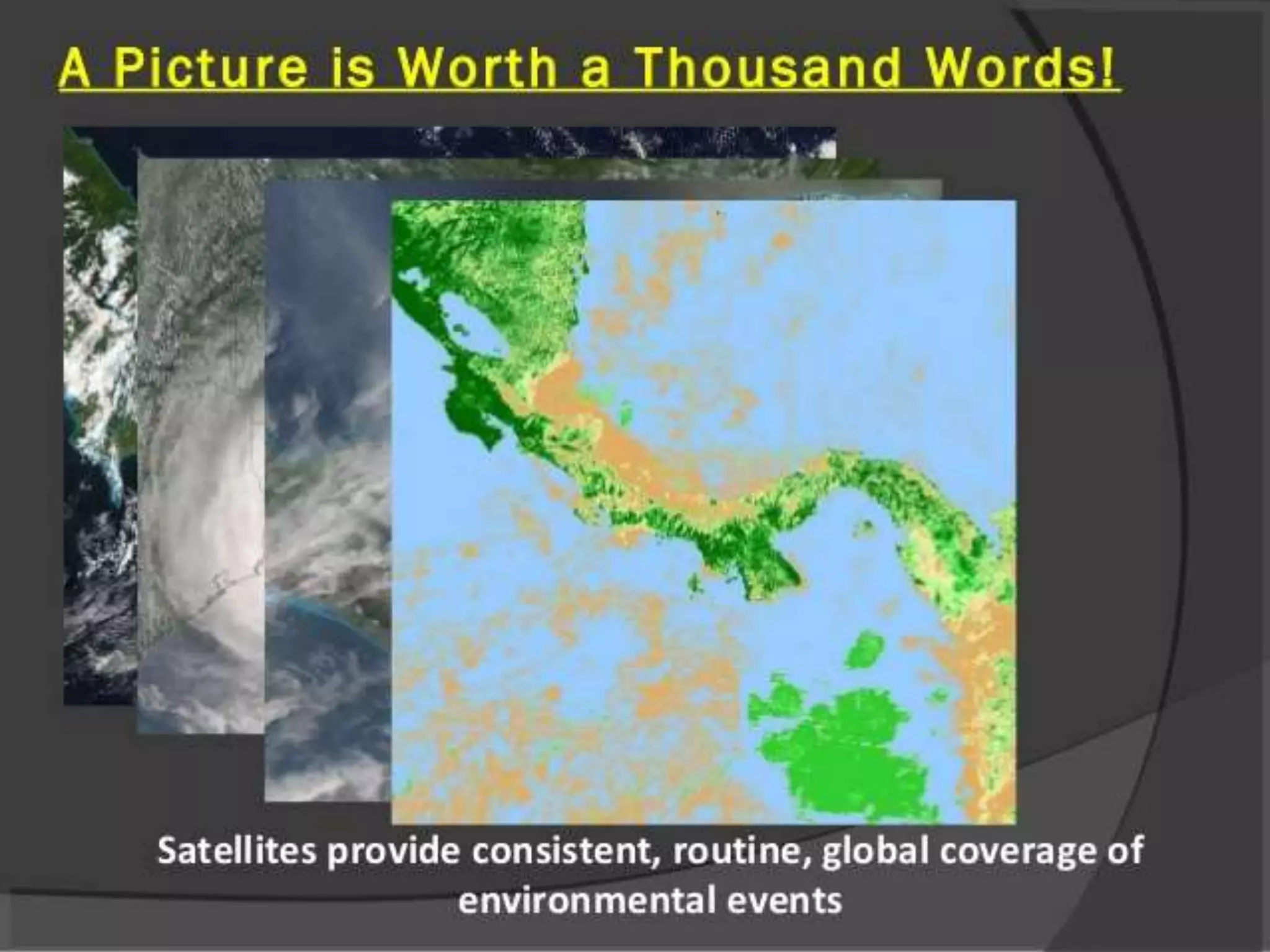
Overview of remote sensing; data gathering using radiation, particles and fields.
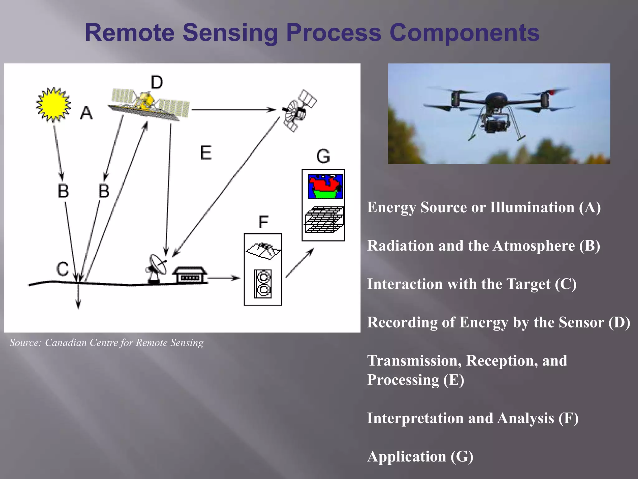
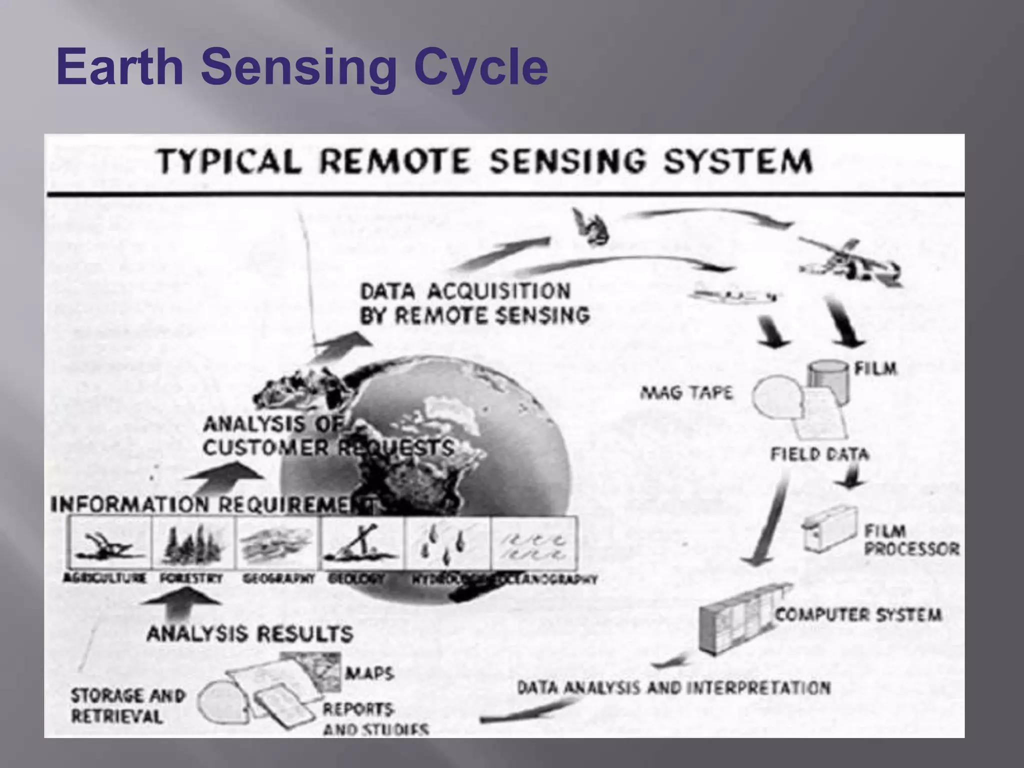
Details on components like energy source, interaction with targets, and earth sensing cycle.
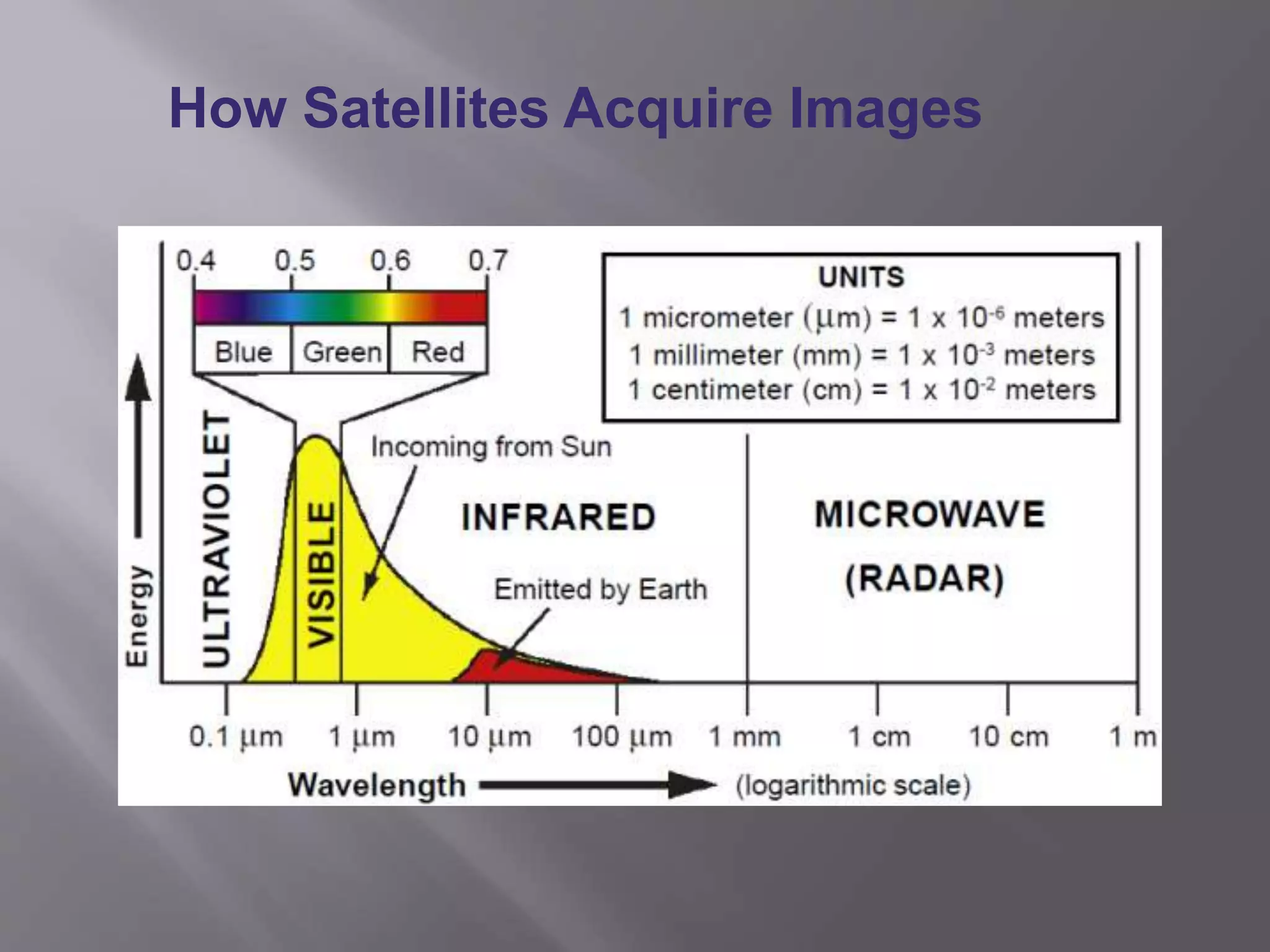
Explanation on methods of how satellites acquire images of the earth.
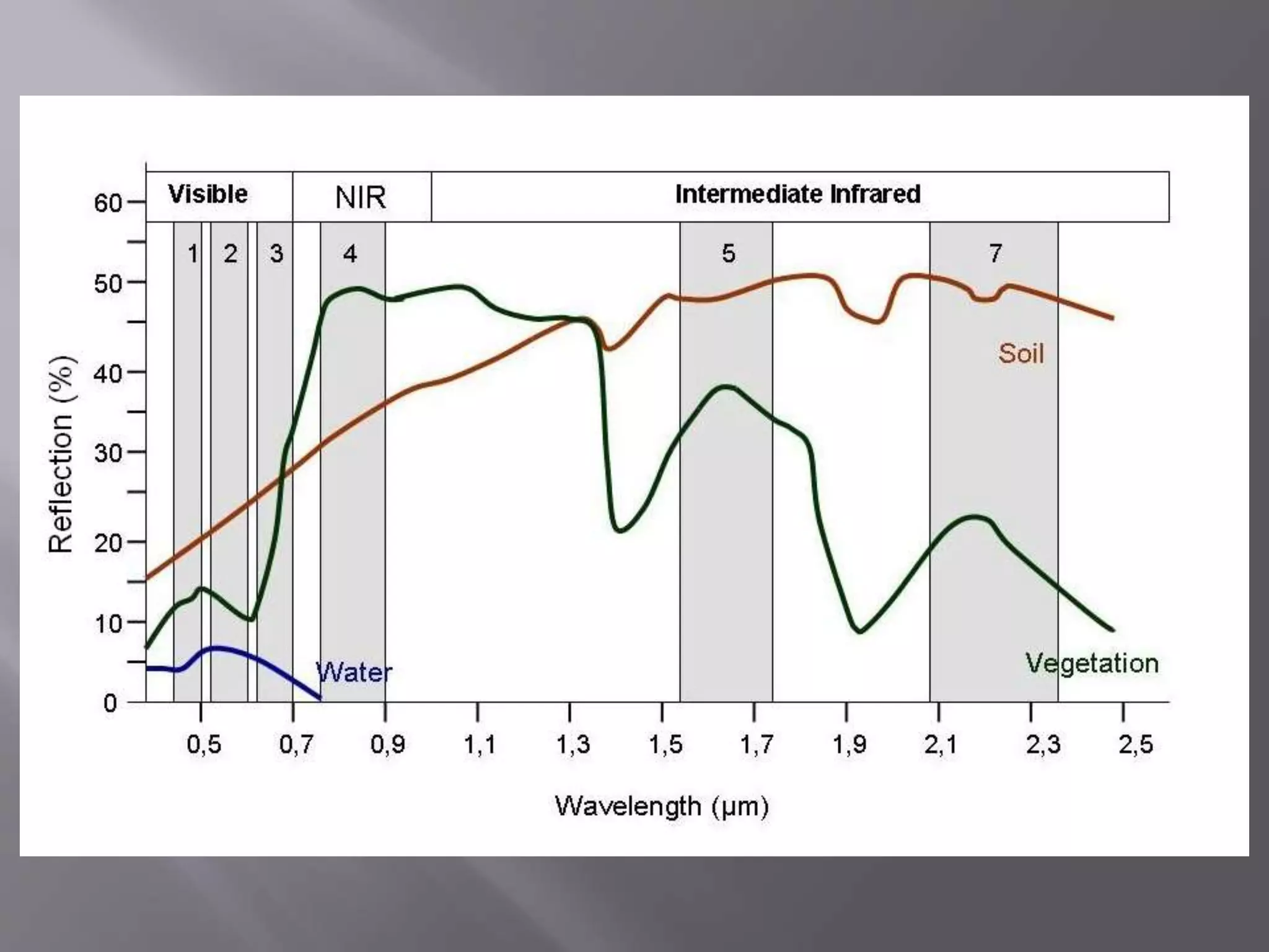
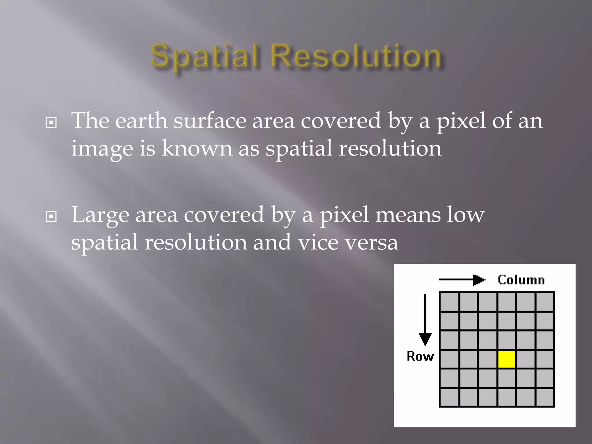
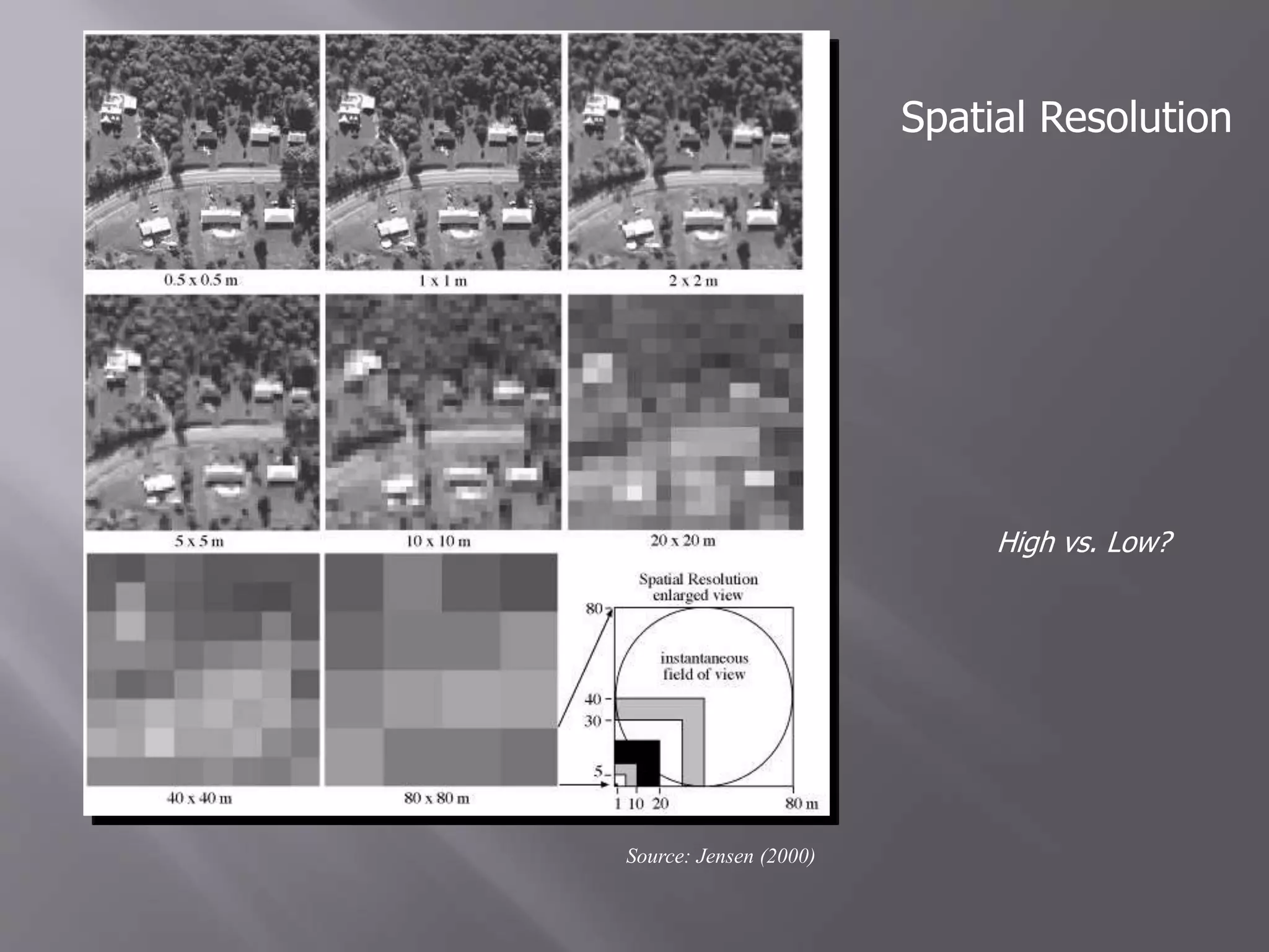
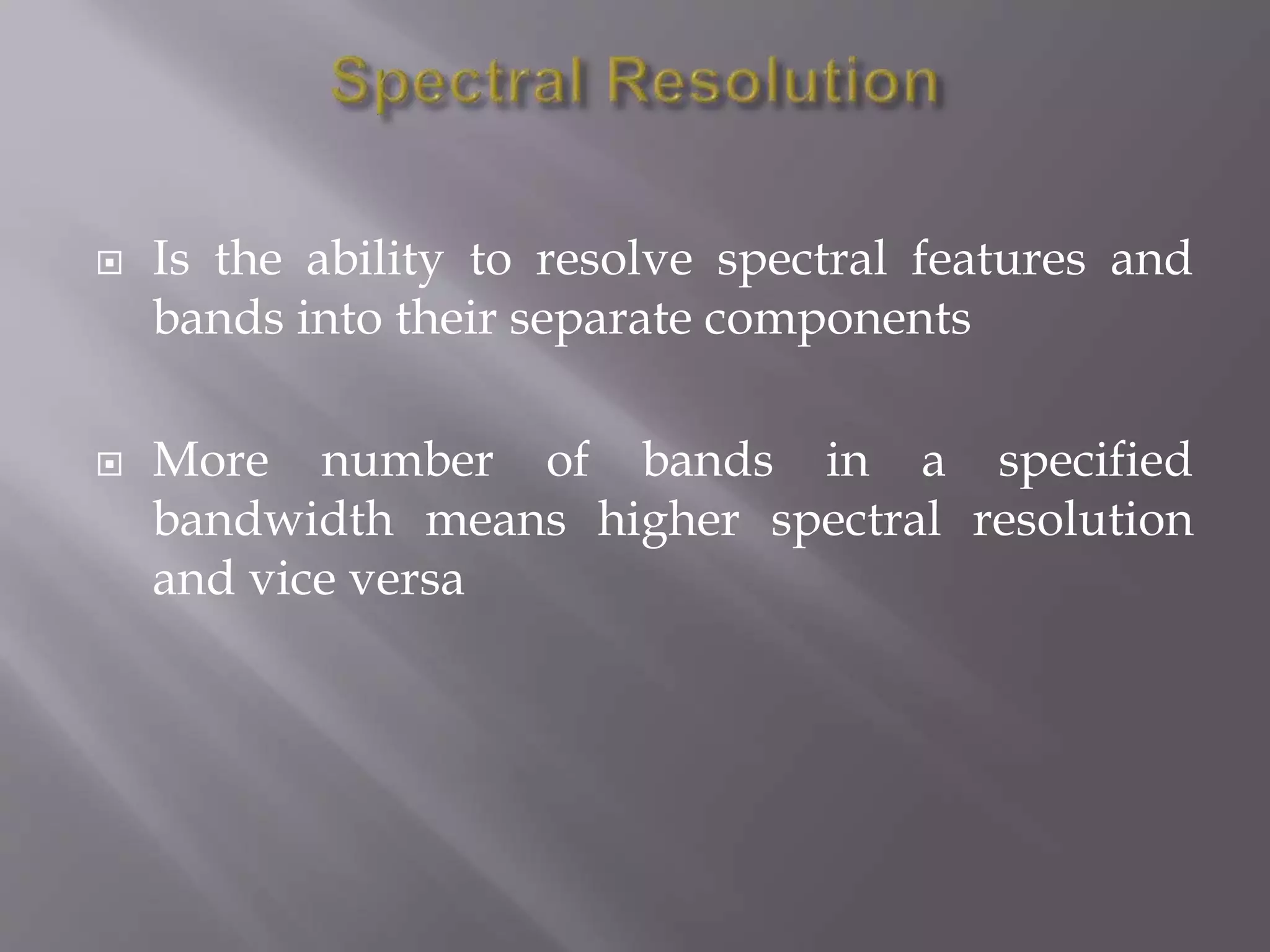
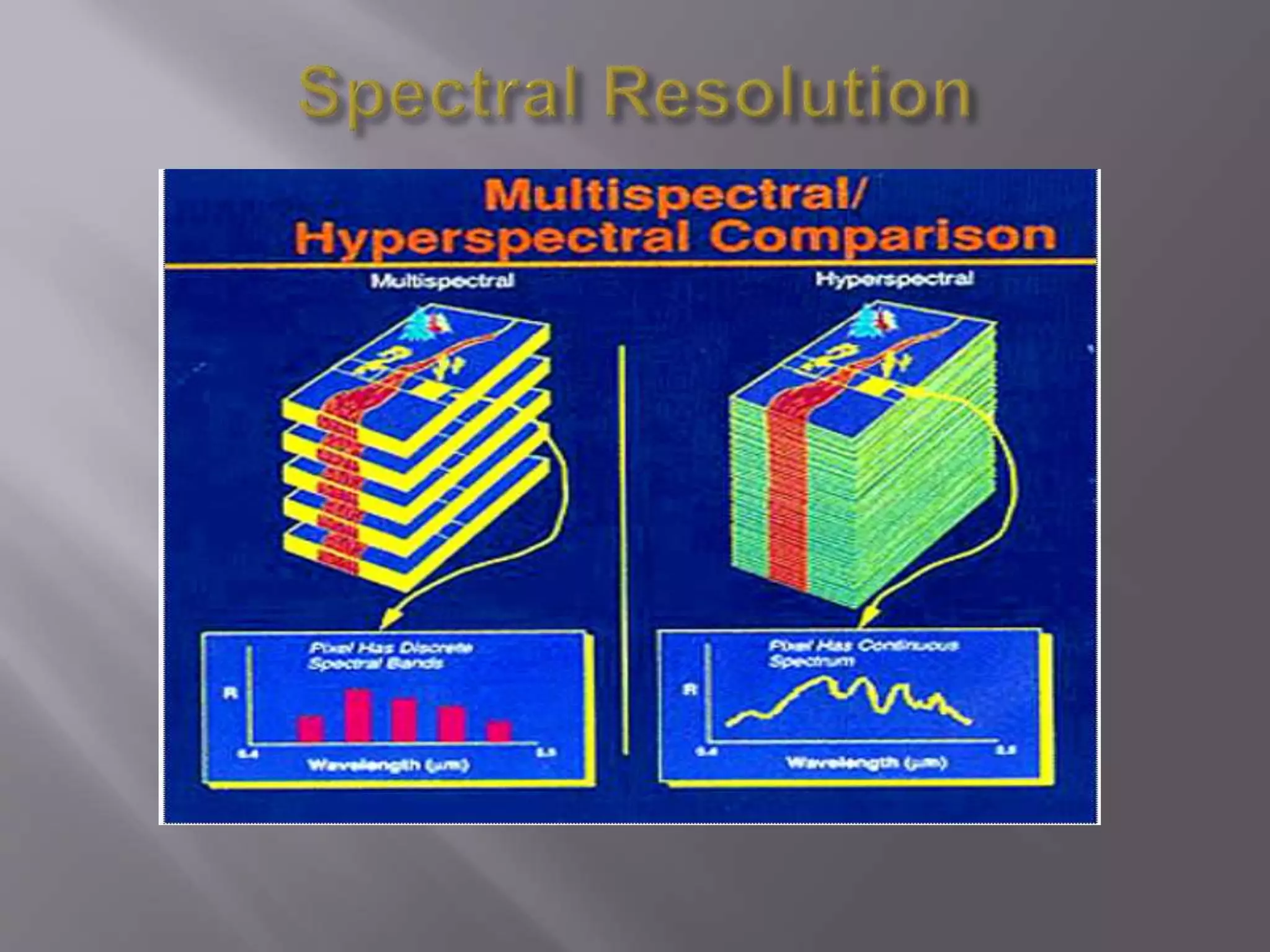
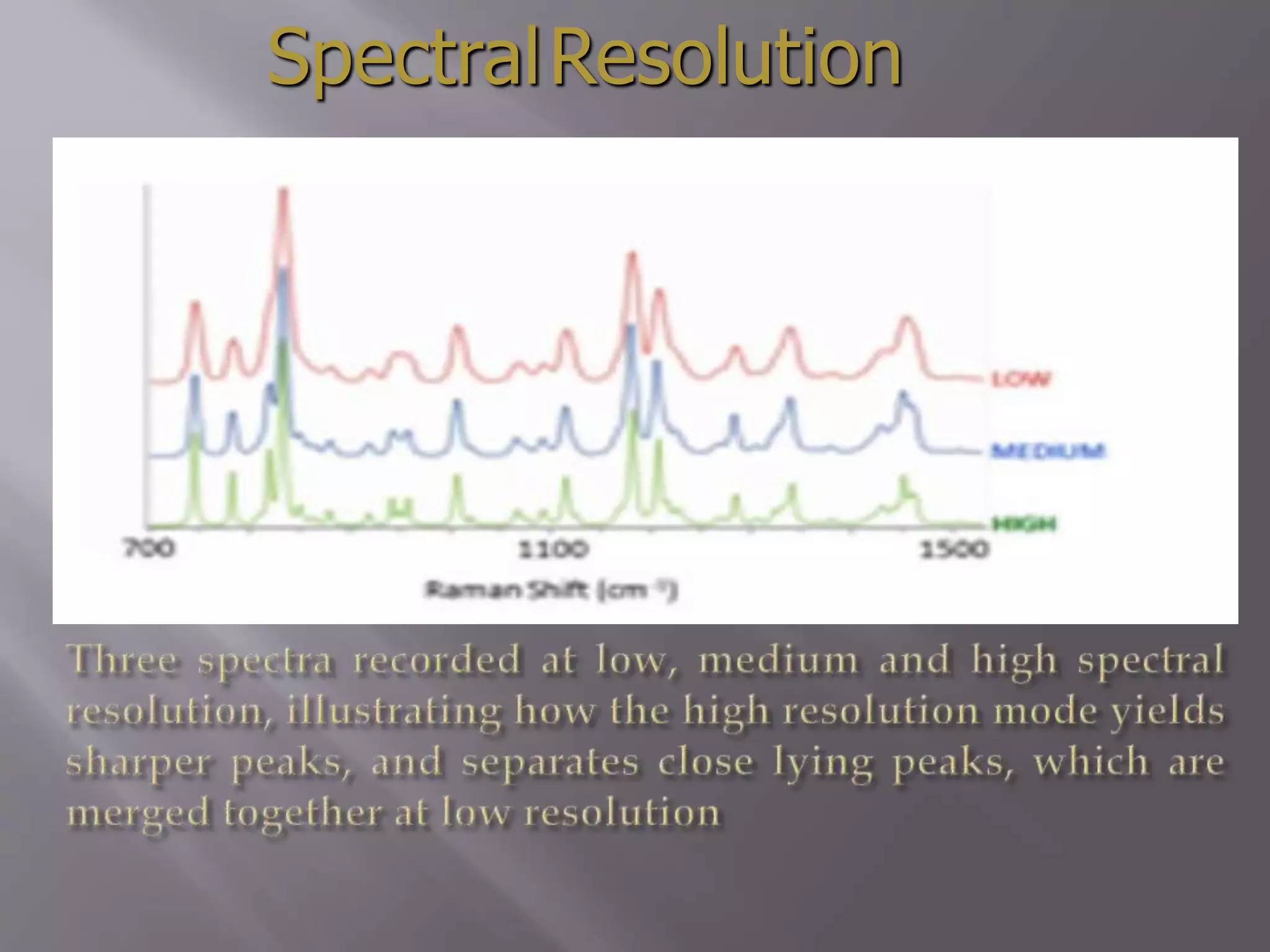
Definitions of spatial, spectral, and temporal resolution in remote sensing.Focus on spectral resolution, importance of band separation and number of bands.
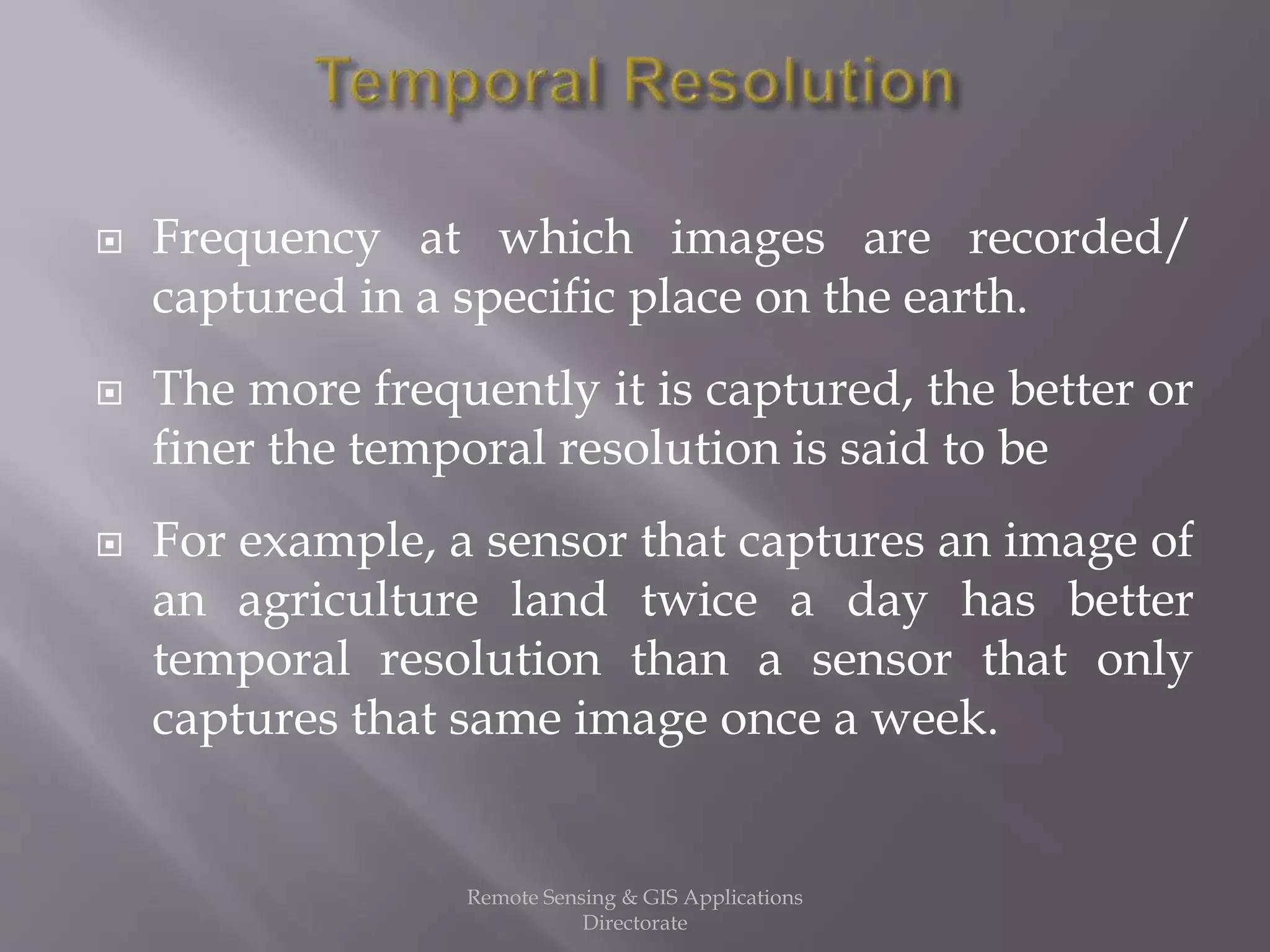
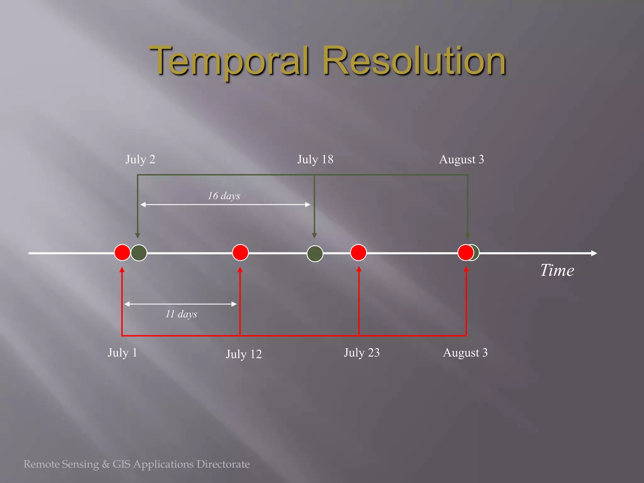
Discussion on temporal resolution, frequency of image capture significance.
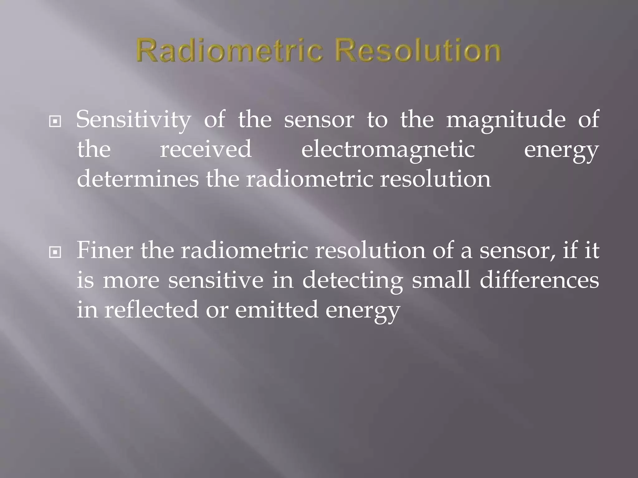
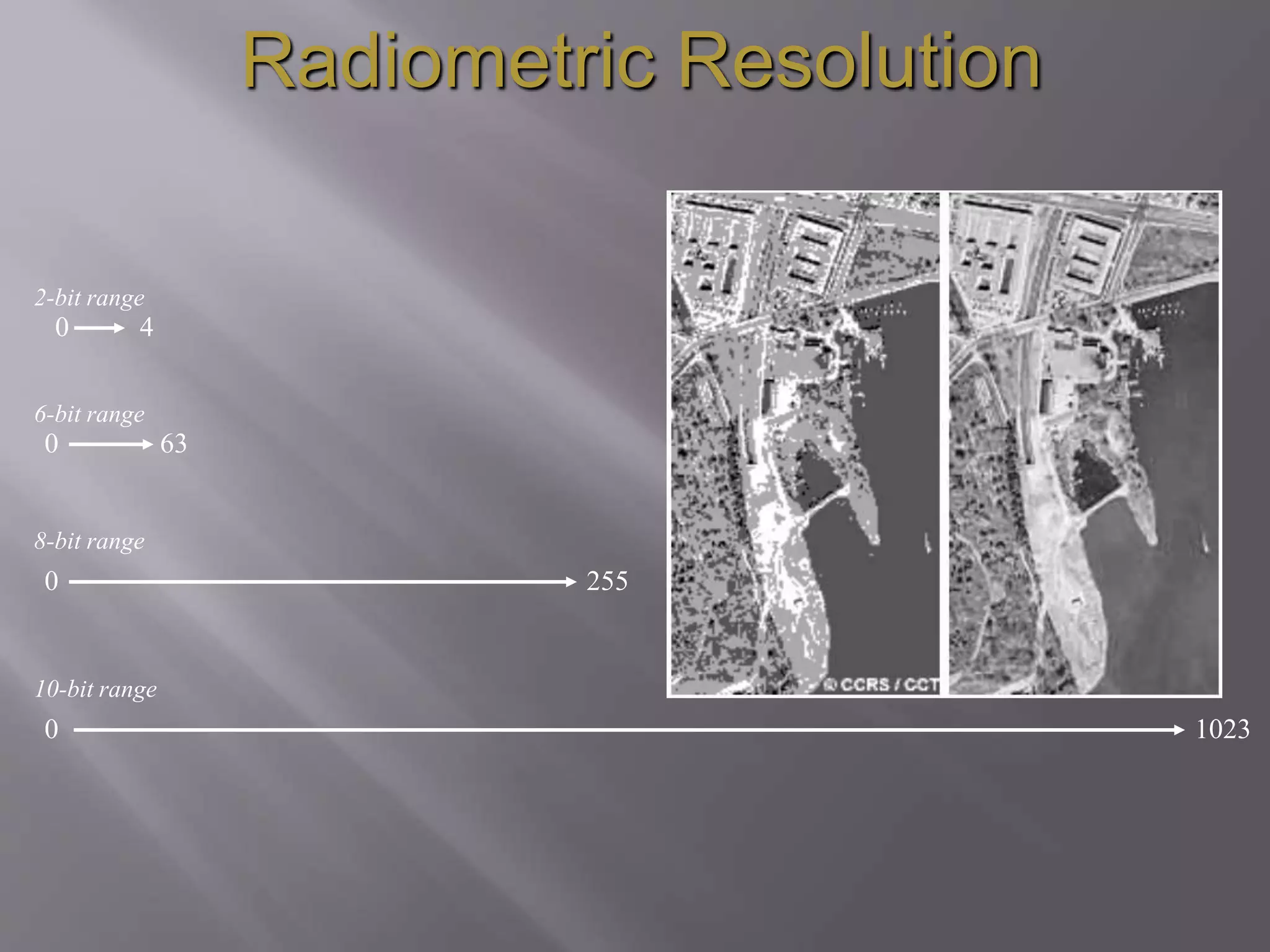
Explains radiometric resolution sensitivity and its ranges in different bits.
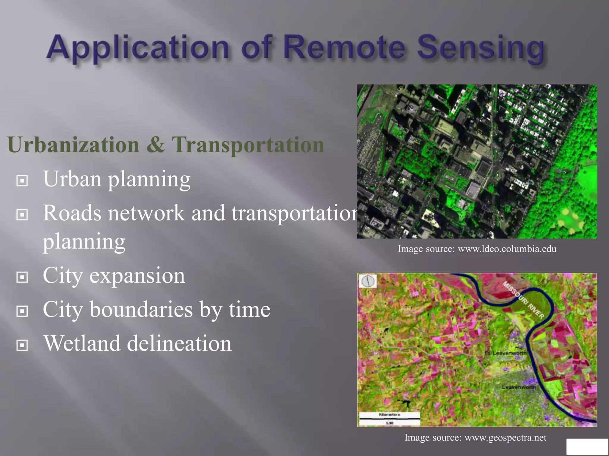
Remote sensing applications in urbanization, city boundaries, and transportation.
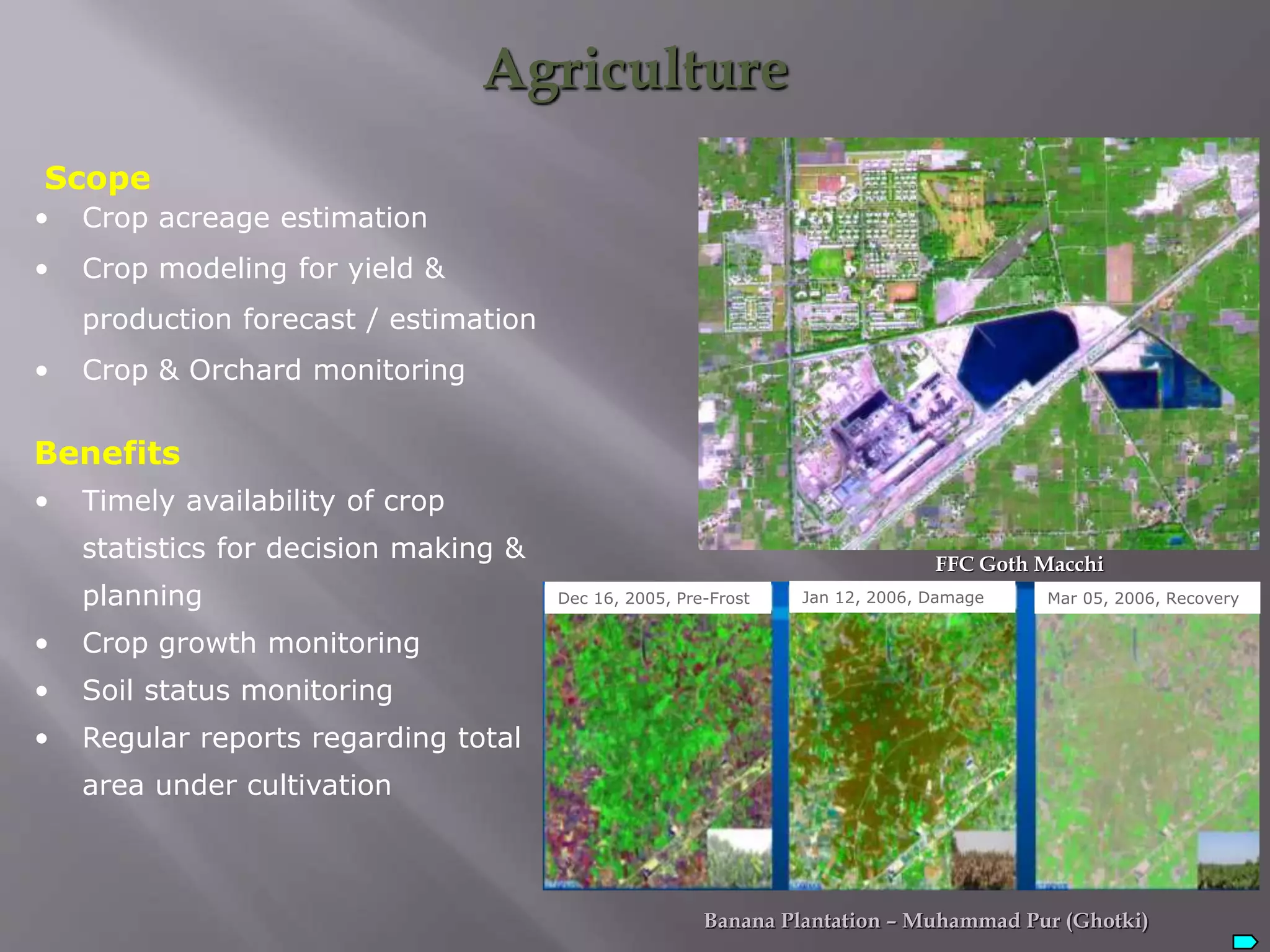
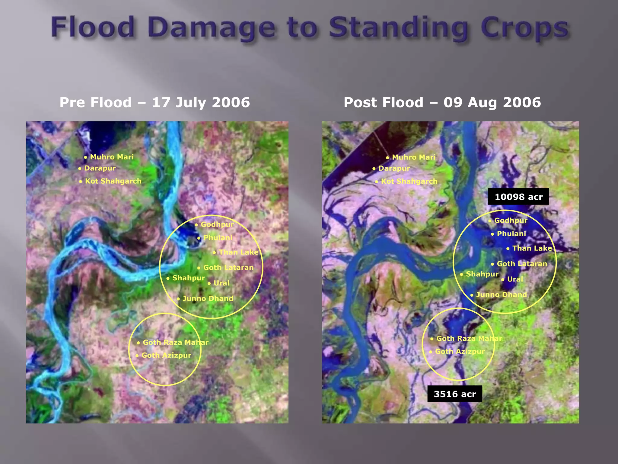
Role of remote sensing in crop monitoring, estimating acreage, and agricultural planning.
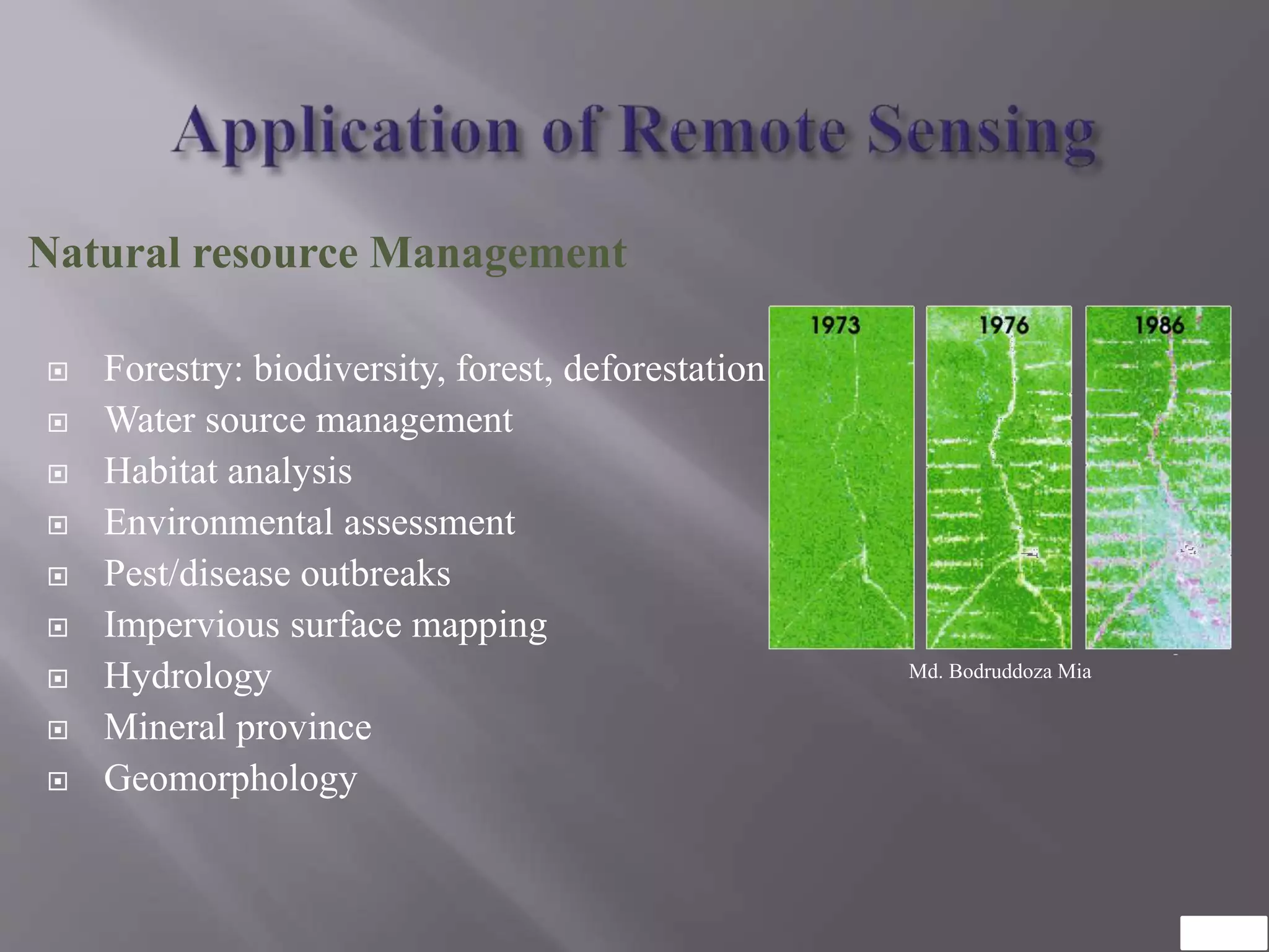
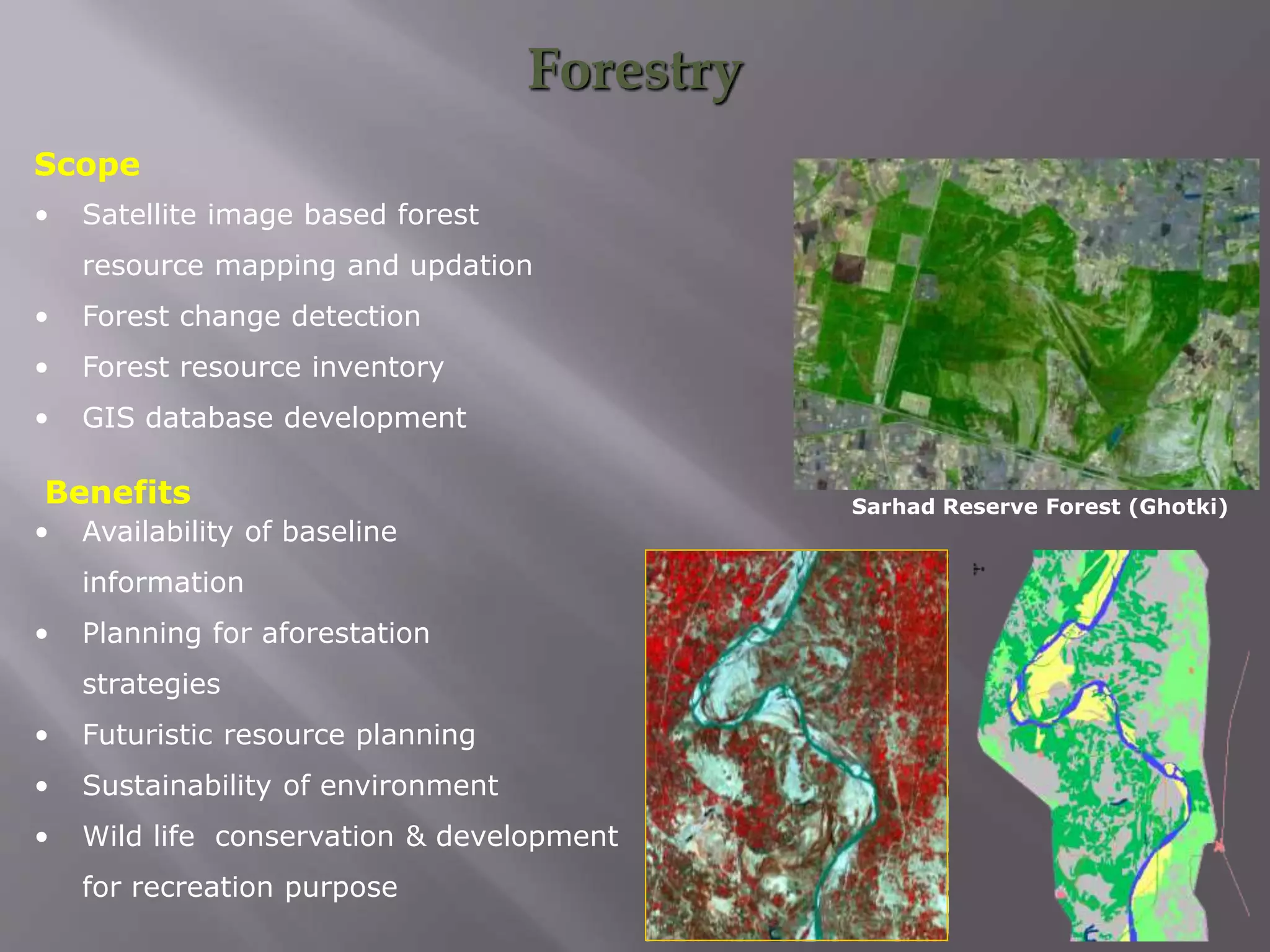
Use of remote sensing in forestry, water management, and environmental assessment.
Utilization of satellite imagery for forest resource management and conservation.
Presentation conclusion and references to further resources on remote sensing.


![Pollution.ppt [Autosaved].ppt yogesh kumbhar](https://cdn.slidesharecdn.com/ss_thumbnails/pollution-251205194856-d30cfee8-thumbnail.jpg?width=640&height=640&fit=bounds)


