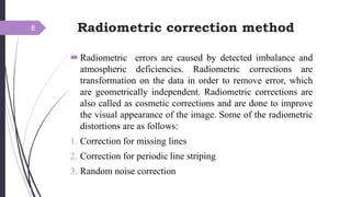
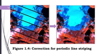
The document outlines the processes and techniques used in digital image processing, particularly in the context of remote sensing applications. It covers the challenges associated with visual image interpretation and the advantages of manipulating digital data to create accurate maps, highlighting the importance of pre-processing and image processing stages. Key concepts such as radiometric and geometric corrections, image enhancement, transformation techniques, and classification methods are also discussed.