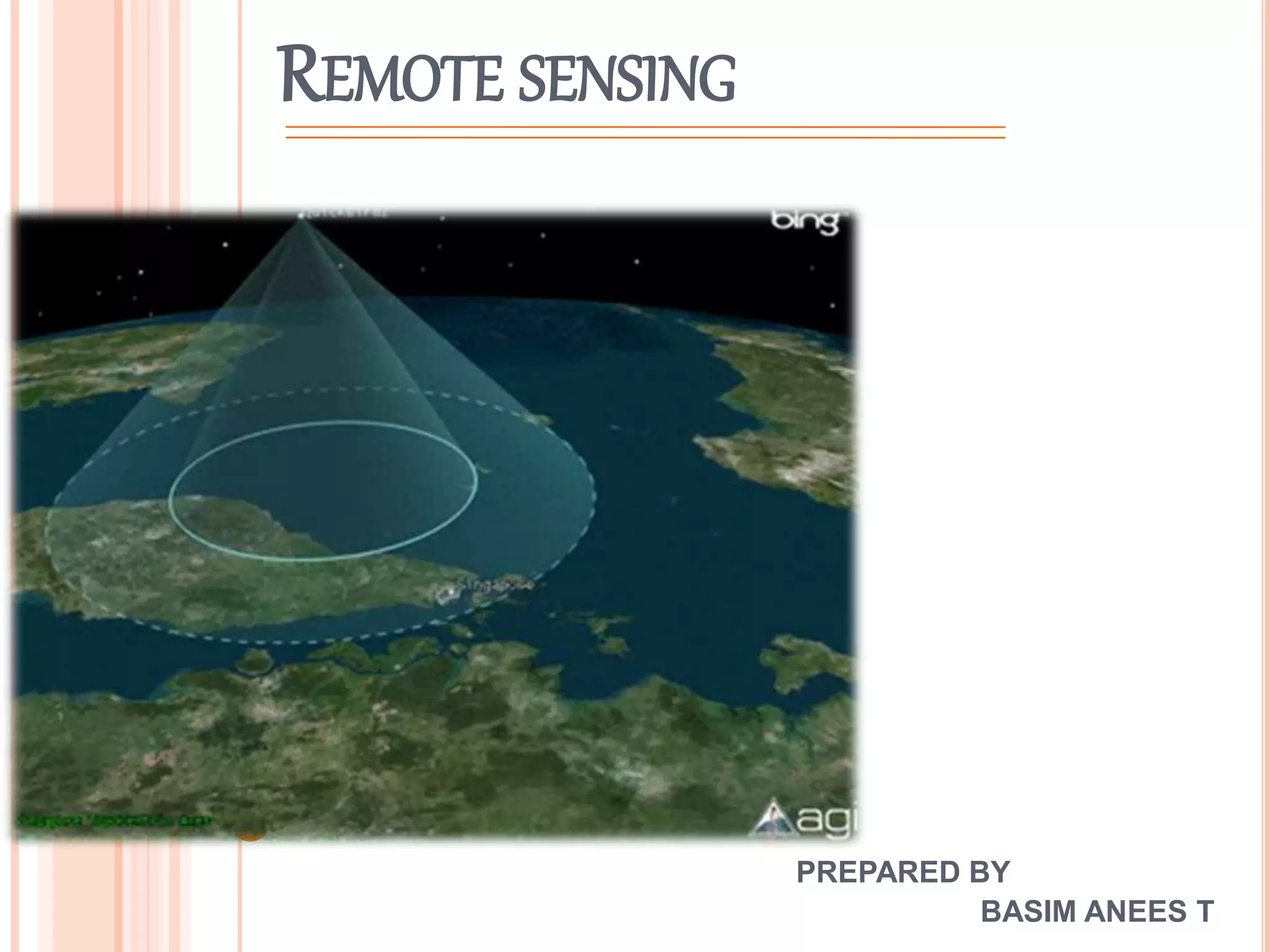
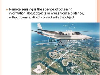
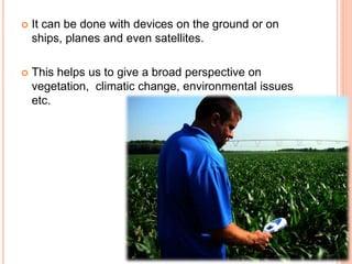
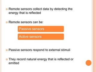
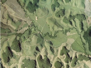
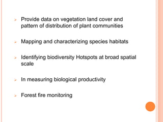
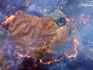
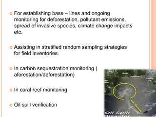
REMOTE SENSING
PREPARED BY
BASIM ANEES T
ļ‚¢ Remote sensing is the science of obtaining
information about objects or areas from a distance,
without coming direct contact with the object
ļ‚¢ It can be done with devices on the ground or on
ships, planes and even satellites.
ļ‚¢ This helps us to give a broad perspective on
vegetation, climatic change, environmental issues
etc.
ļ‚¢ Remote sensors collect data by detecting the
energy that is reflected
ļ‚¢ Remote sensors can be:
ļ‚¢ Passive sensors respond to external stimuli
ļ‚¢ They record natural energy that is reflected or
emitted
Passive sensors
Active sensors
ļ‚¢ Active sensors use internal stimuli to collect data
ļ‚¢ For example:
A laser beam remote sensing system projects a
laser beam onto the surface of earth and measures
the time it takes for laser to reflect back to its
sensors
APPLICATIONS
ļ‚¢ Remote sensing is used in numerous fields like:
 Geography
 Earth science (Hydrology, ecology,
oceanography, glaciology, geology)
 Military Intelligence
 Commercial, economic planning and
humanitarian applications
 Vegetation and environment
ELEMENTS IN REMOTE SENSING
 Energy source
 Radiation and atmosphere
 Interaction with the target
 Recording of energy by sensors
 Transmission, reception and processing
 Interpretation and analysis
DATA ACQUISITION
ļ‚¢ Data acquisition can be done using:
 Radars
 Satellites
 Ultrasound
 Lidar (light detection and ranging)
 Photometers and Radiometers
 Aerial photographs
 Seismographs
 Geodetic
ļ‚¢ Electromagnetic energy may be detected either
photographically or electronically
ļ‚¢ And image produced can be analog or digital
ļ‚¢ Aerial photographs are examples of analog images,
while satellite images are of digital images
SATELLITE SENSORS
ļ‚¢ They revolve around the earth
ļ‚¢ The path followed by a satellite is referred to as its
orbit
ļ‚¢ They are of two types:
Geostationary
Near polar
APPLICATION IN VEGETATION CLASSIFICATION
ļ‚¢ The reflectance quality of a vegetation detected
using remote sensors enables its classification
ļ‚¢ Green vegetation will reflect more energy than dry
vegetation
ļ‚¢ Tree leaves and crop canopies reflect more in
shorter radar wavelengths,
ļ‚¢ While tree trunks and limbs reflect more in longer
wavelengths
ļ‚¢ The density of the tree or plant canopy will affect
the scattering of wavelengths
ļ‚¢ Thus by analyzing reflectance, we can determine
characteristics of a vegetation.
ļ‚¢ Moreover, Aerial photographs, color infrared
photographs, black and white infra red photographs
helps to identify species.
ļ‚¢ They also give the details of branching
characteristics, crown shapes, spatial distribution
and patterns of species.
ļ‚¢ This information along with the topographic
variables obtained through field work is a valuable
tool in vegetation classification
ļ‚¢ Different types of images will display diverse
characteristics of vegetation
ļ‚¢ Band 1 of AVHRR (advance very high resolution
radiometer) will allow chlorophyll to absorbed in red
wavelength.
ļ‚¢ And a low value indicate high concentration of
chlorophyll
ļ‚¢ Similarly, Band 2 of AVHRR include infrared
wavelengths and record the cell structure of the
leaves
ļ‚¢ High values indicate more growth, indicated by dark
green signatures
ļ‚¢ While low value are indicated by orange signatures
ļ‚¢ Some satellites that successfully identify vegetation
types include:
 Landsat MSS
 Landsat TM
 SPOT HRV
 RADARSAT
LIMITATIONS
ļ‚¢ Difficulty in distinguishing fine, ecological divisions
between certain vegetation classes.
ļ‚¢ If vegetation share common heterogeneous traits
and similar spectral responses, difficulties are
created in classifying vegetations
REMOTE SENSING IN ECOSYSTEM MANAGEMENT AND ENVIRONMENTAL
ISSUES
ļ‚¢ Remote sensing helps in :
 Habitat suitability mapping
 Monitor habitat loss and fragmentation
 Wetland mapping and monitoring
 Identifying and monitoring threats
 Predicting biodiversity richness
 Predicting species presence or absence
 Provide data on vegetation land cover and
pattern of distribution of plant communities
 Mapping and characterizing species habitats
 Identifying biodiversity Hotspots at broad spatial
scale
 In measuring biological productivity
 Forest fire monitoring
ļ‚¢ For establishing base – lines and ongoing
monitoring for deforestation, pollutant emissions,
spread of invasive species, climate change impacts
etc.
ļ‚¢ Assisting in stratified random sampling strategies
for field inventories.
ļ‚¢ In carbon sequestration monitoring (
aforestation/deforestation)
ļ‚¢ In coral reef monitoring
ļ‚¢ Oil spill verification
ļ‚¢ To monitor marine protected areas
ļ‚¢ Monitor desertification process
ļ‚¢ To raise public awareness, e.g. Toms data on
ozone hole, receding glaciers and climate change
ļ‚¢ It can bring people together across boundaries to
address common problems
ļ‚¢ Powerful tool for international cooperation
ļ‚¢ To detect changes in water and to test water quality
ļ‚¢ In Air quality – remote sensing of particulate
aerosols in the atmosphere helps in this
ļ‚¢ Conservation of endangered species
ļ‚¢ To identify flood plains
ļ‚¢ To update highly dynamic, rapidly changing coastal
environment
ļ‚¢ In distinguishing landscape categories etc.
THANK YOU

Remote sensing in Plants

  • 1.
  • 2.
    ļ‚¢ Remote sensingis the science of obtaining information about objects or areas from a distance, without coming direct contact with the object
  • 3.
    ļ‚¢ It canbe done with devices on the ground or on ships, planes and even satellites. ļ‚¢ This helps us to give a broad perspective on vegetation, climatic change, environmental issues etc.
  • 4.
    ļ‚¢ Remote sensorscollect data by detecting the energy that is reflected ļ‚¢ Remote sensors can be: ļ‚¢ Passive sensors respond to external stimuli ļ‚¢ They record natural energy that is reflected or emitted Passive sensors Active sensors
  • 5.
    ļ‚¢ Active sensorsuse internal stimuli to collect data ļ‚¢ For example: A laser beam remote sensing system projects a laser beam onto the surface of earth and measures the time it takes for laser to reflect back to its sensors
  • 6.
    APPLICATIONS ļ‚¢ Remote sensingis used in numerous fields like:  Geography  Earth science (Hydrology, ecology, oceanography, glaciology, geology)  Military Intelligence  Commercial, economic planning and humanitarian applications  Vegetation and environment
  • 7.
    ELEMENTS IN REMOTESENSING  Energy source  Radiation and atmosphere  Interaction with the target  Recording of energy by sensors  Transmission, reception and processing  Interpretation and analysis
  • 8.
    DATA ACQUISITION ļ‚¢ Dataacquisition can be done using:  Radars  Satellites  Ultrasound  Lidar (light detection and ranging)  Photometers and Radiometers  Aerial photographs  Seismographs  Geodetic
  • 9.
    ļ‚¢ Electromagnetic energymay be detected either photographically or electronically ļ‚¢ And image produced can be analog or digital ļ‚¢ Aerial photographs are examples of analog images, while satellite images are of digital images
  • 10.
    SATELLITE SENSORS ļ‚¢ Theyrevolve around the earth ļ‚¢ The path followed by a satellite is referred to as its orbit ļ‚¢ They are of two types: Geostationary Near polar
  • 12.
    APPLICATION IN VEGETATIONCLASSIFICATION ļ‚¢ The reflectance quality of a vegetation detected using remote sensors enables its classification ļ‚¢ Green vegetation will reflect more energy than dry vegetation ļ‚¢ Tree leaves and crop canopies reflect more in shorter radar wavelengths, ļ‚¢ While tree trunks and limbs reflect more in longer wavelengths
  • 14.
    ļ‚¢ The densityof the tree or plant canopy will affect the scattering of wavelengths ļ‚¢ Thus by analyzing reflectance, we can determine characteristics of a vegetation. ļ‚¢ Moreover, Aerial photographs, color infrared photographs, black and white infra red photographs helps to identify species. ļ‚¢ They also give the details of branching characteristics, crown shapes, spatial distribution and patterns of species.
  • 16.
    ļ‚¢ This informationalong with the topographic variables obtained through field work is a valuable tool in vegetation classification ļ‚¢ Different types of images will display diverse characteristics of vegetation ļ‚¢ Band 1 of AVHRR (advance very high resolution radiometer) will allow chlorophyll to absorbed in red wavelength. ļ‚¢ And a low value indicate high concentration of chlorophyll
  • 17.
    ļ‚¢ Similarly, Band2 of AVHRR include infrared wavelengths and record the cell structure of the leaves ļ‚¢ High values indicate more growth, indicated by dark green signatures ļ‚¢ While low value are indicated by orange signatures
  • 19.
    ļ‚¢ Some satellitesthat successfully identify vegetation types include:  Landsat MSS  Landsat TM  SPOT HRV  RADARSAT
  • 20.
    LIMITATIONS ļ‚¢ Difficulty indistinguishing fine, ecological divisions between certain vegetation classes. ļ‚¢ If vegetation share common heterogeneous traits and similar spectral responses, difficulties are created in classifying vegetations
  • 21.
    REMOTE SENSING INECOSYSTEM MANAGEMENT AND ENVIRONMENTAL ISSUES ļ‚¢ Remote sensing helps in :  Habitat suitability mapping  Monitor habitat loss and fragmentation  Wetland mapping and monitoring  Identifying and monitoring threats  Predicting biodiversity richness  Predicting species presence or absence
  • 23.
     Provide dataon vegetation land cover and pattern of distribution of plant communities  Mapping and characterizing species habitats  Identifying biodiversity Hotspots at broad spatial scale  In measuring biological productivity  Forest fire monitoring
  • 25.
    ļ‚¢ For establishingbase – lines and ongoing monitoring for deforestation, pollutant emissions, spread of invasive species, climate change impacts etc. ļ‚¢ Assisting in stratified random sampling strategies for field inventories. ļ‚¢ In carbon sequestration monitoring ( aforestation/deforestation) ļ‚¢ In coral reef monitoring ļ‚¢ Oil spill verification
  • 26.
    ļ‚¢ To monitormarine protected areas ļ‚¢ Monitor desertification process ļ‚¢ To raise public awareness, e.g. Toms data on ozone hole, receding glaciers and climate change ļ‚¢ It can bring people together across boundaries to address common problems ļ‚¢ Powerful tool for international cooperation ļ‚¢ To detect changes in water and to test water quality
  • 28.
    ļ‚¢ In Airquality – remote sensing of particulate aerosols in the atmosphere helps in this ļ‚¢ Conservation of endangered species ļ‚¢ To identify flood plains ļ‚¢ To update highly dynamic, rapidly changing coastal environment ļ‚¢ In distinguishing landscape categories etc.
  • 30.