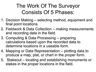
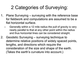
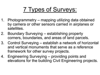
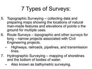
Downloaded 142 times

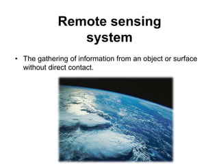


This document provides an overview of remote sensing and geographic information systems. It discusses the history of remote sensing from early aerial photography to modern satellite imagery. Both passive and active remote sensing techniques are described, along with common applications in fields like forestry, agriculture, and land use analysis. Optical, radar, and lidar remote sensing systems are outlined. The document also introduces concepts in photogrammetry, surveying, and geographic information systems, including data structures and components of GIS.

![Rs unit iii-gis--- [repaired]](https://cdn.slidesharecdn.com/ss_thumbnails/rsunit-iiigis-repaired-180305142425-thumbnail.jpg?width=640&height=640&fit=bounds)