Downloaded 214 times
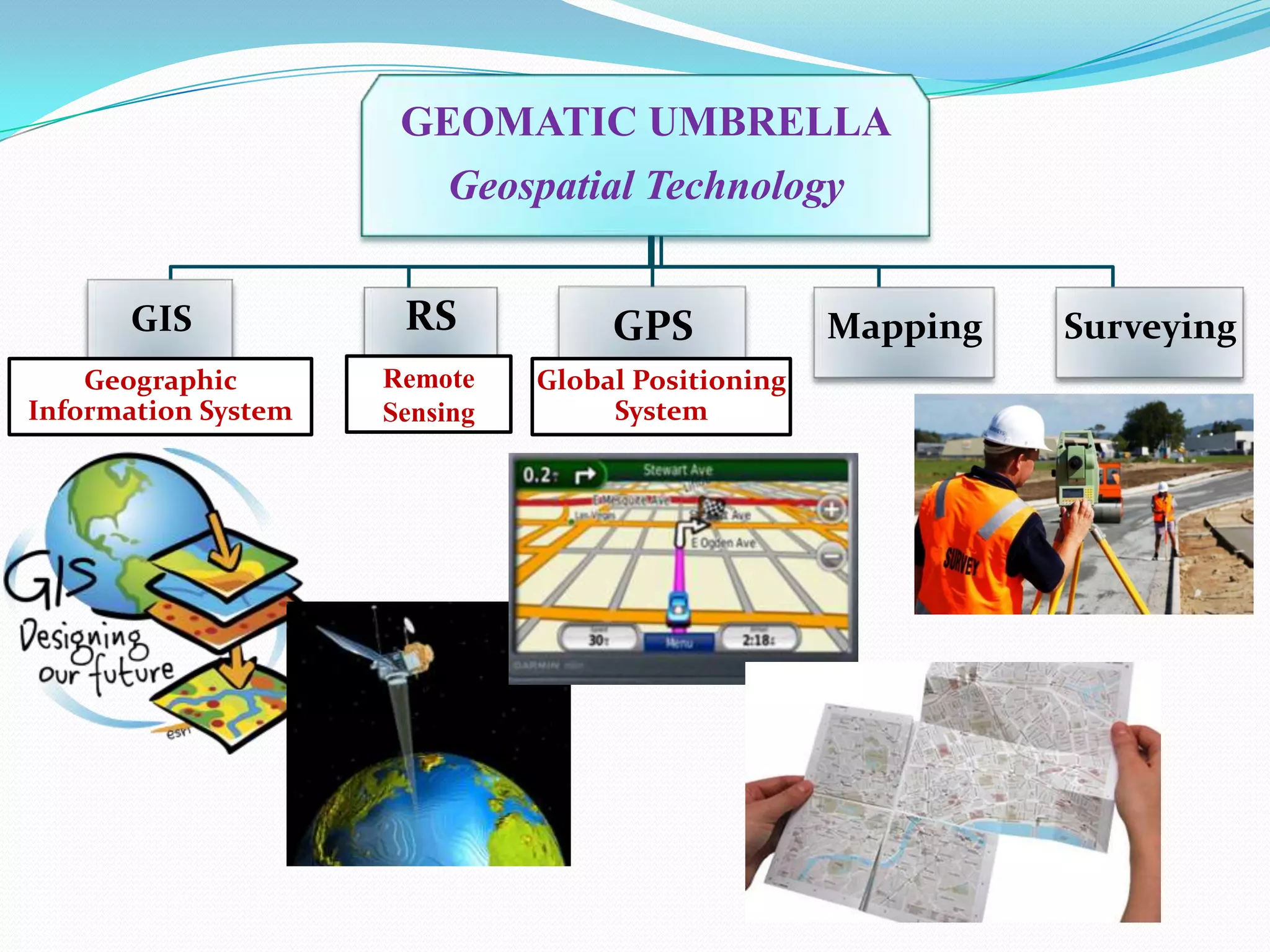
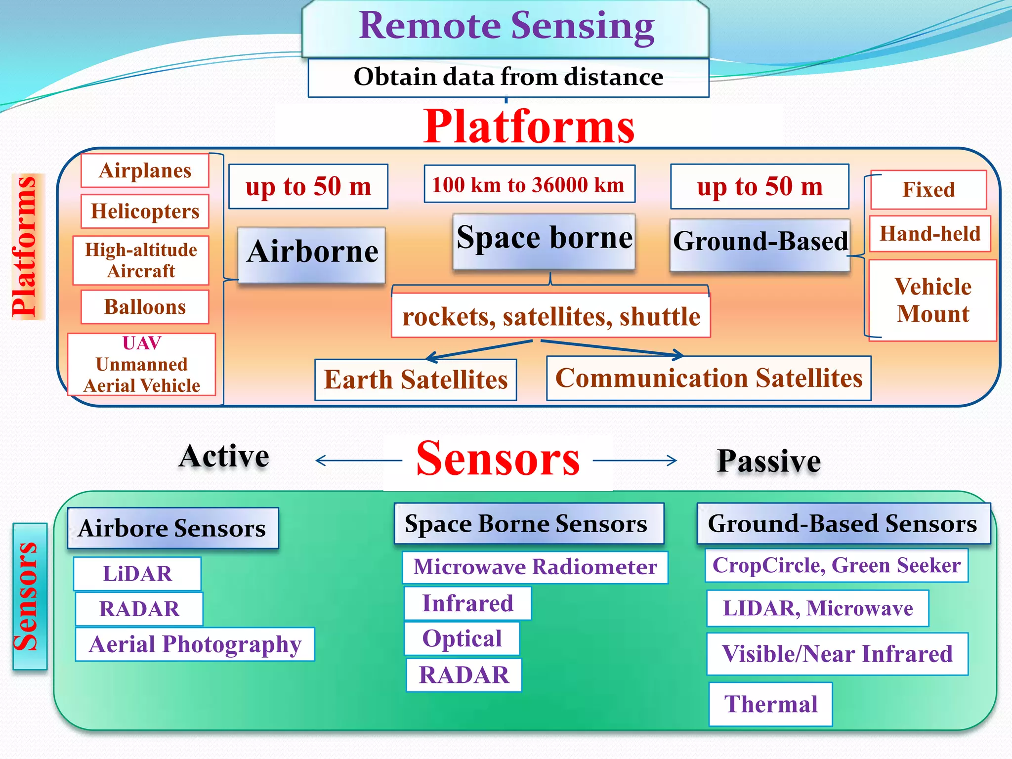
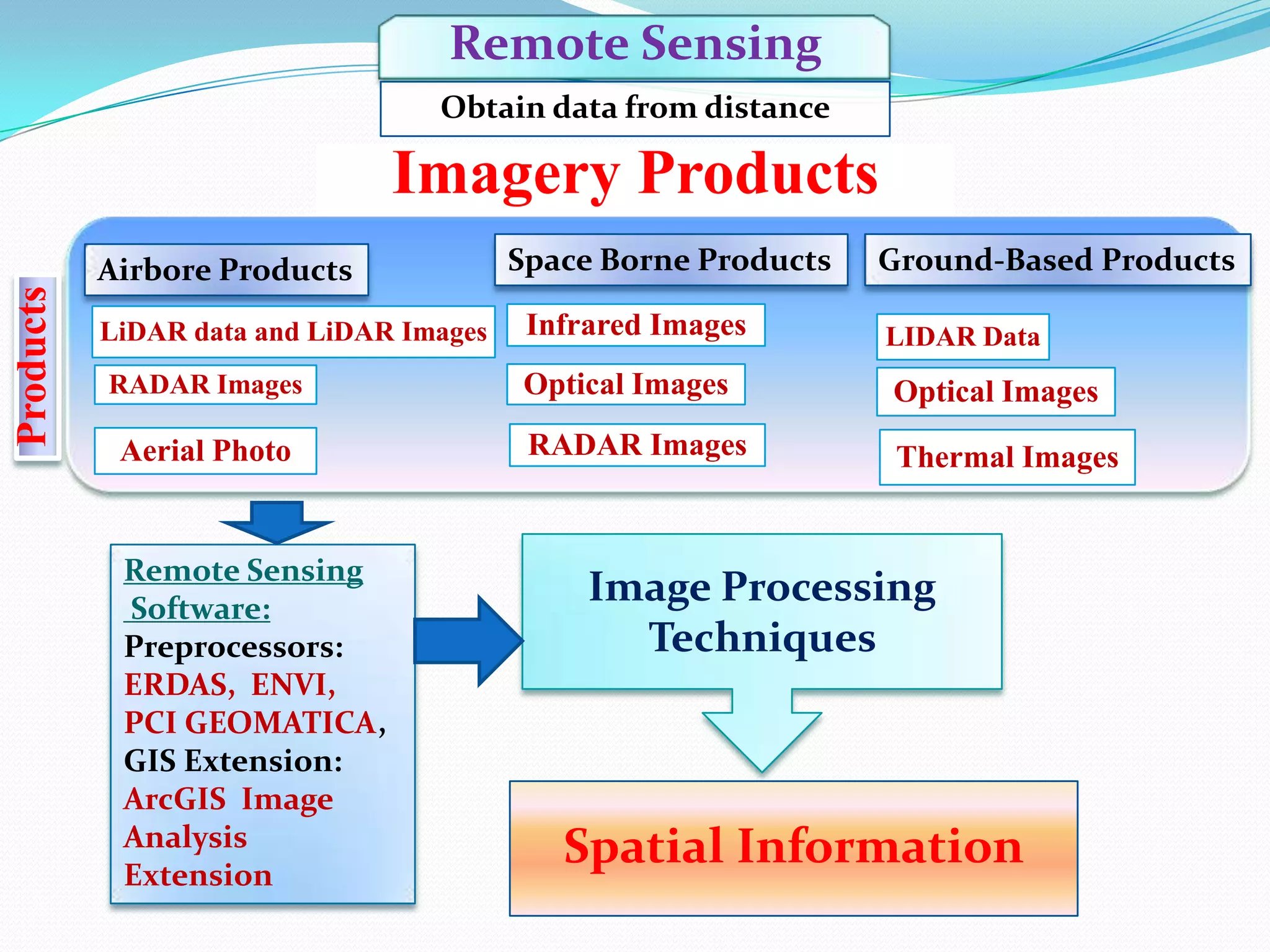
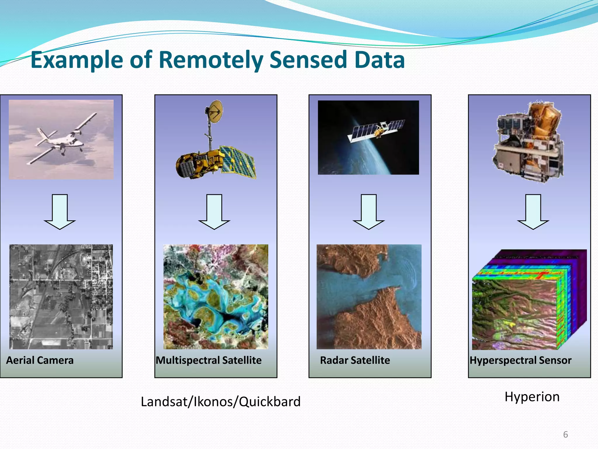
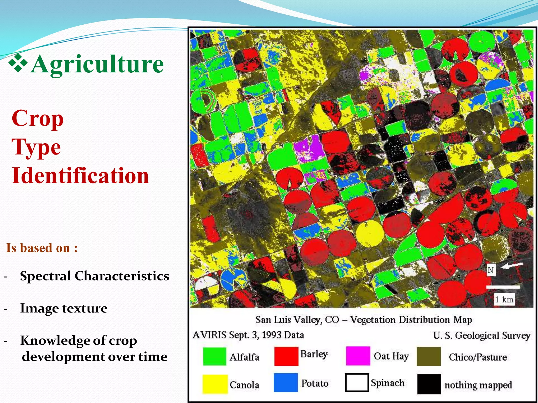
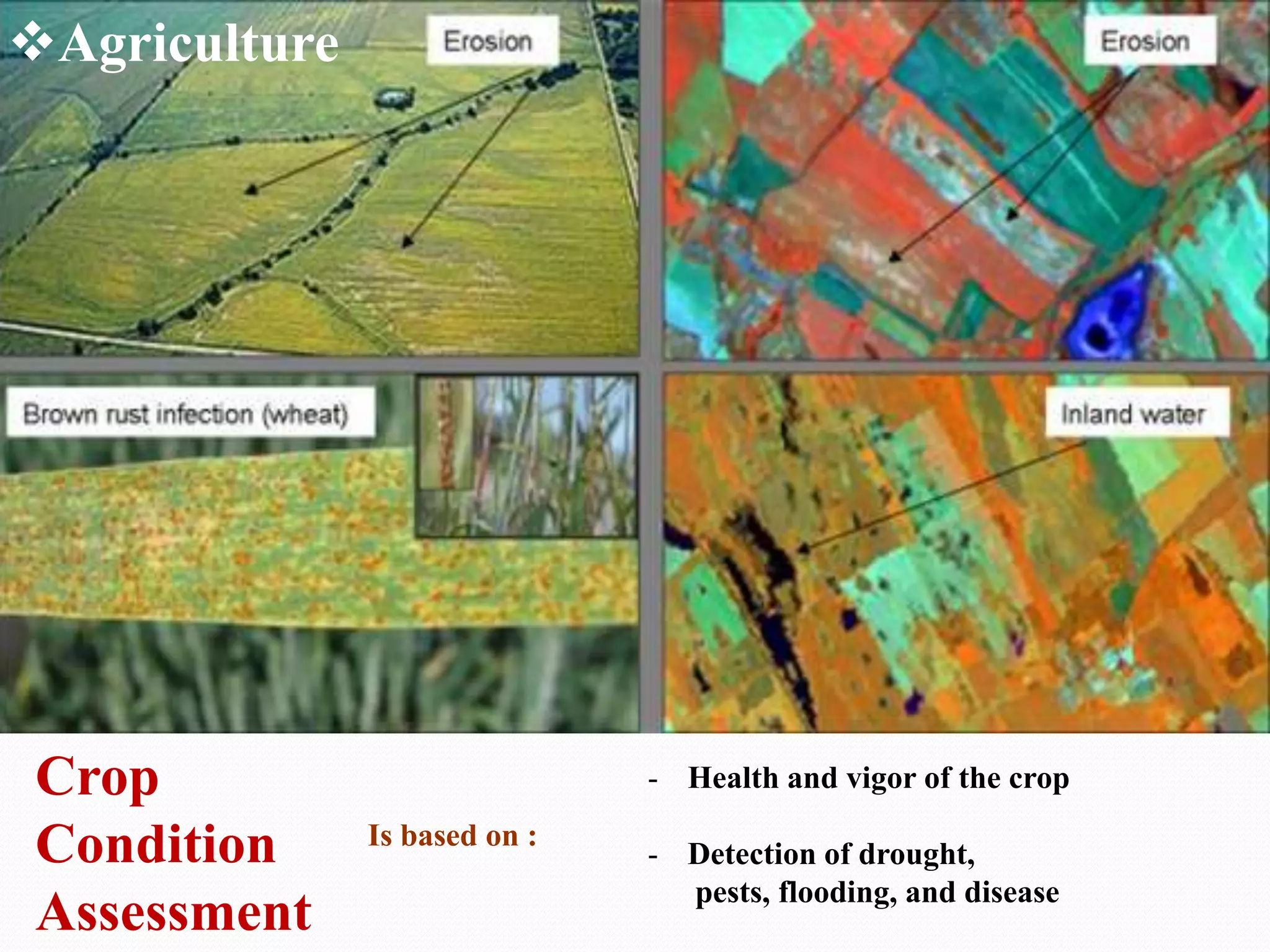
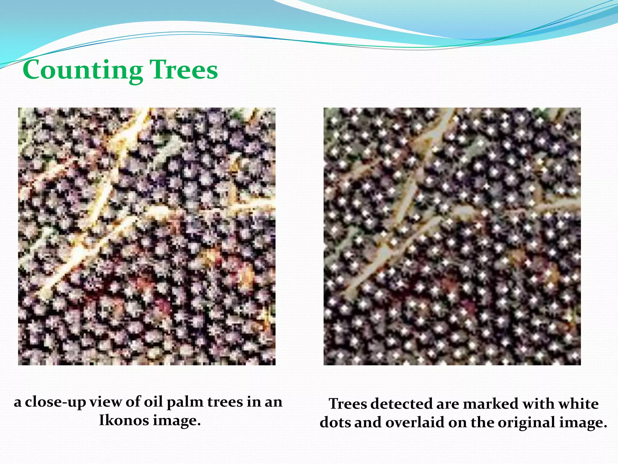
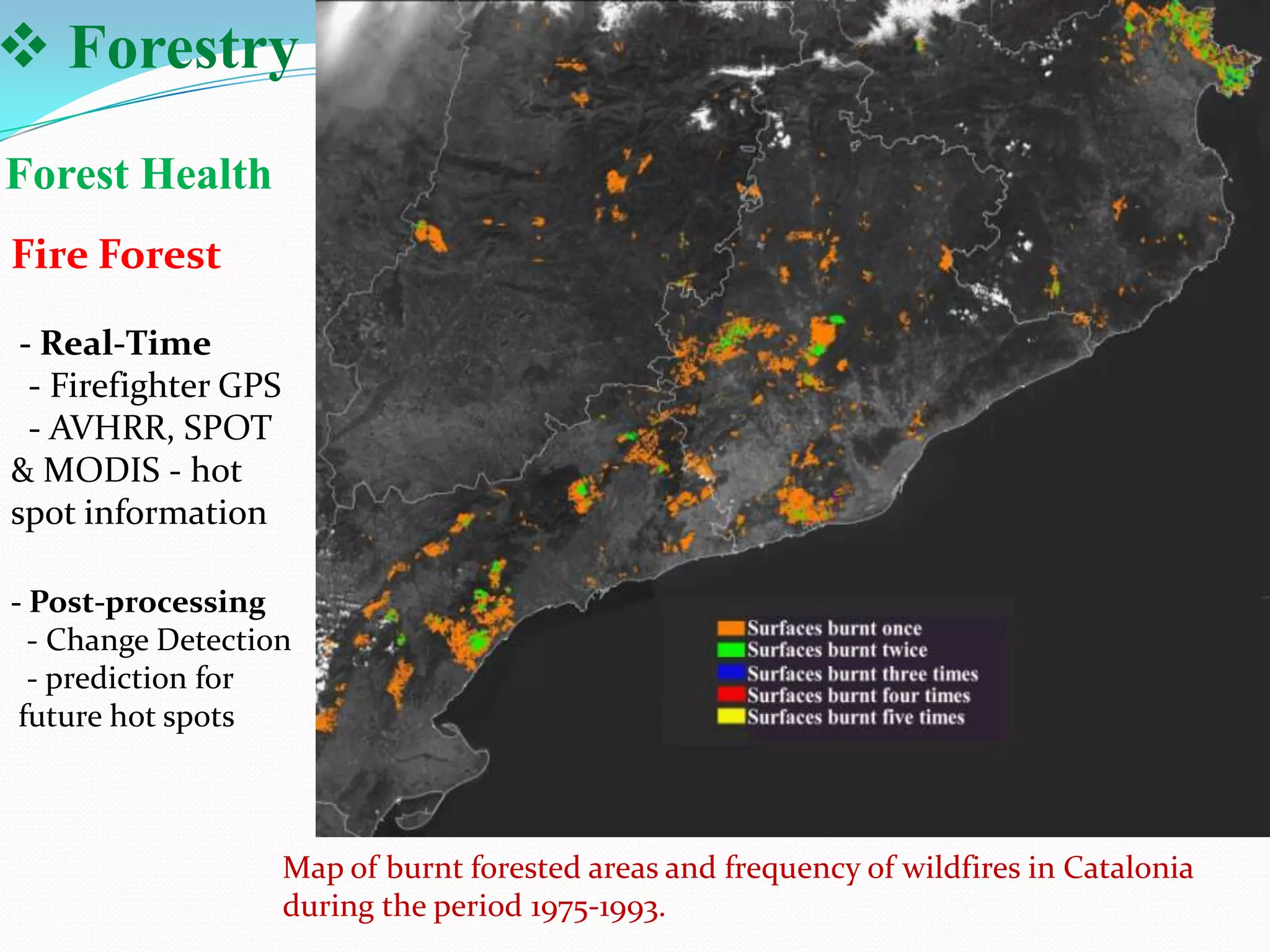
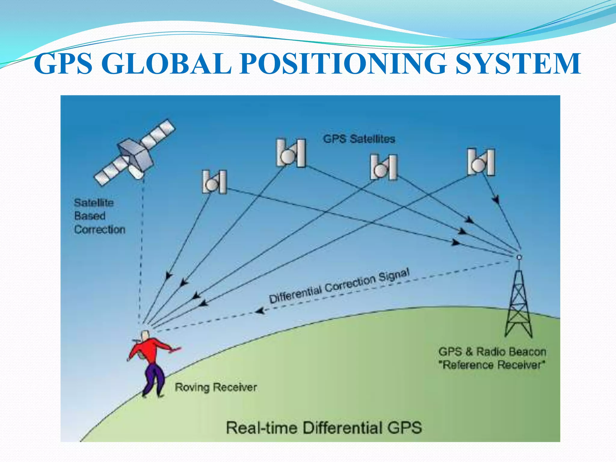
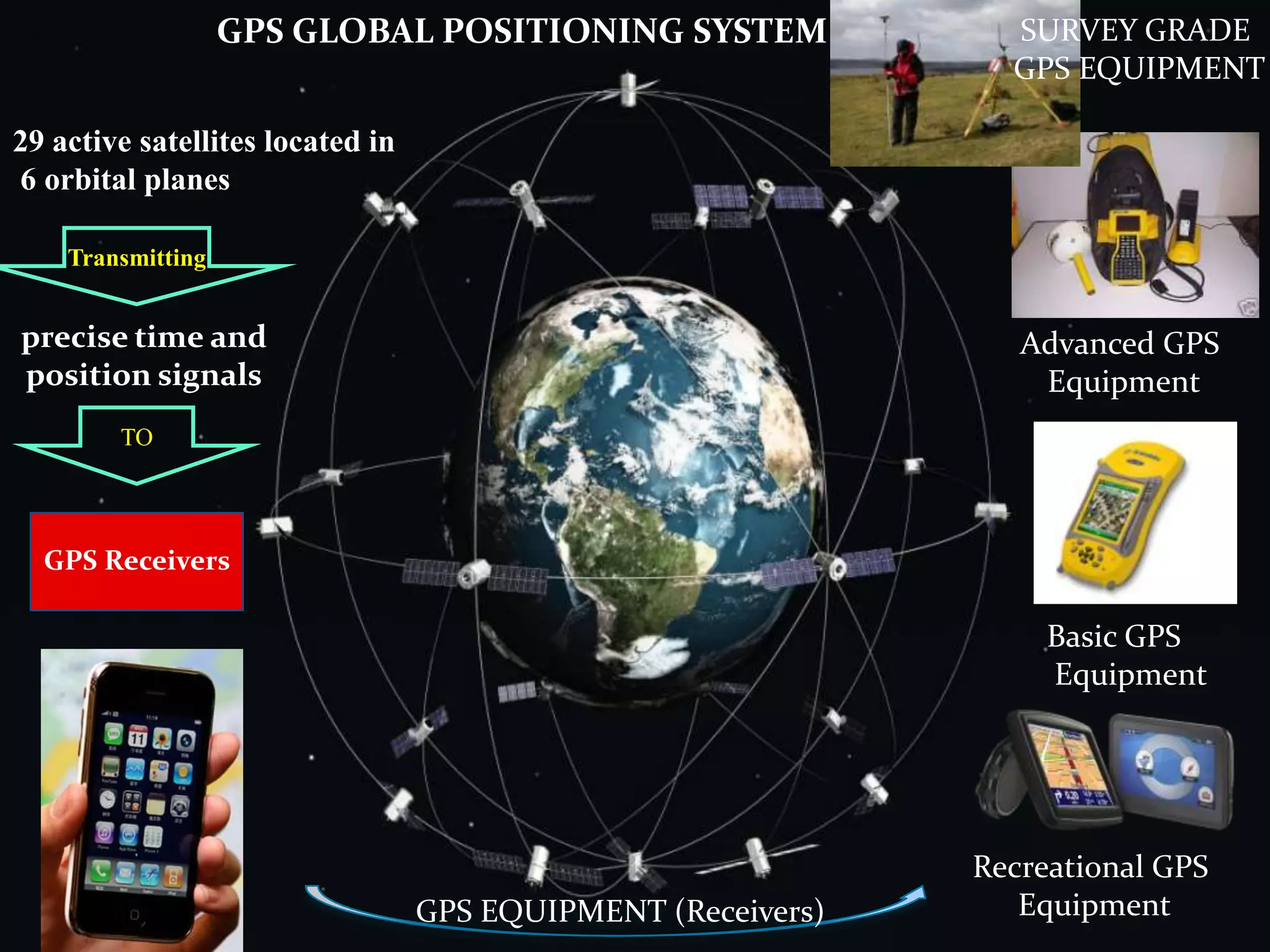
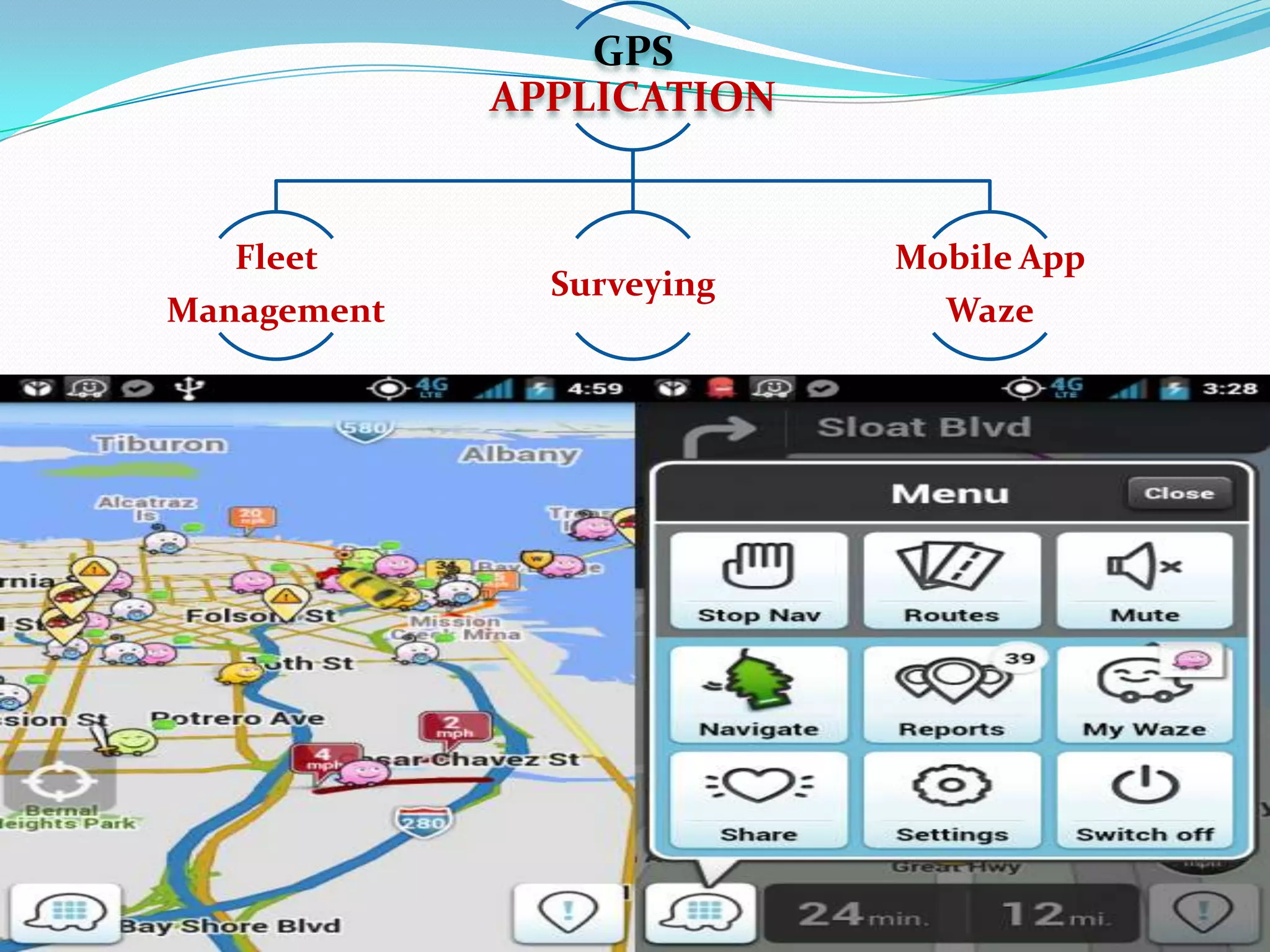
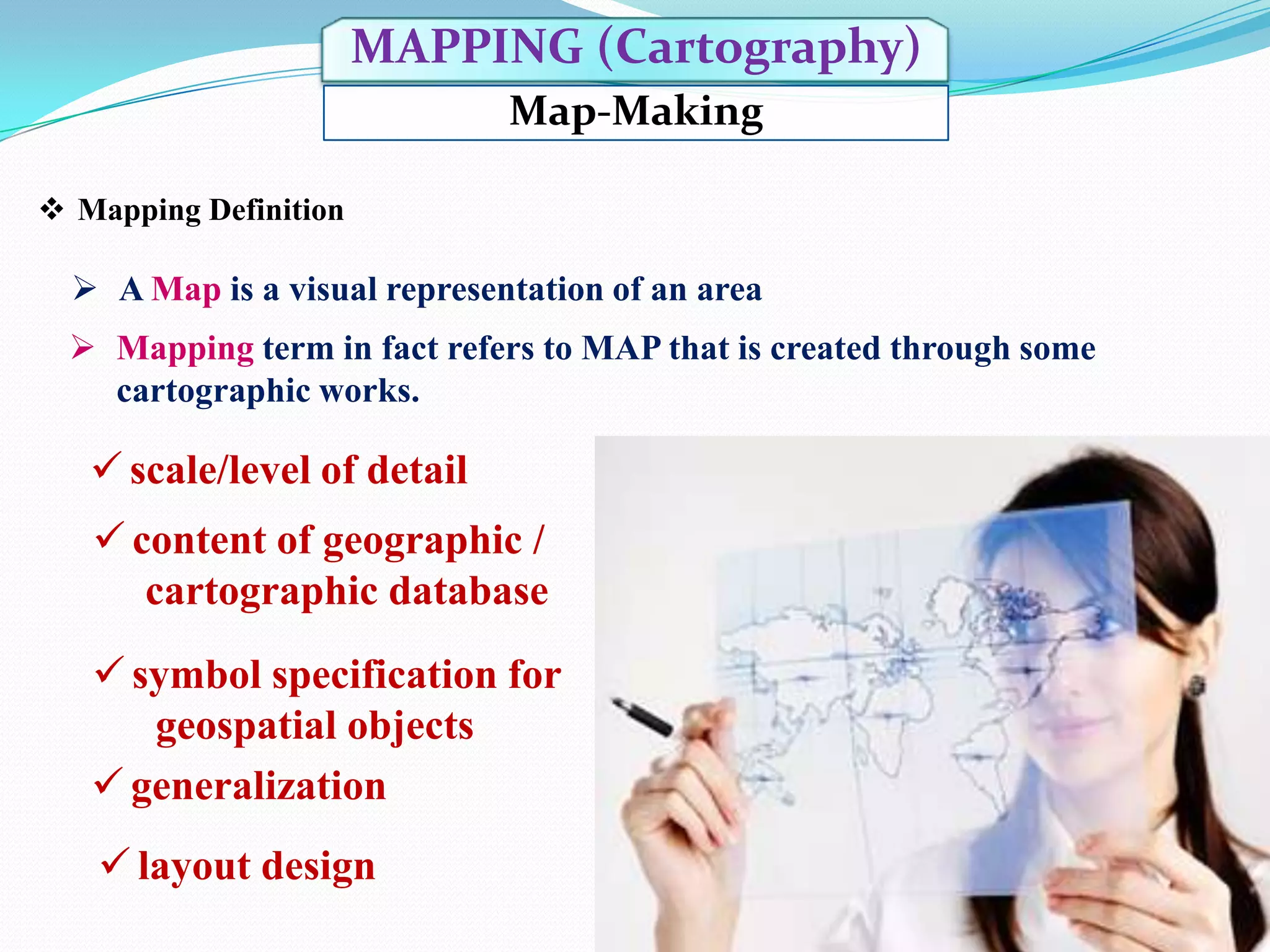
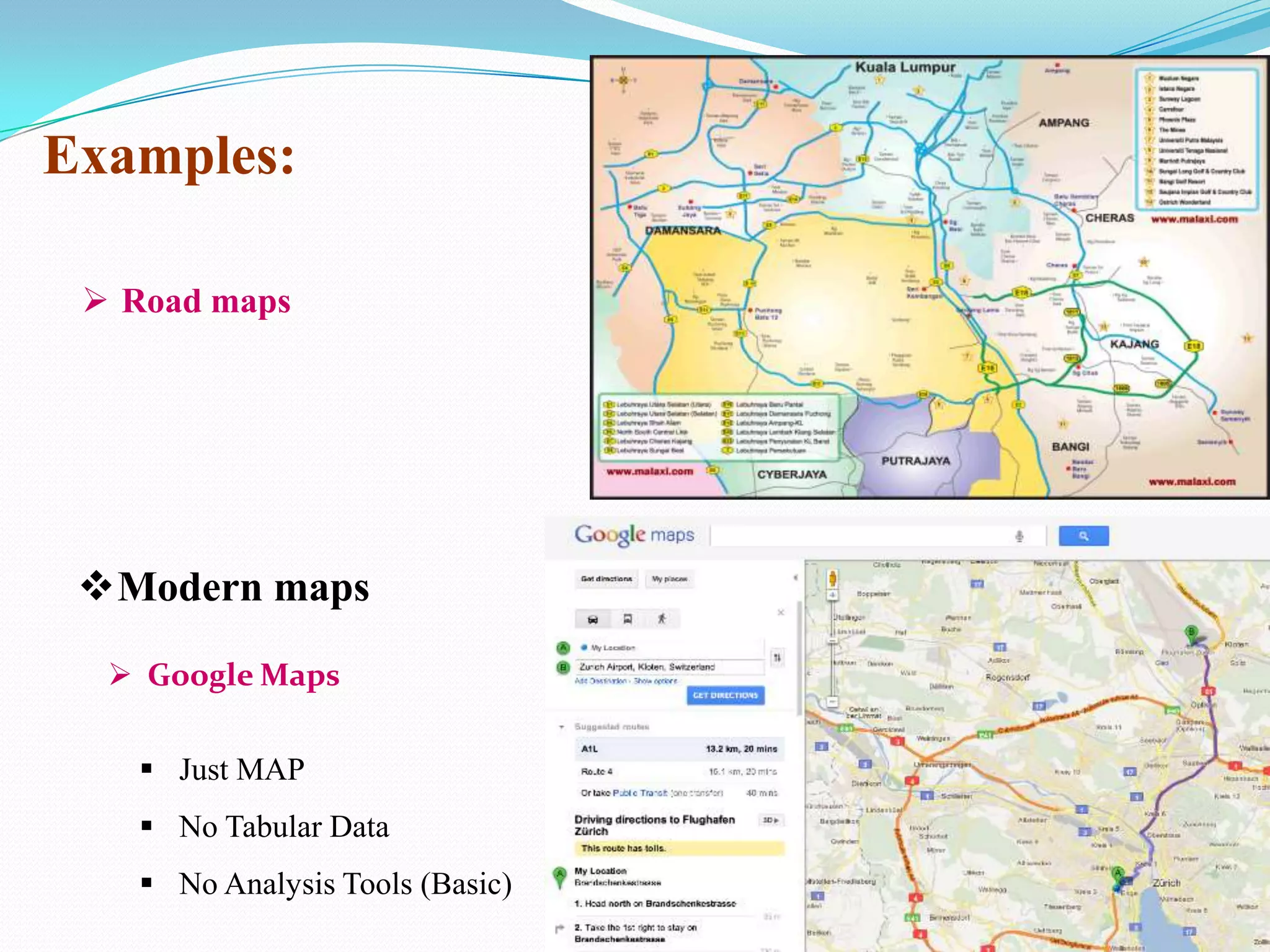
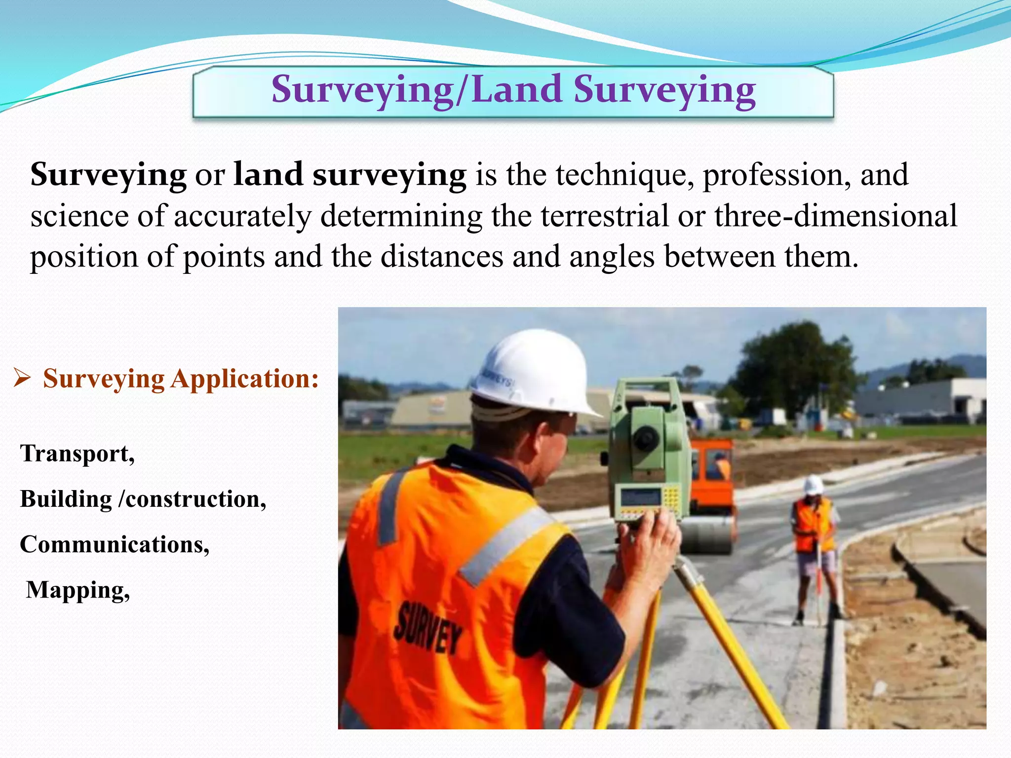
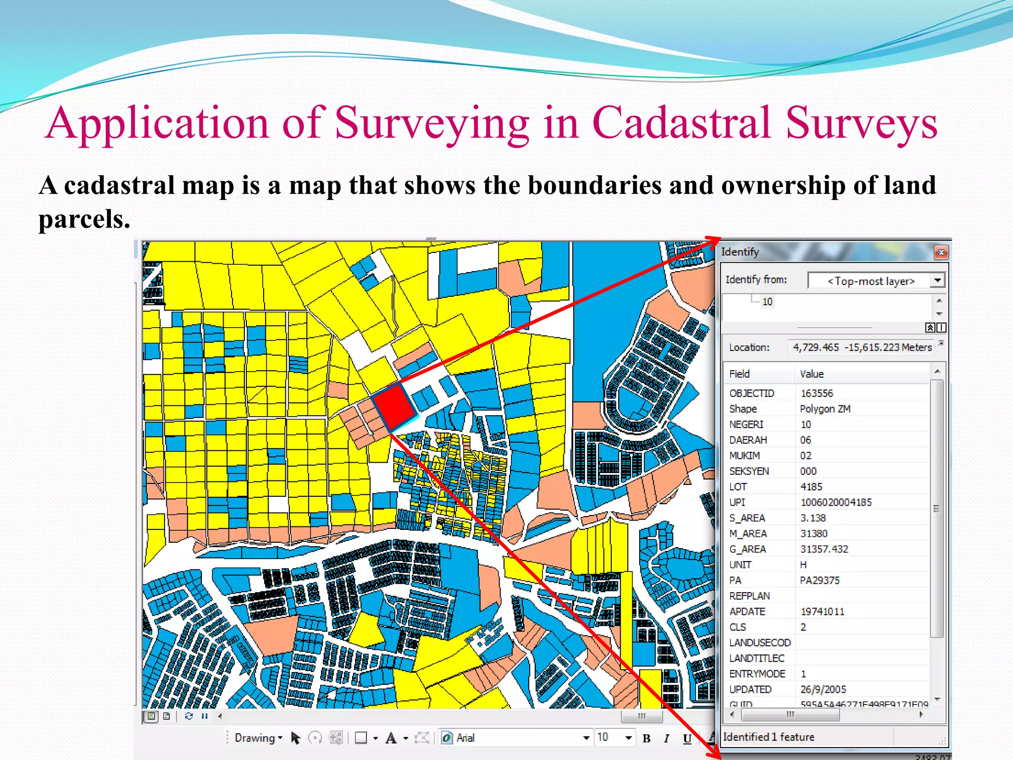
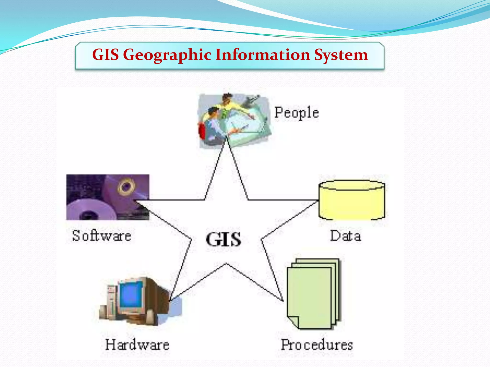
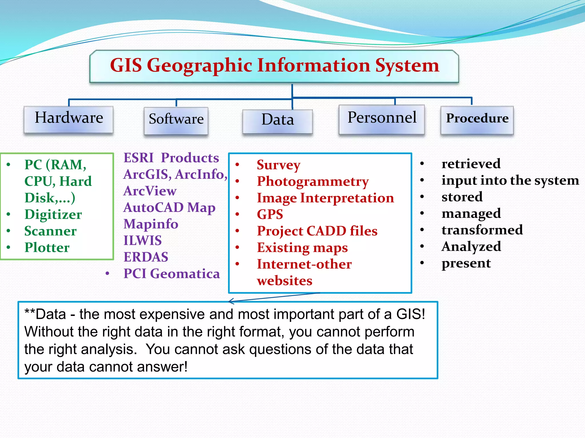
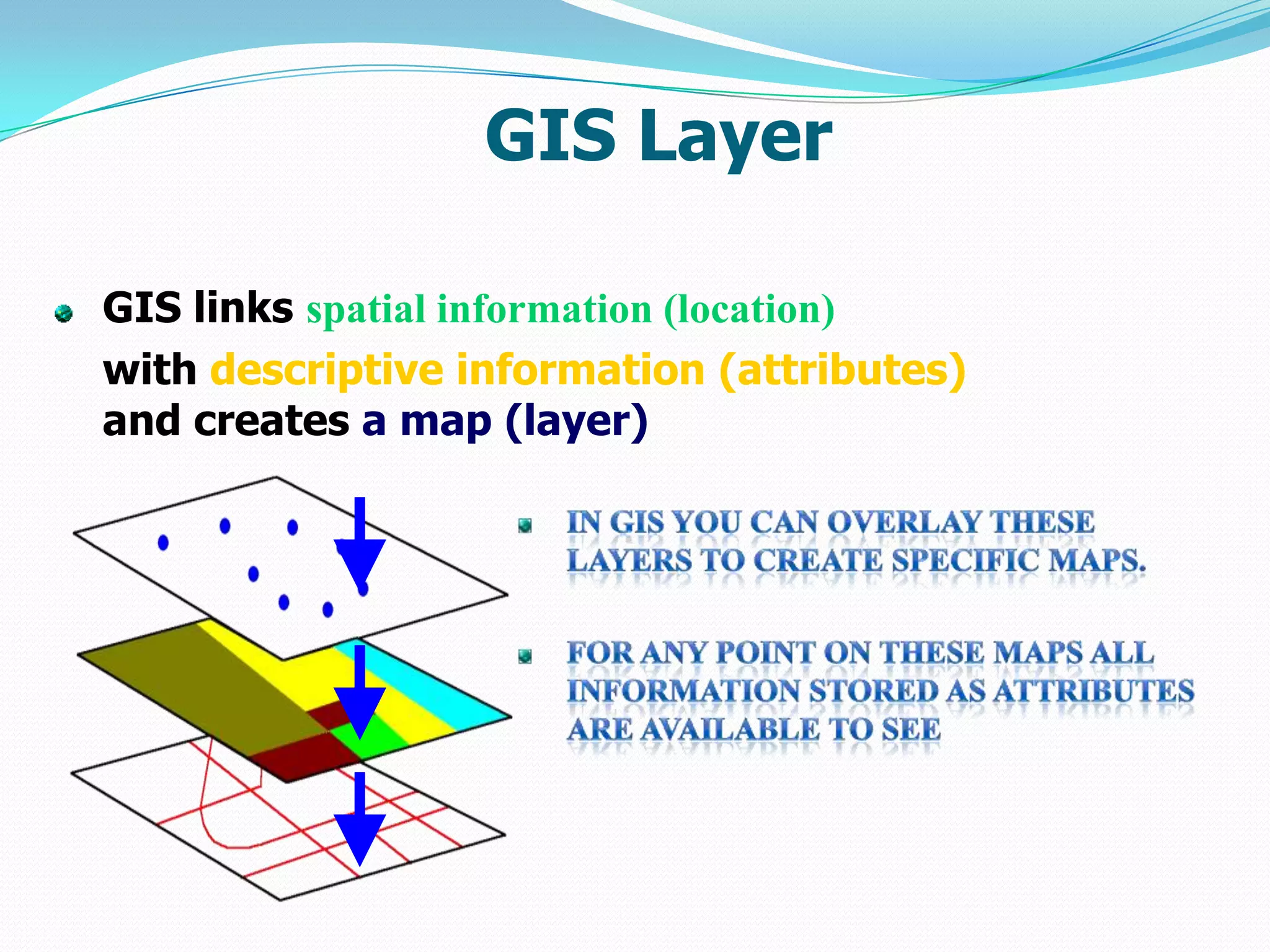
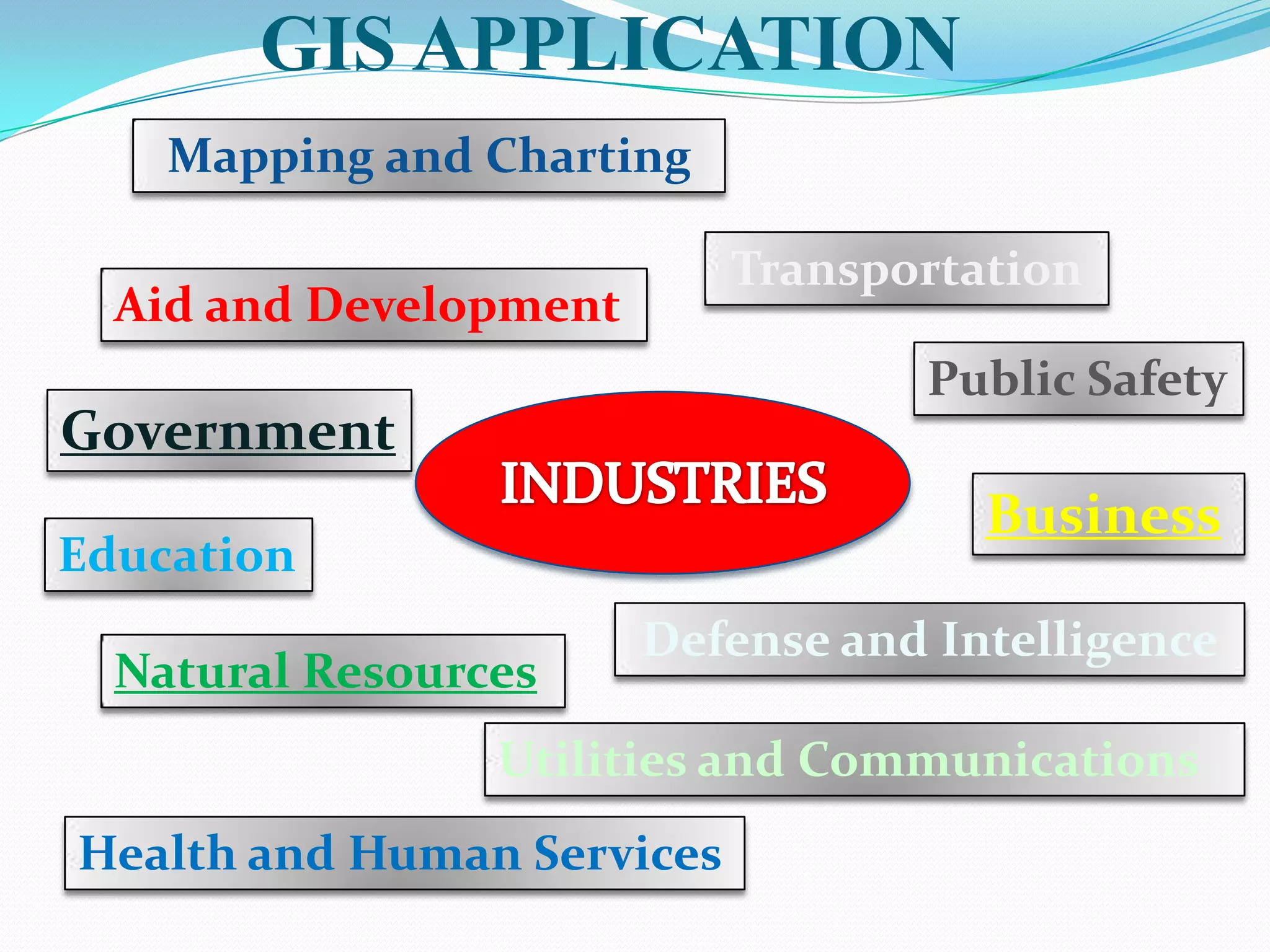
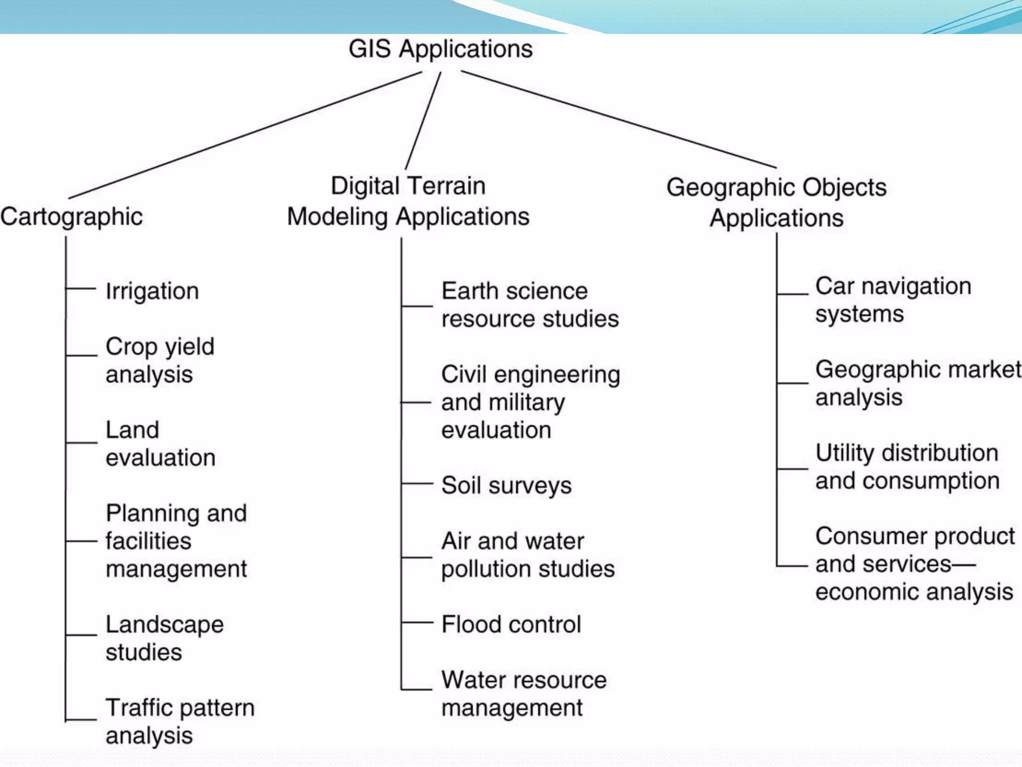
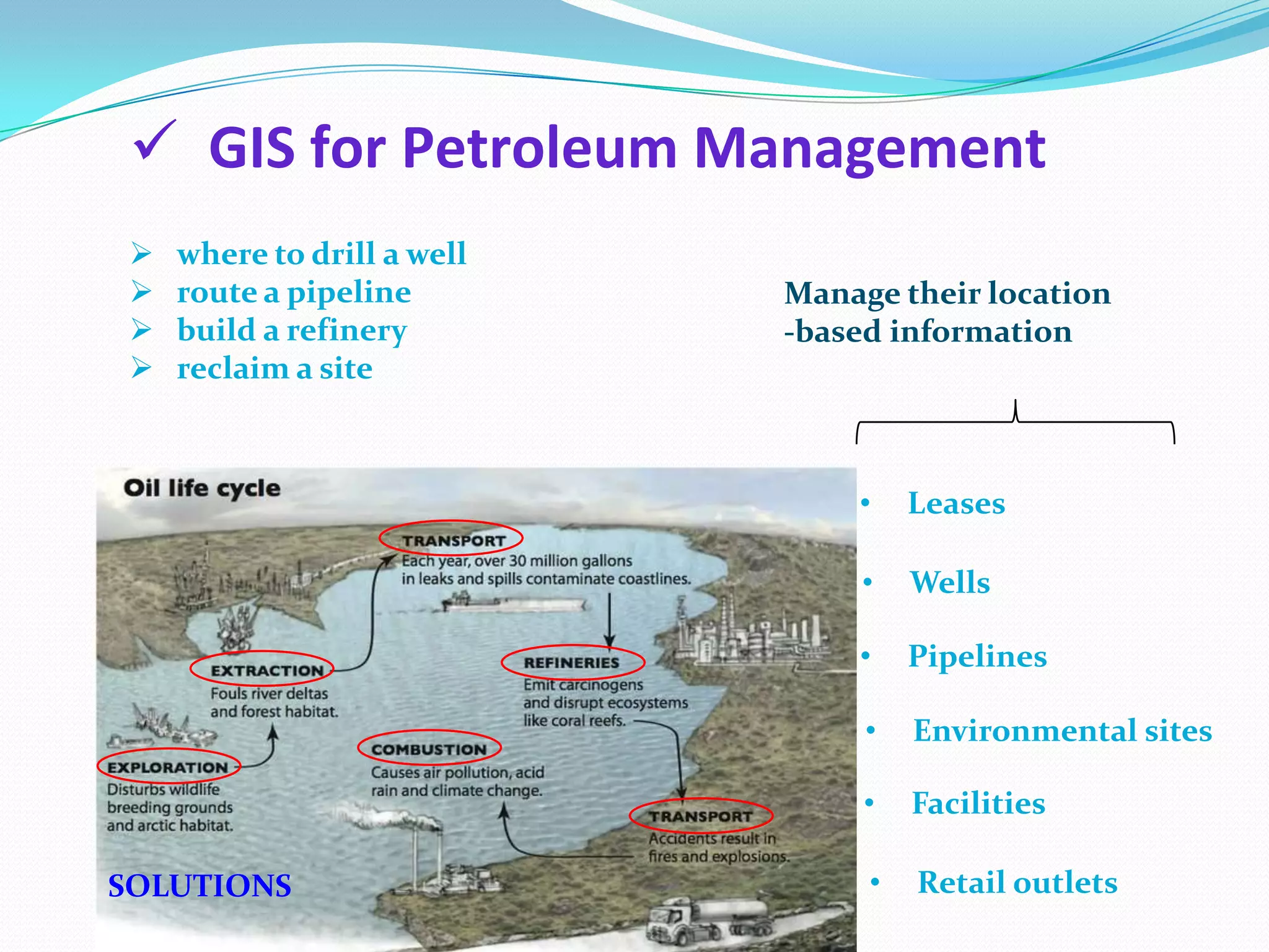
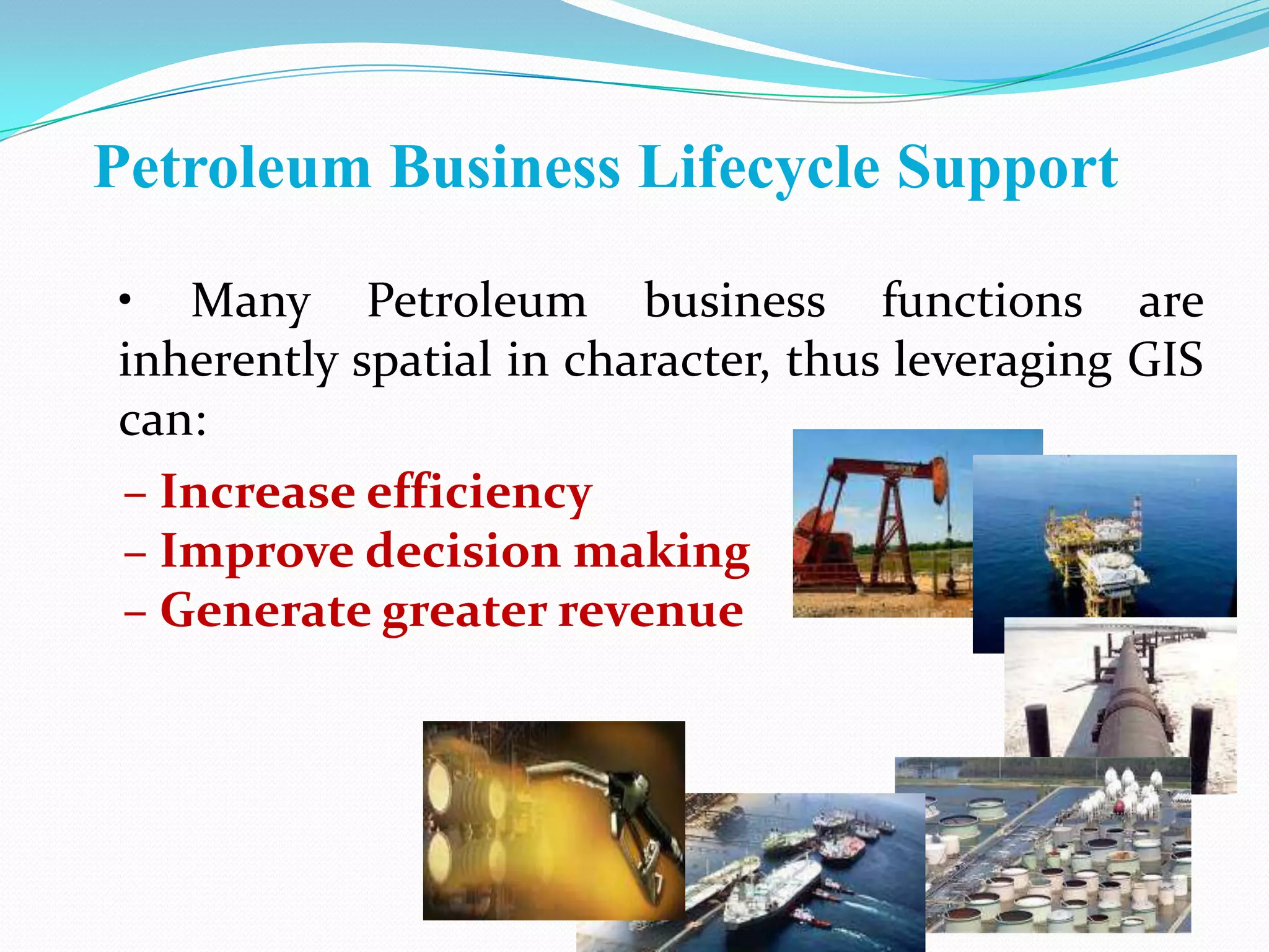
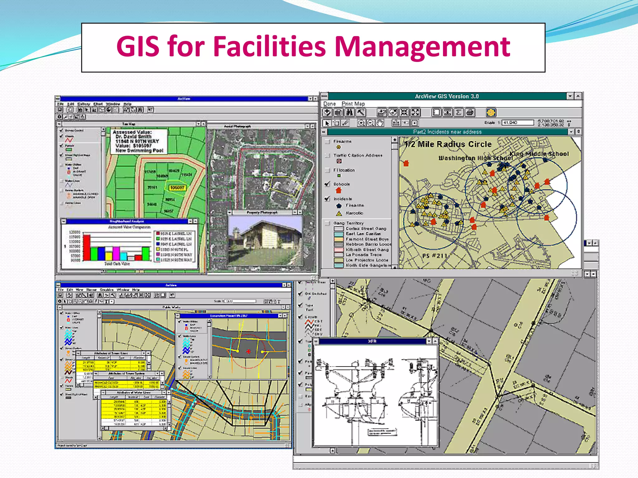

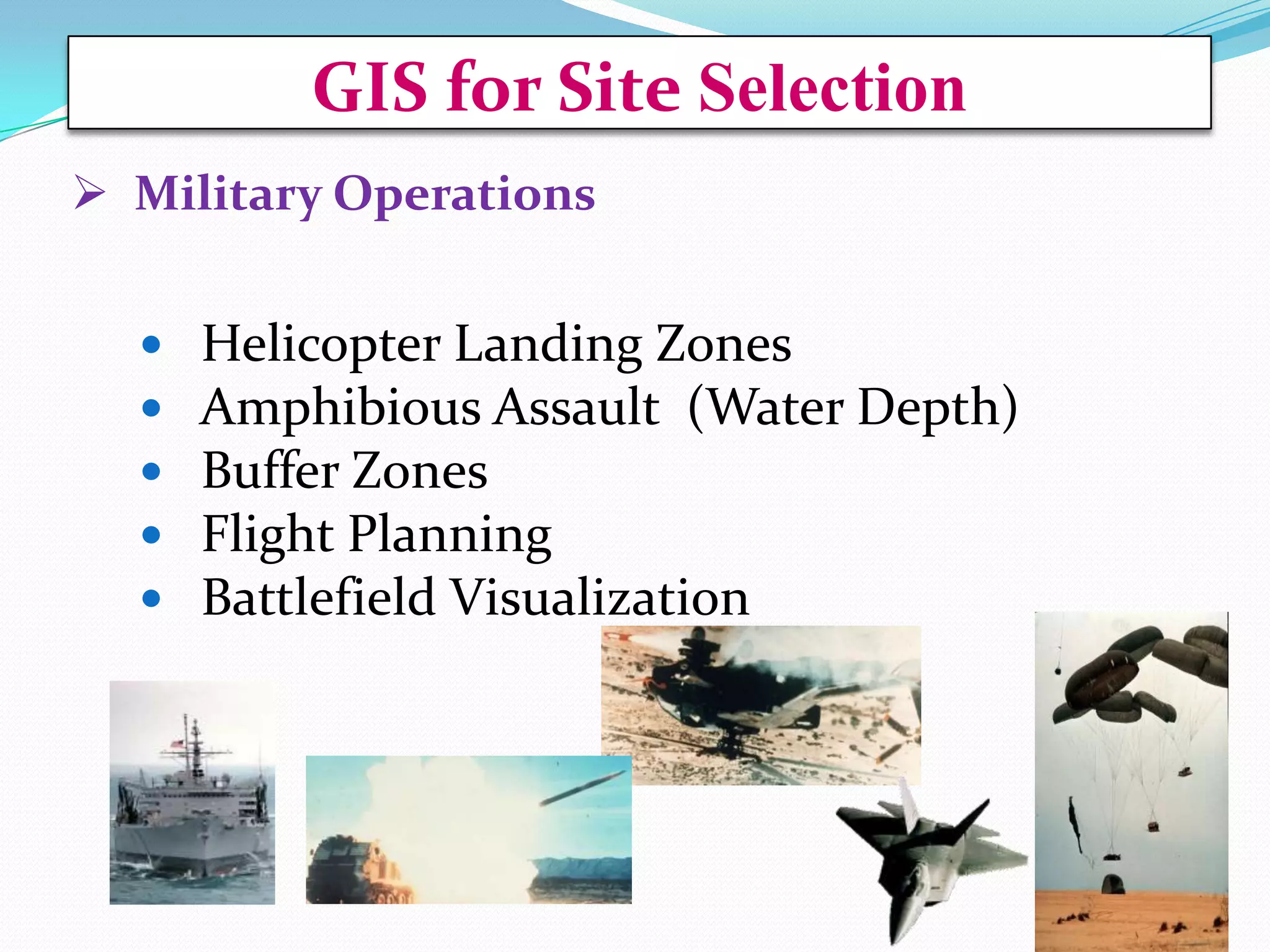
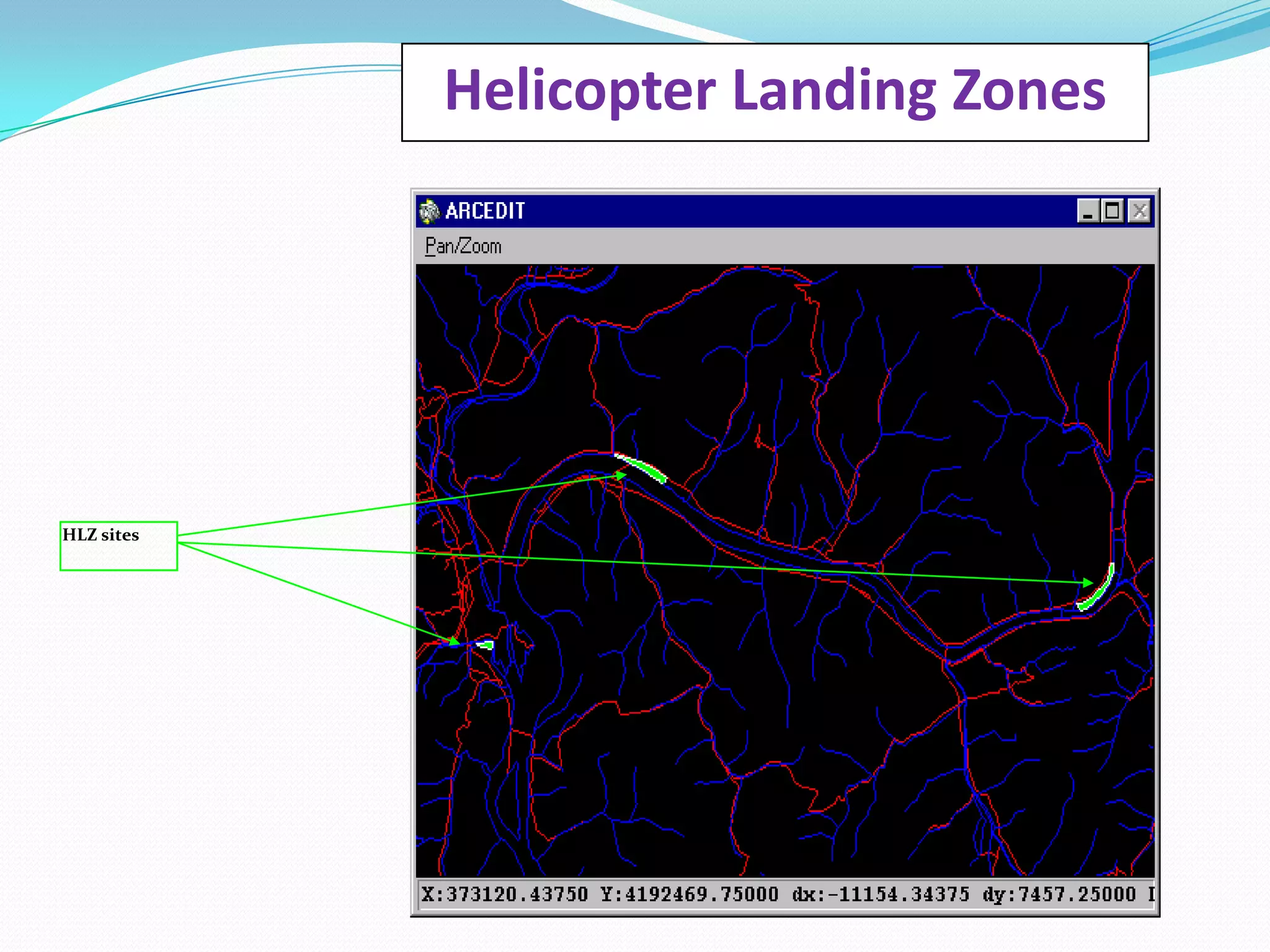
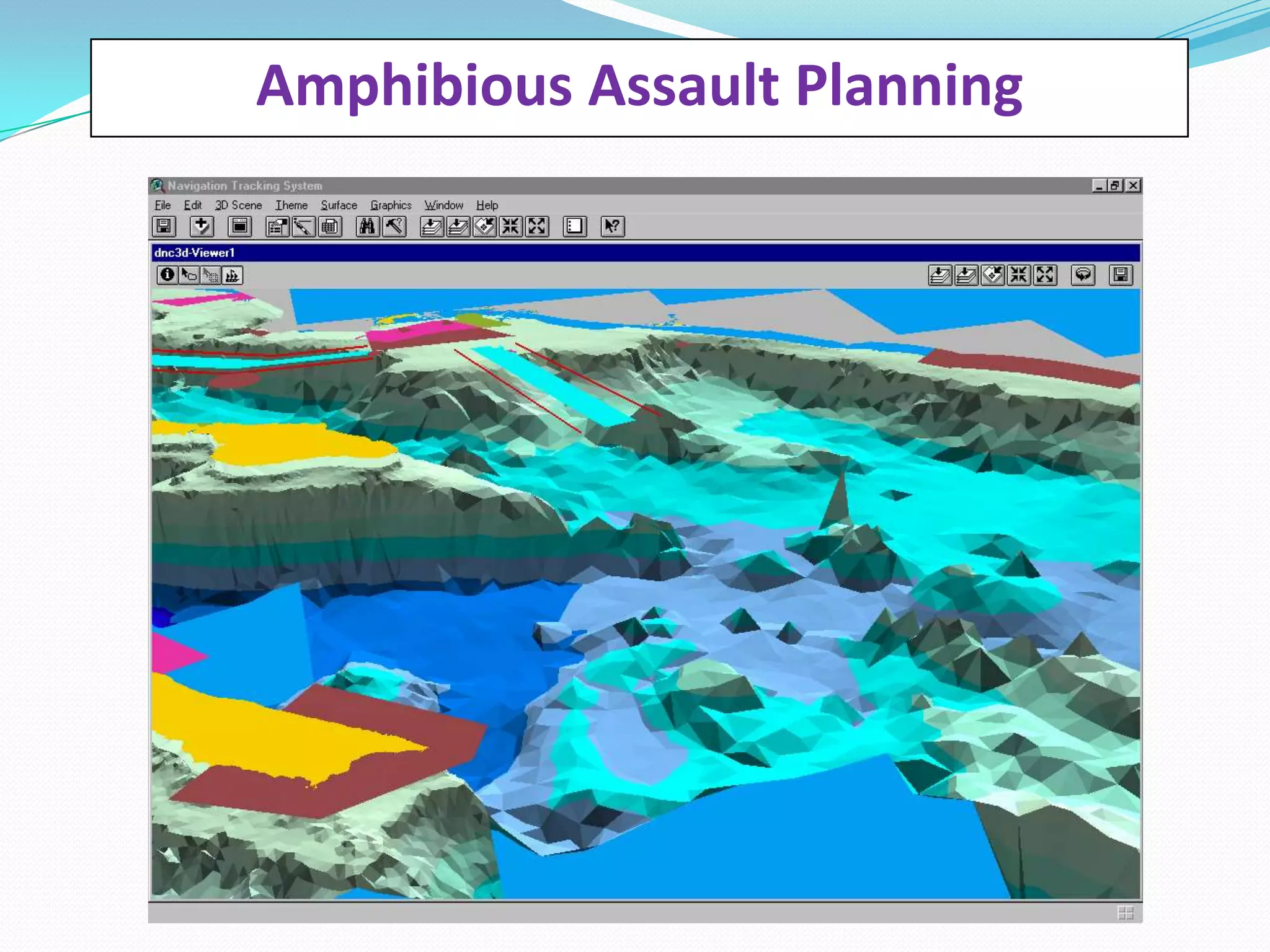
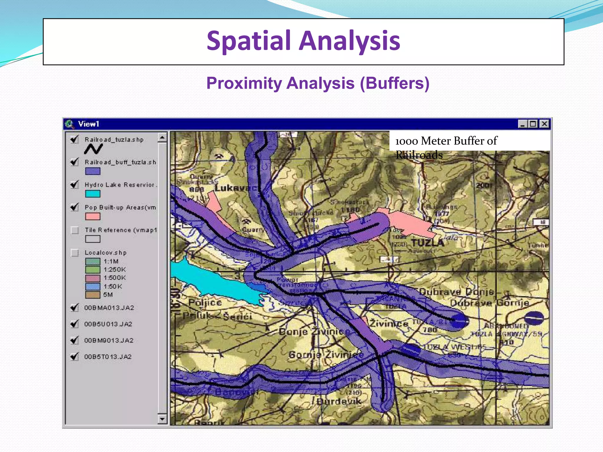
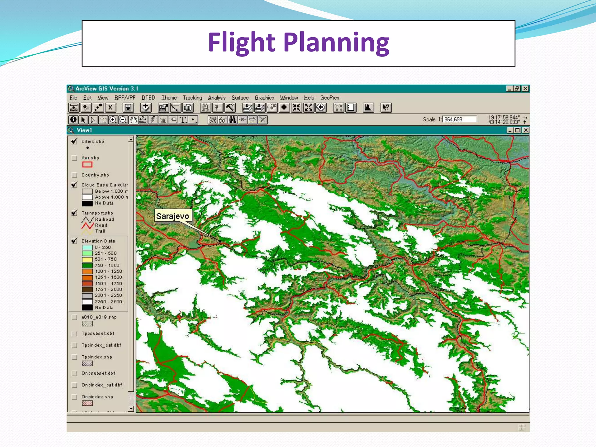
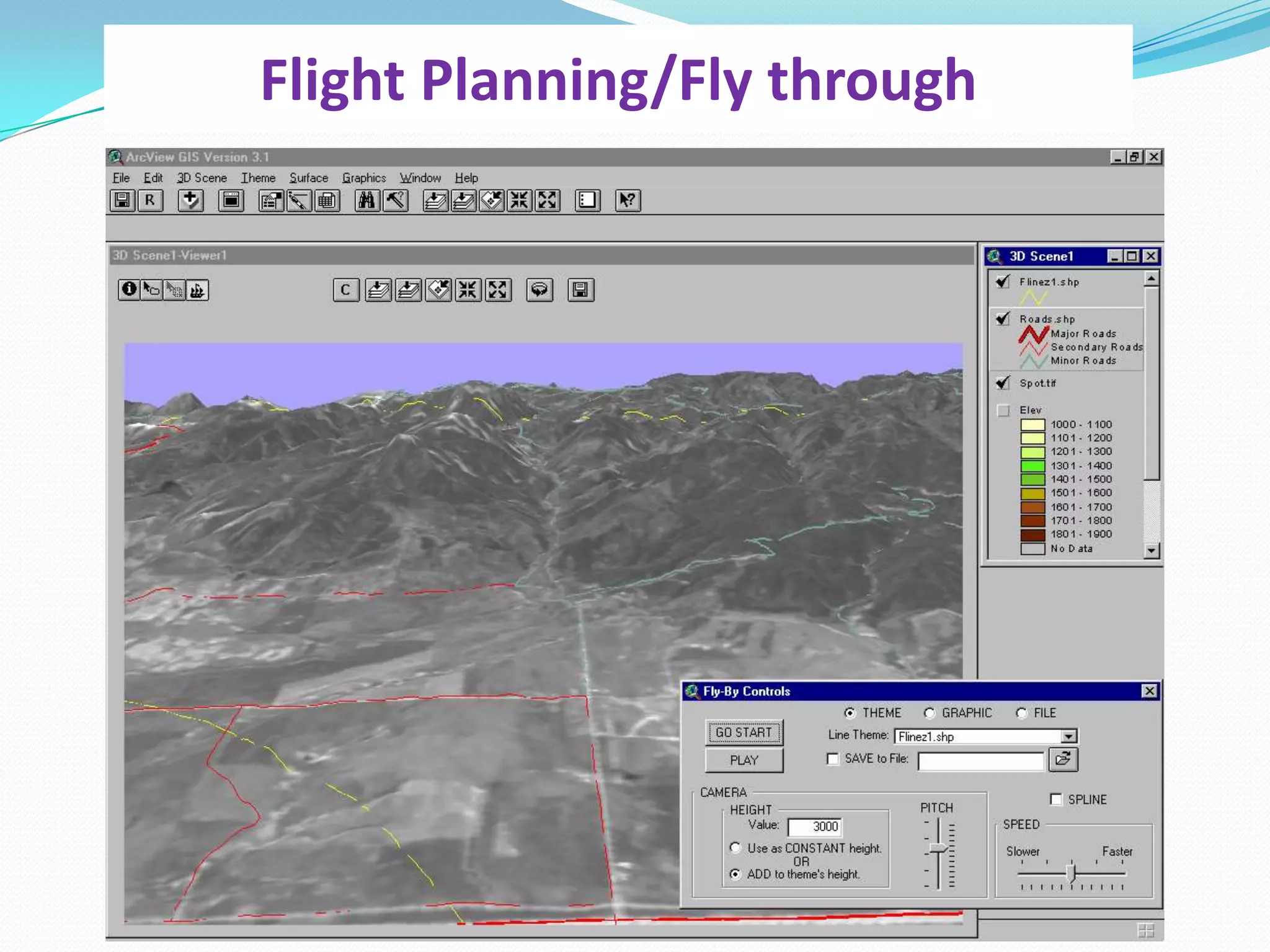
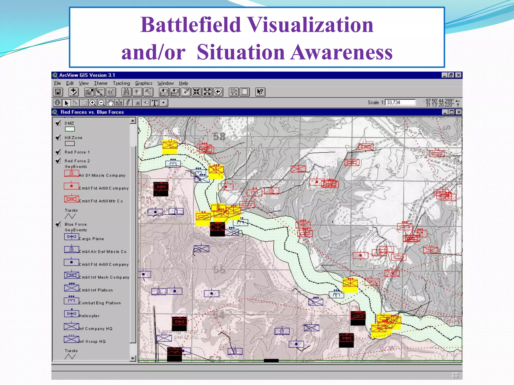
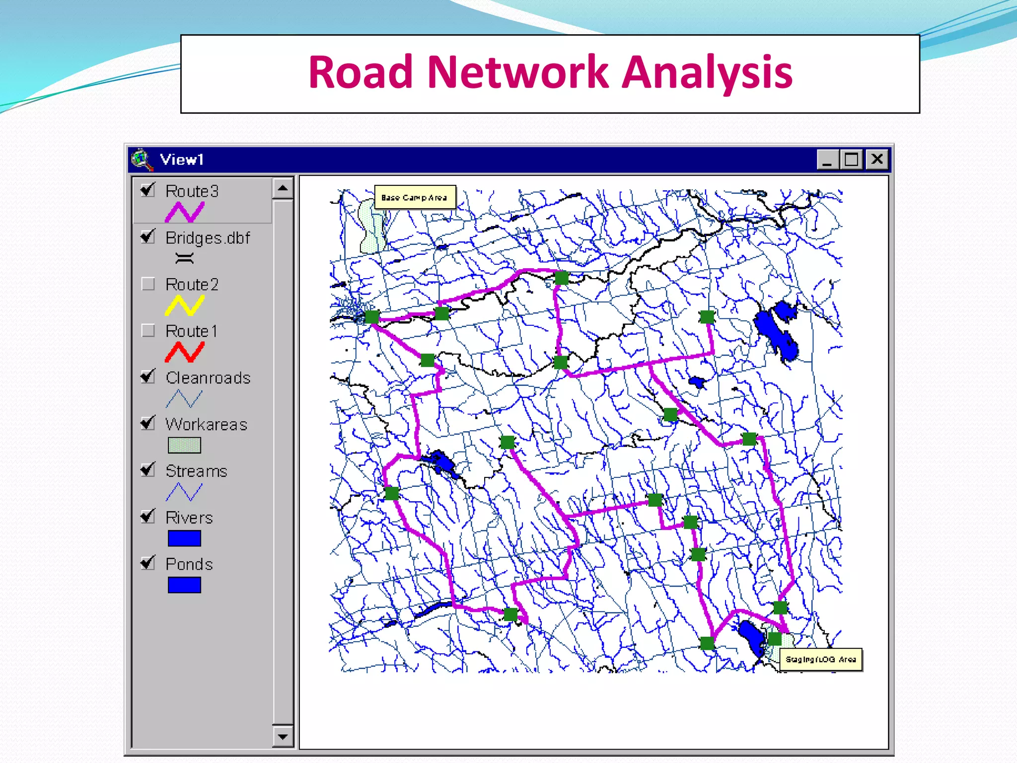
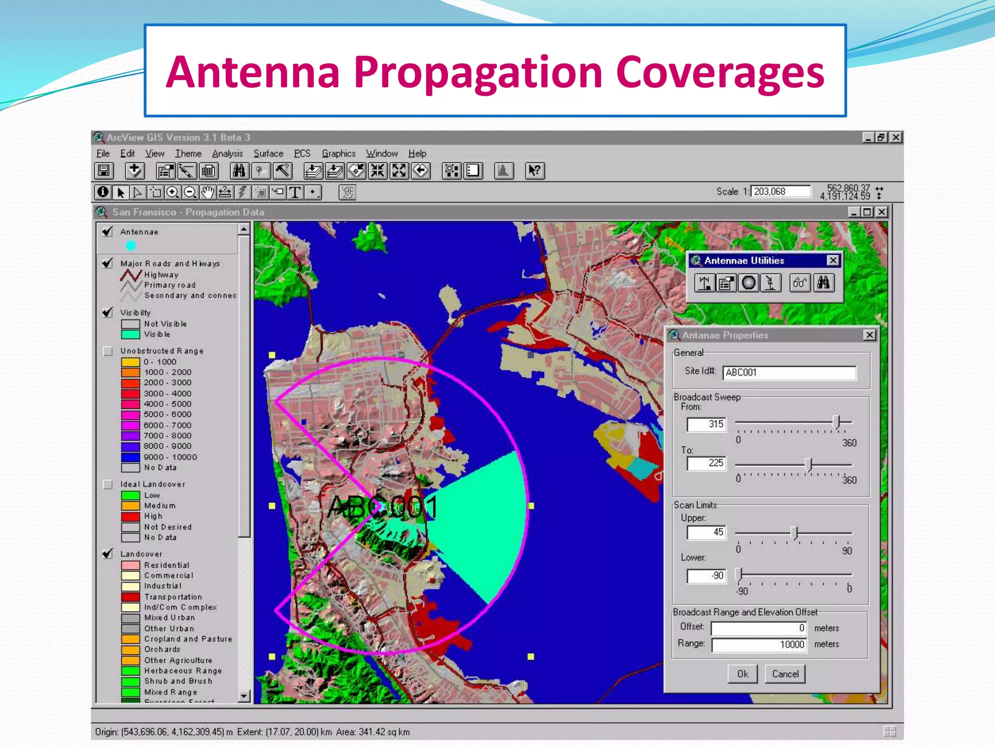
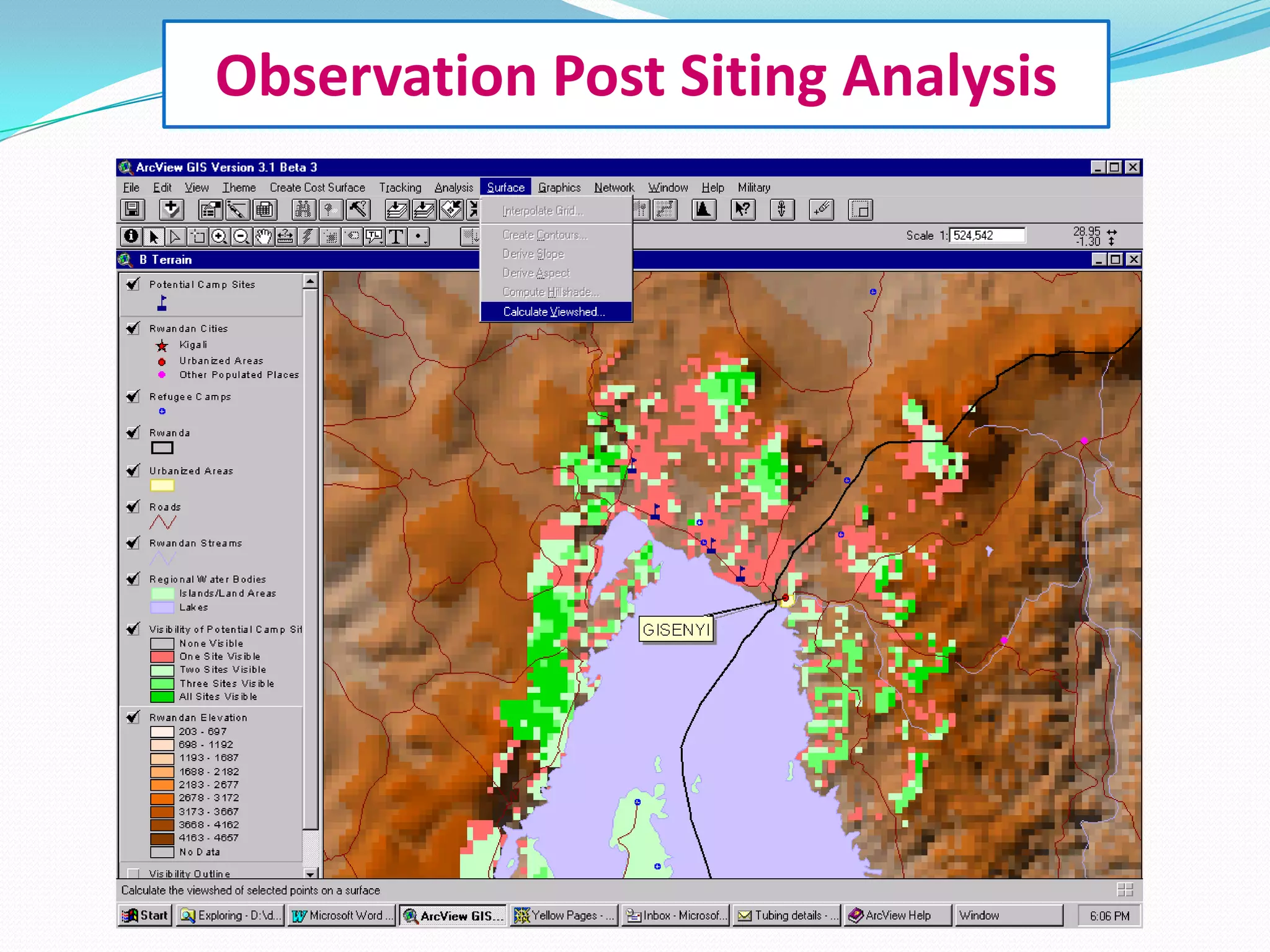
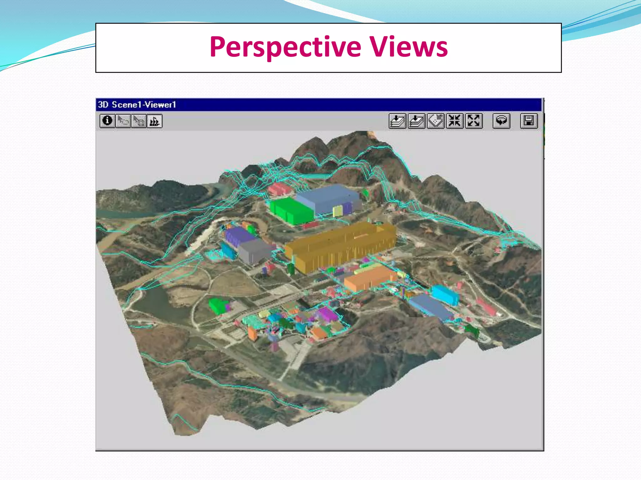

This document provides an outline for a presentation on geospatial technologies including remote sensing, GPS, mapping, surveying, and GIS. It begins with an introduction to the geomatic umbrella and defines key geospatial concepts. It then discusses remote sensing platforms and sensors, and provides examples of agricultural and forestry applications. It also summarizes GPS systems and applications. The document defines mapping and surveying and provides examples. It concludes with an overview of GIS hardware, software, data, and functions and discusses example applications in emergency management, petroleum management, and utilities.


