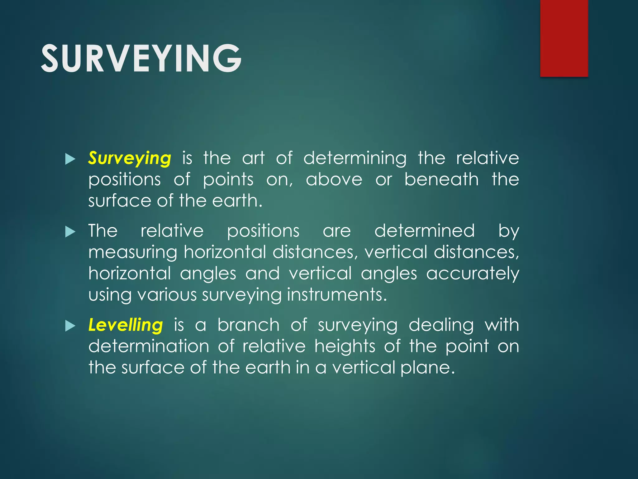
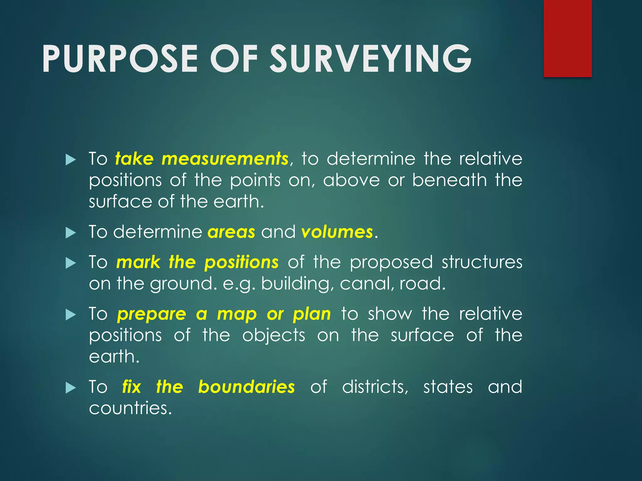
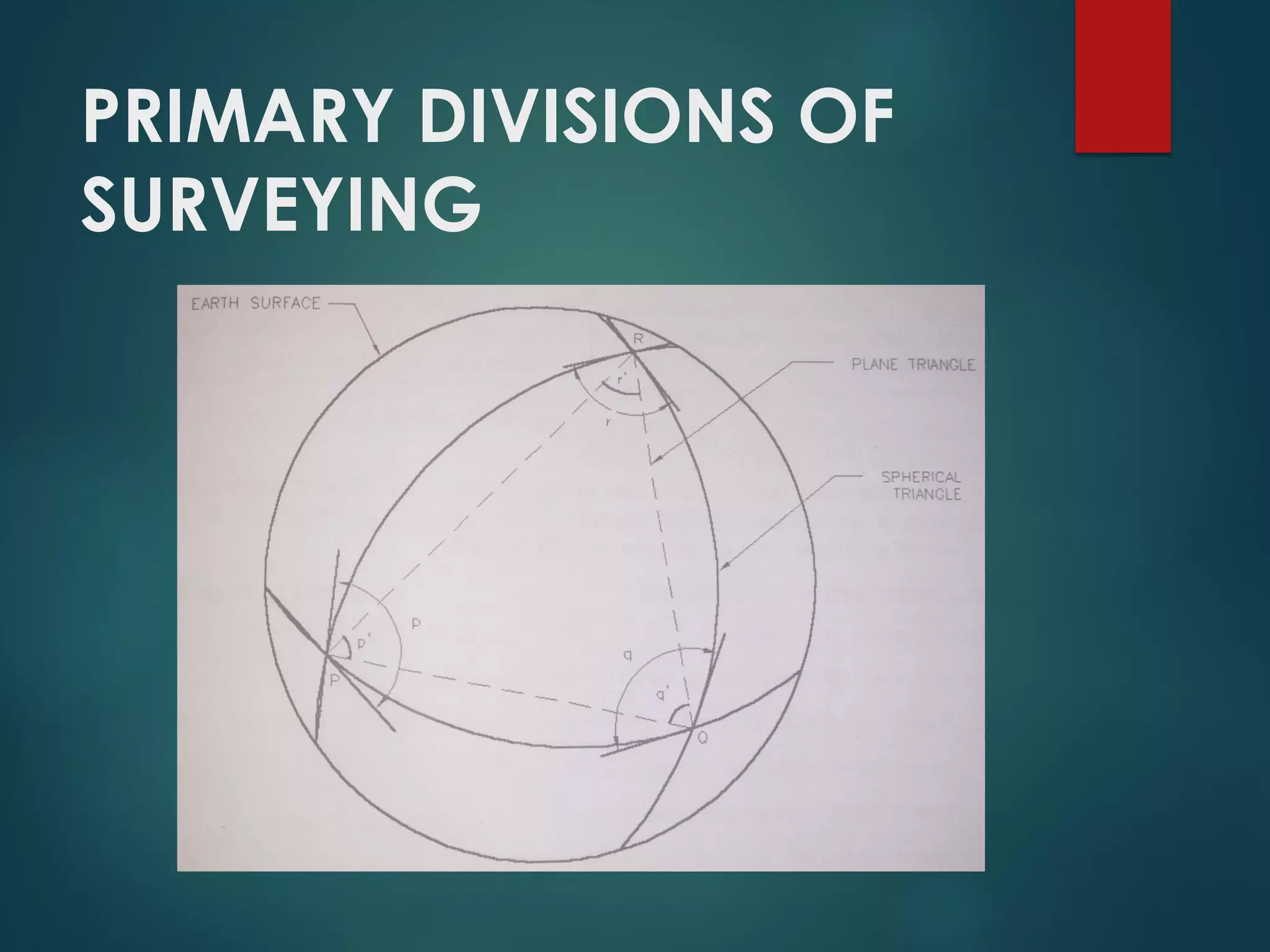
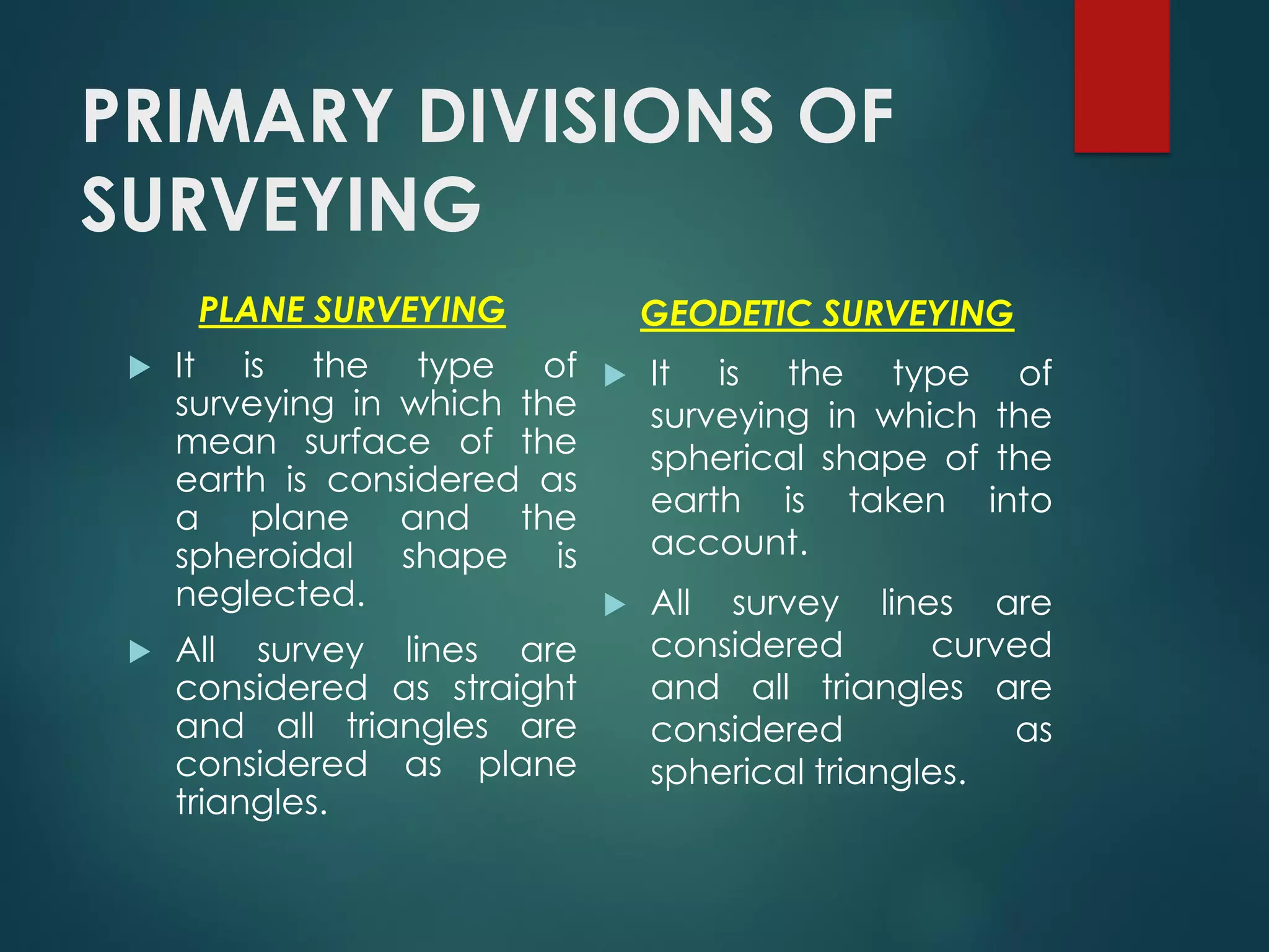
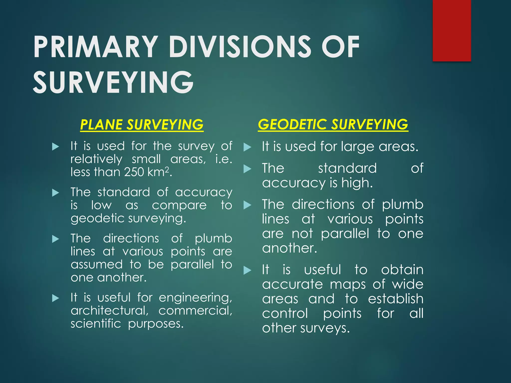
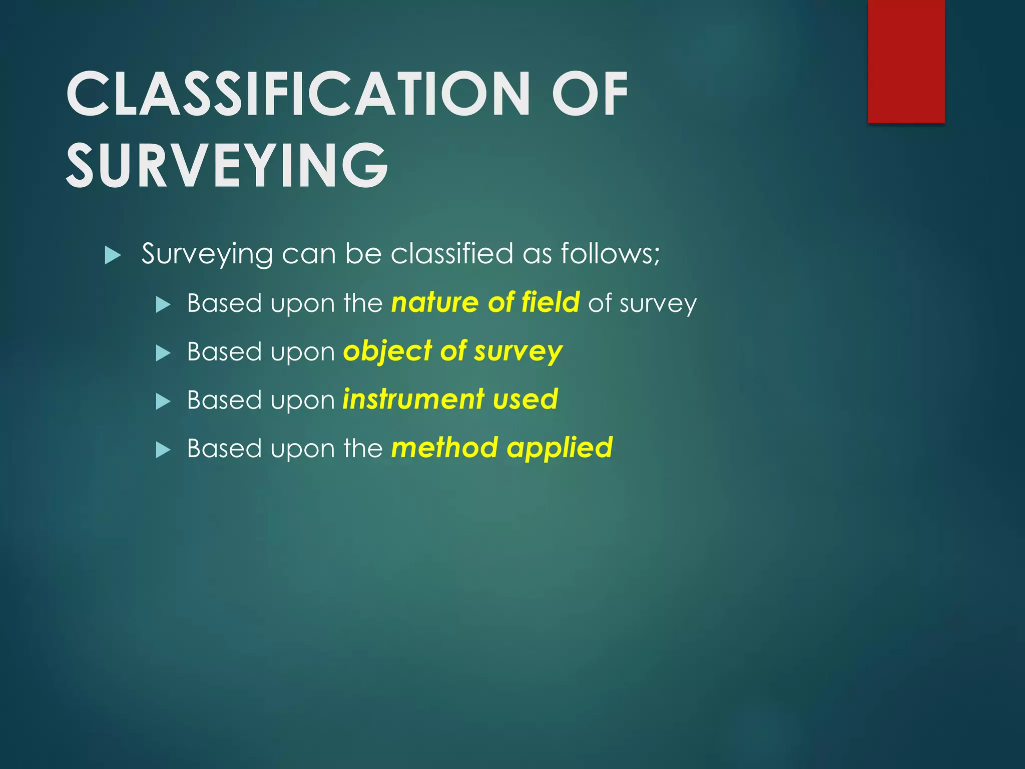
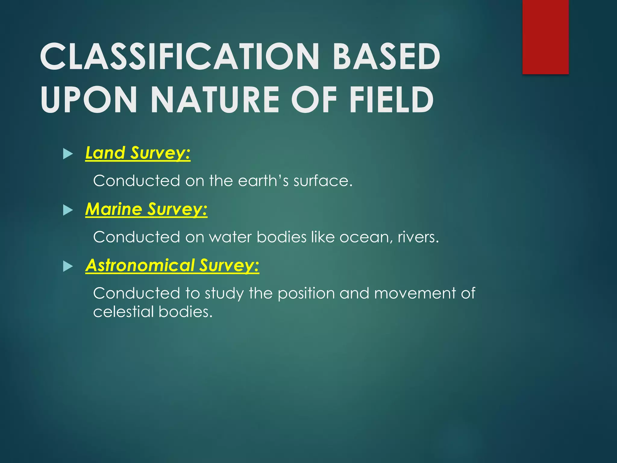
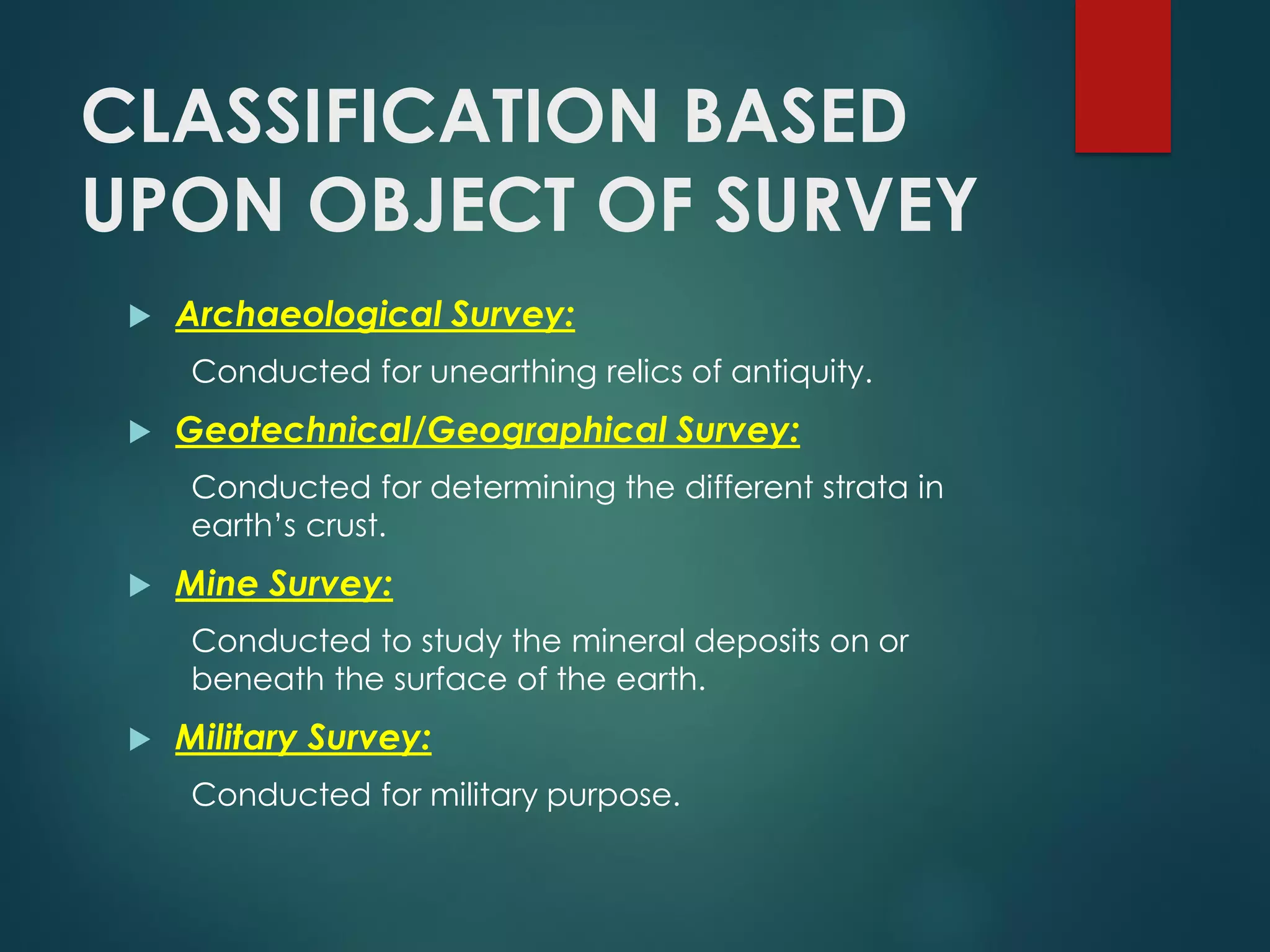
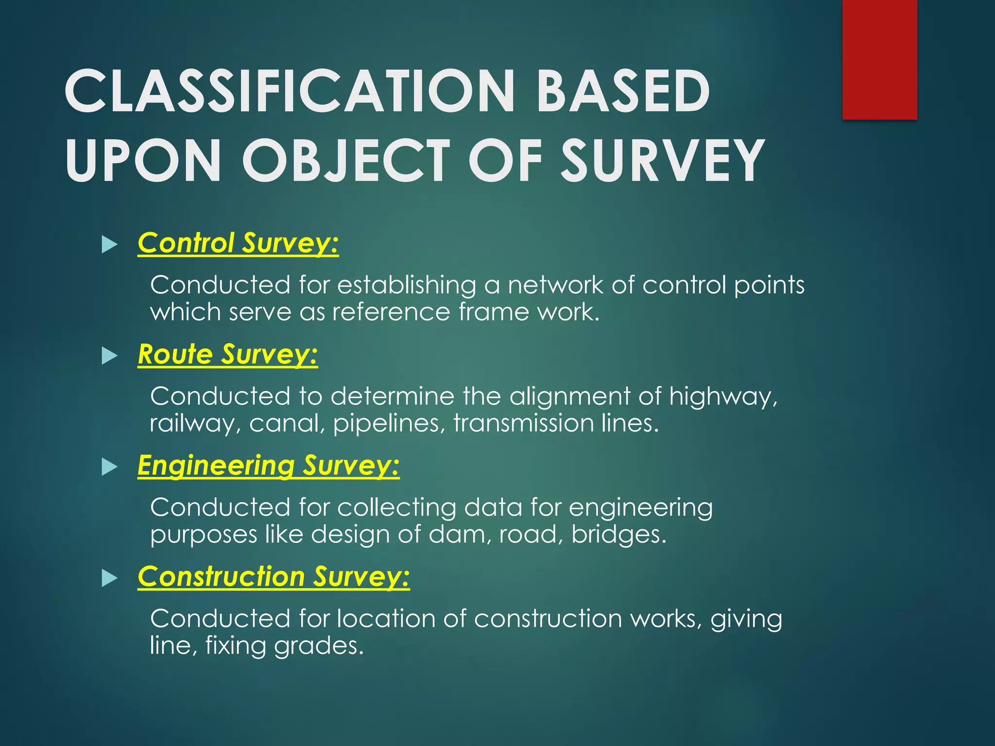
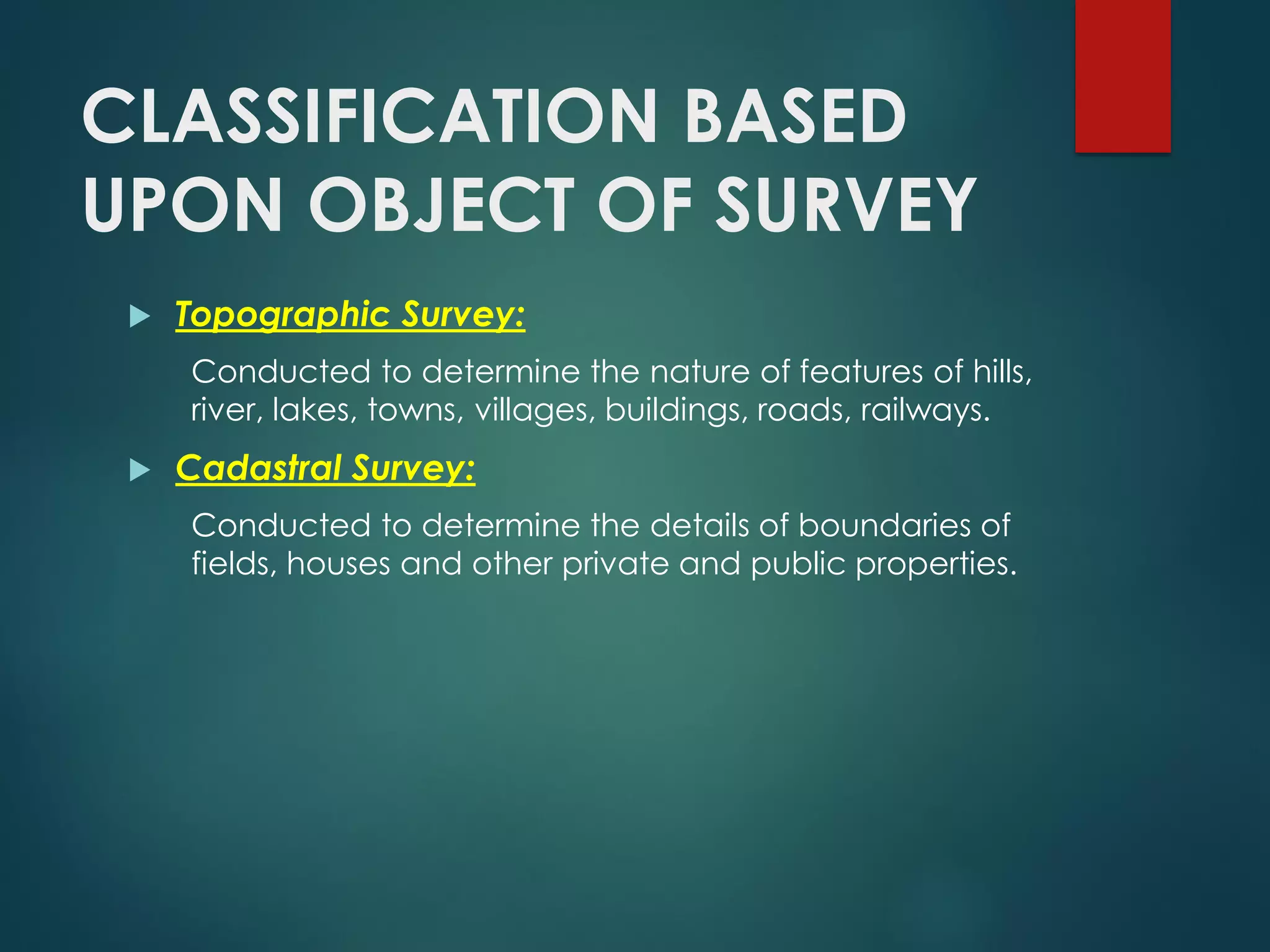
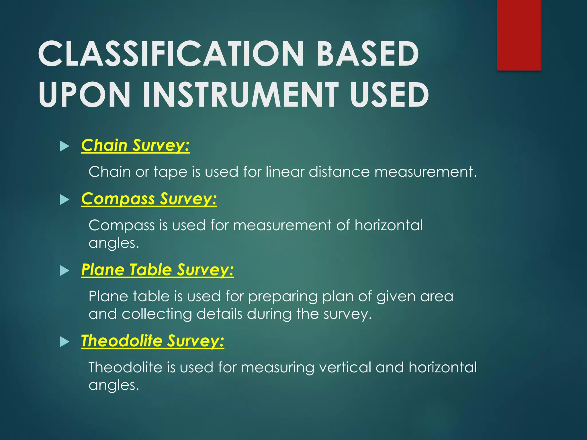
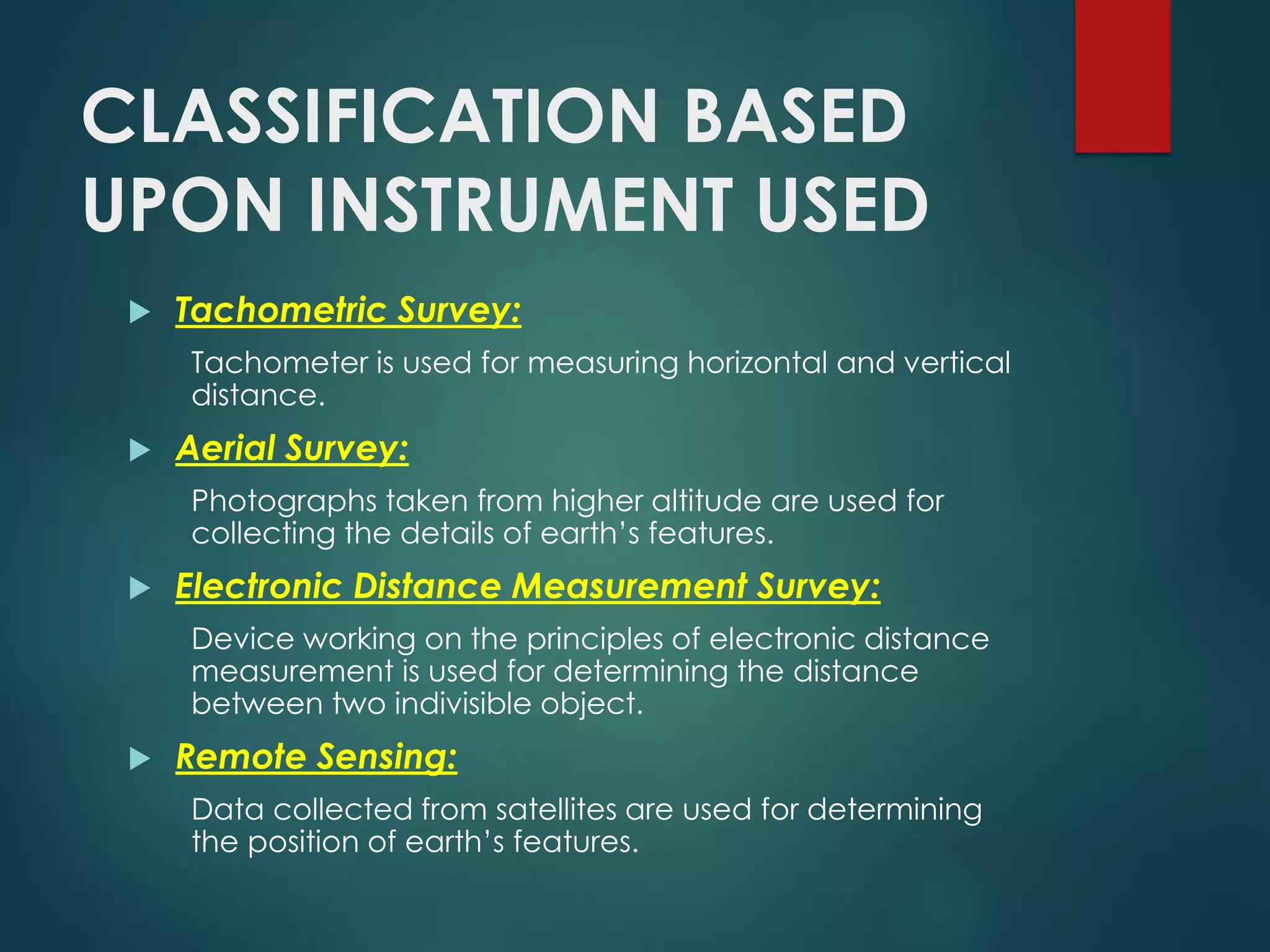
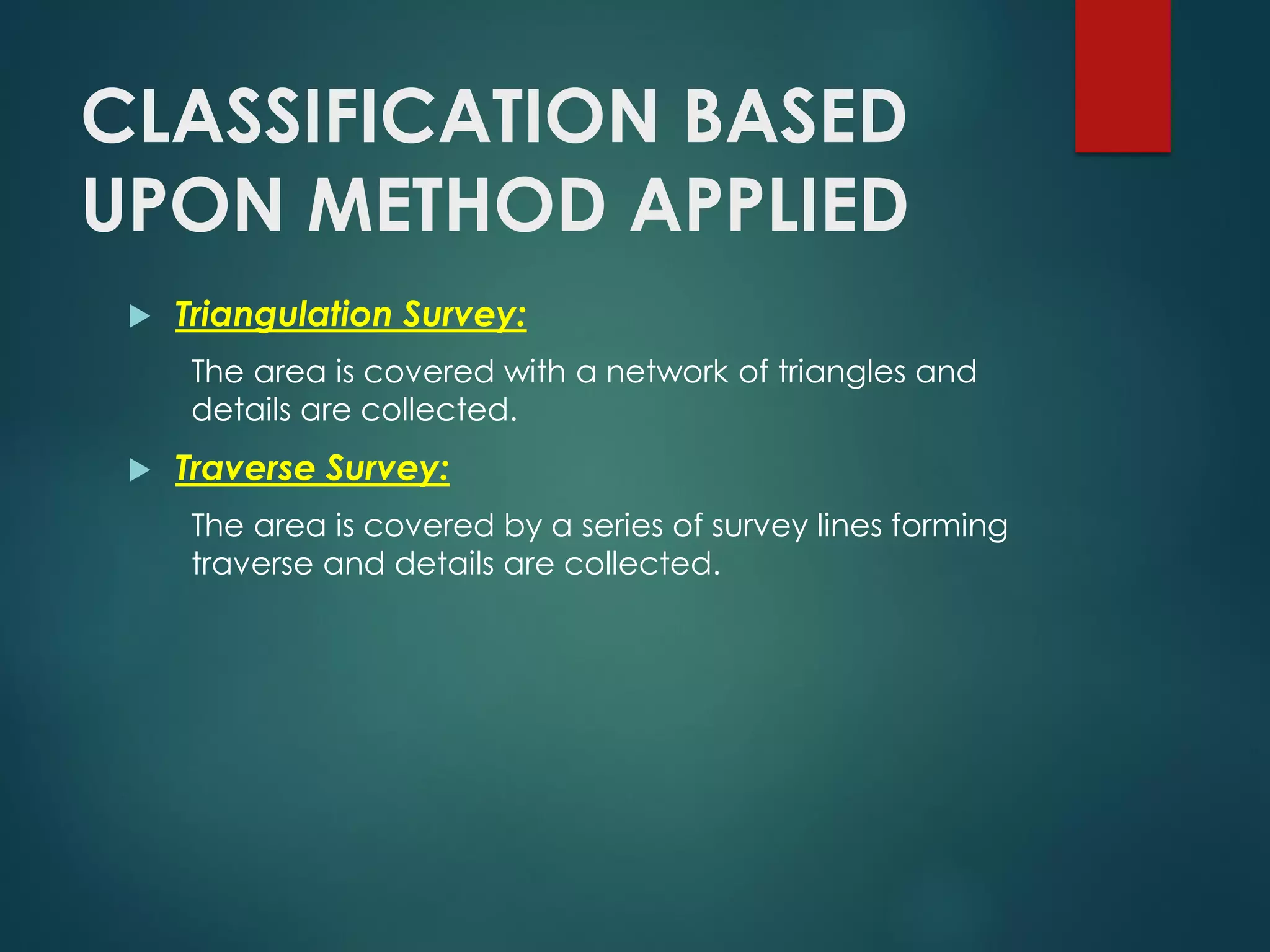
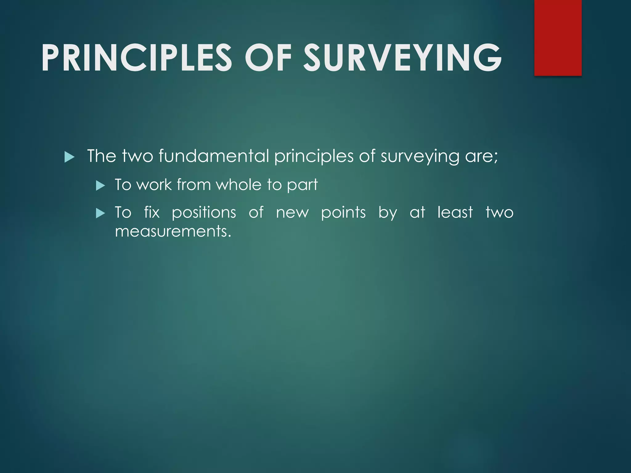
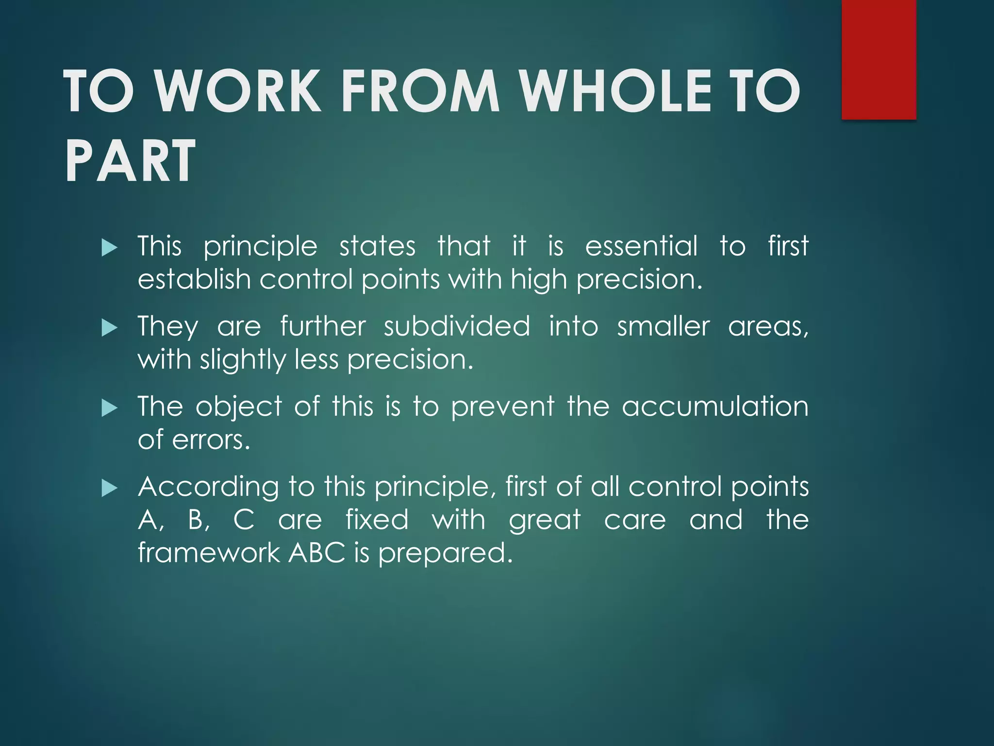
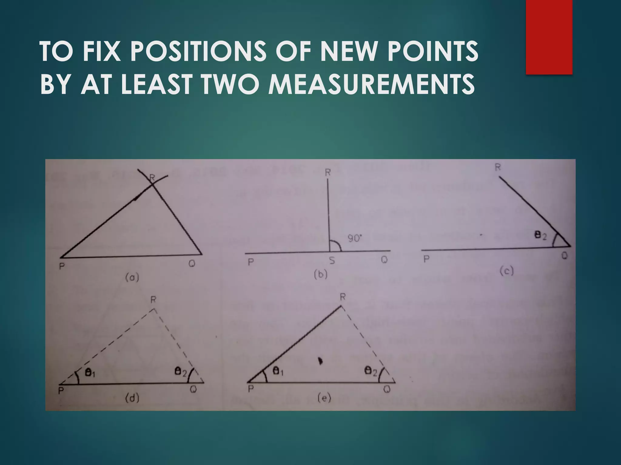
This document provides an introduction to surveying. It defines surveying as determining the relative positions of points on Earth through distance and angle measurements. It describes the primary purposes of surveying as measurement, boundary delineation, and mapmaking. The key divisions of surveying discussed are plane versus geodetic surveying, and classifications based on field type, purpose, instruments used, and methods applied. The document outlines fundamental surveying principles like working from overall control points to specifics, and fixing new points through minimum two measurements.


![Reading Techniques [Autosaved].pptxReading Techniques [Autosaved].pptx](https://cdn.slidesharecdn.com/ss_thumbnails/readingtechniquesautosaved-251211193055-b8821f9d-thumbnail.jpg?width=640&height=640&fit=bounds)


