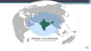
India is developing its own satellite navigation system called the Indian Regional Navigation Satellite System (IRNSS) to provide positioning capabilities similar to GPS. The IRNSS will consist of a constellation of 7 satellites (3 geosynchronous and 4 geosynchronous) and ground stations to provide navigation services with less than 10 meters of accuracy over India. Two satellites have already been launched with the goal of a complete operational system by 2015-2016 to provide real-time positioning and timing services to users across India and in the surrounding region.