NAVIC is India's regional satellite navigation system that provides accurate real-time positioning and timing services over India and 1500 km around it. It was launched to provide an alternative to foreign systems like GPS and ensure access to critical navigation services in all situations. The NAVIC system consists of 7 satellites (3 in GEO orbit and 4 in GSO orbit) that provide navigation signals in the L5 and S bands. NAVIC offers benefits for navigation, mapping, disaster management and more. It provides a more accurate positioning service than GPS over India and surrounding regions.
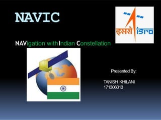
NAVIC (Navigation with Indian Constellation) is an Operational name of IRNSS.
Independent Indian Regional Navigation Satellite System
provide accurate position information service to users in India as well as the region extending up to 1500 km from its boundary.
In this Programme there are two levels of service/access to data
1. Standard Positioning Service (SPS)
-which is provided to all the users
2. Restricted Service (RS)
- which is an encrypted service provided only to the authorised users like Indian Security forces.
• NAVIC has total of 7 satellites of which 3 are in GEO (GeoStationary) orbit and 4 are in GSO (GeoSynchronous) orbit.
IRNSS is an independent regional navigation satellite system developed by India with an operational name of NAVIC ("SAILOR") or "navigator" in Sanskrit, Hindi and many other Indian languages.
The Indian Regional Navigation Satellite System or IRNSS is an ingenuously developed Navigation Satellite System that is used to provide accurate real-time positioning and timing services over India and region extending to 1500 km around India. The fully deployed IRNSS system consists of 3 satellites in GEO orbit and 4 satellites in GSO orbit, approximately 36,000 km altitude above earth surface.However, the full system comprises nine satellites, including two on the ground as stand-by.The requirement of such a navigation system is driven because access to foreign government-controlled global navigation satellite systems is not guaranteed in hostile situations, as happened to the Indian military depending on American GPS during the Kargil War.The IRNSS would provide two services, with the Standard Positioning Service open for civilian use, and the Restricted Service (an encrypted one) for authorized users (including the military).
NAVIC (Navigation with Indian Constellation)Mohan Kanni
A small presentation on NAVIC (Navigation with Indian Constellation) on what it consists of and its uses to the country from an ordinary person to commercial business and Military usage For National Security Purposes. Having a Indigenous Navigation system is Vital to country like India due to various prospects.
Global Positioning System . It gives the idea about Global Positioning System. It is one type of satellite made by India. Which means Indian reasearch Navigation 🧭
Group presentation done on GPS technology it covers
1.Introduction -History,Background
2.What is GPS - Technology, infrastructure
3.How GPS Works - Theory,Mathematical explanation
4.Applications of GPS
5.Drawbacks of GPS
6.Future Development
#References are added to the note section of the slides.
This content introduces the Global Navigation Satellite System (GNSS), its example, earth observation orbit types, coordinate systems, GNSS time system, converting height (ellipsoidal, geoid, orthometric heights) and various GNSS applications.
IRNSS is an independent regional navigation satellite system developed by India with an operational name of NAVIC ("sailor" or "navigator" in Sanskrit, Hindi and many other Indian languages), which also stands for ”NAVigation with Indian Constellation”.
Indian Regional Navigational Satellite System (IRNSS)Yelendher Reddy
1. THE BEGINNING
2. WHY?
3. SERVICES
4. ARCHITECTURE
5. SATELLITES
6. IRNSS COVERAGE
7. BENEFITS
Approved by Government of India in May 2006.
The total cost of the project is expected to be ₹1420 crore (US$209 million).
the full system comprises nine satellites.
3 satellites in GEO orbit.
4 satellites in GSO orbit.
2 on the ground as stand-by.
Third country in the world to have it’s own navigational system.
INDIAN REGIONAL NAVIGATIONAL SATELLITE SYSTEM (IRNSS)Yelendher Reddy
1. THE BEGINNING
2. WHY?
3. SERVICES
4. ARCHITECTURE
5. SATELLITES
6. IRNSS COVERAGE
7. BENEFITS
Approved by Government of India in May 2006.
The total cost of the project is expected to be ₹1420 crore (US$209 million).
the full system comprises nine satellites.
3 satellites in GEO orbit.
4 satellites in GSO orbit.
2 on the ground as stand-by.
Third country in the world to have it’s own navigational system.
Indian military depending on American GPS during Wars.
Here you can find out about every mission ISRO carried out in 2018. ISRO has so far carried out 110 missions on its 71 spacecrafts, out of which 9 were concluded in 2018.
This presentation covers:
Basics of Satellite communication
Indian Communication satellites
Satellite link and elements of satellite communication
Frequency bands of satellite communication
Different orbits of satellite communication
Link budget calculations
Ethnobotany and Ethnopharmacology:
Ethnobotany in herbal drug evaluation,
Impact of Ethnobotany in traditional medicine,
New development in herbals,
Bio-prospecting tools for drug discovery,
Role of Ethnopharmacology in drug evaluation,
Reverse Pharmacology.
Read| The latest issue of The Challenger is here! We are thrilled to announce that our school paper has qualified for the NATIONAL SCHOOLS PRESS CONFERENCE (NSPC) 2024. Thank you for your unwavering support and trust. Dive into the stories that made us stand out!
The Art Pastor's Guide to Sabbath | Steve ThomasonSteve Thomason
What is the purpose of the Sabbath Law in the Torah. It is interesting to compare how the context of the law shifts from Exodus to Deuteronomy. Who gets to rest, and why?
Students, digital devices and success - Andreas Schleicher - 27 May 2024..pptxEduSkills OECD
Andreas Schleicher presents at the OECD webinar ‘Digital devices in schools: detrimental distraction or secret to success?’ on 27 May 2024. The presentation was based on findings from PISA 2022 results and the webinar helped launch the PISA in Focus ‘Managing screen time: How to protect and equip students against distraction’ https://www.oecd-ilibrary.org/education/managing-screen-time_7c225af4-en and the OECD Education Policy Perspective ‘Students, digital devices and success’ can be found here - https://oe.cd/il/5yV
We all have good and bad thoughts from time to time and situation to situation. We are bombarded daily with spiraling thoughts(both negative and positive) creating all-consuming feel , making us difficult to manage with associated suffering. Good thoughts are like our Mob Signal (Positive thought) amidst noise(negative thought) in the atmosphere. Negative thoughts like noise outweigh positive thoughts. These thoughts often create unwanted confusion, trouble, stress and frustration in our mind as well as chaos in our physical world. Negative thoughts are also known as “distorted thinking”.
How to Create Map Views in the Odoo 17 ERPCeline George
The map views are useful for providing a geographical representation of data. They allow users to visualize and analyze the data in a more intuitive manner.
Palestine last event orientationfvgnh .pptxRaedMohamed3
An EFL lesson about the current events in Palestine. It is intended to be for intermediate students who wish to increase their listening skills through a short lesson in power point.
Operation “Blue Star” is the only event in the history of Independent India where the state went into war with its own people. Even after about 40 years it is not clear if it was culmination of states anger over people of the region, a political game of power or start of dictatorial chapter in the democratic setup.
The people of Punjab felt alienated from main stream due to denial of their just demands during a long democratic struggle since independence. As it happen all over the word, it led to militant struggle with great loss of lives of military, police and civilian personnel. Killing of Indira Gandhi and massacre of innocent Sikhs in Delhi and other India cities was also associated with this movement.
The Roman Empire A Historical Colossus.pdfkaushalkr1407
The Roman Empire, a vast and enduring power, stands as one of history's most remarkable civilizations, leaving an indelible imprint on the world. It emerged from the Roman Republic, transitioning into an imperial powerhouse under the leadership of Augustus Caesar in 27 BCE. This transformation marked the beginning of an era defined by unprecedented territorial expansion, architectural marvels, and profound cultural influence.
The empire's roots lie in the city of Rome, founded, according to legend, by Romulus in 753 BCE. Over centuries, Rome evolved from a small settlement to a formidable republic, characterized by a complex political system with elected officials and checks on power. However, internal strife, class conflicts, and military ambitions paved the way for the end of the Republic. Julius Caesar’s dictatorship and subsequent assassination in 44 BCE created a power vacuum, leading to a civil war. Octavian, later Augustus, emerged victorious, heralding the Roman Empire’s birth.
Under Augustus, the empire experienced the Pax Romana, a 200-year period of relative peace and stability. Augustus reformed the military, established efficient administrative systems, and initiated grand construction projects. The empire's borders expanded, encompassing territories from Britain to Egypt and from Spain to the Euphrates. Roman legions, renowned for their discipline and engineering prowess, secured and maintained these vast territories, building roads, fortifications, and cities that facilitated control and integration.
The Roman Empire’s society was hierarchical, with a rigid class system. At the top were the patricians, wealthy elites who held significant political power. Below them were the plebeians, free citizens with limited political influence, and the vast numbers of slaves who formed the backbone of the economy. The family unit was central, governed by the paterfamilias, the male head who held absolute authority.
Culturally, the Romans were eclectic, absorbing and adapting elements from the civilizations they encountered, particularly the Greeks. Roman art, literature, and philosophy reflected this synthesis, creating a rich cultural tapestry. Latin, the Roman language, became the lingua franca of the Western world, influencing numerous modern languages.
Roman architecture and engineering achievements were monumental. They perfected the arch, vault, and dome, constructing enduring structures like the Colosseum, Pantheon, and aqueducts. These engineering marvels not only showcased Roman ingenuity but also served practical purposes, from public entertainment to water supply.
How to Make a Field invisible in Odoo 17Celine George
It is possible to hide or invisible some fields in odoo. Commonly using “invisible” attribute in the field definition to invisible the fields. This slide will show how to make a field invisible in odoo 17.
3. Introduction
Theindian regional navigation satellite system or IRNSS
InApril 2016,with the last launch of constellation satellite ,
IRNSSwas renamed “NAVIC” by indian prime minister
‘Narendra modi’.
NAVIC–Navigation with IndianConstellation
NAVICmeans“sailor” or “navigator” in Sanskrit, Hindi and
many other indianlanguages.
An autonomous regional satellite navigation system.
provide accurate real –time positioning and timing services
over India and the region extending to 1500 km (930 miles )
around india.
4. Why l aunched?
Accessto foreign government controlled
‘Global Navigation Satellite Systems ‘ is not
guaranteed in hostilesituations
Ashappened to the Indian Military in 1999
when it wasdependent on theAmericanGPS
during the kargilwar.
5. Other Navigation satellite system
USA–Global
positioning system
(GPS)
RUSSIA–Glonass
EU-Gallileo
CHINA–Beiduo(BDS)
INDIA –NAVIC(IRNSS)
6. The Beginning
Approved by governmentof
india inMay 2006
Thetotal cost of the project is
expected to beRs1420crores
The fullsystem comprises 9
satellites
3satellites inGEOorbit
4 satellites inGSOorbit
2 on the ground asstand by
9. Space Segment
o Minimum number of
satellites required for
IRNSS constellation is
worked out to be 7 (3
geo and 4 gso ).
o The 3 geo will be located
at 32.5°, 83° and 131.5°
East. and
o the 4 gso have their
longitude crossings 55°
east and 111.75ºEast (two
in each plane).
10. NAVIC navigation signals
BAND SPS RS
L5 (1176.45MHz) BPSK BOC(5,2)
Sband(2492.028 MHz) BPSK BOC(5,2)
CDMARanging frequencies
up link : 6712.0MHz(BW 24 MHz)
Down link : 3412.0MHz(BW 24 MHz)
12. Satellites
IRNSS-1A:
Built at ISRO satellite centre , Bangalore .
It has a lift mass of 1380 kg and carries a navigation
pay load and c- band ranging transponder, which
operate in L5 band(1176.45 MHz)and s
band(2492.028)MHz .
IRNSS-1B:
It was placed in geo synchronous orbit on 4 april 2014
aboard the PSLV-C24 rocket from sathish dawan space
centre , sriharikota.
The IRNSS -1B satellites weighs 1,432 kg and has two
payloads : navigation payload and cdma ranging payload in
addition with a laser retro-reflector.
13. IRNSS-1C:
It was placed in GSO on 16 oct 2014 aboard PSLV-C26
from the sathish dawan space centre,sriharikota
IRNSS-1C satellite has two payloads :navigation payload
and cdma ranging payload
The navigation system so developed will be a regional one
targeted towards south asia .
The both 1B and 1C design of the payload
makes the IRNSS system inter-operable
and compatible with GPS and Galileo. . The
satellite will provide Navigation ,tracking and
mapping services
14. IRNSS 1-D:
It is fourth out of seven in the IRNSS satellite
system.
It was successfully launched using indian
PSLV –C27 on 28 march 2015.
IRNSS 1-E:
It is the fifth IRNSS satellite. it was launched
on 20 january 2016 using indian PSLV-C31.
A highly accurate Rubidium atomic clock is
part of the navigation payload of the satellite
It carries two types of payloads – navigation
and cdma ranging.
15. IRNSS-1F :
It is the sixth IRNSS satellite . It was launched on 10
march 2016 using indian PSLV-c32.
IRNSS-1G:
It is the seventh IRNSS satellite. It was launched
on 28 april 2016 using indian PSLV-C33,which
conclude the setting up of the IRNSS.
17. Clock failure
In 2017 it was announced that three rubidium atomic
clocks on board IRNSS -1A have all failed .
This rendors the satellite somewhat redundant
and requires replacement .
Although the satellite still performs other functions
,the data will be coarse ,and this cannot be used
for accurate measurement.
Isro plans to replace it with IRNSS-1H in the second
half of 2017.
18. GPS Vs NAVIC
• More accurate than theAmericanGPSsystem.
•UnlikeAmericanGPS,Isro is recommending asmall
additional hardware in handheld devices that can
receive S-Band signals from IRNSSsatellites and
inclusion of acode in the phone software to receive L-
Band signals.
•Both these L and S-band signals received are being
calculated by aspecial embedded software which
reducesthe errors causedby atmospheric disturbances
significantly. This, in turn, gives asuperior quality
location accuracythan theAmericanGPSsystem
21. Conclusion
NAVIC (Navigation with Indian Constellation) is an Operational
name of IRNSS.
Independent Indian Regional Navigation Satellite System
provide accurate position information service to users in India
as well as the region extending up to 1500 km from its
boundary.
In this Programme there are two levels of service/access to
data
1. Standard Positioning Service (SPS)
-which is provided to all the users
2. Restricted Service (RS)
- which is an encrypted service provided only to the authorised
users like Indian Security forces.
• NAVIChastotal of 7 satellites of which 3 are in GEO(GeoStationary)
orbit and 4 are in GSO (GeoSynchronous) orbit.