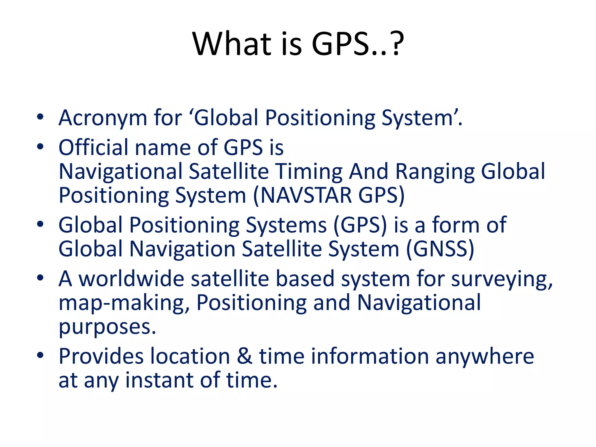
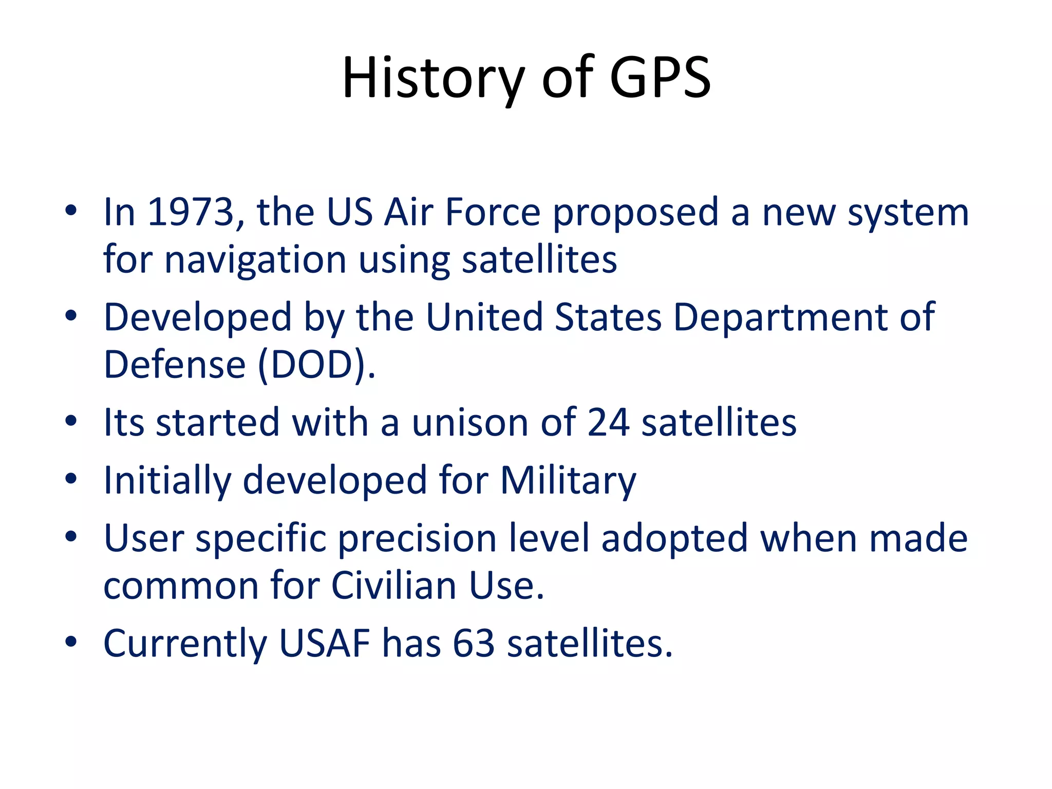
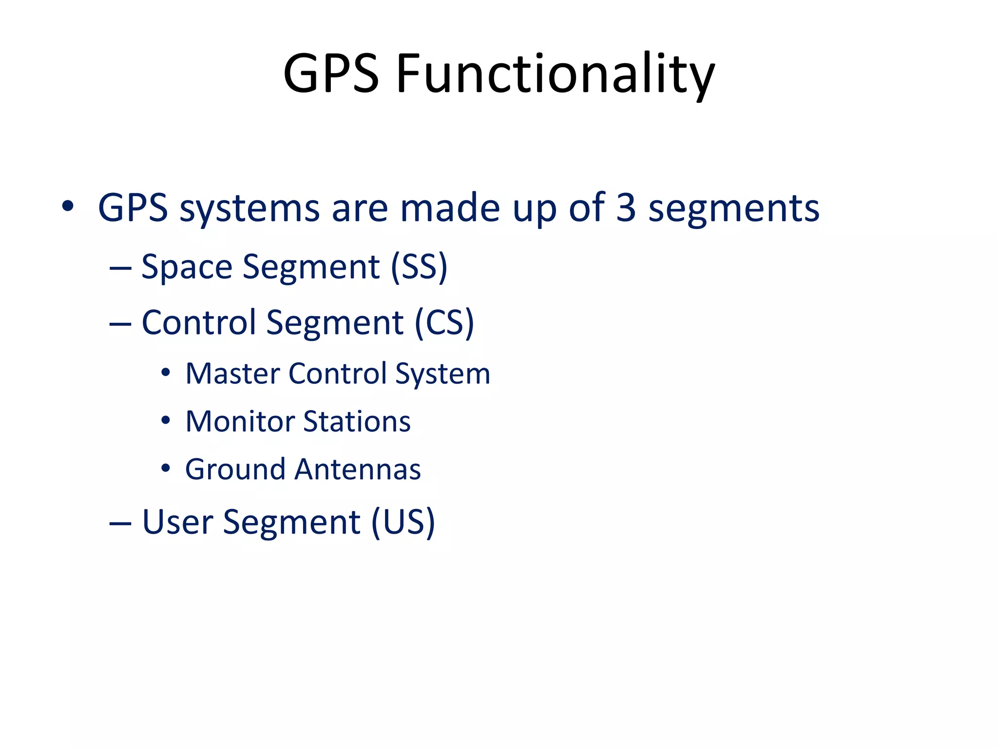
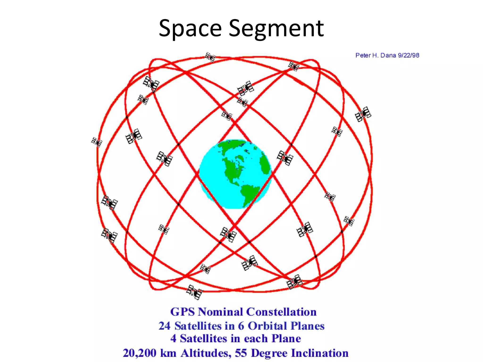
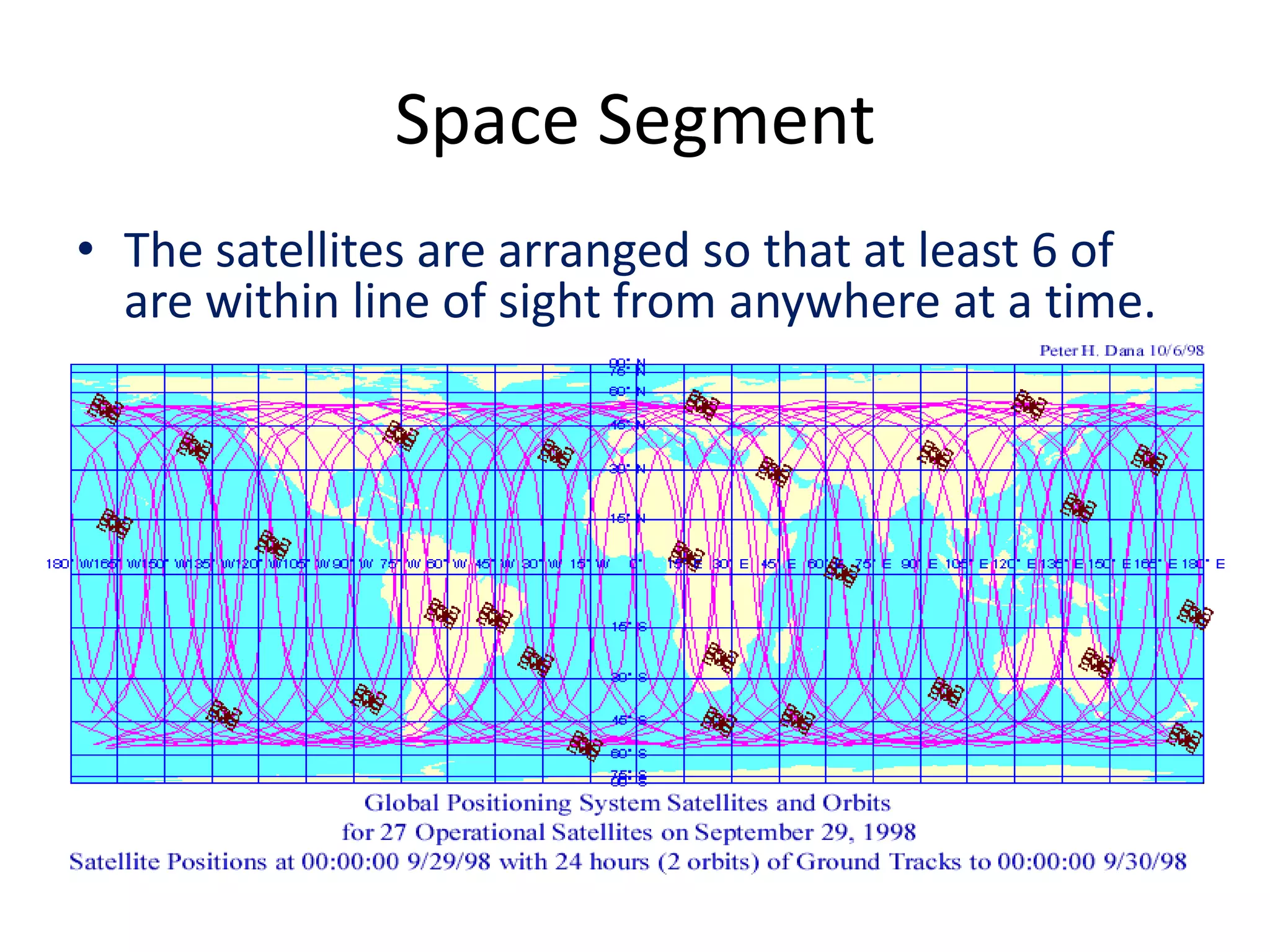
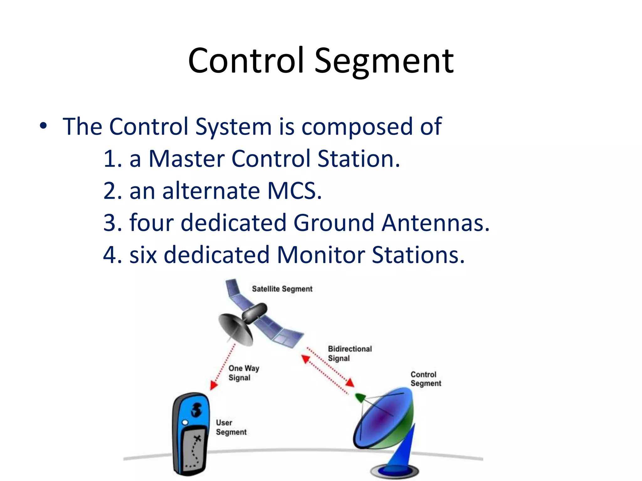
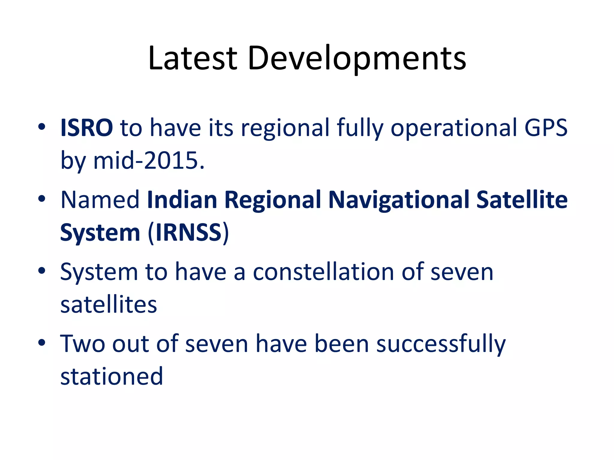
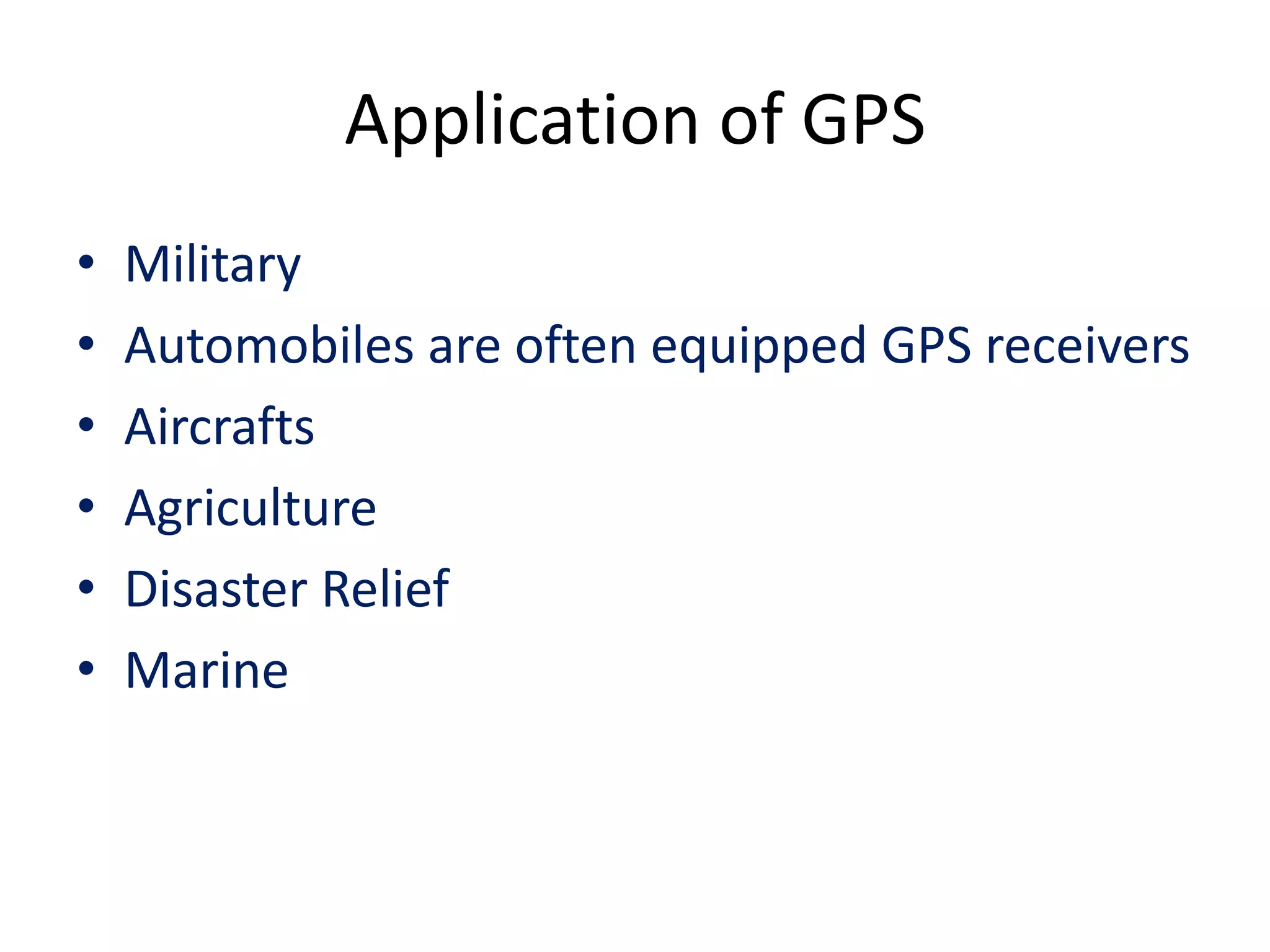
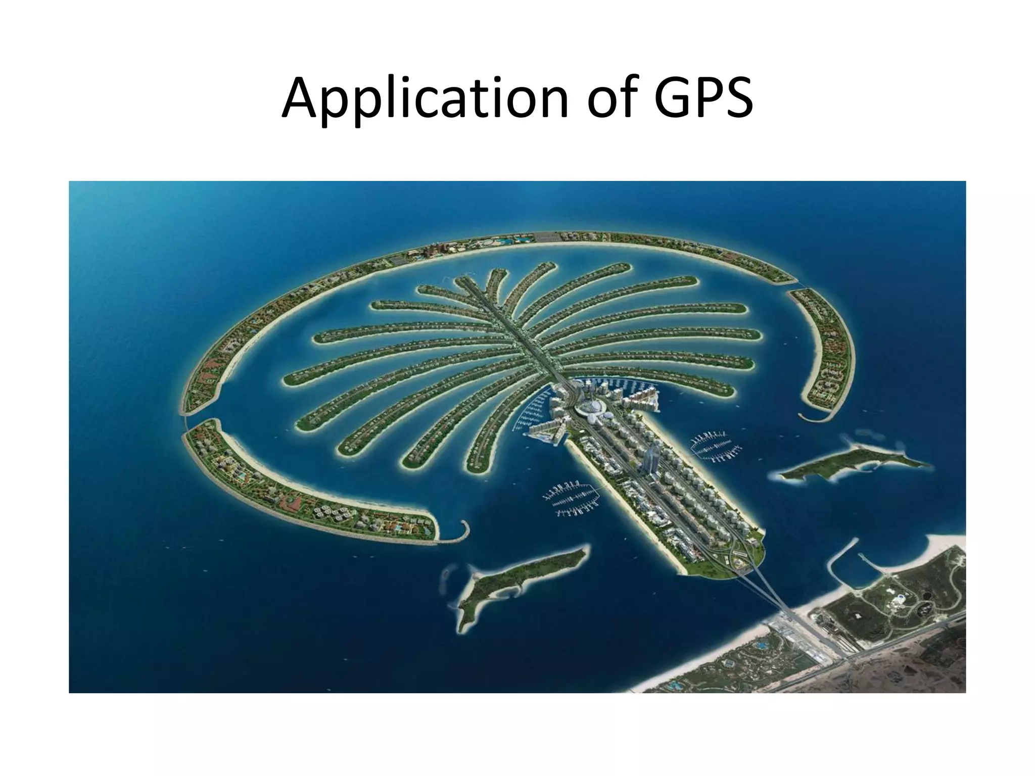
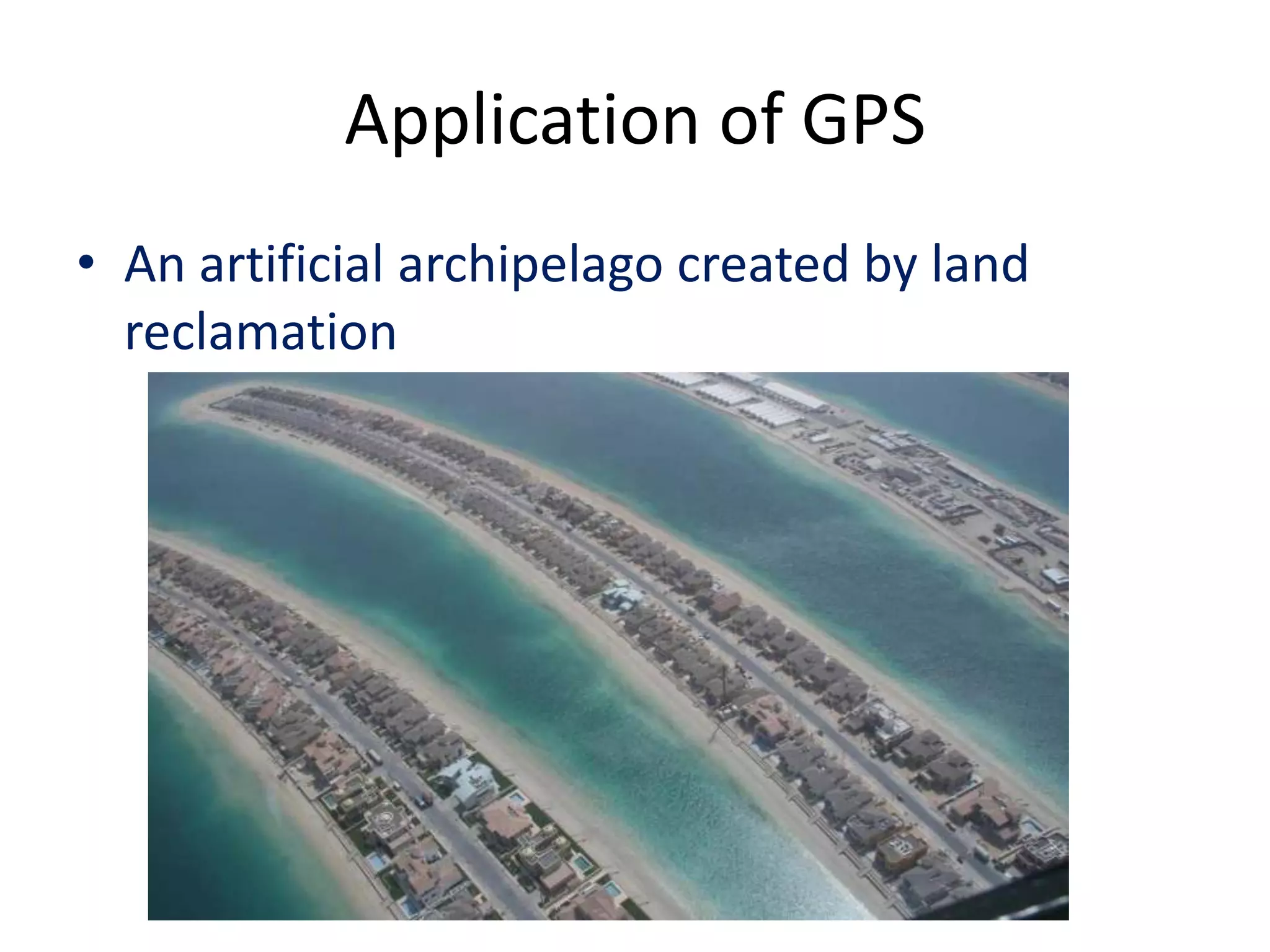
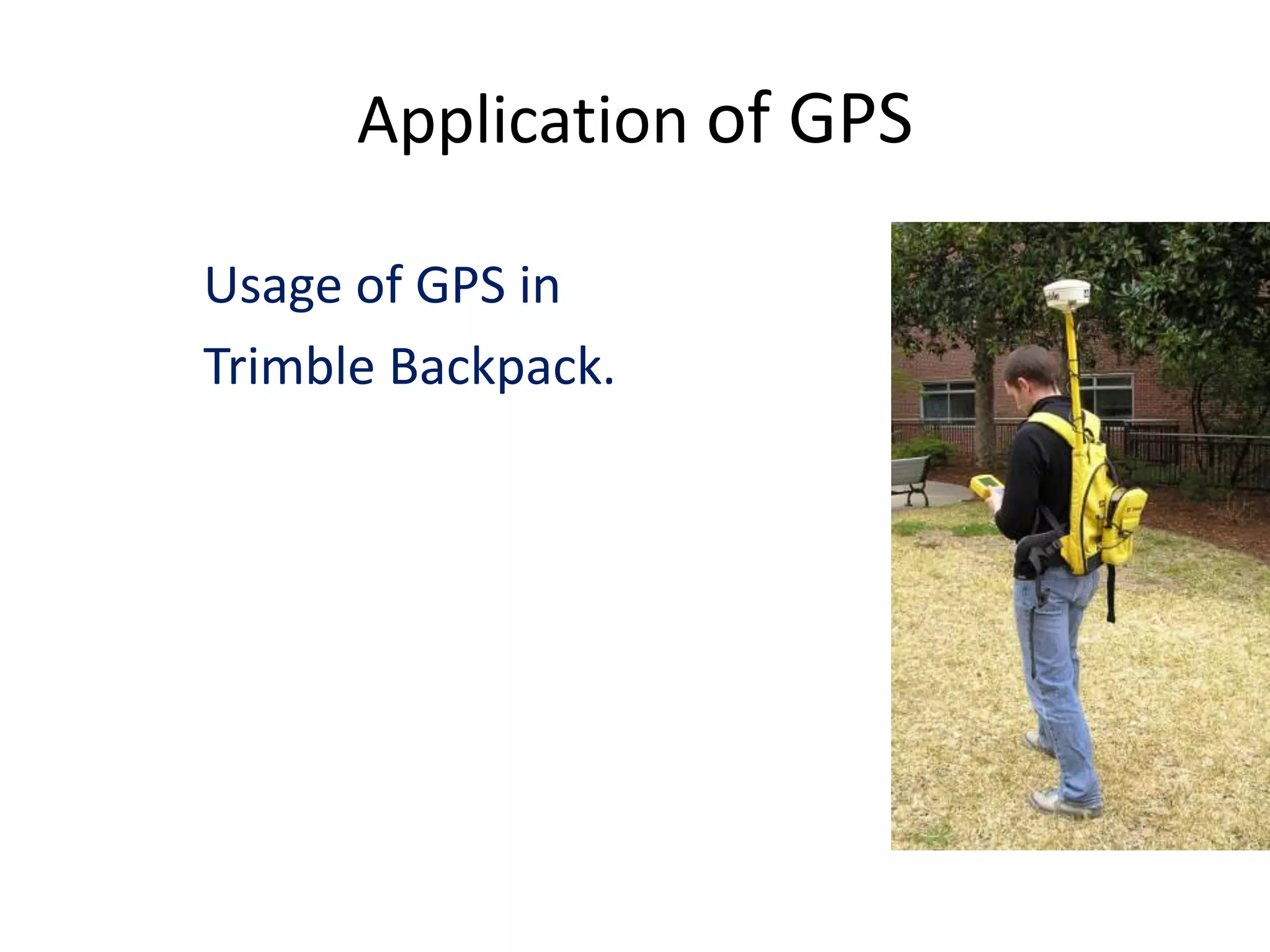
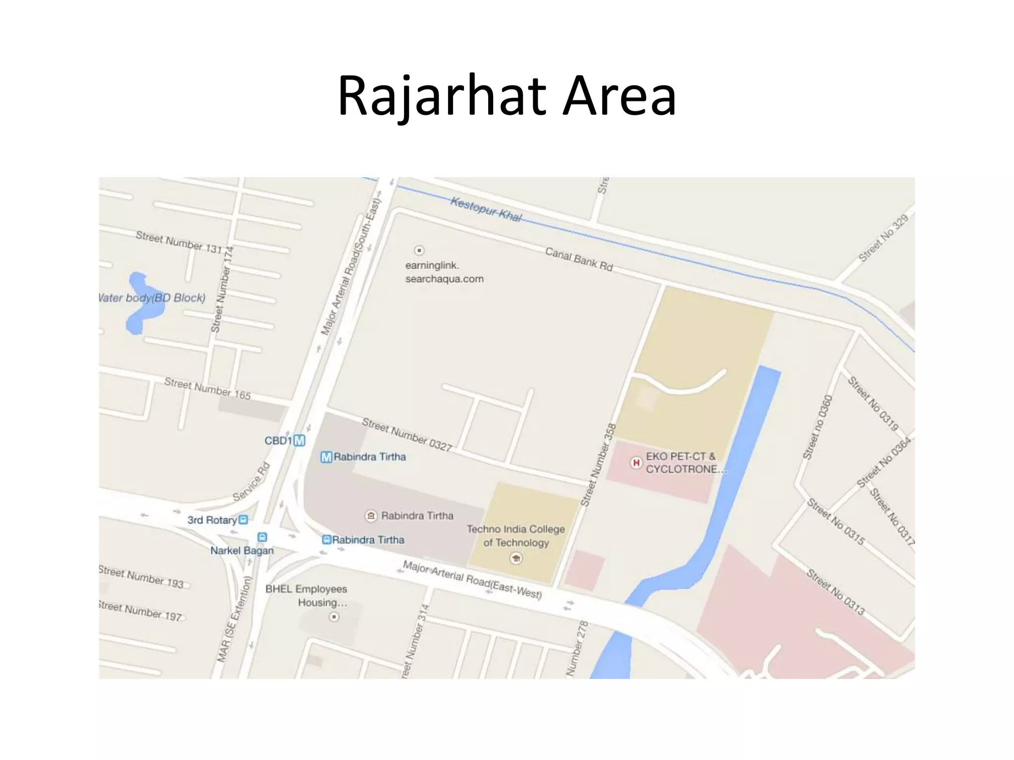
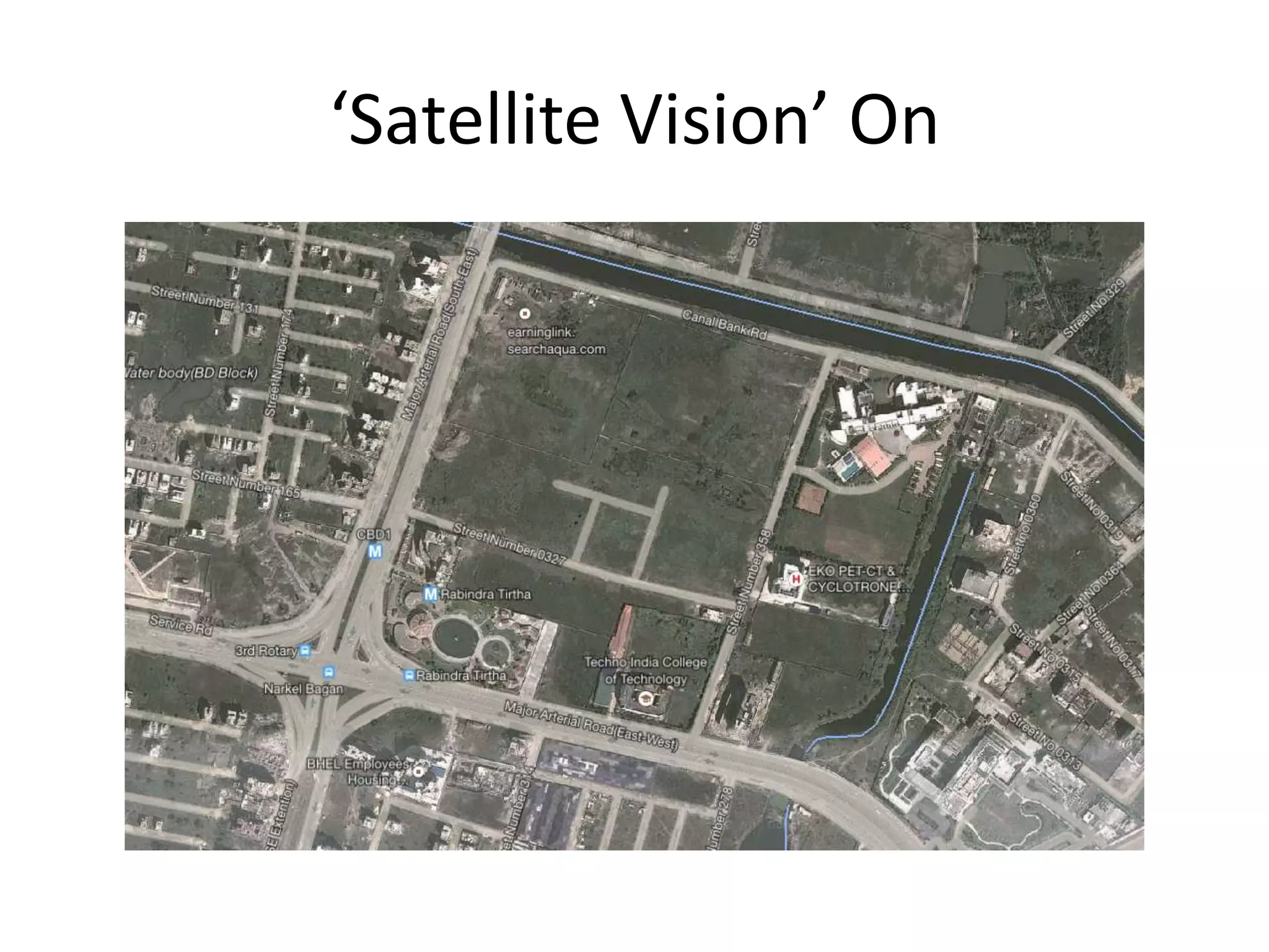
Seminar on GPS
Shaeq Ahmad
Electronics and Communication Engineering
6th Semester
Techno India College of Technology
What is GPS..?
• Acronym for ‘Global Positioning System’.
• Official name of GPS is
Navigational Satellite Timing And Ranging Global
Positioning System (NAVSTAR GPS)
• Global Positioning Systems (GPS) is a form of
Global Navigation Satellite System (GNSS)
• A worldwide satellite based system for surveying,
map-making, Positioning and Navigational
purposes.
• Provides location & time information anywhere
at any instant of time.
History of GPS
• In 1973, the US Air Force proposed a new system
for navigation using satellites
• Developed by the United States Department of
Defense (DOD).
• Its started with a unison of 24 satellites
• Initially developed for Military
• User specific precision level adopted when made
common for Civilian Use.
• Currently USAF has 63 satellites.
GPS Functionality
• GPS systems are made up of 3 segments
– Space Segment (SS)
– Control Segment (CS)
• Master Control System
• Monitor Stations
• Ground Antennas
– User Segment (US)
Space Segment
Space Segment
• GPS satellites fly in circular orbits at an
altitude of 20,200 km and with a period of 12
hours.
• Powered by solar cells, the satellites
continuously orient themselves to point their
solar panels toward the sun and their antenna
toward the earth.
• Each planes has about 55° tilt relative to
Earth's equator.
Space Segment
• The satellites are arranged so that at least 6 of
are within line of sight from anywhere at a time.
Control Segment
• The Control System is composed of
1. a Master Control Station.
2. an alternate MCS.
3. four dedicated Ground Antennas.
4. six dedicated Monitor Stations.
User Segment
• GPS Receivers composed of an Antenna,
tuned to the frequencies transmitted by the
satellites, receiver-processors, and a highly
stable clock(Crystal Oscillator).
• They may also include a display for providing
location and speed information to the user
GPS Frequency Overview
Band Frequency Description
L1 1575.42 MHz
Coarse-acquisition (C/A) and
encrypted precision (P(Y))
codes, plus the L1 civilian
(L1C) and military (M) codes
on future Block III satellites.
L2 1227.60 MHz
P(Y) code, plus the L2C and
military codes on the Block
IIR-M and newer satellites.
L3 1381.05 MHz
Used for nuclear detonation
(NUDET) detection.
GPS Frequency Overview
Band Frequency Description
L4 1379.913 MHz
Being studied for additional
ionospheric correction.
L5 1176.45 MHz
Proposed for use as a civilian
safety-of-life (Sol) signal.
GPS Signal
Latest Developments
• ISRO to have its regional fully operational GPS
by mid-2015.
• Named Indian Regional Navigational Satellite
System (IRNSS)
• System to have a constellation of seven
satellites
• Two out of seven have been successfully
stationed
Application of GPS
• Military
• Automobiles are often equipped GPS receivers
• Aircrafts
• Agriculture
• Disaster Relief
• Marine
Application of GPS
Application of GPS
• An artificial archipelago created by land
reclamation
Application of GPS
Usage of GPS in
Trimble Backpack.
More Applications
Now let us have a quick look
what GPS is to all of us
Rajarhat Area
‘Satellite Vision’ On
Our College
Conclusion
• GPS will find more civilian uses
• It can be used as a safety device
References
• http://www.physics.hmc.edu/research/geo/gp
s.html
• http://www.trackingtheworld.com/articles/th
e-future-of-gps-tracking-systems.php
• http://www.ndtv.com/article/india/isro-to-
give-india-its-desi-gps-504094

Global Positioning System for College Seminar

  • 1.
    Seminar on GPS ShaeqAhmad Electronics and Communication Engineering 6th Semester Techno India College of Technology
  • 2.
    What is GPS..? •Acronym for ‘Global Positioning System’. • Official name of GPS is Navigational Satellite Timing And Ranging Global Positioning System (NAVSTAR GPS) • Global Positioning Systems (GPS) is a form of Global Navigation Satellite System (GNSS) • A worldwide satellite based system for surveying, map-making, Positioning and Navigational purposes. • Provides location & time information anywhere at any instant of time.
  • 3.
    History of GPS •In 1973, the US Air Force proposed a new system for navigation using satellites • Developed by the United States Department of Defense (DOD). • Its started with a unison of 24 satellites • Initially developed for Military • User specific precision level adopted when made common for Civilian Use. • Currently USAF has 63 satellites.
  • 4.
    GPS Functionality • GPSsystems are made up of 3 segments – Space Segment (SS) – Control Segment (CS) • Master Control System • Monitor Stations • Ground Antennas – User Segment (US)
  • 5.
  • 6.
    Space Segment • GPSsatellites fly in circular orbits at an altitude of 20,200 km and with a period of 12 hours. • Powered by solar cells, the satellites continuously orient themselves to point their solar panels toward the sun and their antenna toward the earth. • Each planes has about 55° tilt relative to Earth's equator.
  • 7.
    Space Segment • Thesatellites are arranged so that at least 6 of are within line of sight from anywhere at a time.
  • 8.
    Control Segment • TheControl System is composed of 1. a Master Control Station. 2. an alternate MCS. 3. four dedicated Ground Antennas. 4. six dedicated Monitor Stations.
  • 9.
    User Segment • GPSReceivers composed of an Antenna, tuned to the frequencies transmitted by the satellites, receiver-processors, and a highly stable clock(Crystal Oscillator). • They may also include a display for providing location and speed information to the user
  • 10.
    GPS Frequency Overview BandFrequency Description L1 1575.42 MHz Coarse-acquisition (C/A) and encrypted precision (P(Y)) codes, plus the L1 civilian (L1C) and military (M) codes on future Block III satellites. L2 1227.60 MHz P(Y) code, plus the L2C and military codes on the Block IIR-M and newer satellites. L3 1381.05 MHz Used for nuclear detonation (NUDET) detection.
  • 11.
    GPS Frequency Overview BandFrequency Description L4 1379.913 MHz Being studied for additional ionospheric correction. L5 1176.45 MHz Proposed for use as a civilian safety-of-life (Sol) signal.
  • 12.
  • 13.
    Latest Developments • ISROto have its regional fully operational GPS by mid-2015. • Named Indian Regional Navigational Satellite System (IRNSS) • System to have a constellation of seven satellites • Two out of seven have been successfully stationed
  • 14.
    Application of GPS •Military • Automobiles are often equipped GPS receivers • Aircrafts • Agriculture • Disaster Relief • Marine
  • 15.
  • 16.
    Application of GPS •An artificial archipelago created by land reclamation
  • 17.
    Application of GPS Usageof GPS in Trimble Backpack.
  • 18.
    More Applications Now letus have a quick look what GPS is to all of us
  • 19.
  • 20.
  • 21.
  • 22.
    Conclusion • GPS willfind more civilian uses • It can be used as a safety device
  • 23.