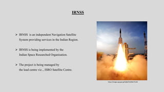
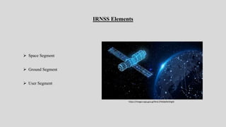
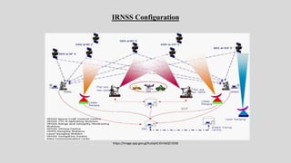
2. IRNSS
IRNSS is an independent Navigation Satellite
System providing services in the Indian Region.
IRNSS is being implemented by the
Indian Space Researched Organisation.
The project is being managed by
the lead centre viz.., ISRO Satellite Centre.
https://images.app.goo.gl/5qBaPJ2zK8bvTVLG9
3. IRNSS Applications
IRNSS provides fairly good accuracy and
the whole constellation is seen all the time.
There are plans to send integrity and
ionospheric correction messages to the user.
In view of the independent nature constellation
it is planned to cater to specialized users.
4. IRNSS Elements
Space Segment
Ground Segment
User Segment
https://images.app.goo.gl/NraL1FKddpNcGhgt6
6. Space Segment
Space Segment consists of Seven satellites.
3 satellites in GEO-Stationary orbit.
4 Satellites in GEO Synchronous orbit.
IRNSS Satellites are to be launched
by the Indian launcher PSLV.
8. Ground segment
IRNSS Ranging & Integrity Monitoring stations (IRIM)
• Receive the data from the GEOs
and GSOs.
• Transmit the data to Navigation Control
Centre.
• Facilitate One way ranging of the
GEOs & GSOs.
9. Ground Segment(cont’d)
IRNSS Navigation Control Centre(INC)
• Estimate and predict Ephemeris
• Determine Ionospheric corrections
• Determine Integrity
Spacecraft Control Centre (SCC)
• Manage and maintain the Satellite Constellation
10. USER Segment
The user segment consists of a specially
designed dual frequency receiver.
All the seven IRNSS satellites will be
continuously tracked by user receiver.
The user receiver will have min. G/T
of Db/K similar to GPS user receiver.
11. IRNSS Schedule
The first Satellite will be launched
by mind 2009.
The next three satellites will be
launched by end of 2010.
The entire constellation will be
in place by 2011.
12. FAQ’S
• How many satellites are there in IRNSS?
• How does IRNSS help in navigation?
• Which is the first navigation satellite
of India?
• Which type of satellite is IRNSS?
• How can we use IRNSS?