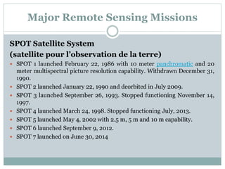
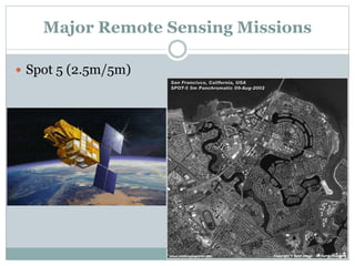
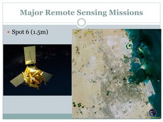
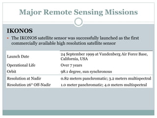
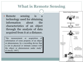
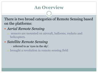
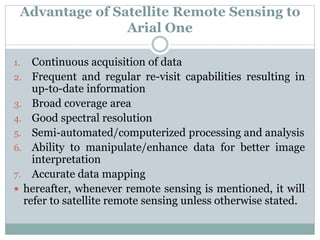
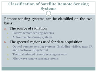
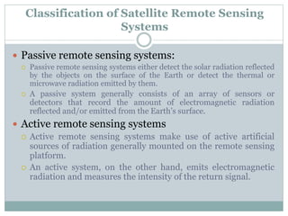
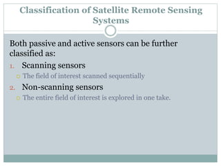
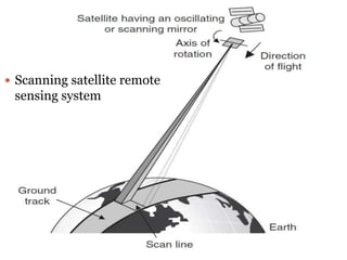
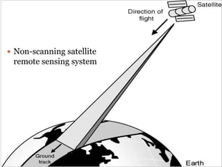
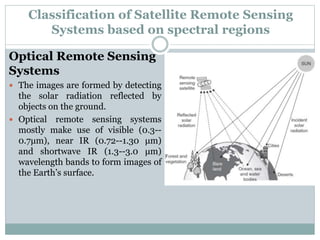
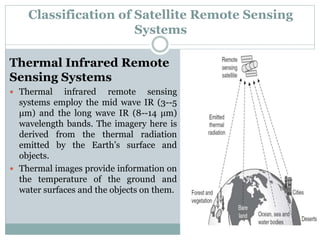
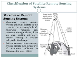
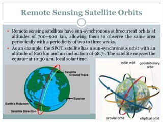
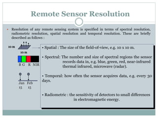
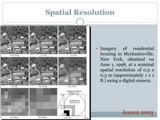
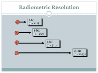
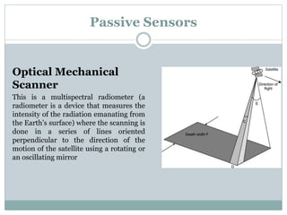
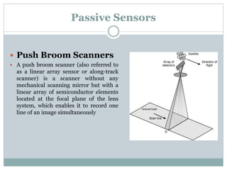
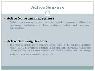
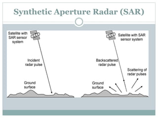
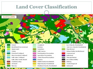
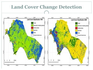
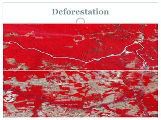
The document discusses remote sensing satellites. It begins by defining remote sensing as obtaining information about an object through analysis of data acquired from a distance without physical contact. There are two broad categories of remote sensing based on platforms: aerial and satellite. Satellite remote sensing has advantages like continuous data acquisition and broad area coverage. Remote sensing systems are classified based on the radiation source as passive or active, and based on spectral regions as optical, thermal infrared, or microwave. Key resolutions for remote sensing include spatial, spectral, temporal, and radiometric. Common applications are land cover mapping, change detection, flood monitoring, and more. Major satellite missions discussed are Landsat, SPOT, and IKONOS.
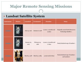
![Major Remote Sensing Missions(Landsat)
Instrument Picture Launched Terminated Duration Notes
Landsat 4 July 16, 1982
December 14,
1993
11 years, 4 months and
28 days
Landsat 5 March 1, 1984 June 5, 2013[7]
29 years, 3 months and
4 days
Nearly identical copy of Landsat 4.
Longest Earth-observing satellite
mission in history.
Landsat 6
October 5,
1993
October 5, 1993 0 days Failed to reach orbit.](https://image.slidesharecdn.com/remotesensingsatellitesin-160405131525/85/A-Brief-Introduction-to-Remote-Sensing-Satellites-35-320.jpg)
![Major Remote Sensing Missions(Landsat)
Instrument Picture Launched Terminated Duration Notes
Landsat 7 April 15, 1999 Still active
16 years, 11 months and
15 days
Operating with scan line corrector
disabled since May 2003.[8]
Landsat 8
February 11,
2013
Still active
3 years, 1 month and
19 days
Originally named Landsat Data
Continuity Mission from launch until
May 30, 2013, when NASA operations
were turned over to USGS.[9]](https://image.slidesharecdn.com/remotesensingsatellitesin-160405131525/85/A-Brief-Introduction-to-Remote-Sensing-Satellites-36-320.jpg)