Introduction to Robotics in Mechanical Engineering.pptx
Navic india's own navigation system
1. 2
IRNSS Architecture and Applications
Maddi venkata gopi a
a
Chebrolu Engineering College,Chebrolu,Guntur (D.T)Andhrapradesh.
Abstract— The Indian Regional Navigational Satellite System (IRNSS) is an autonomous regional
satellite navigation system being developed by the Indian Space Research Organization (ISRO) which
would be under complete control of the Indian government. The requirement of such a navigation system
is driven by the fact that access to Global Navigation Satellite Systems, GPS, is not guaranteed in hostile
situations. The IRNSS would provide two services, with the Standard Positioning Service open for civilian
use and the Restricted Service, encrypted one, for authorized users (military). Here in this paper we study
architecture and applications very briefly.
Keywords— IRNSS Constellation, Navigation, Architecture, Applications.
1) INTRODUCTION:-
ISRO developed a satellite based navigation system, called Indian Regional Navigation Satellite
System (IRNSS), with a constellation of 7 satellites and complementary round infrastructure. Two
spare satellites are also planned. The IRNSS system was planned to be made operational by end of
2014. Government has approved the IRNSS project at a total cost of Rs. 1420.00 crores in May 2006
for both space and ground infrastructure. The IRNSS is expected to provide positional accuracies
similar to the Global Positioning System (10 m over Indian landmass and 20 m over the Indian
Ocean) in a region centered around the country with a coverage extending up to 1,500 km from India
between longitude 40° E to 140° E and between latitude ± 40°.IRNSS was featured with highly
accurate position, velocity and time information in real time for authorized users on a variety of
vehicles. Data with good accuracy for a single frequency user with the help of Ionospheric
corrections. All weather operation on a 24 hour basis.
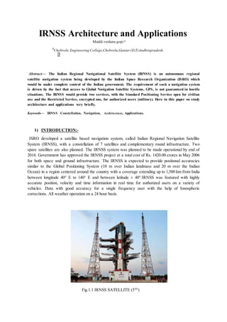
Fig.1.1 IRNSS SATELLITE (5TH
)
2. Polar Satellite Launch Vehicle in its twenty fourth flight (PSLV-C22) have launched India’s first
dedicated navigational satellite system IRNSS-1A. Each IRNSS satellite weights about 1,380 kg and
their solar panels generate 1,400 Watt of power.
2) IRNSS SATELLITE:-
The satellites will be configured with an optimized I-1K bus (compatible for launch onboard PSLV)
with a power handling capability of around 1600W. The satellite is designed for a nominal life of 7
years. Its payload will consist of electronic equipment to generate navigation signals and extremely
accurate on-board atomic clocks. The navigation signals in S-band (2-4 GHz) are fed to a high
performance phased array antenna for the required coverage. There is a ranging payload consisting of
a C-band transponder that facilitates accurate determination of the range of the satellite. IRNSS-1A
also carries corner-cube retro-reflectors for laser ranging.
FIG.2 IRNSS SATELLITE
The INRSS consist of three segments: space, ground and user. The space segment consists of a
constellation of seven satellites: three (Geostationary Orbit) GEOs located at 34° E, 83° E and 131.5°
E and four (Geosynchronous Orbit) GSOs at an inclination angle of 29° placed two each at with
equator crossing at 55° and 111° East.
IRNSS ground segment consists ground stations for generation and transmission of navigation
parameters, satellite control, satellite ranging and monitoring. A total of 20 stations are planned, most
of them located at airports along with GAGAN ground elements. IRNSS will have the two Master
Control Stations (MCS), which may be co-located with
GAGAN INMCC.
IRNSS will have two types of signals in L5 (1176.45 MHz) & S (2492.028 MHz) band. Both L5 and
S-band consists of two downlinks.
IRNSS provides two basic services such as Standard Positioning Service (SPS) for common civilian
users and Restricted services (RS) for special authorized users. The
3. system can be augmented with local area augmentation for higher accuracy
IRNSS is an autonomous regional satellite navigation system being developed by ISRO (Indian Space
Research Organization).The objective of the IRNSS is to implement an independent and indigenous
regional space borne navigation system for national applications.
The IRNSS design requirements call for a position accuracy of < 20 m
throughout India and within the region of coverage extending about 1500 km beyond. The system is
expected to provide accurate real-time position, velocity and time observables for users on a variety of
platforms with 24 hour x 7 day service availability under all weather conditions.The IRNSS was being
developed parallel to the GAGAN (GPS Aided GEO Augmented Satellite Navigation) program, the
ISRO SBAS (Satellite Based Augmentation System) version of an overlay system for GNSS signal
corrections
The IRNSS system consists of a constellation of seven satellites and a
supporting ground segment. Three of the satellites in the constellation will be placed in a
geostationary orbit and the remaining four in a geosynchronous inclined orbit of 29º relative to the
equatorial plane. Such an arrangement would mean all seven satellites would have continuous radio
visibility with Indian control stations.
ISRO has filed for 24 MHz bandwidth of spectrum in the L5-band (1164 - 1189 MHz) for IRNSS and
for the second signal in S-band (2483.5 - 2500 MHz).
3) The IRNSS constellation architecture consists of the following elements:
3.1 Space segment
The IRNSS satellites carry a navigation payload in a redundant configuration. A separate C-band
transponder for precise CDMA ranging is included in the payload configuration. The important
functions of the IRNSS payload are: Transmission of the navigational timing information in the L5
bands; transmission of navigation, timing informationin S-band; generation of navigation data on-
board, CDMA ranging transponder for precise ranging.
The navigation payload will have the following subsystems: NSGU
(Navigation Signal Generation Unit), Atomic clock unit, comprising of Rubidium atomic clocks,
clock management and control unit, frequency generation unit, modulation unit, high power amplifier
unit, power combining unit and navigation antenna.
The IRNSS spacecraft are dedicated for navigation services and they
are configured to be of a class that can be launched by the Indian launcher PSLV. The design
incorporates most of the proven subsystems available indigenously tailoring it is specifically for the
navigation Fig. 3 Deployed IRNSS Spacecraft
4. 3.2 Ground segment :-
The IRNSS ground segment includes the major systems for controlling the satellite constellation and
will consist of the IRNSS Spacecraft Control Facility (IRSCF), IRNSS Navigation Control Facility,
IRNSS Range and Integrity Monitoring Stations, ranging stations, a timing center, IRNSS TTC and
uplink stations, and the IRNSS Data Communication Network.
IRNSS Ground Segment Elements:-
· IRSCF (IRNSS Satellite Control Facility)
- IRTTC (IRNSS TTC and Land Uplink Stations)
- IRSCC (IRNSS Satellite Control Center)
· IRIMS (IRNSS Range and Integrity Monitoring Stations)
· IRNCF (IRNSS Navigation Control Facility)
· IRDCN (IRNSS Data Communication Network)
5. Seventeen IRIMS sites will be distributed across the country for orbit determination and ionospheric
modeling. Four ranging stations, separated by wide and long baselines, will provide two-way CDMA
(Code Division Multiple Access) ranging. The IRNSS timing center will consist of highly stable
clocks. The navigation center will receive all this data through communication links, then process and
transmit the information to the satellites.
IRNSS will have a network of 21 ranging stations geographically
distributed primarily across India. They provide data for the orbit determination of IRNSS satellites
and monitoring of the navigation signals. The data from the ranging/monitoring stations is sent to the
data processing facility at INC where it is processed to generate the navigation messages. The
navigation messages are then transmitted from INC to the IRNSS satellites through the spacecraft
control facility at Hassan/Bhopal. The state of the art data processing and storage facilities at INC
enable swift processing of data and support its systematic storage.
Fig. 4 IRNSS Ground Segment Architecture
3.3 User segment:-
The user segment consists of IRNSS receivers operating in:
· Single frequency (L5 at 1176.45 MHz or S-band at 2492.028 MHz)
· Dual frequency (L5 and S-band)
The single frequency and dual frequency receivers shall receive both SPS
(Special Positioning System), which is provided to all users, and RS (Restricted/Authorized Service)
signals, which is an encrypted service provided only to authorized users.
The IRNSS user receiver calculates its position using the timing
information embedded in the navigation signal, transmitted from the IRNSS satellites. The timing
information being broadcast in the navigation signal is derived from the atomic clock onboard the
IRNSS satellite.
6. The IRNWT (IRNSS Network Time) is determined from a clock
ensemble composed of the cesium and hydrogen maser atomic clocks at the INC (Indian Navigation
Centre) ground stations. As with UTC, IRNWT is also a weighted mean average time, but with two
substantial differences. IRNWT will be made available in real time and is a continuous time without
leap seconds. The IRNSS satellites carry a rubidium atomic frequency standard onboard. At INC
through navigation software, these onboard clocks are monitored and controlled. The deviation
between each of the satellite and IRNWT is modeled with a quadratic function of time, and the
parameters of this model are calculated and transmitted as a part of the IRNSS broadcast navigation
messages. The estimated accuracy is < 20 m over the Indian ocean region, and < 10 m over
main land India.
Fig .5 India Coverage by NaVic
The parameters are often called as clock bias (A0) or the clock offset (in seconds), drift (A1) or the
relative frequency instability (in seconds/second) and aging (A2), also referred to as relative
frequency shift (in seconds/second2). Apart from these corrections, any IRNSS users should consider
the necessary relativistic time adjustment. With these adjustment parameters, which are usually
calculated once per day, are then transmitted to the satellites, thus the satellite clock errors are
expected to be well within 5-10ns which fulfills the requirement.
4 . Navigation payload
Each satellite has two payloads : the Navigation payload and the CDMA ranging payload in addition
with a retroreflector array. The payload generates navigation signals at L5 and S- band. The design of
the payload makes the IRNSS system interoperable and compatible with GPS and Galileo. · A highly
accurate Rubidium atomic clock is part of the navigation payload.
· The ranging payload of IRNSS-1A consists of a C-band transponder which facilitates accurate
determination of the spacecraft range.
5. IRNSS Signals
7. The IRNSS constellation is expected to provide position accuracy (2¿) of better than 20 m over India
and a region extending outside the Indian land mass to about 1,500 km. The system will provide two
types of services:
1) SPS (Standard Positioning Service)
2) RS (Restricted/Authorized Service)
Both of these services will be provided at two frequencies, one in the L5 band and the other in S-
band.
SPS will use bi-phase shift keying BPSK (1) modulation, whereas the
RS service will employ binary offset carrier (BOC (5, 2)) modulation. An additional BOC pilot signal
is being provided for the RS Service in order to help provide better acquisition and performance. As
each L5-band and S-band contains three signals, the IRNSS design adds an interplex signal in order to
maintain the constant envelope characteristic of the composite signal.
The transmission is done using the L-band and S-band helix array
antenna to provide global coverage in right-hand circularly polarized (RHCP) signals. Thus, user
receivers can operate in single-and/or dual-frequency mode.
6.Timing group delay
The time of radiation of the navigation signals on each carrier frequency and among frequencies is not
synchronized due to the different digital and analog signal paths that each signal must travel from the
IRNSS satellite signal generator to the transmit antenna. This hardware group delay is defined as a
time difference between the transmitted RF signal (measured at the phase center of a transmitting
antenna) and the signal at the output of the onboard frequency source.
Three different parameters comprise this group delay: a fixed/bias
group delay, a differential group delay and a group delay uncertainty in bias and differential value.
The fixed delay or hardware group delay is a bias term included in the clock correction parameters
transmitted in the navigation data and is, therefore, accounted for by the user computations of system
time in the appropriate GPS interface specifications. More specifically, this delay represents the
amount of time it takes the signal to start from the common clock, travel through each code generator,
modulator, up-converter, transmitter, and finally emerge from the satellite antenna.
The hardware group delay uncertainty reflects the variability in the path delay
due to changeable conditions in the operational environment and other factors. The effective
uncertainty of the group delay will be in the range of few nanoseconds (on the order of 1-3 ns).
Each IRNSS navigation signal has two hardware paths - main and redundant. The hardware will
each IRNSS navigation signal has two hardware paths - main and redundant. The hardware will be
different for each path in terms of data generator, modulator, up converter, travelling-wave tube
amplifier (TWTA), cable, and integration components.
8. In case of failure, the signal will be diverted from the main subsystem to the
redundant subsystem. he delay of main and redundant subsystem will be different and thus cause a
difference in the mean path delay based on the selected path for the navigation signal.
Differential group delay is the difference in delays between two navigation
signals. It consists of random plus bias components. The mean differential is defined as the bias
component and will be either positive or negative. For a given navigation payload redundancy
configuration, the absolute value of the mean differential delay shall not exceed a few nanoseconds,
i.e., on the order of 15 to 30 ns.
IRNSS-1A was the first of the seven satellites constituting the space segment of
the Indian Regional Navigation Satellite System. IRNSS is an independent regional navigation
satellite system designed to provide position information in the Indian region and 1500 km around the
Indian mainland. IRNSS would provide two types of services, namely, Standard Positioning Services
(SPS) - provided to all users - and Restricted Services (RS) provided only to authorize users.
A number of ground stations responsible for the generation and transmission of
navigation parameters, satellite control, satellite ranging and monitoring, etc., have been established
in as many as 15 locations across the country.
The entire IRNSS constellation of seven satellites is planned to be completed by 2015-16.
REFERECES
[1] Indian Regional Navigational System by Parimal Majihiya, J.K.Hota.(www.inside Gnss.com)
[2] Analysis of IRNSSover Indian Subcontinent by Vyasaraj GuruRao1, GerardLachapelle1, Vijay KumarSB2 ION ITM 2011,Session
B5, San
Diego, CA, 24-26January2011.
[3] Leick, A. (1995), GPS Satellite Surveying Second Edition, John Wiley & Sons, Inc.
[4] Bhaskaranarayana, A. (July 15th 2008) Indian IRNSS & GAGAN, Presentation to COSPAR Meeting, Montreal.
[5] G. X. Gao (2007), “DME/TACANInterference andits Mitigationin L5/E5 Bands” in ION Institute ofNavigation
Global Navigation Satellite Systems, Conference, 2007.
[6] IRNSS-Satellite Mission-eo Portal Directory –Earth online directory.eoportal.org.
.
9. Index
1) Abstract …………………………………………………………………… 1
2) Introduction…………………………………………………………………1 – 2
3) IRNSS satellite ………………………………………………………………2-3
4) Segments in IRNSS architecture……………………………………………..
i) Space Segment……………………………………………………..3-4
ii) Ground Segments and Elements…………………………………..4-5
iii) User Segment ……………………………………………………...6-7
5)IRNSS signals………………………………………………………………….7
6)Timing Group Delay…………………………………………………………...7-8
7)References ………………………………………………………………………8
10. A Seminar Report on
NaVic India’s Own Navigation System
A Dissertation submitted to
JAWAHARLAL NEHRU TECHNOLOGICAL UNIVERSITY, Kakinada.
In the partial fulfillment of the requirements for the award of the degree of
Submitted by
Maddi Venkata Gopi
(14HU1A0425)
CHEBROLU ENGINEERING COLLEGE
(Approved by AICTE, NEW DELHI & Affiliated to JNTUK, Kakinada, AP)
CHEBROLU (Village & Mandal), GUNTUR-522212