Downloaded 397 times


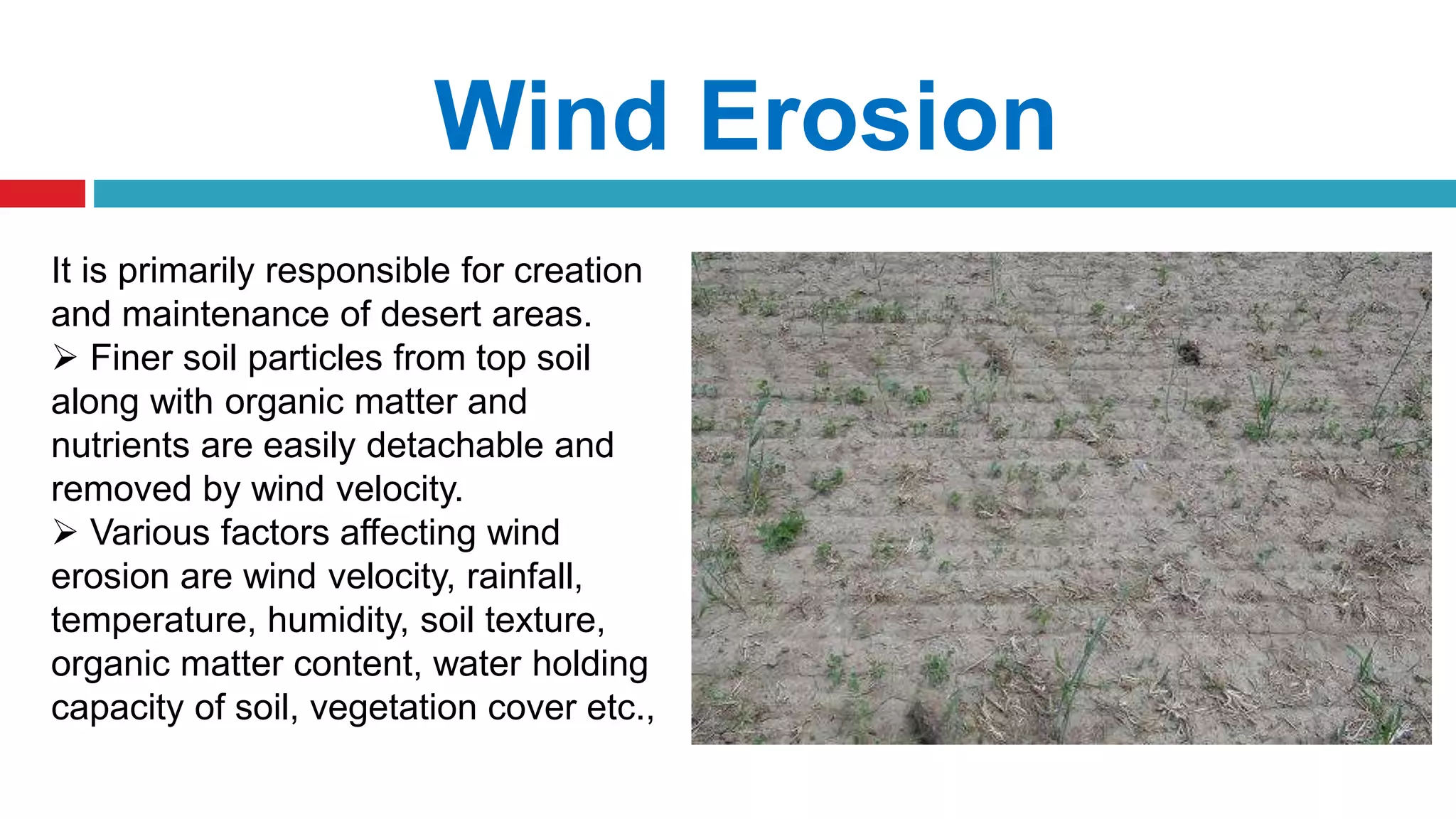


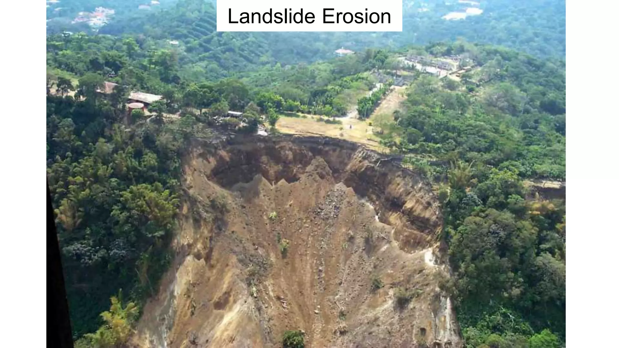


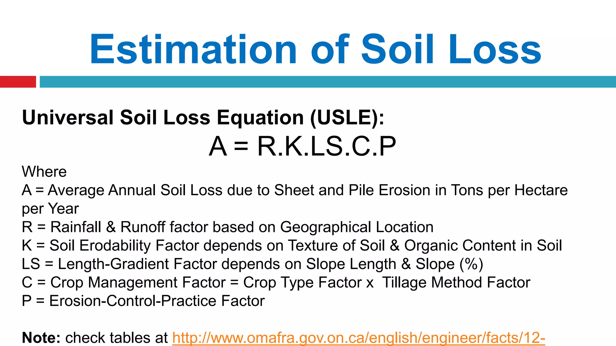


The document discusses soil erosion, its types, causes, effects, and measures for erosion control in watershed management. It distinguishes between natural geologic erosion and man-made accelerated erosion, illustrating the impact of factors like rainfall, wind, and agricultural practices. Additionally, it presents the Universal Soil Loss Equation (USLE) for estimating soil loss, highlighting its applicability to various land use scenarios.