Download as PDF, PPTX

![5
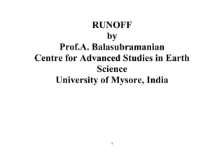
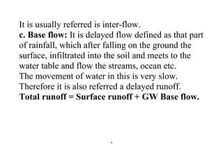
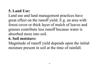
a. Surface Runoff:
That portion of rainfall which enters the stream
immediately after the rainfall.
It occurs when all loses is satisfied and rainfall is
still continued and rate of rainfall [intensity] in
greater than infiltration rate.
b. Sub-Surface Runoff:
That part of rainfall which first leaches into the
soil and moves laterally without joining the water
table, to the stream, rivers or ocean is known as
sub-surface runoff.](https://image.slidesharecdn.com/runoff-170730154611/85/Runoff-5-320.jpg)
![14
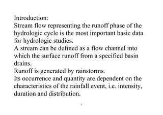
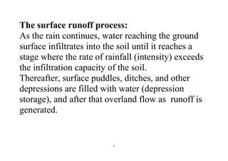
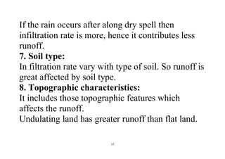
2. Shape of Watershed:
Runoff is greatly affected by shape of watershed.
Shape of watershed is generally expressed by the
term “form factor” and “compactness coefficient”.
Form Factor = Ratio of average width to axial
length of watershed.
Compactness Coefficient: Ratio off perimeter of
watershed to circumference of circle whose area is
equal to area of watershed.
Two types of shape: Fan shape [tends to produce
higher runoff very early].](https://image.slidesharecdn.com/runoff-170730154611/85/Runoff-14-320.jpg)
![15
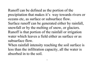
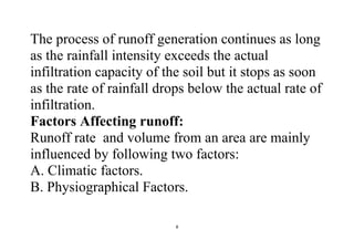
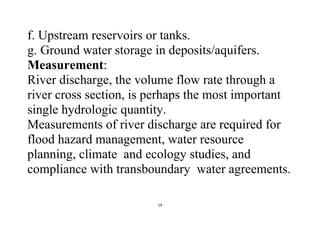
Fern shape [tend to produced less runoff].
3. Slope of Watershed: It has complex effect. It
controls the time of overland flow and time of
concentration of rainfall. E.g. sloppy watershed
results in greater runoff due to greater runoff
velocity and vice-versa.
4. Orientation of Watershed: This affects the
evaporation and transpiration losses from the area.
The north or south orientation, affects the time of
melting of collected snow.](https://image.slidesharecdn.com/runoff-170730154611/85/Runoff-15-320.jpg)
![18
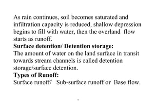
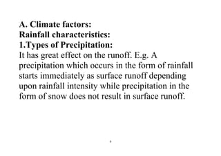
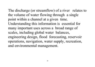
9. Drainage Density:
It is defined as the ratio of the total channel length
[L] in the watershed to total watershed area [A].
Greater drainage density gives more runoff
Drainage density = L/A.
10. Storage Characteristics:
a. Depressions
b. Ponds, lakes and pools
c. Stream
d. Channels.
e. Check dams in gullies](https://image.slidesharecdn.com/runoff-170730154611/85/Runoff-18-320.jpg)

The document discusses runoff as a critical component of the hydrologic cycle, defining it as the portion of precipitation that flows to rivers or oceans and detailing the processes and factors influencing runoff generation, including climatic and physiographic elements. Measurement techniques for stream discharge and the importance of understanding runoff in various contexts such as water resource management, flood control, and environmental impact are also explored. Additionally, the document addresses the environmental consequences of surface runoff, including erosion, pollution, and flooding.