TOPICS
Erosion Process
1. FactorsAffecting Erosion
2. Types Of Erosion and Assessment Of Erosion
3. Modelling Erosion Using Usle, Rusle, Introduction To Few Other Models, Indian
Studies.
4. Control Measures For Soil Erosion : Vegetative And Mechanical (Including
Design), For Agricultural And Non-agricultural Lands
5. Wind Erosion And Its Modelling, Control Measures
2.
1.Factors Affecting Erosion
Erosionis influenced by several key factors:
Water: Rainfall, rivers, and ocean waves can erode soil and rock. The speed and volume of water play
significant roles in erosion rates.
Wind: In arid and semi-arid regions, wind can transport sand and dust, leading to erosion of surfaces.
Soil Type: Different soil types have varying susceptibility to erosion. Sandy soils are often more prone
to erosion than clay soils, which tend to hold together better.
Vegetation: Plant roots help anchor soil in place, reducing erosion. Areas with dense vegetation
typically experience less erosion compared to bare soil.
Topography: Steep slopes are more susceptible to erosion due to gravity, while flat areas tend to retain
soil better.
Human Activities: Land use changes, such as deforestation, agriculture, and urban development, can
increase erosion by removing vegetation and disturbing the soil.
Climate: Temperature, humidity, and weather patterns influence erosion rates. For example, heavy
rainfall can lead to increased erosion.
Understanding these factors can help in managing and mitigating erosion in various environments.
3.
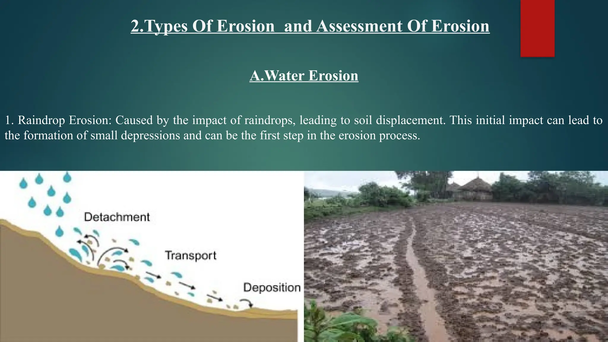
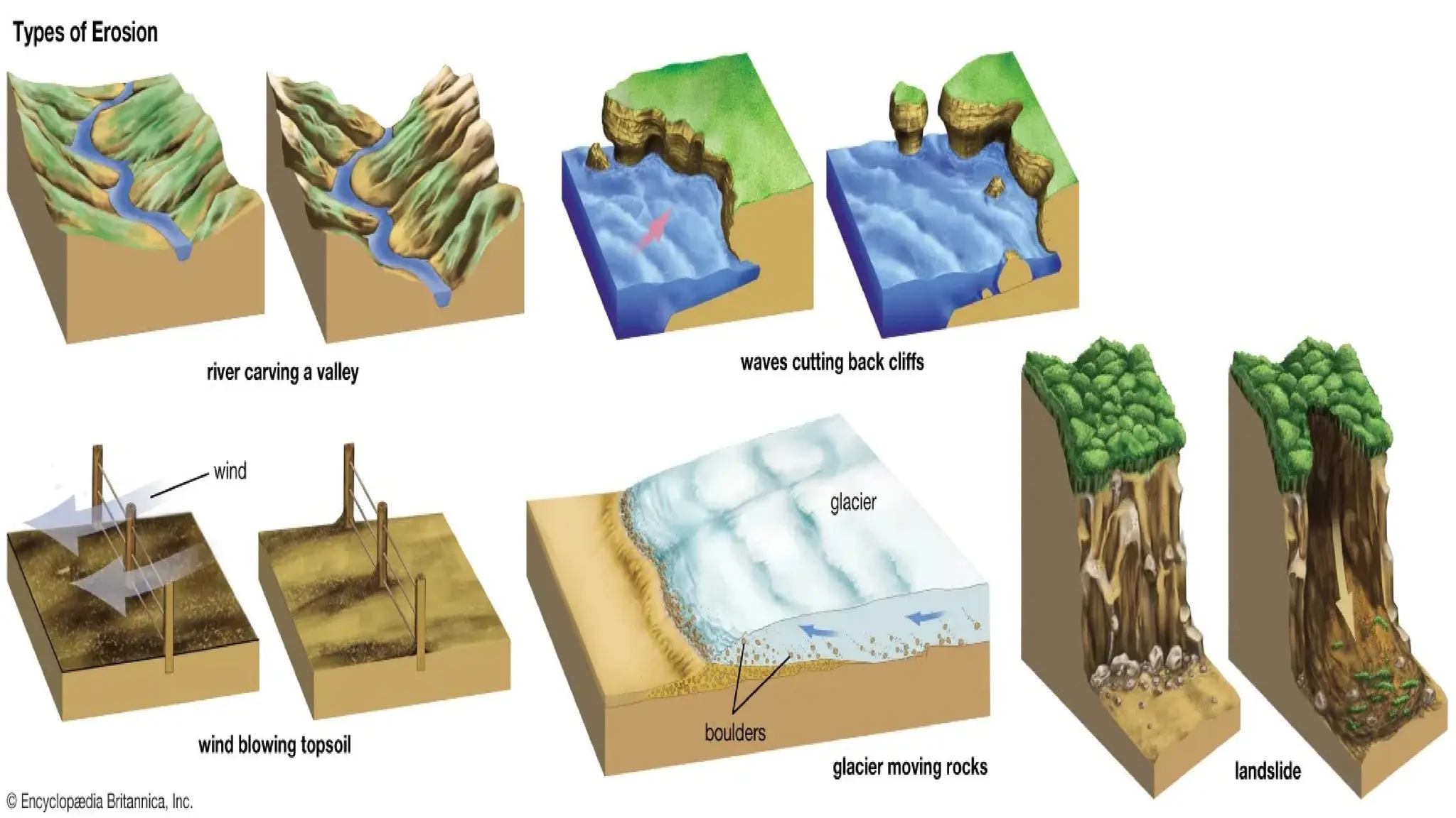
2.Types Of Erosionand Assessment Of Erosion
A.Water Erosion
1. Raindrop Erosion: Caused by the impact of raindrops, leading to soil displacement. This initial impact can lead to
the formation of small depressions and can be the first step in the erosion process.
4.
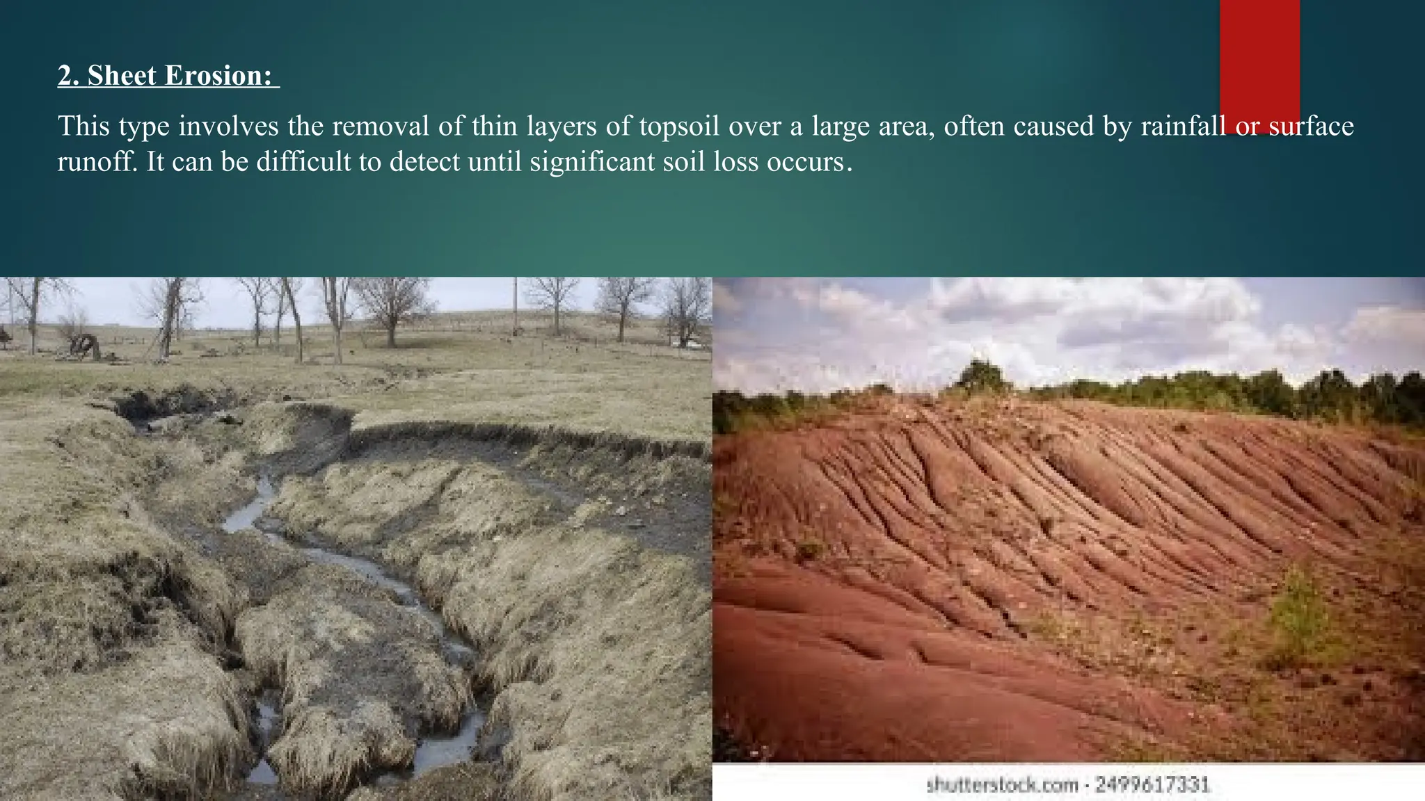
2. Sheet Erosion:
Thistype involves the removal of thin layers of topsoil over a large area, often caused by rainfall or surface
runoff. It can be difficult to detect until significant soil loss occurs.
5.
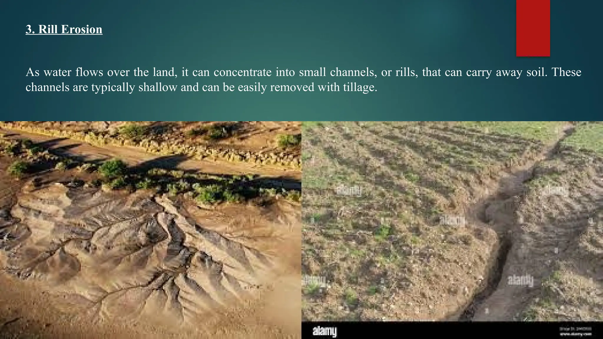
3. Rill Erosion
Aswater flows over the land, it can concentrate into small channels, or rills, that can carry away soil. These
channels are typically shallow and can be easily removed with tillage.
6.
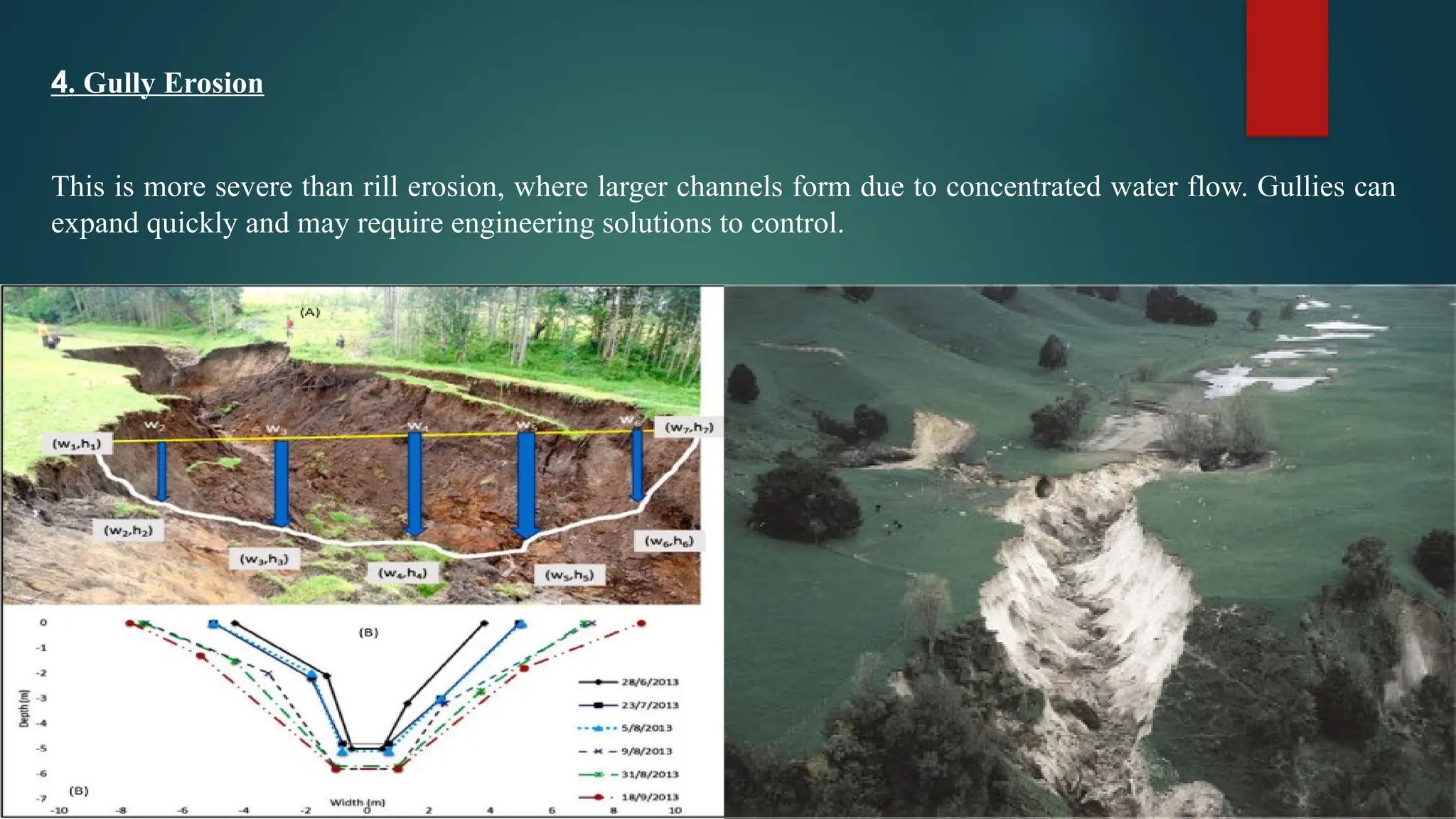
4. Gully Erosion
Thisis more severe than rill erosion, where larger channels form due to concentrated water flow. Gullies can
expand quickly and may require engineering solutions to control.
8.
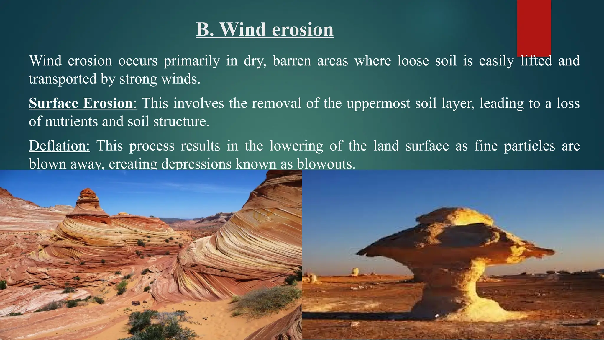
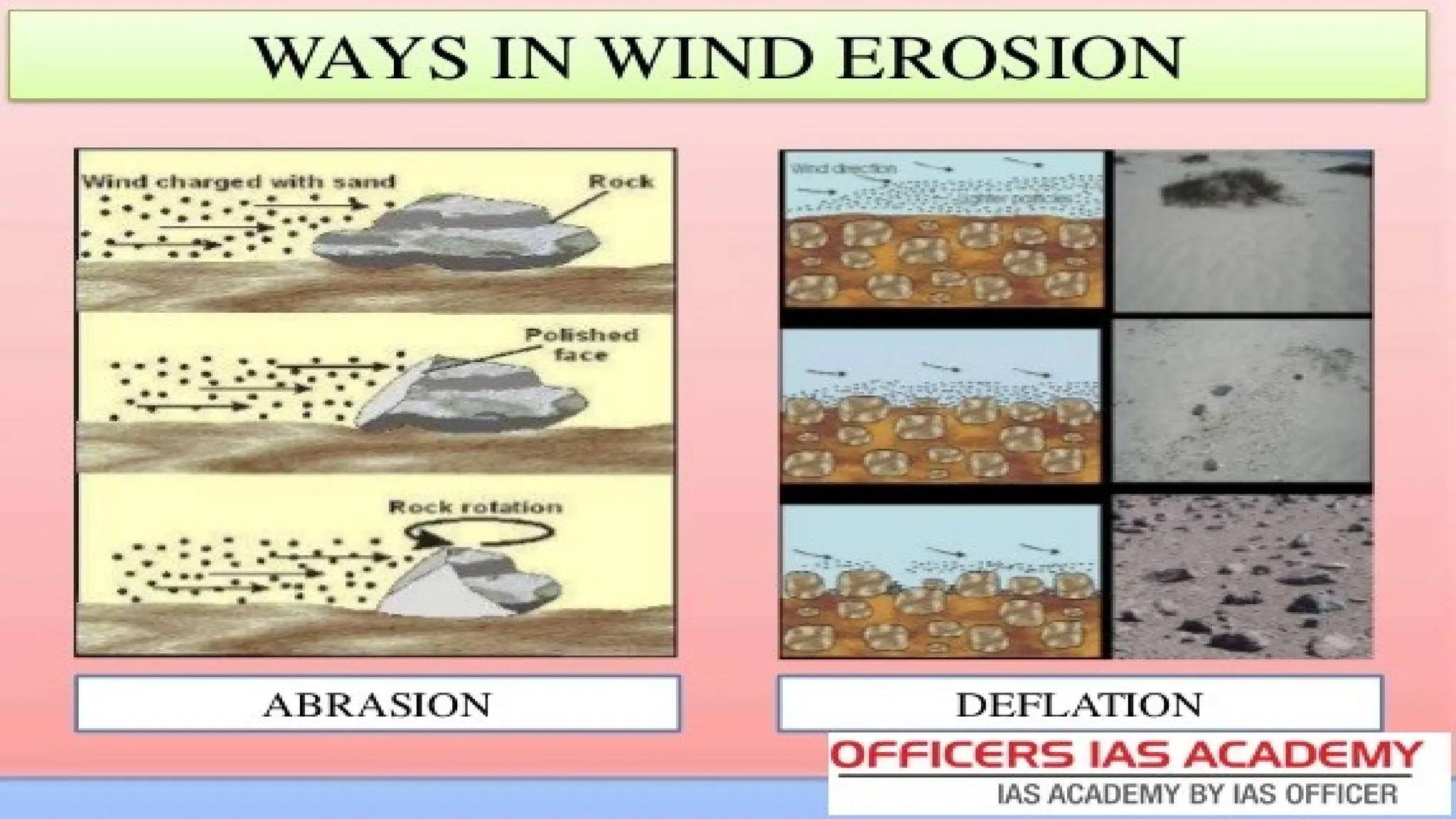
B. Wind erosion
Winderosion occurs primarily in dry, barren areas where loose soil is easily lifted and
transported by strong winds.
Surface Erosion: This involves the removal of the uppermost soil layer, leading to a loss
of nutrients and soil structure.
Deflation: This process results in the lowering of the land surface as fine particles are
blown away, creating depressions known as blowouts.
10.
Assessment of Erosion
•Field Surveys: Direct observation and measurement of soil loss in affected areas
through visual assessments and physical measurements.
• Erosion Pins: Metal rods inserted into the ground to measure changes in soil surface
elevation over time, providing a direct measurement of erosion rates.
• Remote Sensing: Utilization of satellite imagery and aerial photography to analyze land
cover changes and detect areas of significant erosion.
11.
3.Modelling Erosion
UniversalSoil Loss Equation (USLE):Purpose: The USLE is a widely used empirical model to
estimate average annual soil loss from a specific area due to erosion caused by rainfall and associated
runoff.
Equation: = × × × × A=R×K×LS×C×PA Estimated soil loss (tons/acre/year)
𝐴 𝑅 𝐾 𝐿𝑆 𝐶 𝑃
R: Rainfall erosivity factor (indicates the potential of rain to cause erosion)
K: Soil erodibility factor (measures the susceptibility of soil to erosion)
LS: Slope length and steepness factor (represents the effects of slope on erosion)
C: Cover management factor (reflects the effect of land cover and management practices)
P: Support practice factor (accounts for erosion control practices used)
Revised Universal Soil Loss Equation (RUSLE):An updated version of the USLE that addresses some
of its limitations, improving the predictive capabilities by including seasonal variations and changes in
land use and management practices.
12.
Application of USLE:
Data Collection:
• Gather data on local rainfall patterns, soil types, land use, and management practices.
• Determine the specific values for each factor in the USLE equation.
Calculating Erosion Potential:
• Plug the values into the USLE equation to calculate the estimated soil loss for the area of interest.
Management Decisions:
• Use the results to identify areas at high risk for erosion and implement appropriate control measures,
such as planting cover crops or constructing terraces.
13.
EXAMPLE:
Estimate the soilloss for a cornfield located on a slope in a temperate region. The land is tilled
annually, and you have to assess the effectiveness of management practices.
Data Collected:
Rainfall Erosivity Factor (R): 120 (units: MJ mm ha ¹ h ¹ yr ¹)
⁻ ⁻ ⁻
Soil Erodibility Factor (K): 0.25 (tons per acre per unit rainfall)
Slope Length and Steepness Factor (LS): 1.2 (dimensionless)
Cover Management Factor (C): 0.2 (reflects 80% ground cover with corn)
Support Practice Factor (P): 1.0 (no additional erosion control measures)
By applying the USLE Formula
We have : = × × × × A=R×K×LS×C×P
𝐴 𝑅 𝐾 𝐿𝑆 𝐶 𝑃
By substituting the values we have : A=7.2 tons per acre per year
14.
Assessment and Recommendations
Interpretation:
Soil Loss Rate: An estimated loss of 7.2 tons per acre per year is moderate and indicates that while the corn
cover is helping to reduce erosion, there may still be significant soil loss, especially during heavy rainfall events.
Recommendations
Implementing Erosion Control Measures: Consider integrating cover crops during the off-season or employing
contour farming practices to further reduce erosion.
Monitoring
Regular monitoring of soil loss should be conducted to assess the effectiveness of implemented practices and
adjust as necessary.
Modeling Considerations
Further Analysis:
Sensitivity Analysis: Evaluate how sensitive the model outputs are to changes in R, K, LS, C, and P. For
instance, increasing the C value to reflect reduced ground cover would show a higher erosion potential.
GIS Integration: Use Geographic Information Systems (GIS) to spatially analyze erosion risk across the entire
watershed, allowing for targeted management practices.
15.
4. Control MeasuresFor Soil Erosion
Soil erosion, the detachment and removal of soil particles by wind, water, or human activity, can result in
the loss of arable land, degraded landscapes, and reduced agricultural productivity. Effective soil erosion
control measures involve both vegetative and mechanical strategies. These measures are used in
agricultural as well as non-agricultural lands to prevent or reduce soil loss, enhance soil fertility, and
promote land sustainability.
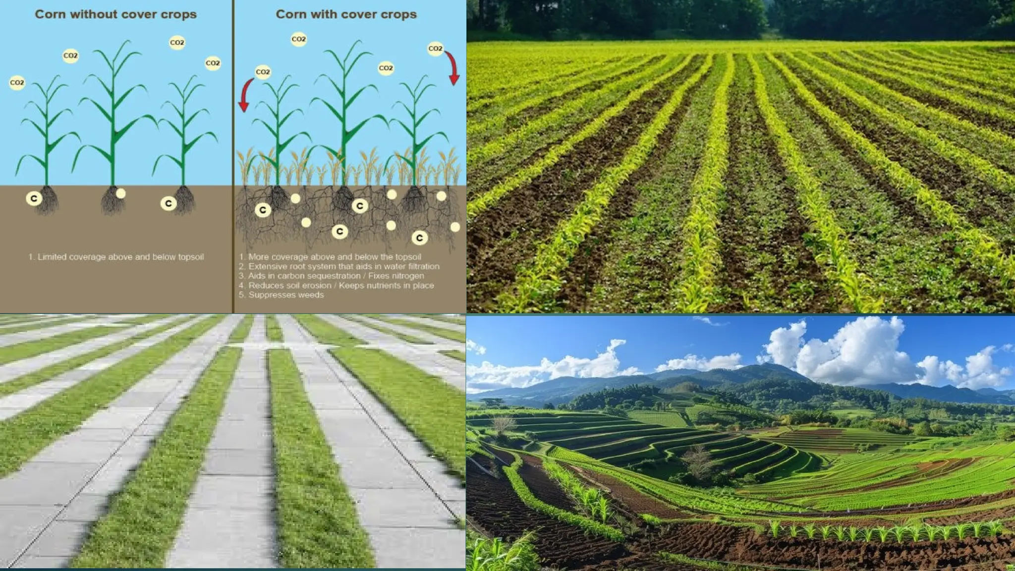
1. Vegetative Measures
Vegetative measures rely on the use of plants to control erosion. Plants act as physical barriers, reducing the
impact of water or wind, stabilizing soil, and improving soil structure.
Cover Crops: These are crops planted to cover the soil and prevent erosion during periods when the
main crops are not growing. Examples include grasses, legumes, and clovers. They help absorb excess
water, improve soil structure, and provide organic matter to the soil.
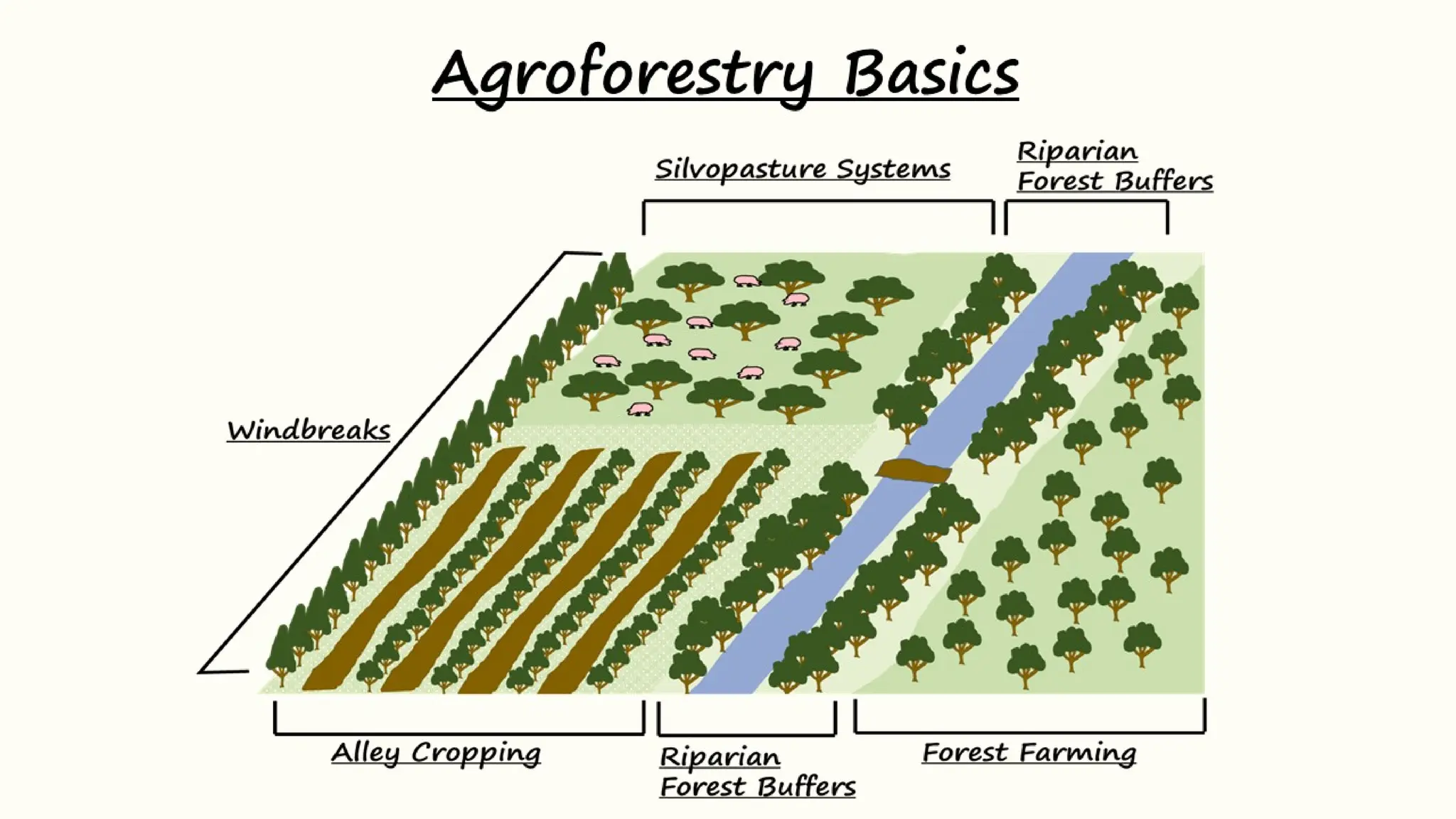
Grass Strips: Narrow strips of grass planted along contours or across slopes can significantly reduce the
velocity of water runoff, trapping soil particles and preventing them from being carried away.
17.
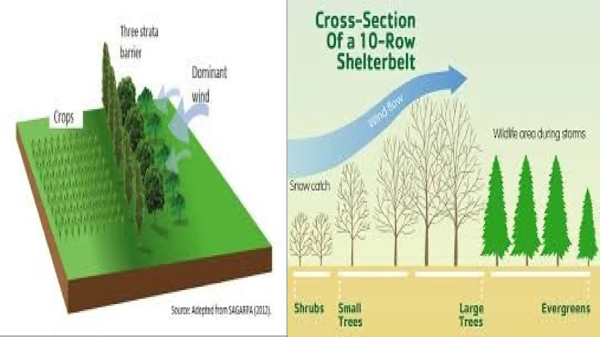
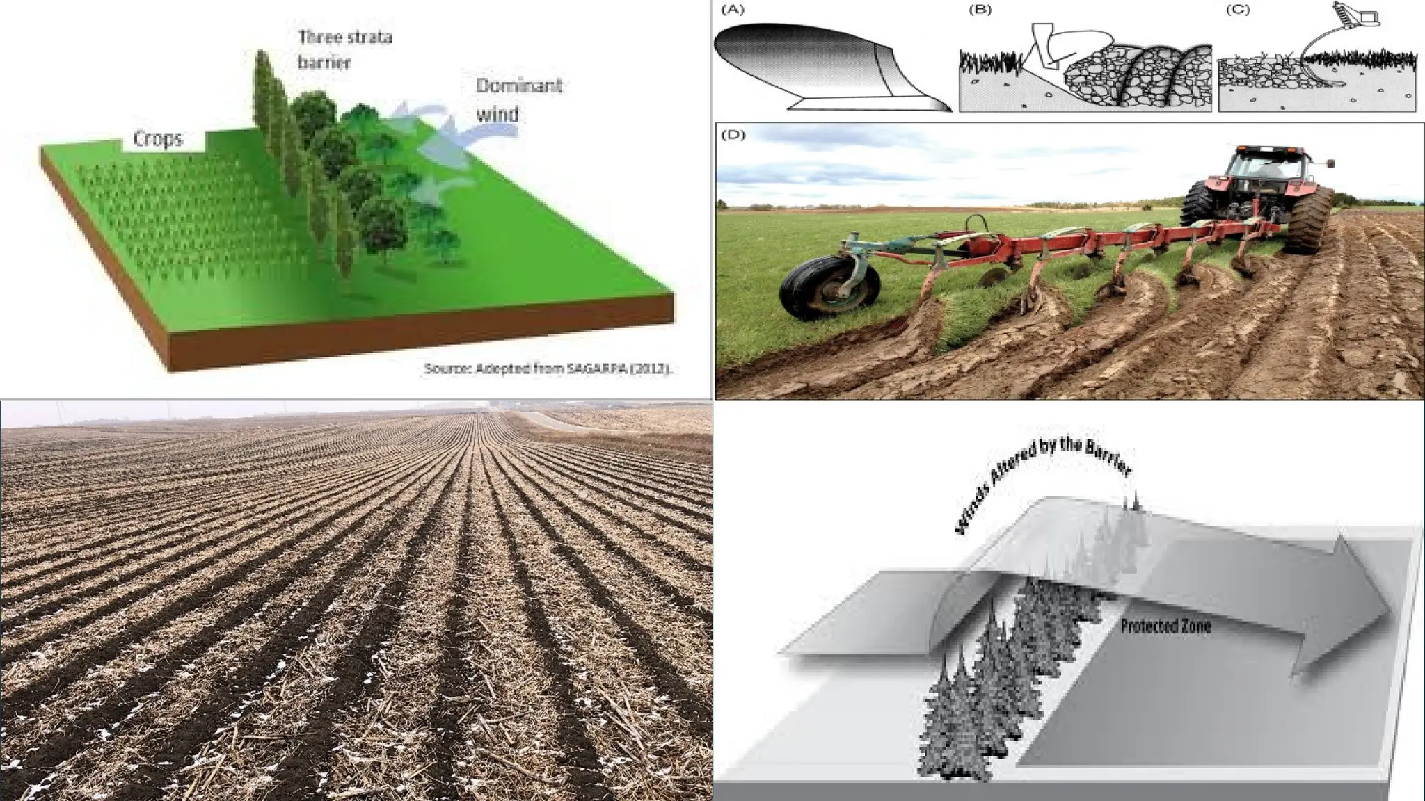
Windbreaks andShelterbelts: Rows of trees or shrubs planted along the perimeter of fields,
especially in windy areas, can reduce wind speed, prevent wind erosion, and protect crops and soil
from desiccation.
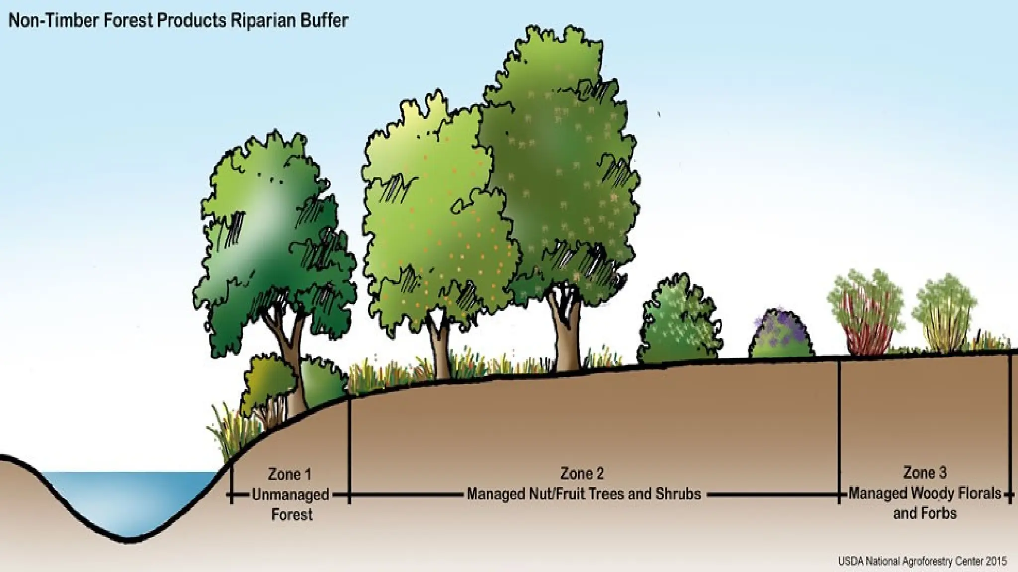
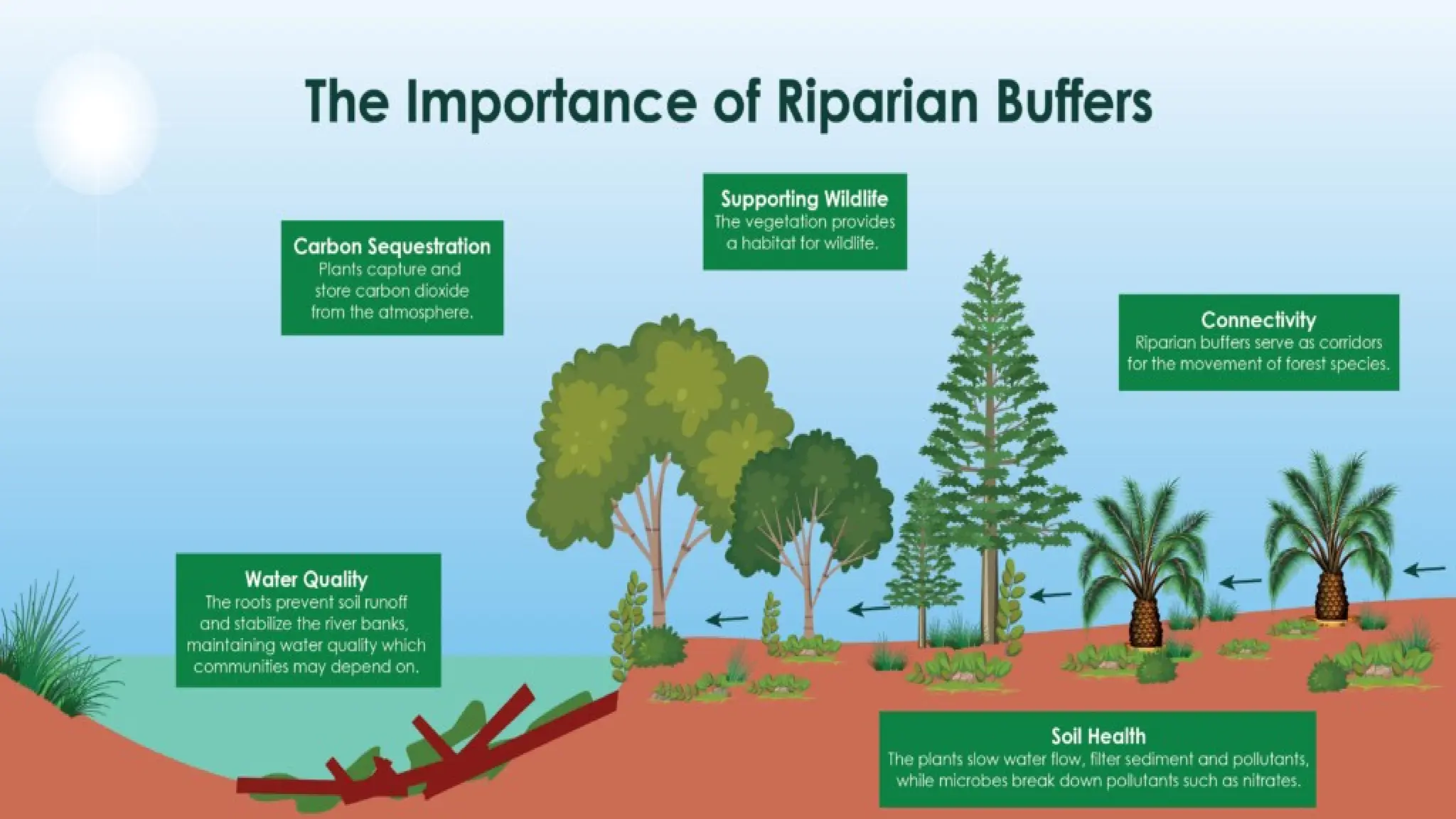
Riparian Buffers: Vegetation planted along rivers and streams not only reduces water erosion but
also filters pollutants before they reach water bodies. These buffers can significantly reduce
sedimentation and improve water quality.
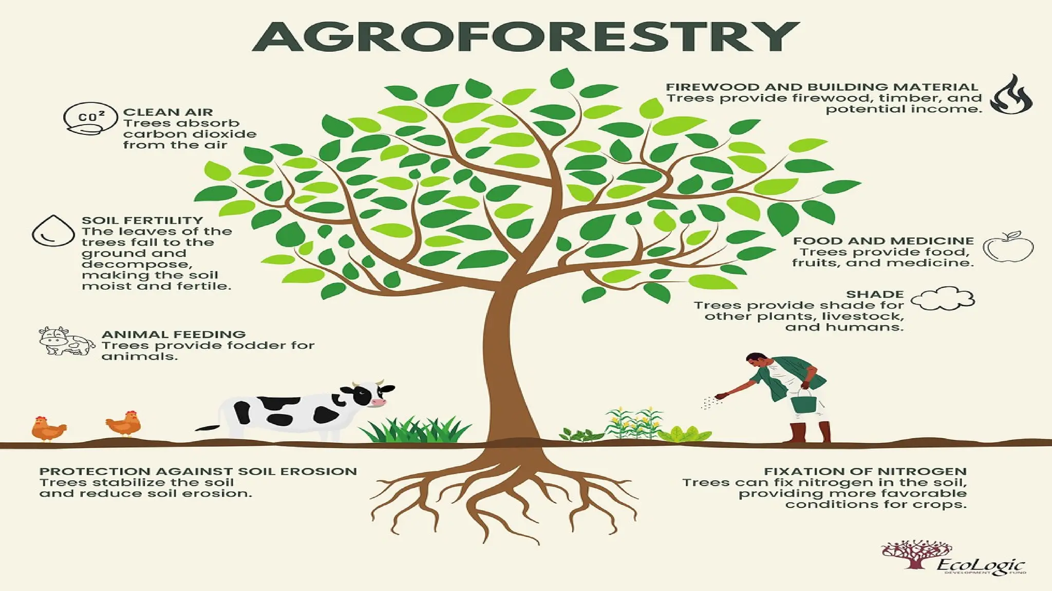
Agroforestry: Integrating trees and shrubs with crops on the same land can improve soil stability by
enhancing root structure and reducing the impact of both wind and water erosion.
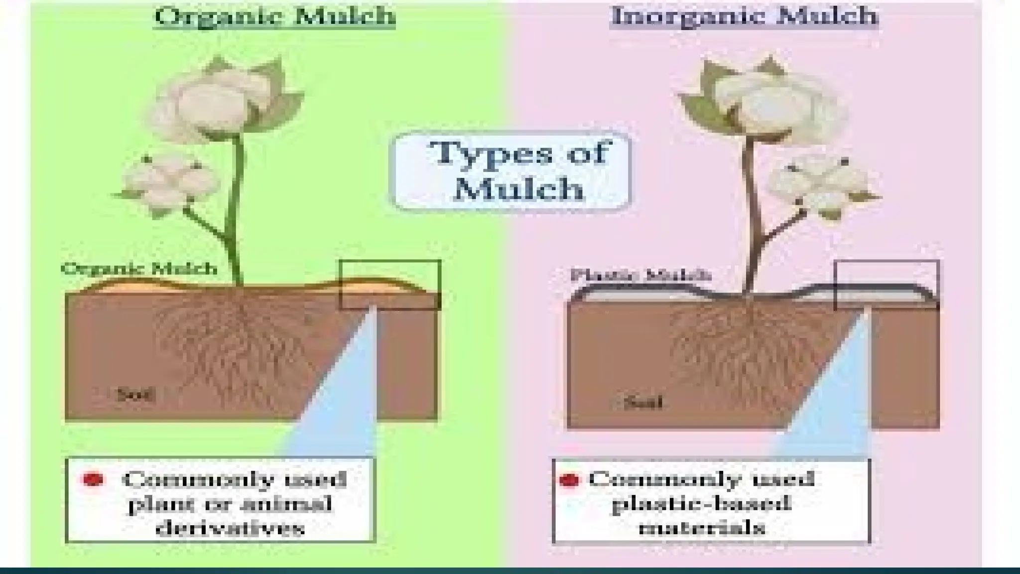
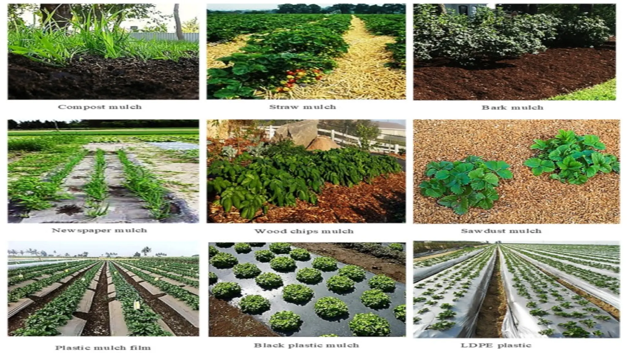
Mulching: Organic or inorganic mulch (e.g., straw, leaves, or plastic sheets) applied to the soil
surface protects the soil from direct rainfall impact, reduces evaporation, and helps to hold soil in
place.
25.
2.Mechanical Control Measures
Mechanicalcontrol measures involve physical structures or practices designed to reduce the forces causing
soil erosion. These structures typically require design considerations based on the topography, climate, and
land use.
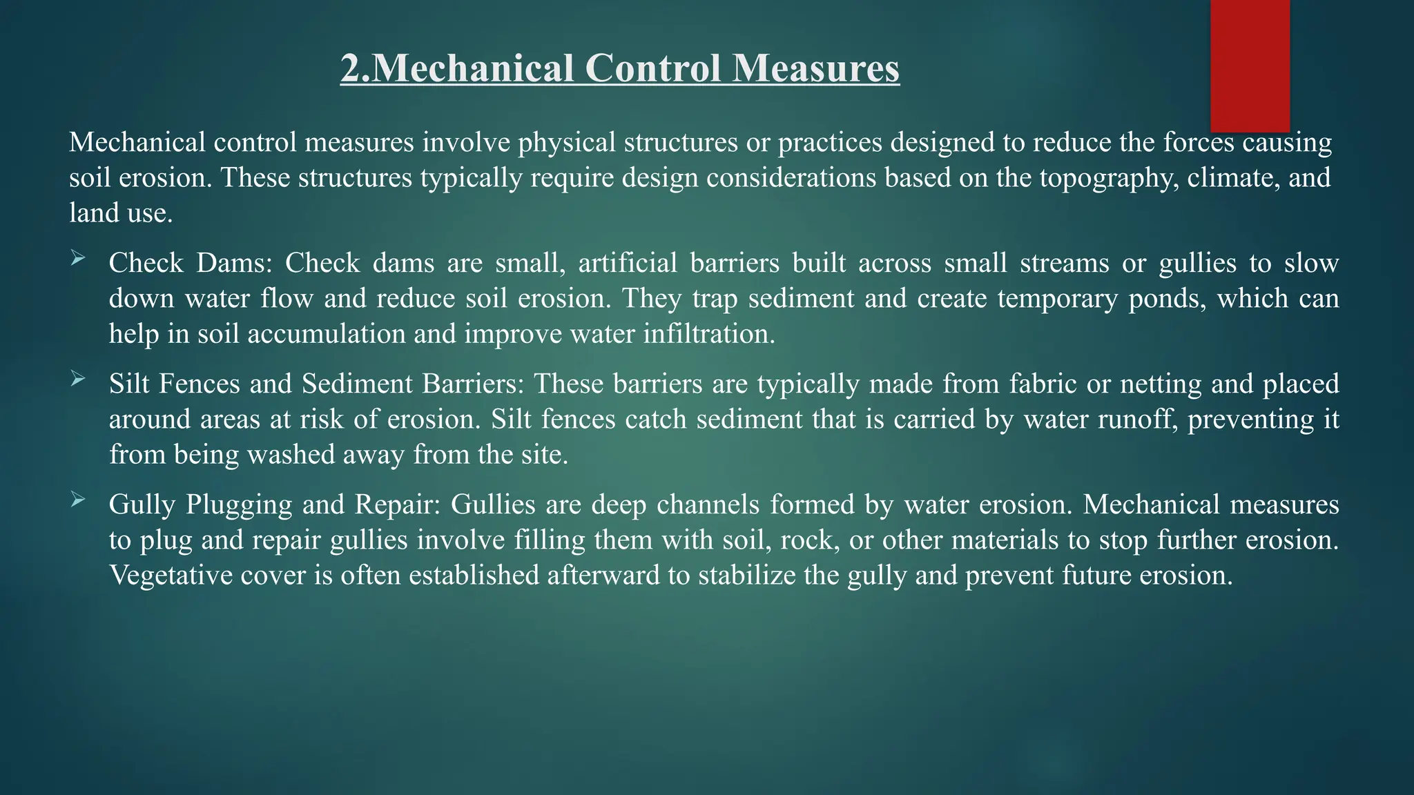
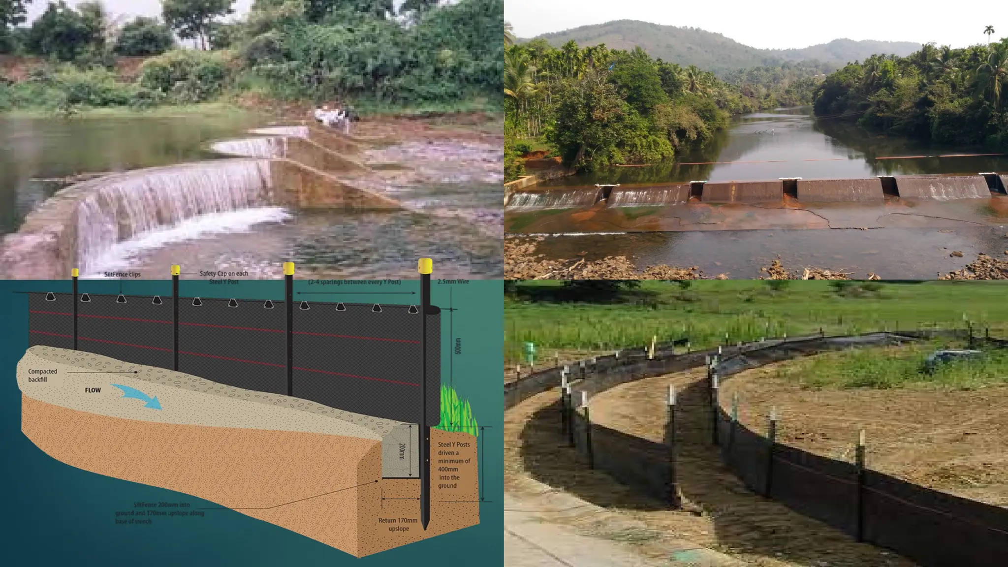
Check Dams: Check dams are small, artificial barriers built across small streams or gullies to slow
down water flow and reduce soil erosion. They trap sediment and create temporary ponds, which can
help in soil accumulation and improve water infiltration.
Silt Fences and Sediment Barriers: These barriers are typically made from fabric or netting and placed
around areas at risk of erosion. Silt fences catch sediment that is carried by water runoff, preventing it
from being washed away from the site.
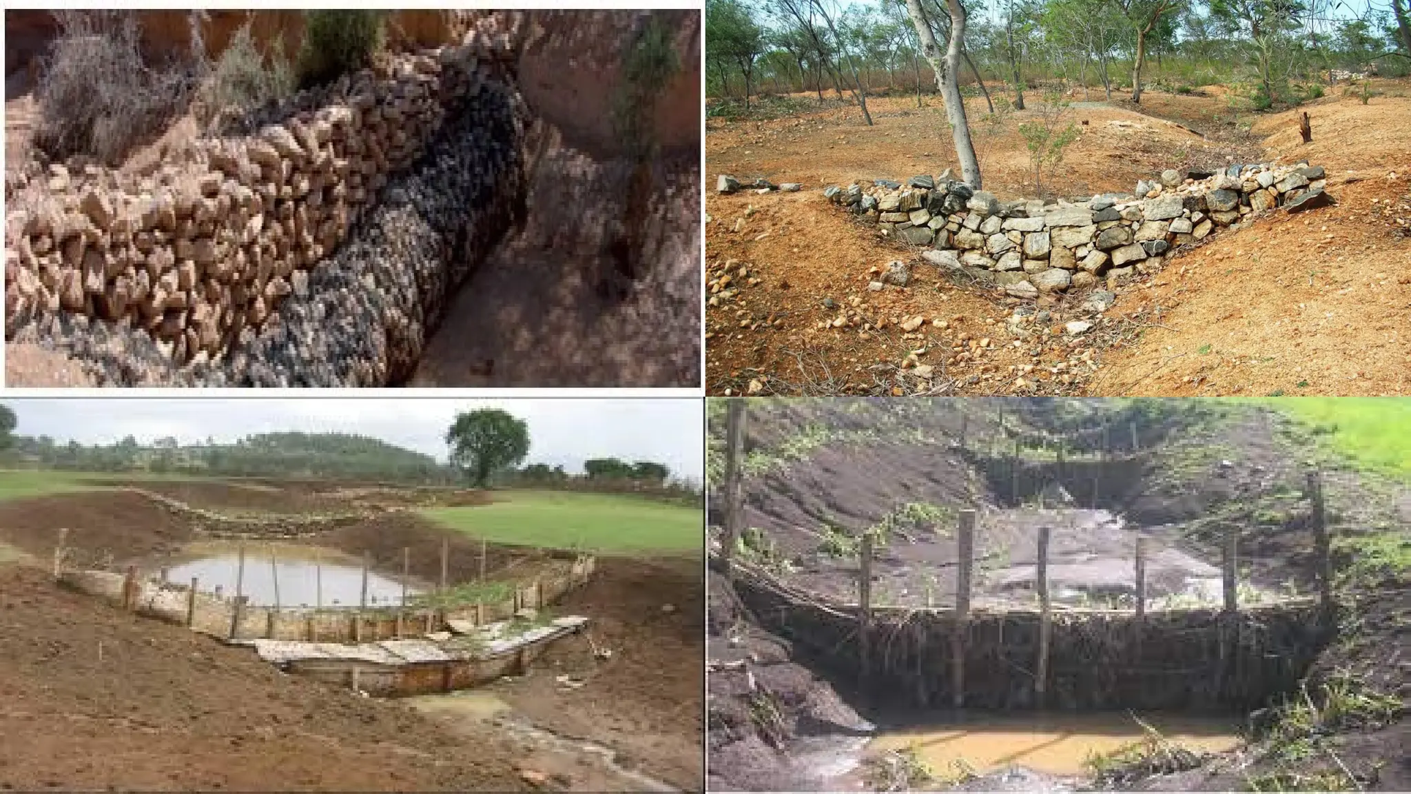
Gully Plugging and Repair: Gullies are deep channels formed by water erosion. Mechanical measures
to plug and repair gullies involve filling them with soil, rock, or other materials to stop further erosion.
Vegetative cover is often established afterward to stabilize the gully and prevent future erosion.
26.
Mulching: Applyingorganic or inorganic mulch to the soil surface reduces water evaporation, protects
the soil from raindrop impact, and helps improve water infiltration. Mulch can be made from straw,
grass clippings, wood chips, or synthetic materials.
Erosion Control Blankets: These are woven fabrics or mats placed on the soil surface, often on slopes
or disturbed areas, to prevent soil erosion. They help stabilize the soil while vegetation is becoming
established.
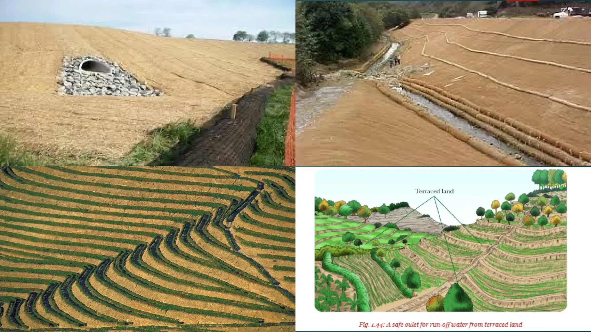
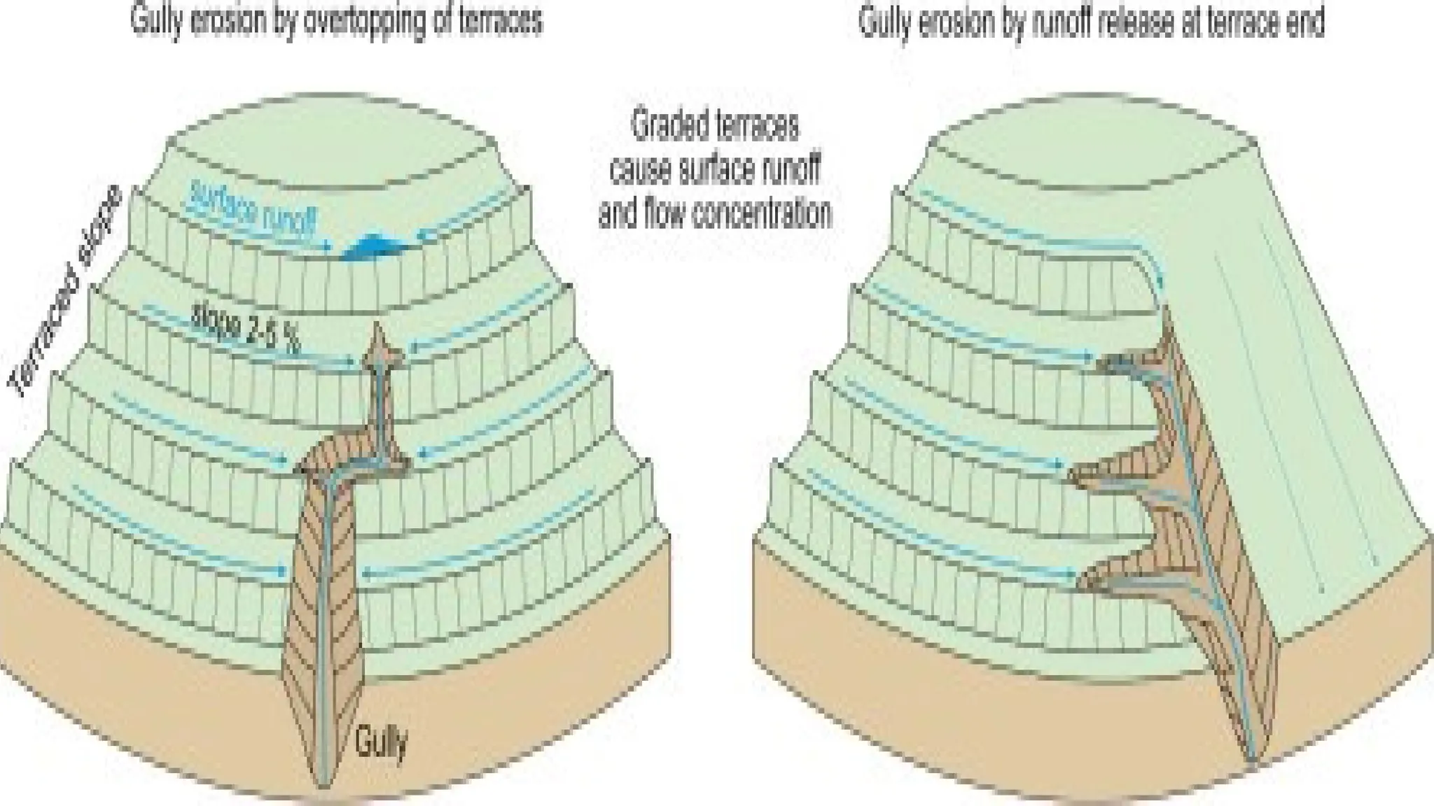
Terracing and Diversion Channels: For agricultural lands with steep slopes, terracing and diversion
channels can be designed to reduce water velocity and direct water to safe outlets.
31.
Design Considerations forMechanical Measures
Topography: The slope of the land and the direction of water flow are critical in
designing the right type of structure (e.g., terraces, bunds, or dams).
Soil Type: Different soil types may require different approaches, as sandy soils may be
more prone to wind erosion, while clayey soils may be more susceptible to water
erosion.
Climate: The amount of rainfall, wind speeds, and seasonal variations will determine the
type and scale of the control measures needed.
Economic Feasibility: The cost of installation, maintenance, and operation should be
evaluated, especially for large-scale erosion control systems.
32.
5. Wind ErosionAnd Its Modelling, Control Measures
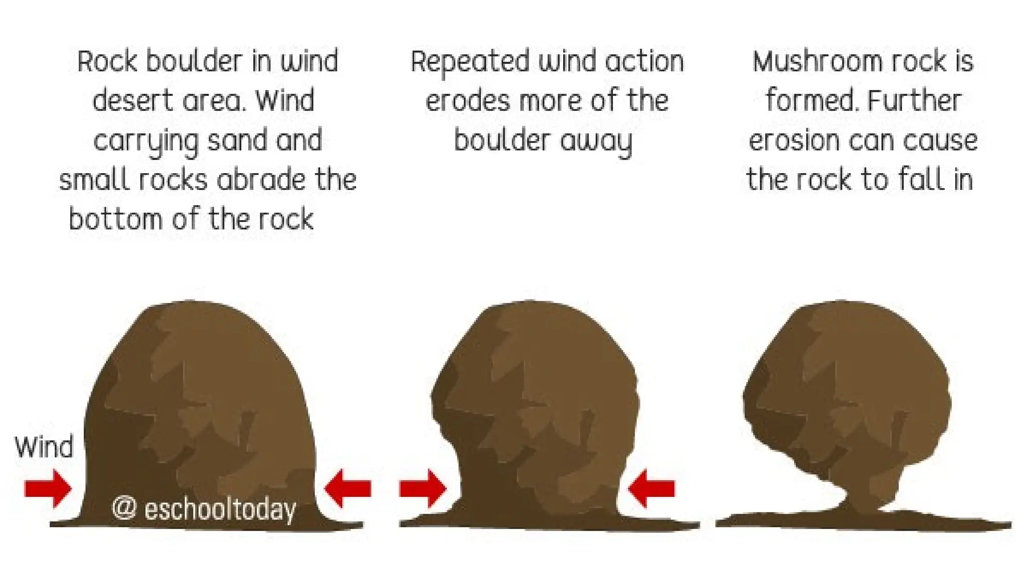
Wind erosion occurs when wind forces soil particles off the surface of the land. It is particularly common
in arid and semi-arid regions, where there is little vegetation to protect the soil. Wind erosion can lead to
the loss of topsoil, reduced soil fertility, and the creation of dust storms, all of which have detrimental
effects on agriculture and air quality.
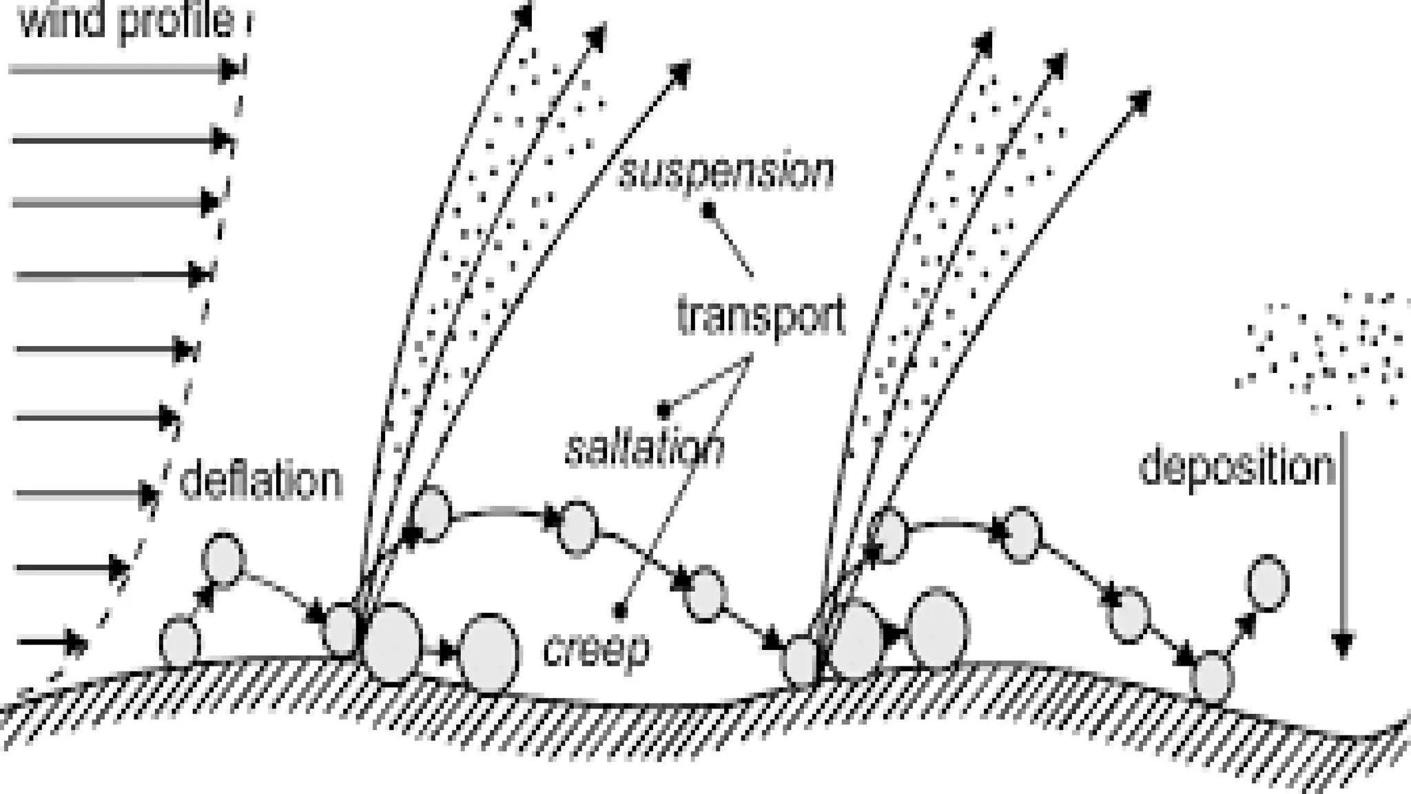
Wind Erosion Process
Detachment: Wind picks up loose, dry, and unprotected soil particles. Fine particles like sand and silt are
most susceptible to wind movement.
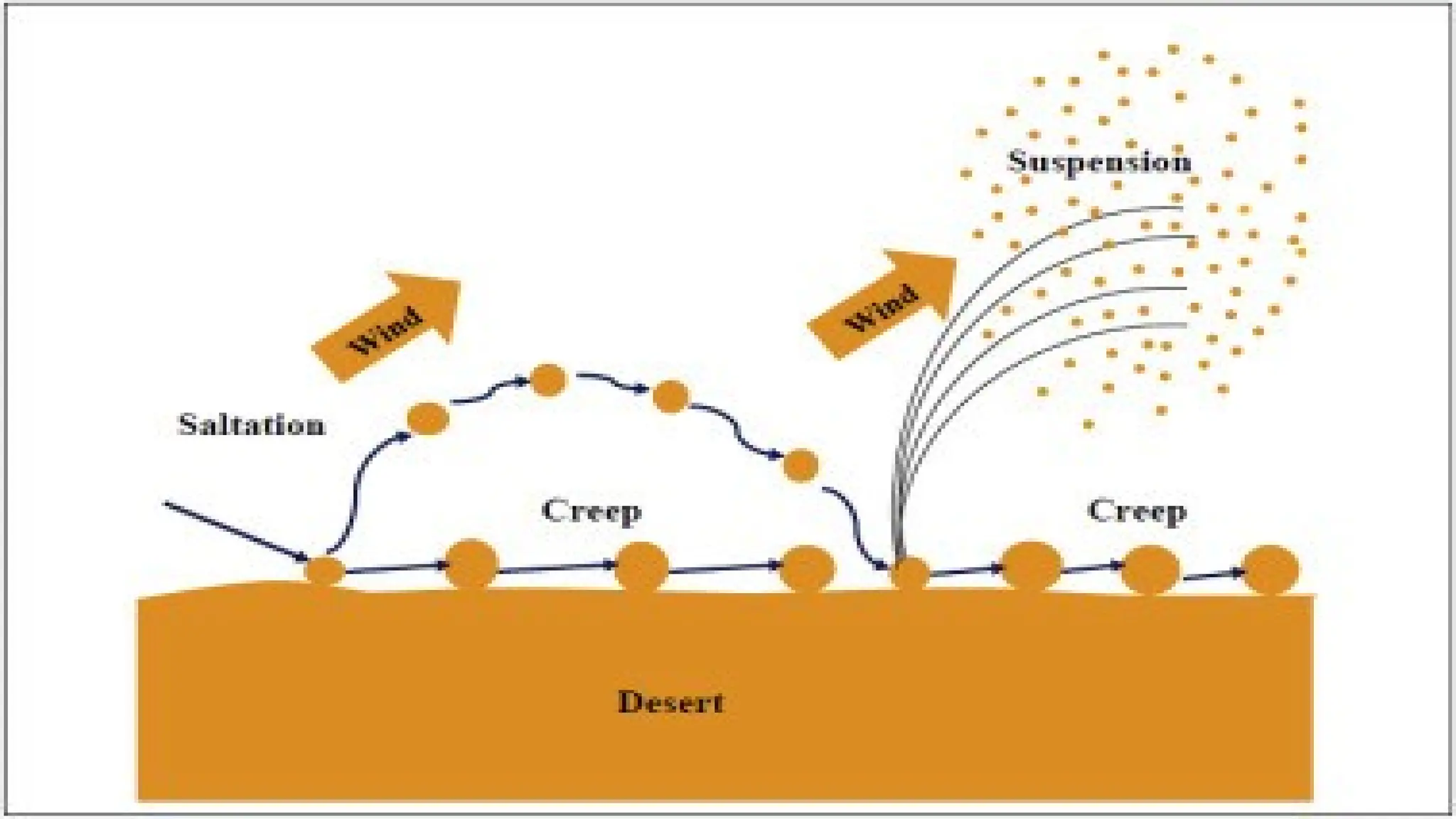
Transport: Once the soil particles are detached, the wind transports them in three main ways: saltation
(bouncing of particles), suspension (carrying particles in the air), and creep (rolling of larger particles
along the surface).
Deposition: Wind deposits the transported soil particles when the wind speed decreases or encounters
obstacles.
36.
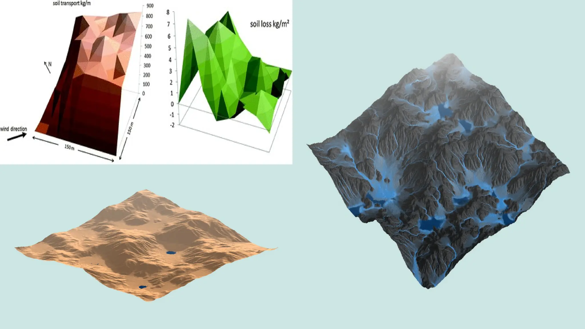
Wind Erosion Modelling
Modellingwind erosion helps predict the amount of soil loss due to wind and the effectiveness of control
measures. Key factors influencing wind erosion models include:
Wind velocity: Higher wind speeds increase the risk of erosion.
Soil texture: Sandy soils are more prone to wind erosion than clay-rich soils.
Surface roughness: Smooth, bare surfaces are more susceptible to wind erosion, while rough or
vegetated surfaces help reduce it.
Vegetation cover: The presence of vegetation, especially deep-rooted plants, can reduce wind speed near
the soil surface, mitigating erosion.
Several mathematical models exist to estimate wind erosion, such as the Wind Erosion Equation (WEQ),
which considers these factors and provides a quantitative prediction of soil loss.
38.
Control Measures forWind Erosion
Windbreaks and Shelterbelts: The most effective method for controlling wind erosion is planting rows of
trees or shrubs to act as windbreaks. These barriers slow down the wind, reducing its erosive force on the
soil surface.
Surface Cover: Maintaining surface cover through the use of vegetation (like grasses or cover crops) or
mulches reduces the impact of wind on soil by providing a physical barrier.
Tillage Practices: Minimizing tillage and leaving crop residues on the soil surface helps create a rougher
surface, which reduces the ability of wind to pick up and transport soil particles.
Wind Erosion Barriers: Artificial barriers like fences or netting can also be used to reduce wind speed and
prevent soil erosion in highly exposed areas.
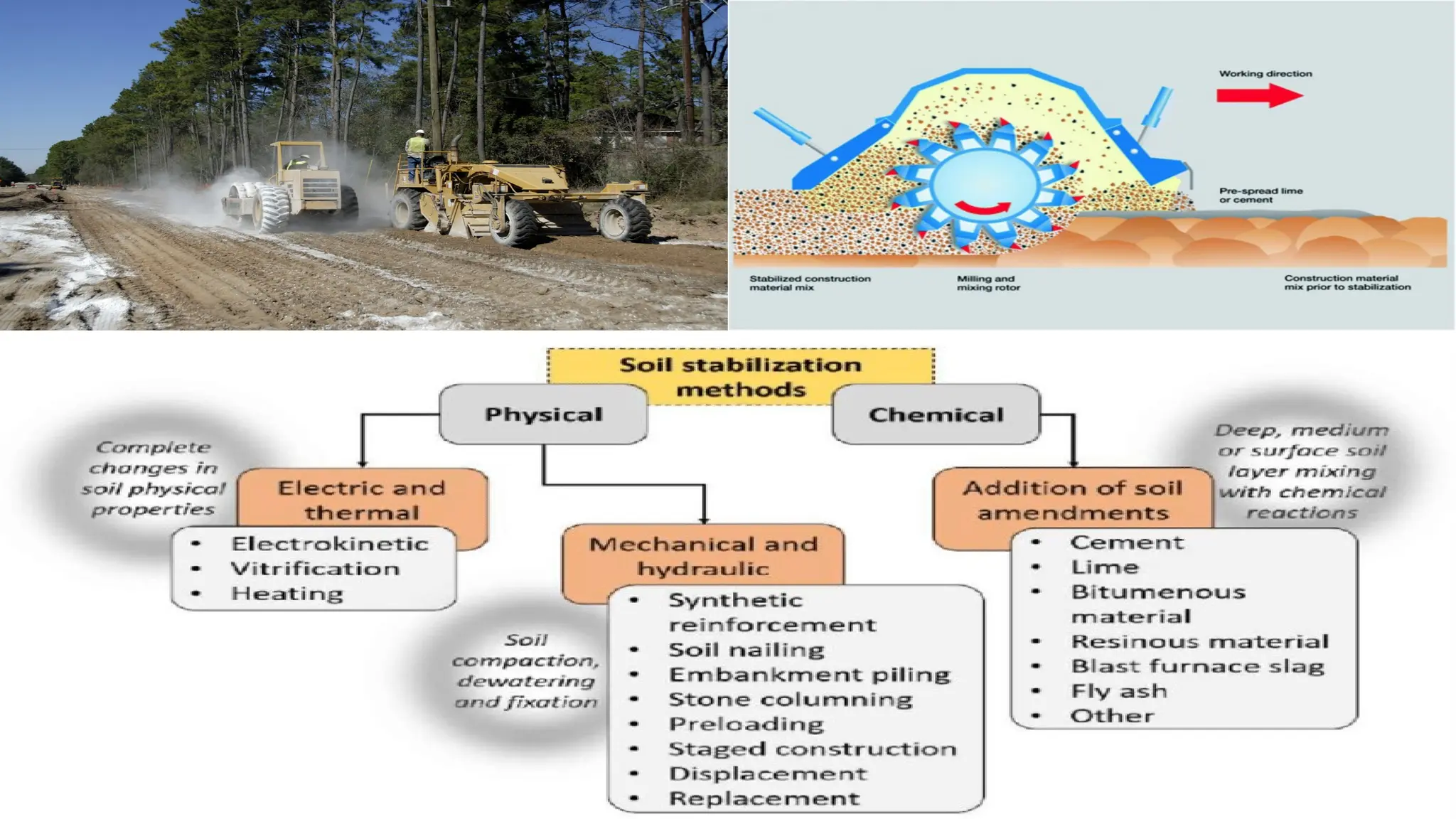
Soil Stabilization Techniques: For areas highly susceptible to wind erosion, soil stabilization methods such
as applying polymers or soil-binding agents can help bind the soil particles together and prevent them from
being blown away.
Rotation of Land Use: Rotating agricultural practices and fallowing parts of the land can help maintain soil
cover and reduce the impact of wind erosion.