An assessment of the impact of flooding on the road transport infrastructure in Enugu Metropolis was carried out using survey research method. Thirty impact indicators were rated by the respondents against six impact dimensions of population, vulnerability of activities, frequency, intensity, extent and risk. Three null hypotheses were postulated and tested. One sample t-test was used for testing hypothesis one which stated that damages to the road transport infrastructure resulting from flooding are not significant to warrant mitigation.Since the p-value =0.000(p<0.05),>< 0.05), indicating high impact of flooding on the socio-economic activities in Enugu urban.Furthermore a statistically significant impact was equally recorded in hypothesis three since thecalculated p–value (0.000)was less than 0.05, (p < 0.05). The implication was that damages to road transport infrastructure due to flooding have significant impact on the environmental sustainability of the study area. The model generated hadGoodness of Fit Index (GFI) = 0.974; Adjusted Goodness of Fit Index (AGFI) = 0.951; Comparative Fit Index (CFI)= 0.949 and Incremental Fit Index (IFI) = 0.950; while the Root Mean Square Error of Approximation (RMSEA) = 0.059. The paper therefore recommendedproper infrastructural design and planning, good governance, population control and appropriate weather monitoring as some measures that could be adopted to mitigate the impact of flooding on the road transport infrastructure in Enugu Urban.
Endemic Hydro climatic Flood Hazards in Some Cameroonian Coastal Cities: The ...CrimsonpublishersMCDA
Rapid urbanisation of the three Cameroon’s coastal cities of Douala, Kumba and Limbe has provoked and sustained intense competition for the limited space by burgeoning urbanites and broadening scope of lucrative economic activities within the cities. The unfortunate aspect has been that the urban poor are being bided off from suitable land spaces and coerced to source a living on fragile urban zones as river valleys, poorly reclaimed marshes on urban flood plains, which are high risk zones for flooding. Empirical and statistical analyses complemented by field investigations, and mapping techniques have been used to establish and exposed some hitherto latent dimensions of this perennial demise of these urban centres.
Contrary to earlier explanations that saw man as the principal architect of his own doom, present findings reveal but the imposing role of hydroclimatic excesses reinforced by the urban geomorpoholigcal dispositions of these urban landscapes as the primal triggers of this seasonal urban crisis. This makes the hazard of seasonal urban flooding in these cities more of the work of nature than the hand of man. Based on this, it is recommended that current flood management strategies should be restructured to top target the root causes rather than cosmetically targeting the consequences, if these cities must integrate the main path to urban sustainability come 2030 as targeted set in the Sustainable Development Goals (SDGs).
https://crimsonpublishers.com/mcda/fulltext/MCDA.000538.php
For more open access journals in Crimson Publishers please click on link: https://crimsonpublishers.com
For more articles on journal of Agronomy please click on below link: https://crimsonpublishers.com/mcda/
EIP Water Action Group City Blueprints September 2013EIP Water
The City Blueprint for Water is a baseline assessment of the sustainability of water management in a city (or other dominantly urban region). The result allows a city to quickly understand how advanced it is in sustainable water management and enables it to compare its status with other leading cities.
This project is one of nine Action Groups selected by the European Commission as an initial EIP Water Action Group.
Sixteen cities/regions have participated so far (August 2013) and many others are being approached. This is an opportunity to take part in a new and innovative programme to help improve city-level water stewardship, in the spirit of smart and sustainable cities.
The basic output is a simple radar chart as shown in the example from Melbourne at the top of this page. The chart provides a quick visual representation of the city’s water stewardship status, and is a tool for easy comparison between cities. It covers 24 key water-related subject areas, such as water footprint, water scarcity, water quality, drinking water availability and wastewater management.
A City Blueprint is just the first step on a journey of communication and cooperation between cities. A key intention is to encourage cities to share their best practices with others, and for all to improve. A website will be developed to facilitate this. All cities are different. Some are advanced in a few or many subject areas. Some have much work to do. The aim is not to highlight failings, but instead to help a city identify areas of focus for improvement, and to learn from the best practices of others, as well as demonstrating and sharing their own best practices.
Relationship between community and nature in the egyptian villages efla2012Ahmed Haron
The relationship between man and nature since the dawn of history embodied in the first agricultural community in the valley of the Nile in Egypt, which is one of the early societies that were formed and connected to nature. This community has been affected and influenced this nature to form one of the great civilizations over history. This relationship has continued in this valley to evolve towns, villages, countries and different communities and the key factors of these communities were water and greenery .
In recent times as a result of social, cultural and urban changes, this distinctive relationship face a set of challenges and problems that may affect the natural environment where it began migration from rural to urban areas and the collapse of the traditional concept of farming so that the urban population in Egypt could reach from 40% in 2010 to 60% in 2030, threatening the agricultural environment. Facing main reasons like the cultures of social change to rural communities in Egypt and the lack of scientific development environment may help these communities to survive and extent.
Egyptian lakes have social and environmental mixture which mixing between farmers, fishers and Bedouins. These various societies and different cultures live together surrounding Egyptian lakes that give these sites very special character. Villages surrounding lakes are contorted with number of problems such as accommodations, rapidly growing populations, unemployment, lack of education and lack of environmental awareness.
The research presents the problem of these communities surrounding Egyptian lakes and the development of methods and environmental performance of these urban communities in line with the challenges of recent time.
The aim of this paper is to formulate a conceptual framework to achieve the harmony between Urban, community and surrounding nature in Egyptian villages. Through an interdisciplinary literature review the concepts of green and social infrastructure. Finally, based on a synthesis of the literature a conceptual framework is presented.
Hydropower, Anti-politics and the opening of new political spaces in the East...Deepa Joshi
This document discusses hydropower development in the Eastern Himalayas region of Sikkim, India. It argues that while hydropower is advocated as promoting green growth, the governance of hydropower projects often disregards social and environmental controversies surrounding dams. In Sikkim, state and private actors have tried to restrict public participation and opposition to hydropower projects through "anti-politics" tactics. However, this has led communities affected by dams to voice unprecedented opposition and demand participation, indicating new politicization and democratization processes emerging from grassroots activism.
Flooding is a natural process which, that can occur in any part of the world during the volume of water reaches beyond the holding capacity of the drainage system. In whatever the case flooding has a major impact on the economic, social and environmental condition of the victim areas
REAL WORLD EXAMPLES OF SOLUTIONS FOR SUSTAINABLE CITIES
Cities present a crucial challenge and opportunity in the coming decades, as more than 2.5 billion people are expected to be added to the world's urban areas by 2050.
This presentation from Ani Dasgupta, Global Director, WRI Ross Center for Sustainable Cities, explores real-world examples of how change has been made in some of the fastest growing cities and economies of the world and discuss actions to ensure sustainable urbanization in the years and decades ahead.
There is strong evidence that improved economic productivity and resource efficiency that accompany urbanization can be achieved while simultaneously addressing the environmental and social externalities from rapid urban growth. Although a combination of technological, social and political innovation is necessary, a wide range of actionable solutions are currently available to address the challenges cities face across various sectors. 2015-16 is an unprecedented year of opportunity - with COP, SDG and Habitat III - for advancing action at the global and city level towards advancing sustainable urban growth.
The newly released book Sustainable Urban Environments - An Ecosystem Approach ‘helps the reader grasp opportunities for integration of knowledge and technologies in the design, construction and management of the built environment.’ In the first edition of the Delft Environment Initiative Lecture Series on 21-09-2011 several contributors to Sustainable Urban Environments discussed their views on the most pressing challenges facing us in the urban environment today and how they should be integrated in education. These are the slides accompanying the ‘elevator pitches’ they gave. http://home.tudelft.nl/en/research/environment/mini-symposium-sustainable-urban-environments/
Effect of the Year 2012 Flooding On Residential Properties Rental Value in Ka...iosrjce
This document discusses the effect of flooding in 2012 on residential property rental values in Kaduna, Nigeria. It finds that rental values were low in 2012 and 2013 due to flooding, but rose again after government and developer measures. The flooding was caused by riverside encroachment and refuse dumping in rivers. Recommendations include permanent flood prevention, public flood maps, and enforcing development controls.
GLOBAL VIEW OF A VIBRANT WORLD 360° THE ISSUE Urbanisation FACE TO FACEAdhitya Arjanggi
AN URBAN PLANET:The sustainable city challenge
CITY LIVING: Creating vibrant sustainable cities SECURING CRITICAL INFRASTRUCTURE SOME FOR ALL FOREVER:Water resource management on an urban planet
TRANSFORMING TRANSPORT: The 21st century urban challenge
URBAN ENERGIES RESOURCES DEMAND AND COMMUNITY IMPACTS A 360° face to face interview BUILDING A LEGACY Creating an agile global culture of inventiveness, safety and sustainability
NEW SKILLS MAKE THE SUSTAINABLE DIFFERENCE INSPIRATIONAL ENGINEERING CAPTURING THE VISION
This document discusses urban environmental degradation in the Caribbean and Latin America. It defines key terms like urban area and environmental degradation. The main causes of urban environmental degradation are identified as poverty, pollution, overpopulation, lack of education, and industrialization. Effects include death, disease, biodiversity loss, and economic impacts. Proposed remedies include green restoration projects, smart city planning, poverty alleviation, and education.
Decarbonising Cities Through Green and Energy Efficient BuildingsJIT KUMAR GUPTA
Paper explains the context , need, role and importance of green built environmnet to make the planet earth sustainable and livable. It explains how green buildings hold the key to minimise global warming, climate change and reduce carbon footprints. Buildings also known to be large consumers of energy, resources and generators of waste and accordingly hold the key to sustainability, Paper also briefs the mechanism of planning and designing the green buildings by looking at the site, materials, technologies, climate and working with nature and using natural resources for evolving design solutions.
Evaluation of the causes and effects of flood in apete, ido local government ...Alexander Decker
This document summarizes a research study that evaluated the causes and effects of flooding in Apete, Nigeria. The study found that poor waste management practices, such as indiscriminate dumping, have blocked drainage systems. High rates of construction along water channels has also contributed to flooding. As a result, many lives and properties have been destroyed by floods in the area. The study utilized questionnaires and interviews to examine the socioeconomic characteristics of residents, identify causes of flooding, determine impacts, and propose solutions to mitigate future floods.
Flood disaster in pakistan and its impact on agriculture growth a reviewMehro6
The document summarizes the impacts of flooding in Pakistan from 2010 to 2014 on agricultural growth. Major floods occurred each year during this period, affecting large areas of crops and damaging infrastructure. The worst impacts were seen in 2010 and 2014, which saw over 1 million acres of crops damaged each year. In total from 2010 to 2014, floods killed over 5,000 people and caused $19 billion in economic losses. The floods disproportionately impacted agricultural regions and farmers, undermining agricultural production and Pakistan's economy.
Human Adaptation in Socio Hydrological Cycle A Review in Geographical Perspec...ijtsrd
This article discusses the new socio hydrological cycle in geography perspective and issues arising from human intervention in the hydrological cycle. Hydrology is considered as a field of water sciences, whether natural or disturbed by the use of various environmental science techniques. However, its emphasis on the impact of human adaptation and its co evolution to the hydrological cycle are sometimes left unexplored. This article traces the development of multi dimensional and interdisciplinary hydrological geography that ultimately involves the human component as an endogenous factor that alters its natural cycle. Subsequently, its discuss and analysis of importance of the new socio hydrological perspective to geography, especially in Malaysian context. Noorazuan Md Hashim "Human Adaptation in Socio-Hydrological Cycle: A Review in Geographical Perspective" Published in International Journal of Trend in Scientific Research and Development (ijtsrd), ISSN: 2456-6470, Volume-4 | Issue-4 , June 2020, URL: https://www.ijtsrd.com/papers/ijtsrd31625.pdf Paper Url :https://www.ijtsrd.com/humanities-and-the-arts/social-science/31625/human-adaptation-in-sociohydrological-cycle-a-review-in-geographical-perspective/noorazuan-md-hashim
Connected and Sustainable Mobility WhitepaperShane Mitchell
Urban mobility problems are rapidly turning into an urban mobility crisis.
ICT offers enormous capabilities, but most are vastly underutilized in urban transportation.
Public- and private-sector organizations must partner in adopting a vision for the sustainable city of the future where transportation continues to play a key role in enabling mobility—yet is dramatically transformed by innovative ICT.
IRJET- Review Paper on Study on Traffic Congestion in National HighwaysIRJET Journal
This document summarizes a research paper on studying traffic congestion on national highways in India. It begins with an introduction to the growth of roads and traffic in India. It then discusses definitions of traffic congestion and types, including recurrent and non-recurrent congestion. The document reviews several past studies on measuring and modeling traffic congestion. It identifies several common causes of traffic congestion in India, such as inadequate public transportation and obstacles in roads. The effects of traffic congestion are outlined, including increased travel time, fuel consumption, vehicle maintenance costs, accidents, and environmental and health impacts. Finally, the document lists several references used in the original research paper.
TRAN2020 Discussion of the influence that transport has on land use and devel...Martin Ledant
This document discusses the influence of transport infrastructure on land use and development. It examines the impact of both increasing and decreasing road capacity. Investing in new transport infrastructure can induce traffic and development, but may increase external costs to society if it encourages sprawl. Reducing road capacity can decrease traffic and external costs if alternative transport is improved, but may negatively impact the economy. The effects depend on accompanying land use and transport policies. Intelligent policies are needed to achieve efficient transportation and land use patterns.
Life support the political ecology of urban air (Paper)Stephen Graham
Humans, increasingly, manufacturer their own air. In and around the three-dimensional aerial environments within and above urban regions, this manufacture of air reaches particular levels of intensity. For a species which expires without air in two or three minutes, this anthropogenic manufacture of air is of incalculable importance. Curiously, however, urban air remains remarkably neglected within the political-ecological literatures. Accordingly, this paper suggests a range of key themes which a political ecology of urban air needs to address. These address, in turn, the links between global warming, urban heart-island effects and killer urban heat-waves; urban pollution crises; the paradoxes of urban pollution; horizontal movements of polluted air; the vertical politics of urban air; the construction of vertical condominiums structures for elites; the vicious circles that characterised air-conditioned urbanism; heat-related deaths of workers building air-conditioned structures in increasingly hot climates; and, finally, the growth of large-scale air-conditioned environments.
A B S T R A C T
This paper reports on a detailed analysis of the metabolism of the Island City of Mumbai should the Indian Government’s proposal for ‘smart’ cities be implemented. It focuses on the environmental impact of increased population density achieved by demolishing existing medium-rise (3-5 storey) housing and replacing it with the proposed high-rise (40-60 storey) towers. The resulting increase in density places a burden on the demand on such things as electricity and water and simultaneously increases the output flows of drainage, solid waste and greenhouse gas production.
An extended urban metabolism analysis is carried out on a proposed development in Mumbai (Bhendi Bazaar) that has been put forward as an exemplar case study by the Government. The flows of energy, water and wastes are calculated based on precedents and from first principles. The results of the case study are then extrapolated across the City in order to identify the magnitude of increased demands and wastes should the ‘smart’ city proposals be fully realised.
Mumbai is the densest city in the world. It already suffers from repeated blackouts, water rationing and inadequate waste and sewage treatment. The results of the study indicate, on a per capita basis, increasing density will have a significant further detrimental effect on the environment.
CONTEMPORARY URBAN AFFAIRS (2017) 1(2), 1-10. Doi: 10.25034/ijcua.2017.3648
This document discusses sustainable transportation strategies for San Antonio, focusing on reducing vehicle miles traveled (VMT). It notes that VMT is a key measure of transportation sustainability, and that San Antonio has set goals to reduce daily per capita VMT. High VMT contributes to urban heat islands and greenhouse gas emissions. Transportation infrastructure like roads and parking lots covers a significant portion of urban land. Comparable cities that have reduced VMT the most have invested more in public transit and implemented smart growth policies. The document recommends San Antonio pursue strategies like expanding rail transit, reducing parking minimums, and evaluating new roads for their impact on VMT.
This document discusses the future representation of cities and proposes building cities in alternative locations due to risks to existing cities. It describes an assignment where students imagine being the mayor of a city in 2033 that is no longer safe to live in due to some problem. The students must propose building a new city either underground, underwater, floating, or through city enhancement. It then provides background information on the definition and history of cities, as well as elements of urban design and infrastructure needed for smart cities.
Kuala Lumpur Waterfront: A Public Place for All? drboon
This document summarizes a research paper on examining public accessibility to the Kuala Lumpur waterfront in Malaysia. It begins by providing background on the importance of waterfronts historically and how their uses have changed. It then discusses 4 attributes related to public accessibility at waterfronts. The paper aims to evaluate public perceptions of accessibility at the Kuala Lumpur waterfront using focus groups. 12 members of the public participated in focus groups to share their experiences and views. The findings aim to inform future development and policies regarding public access to the waterfront.
Urbanization refers to the increasing concentration of population in cities and the transformation of land use to an urban pattern. It is driven by economic factors as people migrate from rural to urban areas for work opportunities. While urbanization brings economic benefits, it also concentrates environmental impacts like pollution, resource use, and waste generation. To develop more sustainably, cities must improve existing infrastructure and plan future development to minimize environmental footprints while meeting growth needs through compact design and alternative transportation options. Understanding urban systems as complex interacting processes is key to managing urbanization's impacts at local and global scales.
The role of environmental resources management and ecology into current urban...Talles Di Cunto
Essay suggesting urban management practises based on ecological principles and design, supported by social participation in a habitat of ever-developing sustainability.
Global trends relevant for European environmentPLACARD
Anita Pirc Velkavrh, Foresight and sustainability group, Integrated assessment programme
PLACARD Foresight workshop – reducing vulnerability to climate-related hazards
24–25 October 2016
National Met Service (ZAMG), Vienna
Thirty five experts from three different science, policy and practice communities – CCA, DRR and foresight – joined us to explore whether foresight can help to reduce climate vulnerability. The answer was positive: combining qualitative and quantitative foresight methods in visioning exercises can help to integrate the two issues.
Request all to join in the initiative of thought leadership platform and in my endeavour of sincere efforts of contributing towards science and society.
The document discusses sustainable transportation and provides examples of its implementation. It begins by describing the evolution of urban form from Walking Cities to Transit Cities and finally Automobile Cities. It then summarizes 10 myths about the inevitability of automobile dependence. Next, it outlines key principles of sustainable transportation as defined by various commissions and studies. Finally, it provides case studies of the Cross City Tunnel project in Sydney and the restoration of Cheonggyecheon Stream in Seoul.
Measuring innovation in the "Process" approach: the case of agro-food product...IJERA Editor
Today, innovation is an important pillar to effectively position in global markets. Nevertheless, produce a good completely new or significantly improved, requires reducing the gap between the intended purpose and the end result it either internally or externally of the firm. This paper also proposes a measurement model based on the "process" approach. This proposal is based on a set of explanatory variables and explained linking internal and external effectiveness of innovative product.
Establishing Optimal Dehydration Process Parameters for Papaya By EmployingA ...IJERA Editor
This study employs a Firefly Algorithm (FA) to determine the optimal osmotic dehydration parameters for papaya. The functional form of the osmotic dehydration model is established via a standard response surface technique. The format of the resulting optimization model to be solved is a non-linear goal programming problem. While various alternate solution approaches are possible, an FA-driven procedure is employed. For optimization purposes, it has been demonstrated that the FA is more computationally efficient than other such commonly-used metaheuristics as genetic algorithms, simulated annealing, and enhanced particle swarm optimization. Hence, the FA approach is a very computationally efficient procedure. It can be shown that the resulting solution determined for the osmotic process parameters is superior to those from all previous approaches.
Catalytic Degradation of 4-Nitrophenol Using Gamma Irradiated PVA/Ag Nanocomp...IJERA Editor
1) PVA/Ag nanocomposites were prepared by adding silver nitrate to a polyvinyl alcohol solution and casting films.
2) The films were gamma irradiated, which reduced silver ions to silver nanoparticles within the PVA matrix.
3) The PVA/Ag nanocomposites were then tested as catalysts for the degradation of 4-nitrophenol, an toxic industrial pollutant. The reaction was monitored using UV-visible spectroscopy.
Improved LSB Steganograhy Technique for grayscale and RGB imagesIJERA Editor
A number of techniques are there to converse securely. Encryption and cryptography are enabling us to have a secure conversation. To protect privacy and communicate in an undetectable way it is required to use some steganography technique. This is to hide messages in some other media generally called cover object. In todays digital world where images are a common means of information sharing, most of the steganography techniques use digital images as a carrier for hiding message. In this paper a LSB based technique is proposed for steganograpgy. This technique is different from standard LSB technique that along with message hidden in LSB bits a part of message also resides at other selective bits using a key. The method is developed to increase the payload capacity and make detection impossible.
Assessment of sanitation levels of sources of water in Osun State Capital, Ni...IJERA Editor
A study of the physicochemical and bacteriological analysis including BOD and COD was carried out for sources of water in Oshogbo the Capital of the State of Osun. Seven water sampling areas were selected to cover the low, medium and high population density areas of the State Capital. Water samples were collected from five sources of water, namely, shallow well, borehole, stream, rain and river. Water samples were collected from the well, borehole and stream water sources from Dada Estate and Isale Oshun for low density population, Ayetoro, Ogo-Oluwa and Oke-Ayepe for medium density, and Oke-Bale and Igbona for high density population areas. Three sampling points were undertaken for the rain water source while River Oshun source at Isale-Oshun was the 25th water sampling point. A total of 25 water quality parameters were analyzed for each of the 25 water sources sampled using the facility at the Rural Water And Environmental Sanitation Agency, RUWESA in Osun State Government Secretariat in Abere. Results indicated that 8 of the water quality parameters, pH, Turbidity; Magnesium hardness, Free Chlorine, Nitrite, Bacteriological, BOD and COD were not within Standards Organization of Nigeria (SON) permitted water quality standards and are of concern to sanitation of potable water in the State Capital. The level of each parameter differs from source to source as well as from level of population densities. The sources that were adjudged polluted were Ogo-Oluwa and Oke-Ayepe well sources; Ogo-Oluwa, Oke-Bale and Igbona stream sources Oke-Bale Rain source.R and the River source at Isale-Oshun. The polluted sources are all within the medium and high population density areas of the State Capital.
Meteor implemented a loyalty program called the "Meteor Goodie Bag" to reward their higher value prepay customers for regularly topping up their accounts and reduce churn. The program targeted Meteor's top 40% of prepay customers by value who had opted into communications. Customers who topped up within the set timeframe would receive the opportunity to select a gift based on the amount topped up, ranging from holidays to iPods. The campaign was successful, exceeding redemption rate goals and significantly reducing churn while increasing average revenue per user.
International Journal of Engineering Research and Applications (IJERA) is an open access online peer reviewed international journal that publishes research and review articles in the fields of Computer Science, Neural Networks, Electrical Engineering, Software Engineering, Information Technology, Mechanical Engineering, Chemical Engineering, Plastic Engineering, Food Technology, Textile Engineering, Nano Technology & science, Power Electronics, Electronics & Communication Engineering, Computational mathematics, Image processing, Civil Engineering, Structural Engineering, Environmental Engineering, VLSI Testing & Low Power VLSI Design etc.
This document discusses features needed for a parallel pattern-based programming system for multicore architectures. It begins by outlining challenges with parallel programming, such as difficulty decomposing problems and debugging parallel code. It then discusses how design patterns can help structure parallelism and describes existing pattern-based parallel programming systems. Key features identified for a new system include ease of programming through abstraction, support for common languages like C/C++/Java, flexibility to optimize performance and handle changes, and portability across architectures. The system should allow patterns to be composed hierarchically and separated from application code for simplicity.
Effects of Soil and Air Drying Methods on Soil Plasticity of Different Cities...IJERA Editor
Atterberg Limits were initially defined in 1911, by Albert Atterberg, a Swedish scientist. Their purposes are to classifying cohesive soils and determine engineering properties of soils. According to ASTM, all the soils tested by Atterberg limits should be oven dried, it is because drying the soils in different degree will alter their properties significantly. Some of the physical properties of soils will undergo changes that appear to be permanent. Therefore, the soil samples should be in natural or air-dried form. However, in reality, due to time constraint and other factors, many will run the tests by using soil samples that are prepared by oven drying method. They assumed that there is no difference between the results of two types of drying method. However, in reality, the properties of soil will be affected and thus give a misleading result. The objective of this study is to determine the effect of two drying methods, air-drying method and oven drying method, on the soil plasticity. Six soil samples from different cities were tested. These tests include sieve analysis, specific gravity test, hydrometer analysis, Plastic limit and liquid limit test. Conclusively, the oven drying method could not replace the air-drying method in soil preparation for both Atterberg limits tests.
Electroelastic Response of a Piezoelectric Semi-infinite Body with D∞ Symmetr...IJERA Editor
In this paper, with the aim of developing a nondestructive evaluation technique using piezoelectric signals in
wooden materials, we theoretically study the electroelastic field in a semi-infinite body with D∞ symmetry
subjected to surface friction parallel to the ∞-fold rotation axis. By applying the analytical technique previously
proposed by us, we formulate expressions for electroelastic field quantities, including electric potential, electric
field, electric displacement, elastic displacement, strain, and stress by using two “elastic displacement potential
functions” and two “piezoelastic displacement potential functions.” These potential functions and, consequently,
the electroelastic field quantities are formulated using Fourier transforms in order to satisfy electroelastic
boundary conditions. We carried out numerical calculations to correctly evaluate field quantities inside the body
and at its surface. As a result, we were successful in quantitatively elucidating the surface electric displacement
in response to the elastic stimulus of surface friction and suggested the possibility of a nondestructive evaluation
technique using piezoelectric signals.
International Journal of Engineering Research and Applications (IJERA) is an open access online peer reviewed international journal that publishes research and review articles in the fields of Computer Science, Neural Networks, Electrical Engineering, Software Engineering, Information Technology, Mechanical Engineering, Chemical Engineering, Plastic Engineering, Food Technology, Textile Engineering, Nano Technology & science, Power Electronics, Electronics & Communication Engineering, Computational mathematics, Image processing, Civil Engineering, Structural Engineering, Environmental Engineering, VLSI Testing & Low Power VLSI Design etc.
Acoustic Analysis of Commercially Available Timber Species in NigeriaIJERA Editor
Several acoustic techniques have been used to determine elastic and damping properties of trees, logs and beams in different parts of the world but such acoustic data on timber are not available in standard form in Nigeria. Ten species of locally occurring Nigerian timber (five hardwood species and five softwoods species) were sampled and subjected to acoustic analysis using a „Portable Ultrasonic Non destructive Digital Indicating Tester (PUNDIT), with a view to assessing the stiffness and strength characteristics of the timber species by obtaining the velocity of ultrasonic longitudinal stress waves through the timber piece and hence calculating the dynamic Modulus of Elasticity (MoE) of each species. Results obtained showed that the velocity of acoustic waves through a timber piece and hence the dynamic modulus of elasticity (MoE) of the piece is directly proportional to the strength of the wood. Of all the timber species tested, the species with the highest MoE value (8.48GPa) was Mansonia (mansonia altissima) while that with the lowest MoE value (1.64GPa) was Alstonia (alstonia booeneicongensis). This study thus provides for the first time, valuable data on the strength characteristics of ten commercially available species of Nigerian timber represented in terms of their dynamic MoE values.
A survey on RBF Neural Network for Intrusion Detection SystemIJERA Editor
Network security is a hot burning issue nowadays. With the help of technology advancement intruders or hackers are adopting new methods to create different attacks in order to harm network security. Intrusion detection system (IDS) is a kind of security software which inspects all incoming and outgoing network traffic and it will generate alerts if any attack or unusual behavior is found in a network. Various approaches are used for IDS such as data mining, neural network, genetic and statistical approach. Among this Neural Network is more suitable approach for IDS. This paper describes RBF neural network approach for Intrusion detection system. RBF is a feed forward and supervise technique of neural network.RBF approach has good classification ability but its performance depends on its parameters. Based on survey we find that RBF approach has some short comings. In order to overcome this we need to do proper optimization of RBF parameters.
Hydrogeological Studies At Jalakandapuram Sub – Basin Of Sarabanga Minor Basi...IJERA Editor
The main objective of the present study is to investigate the hydrogeology of the Jalakandapuram sub – basin, groundwater potential and quality of groundwater for domestic, industrial and agricultural purposes. Jalakandapuram ( Latitudes 11° 35‟30‟‟N to 11°46‟25‟‟N and Longitudes 77°48‟30‟‟ E to 78°2‟E) Sub- basin is one among the four sub- basins of the Sarabanga minor basins which comes under the Cauvery basin. It has an areal extent of about 325 Sq.Kms. The study area has been studied with aerial Photographs (Block and white) prepared under UNDP Project (1971) and satellite Imageries (IRS IA – LISS II ). The base map of the Jalakandapuram sub – basin has been prepared from the topo sheets (1: 50,000 scale) 58 E/14, 58 E/13, 58 I/2 Published by the Geological Survey of India in the year 1972. The location of the study area, its accessibility, Physiography, climate, rainfall and vegetation are presented. to classify the groundwater of Jalakandapuram sub-basin. This was done using the 25 water samples that were collected by the author and analysed in the Soil Testing Laboratory, Salem – 1. Plots of water samples in the hydrogeochemical classification diagrams (Piper‟s, Handa‟s and USSL) throw light on the quality of groundwater within the study area.
This document summarizes the results of a door-dropping campaign by Women's Aid to recruit new donors and raise funds. It achieved a 30% increase in new donors over its target, recruiting 196 new donors who donated on average €141 each. This resulted in Women's Aid acquiring new donors at no net cost, a significant drop from the €121 net cost per acquisition in 2009. The door-dropping campaign was more effective at acquiring new donors than other direct marketing methods and allowed Women's Aid to tell donors' stories and make an early fundraising ask.
Localized Algorithm for Channel Assignment in Cognitive Radio NetworksIJERA Editor
Cognitive Radio has been emerged as a revolutionary solution to migrate the current shortage of spectrum
allocation in wireless networks. In this paper, an improved localized channel allocation algorithm based on
channel weight is proposed. A factor of channel stability is introduced based on link environment, which
efficiently assigns the best channels to the links. Based on the framework, a conflict resolution strategy is used to
make the scheme adaptable to different network conditions. Calculations indicate that this algorithm can reduce
the conflicts, increase the delivery rate and link assignment rate compared with the basic channel assignment
algorithm.
International Journal of Engineering Research and Applications (IJERA) is an open access online peer reviewed international journal that publishes research and review articles in the fields of Computer Science, Neural Networks, Electrical Engineering, Software Engineering, Information Technology, Mechanical Engineering, Chemical Engineering, Plastic Engineering, Food Technology, Textile Engineering, Nano Technology & science, Power Electronics, Electronics & Communication Engineering, Computational mathematics, Image processing, Civil Engineering, Structural Engineering, Environmental Engineering, VLSI Testing & Low Power VLSI Design etc.
This document describes the design of an 8-bit reduced instruction set computer (RISC) processor using Verilog hardware description language. The processor uses a simple instruction set and includes components like a control unit, arithmetic logic unit, shift registers, and accumulator register. It is implemented using a Field Programmable Gate Array (FPGA) for applications like signal processing. The processor follows a three-stage pipeline of fetch, decode, and execute cycles. It was tested through simulation and achieved the goals of high performance and efficiency.
Green roof for sustainable urban flash flood control via cost benefit.pdfShielaJingleSorino
This document discusses the economic benefits of implementing green roofs for local authorities in managing urban flash floods. It finds that extensive green roofs provide a better cost-benefit ratio than intensive green roofs, with benefits 1.2-3.5 times larger than costs. For intensive green roofs, steeper roof slopes provide higher benefit ratios of around 2 times the minimum cost. Extensive green roofs with vegetation see benefits up to 4.2 times larger than minimum costs. Overall, green roofs prove economically worthwhile for local authorities from environmental and financial perspectives, providing a way to encourage sustainable practices.
This document summarizes a study that assesses flood risk in Ambala City, India using geospatial modeling. The study analyzed natural and human factors contributing to flooding. A Geographic Information System (GIS) was used to model flood risk for different return periods using hydrologic and hydraulic models. Model results showed increasing flood inundation areas from 690 to 2300 hectares with return periods from 2 to 20 years. The 5-year flood extent was validated using remote sensing imagery and field data from a 2010 flood. The flood risk modeling can help urban planners make risk-informed land use and development decisions to mitigate flooding impacts.
Assessing the Impacts of Population Relocation Induced by Future Sea-Level Ri...IEREK Press
Coastal communities will be more vulnerable to floods in low-lying areas and seawater inundation as the sea level
rises. Users will have to take a detour to use alternate roads while the vulnerable roads are closed, increasing travel
time. A large amount of literature has been focused on addressing climate change and sea-level rise impacts,
vulnerability, economic evaluation, and adaptation. However, few research has been conducted to study the impacts
of population dynamics due to sea level rise within future transportation network modeling. This study aims to identify
the future transportation infrastructure in the 2035 model that is vulnerable to a two-foot sea level rise in the Tampa
Bay Region, Florida. The impacts of these changes have been considered within three different relocation scenarios
for the affected population in the inundated zones. This analysis uses the two-foot Mean Higher High-Level water
surface data and the digital elevation data provided by NOAA for 2035. The findings of this study reveal how different
sea level rise scenarios could affect the future estimates of the transportation system and could potentially inform
future transportation planning decisions. The analysis found that approximately 358 lane miles of highway links will
be inundated. Moreover, the number of trips produced, and the amount of congestion generated with each scenario
were dependent on the population and employment relocation. The key recommendation of this research is to
incorporate the potential impacts of population relocation due to sea level rise into transportation modeling. Generally,
different scenarios for relocating population and employment generate new traffic demands, which could result in
traffic congestion. Thus, transportation planners should simulate future sea level rise scenarios and evaluate their
impact on the current transportation system. Findings from this study could help transportation planners and decisionmakers identify the locations and transportation facilities that are most vulnerable to rising sea levels, allowing them
to make more informed decisions about adaptation planning.
Building Development Practice in Flood Prone Area: Case of Ogbaru Council Are...IJERA Editor
This study examined the practice of building development in flood prone areas and how it has contributed to the menace of flooding in Ogbaru Council Area of Anambra State Nigeria. It was a survey research where questionnaires were distributed to heads of the selected households, in addition to physical observations on buildings within the selected households. Four towns out of sixteen towns that made up Ogbaru Council Area of Anambra State were purposefully selected. From these towns, 96 households each were randomly selected and a total of 384 questionnaires were administered to the head of each household or their representative, whereas 242 copies were completed, returned and found useful, thus, giving a response rate of 62.92%. The study found that siting of buildings on waterways, flood channels/plains, inadequate/lack of drains in the compounds, lack of planning restriction/developmental control, size of the building/area occupied by the building among others contribute greatly to the incessant flood menace in the study area. The study therefore deduced that some building practices such as those identified above have the ability of exacerbating the velocity and rate of flooding in the area which turned into natural disaster, and thus, recommended strict enforcement of building and urban development laws and control in the state to reduce indiscriminate erecting of building structures on waterways, including planlessness of our emerging urban centres.
A Presentation on infrastructure development, globalization, impact of infrastructure development, sustainable development in infrastructure and some case studies
This document discusses climate change risks for infrastructure projects like railways. It uses the Konkan Railway Corporation Limited (KRCL) project in India as a case study. Some key points:
- KRCL connects two important ports but the terrain is extremely rugged with many rivers, landslides, and heavy rainfall, exposing it to climate risks.
- Past accidents on the railway have been caused by boulders and landslides during heavy rainfall events.
- KRCL has already spent over 280 crore rupees on additional safety works and plans to invest another 340 crore to reduce risks from boulders and landslides.
- Future climate projections for the region include increased annual rainfall and temperatures, making
To From Almutairi, SaudDate 21 January 2014Subject A.docxedwardmarivel
This document proposes writing a report on the negative environmental impacts of construction engineering. It provides background on how infrastructure development can degrade the environment through pollution, habitat destruction, and resource depletion. It then lists several questions to investigate regarding measures to reduce impacts, protecting wildlife, minimizing disruption, and regulating industry standards. The proposed research methods include site visits, literature reviews, and evaluating reliable sources on topics like impact prediction and mitigation. A timeline is also included for completing drafts and presenting findings by late April.
This document presents a study on managing floods in urban environments, using Bengaluru, India as a case study. It includes an abstract that discusses floods as natural disasters and increased urbanization leading to more frequent flooding. The introduction covers flooding as India's most common natural calamity and how urbanization is impacting drainage. The objectives are to study rainfall patterns, land use impacts, soil infiltration, and developing flood management strategies. The methodology involves literature reviews, hydrological studies, and structural and non-structural flood measures.
STRATEGIES TO MINIMIZE HAZARDS OF CONSTRUCTION ACTIVITIES ON WETLANDS: A CASE...MOSES AMO
This document summarizes a study examining strategies to minimize hazards from construction activities on wetlands in Kumasi, Ghana. The study used questionnaires with 20 organizations involved in wetland management. Key findings included:
- Replacing old drains, planting trees along streams, education campaigns, demarcating wetlands, wetland mapping, and enforcing regulations were identified as effective strategies.
- Efforts like acquiring wetlands, planting new species, retaining buffer zones, classifying wetlands, and educating land holders can help manage, protect, and conserve wetlands.
- Most respondent organizations were state entities operating at the planning and management level regarding wetlands.
Floodplain Modelling Materials and MethodologyIDES Editor
A floodplain is the normally dry land area adjoining
river or stream that is inundated during flood events. The
most common reason for flooding could be overtopping of river
or stream due to heavy downfall. The floodplain carries flow
in excess of the river or stream capacity. Flood frequency and
flood water-surface elevations are the crucial components for
the evaluation of flood hazard. This paper presents the
methodology that incorporates advanced technologies for
hydrologic and hydraulic analyses that are needed to be carried
out to predict the flood water-surface elevations for any
ungaged watershed.
Solid Waste Disposal Attitude in Sango Ota, Ogun State: Implication for Susta...Premier Publishers
Solid waste disposal attitude is multidimensional and a complex issue that is prominent in urban areas. It is a global phenomenon confronting both developed and developing countries Sango Ota in Ogun State Nigeria has become an industrial region that attracts other activities and increases in population responsible for high volume of solid waste generation. In this paper, the current disposal means, waste collection method, resident attitude role of government in recent time will be achieved through the use of a questionnaire. Congestion, environmental pollution and health hazard was found to be the significant consequence of improper solid waste disposal with high Wald value and sig. value<0.05 level of significance. Majority of the respondents who chose burning, roadside dumping and flood/canal dumping were of the opinion that payment for either government/private waste collection in their area is expensive (51.1%) compared to other means of disposal. The implication of the findings for waste disposal attitude in achieving sustainable city development in Nigeria tackling solid waste problem in urban cities through public awareness, attitudinal change in achieving waste reduction, provision of collection point within neighbourhood and provision of accessibility to each dwelling with adequate drainage system.
Problematic Infrastructure Factors Affecting Development in the 21st Century ...Premier Publishers
Good infrastructure is linked to economic growth and development, without deny. The study explores five problematic infrastructure factors affecting development in Zimbabwe. The Zimbabwean nation has been struggling to recover from economic crisis, which has bedeviled the economy for quite a long time. The study identified and discussed five problematic infrastructure factors that hinders development. Addressing of the factors will place the country on a better position for recovery using a better recovery pace. The study utilized the Network Theory to support its argument. The identified factors are power cuts and shortages, poor road infrastructure, inefficient rail network within the country, water shortages and poor transport infrastructure for access to ports. The study employed the Relative Importance Index to enable the ranking of identified factors. Policies that target improvement of the identified problems will aid both short term and long-term development of the economy.
Inundation and Hazard Mapping on River Asa, using GISOyeniyi Samuel
This document discusses using GIS to create inundation and hazard maps of River Asa in Ilorin, Nigeria. Land use maps from 1976-2004 were digitized and analyzed, showing increases in built up area and cultivation over time. A digital elevation model was generated from contour lines. Rainfall data from 1984-2013 showed more years exceeding 100mm annually in later periods. Floodplains were mapped based on land use, rainfall, elevation, and slope data. Discharge values were calculated for return periods up to 200 years. The 50-year discharge value was used with GIS, HEC-RAS, and HEC-GeoRAS to produce an inundation map of areas at risk of flooding
Impact of Climate Change on Water Resources in SomaliaIRJET Journal
This document summarizes a research paper on the impacts of climate change on water resources in Somalia. It finds that climate change is causing rising temperatures, variations in precipitation patterns, and an increase in floods and droughts in Somalia. Drought has been a long-standing problem in Somalia and has worsened in recent decades. Precipitation levels and river flows are becoming more erratic due to climate change. The research uses the Standardized Precipitation Index to analyze drought conditions from 2009-2017 and finds varying levels of drought across different cities in Somalia during this period. Climate change is exacerbating water scarcity issues in Somalia and disrupting agricultural and economic activities that rely on consistent water availability. The research aims to increase awareness
Decentralized Solutions to Urban Flooding in Guzelyurt, North CyprusHeather Troutman
Evaluation of various decentralized technologies for an expedient, low-cost, and effective integrated approach to manage stormwater in a low-income district of Guzelyurt, North Cyprus. The proposed system utilizes abandoned septic tanks for retention and direct infiltration of storm water, offering recharge potential for the depleted aquifer. The City Council of Guzelyurt is now discussing a timeline for this project.
Development of a Modified Rational Model for Flood Risk Assessment of Imo Sta...theijes
The document describes a study that used GIS and remote sensing techniques to develop a modified rational model to assess flood risk in Imo State, Nigeria. Key findings included:
- Areas nearest streams in northwest Oguta LGA and northwest Ohaji/Egbema LGA have very high flood risk (7.32% of study area).
- Southeast Oguta LGA, south Ohaji/Egbema LGA, and Otamiri area of Owerri Municipal have high flood risk (34.08% of study area).
- Moderate risk zones include parts of 7 LGAs making up 29.41% of the study area.
- Low risk and risk-
TRANSPORTATION SUSTAINABILITY IN THE NIGER-DELTA REGION OF NIGERIA: A CASE TO...IAEME Publication
Against the background of the recognized fact that , transportation is the lifeline of the economy, this paper discusses transportation problem as it affects the sustainability of the Niger Delta region of Nigeria making use of historical method. The paper notes that the region is characterized by poverty owning to administrative neglect, crumbling social infrastructure and services, high unemployment, social deprivation, abject poverty, filth and squalor, endemics as well as conflict which are all indicators of unsustainability. With the recent intervention of President Goodluck Jonathan in 2012 on the development of the area, the paper proposes a long-term development agenda monitored by stakeholders for the region. Added to this, is a seven point human development agenda as well as compensation for the communities. However, this should not be at the exclusive preserve of the federal government and at the exclusion of other stakeholders.
GEOSPATIAL ANALYSIS OF BUILDING DEMOLITION DURING ROAD EXPANSION PROJECT IN A...IAEME Publication
Building demolition during road expansion is a common phenomenon across Nigerian states which may be due to unlawful construction of buildings without the respect for right of way. The research analysesthe issue of demolition of unlawful erected structures in Ado Odo/Ota Local Government Area(LGA)of Ogun State. The resultobtained thequestionnaire administered and analysed showed that many citizens are aware of the rules and policies guiding road setback but did not adhere to them. In addition,the lack of implementation was partly due to lack of effective monitoring of these rules by government parastatal and agencies. Furthermore,the inappropriate adjustment of building plan in an attempt to convert residential buildings for commercial purposes to generate funds by the land/houseowners also created more congestion on the roads and highways. Buffers were created to determine how many buildings will be affected should government need to expand three roads in Ota. As a result,it was being detected that about hundred buildings will need to be demolished either partly or wholly. We conclude that effective monitoring of government rules and regulation regarding the right of way /road setback should be enforced in other to save lives and properties and also reduce traffic congestion
Similar to Impacts of Flooding on Road Transport Infrastructure In Enugu Metropolitan City, Nigeria. (20)
KuberTENes Birthday Bash Guadalajara - K8sGPT first impressionsVictor Morales
K8sGPT is a tool that analyzes and diagnoses Kubernetes clusters. This presentation was used to share the requirements and dependencies to deploy K8sGPT in a local environment.
Embedded machine learning-based road conditions and driving behavior monitoringIJECEIAES
Car accident rates have increased in recent years, resulting in losses in human lives, properties, and other financial costs. An embedded machine learning-based system is developed to address this critical issue. The system can monitor road conditions, detect driving patterns, and identify aggressive driving behaviors. The system is based on neural networks trained on a comprehensive dataset of driving events, driving styles, and road conditions. The system effectively detects potential risks and helps mitigate the frequency and impact of accidents. The primary goal is to ensure the safety of drivers and vehicles. Collecting data involved gathering information on three key road events: normal street and normal drive, speed bumps, circular yellow speed bumps, and three aggressive driving actions: sudden start, sudden stop, and sudden entry. The gathered data is processed and analyzed using a machine learning system designed for limited power and memory devices. The developed system resulted in 91.9% accuracy, 93.6% precision, and 92% recall. The achieved inference time on an Arduino Nano 33 BLE Sense with a 32-bit CPU running at 64 MHz is 34 ms and requires 2.6 kB peak RAM and 139.9 kB program flash memory, making it suitable for resource-constrained embedded systems.
Electric vehicle and photovoltaic advanced roles in enhancing the financial p...IJECEIAES
Climate change's impact on the planet forced the United Nations and governments to promote green energies and electric transportation. The deployments of photovoltaic (PV) and electric vehicle (EV) systems gained stronger momentum due to their numerous advantages over fossil fuel types. The advantages go beyond sustainability to reach financial support and stability. The work in this paper introduces the hybrid system between PV and EV to support industrial and commercial plants. This paper covers the theoretical framework of the proposed hybrid system including the required equation to complete the cost analysis when PV and EV are present. In addition, the proposed design diagram which sets the priorities and requirements of the system is presented. The proposed approach allows setup to advance their power stability, especially during power outages. The presented information supports researchers and plant owners to complete the necessary analysis while promoting the deployment of clean energy. The result of a case study that represents a dairy milk farmer supports the theoretical works and highlights its advanced benefits to existing plants. The short return on investment of the proposed approach supports the paper's novelty approach for the sustainable electrical system. In addition, the proposed system allows for an isolated power setup without the need for a transmission line which enhances the safety of the electrical network
Harnessing WebAssembly for Real-time Stateless Streaming PipelinesChristina Lin
Traditionally, dealing with real-time data pipelines has involved significant overhead, even for straightforward tasks like data transformation or masking. However, in this talk, we’ll venture into the dynamic realm of WebAssembly (WASM) and discover how it can revolutionize the creation of stateless streaming pipelines within a Kafka (Redpanda) broker. These pipelines are adept at managing low-latency, high-data-volume scenarios.
A review on techniques and modelling methodologies used for checking electrom...nooriasukmaningtyas
The proper function of the integrated circuit (IC) in an inhibiting electromagnetic environment has always been a serious concern throughout the decades of revolution in the world of electronics, from disjunct devices to today’s integrated circuit technology, where billions of transistors are combined on a single chip. The automotive industry and smart vehicles in particular, are confronting design issues such as being prone to electromagnetic interference (EMI). Electronic control devices calculate incorrect outputs because of EMI and sensors give misleading values which can prove fatal in case of automotives. In this paper, the authors have non exhaustively tried to review research work concerned with the investigation of EMI in ICs and prediction of this EMI using various modelling methodologies and measurement setups.
International Conference on NLP, Artificial Intelligence, Machine Learning an...gerogepatton
International Conference on NLP, Artificial Intelligence, Machine Learning and Applications (NLAIM 2024) offers a premier global platform for exchanging insights and findings in the theory, methodology, and applications of NLP, Artificial Intelligence, Machine Learning, and their applications. The conference seeks substantial contributions across all key domains of NLP, Artificial Intelligence, Machine Learning, and their practical applications, aiming to foster both theoretical advancements and real-world implementations. With a focus on facilitating collaboration between researchers and practitioners from academia and industry, the conference serves as a nexus for sharing the latest developments in the field.
A SYSTEMATIC RISK ASSESSMENT APPROACH FOR SECURING THE SMART IRRIGATION SYSTEMSIJNSA Journal
The smart irrigation system represents an innovative approach to optimize water usage in agricultural and landscaping practices. The integration of cutting-edge technologies, including sensors, actuators, and data analysis, empowers this system to provide accurate monitoring and control of irrigation processes by leveraging real-time environmental conditions. The main objective of a smart irrigation system is to optimize water efficiency, minimize expenses, and foster the adoption of sustainable water management methods. This paper conducts a systematic risk assessment by exploring the key components/assets and their functionalities in the smart irrigation system. The crucial role of sensors in gathering data on soil moisture, weather patterns, and plant well-being is emphasized in this system. These sensors enable intelligent decision-making in irrigation scheduling and water distribution, leading to enhanced water efficiency and sustainable water management practices. Actuators enable automated control of irrigation devices, ensuring precise and targeted water delivery to plants. Additionally, the paper addresses the potential threat and vulnerabilities associated with smart irrigation systems. It discusses limitations of the system, such as power constraints and computational capabilities, and calculates the potential security risks. The paper suggests possible risk treatment methods for effective secure system operation. In conclusion, the paper emphasizes the significant benefits of implementing smart irrigation systems, including improved water conservation, increased crop yield, and reduced environmental impact. Additionally, based on the security analysis conducted, the paper recommends the implementation of countermeasures and security approaches to address vulnerabilities and ensure the integrity and reliability of the system. By incorporating these measures, smart irrigation technology can revolutionize water management practices in agriculture, promoting sustainability, resource efficiency, and safeguarding against potential security threats.
Impacts of Flooding on Road Transport Infrastructure In Enugu Metropolitan City, Nigeria.
1. Iloeje, A. F. Int. Journal of Engineering Research and Applications www.ijera.com
ISSN : 2248-9622, Vol. 5, Issue 6, ( Part - 5) June 2015, pp.104-118
www.ijera.com 104 | P a g e
Impacts of Flooding on Road Transport Infrastructure In Enugu
Metropolitan City, Nigeria.
Iloeje, A. F.; Aniagolu, C. O., Okoye, V.
Faculty of Environmental Sciences, Enugu State University of Science and Technology, Agbani;
School of Business Administration, Institute of Management and Technology, Enugu
ABSTRACT
An assessment of the impact of flooding on the road transport infrastructure in Enugu Metropolis was carried
out using survey research method. Thirty impact indicators were rated by the respondents against six impact
dimensions of population, vulnerability of activities, frequency, intensity, extent and risk. Three null hypotheses
were postulated and tested. One sample t-test was used for testing hypothesis one which stated that damages to
the road transport infrastructure resulting from flooding are not significant to warrant mitigation.Since the p-
value =0.000(p<0.05), the null hypothesis is rejected.Structural Equation Modelling (SEM) was used for testing
hypotheses two and three. A statisticallysignificant impact was recorded in hypothesis two since the calculated
p–value (0.000) was less than 0.05, (p < 0.05), indicating high impact of flooding on the socio-economic
activities in Enugu urban.Furthermore a statistically significant impact was equally recorded in hypothesis three
since thecalculated p–value (0.000)was less than 0.05, (p < 0.05). The implication was that damages to road
transport infrastructure due to flooding have significant impact on the environmental sustainability of the study
area. The model generated hadGoodness of Fit Index (GFI) = 0.974; Adjusted Goodness of Fit Index (AGFI) =
0.951; Comparative Fit Index (CFI)= 0.949 and Incremental Fit Index (IFI) = 0.950; while the Root Mean
Square Error of Approximation (RMSEA) = 0.059. The paper therefore recommendedproper infrastructural
design and planning, good governance, population control and appropriate weather monitoring as some
measures that could be adopted to mitigate the impact of flooding on the road transport infrastructure in Enugu
Urban.
Key words: Flooding, Infrastructure, Impact,Mitigation.
I. Introduction
Flood is a natural process which occurs when
water inundates land that is ordinarily dry. When rain
falls on an area of land (catchment), some of the
water percolate into the soil while the left-over flows
downhill as runoff and the amount of this runoff
depends largely on the nature of the catchment.
Floods therefore occur when the amount of water
from the catchment far exceeds the capacity of the
drain channels available. The intensity of rainfall,
thecatchment and the drains are therefore major
contributory factors to flooding. Flooding is a major
environmental phenomenon creating severe impacts
on the socio-economic and environmental aspects of
human endeavour. It is prominent in highly built-up
and low-lying areas especially where little or no
attention was paid to proper planning in the
development of infrastructures. These infrastructures,
therefore are highly vulnerable and are the first to
receive the impacts of this event, prominent among
which is the road transport infrastructure which
attracts very high budgetary provision in the overall
development process. Nemry and Demirel (2012),
stated that for road infrastructures, weather stresses
represent from 30% to 50% of current road
maintenance costs in Europe (8 to 13 billion € /year)
and that 10% of these costs (0.9 billion € /year) are
associated with extreme weather events alone, in
which extreme heavy rainfall and flood events
represent the first contributors. They further opined
that construction, design and maintenance of
transport infrastructures are essential to maintain
their integrity and serviceability. The cost implication
of flooding was highlighted as Aliyu (2014),
copiously quoting NEMA (2013), stated that Nigeria,
in 2012, experienced an unprecedented flood disaster
that affected half of the 36 states with 21 million
people displaced; 597,476 houses destroyed or
damaged; over 363 people killed and an estimated
loss of USD 19.6 billion. However, conspicuously
absent in this report was the damage to road transport
infrastructure.
High incidence of flooding could be attributed to
climate change, reduction in percolation, poor
environmental and infrastructure planning, poor
governance, population explosion as well as rapid
urbanization. The persistent migration of people from
deprived areas, coupled with poor governance have
put unprecedented pressure on cities’ resources and
infrastructure (Odufuwa, Adedeji, Oladesu and
Bongwa, 2012).Flood is a natural disaster and its
occurrence is exacerbated by various human
RESEARCH ARTICLE OPEN ACCESS
2. Iloeje, A. F. Int. Journal of Engineering Research and Applications www.ijera.com
ISSN : 2248-9622, Vol. 5, Issue 6, ( Part - 5) June 2015, pp.104-118
www.ijera.com 105 | P a g e
activities’ interface with the environment.The
impacts and effects of flooding have alsobeen noted
to range from submerging of roads, obstruction of
traffic, coastal erosion, disruption of economic
activities, displacement of people, loss of property, to
loss of lives,Akukwe and Ogbodo(2015)
quotingEtuonovbe (2011). These impacts can be
viewed from both short term, medium and long term
perspectives. The immediate impacts include:
destruction of roads, bridges and culverts and
disruption of road transport systems, traffic jams,
long travel time, loss in man-hour, stress, fatigue as
well as other stress related issues. In the medium and
long term, impacts include: cost of rehabilitation of
damaged infrastructures, cost of reconstruction of
existing ones to cope with futureoccurrences,
restoration of lost assets.
In Enugu urban, significant improvement on the road
transport infrastructure has been made over the past
eight years but these roads are fast deteriorating in
spite of evident quality of the design and
construction. The severe damage inflicted on these
roads, bridges, culverts and public rights of way is
becoming alarming and a source of serious concern
especially when one considers the enormous
resources ploughed into the design and construction
process. The ultimate factor of damage is not the
quantity of water but how high water is above normal
restraints or embankments as stated inAdedeji and
Salami (2008). Some of the major roads within the
metropolis have started showing signs of severe
structural failure. They are inundated when it rains
while the drainage systems have been overwhelmed,
apparently converting these roads to drainage line
probably as a result of blockage and silting of the
designed drains.
It has become a nightmare for city dwellers in Enugu
urban each time there was a downpour. Commuting
takes considerably longer time thus compounding the
already bad traffic situation. The very few
diversionary routes which lack the capacity to take
the diverted traffic are helplessly overwhelmed and
do not seem to offer any significant response to the
chaotic traffic congestion. Kofo (2012) stated that
flood destroys farmlands, property, industrial
installations, roads, railways, residence and it carries
people away. The consequences of flooding are more
severe at the rural areas where costs are more
significant and funds less available. Productivity,
security, welfare, economic viability, social stability
and environmental sustainability are facilitated by
efficient road network and so whereroad alignment is
wrong and road inefficient, flooding is precipitated
causing infrastructural breakdown, thus hindering the
availability of urban facilities.
Authors such as Odufuwaet al, 2012; Watson, 1993;
Neal and Curtis, 2008; Tibaijuka, 2008;have argued
that cities are the focal points that enhance economic
and social activities of people in the society at
large.Kazmierczak and Kenny (2011), further posited
that various types of infrastructure, including water
and energy supply, communications, transport, but
also emergency services (e.g. hospitals) and social
infrastructure (e.g. schools) allow the modern society
to function and the importance of infrastructure in
our lives is emphasised when it is damaged, or when
its function is hindered,
Furthermore, experts have copiously written on
flooding but there is dearth of literature on its impact
on city transportationresulting in the uncertainty
about the potential impacts. For instance, Tunstall et
al, (2006); Tapsell et al (2002); Adger et al (2005);
Brouwer and Remco (2004), all wrote on the social
impact of flooding, while Green et al (1991); Few
(2003); Akukwe and Ogbodo (2015) concentrated on
risk and vulnerability to flooding.
There are emerging signs of dilapidation on the urban
roads in Enugu city that could be linked to
flooding.In this paper, therefore an assessment of the
impact of flooding on the road transport
infrastructure is most imperative so as to alert the
policy makers to devise a lasting strategy to cub the
menace on the city roads.
Three null hypotheses were postulated and they
include:
Ho: Damages to the road transport infrastructure
resulting from flooding are not significant to warrant
mitigation;
Ho: Damages to road transport infrastructure due to
flooding has no significant impacts on the socio-
economic activities of Enugu urban.
Ho:Damages to road transport infrastructure due to
flooding has no significant impact on the
environmental sustainability of Enugu urban road
transport infrastructure. This study is anchored on
these three hypotheses.
II. Materials and Methods
2.1 Study Area
Enugu is the capital of Enugu State, a mainland state
in South-easternNigeria. The state shares borders
with Ebonyi State to the east, Kogi and Benue States
to the northwest and northeast respectively, Anambra
State to the west, Abia and Imo States to the south.
The major cities in close proximity to Enugu are Port
Harcourt in Rivers State, Aba in Abia State, Onitsha
in Anambra State and Abakiliki in Ebonyi State, all
within one to three hours’ drive, the furthest being
Port Harcourt.
Enugu is blessed with good soil, interesting
landscape and excellent climatic conditions.
Enugu is located in a tropical rain forest zone with a
derived savannah (Sani, 2007; Reinfsnyder, 1989)). It
has a humid climate typical of the tropical savanna,
with its highest between March and
3. Iloeje, A. F. Int. Journal of Engineering Research and Applications www.ijera.com
ISSN : 2248-9622, Vol. 5, Issue 6, ( Part - 5) June 2015, pp.104-118
www.ijera.com 106 | P a g e
November(Reinfsnyder, 1989). For the whole of
Enugu State the mean daily temperature is 26.7 °C
(80.1 °F (Sani, 2007).The average annual rainfall in
Enugu is around 2,000 millimetres (79 in), which
arrives intermittently and becomes very heavy during
the rainy seasonEgboka, (1985).
Enugu acquired a township status in 1917 and was of
strategic importance to the British colonial masters
because of its beautiful landscape, serene
environment, perfect scenic beauty, and high
potentials for commerce as a result of the abundant
natural resources of coal, natural gas, limestone,
bauxite and very rich agricultural potentials. It thus
became the capital of the Southern province and later
the regional capital of the then Eastern Region of
Nigeria. The current state government has taken bold
steps to harness these potentials through its various
development programmes thus turning the city into a
very attractive rendezvous for people from all works
of life, encouraging, as it were, commerce, education,
agricultural activities, tourism, and so on. With its
beautiful rolling green hills and well planned
environment, Enugu became a centre of attraction in
terms of improved standard of living. This places, on
environmental stakeholders, the compulsive
responsibility of ensuring the sustained development
of this great city.
2.2 Methodology
This is an empirical study based on qualitative
primary data. Survey research method was, therefore,
adopted using well-structured and extensively
detailed questionnaire administered on respondents
selected from the residents of Enugu metropolis, to
elicit information on the subject matter. The
questionnaire sort information on relevant personal
characteristics of the respondents and on the
magnitude of damage and degree of impact of
flooding on the road transport infrastructure. This
was captured by listing some key impact indicators
and relevant impact dimensions (Appendix). The
Likert-type scale was used to rate the respondents’
perception with which impact evaluation was carried
out. Thirty (30) impact indicators were carefully
selected and rated against six (6) impact dimensions
which include: Vulnerability of activities, Population,
Frequency, Intensity, Extent and Risk. The
questionnaires were administered on six hundred and
twenty five (625) respondents representing the
sample size drawn from a projected population of
nine hundred and one thousand, one hundred and
sixty two (901,162) residents of Enugu urban,
(National Bureau of Statistics, 2006).Three
hypotheses were formulated. One sample t-test was
used to test hypothesis one while hypotheses two and
three were tested using Structural Equation
Modelling (SEM).The oval shaped constructs
(variables) in the (SEM) shown in figure 1 are the
latent constructs, the rectangular shaped ones are the
observed. The construct DRI stands for Damages to
the road transport infrastructure. The indicator
variables for DRI are DR1, DR2and DR3, which
were got from the questionnaire items. The
construct, ESU represents Environmental
Sustainability. Attached to it are the indicator
variables ES1 and ES2 while the construct SEA
means Socio Economic Activities with SE1, SE2,
SE3, SE4, respectively, as the observed variables.
Also each indicator variable has error term on it. The
30 questionnaire items were compressed into the
observed variables in the model according to their
relevance to the indicator variables. This was
achieved by combining similar variables into a
composite measure for the indicator variables. Hair et
al (2010) opined that summated scale provides two
benefits; first it provides a means of overcoming to
some extent, the measurement error inherent in all
measured variables; secondly, summated scale has
the ability to represent the multiple aspects of a
concept in a single measure. All the thirty items in
the questionnaire, measuring Assessment of Socio-
Economic and Environmental Impacts of Flooding on
Road Transport Infrastructure in Enugu Metropolis
were measured using metric scales. Also, for the
purpose of performing the inferential statistics, the
summated scale for the six impact dimensions for
each impact indicator item were computed and the
average scores determined .On the basis of five point
scale, the rating of each of the items for the impact
indicator/ dimensions were as follows;: Very high
(5); High (4); Moderate (3); Low (2); Very low (1)
III. Results and Discussion
3.1Results
Out of six hundred and twenty five respondents, 330
(52.8%) were of the male gender while 295(47.2%)
were female. The data revealed fairness in the gender
distribution. Furthermore, the age distribution
revealed that 395 (63.2%) of the respondents were
not more than 50 years of age while 230 (36.8%) of
the respondents were above age 50.This appears to be
a moderate distribution of age. The level of education
of the valid respondents showed that 425 (68%) of
the respondents had acquired tertiary education while
200(32%) had attained other levels of education;
thus, the degree of education of the respondents
seems to have consolidated the dependability of the
data got from them bythe researchers.
3.1.1 Rating of Impact Indicators/Dimensions by the
Respondents
Table 1 shows that in terms of Vulnerability
dimension, the highest impact of flooding as
perceived by the respondents is traced to population
displacement (mean=4.36) followed by loss of lives
(mean=4.32) while loss of property is third in ranking
4. Iloeje, A. F. Int. Journal of Engineering Research and Applications www.ijera.com
ISSN : 2248-9622, Vol. 5, Issue 6, ( Part - 5) June 2015, pp.104-118
www.ijera.com 107 | P a g e
with (mean=4.30). For Population dimension, the
first in rank from table 2 is frequent failure of tarred
roads (mean=4.82) while social unrest (mean=4.82)
is of equal degree with respect to ranking of
population dimension. The third in order of priority is
loss of environmental aesthetics (mean=4.78). Table
3 which shows Frequency dimension of the impact
indicators reveals that population displacement ranks
first (mean=4.43) followed by destruction of water
line (mean=4.42) while the third in rank is threat to
peace (mean=4.08). Intensity dimension of table 4
reveals that loss of lives emerged first in ranking
(mean=3.82) followed by population displacement
(mean=3.79) and the third in rank is destruction of
power line (mean=3.73). Extent dimension of table 5
indicates that loss of confidence in government
(mean=4.07) ranks first followed by disruption in
business activities(mean=3.99), while third in rank is
threat to peace(mean=3.98). Table 6 of Risk
dimension shows loss of lives as first in
rank(mean=4.40) followed by loss of confidence in
government(mean=4.25) while the third in rank is
high cost of goods and services (mean=4.22).
TABLE 1 IMPACT DIMENSION: VULNERABILITY OF ACTIVITIES
Descriptive Statistics
N Mean Std. Deviation
Loss of lives 625 4.32 .850
Loss of property 625 4.30 .884
Destruction of water line 625 4.18 1.021
Destruction of Power line 625 4.11 .925
High cost of goods and services 625 4.12 .911
Reduction in purchasing power 625 3.94 1.192
Mental Stress 625 3.71 1.122
Fatigue 625 3.23 1.035
Loss in man-hour 625 3.19 1.027
Reduction in productivity 625 3.61 1.322
Disruption of social activities 625 3.92 1.090
Migration 625 4.29 .753
Population displacement 625 4.36 .634
Loss of livelihoods 625 4.04 .844
High cost of infrastructure maintenance 625 3.74 1.039
Slow economic growth 625 3.72 1.083
Slow pace of development 625 3.78 1.049
Public discontent 625 3.60 .881
Loss of confidence in government 625 4.10 .868
Threat to peace 625 4.08 .755
Social unrest 625 3.88 .874
Loss of environmental aesthetics 625 3.90 .914
Frequent failure of tarred roads 625 3.98 .964
High cost of vehicle maintenance 625 3.37 1.285
Enhanced structural weakness of culverts and bridges 625 3.47 1.193
Reduction in lifespan of roads 625 3.25 1.283
Increase in road mishaps 625 3.27 1.242
Poverty 625 3.92 1.358
Traffic congestion 625 3.49 1.159
Disruption in business activities 625 3.99 1.032
Valid N (listwise) 625
5. Iloeje, A. F. Int. Journal of Engineering Research and Applications www.ijera.com
ISSN : 2248-9622, Vol. 5, Issue 6, ( Part - 5) June 2015, pp.104-118
www.ijera.com 108 | P a g e
TABLE 2
IMPACT DIMENSION: POPULATION
Descriptive Statistics
N Mean Std. Deviation
Loss of lives 625 4.46 .952
Loss of property 625 4.46 .987
Destruction of water line 625 4.41 1.029
Destruction of Power line 625 4.42 1.026
High cost of goods and services 625 4.41 .978
Reduction in purchasing power 625 4.37 1.020
Mental Stress 625 4.33 1.061
Fatigue 625 4.31 1.081
Loss in man-hour 625 4.00 1.007
Reduction in productivity 625 3.98 1.031
Disruption of social activities 625 4.35 1.036
Migration 625 4.42 .898
Population displacement 625 4.47 .875
Loss of livelihoods 625 4.30 .920
High cost of infrastructure maintenance 625 4.12 .947
Slow economic growth 625 4.70 .701
Slow pace of development 625 4.68 .692
Public discontent 625 4.75 .704
Loss of confidence in government 625 4.56 .588
Threat to peace 625 4.54 .545
Social unrest 625 4.82 .558
Loss of environmental aesthetics 625 4.78 .687
Frequent failure of tarred roads 625 4.82 .577
High cost of vehicle maintenance 625 4.43 .857
Enhanced structural weakness of culverts and bridges 625 4.49 .665
Reduction in lifespan of roads 625 3.58 1.352
Increase in road mishaps 625 4.74 .674
Poverty 625 4.63 .934
Traffic congestion 625 4.37 .947
Disruption in business activities 625 4.36 .995
Valid N (listwise) 625
6. Iloeje, A. F. Int. Journal of Engineering Research and Applications www.ijera.com
ISSN : 2248-9622, Vol. 5, Issue 6, ( Part - 5) June 2015, pp.104-118
www.ijera.com 109 | P a g e
TABLE 3
IMPACT DIMENSION: FREQUENCY
Descriptive Statistics
N Mean Std. Deviation
Loss of lives 625 3.66 1.132
Loss of property 625 3.86 1.138
Destruction of water line 625 4.42 .743
Destruction of Power line 625 3.99 1.218
High cost of goods and services 625 3.96 1.203
Reduction in purchasing power 625 3.65 1.271
Mental Stress 625 3.42 1.184
Fatigue 625 3.25 1.164
Loss in man-hour 625 3.35 1.281
Reduction in productivity 625 3.88 1.218
Disruption of social activities 625 4.03 1.033
Migration 625 4.07 .973
Population displacement 622 4.43 .594
Loss of livelihoods 625 3.88 1.150
High cost of infrastructure maintenance 625 3.78 1.209
Slow economic growth 625 3.77 1.168
Slow pace of development 625 3.76 1.112
Public discontent 625 3.61 .897
Loss of confidence in government 625 3.86 1.045
Threat to peace 625 4.08 .755
Social unrest 625 3.88 .874
Loss of environmental aesthetics 625 3.90 .914
Frequent failure of tarred roads 625 3.98 .964
High cost of vehicle maintenance 625 3.37 1.285
Enhanced structural weakness of culverts and bridges 625 3.48 1.173
Reduction in lifespan of roads 625 3.27 1.244
Increase in road mishaps 625 3.42 1.212
Poverty 625 3.13 1.384
Traffic congestion 625 3.18 1.345
Disruption in business activities 625 3.55 1.367
Valid N (listwise) 622
7. Iloeje, A. F. Int. Journal of Engineering Research and Applications www.ijera.com
ISSN : 2248-9622, Vol. 5, Issue 6, ( Part - 5) June 2015, pp.104-118
www.ijera.com 110 | P a g e
TABLE 4
IMPACT DIMENSION: INTENSITY
Descriptive Statistics
N Mean Std. Deviation
Loss of lives 625 3.82 .998
Loss of property 625 3.73 1.048
Destruction of water line 625 3.63 1.128
Destruction of Power line 625 3.73 1.020
High cost of goods and services 625 3.64 1.094
Reduction in purchasing power 625 3.48 1.139
Mental Stress 625 3.54 1.014
Fatigue 625 3.29 1.159
Loss in man-hour 625 3.32 1.090
Reduction in productivity 625 3.25 1.141
Disruption of social activities 625 3.45 1.058
Migration 625 3.67 1.023
Population displacement 625 3.79 .910
Loss of livelihoods 625 3.60 .976
High cost of infrastructure maintenance 625 3.37 1.071
Slow economic growth 625 3.48 1.011
Slow pace of development 625 3.38 1.118
Public discontent 625 3.61 .994
Loss of confidence in government 625 3.67 1.030
Threat to peace 625 3.64 1.075
Social unrest 625 3.59 .997
Loss of environmental aesthetics 625 3.48 1.148
Frequent failure of tarred roads 625 3.69 .915
High cost of vehicle maintenance 625 3.24 1.185
Enhanced structural weakness of culverts and bridges 625 3.63 1.001
Reduction in lifespan of roads 625 3.64 1.055
Increase in road mishaps 625 3.62 1.105
Poverty 625 3.34 1.183
Traffic congestion 625 3.66 .977
Disruption in business activities 625 3.47 1.201
Valid N (listwise) 625
8. Iloeje, A. F. Int. Journal of Engineering Research and Applications www.ijera.com
ISSN : 2248-9622, Vol. 5, Issue 6, ( Part - 5) June 2015, pp.104-118
www.ijera.com 111 | P a g e
TABLE 5
IMPACT DIMENSION: EXTENT
Descriptive
Statistics
N Mean Std. Deviation
Loss of lives 625 3.82 .921
Loss of property 625 3.58 1.114
Destruction of water line 625 3.57 1.081
Destruction of Power line 625 3.60 1.053
High cost of goods and services 625 3.60 1.014
Reduction in purchasing power 625 3.39 1.081
Mental Stress 625 3.42 1.001
Fatigue 625 3.15 1.136
Loss in man-hour 625 3.21 1.044
Reduction in productivity 625 3.15 1.105
Disruption of social activities 625 3.31 1.123
Migration 625 3.62 .984
Population displacement 625 3.67 .981
Loss of livelihoods 625 3.65 .874
High cost of infrastructure maintenance 625 3.74 1.039
Slow economic growth 625 3.72 1.083
Slow pace of development 625 3.78 1.049
Public discontent 625 3.60 .881
Loss of confidence in government 625 4.07 .868
Threat to peace 625 3.98 .846
Social unrest 625 3.86 .866
Loss of environmental aesthetics 625 3.85 .934
Frequent failure of tarred roads 625 3.93 .986
High cost of vehicle maintenance 625 3.33 1.271
Enhanced structural weakness of culverts and bridges 625 3.45 1.176
Reduction in lifespan of roads 625 3.26 1.253
Increase in road mishaps 625 3.26 1.215
Poverty 625 2.97 1.284
Traffic congestion 625 3.49 1.159
Disruption in business activities 625 3.99 1.032
Valid N (listwise) 625
9. Iloeje, A. F. Int. Journal of Engineering Research and Applications www.ijera.com
ISSN : 2248-9622, Vol. 5, Issue 6, ( Part - 5) June 2015, pp.104-118
www.ijera.com 112 | P a g e
TABLE 6
IMPACT DIMENSION: RISK
Descriptive Statistics
N Mean Std. Deviation
Loss of lives 625 4.40 .630
Loss of property 625 4.10 .923
Destruction of water line 625 4.04 1.010
Destruction of Power line 625 4.13 .893
High cost of goods and services 625 4.22 .795
Reduction in purchasing power 623 3.85 1.075
Mental Stress 625 3.67 1.166
Fatigue 625 3.47 1.218
Loss in man-hour 625 3.46 1.235
Reduction in productivity 625 3.40 1.318
Disruption of social activities 625 3.65 1.149
Migration 625 4.13 .932
Population displacement 625 4.19 .856
Loss of livelihoods 625 3.93 .978
High cost of infrastructure maintenance 625 3.67 1.114
Slow economic growth 625 3.86 1.094
Slow pace of development 625 3.92 1.052
Public discontent 625 4.04 .953
Loss of confidence in government 625 4.25 .720
Threat to peace 625 4.12 .837
Social unrest 625 4.09 .875
Loss of environmental aesthetics 625 3.90 .914
Frequent failure of tarred roads 625 3.98 .964
High cost of vehicle maintenance 625 3.37 1.285
Enhanced structural weakness of culverts and bridges 625 3.47 1.193
Reduction in lifespan of roads 625 3.25 1.283
Increase in road mishaps 625 3.27 1.242
Poverty 625 3.47 1.297
Traffic congestion 625 3.71 1.132
Disruption in business activities 625 3.99 1.060
Valid N (listwise) 623
3.1.2 Test of Hypothesis
One sample t test was used for testing hypothesis one. From table7 the sample mean is 4.06; standard deviation
is 0.989, n=625while table8 shows that the calculated t-value is 26.734 with624degree of freedom; p-value=
0.000. Since the p-value =0.000(p<0.05), the null hypothesis is rejected. The conclusion therefore is that
damages to the road transport infrastructure resulting from flooding are significant to warrant mitigation.
Structural Equation Modelling (SEM) was used for testing hypotheses two and three in this study.SEM consists
of statistical models that aim at explaining relationships among multiple variables. It examines the structure of
interrelationships expressed in a series of equations similar to a series of multiple regression equations (Hair et
al, 2010). AMOS software version 18 was used for the purpose of structural equation modelling.
Hypothesis two proposed that damages to road transport infrastructure due to flooding has no
significantimpact on the socio-economic activities in Enugu urban. Table 9 shows a statistically
significant impact since the calculated p–value (0.000) is less than 0.05, (p < 0,05). Thus, the
standardized regression weights from table10, indicate that one standard deviation increase in
damages to road transport infrastructure due to flooding increases impact on socio economic activities
by 0.839 standard deviation.
Also, Hypothesis three proposed that damages to road transportinfrastructure due to flooding has no significant
impact on the environmental sustainability of Enugu urban road transport infrastructure. Table 9 equally shows
a statistically significant impact since thecalculated p–value (0.000)isless than 0.05, (p < 0.05).Thus, one
standard deviation increase indamages to road transport infrastructure due to flooding increases impact on
Environmental sustainability of Enugu urban by 0.934 standard deviation. Table 11 further reveals that damages
10. Iloeje, A. F. Int. Journal of Engineering Research and Applications www.ijera.com
ISSN : 2248-9622, Vol. 5, Issue 6, ( Part - 5) June 2015, pp.104-118
www.ijera.com 113 | P a g e
toroad transport infrastructure dueto flooding accounted for 70.3% of variance in socio economicactivities. The
same DRI accounted for 87.3% of variance in environmental sustainability.
Table 7.
N Mean Std. Deviation Std. Error Mean
MEAN RESPONSE 625 4.06 .989 .040
TABLE 8 One-Sample Test
Test Value = 3.00
t df Sig. (2-
tailed)
Mean
Difference
95% Confidence Interval of the
Difference
Lower Upper
MEAN
RESPONSE
26.734 624 .000 1.057 .98 1.14
TABLE 9Regression Weights: (Group number 1 - Default model)
Estimate S.E. C.R. P Label
ESU <--- DRI .939 .124 7.597 *** par_7
SEA <--- DRI .767 .095 8.037 *** par_8
SE1 <--- SEA 1.000
SE2 <--- SEA 1.110 .100 11.099 *** par_1
SE3 <--- SEA 1.093 .113 9.700 *** par_2
SE4 <--- SEA .907 .119 7.635 *** par_3
DR3 <--- DRI 1.000
DR2 <--- DRI 1.248 .143 8.727 *** par_4
DR1 <--- DRI 1.086 .127 8.527 *** par_5
ES1 <--- ESU 1.000
ES2 <--- ESU 1.329 .154 8.603 *** par_6
TABLE 10Standardized Regression Weights: (Group number 1 - Default model)
Estimate
ESU <--- DRI .934
SEA <--- DRI .839
SE1 <--- SEA .646
SE2 <--- SEA .617
SE3 <--- SEA .508
SE4 <--- SEA .380
DR3 <--- DRI .429
DR2 <--- DRI .684
DR1 <--- DRI .632
ES1 <--- ESU .523
ES2 <--- ESU .530
11. Iloeje, A. F. Int. Journal of Engineering Research and Applications www.ijera.com
ISSN : 2248-9622, Vol. 5, Issue 6, ( Part - 5) June 2015, pp.104-118
www.ijera.com 114 | P a g e
TABLE 11Squared Multiple Correlations: (Group number 1 - Default model)
Estimate
ESU .873
SEA .703
ES2 .281
ES1 .273
DR1 .400
DR2 .468
DR3 .184
SE4 .144
SE3 .258
SE2 .381
SE1 .417
3.1.3 MODEL FIT (SEM)
Different criteria were used for assessing the model fit. Table13 shows Goodness of Fit Index (GFI) = 0.974;
and adjusted Goodness of Fit Index (AGFI) = 0.951. Table 14 shows Comparative Fit Index (CFI)=0.949 and
Incremental Fit Index (IFI) = 0.950, while the Root Mean Square Error of Approximation (RMSEA) = 0.059
shown in table 15. These fit indices agree with the empirical investigation carried out by (Ahmad et al, 2006).
TABLE 12 Model Fit Summary
CMIN
Model NPAR CMIN DF P CMIN/DF
Default model 21 75.982 24 .000 3.166
Saturated model 45 .000 0
Independence model 9 1057.745 36 .000 29.382
TABLE 13 RMR, GFI
Model RMR GFI AGFI PGFI
Default model .021 .974 .951 .520
Saturated model .000 1.000
Independence model .131 .608 .509 .486
TABLE 14 Baseline Comparisons
Model
NFI
Delta1
RFI
rho1
IFI
Delta2
TLI
rho2
CFI
Default model .928 .892 .950 .924 .949
Saturated model 1.000 1.000 1.000
Independence model .000 .000 .000 .000 .000
TABLE 15 RMSEA
Model RMSEA LO 90 HI 90 PCLOSE
Default model .059 .044 .074 .150
Independence model .213 .202 .224 .000
12. Iloeje, A. F. Int. Journal of Engineering Research and Applications www.ijera.com
ISSN : 2248-9622, Vol. 5, Issue 6, ( Part - 5) June 2015, pp.104-118
www.ijera.com 115 | P a g e
Figure 1. THE MODEL
3.2 Discussion
Frequent failure of tarred roads seems to have
brought about increase in road mishaps which often
lead to loss of lives, traffic congestion. These could
have accounted for high cost of goods and services as
a result of roads that are inaccessible for commercial
activities. The cost of goods and services being high
could have inevitably given rise to disruption in
business activities, reduction in productivity with
associated poverty. Also, the degree of poverty could
bring about slow economic growth which is capable
of precipitating migration when confidence must
have been lost on the government. The 30 impact
indicator items attained significant mean value
13. Iloeje, A. F. Int. Journal of Engineering Research and Applications www.ijera.com
ISSN : 2248-9622, Vol. 5, Issue 6, ( Part - 5) June 2015, pp.104-118
www.ijera.com 116 | P a g e
beyond the threshold of 3.00 in the 5 point rating
scale which is significant enough to warrant
mitigation.
These impact indicators as shown in this study are
traced to damages to road transport infrastructure
resulting from flooding; thus, these multiplier effects
as shown in the 30 item impact indicators have been
parsimoniously segmented in the structural equation
model used in this study. Thus, damages to road
transport infrastructure resulting from flooding have
significantly influenced socio economic activities and
environmental sustainability. This is validated by the
output of the descriptive statistics for the indicator
items used in this study.
IV. Conclusion
Flooding is a major environmental issue
precipitated by inadequate or silted drains. It has
immense capacity to disrupt socio-economic
activities as a result of the damages to road transport
infrastructure and other municipal utilities. The
impact on the environment is so severe that
sustainability, integrity and serviceability of urban
infrastructures are interfered with giving rise to an
unfriendly and unliveable city. This study has been
able to statistically confirm the degree of impact of
flood events on the environment and therefore
recommends that appropriate mitigation strategies
such as proper infrastructural design and planning,
good governance, population control and appropriate
weather monitoring and alert, be put in place to cope
with the phenomenon.
References
[1] Adedeji, A. A.; and Salamu, A. W. (2008).
Environmental Hazards. Flooding and Its
Effects on Residential Buildings in Ilorin,
Nigeria. Copyright 2015 Scribd.
[2] Adger, W. N., Hughes, T. P., Folke, C.,
Carpenter, S. R., Rockstrom, J. (2005).
Social-Ecological Resilience to Coastal
Disasters. Science 309 (5737). 1036-1039.
[3] Akukwe, T. I., Ogbodo, C. (2015). Spatial
Analysis of Vulnerability to Flooding in Port
HarcourtMetropolis, Nigeria.Sage Open
March 1, 2015. 5:2158244015575558, 1-19.
[4] Ahmad, F. D.; Farooq, C; and Mohamed, A.
(2006). Profling Consumer: A Study of
Qatari Consumers’ Shopping Motivations.
Journal of Retailing and Consumer Service;
13:67-80.
[5] Aliyu, B. N. (2014). Analysis of Vulnerabilty
of Flood Disaster in Kano State,
Nigeria.Greener Journal of Physical Sciences
4(2), 22-29.
[6] Brouwer, R. and Remcovan, E. K. (2004).
Integrated Ecological, Economic and Social
Impact Assessment of alternative Flood
Control Policies in the Netherlands.
Ecological Economics, 50(1-2), 1-21.
[7] Egboka, B. C, (1985). "Water resources
problems in the Enugu area of Anambra
State, Nigeria"
[8] Water Resources and Environmental
Pollution Unit (WREPU), Department of
GeologyAnambra State University of
Technology. p. 98.
[9] Few, R. (2003). Flooding, Vulnerability and
Coping Strategies: local responses to a global
threat.
[10] Progress in Development Studies, 3(1), 43-
58.
[11] Green, C. H., Tunstall, S. M., and Fordham,
M. H. (1991). The Risks from Flooding:
Which Risks andwhose Perception. Disasters,
15(3), 227-236.
[12] Hair, J.; William, C.; Barry, J; Rolph, E.
(2010). Multivariate Data Analysis; Pearson
Education Inc. New Jersey.
[13] Kazmierczak, A., and Kenny, C. (2011). Risk
of Flooding to Infrastructure in Greater
Manchester. The Bruntwood Initiative for
Sustainable Cities at the University of
Manchester.
[14] Kofo, A. A. (2012). Qualitative Studies of
Recent Floods and Sustainable Growth and
Development of Cities and Towns in Nigeria.
International Journal of Academic Research
in Economics and Management Sciences.
1(3), 1-25.
[15] National Emergency Management Agency
(NEMA) (2013). Flood Disaster Report 2012,
Daily Trust Newspaper, May 11, 2012.
[16] National Bureau of Statistics (2006). Federal
Republic of Nigeria 2006Population Census.
[17] http://www.nigerianstat.gov.ng/nbsapps/conn
ections/Pop2006.pdfCensus (2006)
[18] Neal, P. and Curtis, W. (2008). Century of the
City: No time to lose. New York: Rockefeller
Foundation.
[19] Nemry, F. and Demirel, H. (2012). Impacts of
Climate Change on Transport: A focus on
road and rail Transport infrastructures. JRC
Scientific and Policy Reports.
[20] Odufuwa, B. O., Adedeji, H. O., Oladesu, J.
O.,andBongwa, A. (2012). Floods of Fury in
Nigerian Cities. Journal of Sustainable
Development, 5(7), 69-79.
[21] Reifsnyder, W. E.; Darnhofer, T. (1989).
Meteorology and agroforestry. World
Agroforestry Centre. p. 544. ISBN 92-9059-
059-9.
[22] Sanni, L. O. (2007). Cassava post-harvest
needs assessment survey in Nigeria. IITA.
p. 165. ISBN 978-131-265-3.
14. Iloeje, A. F. Int. Journal of Engineering Research and Applications www.ijera.com
ISSN : 2248-9622, Vol. 5, Issue 6, ( Part - 5) June 2015, pp.104-118
www.ijera.com 117 | P a g e
[23] Tapsell, S. M., Penning-Rowsell, E. C.
Tunstall, S. M., Wilson, T. L. (2002).
Vulnerability to Flooding: health and social
dimensions DOI: 10.1098/rsta.2002.1013.
The Royal Society Publishing.
[24] Tibaijuka, A. (2008). The Challenge of
Urbanization and the role of UN-Habitat. A
lecture delivered at Warsaw School of
Economics, April 18, 2008.
[25] Tunstall, S.; Tapsell, S.; Green, C.; Floyd, P.
and George, C. (2006). The health Effects of
Flooding: Social research results from
England and Wales. Journal of Water and
Health 04(3). 365-380.
[26] Watson, S. (1993). Cities of Dreams and
Fantasy: Social Planning in a Post-modern
Era. In Freestone, R. (Ed.), Spirited cities:
Urban Planning, Traffic and Environmental
Management in the Nineties. 140-149.
Sydney: Federation Press.
Appendix
Questionnaire for Prospective Respondents
Section A; Personal Characteristics
Please tick as appropriate.
1. Sex: (a) Male [ ]; (b) Female [ ]
2. Age: (a) Below 25 years [ ]; (b) 26-50 years [ ]; (c) Above 50 years [ ]
3. Marital Status: (a) Married [ ]; (b) Single [ ]; (c) Divorced [ ]; (d) Widowed [ ]
4. Level of Education: (a) Primary [ ]; (b) Secondary [ ]; (c) Tertiary [ ]; (d) Vocational [ ];
(e) Others Specify [ ]
5. Occupation: (a) Public Service [ ]; (b) Self Employed [ ]; (c) Unemployed [ ]; (d) Retired [ ]
6 Ethnic Origin: (a): Ibo [ ] (b) Hausa [ ]; (c) Yoruba [ ]; (d) Other Nigerian [ ]; (e) None of the Above [
].
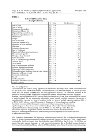
Section B: Assessment of socio-economic and environmental impacts of Flooding on Road Transport
Infrastructure in Enugu Metropolis.
S/No Impact Indicators
(Key areas of impact)
Impact Dimensions
Vulnerability
of activities
Population Frequency Intensity Extent Risk
1 Loss of lives
2 Loss of property
3 Destruction of water
line
4 Destruction of Power
line
5 High cost of goods and
services
6 Reduction in
purchasing power
7 Mental Stress
8 Fatigue
9 Disruption in business
activities
10 Loss in man-hour
11 Reduction in
productivity
12 Disruption of social
activities
13 Migration
14 Population
displacement
15 Loss of livelihoods
16 High cost of
15. Iloeje, A. F. Int. Journal of Engineering Research and Applications www.ijera.com
ISSN : 2248-9622, Vol. 5, Issue 6, ( Part - 5) June 2015, pp.104-118
www.ijera.com 118 | P a g e
infrastructure
maintenance
17 Slow economic growth
18 Slow pace of
development
19 Public discontent
20 Loss of confidence in
government
21 Threat to peace
22 Social unrest
23 Loss of environmental
aesthetics
24 Frequent failure of
tarred roads
25 High cost of vehicle
maintenance
26 Enhanced structural
weakness of culverts
and bridges
27 Reduction in lifespan
of roads
28 Increase in road
mishaps
29 Poverty
30 Traffic congestion