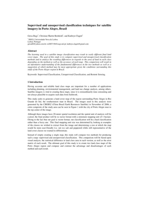

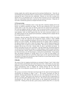
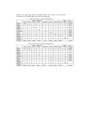
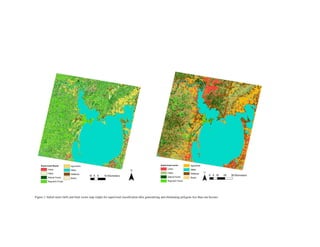
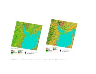
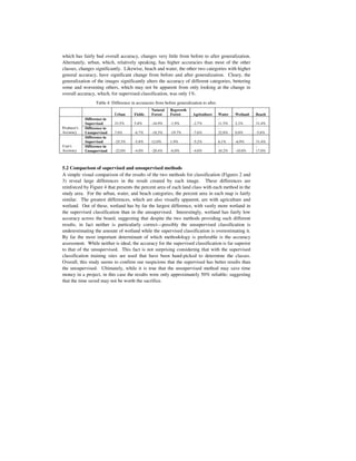

This document compares supervised and unsupervised classification techniques for satellite imagery analysis of land cover in the Porto Alegre region of Brazil. Supervised classification involved collecting over 500 training sites to create signatures for 8 land cover classes. Unsupervised classification used ISOcluster to generate 36 spectral classes which were grouped into the 8 informational classes. Both classifications underwent post-processing including majority filtering and polygon elimination to produce final 1-hectare minimum mapping unit vector maps. Accuracy assessments found the supervised classification to be more accurate at 76% compared to 48% for the unsupervised method.


![Getting Started with Apache Spark: Big Data Made Simple [Free Meetup]](https://cdn.slidesharecdn.com/ss_thumbnails/apachesparkgettingstarted-260203175547-8361bcc3-thumbnail.jpg?width=640&height=640&fit=bounds)

