Area and Grid References
•
2 likes•2,316 views

This document discusses how to locate features on topographic maps using grid references and area references. It explains that topographic maps use a grid system of eastings and northings to precisely locate points, while area references specify the grid square that a feature falls within using the coordinates of the bottom left corner. Examples are provided to demonstrate how to determine both 6-figure grid references and 4-figure area references. Interactive exercises are also included to allow practice of these skills.

Recommended
More Related Content
What's hot
What's hot (20)
Viewers also liked
Similar to Area and Grid References
Similar to Area and Grid References (20)
More from Mr Shipp
More from Mr Shipp (20)
Recently uploaded
Recently uploaded (20)
Area and Grid References
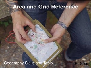
- 1. 1Geography Skills and Tools Area and Grid Reference Mr Shipp
- 2. Grid & Area References • It can be difficult to find places or features easily on a map. • So far we have learnt that to find places on a street directory we use an alpha-numeric grid (e.g. B7) • We also know that to find places on a larger scale, such as a world map we use Latitude & Longitude coordinates to help us find what we are looking for.
- 3. Topographic maps are large scale and we use these for Area and Grid references
- 4. So how do we locate features on a Topographic map? • http://news.bbc.co.uk/2/hi/uk_news/wales/north_west/7824895.stm • This BBC link details the importance of Grid References for emergency services to reach rural areas. • We can locate places easily on a topographic map by using the maps gridlines. • On a topographic map the vertical ( )lines are called eastings because they increase in value as we move eastward. • The horizontal ( ) lines are called northings because they increase in value as we move northwards.
- 5. Eastings Northings N 18 17 16 15 22 23 24 25 26 27
- 6. Area Reference • Features such as a small lake, quarry or village are usually located by means of an Area Reference (AR) • To find the (AR) of a feature we use the coordinate in the lower left-hand corner of the grid square in which the feature is located. • You always read the easting first then the northing. (hint to remember E comes before N in the alphabet) • An area reference always has 4 figures • Into the house and up the stairs” may help you remember!! EXAMPLE: AR3363 easting northing
- 7. Eastings Northings N 18 17 16 15 22 23 24 25 26 27 The Area Reference of the house is: AR2317 Remember with (AR) you use the bottom left hand corner What is the (AR) for: The plane: AR2215 The boy: AR2316
- 8. Area references 21 22 23 24 25 26 39 38 35 36 37 A Time now for a little test. FOUR squares are going to be highlighted and you have TEN seconds to write down the area reference for each square. 10 9 8 7 6 5 4 3 2 1 ACLICK to start..... CLICK for the next square
- 9. Area references 21 22 23 24 25 26 39 38 35 36 37 A 10 9 8 7 6 5 4 3 2 1 BCLICK for the next square B
- 10. Area references 21 22 23 24 25 26 39 38 35 36 37 A 10 9 8 7 6 5 4 3 2 1 CCLICK for the next square C B
- 11. Area references 21 22 23 24 25 26 39 38 35 36 37 A 10 9 8 7 6 5 4 3 2 1 DCLICK for the next square C B D
- 12. Area references 21 22 23 24 25 26 39 38 35 36 37 A CLICK TO CHECK EACH ANSWER C B D A = 2238 B = 2536 C = 2235 D = 2337 How did you get on?
- 13. Grid References • We can locate relatively small and more specific features on map by using Grid Reference (GR). • (GR) locates the exact point on the grid. • Unlike (AR), Grid Reference uses 6 figures. -The first two numbers of each coordinate refers to the eastings and northings that surround the map. - The third number needed to complete each coordinate is obtained by dividing each easting and northing into tenths. Example: GR335638 easting northing Dividing the easting and northing into tenths
- 15. Eastings Northing N 18 17 16 15 22 23 24 25 26 27 What is the grid reference (GR) for the ball in which the boy is about to catch? Answer: GR238169
- 16. 6-figure grid references Come up to the Interactive White Board
- 17. Compass Directions 21 22 23 24 66 67 68 F A B GC H E I D J N E S W NW NE SE SW What direction are you walking ? D F H I JGA C EB A
- 19. CLASS EXERCISE Give the (AR) for the following features: 1. Church; 2. Village Hall; 3. Grove farm; 4. The dairy farm; 5. The town of Little Plumpton; 6. The entire (AR)’s for Gibbet Wood; 7. The (AR)’s that Dale Road passes through; 8. The approximate (GR) of Grove farm.