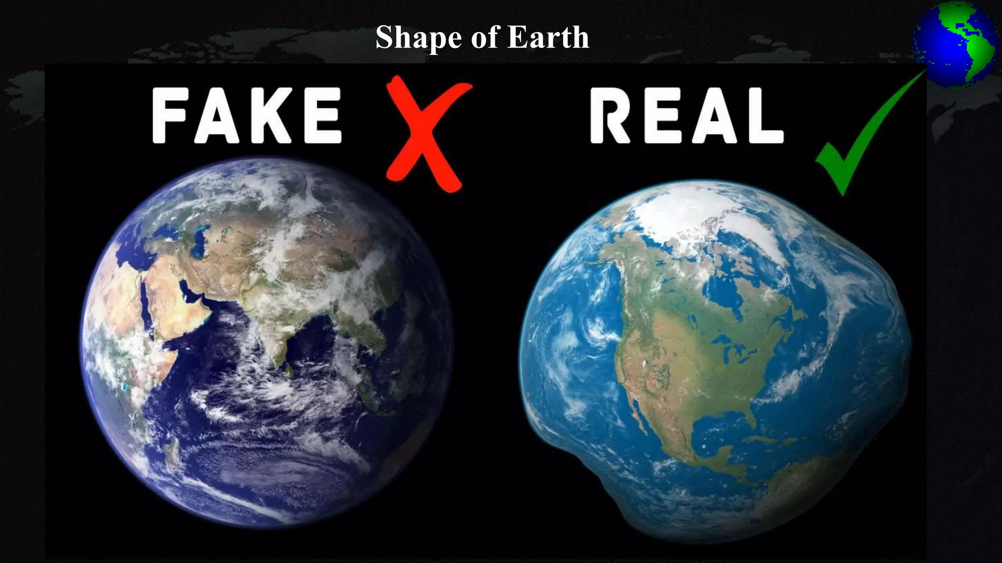
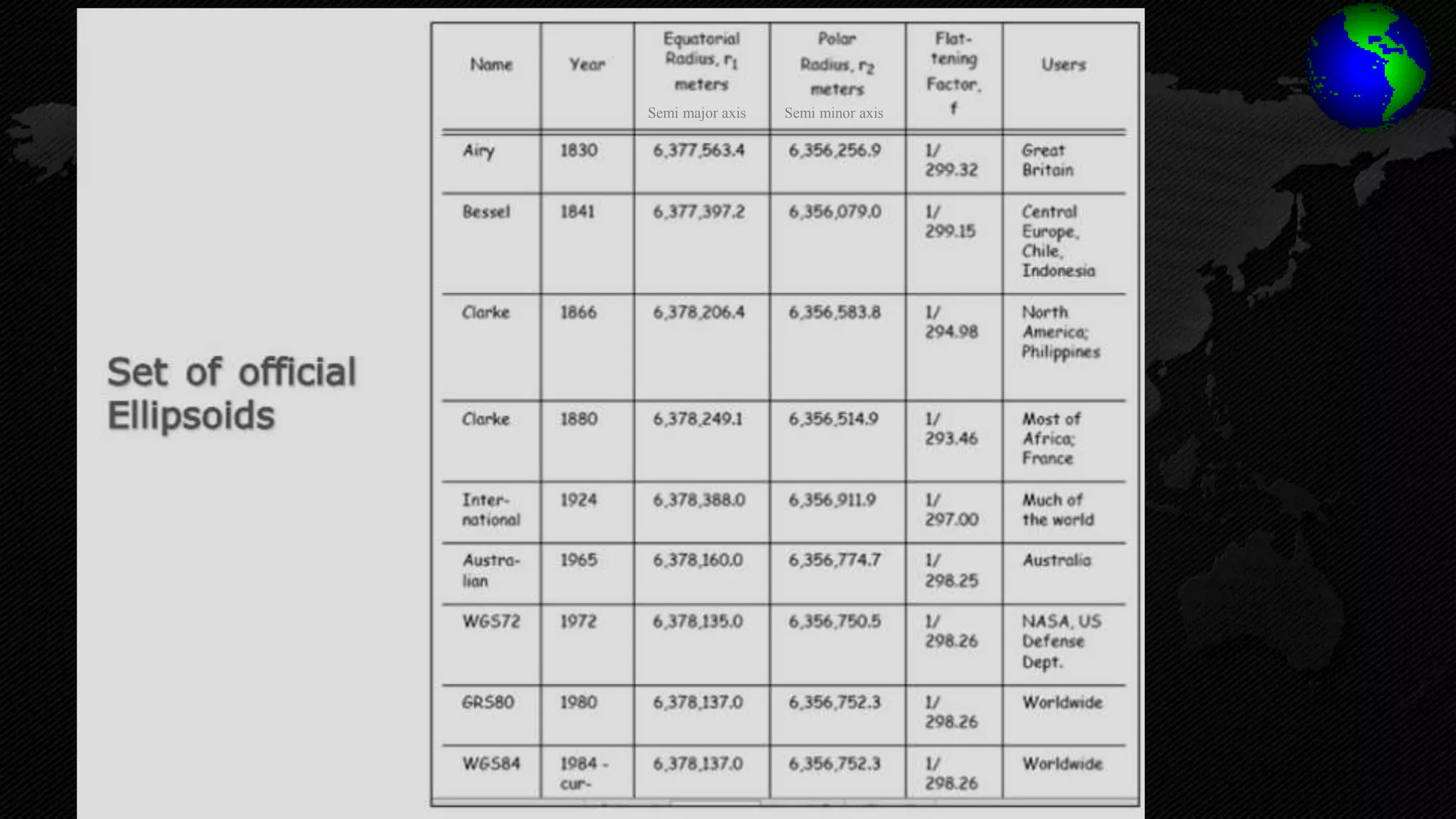
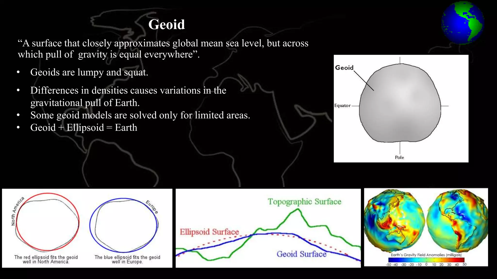
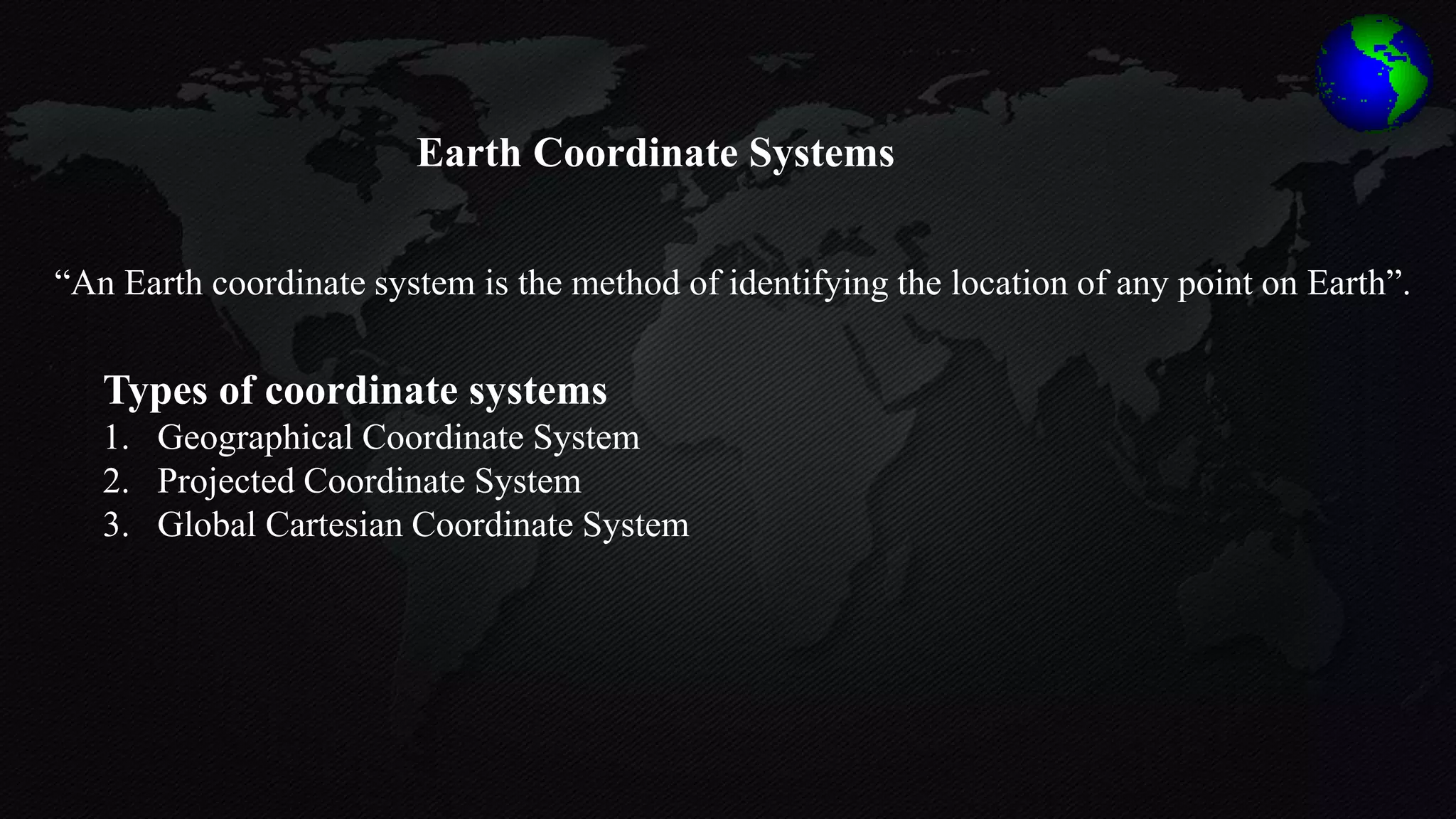
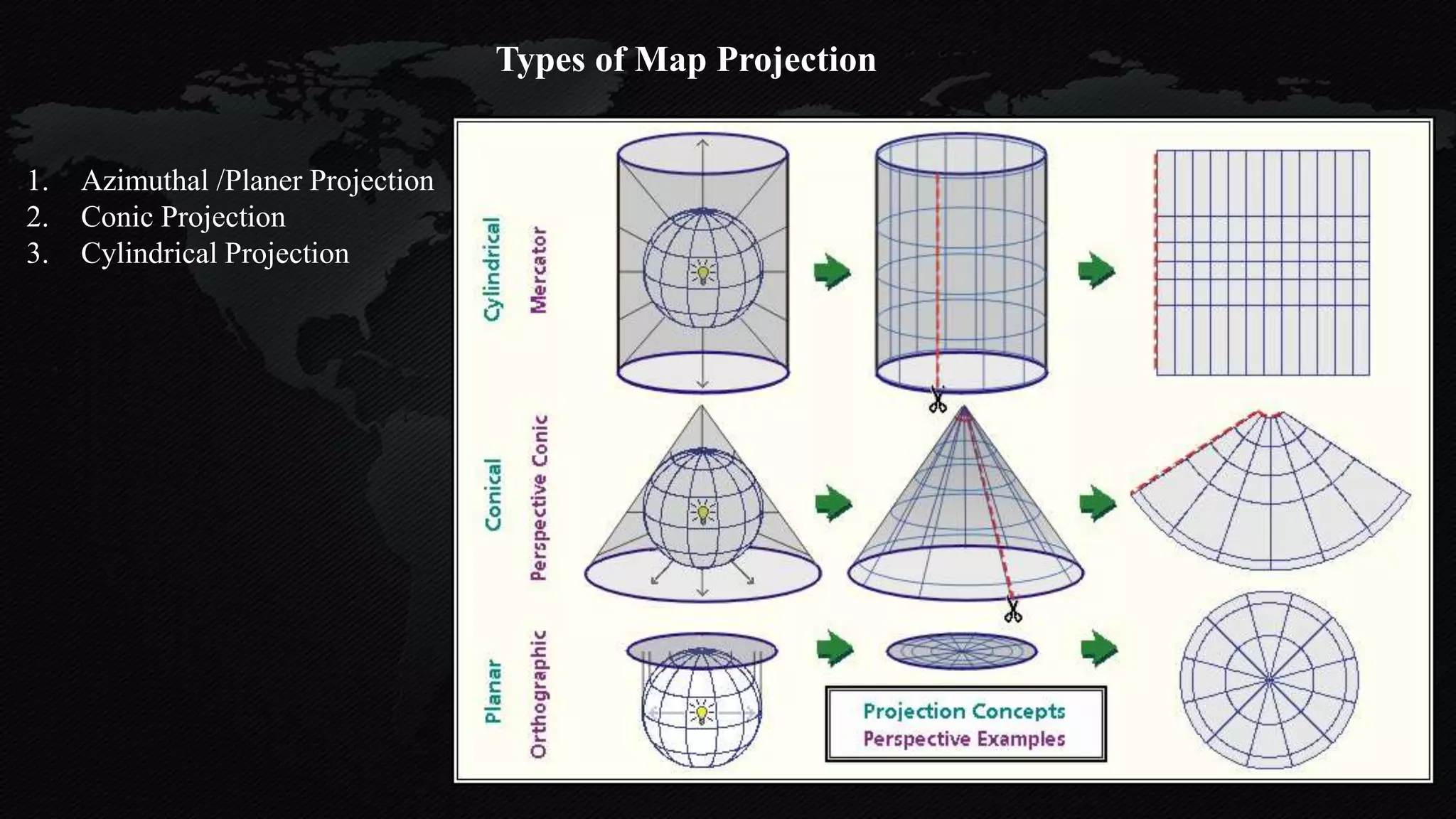
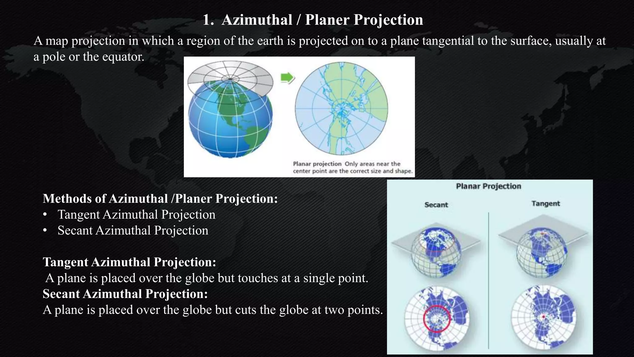
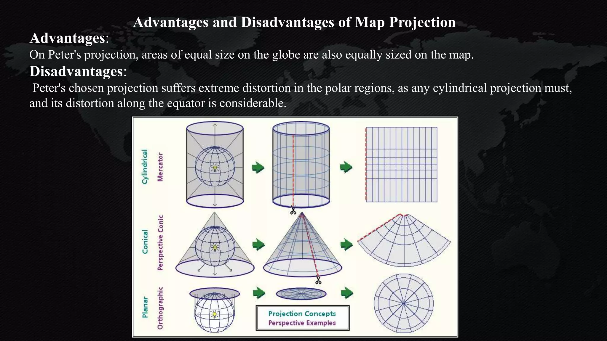
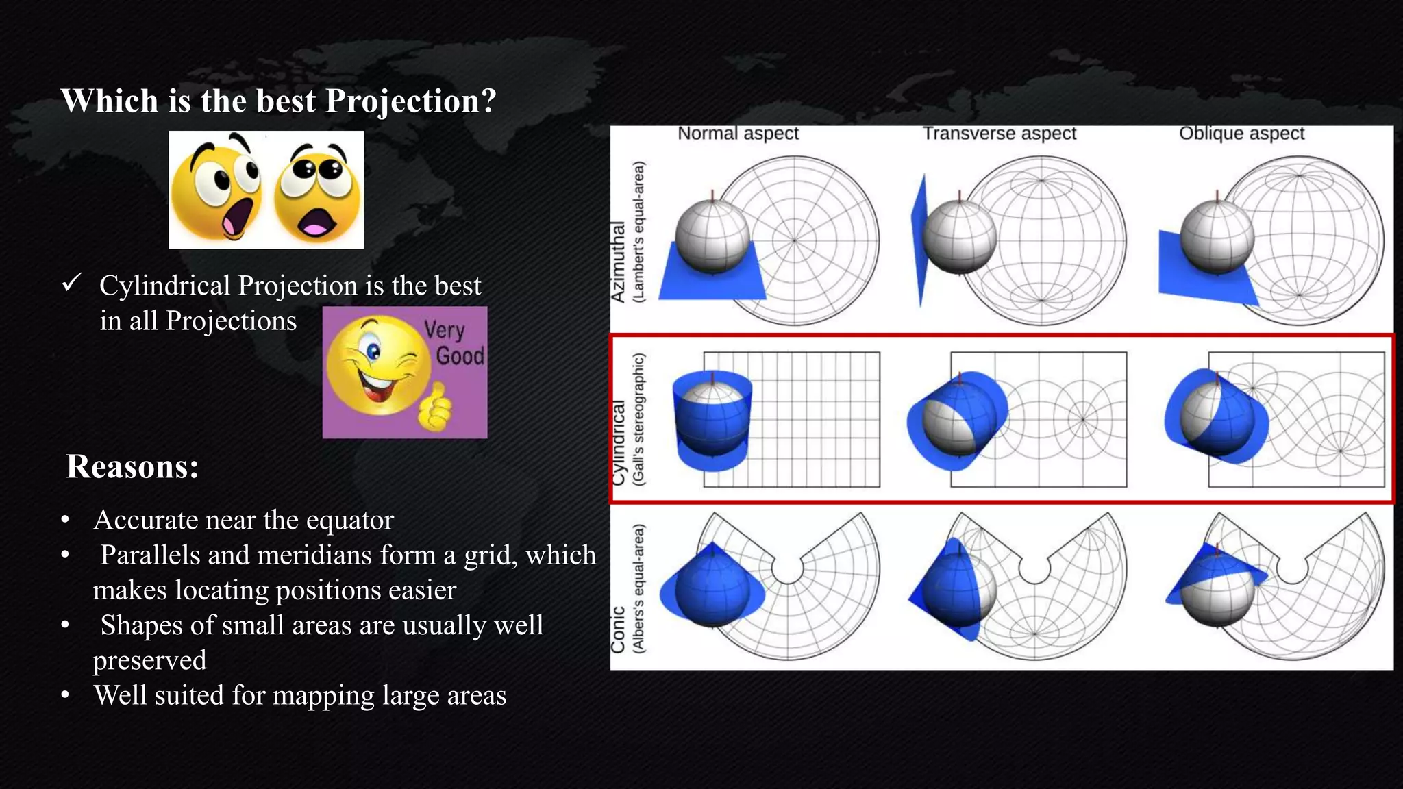
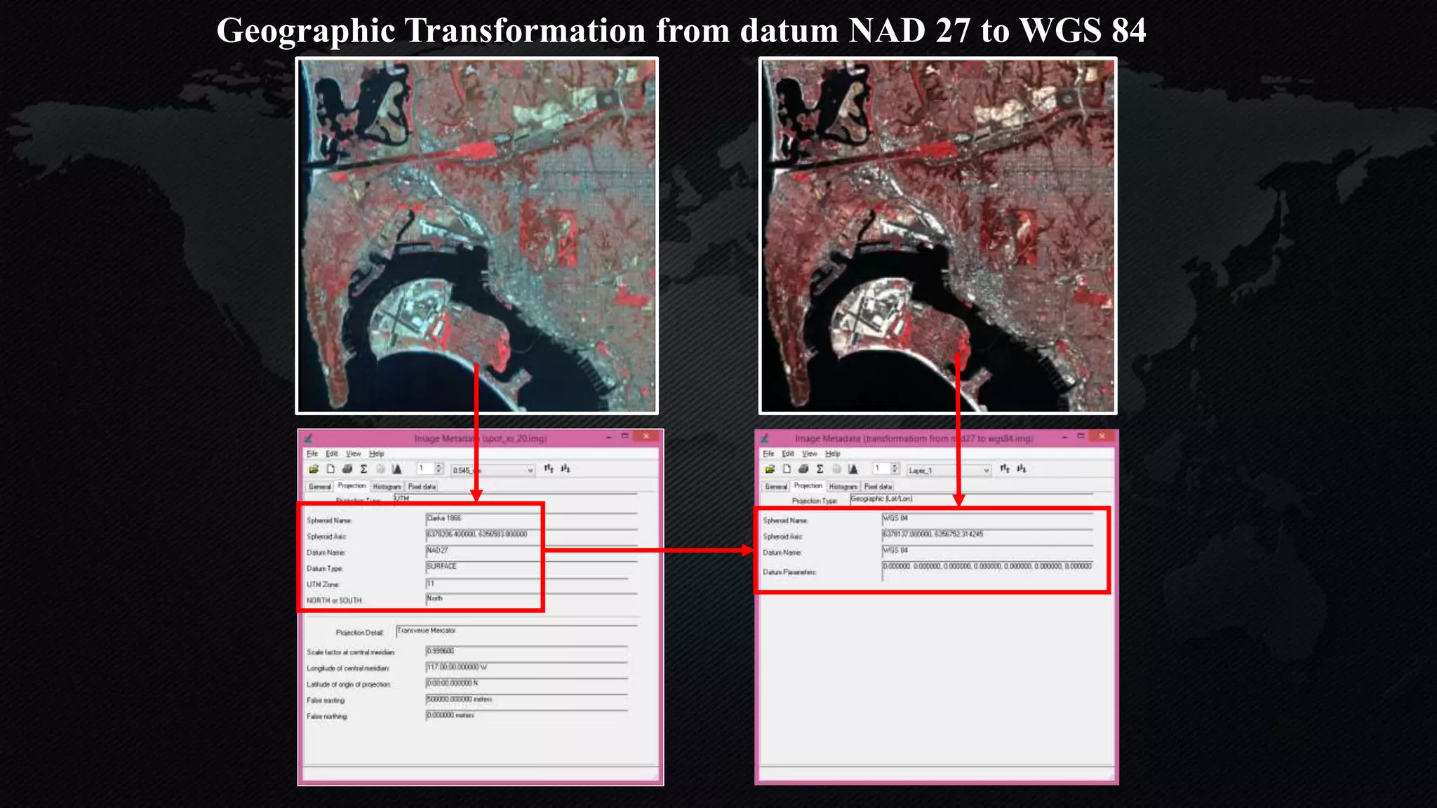
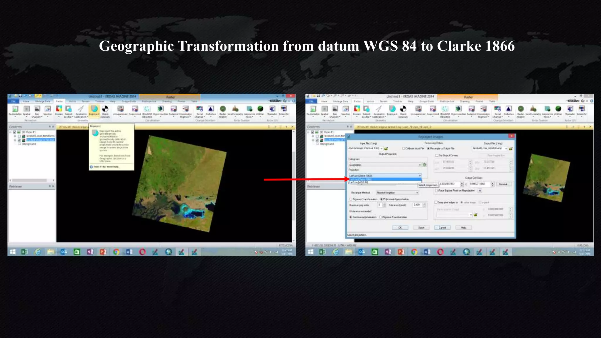
The document discusses earth coordinate systems, focusing on concepts such as datum, spheroid, and various map projection types. It explains the importance of geodesy, the shape of the earth, and different coordinate systems, including geographic and projected systems. Additionally, it compares map projections, highlighting their advantages and disadvantages, particularly the cylindrical projection as the most suitable for large areas.


![Seller Deck - Presentation [Concert L2].PPTX](https://cdn.slidesharecdn.com/ss_thumbnails/sellerdeck-presentationconcertl2-251219171156-24982daf-thumbnail.jpg?width=640&height=640&fit=bounds)


