Remote sensing uses sensors on airborne or spaceborne platforms to detect and record electromagnetic radiation from the Earth's surface. It has two main phases - data acquisition through sensors and data analysis. In geology, remote sensing is used to map lithology, structural features, and monitor hazards. It helps identify rock types and structures that can indicate mineral or oil and gas deposits. Remote sensing provides synoptic data to study geomorphology, hydrology, and other Earth processes over large areas.
The subsurface occurrence of groundwater may be divided into zones of aeration and saturation. The vertical distribution of groundwater is explained in this module.
Remote sensing is the acquisition of information about an object or phenomenon without making physical contact with the object and thus in contrast to in situ observation. In modern usage, the term generally refers to the use of aerial sensor technologies to detect and classify objects on Earth (both on the surface, and in the atmosphere and oceans) by means of propagated signals (e.g. electromagnetic radiation). It may be split into active remote sensing (when a signal is first emitted from aircraft or satellites)[1][2][3] or passive (e.g. sunlight) when information is merely recorded.
International Journal of Engineering Research and Applications (IJERA) is an open access online peer reviewed international journal that publishes research and review articles in the fields of Computer Science, Neural Networks, Electrical Engineering, Software Engineering, Information Technology, Mechanical Engineering, Chemical Engineering, Plastic Engineering, Food Technology, Textile Engineering, Nano Technology & science, Power Electronics, Electronics & Communication Engineering, Computational mathematics, Image processing, Civil Engineering, Structural Engineering, Environmental Engineering, VLSI Testing & Low Power VLSI Design etc.
APPLICATION OF REMOTE SENSING AND GIS IN AGRICULTURELagnajeetRoy
India is a country that depends on agriculture. Today in this era of technological supremacy, agriculture is also using different new technologies like some robotic machinery to remote sensing and Geographical Information System (GIS) for the betterment of agriculture. It is easy to get the information about that area where human cannot check the condition everyday and help in gathering the data with the help of remote sensing. Whereas GIS helps in preparation of map that shows an accurate representation of data we get through remote sensing. From disease estimation to stress factor due to water, from ground water quality index to acreage estimation in various way agriculture is being profited by the application of remote sensing and GIS in agriculture. The applications of those software or techniques are very new to the agriculture domain still much more exploration is needed in this part. New software’s are developing in different parts of the world and remote sensing. Today farmers understand the beneficiaries of these kinds of techniques to the farm field which help in increasing productivity that will help future generation as technology is hype in traditional system of farming.
REMOTE SENSING A VERY USEFUL TECHNOLOGY TO MANKINDkaushikakumar
Hi! I am Kaushika i have given a clear explanation about remotesensing and its types.I have aso explained about the advantages of remote sensing technology.I hope it will be very useful for u.
Remote sensing is the observation of an object from a distance.
It is the art of identifying, observing and measuring an object without coming into direct contact with it by detecting and measuring the radiation of different wavelengths reflected from distant objects.
Similar to 
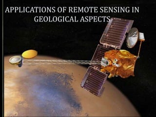
Applications of remote sensing in geological aspects (20)
Read| The latest issue of The Challenger is here! We are thrilled to announce that our school paper has qualified for the NATIONAL SCHOOLS PRESS CONFERENCE (NSPC) 2024. Thank you for your unwavering support and trust. Dive into the stories that made us stand out!
Embracing GenAI - A Strategic ImperativePeter Windle
Artificial Intelligence (AI) technologies such as Generative AI, Image Generators and Large Language Models have had a dramatic impact on teaching, learning and assessment over the past 18 months. The most immediate threat AI posed was to Academic Integrity with Higher Education Institutes (HEIs) focusing their efforts on combating the use of GenAI in assessment. Guidelines were developed for staff and students, policies put in place too. Innovative educators have forged paths in the use of Generative AI for teaching, learning and assessments leading to pockets of transformation springing up across HEIs, often with little or no top-down guidance, support or direction.
This Gasta posits a strategic approach to integrating AI into HEIs to prepare staff, students and the curriculum for an evolving world and workplace. We will highlight the advantages of working with these technologies beyond the realm of teaching, learning and assessment by considering prompt engineering skills, industry impact, curriculum changes, and the need for staff upskilling. In contrast, not engaging strategically with Generative AI poses risks, including falling behind peers, missed opportunities and failing to ensure our graduates remain employable. The rapid evolution of AI technologies necessitates a proactive and strategic approach if we are to remain relevant.
Synthetic Fiber Construction in lab .pptxPavel ( NSTU)
Synthetic fiber production is a fascinating and complex field that blends chemistry, engineering, and environmental science. By understanding these aspects, students can gain a comprehensive view of synthetic fiber production, its impact on society and the environment, and the potential for future innovations. Synthetic fibers play a crucial role in modern society, impacting various aspects of daily life, industry, and the environment. ynthetic fibers are integral to modern life, offering a range of benefits from cost-effectiveness and versatility to innovative applications and performance characteristics. While they pose environmental challenges, ongoing research and development aim to create more sustainable and eco-friendly alternatives. Understanding the importance of synthetic fibers helps in appreciating their role in the economy, industry, and daily life, while also emphasizing the need for sustainable practices and innovation.
A Strategic Approach: GenAI in EducationPeter Windle
Artificial Intelligence (AI) technologies such as Generative AI, Image Generators and Large Language Models have had a dramatic impact on teaching, learning and assessment over the past 18 months. The most immediate threat AI posed was to Academic Integrity with Higher Education Institutes (HEIs) focusing their efforts on combating the use of GenAI in assessment. Guidelines were developed for staff and students, policies put in place too. Innovative educators have forged paths in the use of Generative AI for teaching, learning and assessments leading to pockets of transformation springing up across HEIs, often with little or no top-down guidance, support or direction.
This Gasta posits a strategic approach to integrating AI into HEIs to prepare staff, students and the curriculum for an evolving world and workplace. We will highlight the advantages of working with these technologies beyond the realm of teaching, learning and assessment by considering prompt engineering skills, industry impact, curriculum changes, and the need for staff upskilling. In contrast, not engaging strategically with Generative AI poses risks, including falling behind peers, missed opportunities and failing to ensure our graduates remain employable. The rapid evolution of AI technologies necessitates a proactive and strategic approach if we are to remain relevant.
How to Make a Field invisible in Odoo 17Celine George
It is possible to hide or invisible some fields in odoo. Commonly using “invisible” attribute in the field definition to invisible the fields. This slide will show how to make a field invisible in odoo 17.
The French Revolution, which began in 1789, was a period of radical social and political upheaval in France. It marked the decline of absolute monarchies, the rise of secular and democratic republics, and the eventual rise of Napoleon Bonaparte. This revolutionary period is crucial in understanding the transition from feudalism to modernity in Europe.
For more information, visit-www.vavaclasses.com
Honest Reviews of Tim Han LMA Course Program.pptxtimhan337
Personal development courses are widely available today, with each one promising life-changing outcomes. Tim Han’s Life Mastery Achievers (LMA) Course has drawn a lot of interest. In addition to offering my frank assessment of Success Insider’s LMA Course, this piece examines the course’s effects via a variety of Tim Han LMA course reviews and Success Insider comments.
2024.06.01 Introducing a competency framework for languag learning materials ...Sandy Millin
http://sandymillin.wordpress.com/iateflwebinar2024
Published classroom materials form the basis of syllabuses, drive teacher professional development, and have a potentially huge influence on learners, teachers and education systems. All teachers also create their own materials, whether a few sentences on a blackboard, a highly-structured fully-realised online course, or anything in between. Despite this, the knowledge and skills needed to create effective language learning materials are rarely part of teacher training, and are mostly learnt by trial and error.
Knowledge and skills frameworks, generally called competency frameworks, for ELT teachers, trainers and managers have existed for a few years now. However, until I created one for my MA dissertation, there wasn’t one drawing together what we need to know and do to be able to effectively produce language learning materials.
This webinar will introduce you to my framework, highlighting the key competencies I identified from my research. It will also show how anybody involved in language teaching (any language, not just English!), teacher training, managing schools or developing language learning materials can benefit from using the framework.
Operation “Blue Star” is the only event in the history of Independent India where the state went into war with its own people. Even after about 40 years it is not clear if it was culmination of states anger over people of the region, a political game of power or start of dictatorial chapter in the democratic setup.
The people of Punjab felt alienated from main stream due to denial of their just demands during a long democratic struggle since independence. As it happen all over the word, it led to militant struggle with great loss of lives of military, police and civilian personnel. Killing of Indira Gandhi and massacre of innocent Sikhs in Delhi and other India cities was also associated with this movement.
Unit 8 - Information and Communication Technology (Paper I).pdfThiyagu K
This slides describes the basic concepts of ICT, basics of Email, Emerging Technology and Digital Initiatives in Education. This presentations aligns with the UGC Paper I syllabus.
Macroeconomics- Movie Location
This will be used as part of your Personal Professional Portfolio once graded.
Objective:
Prepare a presentation or a paper using research, basic comparative analysis, data organization and application of economic information. You will make an informed assessment of an economic climate outside of the United States to accomplish an entertainment industry objective.
Model Attribute Check Company Auto PropertyCeline George
In Odoo, the multi-company feature allows you to manage multiple companies within a single Odoo database instance. Each company can have its own configurations while still sharing common resources such as products, customers, and suppliers.
4. It is defined as the science of:
Acquiring images refers to the technology employed eg
electro-optical scanning system.
Processing refers to the procedures that convert raw
data into images.
Interpreting converts an image information that is useful
for human use
cont…
5. Remote Sensors are mechanical
devices where informations are stored
or recorded about the object or scene
under study.
They are classified as
Active or Passive
Image or Non-Image forming
Commercial or Military
6. Passive Remote Sensing:
If the observation is made based on the
electromagnetic radiation from the sun or self-
emitted radiance.
E.g. Photography during daytime with the help of
Sunlight.
7. Active Remote Sensing:
It is also possible to produce electromagnetic
radiation of a specific wavelength or band of
wavelength to illuminate the object or terrain. The
interaction of this radiation can then be studied by
sensing the scattered radiance from the target.
E.g. Photography at night with the help of Flash
Light.
8. “The vehicle or carrier for remote sensor
is borne is called the Platform.”
The typical platforms are satellite and
aircraft, but they can also include radio
controlled airplanes, balloons, and kites for low
altitude remote sensing, as well as ladder and
cherry pickers for ground investigation.
9. Air borne plat form
Space borne plat form
Ground borne plat form
(Cherry-picker with passive microwave
radiometer)
10. The basic principle of remote sensing is governed
by 2 processes viz.
Data acquisition and Data analysis.
11. It comprises of the following distinct elements:
a). Energy source.
b). Propagation of energy through the
atmosphere.
c). Energy interaction with the Earth’s surface
feature.
d). Air borne/Space borne sensors to record the
reflected energy.
e). Generation of sensor data in the form of
pictures or digital information.
12. It involves examining the data using various
viewing instruments to analyse pictorial data or a
computer to analyse digital sensor data.
Reference data or Ground truth check is an
essential part of data analysis.
The acquisition of reference data involves
collection of information about objects, area or any
phenomena that are remotely being sensed.
Finally the information is presented to users who
apply it to their decision making process.
13. A. Radiation and the
atmosphere
B. Interaction with target
C. Energy recorded and converted by
sensor
D.Reception and
processing
E.Interpretation and
analysis
A
A
B
D
E
C
12
65
28
33
76
Process of Remote Sensing
14. The Electromagnetic Spectrum ranges from the shorter
wavelengths (including gamma and x-rays) to the longer
wavelengths (including microwaves and broadcast radio
waves). There are several regions of the electromagnetic
spectrum which are useful for remote sensing.
The light which our eyes can detect is part of the visible
spectrum (small)
There is a lot of radiation around us which is "invisible" to our
eyes, but can be detected by other remote sensing
instruments and used to our advantage
The visible wavelengths cover a range from approximately 0.4
to 0.7 micro meter (violet to red)
15.
16. There are four forms of interaction that can take place
when energy strikes, or is incident upon the surface:
•Transmission (T): radiation passes through a target
•Reflection (R): radiation "bounces" off the target and is
redirected
•Scattering (S): scattering occurs when incident
electromagnetic radiation is dispersed in all
directions from a rough surface.
•Absorption (A): radiation is absorbed into the target
The proportions of each interaction will depend on
the wavelength of the energy and the material and
condition of the feature.
18. Geology involves the study of landforms, strucures,
and the sub surface to understand the processes
operating in the earths crust.
Geological studies are not limited only to the earth-
remote sensing has been used to examine the
composition and structure of other planets.
Remote sensing is used as a tool to extract
information about the land surface , composition
or sub-surface.
19. Multi-spectral data can provide information on
lithology or rock composition based on spectral
reflectance.
Radar provides an expression of surface
topography and roughness.
It is not limited only to direct geological
applications but it is also used to support
logistics,such a route planning for access into
mining area,reclaimation monitoring and
generating base maps upon which geological
data can be referenced or superimposed.
20. Mapping of surficial deposit/bedrock.
Lithological mapping.
Structural mapping.
Lineament extraction.
Mineral exploration.
Exploration of hydrocarbon.
Environmental geology.
Geobotany.
Mapping and monitoring.
Geohazard mapping.
Planetary mapping.
21. Structural geology plays an important role in mineral
and hydrocarbon exploration and potential hazard
identification and monitoring.
Structural mapping is the identification and
characterization of structural expressions.
Structures can indicate potential location for oil and gas
reserve and provide clues to potential hazards such as
earthquakes landslides and volcanic activities.
Aerial photos can be used in temperate areas where
large scale imagery is used, particularly to map
potential geohazards.
22.
23.
24. Geological Unit Mapping consists primarily identifying
physiographic units and determining the rock lithology
or coarse stratigraphy of exposed units.
Remote sensing can be used to describe the lithology
by the color, weathering and erosion characteristics,
drainage patterns and thickness of bedding.
Unit Mapping is useful in oil and mineral exploration
since this resource are often associated with specific
lithologies.
25. Regional lineaments and structural trends
along which groups of mining districts may
occur.
Mapping local fracture patterns that may
control individual ore deposits.
Detecting hydrothermally altered rocks
associated with ore deposits.
Providing basic geologic data.
26.
27. It deals with different landforms that characterize the
earth’s topography, origin, sequence of evolution,
present status and their future trend.
Until space age, scientists conducted most geomorphic
analysis by mapping (generally topographic and
geologic) and by field observation and measurements.
Eventually, aerial photographs became a prime tool for
mapping and interpreting.
Modern macro-geomorphology makes extensive use of
global observation from space crafts that employs a
variety of imaging and sensing systems. Eg: Vidicon
imaging, multi spectral scanning, radiometers and
Radars.
28. Hydrology is inherently related to many other
applications of remote sensing, particularly forestry,
agriculture and land cover.
Most hydrological processes are dynamic and require
frequent observation.
Remote Sensing offers a synoptic view of the spatial
distribution and dynamics of hydrological phenomena,
often unattainable by traditional ground surveys
29. Examples of Hydrological applications:
Flood delineation and mapping
Remote sensing techniques are used to measure and
monitor the real extent of the flooded areas to
efficiently target rescue efforts and to provide
quantifiable estimates of the amount of land affected.
Incorporating remotely sensed data into a GIS allows
for quick calculation and assessment of water levels,
damage, and areas facing potential flood danger
30. Remote Sensing based groundwater prospect zone
map serve as a base for further exploration using
hydrogeological and geophysical methods to locate
well sites.
If remote sensing data are used at first level to
delineate prospective zones and further follow up by
hydrogeological and geophysical surveys, higher
success could be achieved besides saving in terms of
cost, time and work.
Remote Sensing data helps in identifying suitable areas
for recharging groundwater.
31. Remote Sensing means acquiring information
about an object or phenomenon from a distance,
without actually coming in contact with the object
under study.
The quantity most frequently used in present day
remote sensing systems is the Electromagnetic
Energy emanating from the object of interest.
Principally, there are two types of Remote Sensing
viz. Active and Passive Remote sensing.
32. It has two phases: Data acquisition phase and Data
analysis phase.
The underlying principle on which the whole
Remote Sensing technique is developed is that all
objects on the Earth’s surface have characteristic
spectral signatures.
The applications of Remote Sensing in the Earth’s
science as a whole, especially in Geology is
manifold.
33. BOOKS:
A.N. Patel and Surendra Singh, “Principles of Remote
Sensing” Edition-1999, Page No. 1, 27, 113.
Scientific Publishers (India), Jodhpur.
Basuded bhatta, ”remote sensing and
GIS”2008,2011,oxford university press.
Flyod F .Sabins, “ remote sensing,principles and
interpretation,1996.3rd edition .
Editor's Notes
APPLICATIONS OF REMOTE SENSING IN GEOLOGICAL ASPECTS