Downloaded 58 times
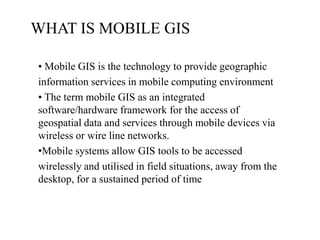
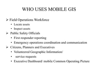
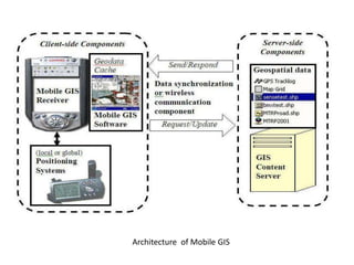


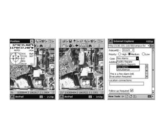


Mobile GIS allows geographic information systems tools and data to be accessed on mobile devices through wireless networks. It has applications in fields like public safety, utilities management, and land surveying by enabling workers to view maps and collect geospatial data in the field. The key components of a mobile GIS include positioning systems, mobile GIS software, data synchronization capabilities, and geospatial data servers. A case study demonstrates how a university integrated a mobile GIS platform using ArcPad software on PocketPC devices to help campus security and emergency response teams respond quickly to incidents.


