Downloaded 61 times
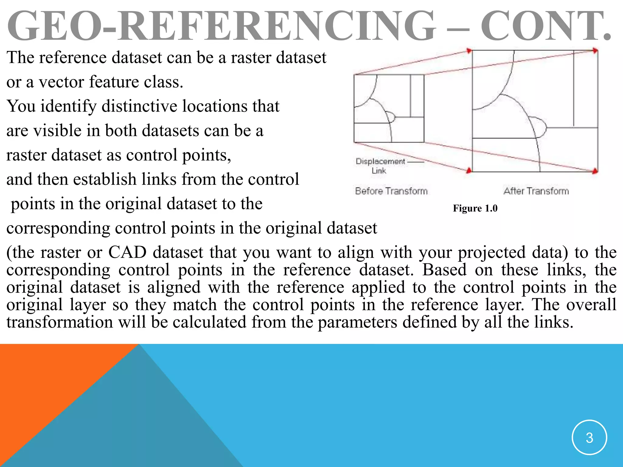

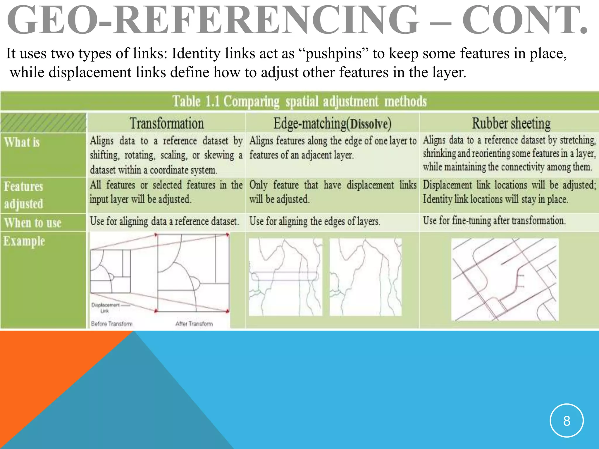

Geo-referencing aligns raster or CAD data to a reference dataset with a known coordinate system. This process identifies control points visible in both datasets and links them, applying a transformation to align the original dataset to the reference. Geo-referencing can correct minor shifts or more drastic displacements. It saves transformation information in an external file or rectifies the data into the reference system. Spatial adjustment similarly aligns vector data during an edit session using transformation, edge-matching, or rubber sheeting methods based on control point links.