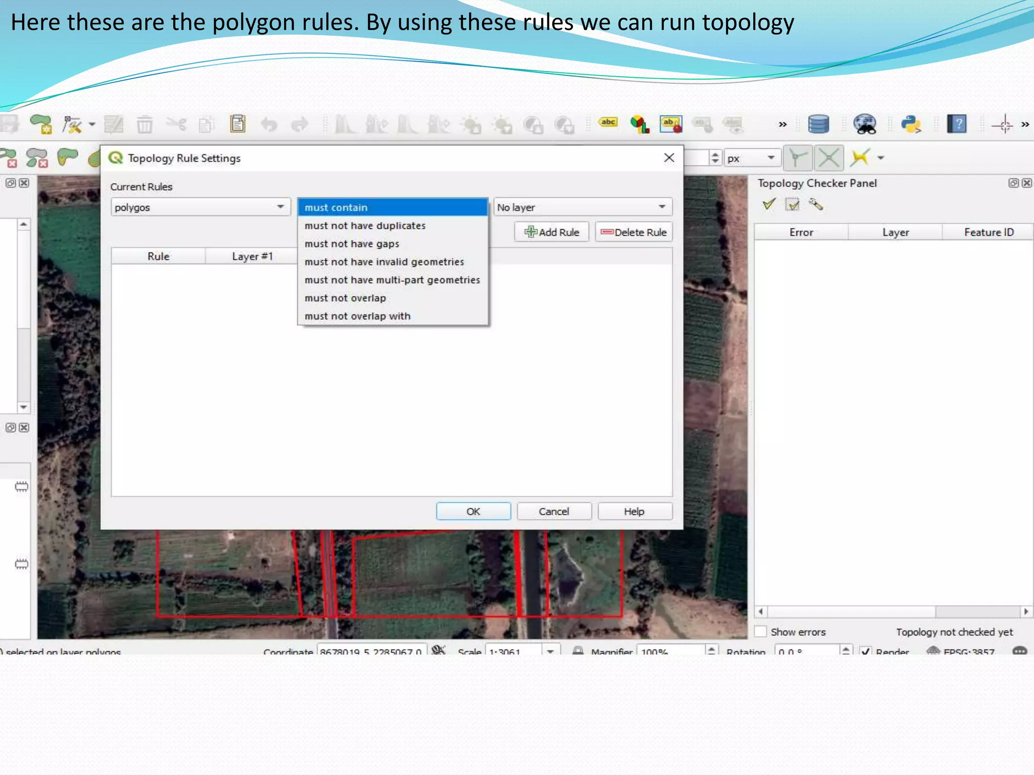
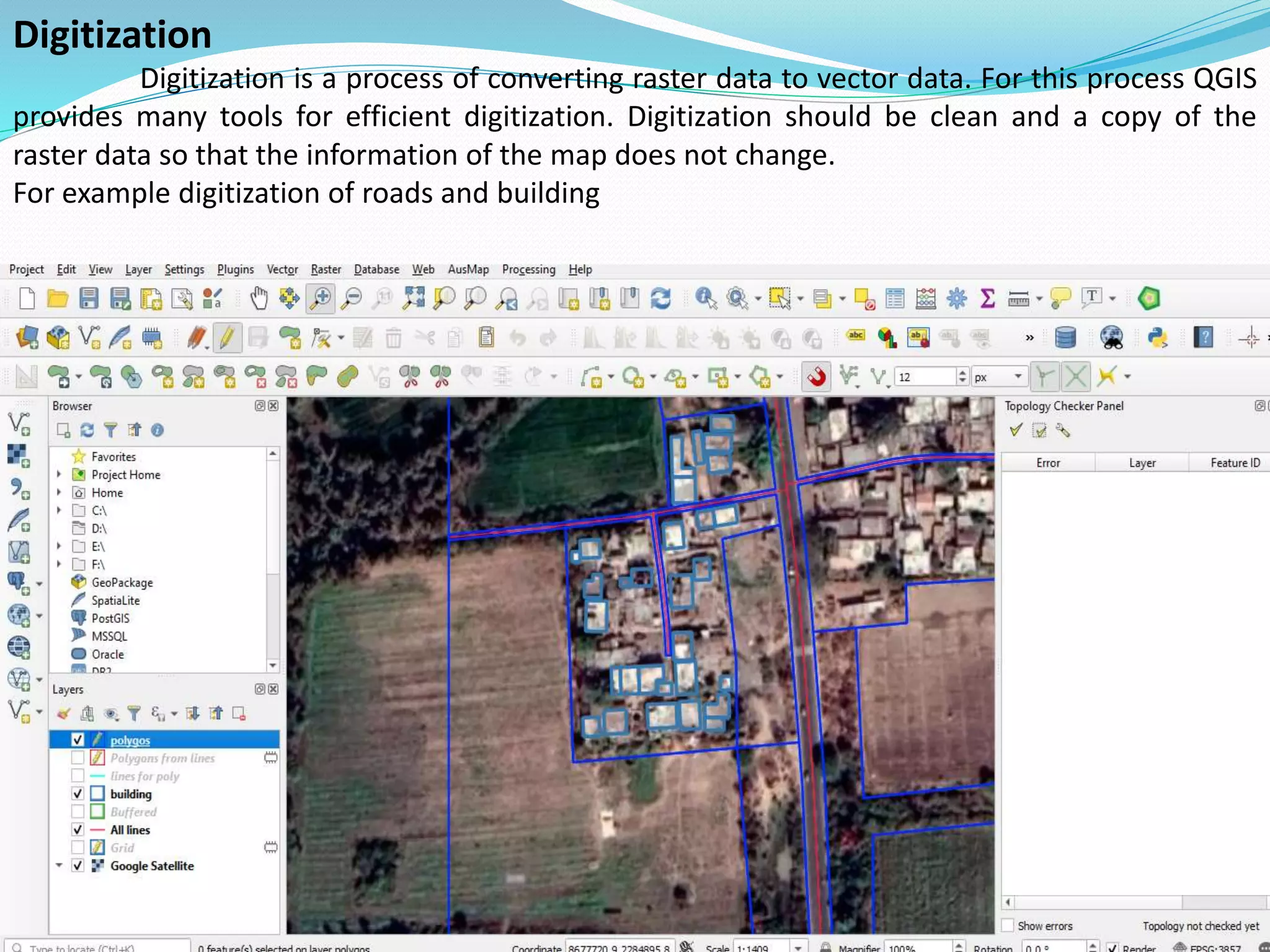
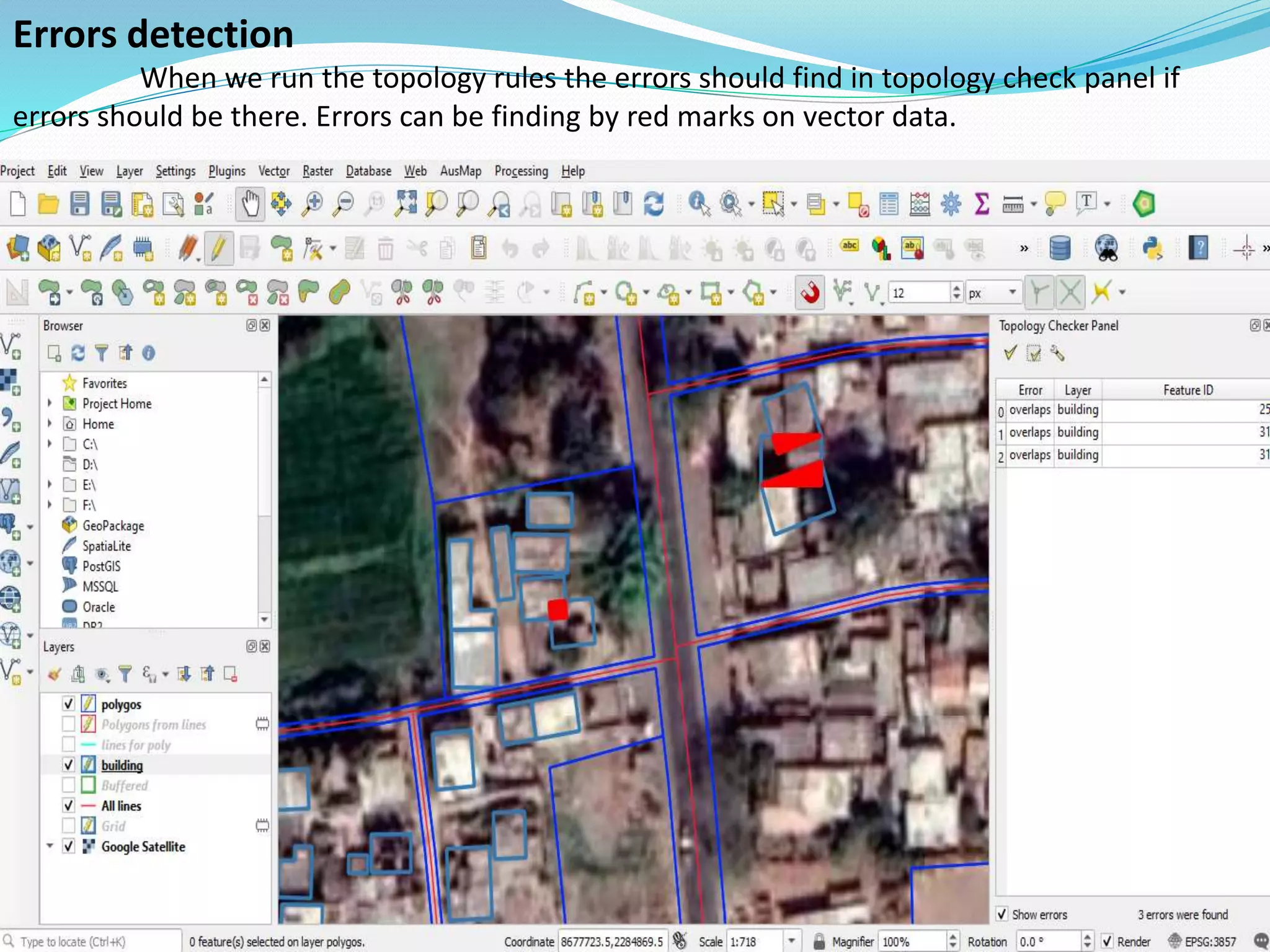
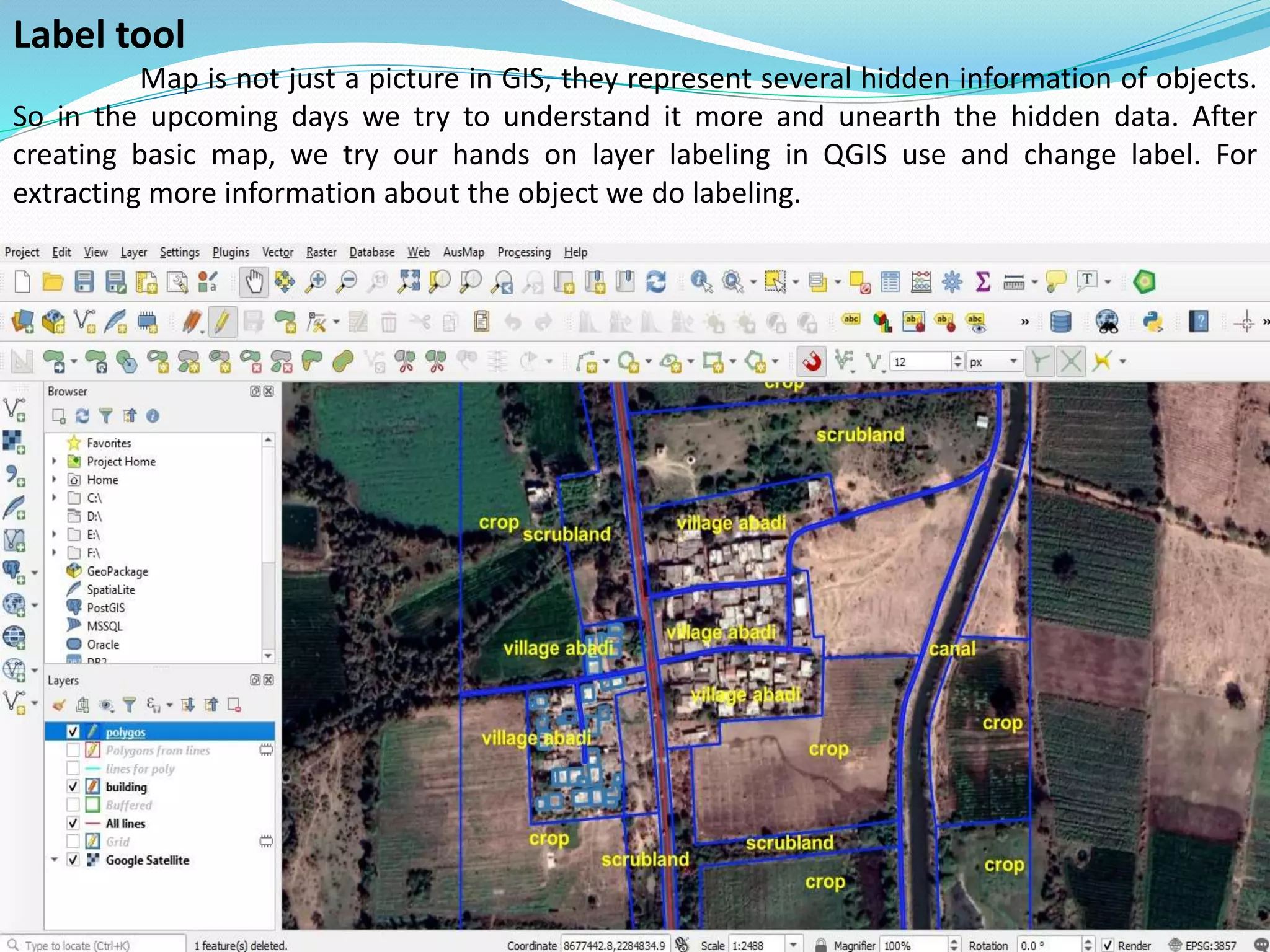
This document provides an overview of using QGIS open source GIS software to load, manipulate, and classify geospatial data. It discusses loading data formats like shapefiles and geodatabases, exploring the QGIS interface, performing digitization and attribute editing, running topology rules to check for errors, and labeling layers to provide more information about mapped features. Exercises are demonstrated step-by-step to help users understand how to apply GIS theory and create basic maps in QGIS.