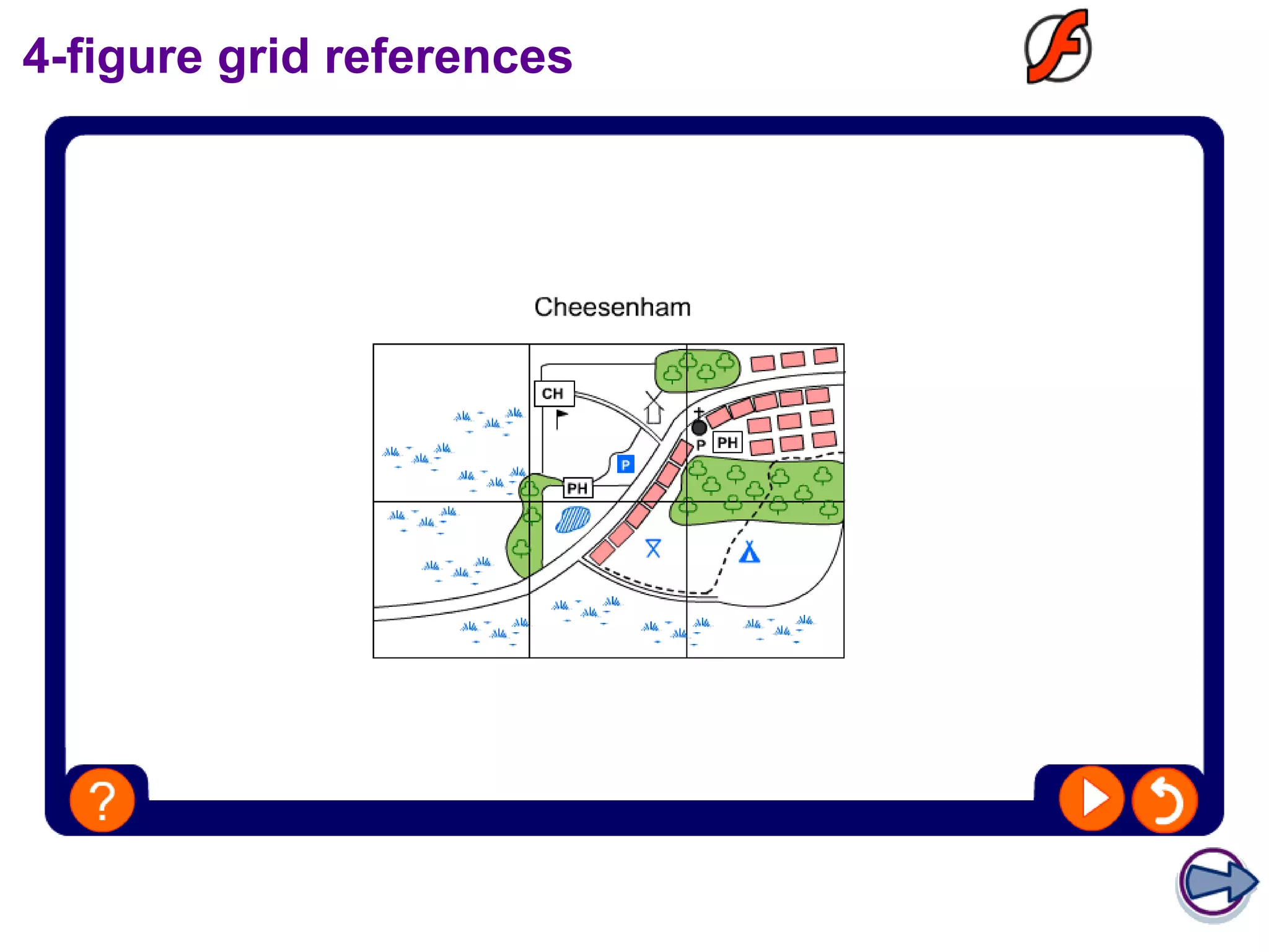
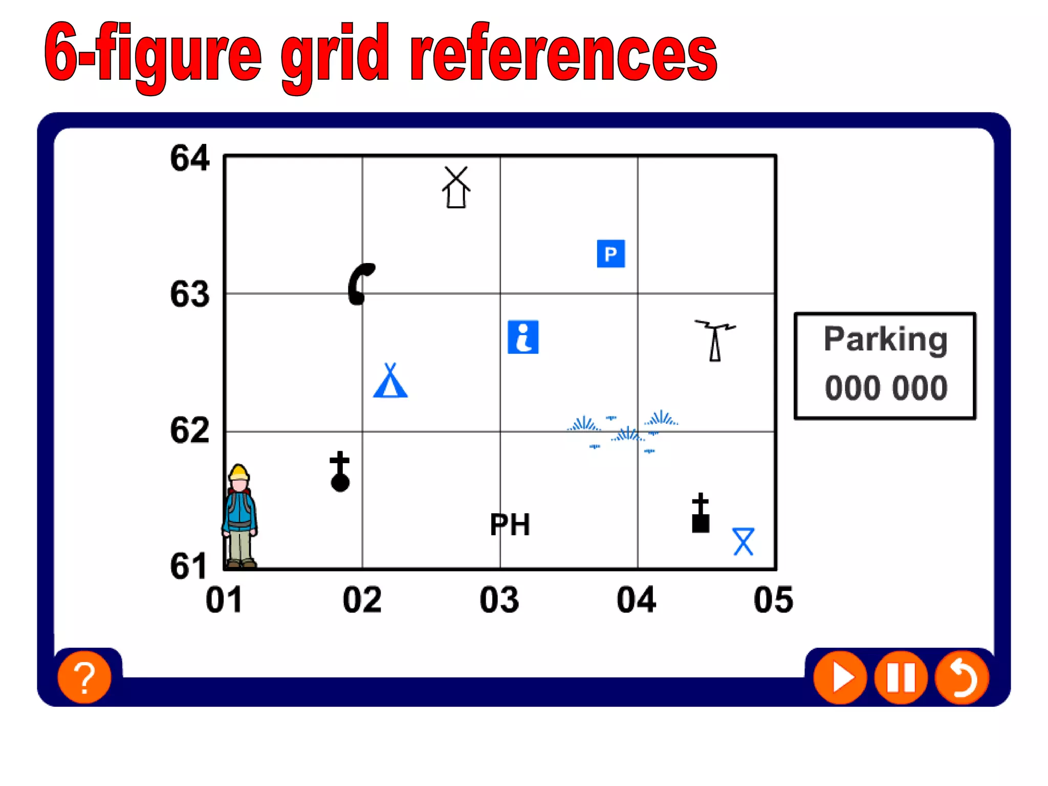
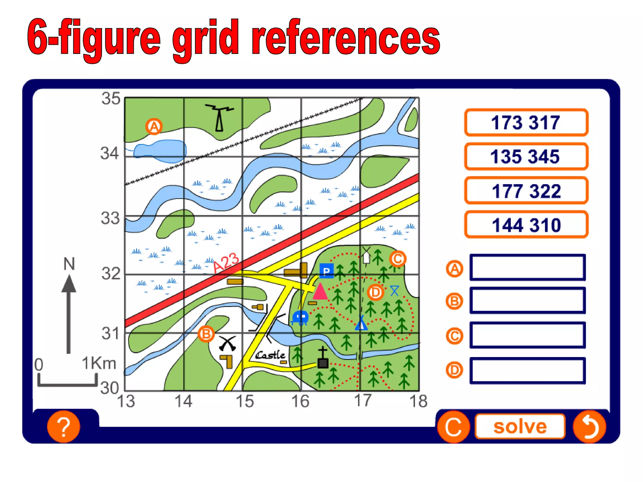
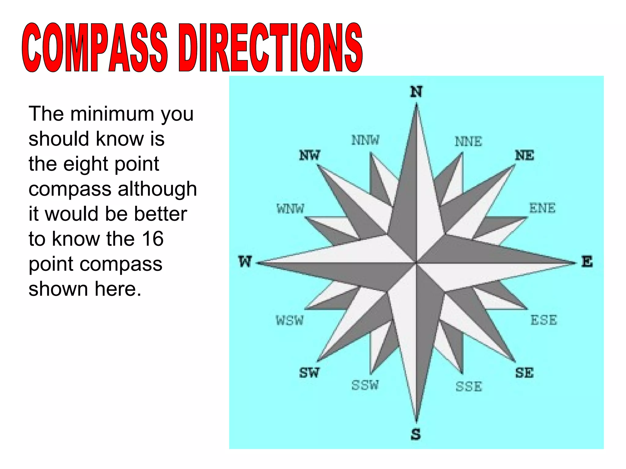
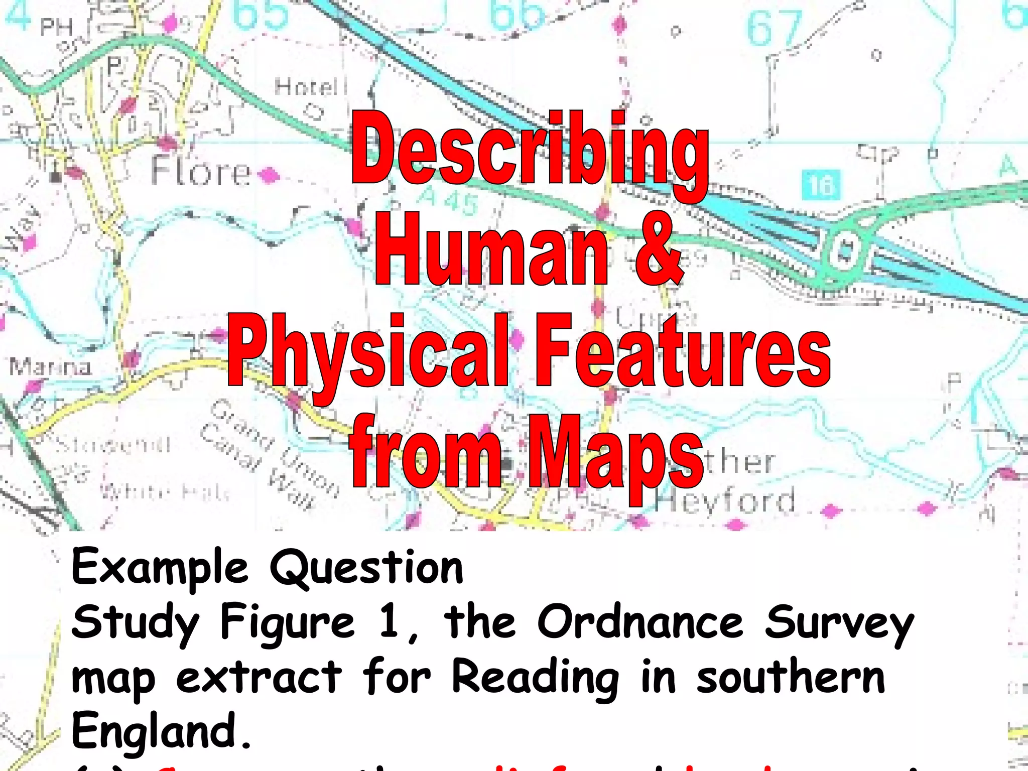
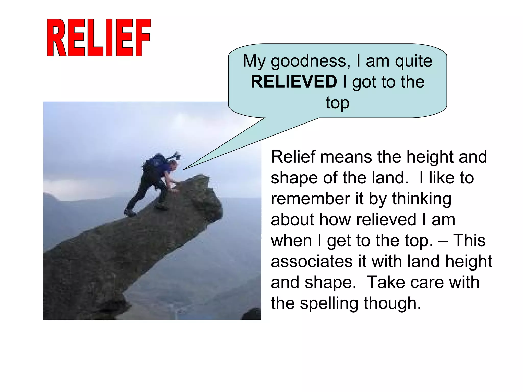
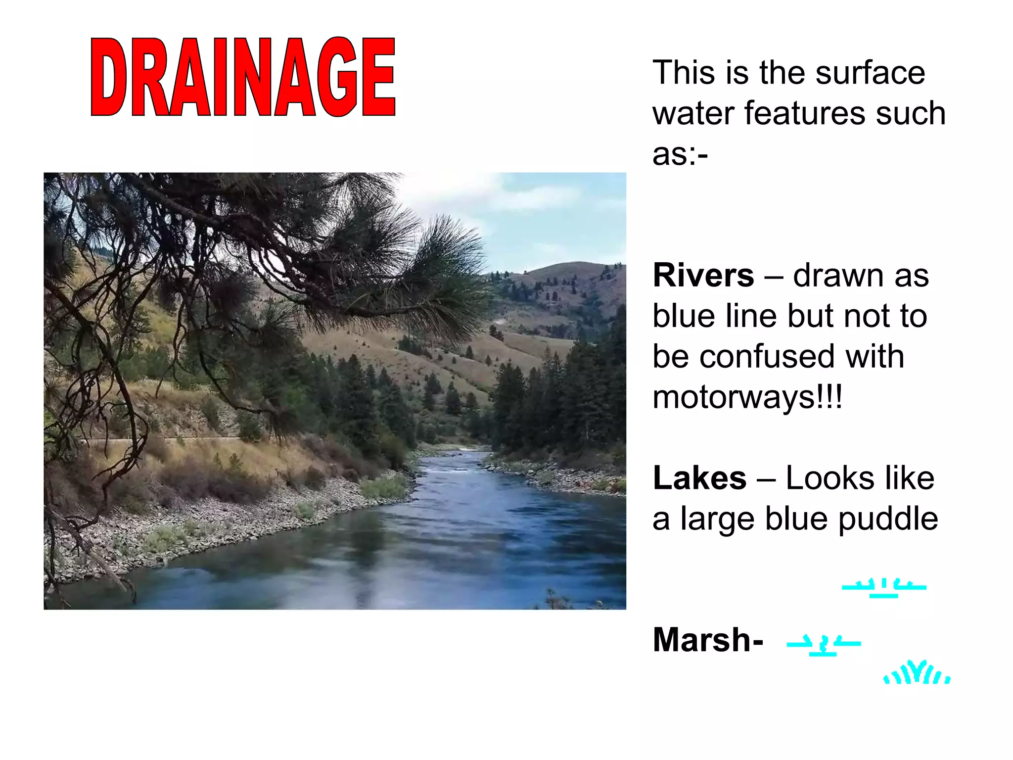
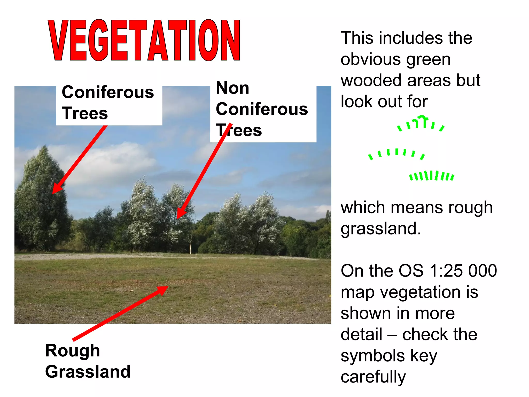
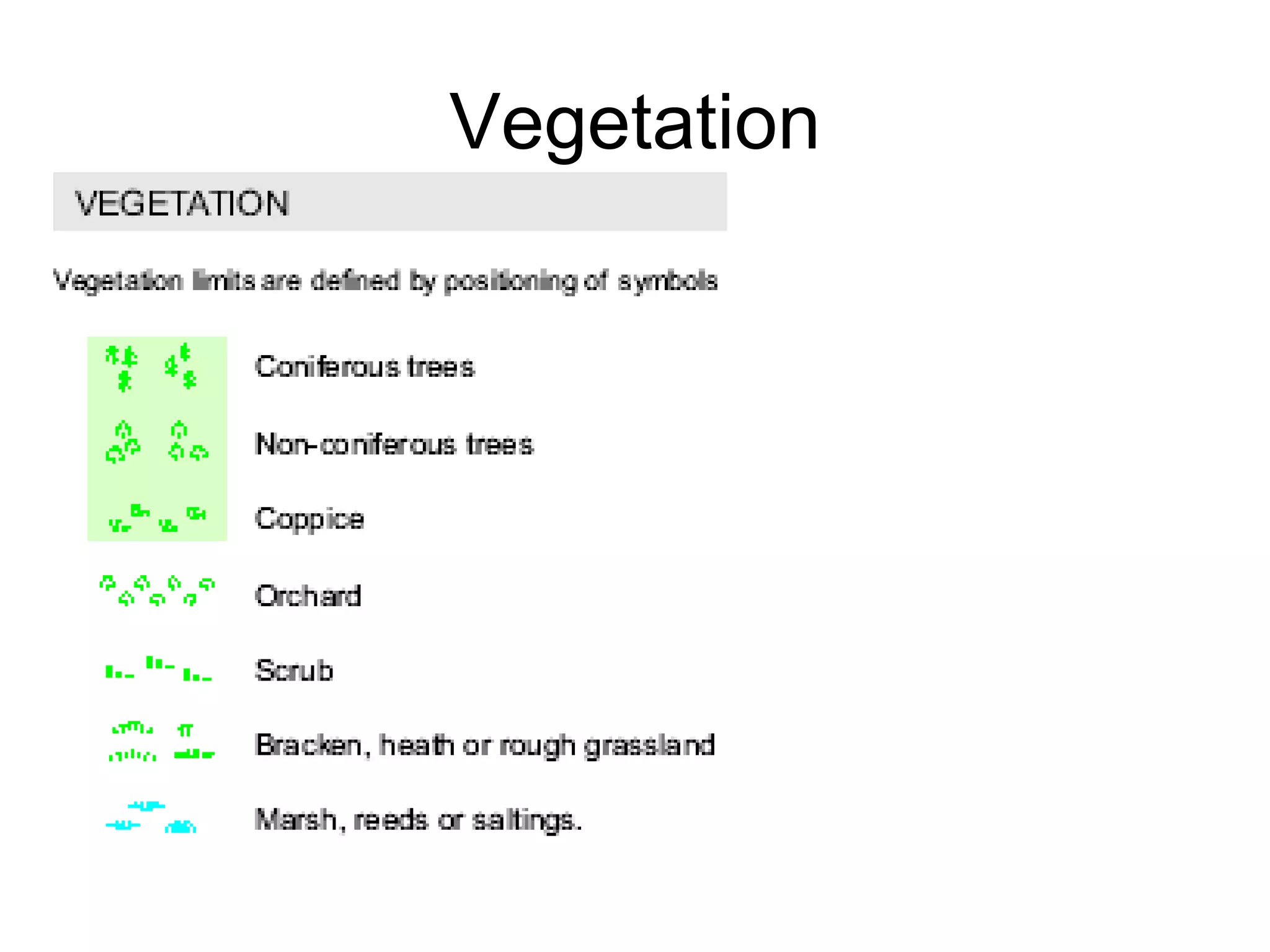
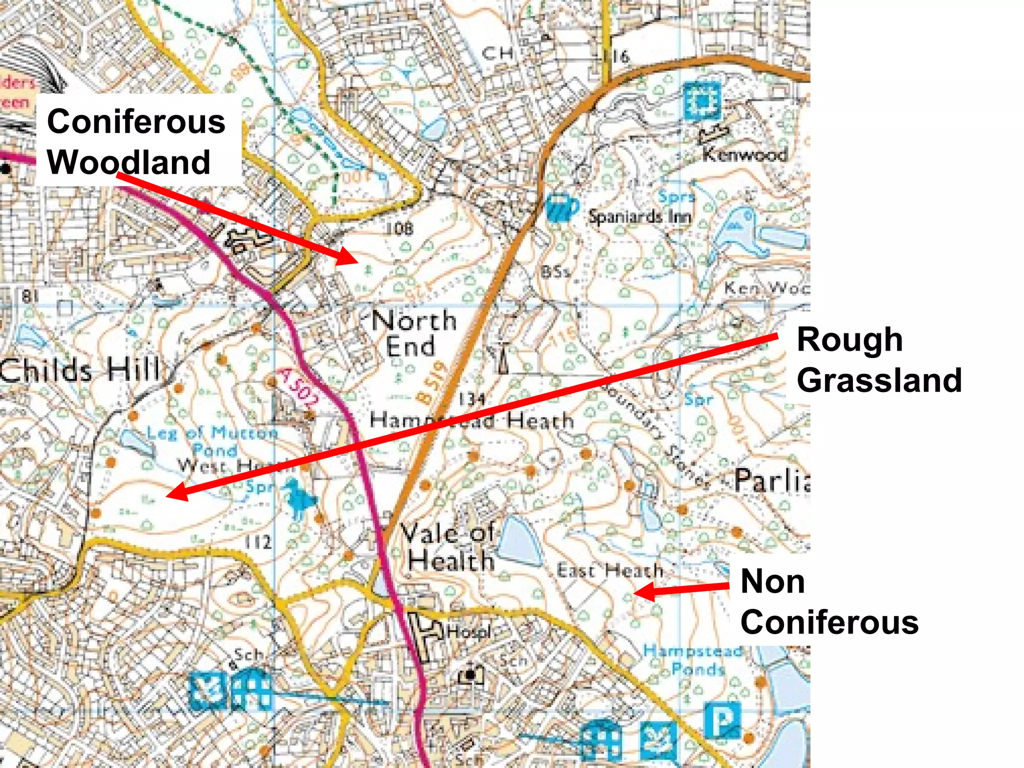
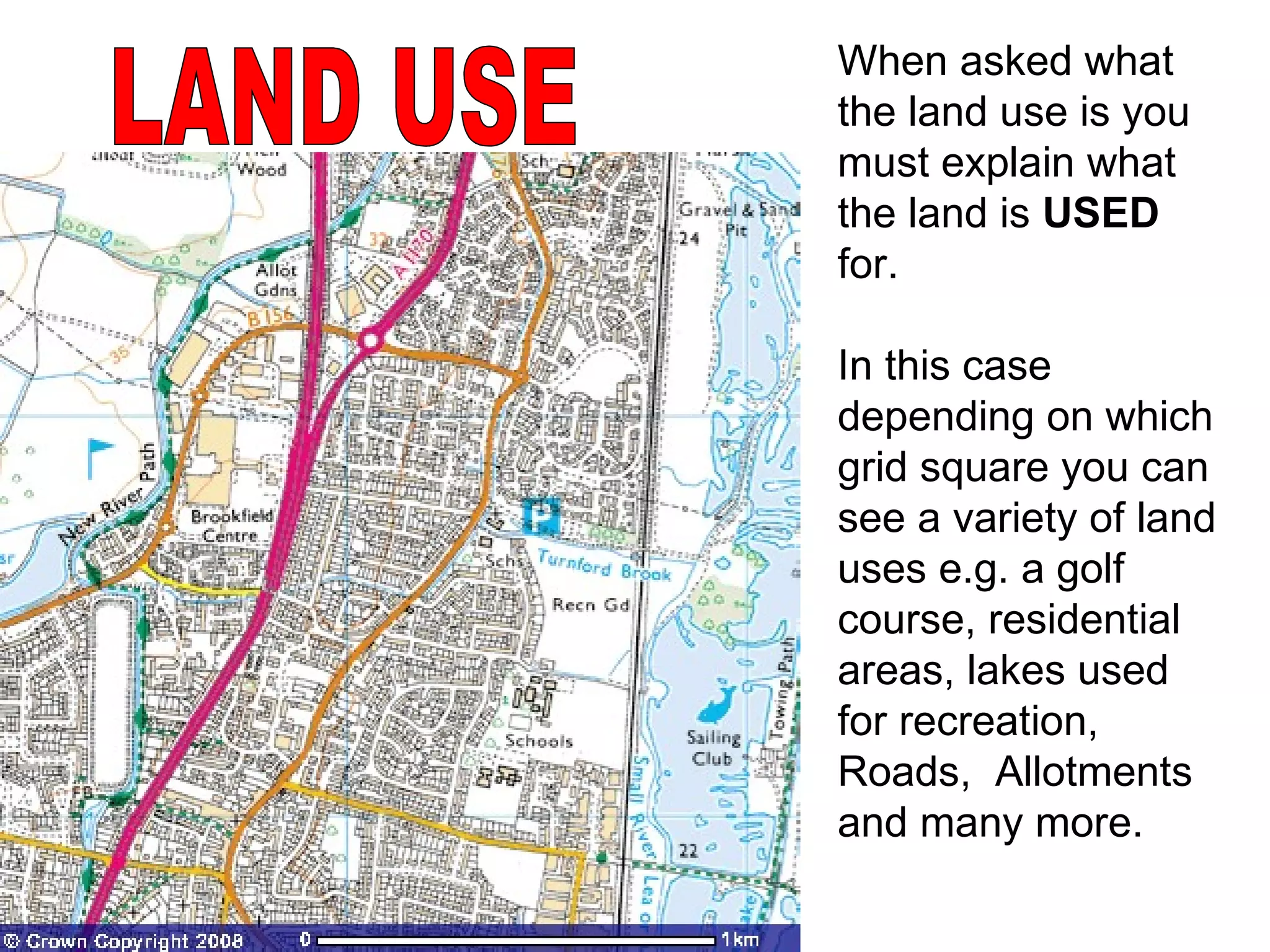
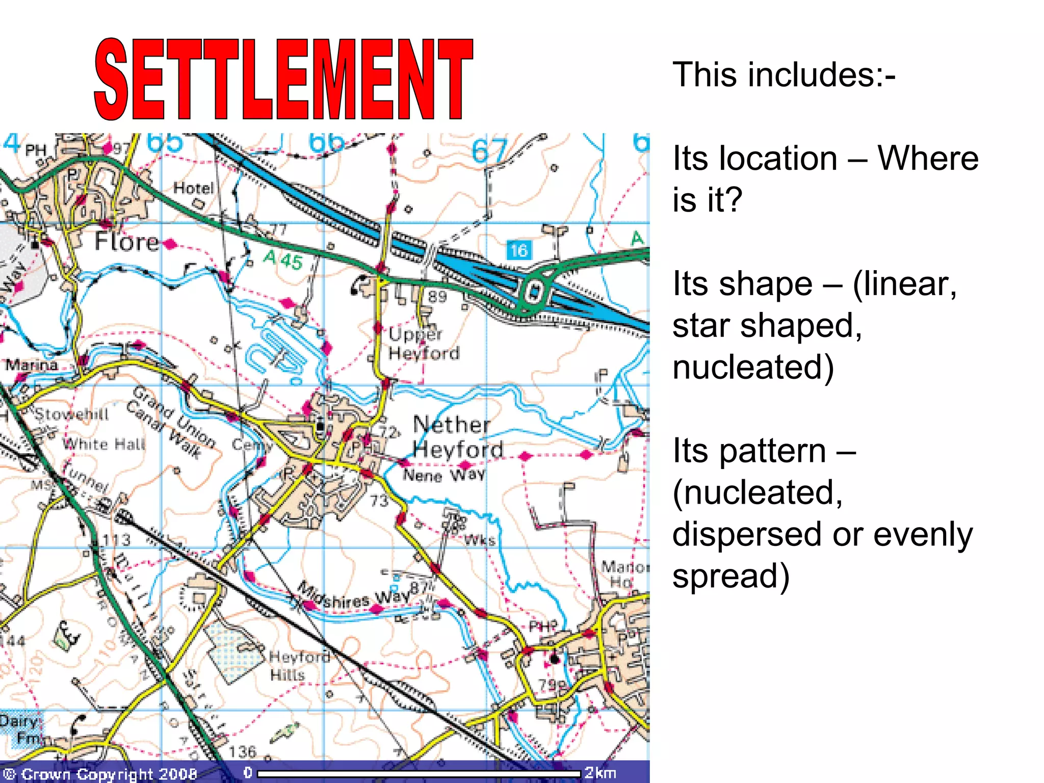
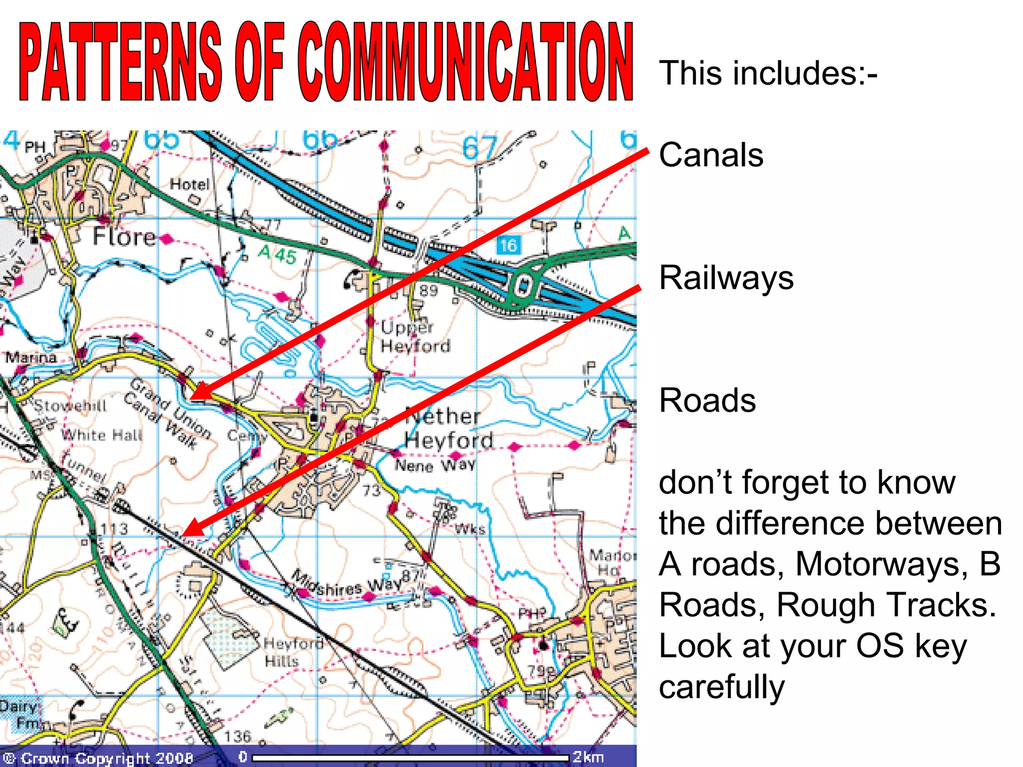
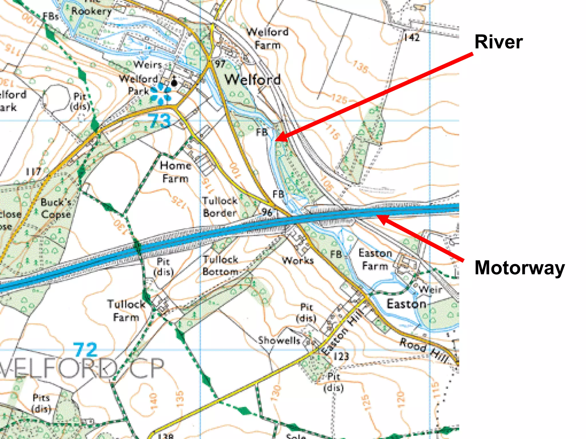
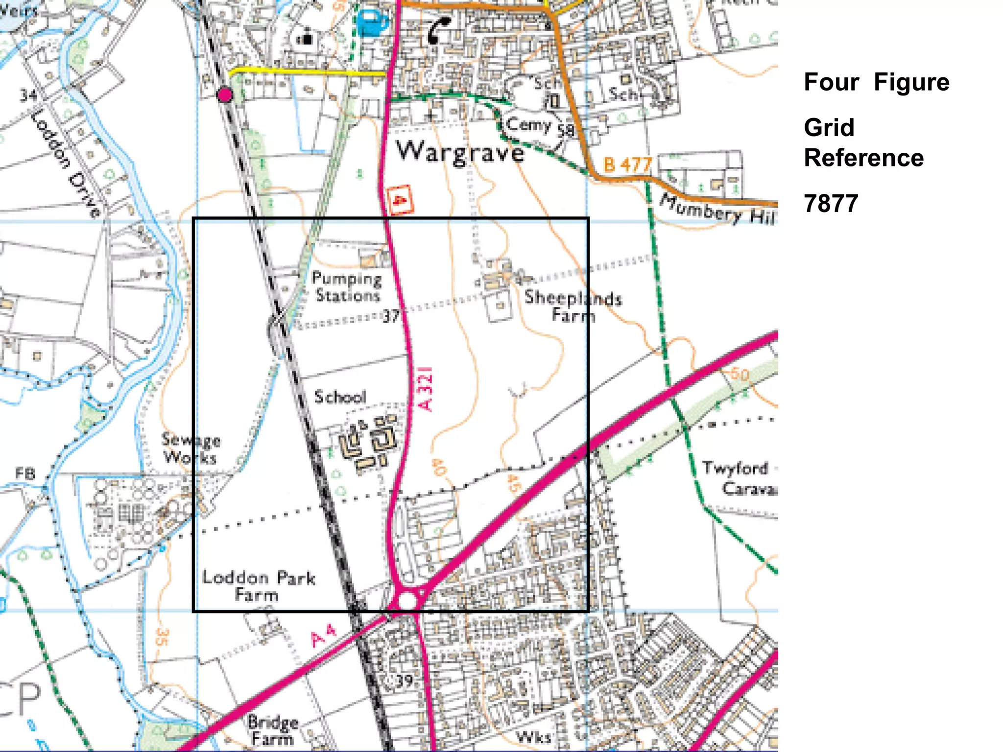
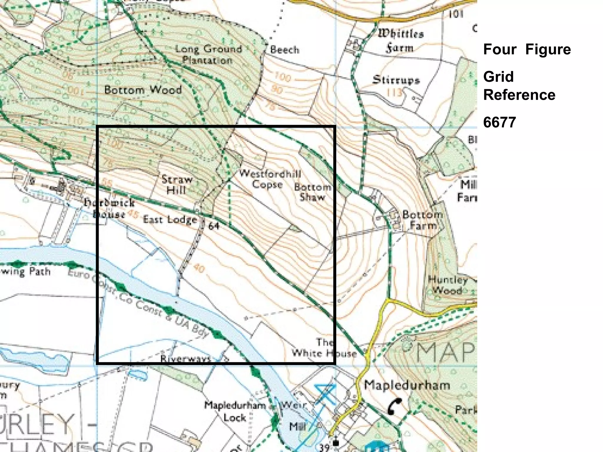
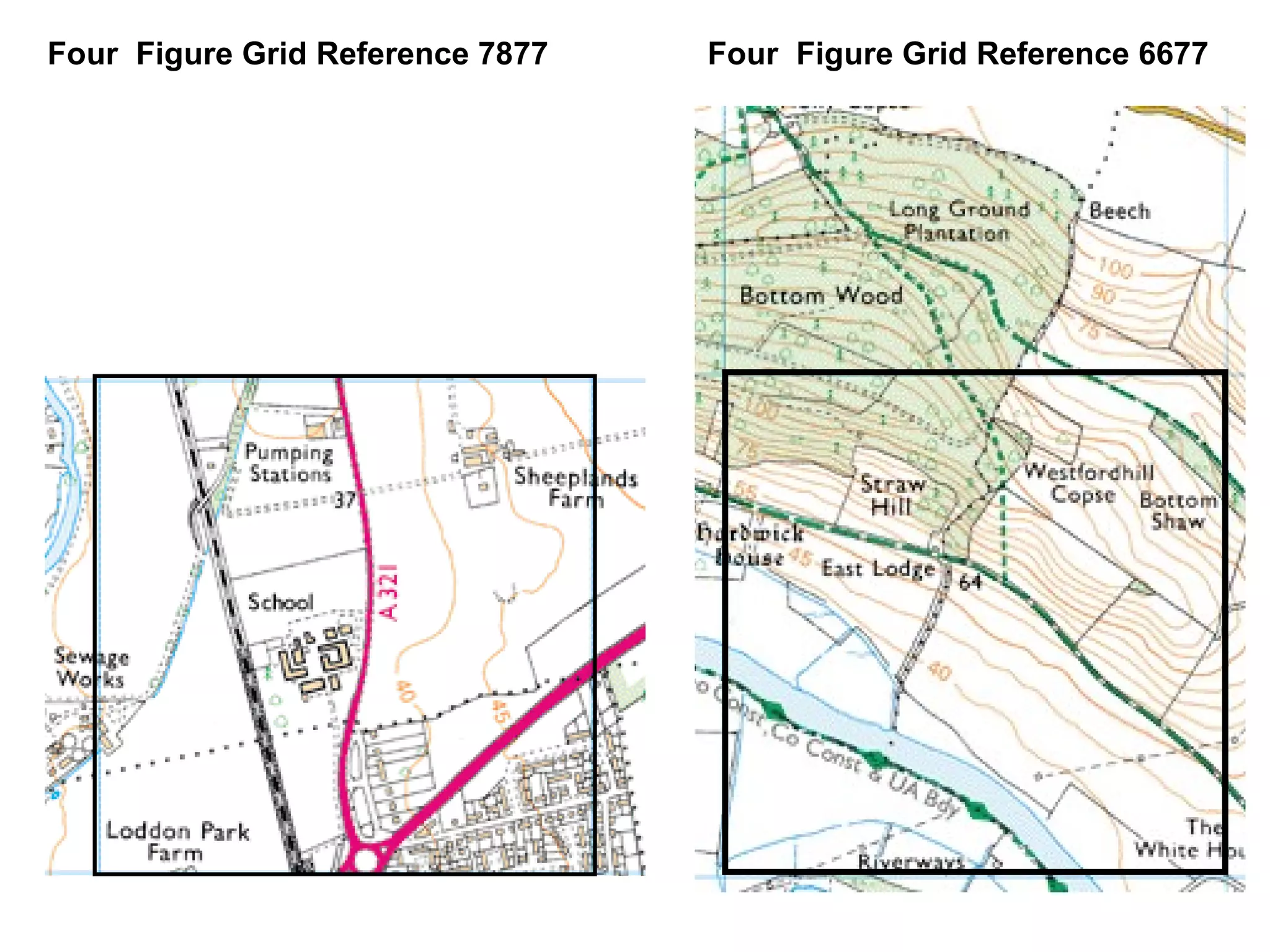
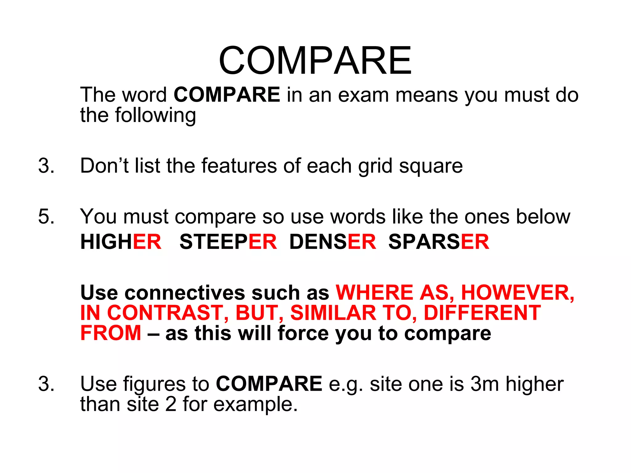
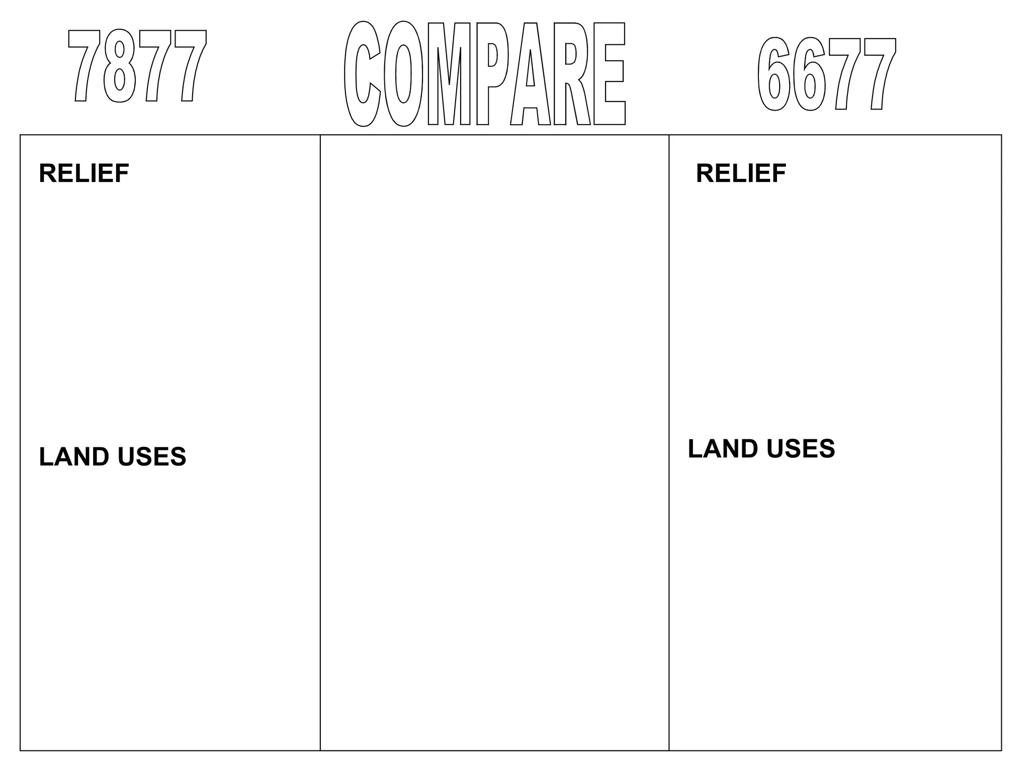
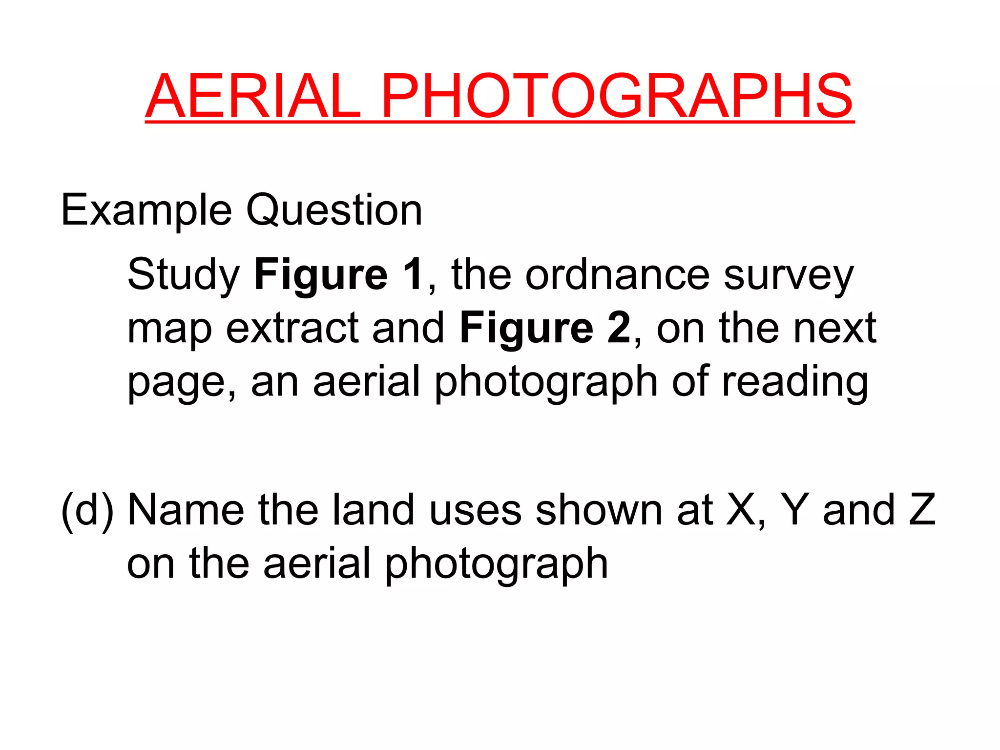
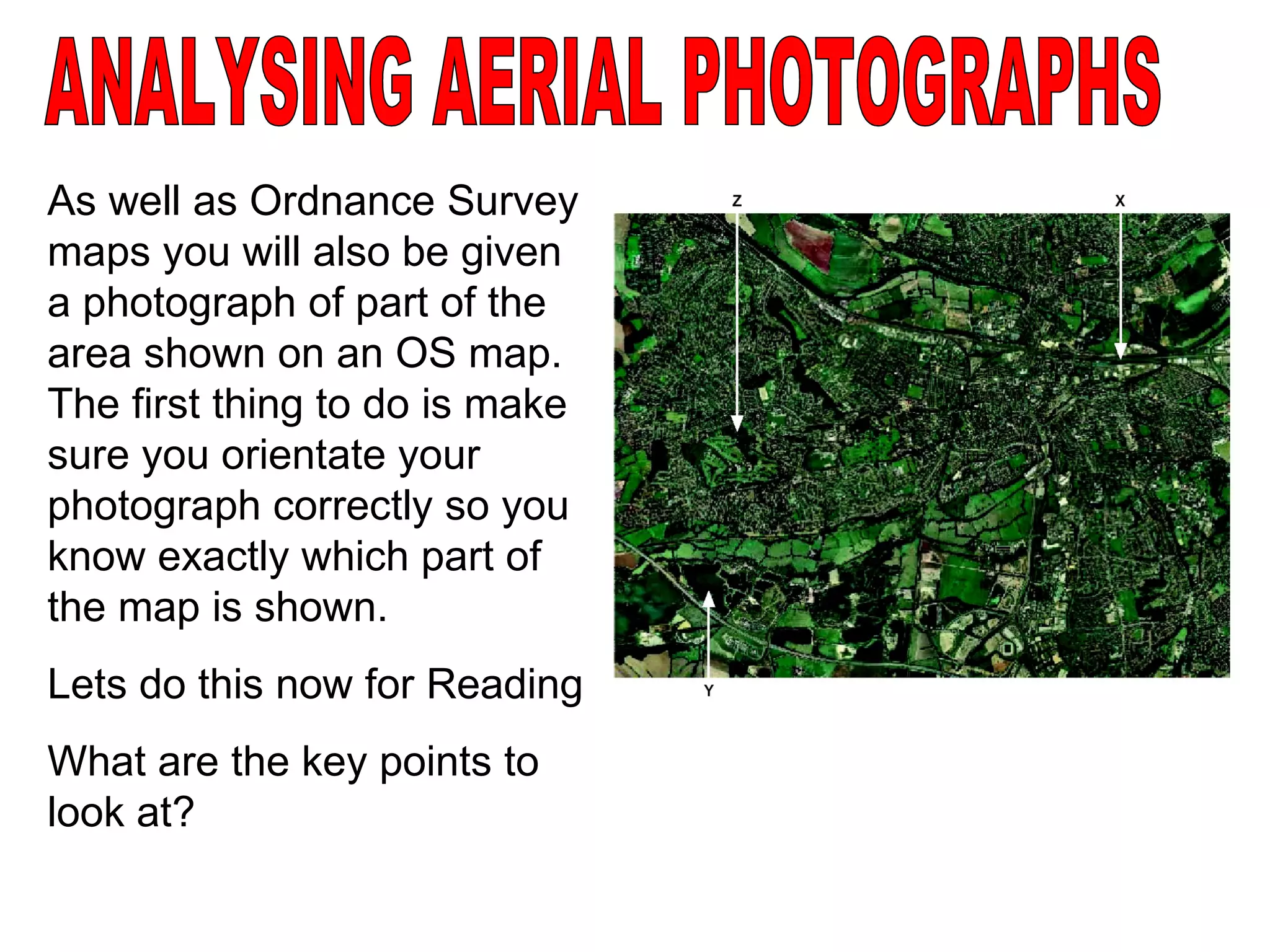
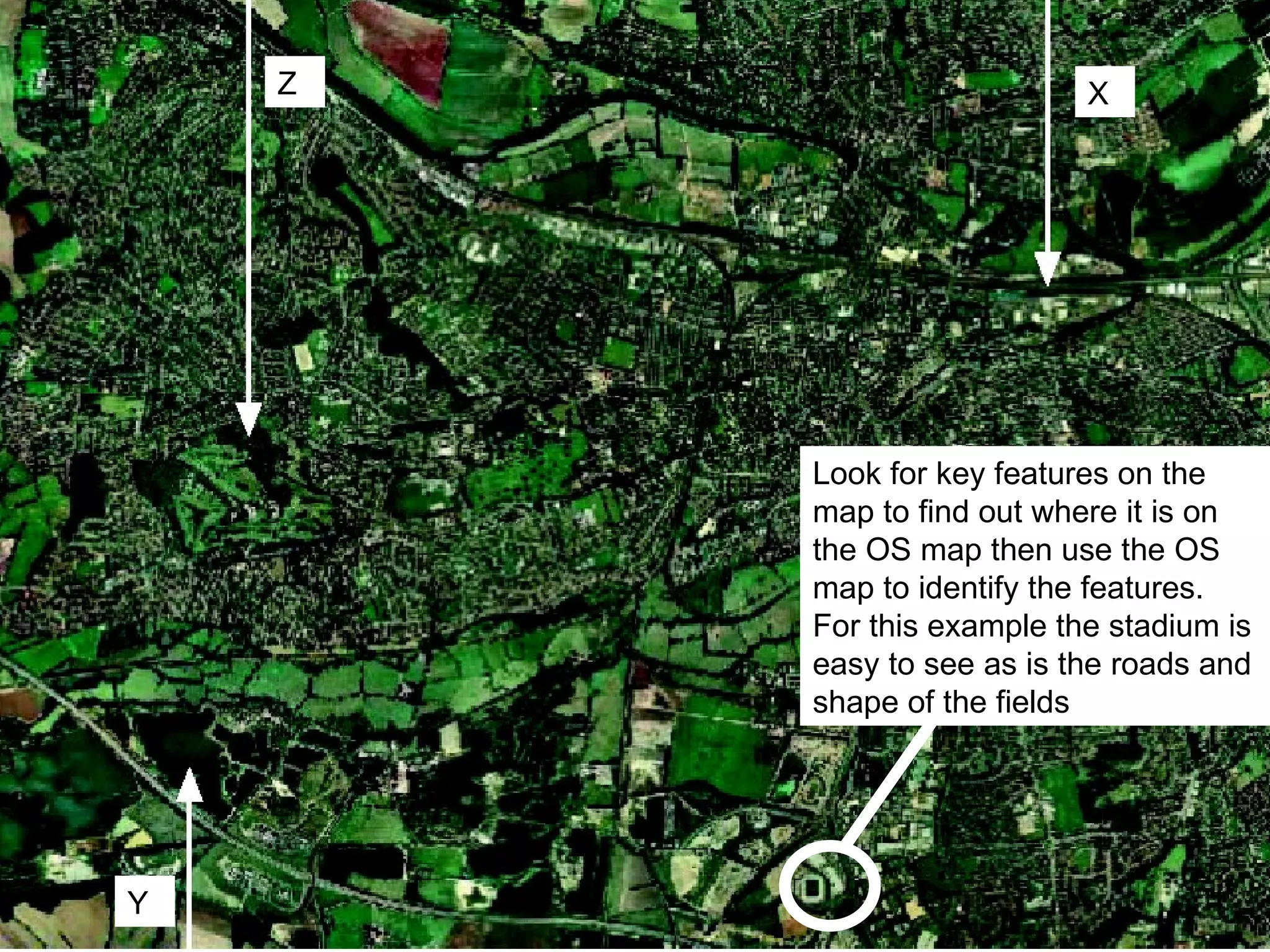
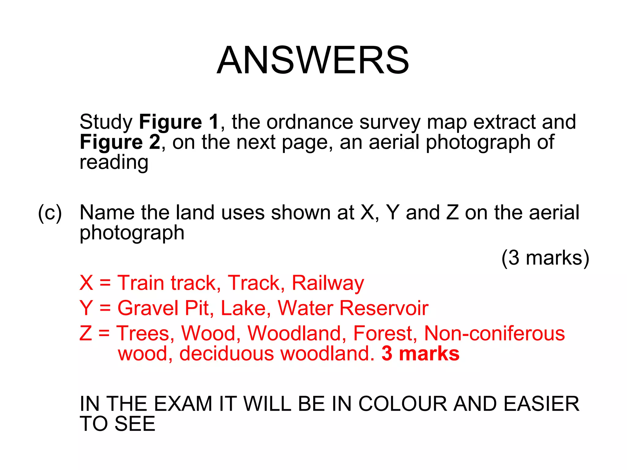
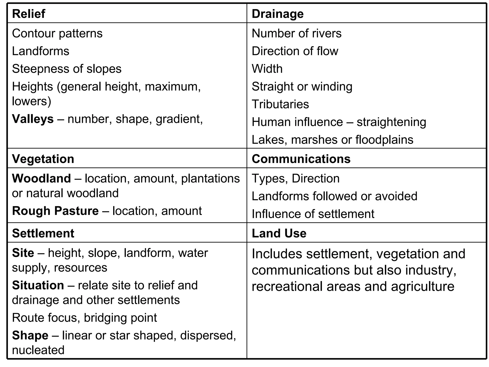
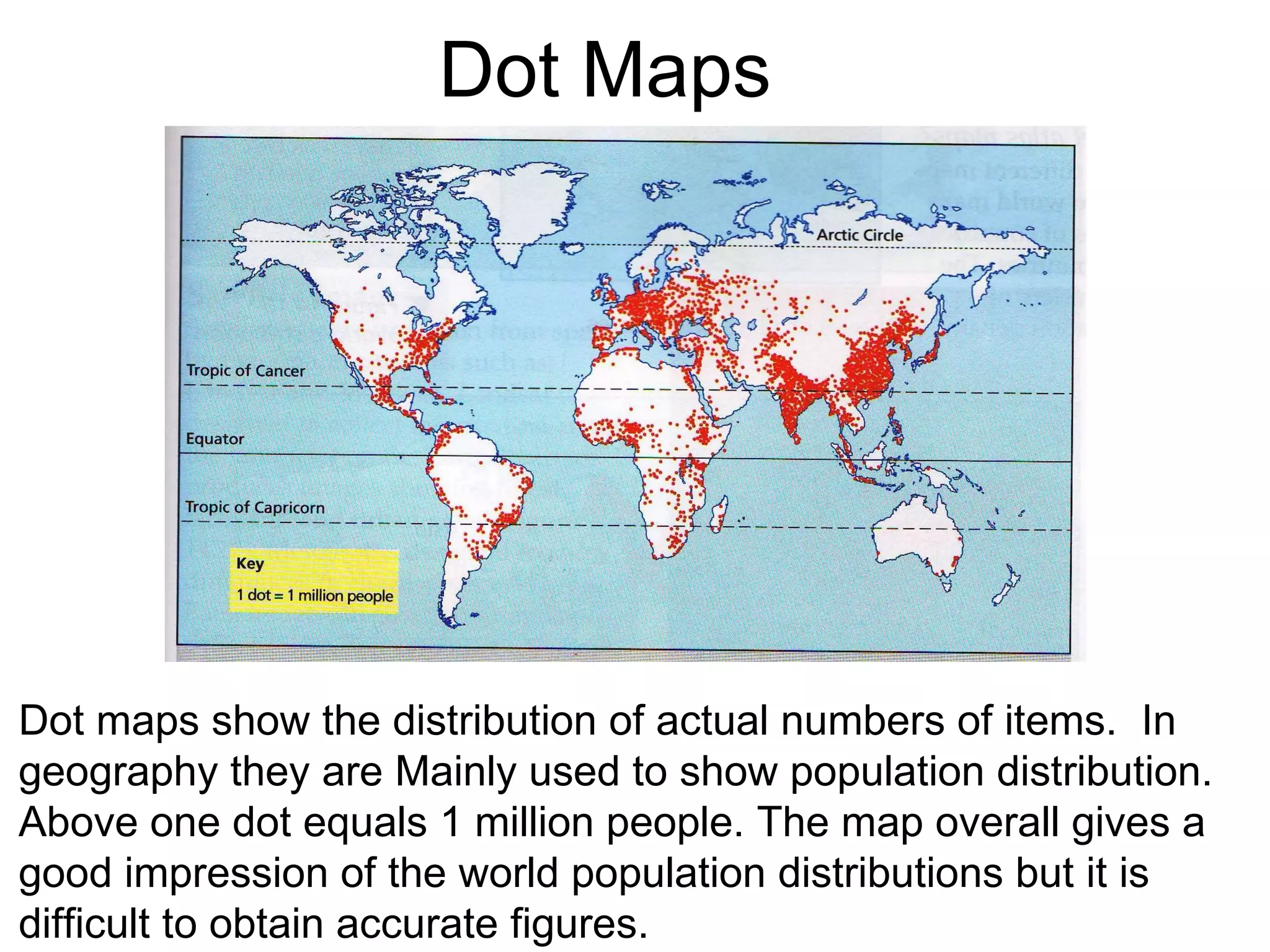
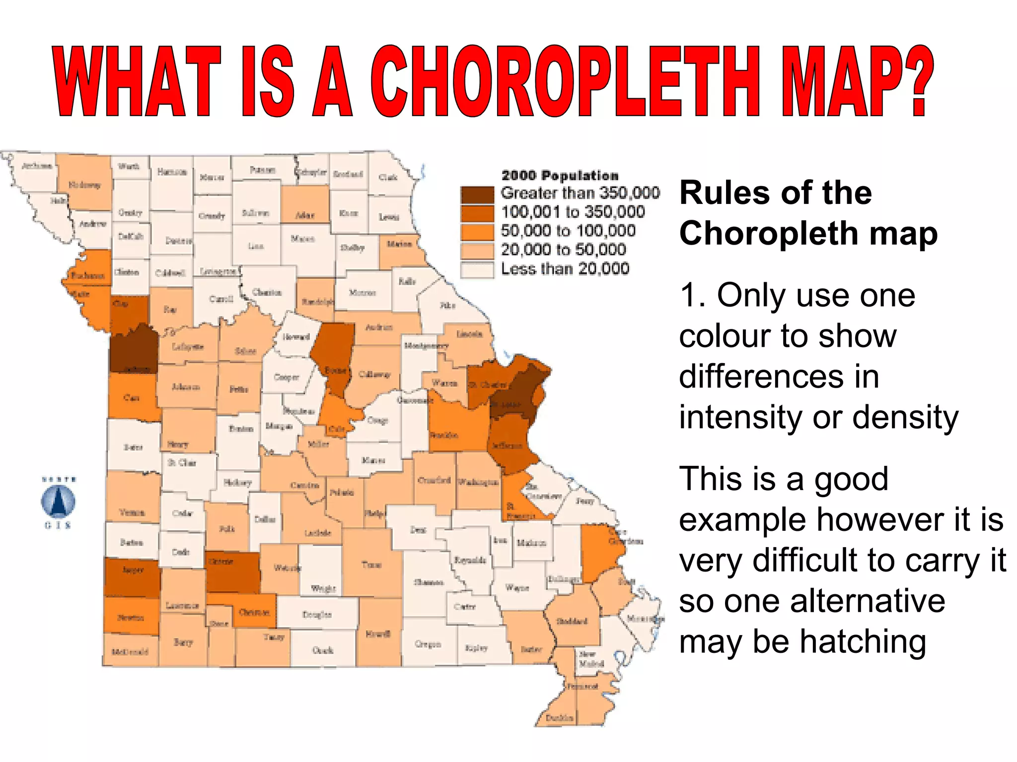
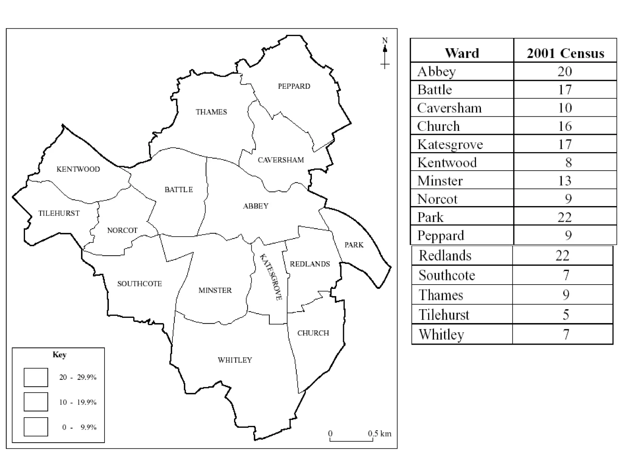
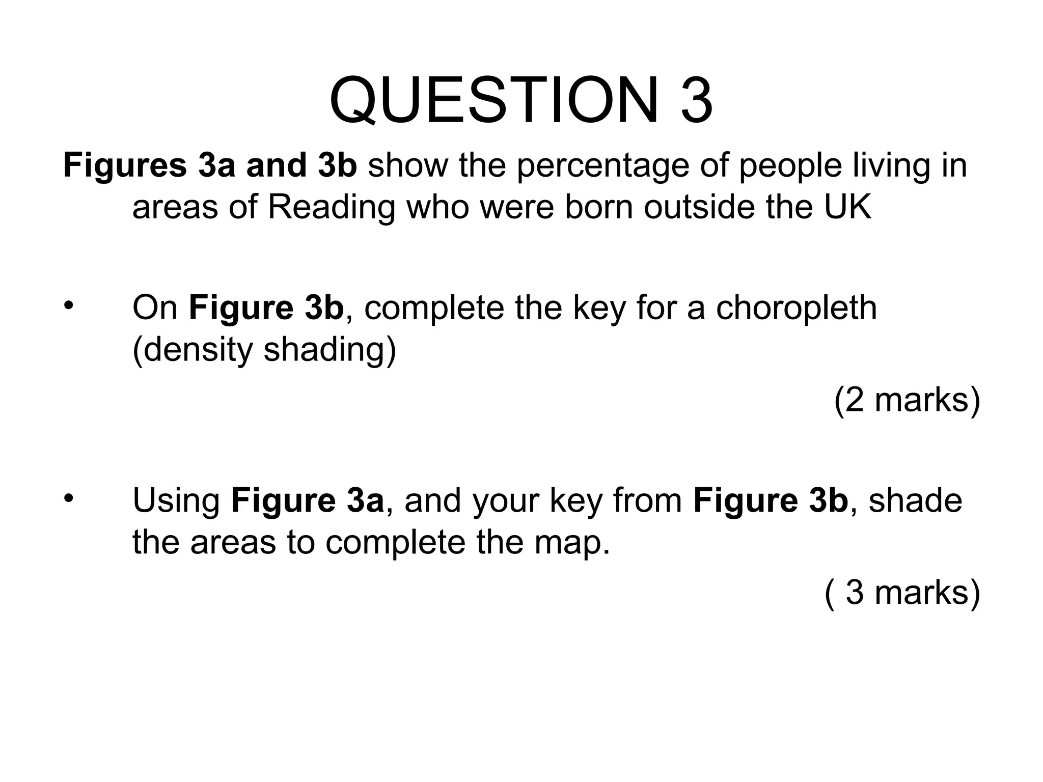
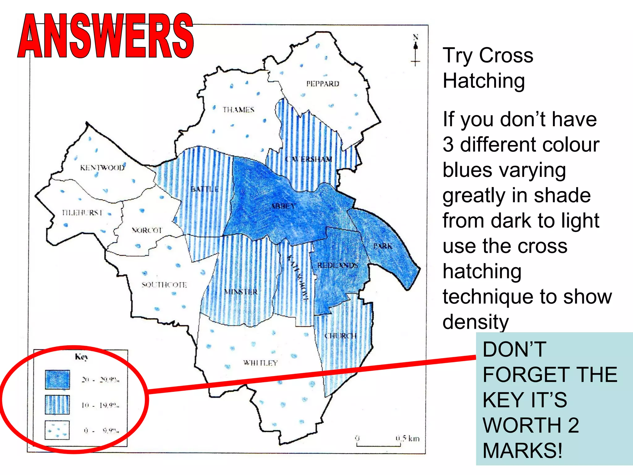
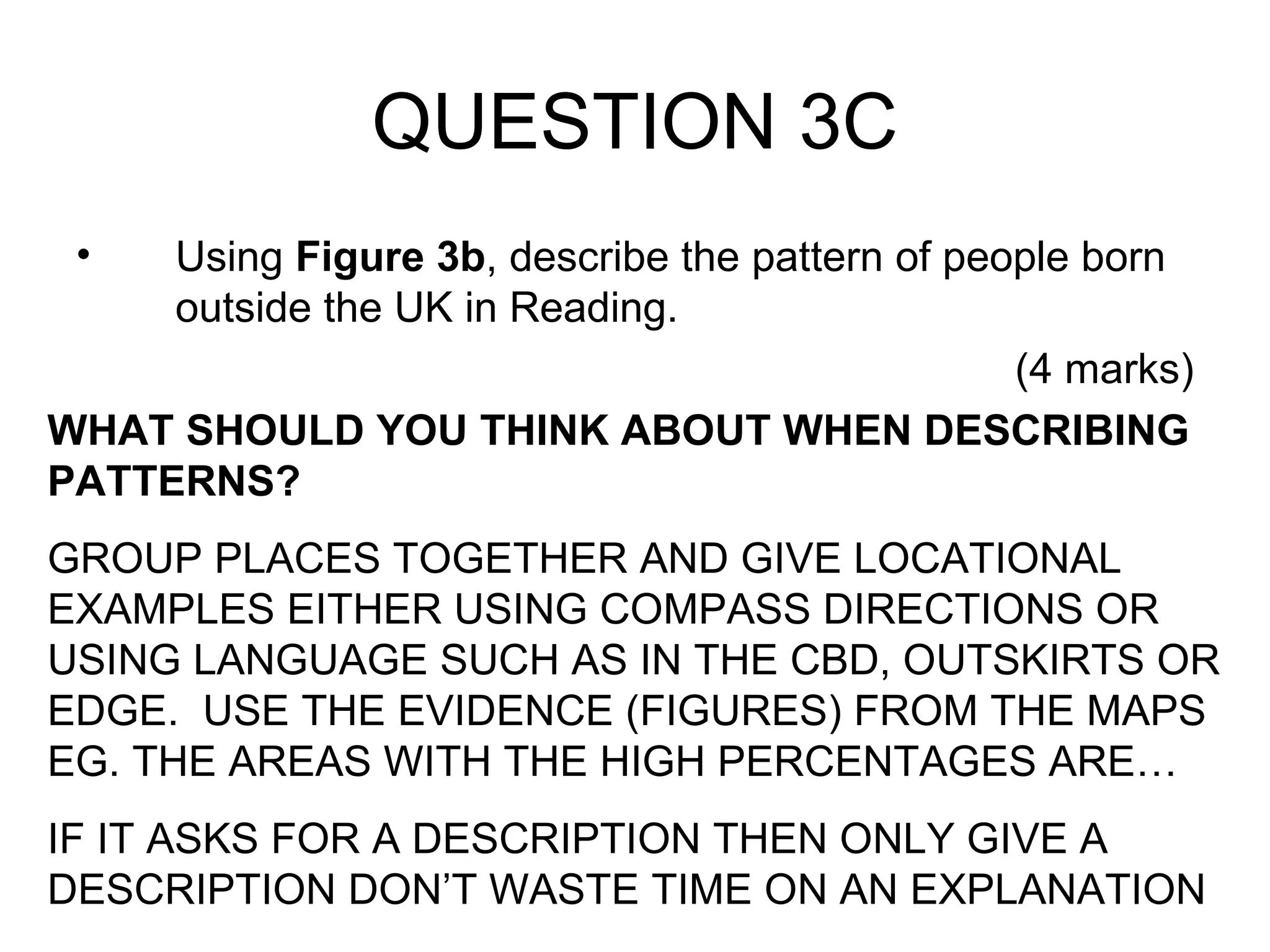
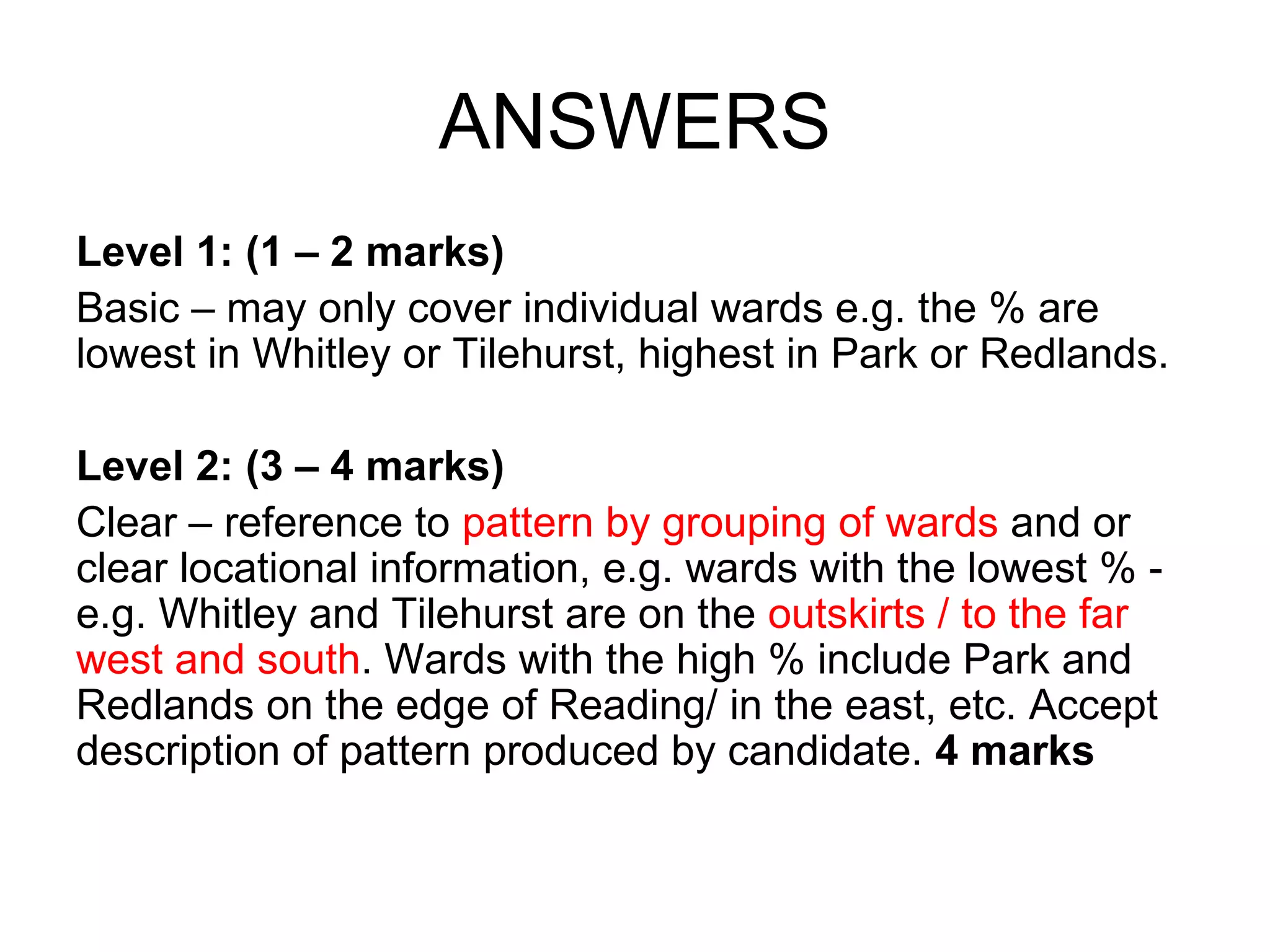
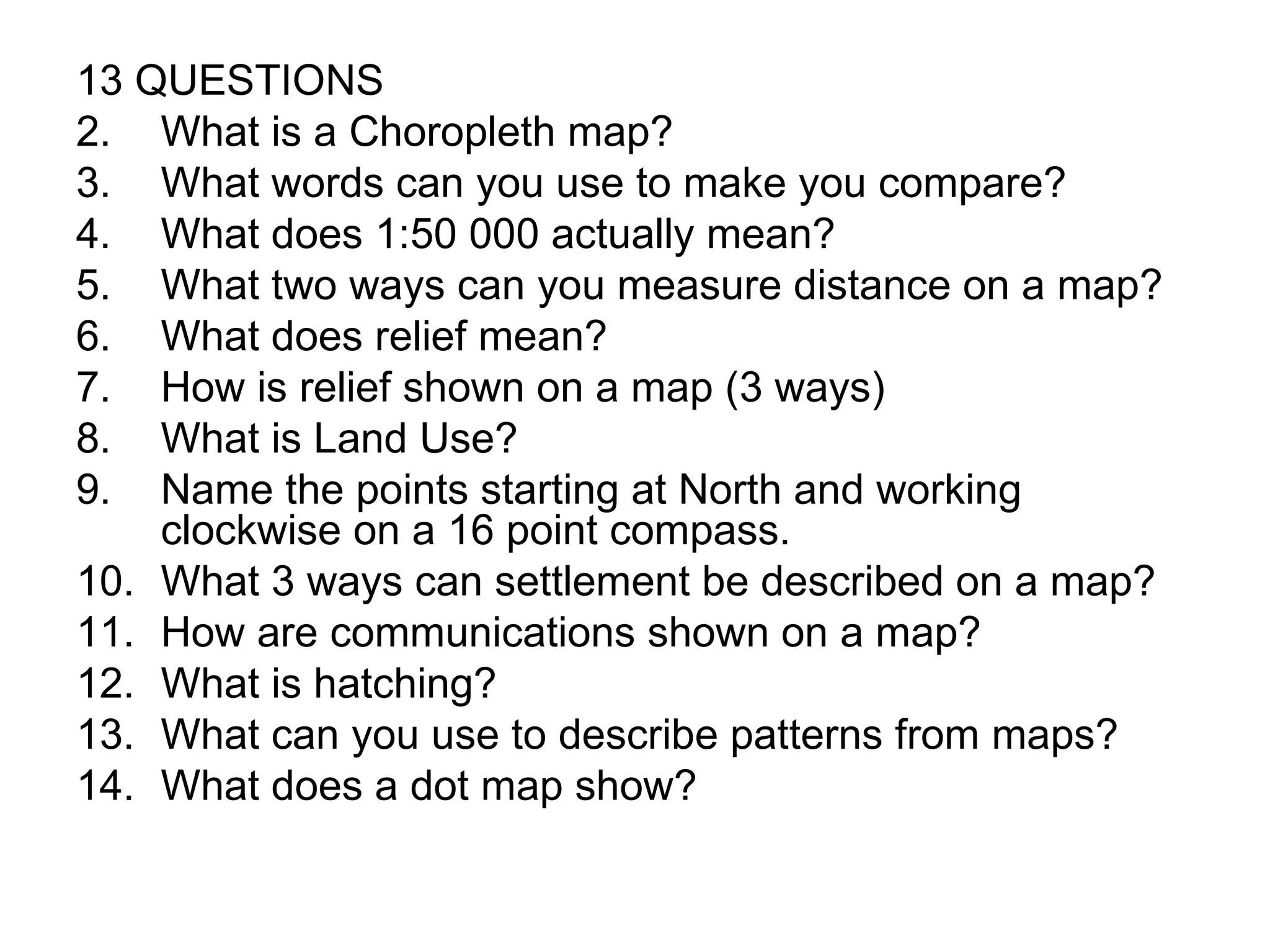
The document provides guidance on map skills for a geography exam, including how to interpret Ordnance Survey maps, use grid references, measure distances, describe features, and understand different map types. It explains how to analyze maps, aerial photographs, and compare map features. Key skills covered are reading map scales, symbols, relief, land use, settlement patterns, and using maps to describe patterns and distributions.