Downloaded 124 times
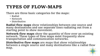
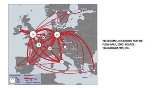
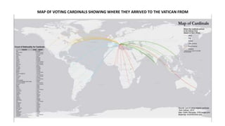
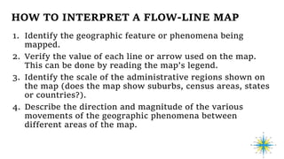
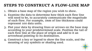

Flow-line maps are thematic maps used in cartography to illustrate the movement of objects across different areas, such as goods, species, and traffic volume, utilizing line symbols of varying widths to represent qualitative and quantitative data. There are three main types of flow maps: radial, network, and distributive, each serving different visualization purposes. To create a flow-line map, one must obtain a base map, determine line thickness according to data magnitude, and accurately plot movements with a clear legend.