The document discusses land use and urban issues in large cities in MEDCs. It includes questions about identifying land uses in a central business district and describing problems caused by urban sprawl and shanty towns. Responses are requested to describe issues associated with each, including problems in shanty towns and attempts to address those problems.
The document discusses coastal landscapes and processes. It includes figures and questions about coastal defense schemes, the formation of coastal landforms, and methods of protecting coastlines. Specifically, it addresses a planned coastal defense for Lyme Regis, how stacks may form at the end of headlands, features of coastlines formed by erosion, and descriptions of coastal defenses shown in photographs.
1. The document discusses river landscapes and processes such as meanders, flood plains, and flooding. It includes diagrams of river features and flooding case studies.
2. Flood plains are formed through hydraulic power and erosion of the outside bend of river meanders. Meanders also migrate downstream over time. When the river floods, silt and sand are deposited building up the flood plain.
3. Flooding can have severe effects if water cannot drain back into river channels due to high levees that are formed by sediment deposition during repeated floods.
The document discusses tectonic activity including earthquakes and volcanoes. It provides information about a 2004 earthquake in the Indian Ocean measuring 9.0 on the Richter scale that was centered off the coast of Sumatra. It then discusses the volcano Mount Vesuvius near Italy and advantages and disadvantages of living near volcanoes. Finally, it discusses the distribution of volcanoes globally and features of the volcanoes Mauna Loa and Mount St. Helens.
This document discusses coastal landscapes and processes. It contains information about:
1) A photograph of Flamborough Head on the east coast of England, identifying rock stacks (X) and cliffs (Y).
2) How wave-cut platforms are formed by destructive waves eroding cliffs through attrition and corrasion, forming a wave-cut notch that gets larger until the cliff retreats.
3) Coastal defenses shown in a photograph of sand dunes, suggesting they are needed to protect the coastline from erosion.
Describe how governments are attempting to cope with the problems of an agein...tudorgeog
The UK government is attempting to cope with an aging population by delaying the retirement age and increasing the age for receiving state pensions. This forces people to work longer and continue paying taxes to fund increased social services and healthcare for the elderly, such as nursing homes. Younger populations are declining so less money is being allocated to education and more is being spent on healthcare and social provision for the aging population.
This document discusses urbanization and the growth of cities. It examines factors that influence urban growth, including migration, and the effects of rapid urban growth in less economically developed countries. The document also looks at how some cities have addressed issues arising from urbanization through policies aimed at improving infrastructure and living conditions.
This document discusses secondary industries like steel-making in Great Britain. It examines the location of steel mills and defines secondary industries as those that process raw materials. The document also looks at the Cambridge Science Park, discussing its layout and factors that influenced its location. Some advantages of developing science parks for local areas are also mentioned.
Cities in MEDCs and LEDCs both have a central business district (CBD), but differ in the location of wealthy and poor residents. In LEDC cities, the wealthy live near the CBD while the poor live in shanty towns on the outskirts. However, in MEDC cities the wealthy reside on the outskirts and the poor inner city areas close to the CBD.
This document discusses managing resources and tourism development. It addresses:
- Unequal distribution of resources between countries and the need for recycling.
- Causes of global warming like increased greenhouse gases.
- Reasons tourists are attracted to areas like the Maldives and rules for sustainable tourism development.
- Benefits and disadvantages of tourism for LEDCs and how MEDCs also gain from tourism in developing countries.
- Renewable energy production and reducing carbon dioxide emissions through international agreements.
This document discusses factors that influence the location of industries. It asks the reader to identify primary industries from a list and describe features of primary industry shown in a photograph. It also discusses reasons for the location of industry in Northern Italy based on a sketch map. The document examines how governments try to reduce pollution from heavy industries and explains how factors like transportation, markets, raw materials, and labor availability affect industrial location according to a diagram.
This document contains sample questions from past science exams on various topics:
1. An experiment on the electrical conductivity of lead bromide, measuring the current through an ammeter.
2. An experiment using a concave lens to form an image.
3. An experiment culturing bacteria to study the relationship between colony growth and time.
4. An experiment comparing the elasticity of natural rubber and processed rubber.
It also provides multi-part questions testing the ability to form hypotheses, design experiments, analyze data, and apply science concepts. Questions cover topics like food processing, polymer properties, and classifying materials as conductors, insulators and thermoplastics/thermosets.
The document discusses restoration works along the River Skerne in Darlington. It includes a figure showing changes to the river channel, including widening the channel and creating floodplains. The restoration scheme aims to attract visitors to the area by creating a natural environment. The document also discusses the formation of oxbow lakes when a meander is cut off from the main river channel. River flooding is examined, including describing the causes of a flood that was studied. Flood plain zoning is discussed as a sustainable management strategy to reduce flooding impacts.
This document appears to be a test for a marketing course, with two multiple choice questions. Question 1 asks students to describe the concept of the marketing mix in 4 sentences or less. Question 2 asks students to list 4 elements of the micro marketing environment and provide 2 examples of demographic factors from the macro environment. The test provides space for students to write their answers but does not include any other context or instructions.
Yana leaves home at 10:50 and walks to the bus stop at City Gate in 14 minutes. She arrives at the bus stop at 11:04. She gets on the next bus which arrives at Kingswood Park at 11:30. The bus takes 18 minutes to travel from City Gate to Kingswood Park.
The document provides instructions for a mathematics exam. It tells students to use black ink, fill in personal information, answer all questions, and show working. It notes the total marks, marks per question, and questions where writing quality is assessed. It advises students to read questions carefully, check time, try to answer every question, and check answers. The document contains no questions.
This document is a 17-page chemistry exam consisting of multiple choice and short answer questions covering topics like purification methods, petroleum fractions, limestone thermal decomposition, bromine extraction, and aluminum electrolysis. It includes a 3-page periodic table and some blank pages. Students are to answer all questions directly on the exam paper using a dark pen or pencil and without other materials.
This document is a 17-page chemistry exam consisting of multiple choice and short answer questions covering topics like purification methods, petroleum fractions, limestone thermal decomposition, bromine extraction, fuel combustion, aluminum electrolysis, and the periodic table. It includes 3 blank pages at the end.
This document contains instructions for multiple biology lab exercises involving the microscopic examination and comparison of tissues and organs. Students are asked to:
1) Draw and label diagrams of blood vessel cross-sections, noting the differences between an artery and vein.
2) Label diagrams of eye anatomy, including the pupil and iris. Drawings are also required showing how the pupil and iris change size in different light conditions.
3) Identify labeled structures in a diagram of human skin, including how one structure regulates body temperature.
4) Compare flower structures in diagrams and under the microscope, as well as explain pollination in marrows.
5) Create a bar chart comparing sugar contents in various fruits.
This document contains instructions for multiple biology lab exercises involving the microscopic examination and comparison of tissues and organs. Students are asked to:
1) Draw and label diagrams of blood vessel cross-sections, noting the differences between an artery and vein.
2) Label diagrams of eye anatomy, including the pupil and iris. Drawings are also required showing how the pupil and iris change size in different light conditions.
3) Identify labeled structures in a diagram of human skin, and describe how one structure regulates body temperature.
4) Compare flower structures in diagrams and describe pollen grain functions. Tables are included to record observations.
5) Create a bar chart comparing sugar contents of various fruits, and
This document is an 18-page specimen paper for the Cambridge IGCSE Mathematics exam. It contains 9 questions testing a range of math skills, including: solving equations, ratios, percentages, trigonometry, transformations, and graphing. Students are instructed to show all working and give answers to an appropriate degree of accuracy. The paper is out of a total of 104 marks.
This document contains information about a physics module, including:
1. A table to be filled in with SI prefixes and their symbols/values.
2. A word problem involving mass, diameter, height, acceleration, temperature increase, and heat energy.
3. Figures and questions about a milliammeter, including correcting zero error and explaining how a mirror strip increases accuracy.
4. Figures and questions about a measuring instrument, including identifying parts and measuring thickness.
5. A velocity-time graph problem involving initial velocity, acceleration, and motion characteristics.
6. Questions about measuring wire diameter using a meter rule or other suitable instrument.
7. An explanation and
This document contains instructions and questions for an exam on Architecture and Town Planning. It is divided into two sections, with 12 total questions. For Section I, students must answer 1 question from questions 1-2, 1 question from 3-4, and 1 question from 5-6. For Section II, students must answer 1 question from 7-8, 1 question from 9-10, and can choose between question 11 or 12. The document provides instructions on the expected answer format and assumes data as needed. It contains technical architectural and planning content and questions.
This document contains a biology exam with multiple choice and short answer questions covering various topics:
1) The carbon cycle, with questions about the processes of respiration, photosynthesis, and the effects of increased carbon dioxide in the atmosphere.
2) The effects of releasing untreated sewage into a river, such as water pollution.
3) A grassland food web with questions about producers, consumers, and how populations might change from events like locust plagues.
4) A diagram of a pea flower and questions about plant reproduction, pollination, and the environmental factors needed for germination.
This 12-page document consists of chemistry exam questions covering topics such as electron configurations, fossil fuels, plant growth and fertilizers, carboxylic acids, carbon monoxide production, electrolysis, scandium properties, and salt preparation and identification. The questions include multiple choice, short answer, drawing structures, explaining observations, and calculations.
These are some IGCSE Topicwise Past paper sheets fro practise. Members of www.smartexamresources.com can gain access to all micro-topicwise past papers along with study notes, learning videos for IGCSE and a lot more.
The document is a geography exam question paper that contains 8 questions divided into two sections. It provides instructions for candidates regarding the structure of the paper, number of questions to attempt, marking scheme and other exam guidelines. It lists the various questions under the two sections, along with the number of marks allocated to each question/part. The questions cover topics related to physical and human geography such as biomes, landforms, soils, climate, industries, settlements, agriculture, migration etc. Candidates are required to answer questions in the space provided in the question paper and follow all instructions carefully.
1. An oil tank with dimensions of 2.4m by 1.5m by 1.5m depth is filled with oil of density 850kg/m3. The document involves calculating the pressure, force and mass of the oil in the tank. It also discusses what happens when a brass key is dropped in the oil.
2. The document describes experiments to determine the volume and density of irregularly shaped objects like wood and brass by displacement of water in a measuring cylinder.
3. Several documents describe methods and calculations to determine the density of various objects like paper, coins, aluminum foil and a stone through measurement of mass, volume, and using the density formula of mass divided by volume. Precautions
Inequality in the peak district & intro to field & case studywhiskeyhj
The document discusses rural inequality in the Peak District of England. It finds that inequality is highly concentrated in specific villages, with wealth most concentrated in villages closest to major urban areas that function as commuter towns. The Peak District demonstrates deprivation particularly in the category of "barriers to housing." A key issue is the growing gap between many rural jobs and inflated housing prices, exacerbated by the loss of social housing and difficulties developing new housing due to planning restrictions as a national park.
The document discusses tourism in Kenya and renewable energy sources. It asks the reader to answer questions about physical features that attract tourists to Kenya, types of holidays available there, and disadvantages tourism may bring to LEDCs. It also asks the reader to provide an example of a renewable energy source and reasons for its location. The overall purpose seems to be assessing the reader's understanding of tourism and renewable resources in various countries and areas.
The document discusses tectonic activity and includes several questions. It describes the 1980 eruption of Mount St. Helens and its effects on the natural environment and local people. It asks about the formation of young fold mountains and the physical features of a range studied. It describes the distribution of major earthquakes shown in a figure and asks about locations of greatest loss of life from an earthquake. It also asks about short and long-term responses to an earthquake or volcano eruption that was studied.
The document discusses the structure and composition of the Earth, including the crust, mantle, outer core, and inner core. It also discusses plate tectonics and the different types of plate boundaries: constructive, destructive, conservative, and collision. At destructive boundaries, oceanic plates are subducted under continental plates, forming volcanoes. At collision boundaries, continental plates push together to form mountain ranges. At constructive boundaries, plates move apart and new crust is formed.
Montserrat is a small Caribbean island where the Soufriere Hills volcano began erupting in 1995, destroying much of the southern half of the island. The most intense eruptions occurred in 1997, covering over 2/3 of the island in ash and forcing over half of the population to evacuate. The eruptions closed the airport and port, destroyed infrastructure like schools and hospitals, and devastated the island's economy by ruining the tourism and agriculture industries. In response, the British government provided aid funds, the Montserrat Volcano Observatory was established to monitor future volcanic activity, and the capital was relocated to the safer northern side of the island.
The document provides information about various renewable and non-renewable energy sources. It discusses the North Hoyle offshore wind farm located off the coast of Wales, including that it has 30 turbines that provide enough energy for 40,000 homes. It also discusses the Three Gorges Dam in China, the largest hydroelectric project in the world, which will generate thousands of megawatts of electricity but required the relocation of over 2 million people.
The document summarizes problems and solutions in Sheffield, England. Key problems included traffic congestion, lack of parking, declining retail, poverty, unemployment, and derelict housing and land especially in the inner city. Solutions involved demolishing old buildings, attracting new offices, improving parks, roads and public transport, regenerating areas, and creating new housing, jobs, and cultural/retail opportunities through large investments starting in the 2000s. The Sheffield Development Corporation helped clear derelict land and improve communities, though high rise housing caused further issues and unemployment remained high in some areas.
Volcanoes occur at boundaries where tectonic plates meet, such as divergent boundaries where plates move apart or convergent boundaries where they move together, or at hot spots where the Earth's crust is thinner. When two plates are pushed together at a convergent boundary, one plate may be subducted under the other due to its greater density, melting rock and forming magma. Pressure builds as magma rises into the magma chamber until an eruption releases gases and material.
This document discusses types of resources, problems with non-renewable energy, and methods to reduce pollution and conserve resources. It defines renewable and non-renewable resources and examines fossil fuels, pollution, acid rain, and global warming. Suggested solutions include using alternative energy sources, reducing pollution emissions, improving energy efficiency, and recycling resources.
Coastal areas face problems of erosion and flooding due to rising sea levels and increased storm activity. This threatens homes, businesses and tourism. Coastal defenses use hard engineering like seawalls and groynes, or soft engineering like beach nourishment and managed retreat, to protect coastlines. However, all methods have disadvantages such as visual impacts or increasing erosion elsewhere. Coastal resorts also struggle with declining visitor numbers from overseas competition and require solutions like improving attractions to revitalize their economies.
Tourism is an important industry in Kenya, providing jobs and foreign income. Popular tourist attractions include wildlife reserves like the Maasai Mara and coastal beaches. While tourism has economic benefits, it also has social and environmental costs like disturbing wildlife, pollution, and forcing some tribes off their lands. Some efforts are being made for more sustainable eco-tourism like the Bamburi Nature Trail and Basecamp Masai Mara which support local communities and conservation.
Managing The Physical Environment 2 1200425132497774 3whiskeyhj
The Peak District National Park in the UK has experienced significant growth in tourism due to factors like increased leisure time and wealth. This has created pressures from traffic, overcrowding, and development. Honeypot sites like Castleton attract large numbers of visitors. While tourism provides economic benefits, it also causes issues like congestion, high housing prices, and damage to the natural environment. Sustainable tourism aims to allow current and future visitors to enjoy the area by managing development, traffic, and respect for the local community.
Acid rain is formed when sulfur dioxide and nitrogen oxide gases released from burning fossil fuels react with water and oxygen in the atmosphere. These acids can be transported long distances and affect areas far from where the emissions originated. Acid rain damages forests and fish populations by making soils and waterways too acidic. It also erodes buildings by accelerating the chemical breakdown of stone. Methods to reduce acid rain include installing flue gas desulfurization systems in power plants, increasing the height of smokestacks, improving energy efficiency, using cleaner-burning fuels, and developing renewable energy sources.
Rapid urbanization is occurring in cities in less economically developed countries (LEDCs) due to rural-urban migration. This causes megacities and expansion of informal settlements known as shanty towns. Rio de Janeiro is used as a case study, where rapid growth has caused issues like lack of adequate housing, sanitation problems, and increased crime. Solutions implemented in favelas like Rocinha include self-help housing schemes providing materials for residents to upgrade homes.
The document discusses urban land use models and zones. It provides information on the concentric zone model and sector model, describing typical land uses like commercial, residential, and industrial that tend to group together in urban zones moving from the urban center outwards. Key zones discussed include the central business district, inner city, inner and outer suburbs, and rural-urban fringe at the edge of cities.
There are several ways to manage and control flooding, including controlling water levels with dams and pumping stations, building barriers like embankments and levees, altering river channels by straightening or widening them, and controlling land use around rivers through zoning and afforestation. Hard management strategies involve large-scale engineering works like dams, levees, dredging, and channel alterations. Soft strategies work with nature and are more sustainable options like afforestation, flood plain zoning, and flood warning systems.
Flooding regularly occurs in Bangladesh due to several factors:
1) Bangladesh has a low-lying delta region with 70% of land under 1m above sea level, making it prone to flooding from rivers and monsoon rains.
2) Heavy monsoon rains from May to October cause rivers like the Ganges and Brahmaputra to overflow their banks.
3) Melting snow from the Himalayas in spring adds additional water to rivers flowing through Bangladesh.
The document discusses river drainage basins and flooding. It defines key terms related to the water cycle within a drainage basin such as precipitation, infiltration, interception, surface runoff, throughflow, evaporation, evapotranspiration, percolation, and the water table. It also explains the components of a flood hydrograph including the rising limb, falling limb, peak discharge, peak rainfall, storm flow, and normal base flow. Factors that influence the shape of a hydrograph are described such as land use, geology, soil, vegetation, and topography.
The document provides information about river characteristics and landforms. It describes key features of drainage basins such as tributaries, watersheds and confluences. It explains the changes that occur along a river's long profile from upper to middle to lower course, including differences in gradient, erosion processes and landforms. Specific features of the upper course like interlocking spurs and waterfalls are also outlined. The formation of meanders and oxbow lakes in the middle course through erosion and deposition is detailed.
Types Of Manufacturing Industry 1231882206365527 3whiskeyhj
The document discusses the three divisions of manufacturing industry: heavy, light, and high-tech. Heavy industry involves refining raw materials like minerals and metals on a large scale, often over large areas of land, and can cause pollution. Light and high-tech industries are more "footloose," having fewer constraints on location due to smaller facilities and lower raw material needs. They are located in pleasant areas near transportation and markets. High-tech industries also locate near research centers and universities to stay innovative in fast-changing fields.
Dive into the realm of operating systems (OS) with Pravash Chandra Das, a seasoned Digital Forensic Analyst, as your guide. 🚀 This comprehensive presentation illuminates the core concepts, types, and evolution of OS, essential for understanding modern computing landscapes.
Beginning with the foundational definition, Das clarifies the pivotal role of OS as system software orchestrating hardware resources, software applications, and user interactions. Through succinct descriptions, he delineates the diverse types of OS, from single-user, single-task environments like early MS-DOS iterations, to multi-user, multi-tasking systems exemplified by modern Linux distributions.
Crucial components like the kernel and shell are dissected, highlighting their indispensable functions in resource management and user interface interaction. Das elucidates how the kernel acts as the central nervous system, orchestrating process scheduling, memory allocation, and device management. Meanwhile, the shell serves as the gateway for user commands, bridging the gap between human input and machine execution. 💻
The narrative then shifts to a captivating exploration of prominent desktop OSs, Windows, macOS, and Linux. Windows, with its globally ubiquitous presence and user-friendly interface, emerges as a cornerstone in personal computing history. macOS, lauded for its sleek design and seamless integration with Apple's ecosystem, stands as a beacon of stability and creativity. Linux, an open-source marvel, offers unparalleled flexibility and security, revolutionizing the computing landscape. 🖥️
Moving to the realm of mobile devices, Das unravels the dominance of Android and iOS. Android's open-source ethos fosters a vibrant ecosystem of customization and innovation, while iOS boasts a seamless user experience and robust security infrastructure. Meanwhile, discontinued platforms like Symbian and Palm OS evoke nostalgia for their pioneering roles in the smartphone revolution.
The journey concludes with a reflection on the ever-evolving landscape of OS, underscored by the emergence of real-time operating systems (RTOS) and the persistent quest for innovation and efficiency. As technology continues to shape our world, understanding the foundations and evolution of operating systems remains paramount. Join Pravash Chandra Das on this illuminating journey through the heart of computing. 🌟
Salesforce Integration for Bonterra Impact Management (fka Social Solutions A...Jeffrey Haguewood
Sidekick Solutions uses Bonterra Impact Management (fka Social Solutions Apricot) and automation solutions to integrate data for business workflows.
We believe integration and automation are essential to user experience and the promise of efficient work through technology. Automation is the critical ingredient to realizing that full vision. We develop integration products and services for Bonterra Case Management software to support the deployment of automations for a variety of use cases.
This video focuses on integration of Salesforce with Bonterra Impact Management.
Interested in deploying an integration with Salesforce for Bonterra Impact Management? Contact us at sales@sidekicksolutionsllc.com to discuss next steps.
Building Production Ready Search Pipelines with Spark and MilvusZilliz
Spark is the widely used ETL tool for processing, indexing and ingesting data to serving stack for search. Milvus is the production-ready open-source vector database. In this talk we will show how to use Spark to process unstructured data to extract vector representations, and push the vectors to Milvus vector database for search serving.
A Comprehensive Guide to DeFi Development Services in 2024Intelisync
DeFi represents a paradigm shift in the financial industry. Instead of relying on traditional, centralized institutions like banks, DeFi leverages blockchain technology to create a decentralized network of financial services. This means that financial transactions can occur directly between parties, without intermediaries, using smart contracts on platforms like Ethereum.
In 2024, we are witnessing an explosion of new DeFi projects and protocols, each pushing the boundaries of what’s possible in finance.
In summary, DeFi in 2024 is not just a trend; it’s a revolution that democratizes finance, enhances security and transparency, and fosters continuous innovation. As we proceed through this presentation, we'll explore the various components and services of DeFi in detail, shedding light on how they are transforming the financial landscape.
At Intelisync, we specialize in providing comprehensive DeFi development services tailored to meet the unique needs of our clients. From smart contract development to dApp creation and security audits, we ensure that your DeFi project is built with innovation, security, and scalability in mind. Trust Intelisync to guide you through the intricate landscape of decentralized finance and unlock the full potential of blockchain technology.
Ready to take your DeFi project to the next level? Partner with Intelisync for expert DeFi development services today!
Unlock the Future of Search with MongoDB Atlas_ Vector Search Unleashed.pdfMalak Abu Hammad
Discover how MongoDB Atlas and vector search technology can revolutionize your application's search capabilities. This comprehensive presentation covers:
* What is Vector Search?
* Importance and benefits of vector search
* Practical use cases across various industries
* Step-by-step implementation guide
* Live demos with code snippets
* Enhancing LLM capabilities with vector search
* Best practices and optimization strategies
Perfect for developers, AI enthusiasts, and tech leaders. Learn how to leverage MongoDB Atlas to deliver highly relevant, context-aware search results, transforming your data retrieval process. Stay ahead in tech innovation and maximize the potential of your applications.
#MongoDB #VectorSearch #AI #SemanticSearch #TechInnovation #DataScience #LLM #MachineLearning #SearchTechnology
Digital Marketing Trends in 2024 | Guide for Staying AheadWask
https://www.wask.co/ebooks/digital-marketing-trends-in-2024
Feeling lost in the digital marketing whirlwind of 2024? Technology is changing, consumer habits are evolving, and staying ahead of the curve feels like a never-ending pursuit. This e-book is your compass. Dive into actionable insights to handle the complexities of modern marketing. From hyper-personalization to the power of user-generated content, learn how to build long-term relationships with your audience and unlock the secrets to success in the ever-shifting digital landscape.
Programming Foundation Models with DSPy - Meetup SlidesZilliz
Prompting language models is hard, while programming language models is easy. In this talk, I will discuss the state-of-the-art framework DSPy for programming foundation models with its powerful optimizers and runtime constraint system.
Monitoring and Managing Anomaly Detection on OpenShift.pdfTosin Akinosho
Monitoring and Managing Anomaly Detection on OpenShift
Overview
Dive into the world of anomaly detection on edge devices with our comprehensive hands-on tutorial. This SlideShare presentation will guide you through the entire process, from data collection and model training to edge deployment and real-time monitoring. Perfect for those looking to implement robust anomaly detection systems on resource-constrained IoT/edge devices.
Key Topics Covered
1. Introduction to Anomaly Detection
- Understand the fundamentals of anomaly detection and its importance in identifying unusual behavior or failures in systems.
2. Understanding Edge (IoT)
- Learn about edge computing and IoT, and how they enable real-time data processing and decision-making at the source.
3. What is ArgoCD?
- Discover ArgoCD, a declarative, GitOps continuous delivery tool for Kubernetes, and its role in deploying applications on edge devices.
4. Deployment Using ArgoCD for Edge Devices
- Step-by-step guide on deploying anomaly detection models on edge devices using ArgoCD.
5. Introduction to Apache Kafka and S3
- Explore Apache Kafka for real-time data streaming and Amazon S3 for scalable storage solutions.
6. Viewing Kafka Messages in the Data Lake
- Learn how to view and analyze Kafka messages stored in a data lake for better insights.
7. What is Prometheus?
- Get to know Prometheus, an open-source monitoring and alerting toolkit, and its application in monitoring edge devices.
8. Monitoring Application Metrics with Prometheus
- Detailed instructions on setting up Prometheus to monitor the performance and health of your anomaly detection system.
9. What is Camel K?
- Introduction to Camel K, a lightweight integration framework built on Apache Camel, designed for Kubernetes.
10. Configuring Camel K Integrations for Data Pipelines
- Learn how to configure Camel K for seamless data pipeline integrations in your anomaly detection workflow.
11. What is a Jupyter Notebook?
- Overview of Jupyter Notebooks, an open-source web application for creating and sharing documents with live code, equations, visualizations, and narrative text.
12. Jupyter Notebooks with Code Examples
- Hands-on examples and code snippets in Jupyter Notebooks to help you implement and test anomaly detection models.
Skybuffer SAM4U tool for SAP license adoptionTatiana Kojar
Manage and optimize your license adoption and consumption with SAM4U, an SAP free customer software asset management tool.
SAM4U, an SAP complimentary software asset management tool for customers, delivers a detailed and well-structured overview of license inventory and usage with a user-friendly interface. We offer a hosted, cost-effective, and performance-optimized SAM4U setup in the Skybuffer Cloud environment. You retain ownership of the system and data, while we manage the ABAP 7.58 infrastructure, ensuring fixed Total Cost of Ownership (TCO) and exceptional services through the SAP Fiori interface.
How to Interpret Trends in the Kalyan Rajdhani Mix Chart.pdfChart Kalyan
A Mix Chart displays historical data of numbers in a graphical or tabular form. The Kalyan Rajdhani Mix Chart specifically shows the results of a sequence of numbers over different periods.
Ocean lotus Threat actors project by John Sitima 2024 (1).pptxSitimaJohn
Ocean Lotus cyber threat actors represent a sophisticated, persistent, and politically motivated group that poses a significant risk to organizations and individuals in the Southeast Asian region. Their continuous evolution and adaptability underscore the need for robust cybersecurity measures and international cooperation to identify and mitigate the threats posed by such advanced persistent threat groups.
Your One-Stop Shop for Python Success: Top 10 US Python Development Providersakankshawande
Simplify your search for a reliable Python development partner! This list presents the top 10 trusted US providers offering comprehensive Python development services, ensuring your project's success from conception to completion.
Presentation of the OECD Artificial Intelligence Review of Germany
Settlement Higher
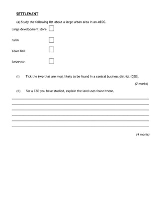
1. SETTLEMENT
(a) Study the following list about a large urban area in an MEDC.
Large development store
Farm
Town hall
Reservoir
(i) Tick the two that are most likely to be found in a central business district (CBD).
(2 marks)
(ii) For a CBD you have studied, explain the land uses found there.
………………………………………………………………………………………………………………………………………………………………
………………………………………………………………………………………………………………………………………………………………
………………………………………………………………………………………………………………………………………………………………
………………………………………………………………………………………………………………………………………………………………
………………………………………………………………………………………………………………………………………………………………
………………………………………………………………………………………………………………………………………………………………
(4 marks)
3. (i) Describe the problems caused by urban sprawl.
………………………………………………………………………………………………………………………………………………………………
………………………………………………………………………………………………………………………………………………………………
………………………………………………………………………………………………………………………………………………………………
………………………………………………………………………………………………………………………………………………………………
………………………………………………………………………………………………………………………………………………………………
………………………………………………………………………………………………………………………………………………………………
(4 marks)
(c) Study Figure 5, a sketch map of part of a shanty town.
4. (i) With reference to areas or cities you have studied, describe the problems of shanty
town and the attempts to solve them.
………………………………………………………………………………………………………………………………………………………………
………………………………………………………………………………………………………………………………………………………………
………………………………………………………………………………………………………………………………………………………………
………………………………………………………………………………………………………………………………………………………………
………………………………………………………………………………………………………………………………………………………………
………………………………………………………………………………………………………………………………………………………………
………………………………………………………………………………………………………………………………………………………………
………………………………………………………………………………………………………………………………………………………………
………………………………………………………………………………………………………………………………………………………………
………………………………………………………………………………………………………………………………………………………………
(6 marks)
(c) Study Figure 6, a sketch map of the site of Lincoln.
5. Explain how the site of Lincoln may have helped its development.
………………………………………………………………………………………………………………………………………………………………
………………………………………………………………………………………………………………………………………………………………
………………………………………………………………………………………………………………………………………………………………
………………………………………………………………………………………………………………………………………………………………
………………………………………………………………………………………………………………………………………………………………
………………………………………………………………………………………………………………………………………………………………
………………………………………………………………………………………………………………………………………………………………
………………………………………………………………………………………………………………………………………………………………
………………………………………………………………………………………………………………………………………………………………
………………………………………………………………………………………………………………………………………………………………
(6 marks)
(a) Study Figure 3, showing types of settlement in a hierarchy.
6. (i) Describe what Figure 3 shows about the numbers and sizes of settlements in a hierarchy.
........................................................................................................................
........................................................................................................................
........................................................................................................................
........................................................................................................................
(2 marks)
(ii) Describe the differences, other than size and number, between villages and cities.
........................................................................................................................
........................................................................................................................
........................................................................................................................
........................................................................................................................
........................................................................................................................
........................................................................................................................
........................................................................................................................
........................................................................................................................
(4 marks)
(b) Using one or more examples of cities in MEDCs, describe the changes taking place in the CBD
(Central Business District).
........................................................................................................................
........................................................................................................................
........................................................................................................................
........................................................................................................................
........................................................................................................................
........................................................................................................................
........................................................................................................................
........................................................................................................................
8. (iii) Using Figure 4, which continent has the greatest number of cities with populations over 5
million?
........................................................................................................................
(1 mark)
(iv) Explain the distribution of the cities shown in Figure 4.
........................................................................................................................
........................................................................................................................
........................................................................................................................
........................................................................................................................
........................................................................................................................
........................................................................................................................
........................................................................................................................
........................................................................................................................
(4 marks)
(d) Using one or more examples, explain how city planners in LEDCs are trying to solve the
problems of rapid growth.
........................................................................................................................
........................................................................................................................
........................................................................................................................
.......................................................................................................................
........................................................................................................................
........................................................................................................................
........................................................................................................................
........................................................................................................................
.......................................................................................................................
.......................................................................................................................
........................................................................................................................
(6 marks)
9. (a) Study Figure 4, which shows a number of settlement sites.
(i) What is the meaning of the term ‘site of a settlement’?
………………………………………………………………………………………………………………………………………………………………
………………………………………………………………………………………………………………………………………………………………
(1 mark)
A number of settlement sites are marked on Figure 4. On figure 4 label the following:
A gap town site;
A bridging point.
(2 marks)
10. (ii) Why are some of the settlements shown in figure 4 more likely than the others to
develop into trading centres?
………………………………………………………………………………………………………………………………………………………………
………………………………………………………………………………………………………………………………………………………………
………………………………………………………………………………………………………………………………………………………………
………………………………………………………………………………………………………………………………………………………………
………………………………………………………………………………………………………………………………………………………………
………………………………………………………………………………………………………………………………………………………………
(4 marks)
(b) Study figure 5, which shows a street map of part of the city of Gloucester.
(i) What is the meaning of the term ‘urban zone’?
………………………………………………………………………………………………………………………………………………………………
………………………………………………………………………………………………………………………………………………………………
………………………………………………………………………………………………………………………………………………………………
(2 marks)
11. (ii) Figure 5 is part of which urban zone?
…………………………………………………………………………………………………………………………
(1 mark)
(ii) Give two reasons for your answer to (b) (ii).
1……………………………………………………………………………………………………………………………………………………………
………………………………………………………………………………………………………………………………………………………………
2……………………………………………………………………………………………………………………………………………………………
………………………………………………………………………………………………………………………………………………………………
(2 marks)
(iii) Describe the main features of the outer suburbs of a settlement.
………………………………………………………………………………………………………………………………………………………………
………………………………………………………………………………………………………………………………………………………………
………………………………………………………………………………………………………………………………………………………………
………………………………………………………………………………………………………………………………………………………………
………………………………………………………………………………………………………………………………………………………………
………………………………………………………………………………………………………………………………………………………………
(4 marks)
(c) Study Figure 6, a scatter graph showing the link between the population and the number of
shops in some villages near Gloucester.
12. (i) On figure 6, draw the line of best-fit.
(ii) What is the relationship shown in Figure 6?
(iii)
………………………………………………………………………………………………………………………………………………………………
………………………………………………………………………………………………………………………………………………………………
(2 marks)
(d) Describe how governments of MEDCs try to cope with urban sprawl.
………………………………………………………………………………………………………………………………………………………………
………………………………………………………………………………………………………………………………………………………………
………………………………………………………………………………………………………………………………………………………………
………………………………………………………………………………………………………………………………………………………………
………………………………………………………………………………………………………………………………………………………………
………………………………………………………………………………………………………………………………………………………………
………………………………………………………………………………………………………………………………………………………………
………………………………………………………………………………………………………………………………………………………………
………………………………………………………………………………………………………………………………………………………………
(6 marks)
(a) (i) What is the meaning of the term ‘urban growth’?
................................................................................................................................................................................
................................................................................................................................................................................
..
(1 mark)
(b) Study Figure 4, on the next page, which shows why the city of Kolkata (Calcutta) has grown
as the result of migration and other factors.
13. (i) Using Figure 4, give two physical and two human factors that caused a growth in Kolkata’s
population.
Physical factors
1 ......................................................................................................................
........................................................................................................................
..
2 ......................................................................................................................
........................................................................................................................
..
14. Human factors
1 ......................................................................................................................
........................................................................................................................
..
2 ......................................................................................................................
........................................................................................................................
..
(4 marks)
(ii) Describe the effects of rapid growth on LEDC cities, such as Kolkata.
........................................................................................................................
........................................................................................................................
........................................................................................................................
........................................................................................................................
........................................................................................................................
........................................................................................................................
........................................................................................................................
........................................................................................................................
(4 marks)
(iii) Planners in LEDCs have tried many schemes to cope with the rapid growth of cities. Describe
the advantages and disadvantages of one or more of these schemes.
........................................................................................................................
........................................................................................................................
........................................................................................................................
........................................................................................................................
........................................................................................................................
........................................................................................................................
........................................................................................................................
........................................................................................................................
........................................................................................................................
........................................................................................................................
(6 marks)
15. (c) Compare an urban model of an MEDC city with one of a city in an LEDC. You may include a
diagram(s) in your answer.
........................................................................................................................
........................................................................................................................
........................................................................................................................
........................................................................................................................
........................................................................................................................
........................................................................................................................
........................................................................................................................
........................................................................................................................
........................................................................................................................
........................................................................................................................
........................................................................................................................
(6 marks)
(a) Study Figure 3, on the insert, maps of five British towns.
(i) Choose two of the following towns.
Henley-on-Thames Shrewsbury Carmarthen Leicester
Circle the two you have chosen.
Explain different advantages of the original site of each of your chosen towns.
1 ......................................................................................................................
........................................................................................................................
........................................................................................................................
........................................................................................................................
..
2 ......................................................................................................................
........................................................................................................................
........................................................................................................................
........................................................................................................................
..
(4 marks)
16. (ii) Suggest why Dorking has grown into a trading centre.
........................................................................................................................
........................................................................................................................
........................................................................................................................
........................................................................................................................
........................................................................................................................
........................................................................................................................
........................................................................................................................
(4 marks)
(b) Study Figure 4, which shows the population change of an inner city area in an MEDC
between 1901 and 2001.
Suggest reasons for the population changes shown on Figure 4.
........................................................................................................................
........................................................................................................................
........................................................................................................................
........................................................................................................................
........................................................................................................................
........................................................................................................................
........................................................................................................................
........................................................................................................................
........................................................................................................................
(4 marks)
17. (c) Bangkok is the capital of Thailand, an LEDC in South East Asia. Study Figure 5, a sketch map
of Bangkok.
Figure 5
(i) Suggest reasons for the distribution of the shanty towns in Bangkok.
........................................................................................................................
........................................................................................................................
........................................................................................................................
........................................................................................................................
........................................................................................................................
........................................................................................................................
........................................................................................................................
........................................................................................................................
(4 marks)
18. (ii) With the help of one or more examples, explain how the lives of people living in some shanty
towns have been improved.
........................................................................................................................
........................................................................................................................
........................................................................................................................
........................................................................................................................
........................................................................................................................
........................................................................................................................
........................................................................................................................
........................................................................................................................
........................................................................................................................
........................................................................................................................
........................................................................................................................
........................................................................................................................
........................................................................................................................
........................................................................................................................
........................................................................................................................
........................................................................................................................
........................................................................................................................
........................................................................................................................
........................................................................................................................
(9 marks)
(a) Study Figure 3, which shows the locations of newsagents and shoe shops in a city.
19. (a) Compare the distribution of newsagents and shoe shops in this city.
........................................................................................................................
........................................................................................................................
........................................................................................................................
........................................................................................................................
........................................................................................................................
........................................................................................................................
........................................................................................................................
........................................................................................................................
(4 marks)
(b) (i) What is the meaning of the term ‘settlement hierarchy’?
........................................................................................................................
........................................................................................................................
(1 mark)
(b) (ii) Give two ways that the number and types of services in a settlement can help to place it
in an urban hierarchy.
1 ......................................................................................................................
........................................................................................................................
..
2 ......................................................................................................................
........................................................................................................................
..
(2 marks)
(c) Explain how a settlement may change its function over time.
........................................................................................................................
........................................................................................................................
........................................................................................................................
........................................................................................................................
........................................................................................................................
........................................................................................................................
........................................................................................................................
........................................................................................................................
........................................................................................................................
(4 marks)
20. (d) The Central Business Districts (CBDs) of some cities in MEDCs are facing problems.
(i) Describe the problems affecting the CBDs of some cities in MEDCs.
........................................................................................................................
........................................................................................................................
........................................................................................................................
........................................................................................................................
........................................................................................................................
........................................................................................................................
........................................................................................................................
........................................................................................................................
(4 marks)
(d) (ii) Using a named urban area, describe what has been done to improve the CBD.
Name of urban
area ..................................................................................................................
........................................................................................................................
........................................................................................................................
........................................................................................................................
........................................................................................................................
........................................................................................................................
........................................................................................................................
........................................................................................................................
........................................................................................................................
......
(4 marks)
(d) Study Figure 4, on the insert, photographs of a shanty town in an LEDC.
21. Using Figure 4 and your own knowledge, explain why the conditions shown in the photograph are
found in shanty towns.
........................................................................................................................
........................................................................................................................
........................................................................................................................
........................................................................................................................
........................................................................................................................
........................................................................................................................
........................................................................................................................
........................................................................................................................
........................................................................................................................
........................................................................................................................
........................................................................................................................
........................................................................................................................
........................................................................................................................
(6 marks)