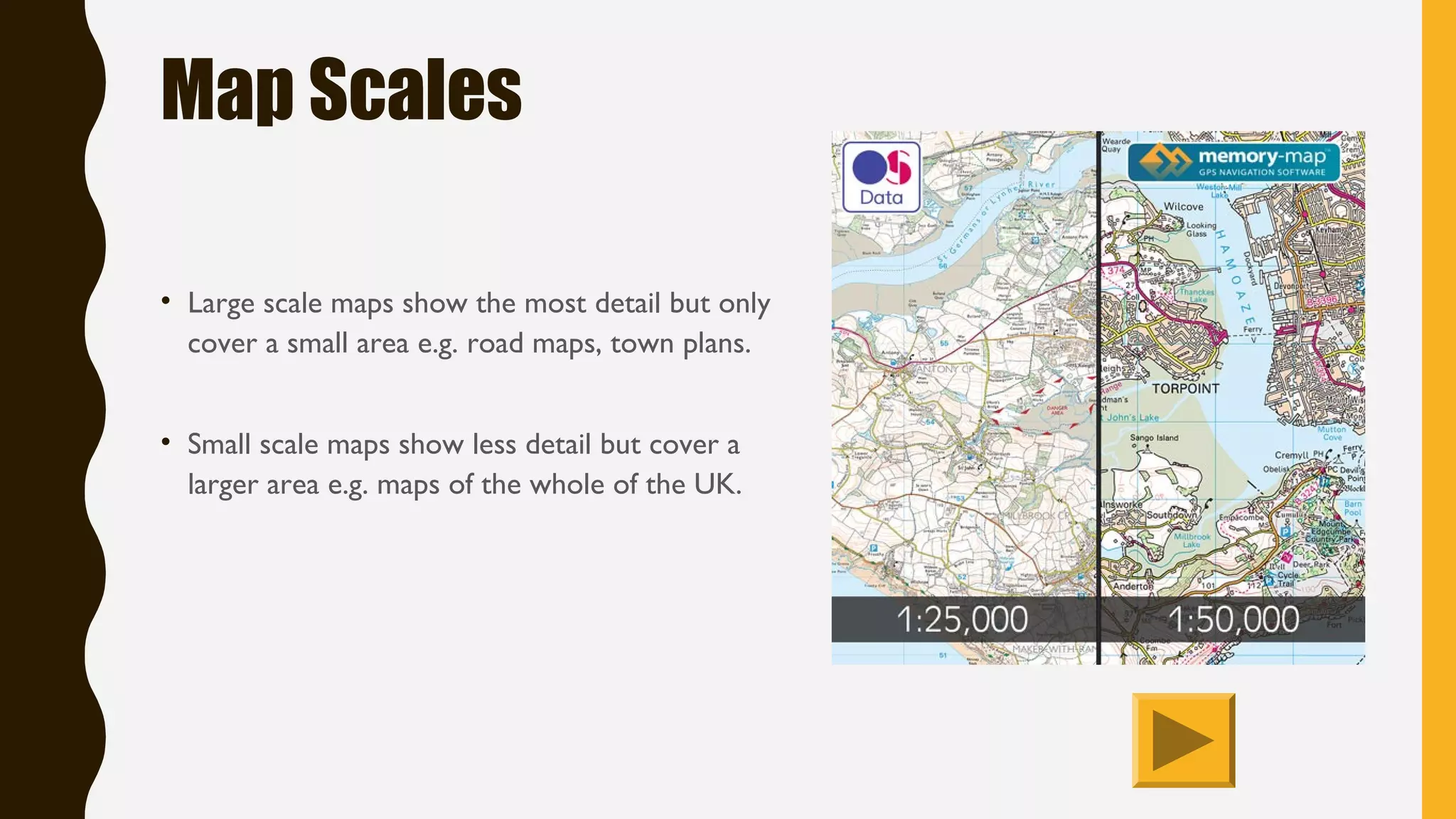
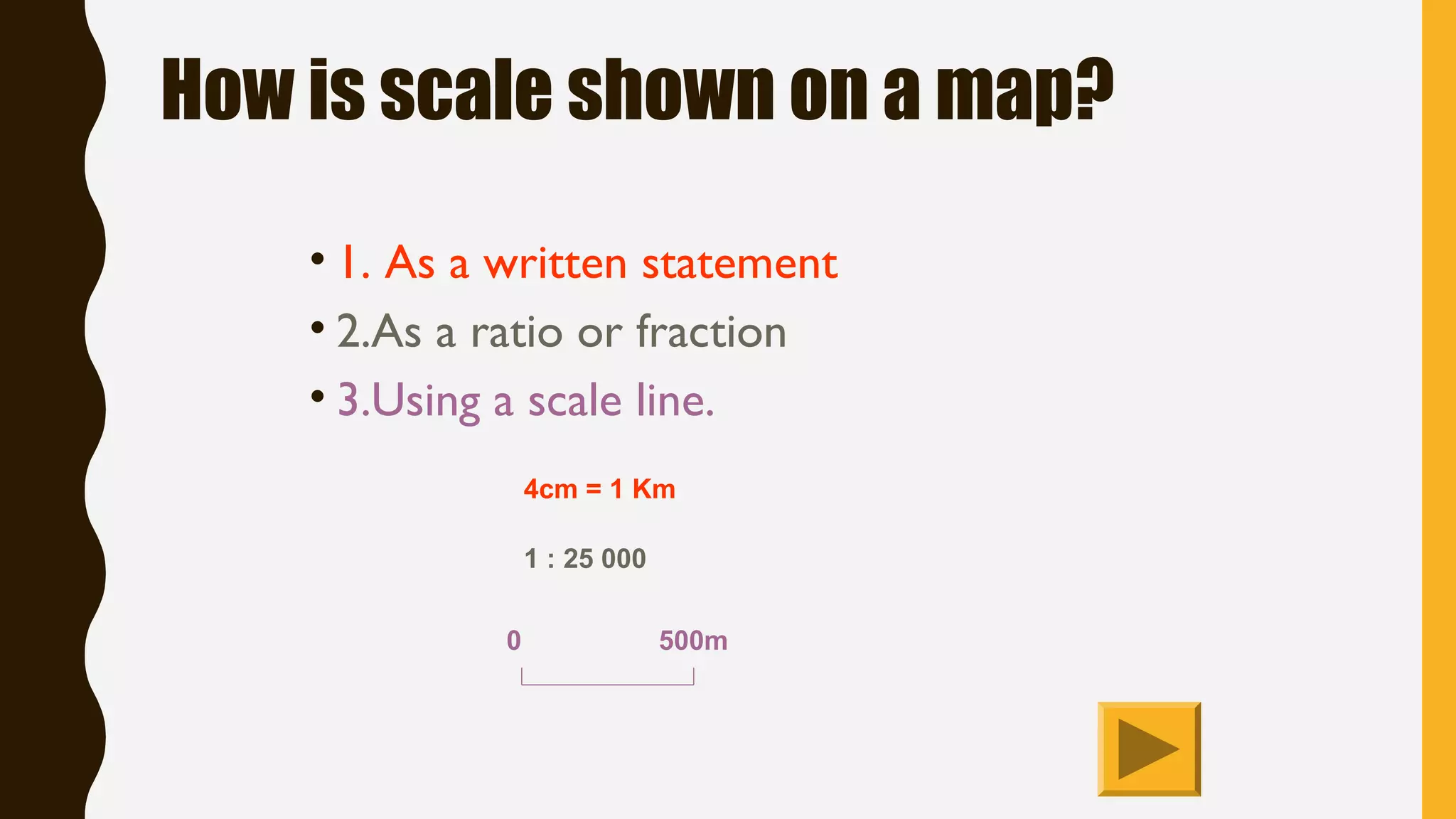


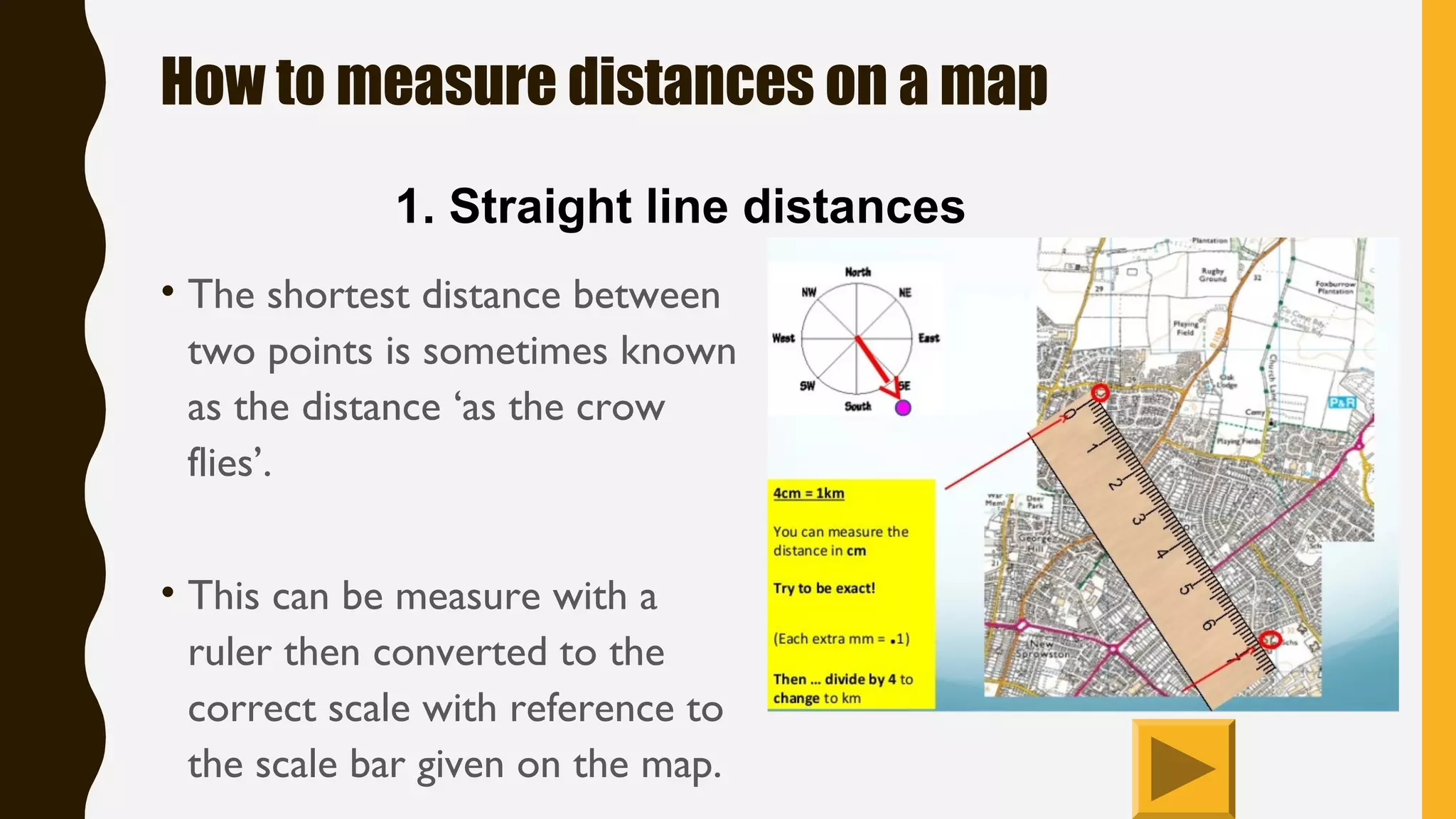
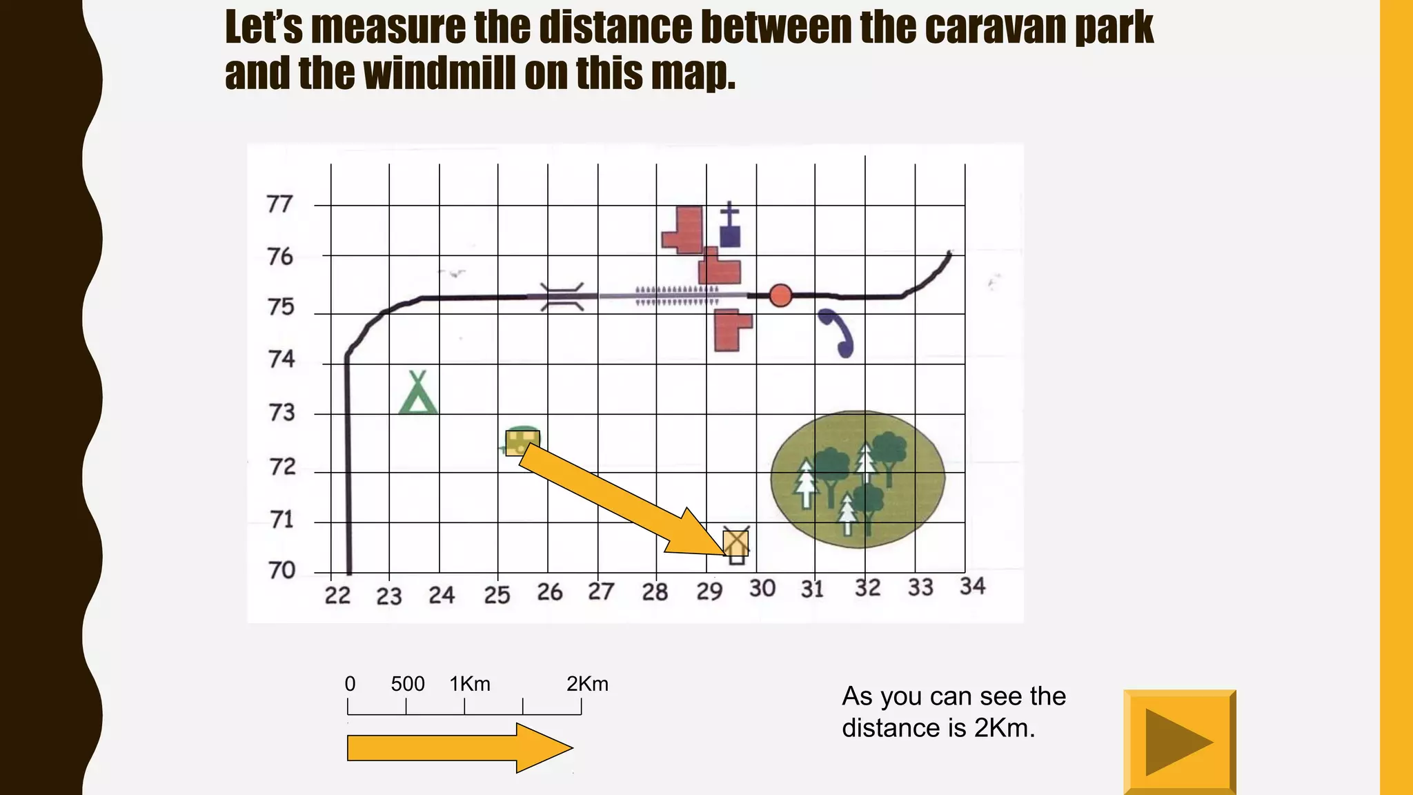

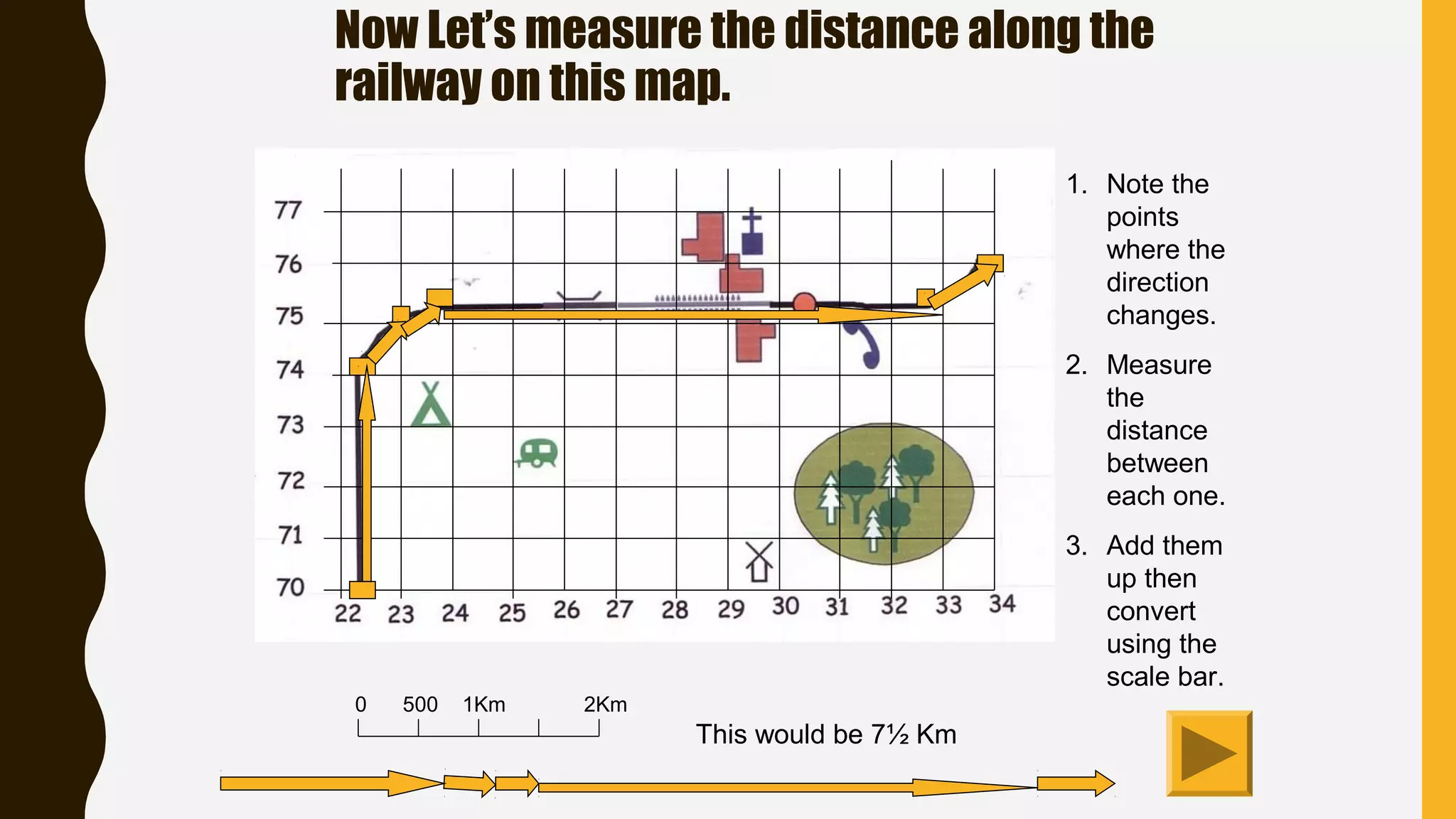


Large scale maps show more detail but cover smaller areas, while small scale maps show less detail but cover larger areas. Maps show scale using a written statement, ratio, or scale line. Scale lines indicate the relationship between distances on the map and in real life. To measure distances, you can measure straight lines directly on the map and convert using the scale. For curved distances, you lay a string along the route and measure total length to convert using the scale. Grid lines on Ordnance Survey maps always form 1km squares, with the scale determining square size on the map.