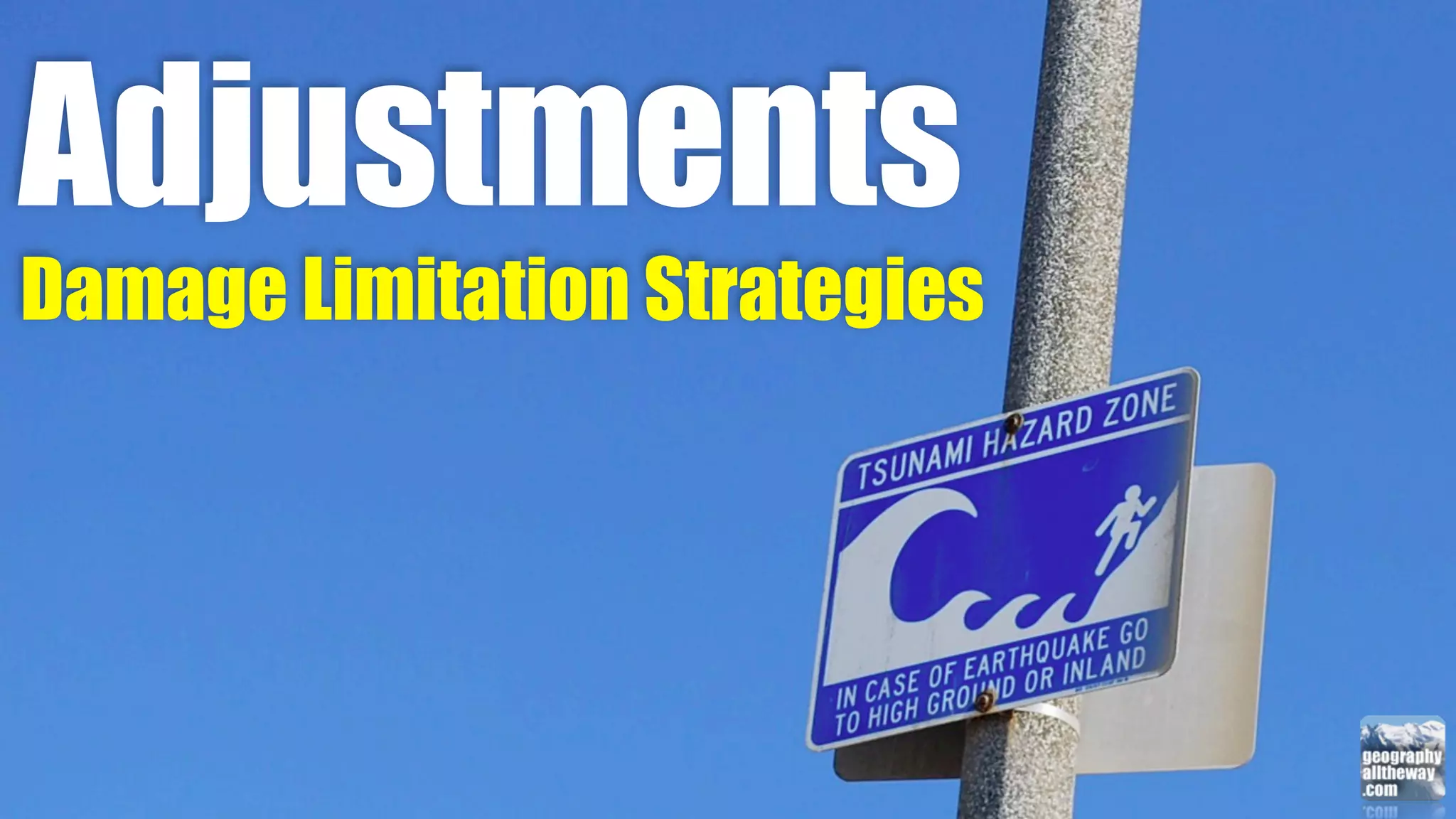
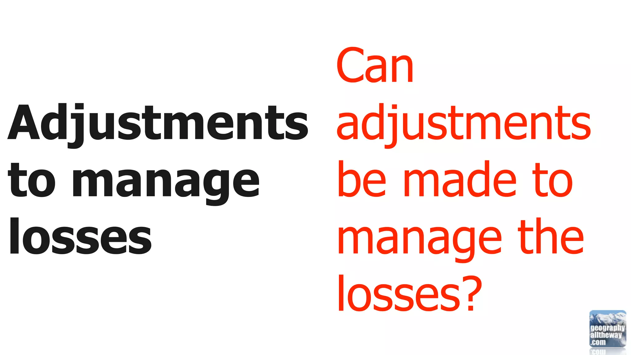
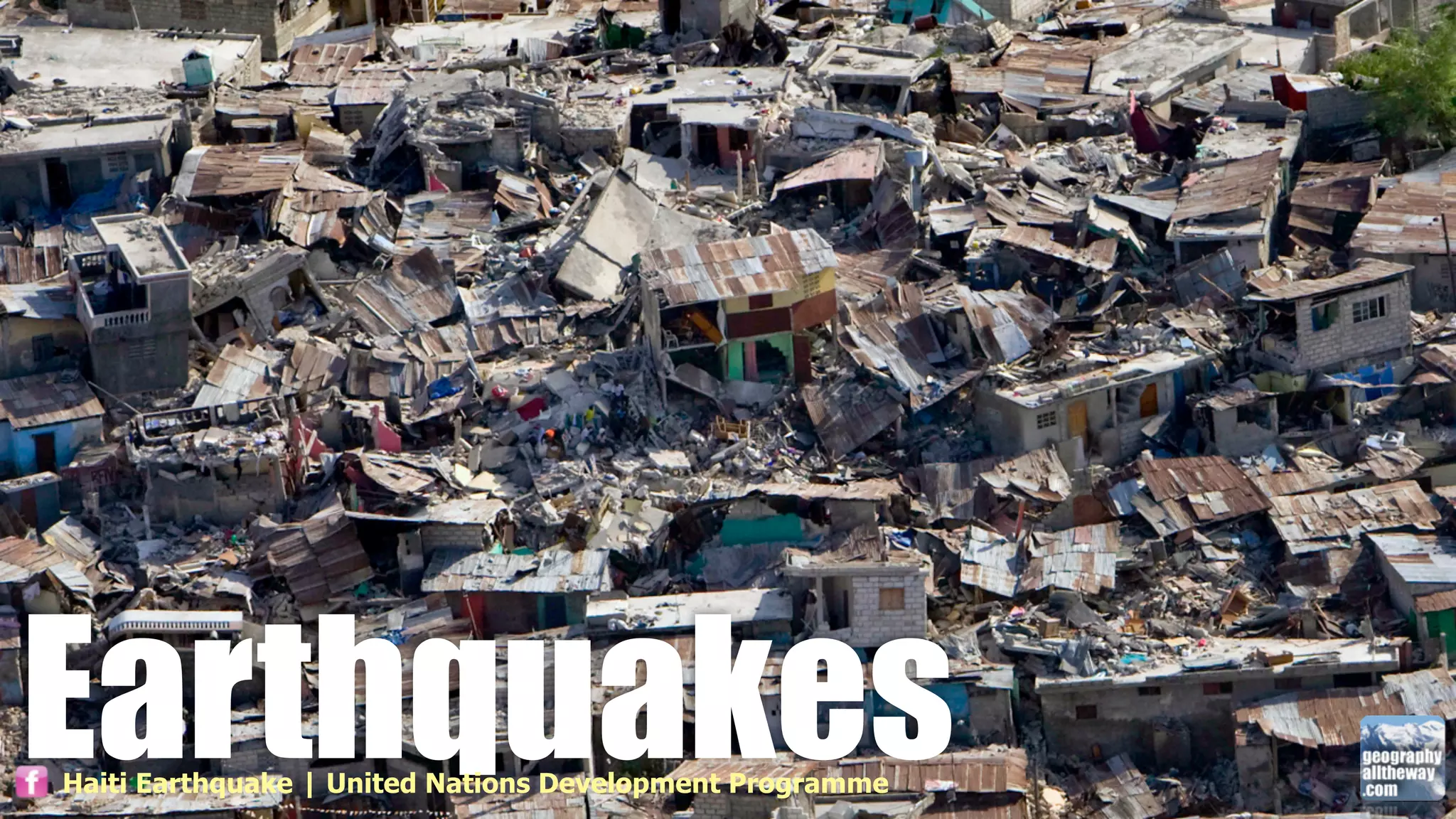
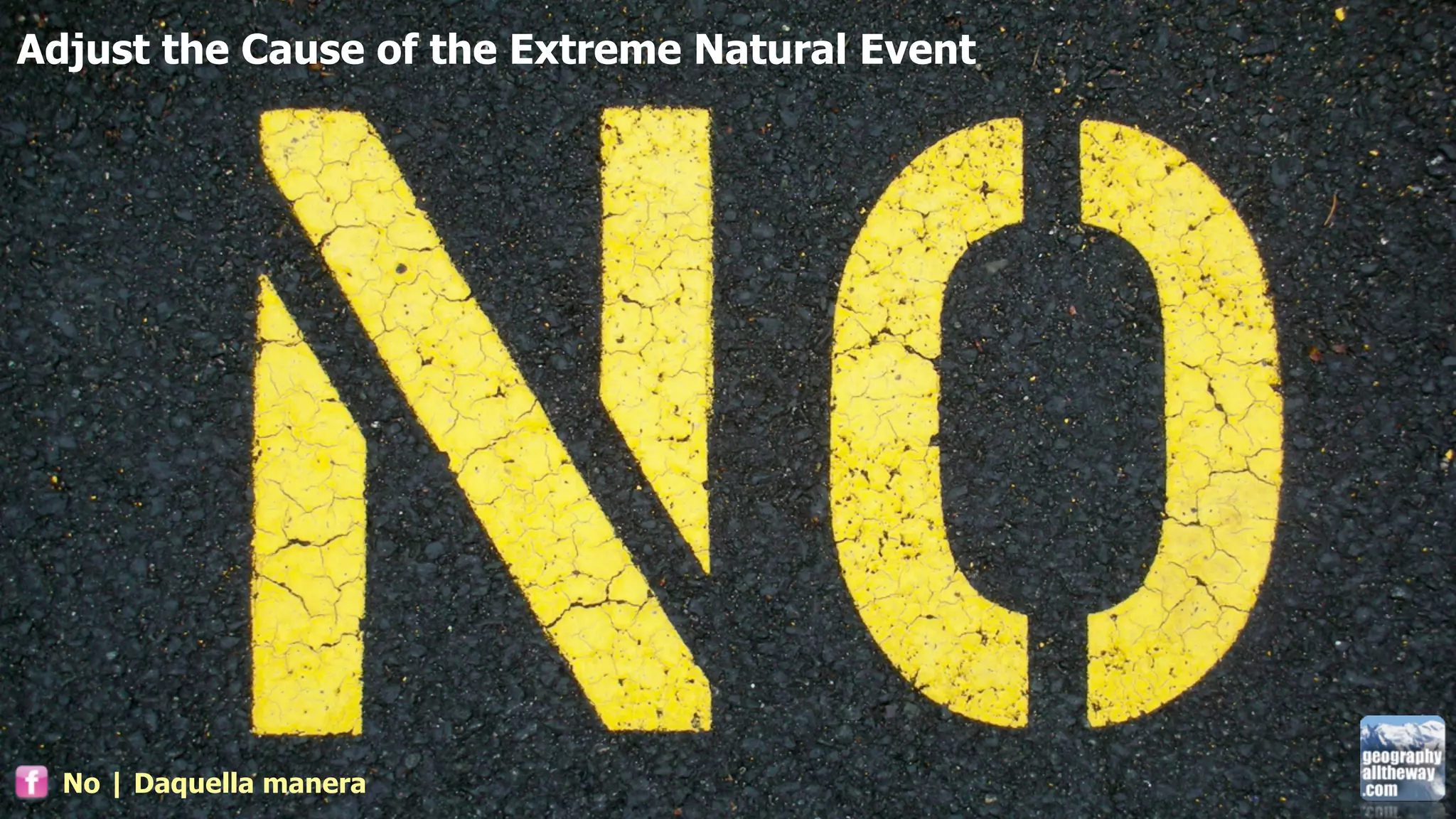
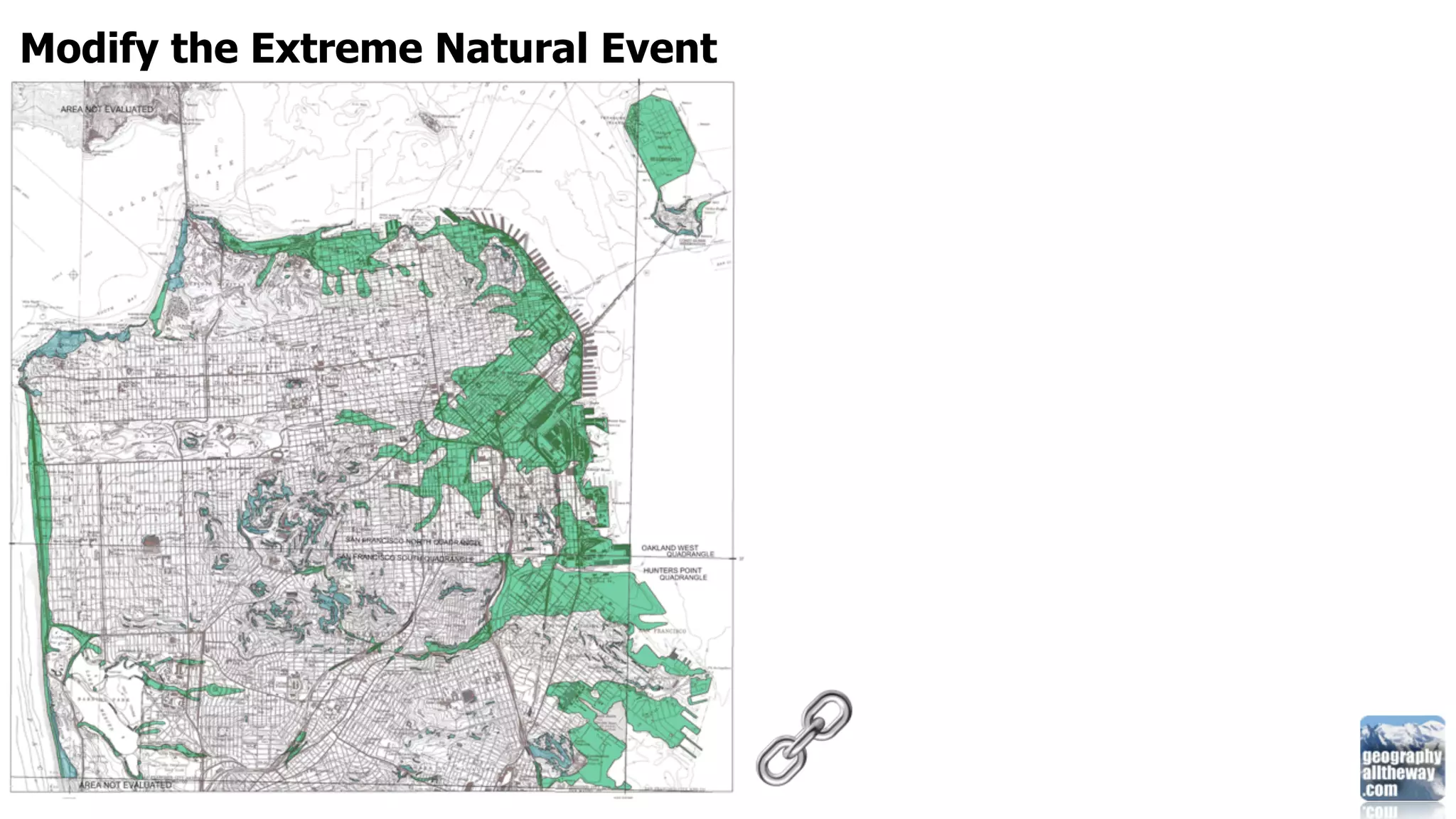
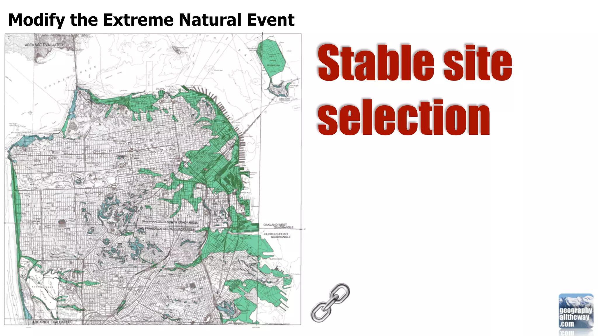
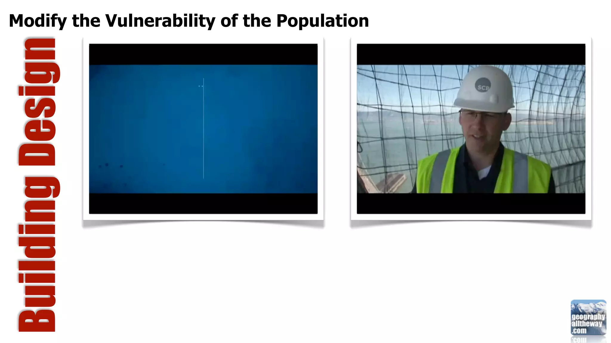
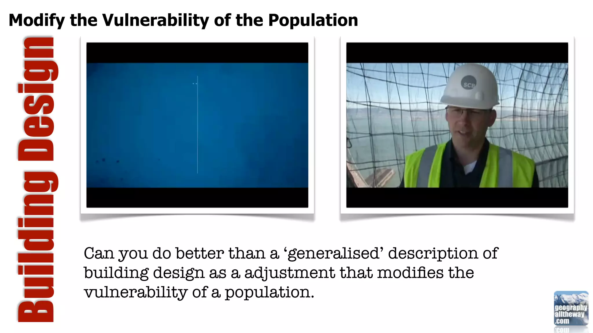
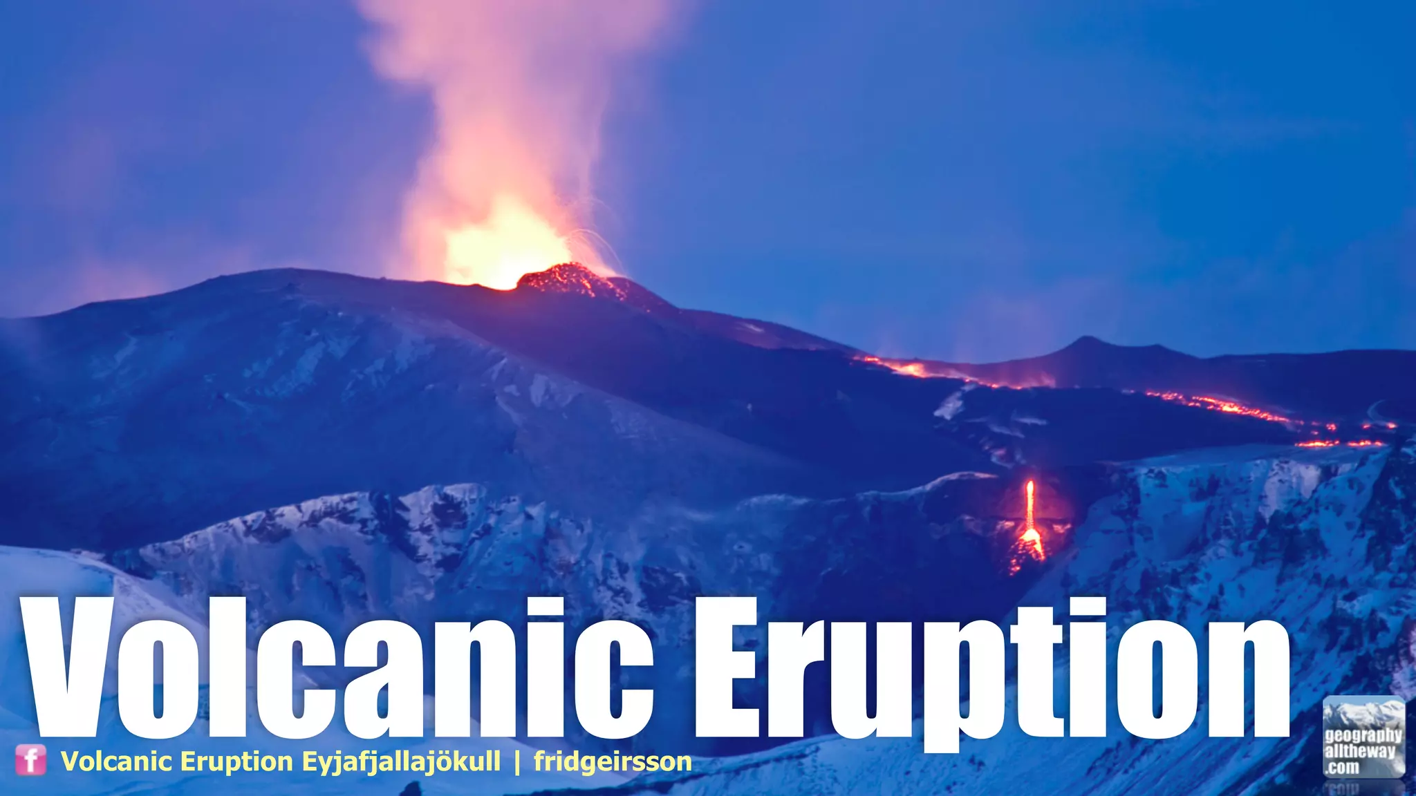
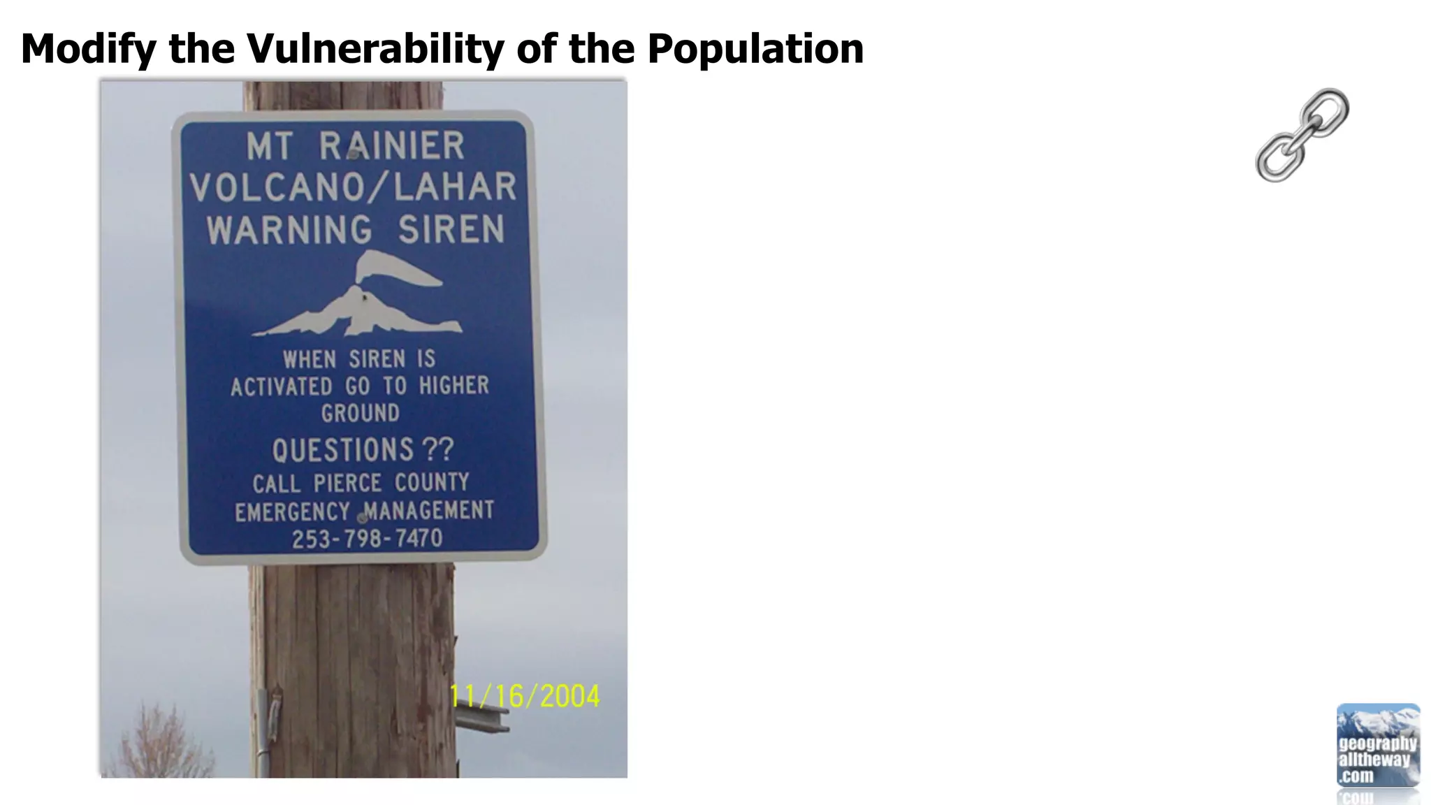
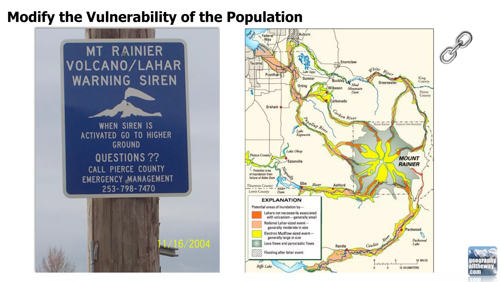
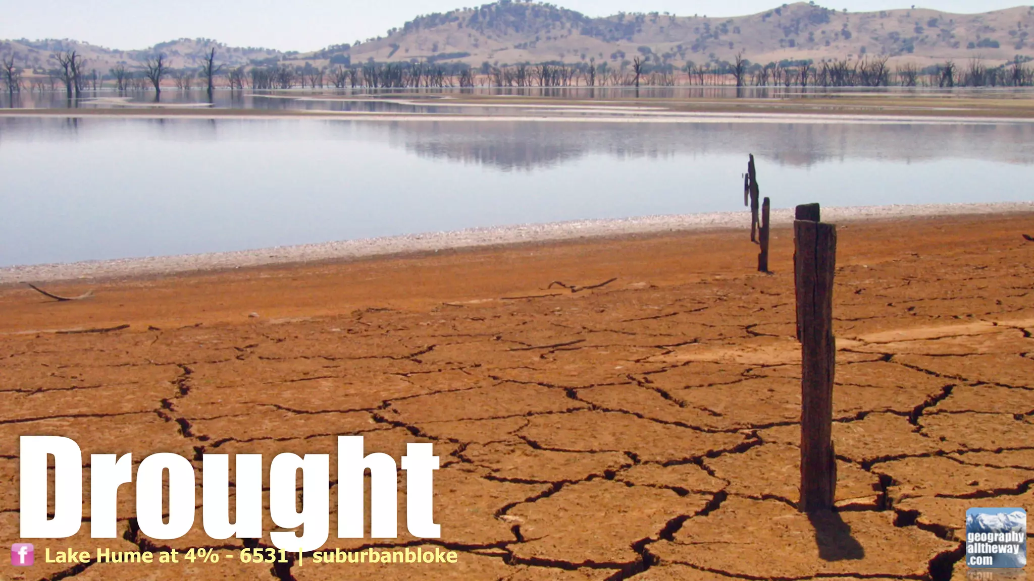
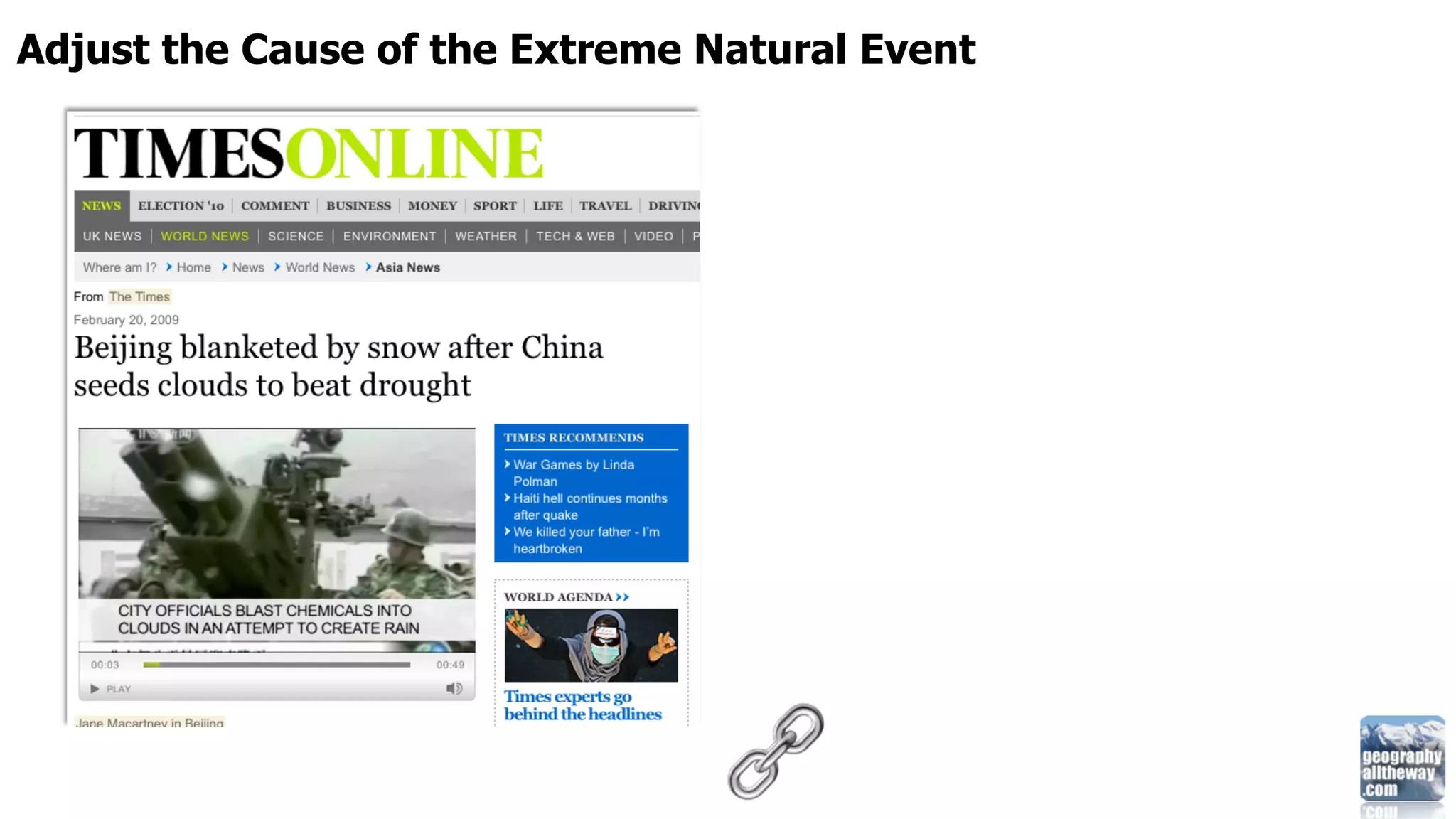
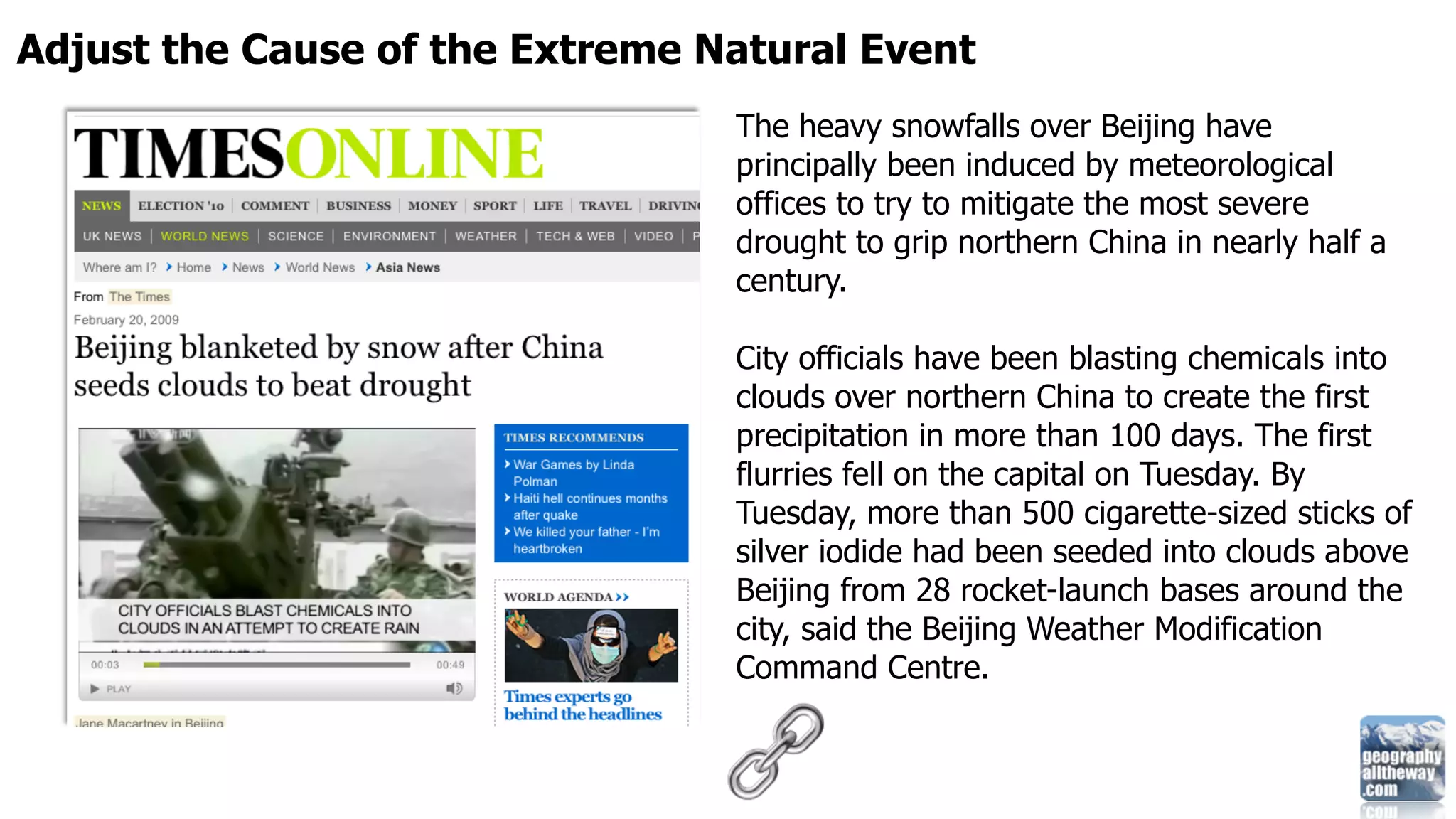
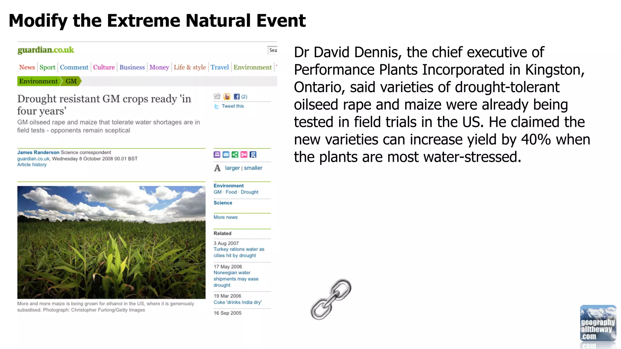
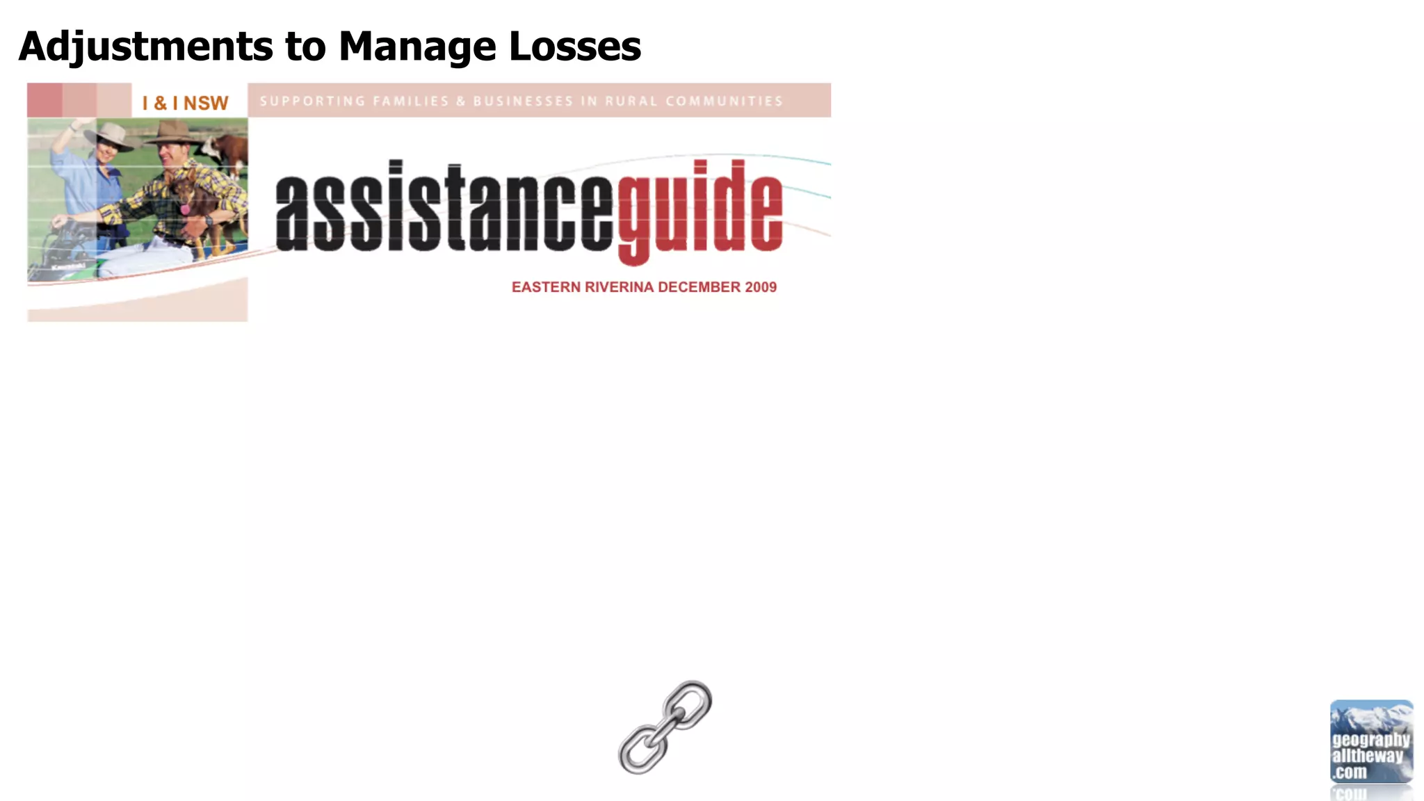
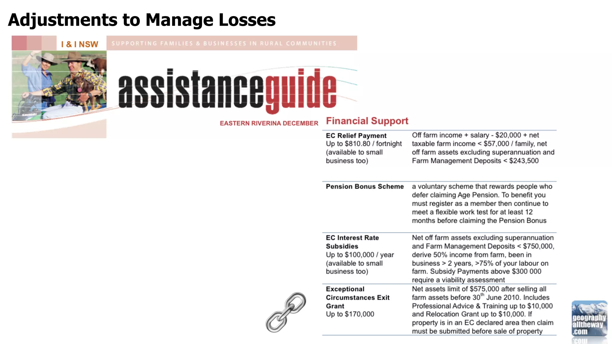
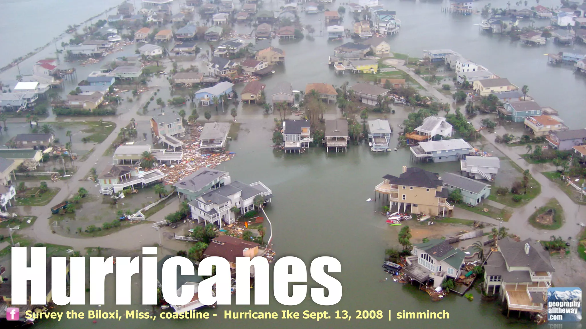
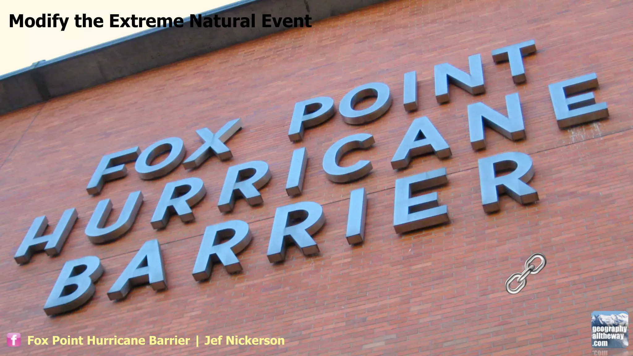
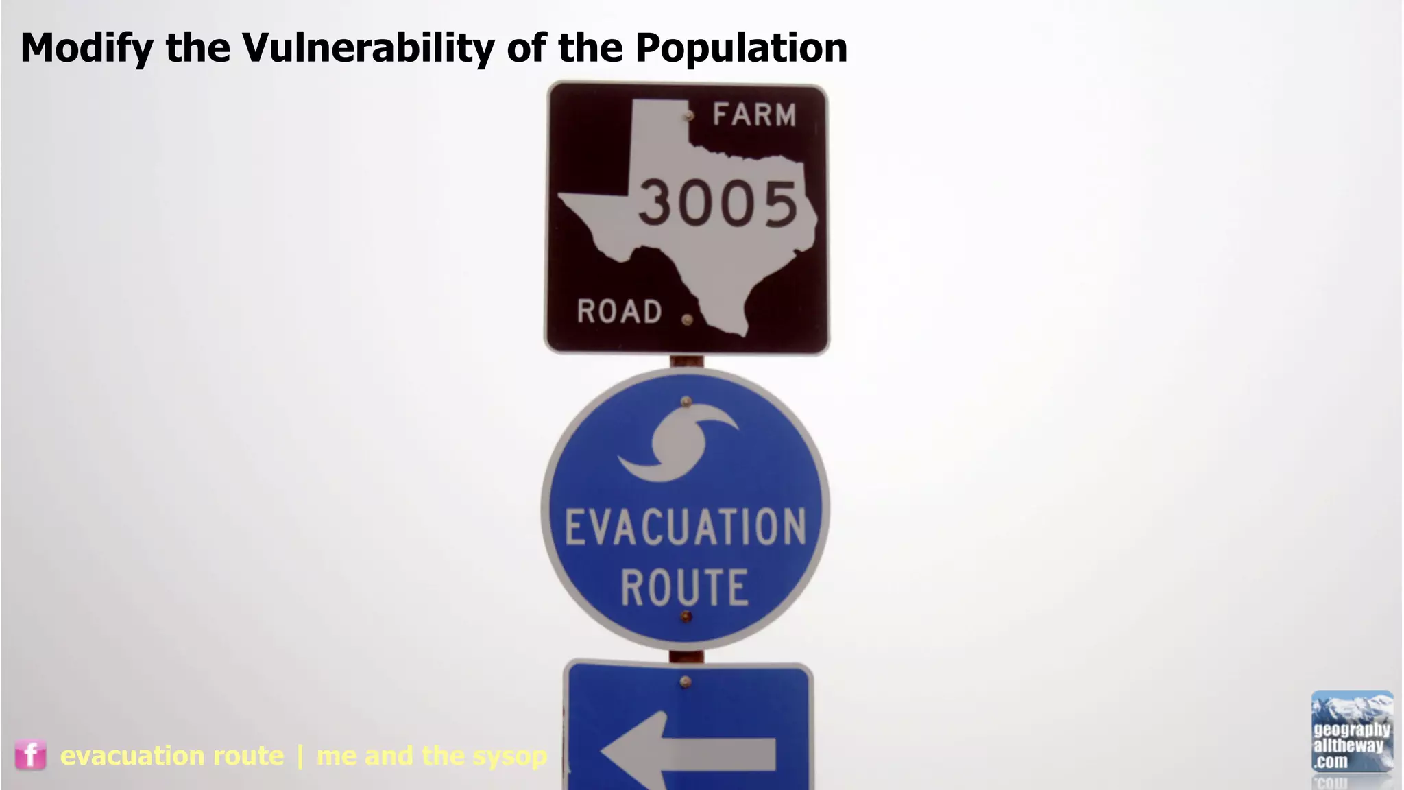
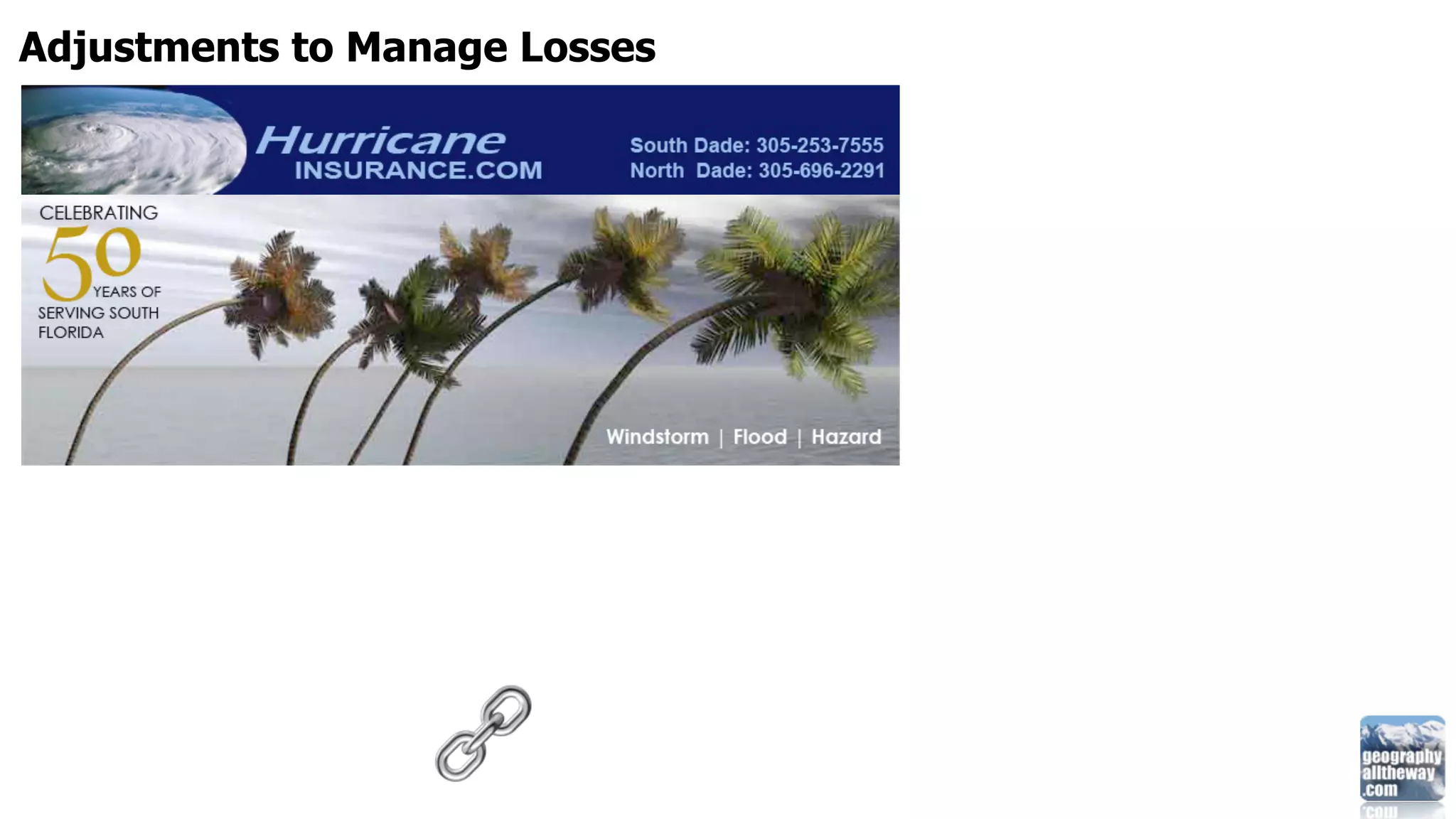
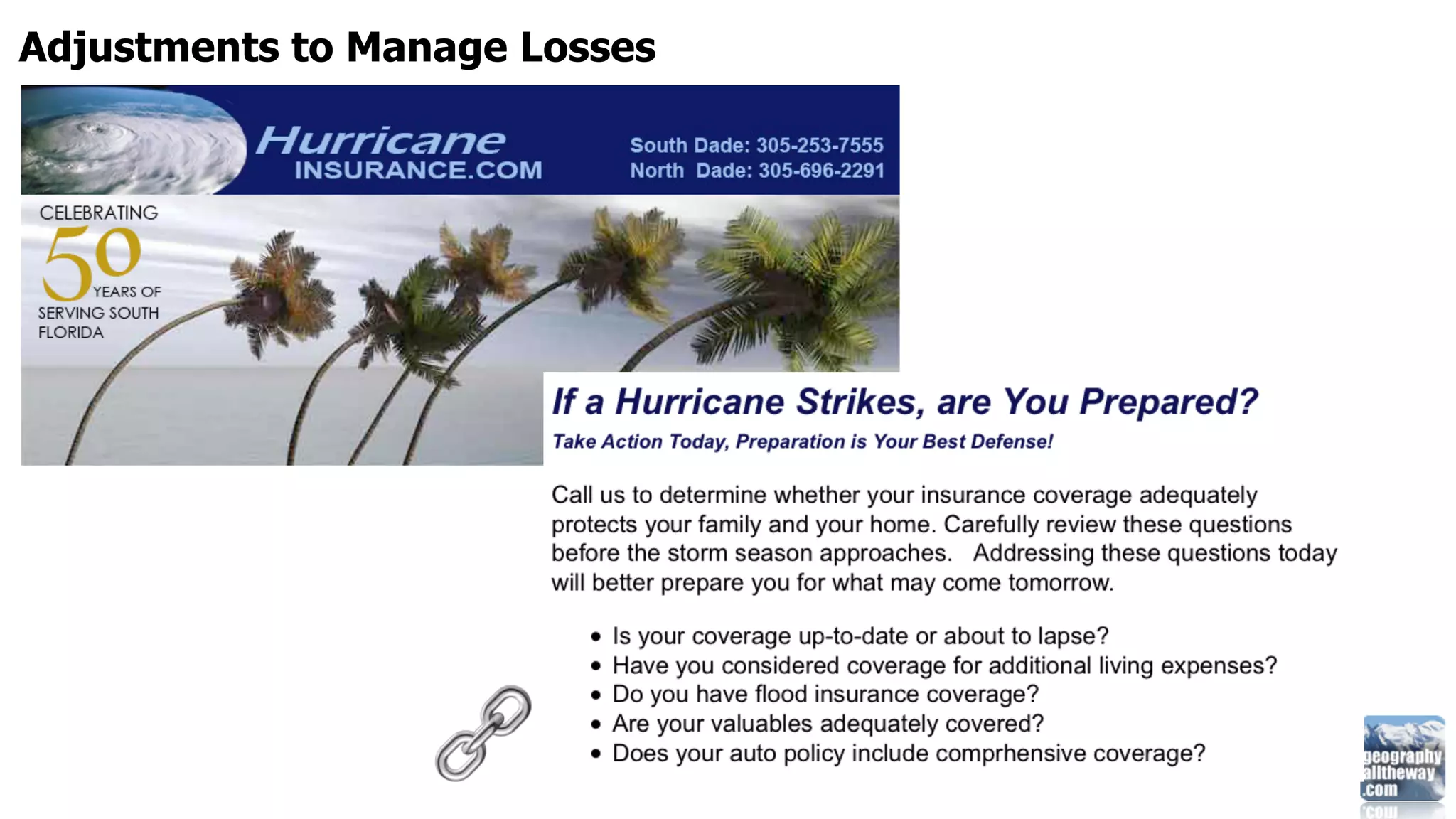
Damage limitation strategies for potential hazards and disasters include modifying the causes, impacts, and vulnerabilities. This involves actions such as cloud seeding to induce rainfall during droughts, developing drought-resistant crops, encouraging water conservation, constructing barriers to weaken hurricanes, and establishing evacuation routes. Adjustments can also be made to better manage resulting losses.
April 6th Presentation: Greenbelt Forest StewardsCHEARS
Here are the key things to assess regarding exposure:
- Sunlight - Note direction of sun exposure and hours of direct sun. This will help determine shade-loving vs. sun-loving plants.
- Wind - Assess prevailing wind directions and speeds. Strong winds may require wind tolerant species.
- Microclimates - Note any areas that receive more/less sun or rain due to structures or landforms. These microclimates allow for more plant diversity.
- Frost pockets - Low-lying areas prone to frost should be avoided for frost-sensitive plants.
Documenting exposure will help select plants adapted to the specific sun/shade, wind and temperature conditions on your site. This improves plant health
The document discusses how humans impact the environment and various environmental issues. It notes that as the human population has increased from 10 million to over 6 billion in 10,000 years, our impact on the environment has also increased. Some key environmental issues discussed include air and water pollution, global warming, soil damage, and ecosystem disruption which can harm biodiversity. Solutions mentioned are conservation efforts to protect habitats and restoration to repair damaged areas.
The document discusses WWF's 2009 campaign to raise awareness of environmental issues by portraying forests as the "Lungs of the Earth". The campaign aimed to educate people in rich countries about the effects of deforestation such as soil erosion, disrupted water cycles, loss of biodiversity, and climate change. It analyzes whether the campaign's portrayal of forests as lungs is like an anti-smoking campaign, and hopes to inform people of the severity of deforestation's consequences without taking a drastic approach.
Deforestation involves removing forests and trees to convert the land to other uses, and disrespecting nature can lead to environmental calamities. Past studies found that beach pollution was often limited to specific areas or occurred infrequently.
This document defines environmental hazards and identifies types of hazards. It discusses hazard and risk, defining hazard as a situation that poses a threat and risk as the likelihood of an adverse event. The document outlines types of environmental hazards including chemical, biological, physical, and geohazards. It discusses risk assessment as estimating potential harm and risk management as reducing risk. The document provides examples of chemical, biological, physical, and geohazard types and suggests preventing and mitigating hazards impacts.
Eva van Gorsel_The role of climate, disturbance and land management on water ...TERN Australia
This document discusses research on the role of climate, disturbance, and land management on water use and carbon uptake in a managed subalpine forest ecosystem. It finds that the forest's carbon and water exchanges are highly driven by climate factors like temperature, radiation, and precipitation on daily to annual timescales. Disturbances from insect damage and selective logging also impact the forest's carbon and water fluxes. The research aims to better understand how the forest ecosystem will respond to prolonged dry and wet periods under future climate conditions.
5th International Disaster and Risk Conference IDRC 2014 Integrative Risk Management - The role of science, technology & practice 24-28 August 2014 in Davos, Switzerland
Climate change is caused by both natural factors like changes in the sun's output as well as human activities that increase greenhouse gases. We know the climate is changing due to measurements of rising global temperatures and sea levels as well as observational records like ice cores. If greenhouse gases continue to increase, the impacts of climate change are projected to intensify and include more extreme weather, rising sea levels, and effects on human health, water resources, agriculture and forests. Individual actions as well as technological solutions will be needed to reduce emissions and mitigate the effects of climate change.
Paul found in Athens an altar with the inscription, “To an mercy on us. We have failed as stewards of your creation. We have
unknown god.” He proclaimed to them the unknown God they worshiped. polluted the air, land and water. We have wasted resources and
ignored the cries of your people in poverty. Forgive us for our
Leader: We gather today to proclaim the God who is known— complacency. Renew in us a sense of wonder for this good earth.
the Creator of heaven and earth. Inspire in us a spirit of caretaking. Guide our leaders to make wise
decisions to curb climate change. Strengthen communities suffering
All: Let us worship the God
Jimi Hendrix was a pioneering and innovative guitarist who distinguished himself in 1967 through his musical skills and showmanship, such as burning his guitar on stage. The document discusses Kiss the Sky, a Hendrix legacy event that will launch the first music seen from space to raise awareness about climate change. It will be a large reforestation project in Australia that empowers indigenous people to use traditional land management practices like controlled burns to reduce wildfires and emissions while protecting wildlife. The event has the support of Jimi Hendrix's brother and will feature his guitar-shaped controlled burns visible from space to honor Hendrix's legacy and address environmental issues.
The document defines key terms related to climate change and the environment. It provides definitions for afforestation, air, air pollution, agroclimatology, adverse effect, atmosphere, biodiversity, biomass, biomass energy, capacity, capacity building, carbon cycle, carbon dioxide, city climate, climate, climate change, climate hazard, deforestation, degradation, ecosystem, energy, environment, environmental degradation, eutrophication, global warming, greenhouse effect, habitat, humidity, land degradation, and pollution.
Environmental Hazards - A Few Humanistic SolutionsMuhammad Ashhar
Earth and the total of all surroundings of a living organism is our environment. Moreover, the very condition of environment is the reflection of human and non-human activities. In this era, due to mankind’s undue interference, safe environment is depleting day by day. We propounded a few safety measures against this calamity.
This document discusses sustainable landscape systems. It defines sustainable development as meeting present needs without compromising future generations' ability to meet their own needs. It discusses using landscape design practices like reducing compaction and using soil biology and compost to grow food naturally. Sustainable landscape plans should examine site conditions, identify issues, and implement designs using techniques like rain gardens and constructed wetlands to intercept stormwater flow and manage water sustainably.
[Challenge:Future] 'paper zero' for envisioned landlossChallenge:Future
The document proposes the idea of "Paper zero" to delay envisioned land loss from rising sea levels due to melting glaciers. Paper zero involves stopping the use of paper to save trees and shut down paper mills, reducing pollution and energy usage. This could avert land loss for several more years by controlling CO2 emissions, temperature rise, and glacial melting. Implementing paper zero would have positive environmental impacts and help ensure a greener future with safer fresh water supplies and controlled temperature rise.
The document discusses principles for sustainable landscape design that are plantwise, waterwise, and firewise. It notes that traditional landscapes provided ecosystem services but relied on unlimited resources. As climate change causes increases in temperature and carbon dioxide, the implications for agriculture and horticulture include greater selection for invasive species. The document advocates for a new landscape matrix that preserves regulating, provisioning, and cultural ecosystem services by following soilwise, waterwise, resourcewise, plantwise, peoplewise, and firewise principles.
Diane McClymont Peace, Environmental Health Research Division, First Nations and Inuit Health Branch, Health Canada. Presentation at the HOUSING REALITIES FOR INUIT 2012 WORKSHOP organized by Inuit Tuttarvingat of NAHO, February 16, 2012.
Causes of Species Extinction
There are several causes of species extinction according to the document. Hunting, trapping, habitat destruction, pollution, and overharvesting can all directly cause populations to decline and potentially go extinct. Indirect causes of extinction mentioned include climate change, water and air pollution, and human activities that destroy coastal and forest habitats. As human populations and activities increase, they place greater pressure on global biodiversity by contributing to problems like deforestation, pollution, and overexploitation of natural resources. Maintaining sustainable practices is important to prevent further species losses.
The document summarizes the Sustainable Sites Initiative, which provides standards for sustainable landscaping practices that can earn points in the LEED program. Some key points of the initiative include minimizing water and resource usage, controlling invasive species, increasing plant biomass to offset emissions, and using native plants to support biodiversity. It also emphasizes enhancing human health through views of nature, outdoor spaces for activity and gathering, and using landscaping like retention ponds as amenities. Overall, the initiative aims to restore natural systems, prioritize materials reuse and recycling, and support long-term sustainable site maintenance and operations.
The document provides design guidelines and recommendations for developing an ecotourism site at High Gate Organic Farm in Robin's Bay, Jamaica. Key points include:
- An environmental assessment was conducted of the farm site and surrounding watershed to identify significant landscapes and land uses.
- Design recommendations were developed for best practices in developing an ecotourism site that is environmentally sustainable and protects natural resources.
- A multidisciplinary team from the University of Minnesota and University of West Indies collaborated on the project to provide expertise and analysis to inform the ecotourism development.
1. The document discusses several environmental challenges facing California, including earthquakes caused by tectonic plates boundaries and the effects of climate change like drought and wildfires.
2. It provides information on major earthquake faults in California and how climate change is leading to more extreme weather.
3. The summary emphasizes that knowledge is key to safety and encourages assessing hazard risks, reducing carbon footprints, and taking mitigation and preparedness actions to safely adapt to disasters.
This document provides definitions for key terms related to conflicts in land management in the Cairngorms National Park. It discusses the fragile geology of the area including granite formations, corries, and glacial features. It also addresses the sensitive climate, biodiversity, fragmented approaches to land use, economic opportunities, and debates around increasing tourism and its environmental impacts. Managing these competing interests in a sustainable way that preserves the natural heritage and cultural values of the park is an ongoing challenge.
MGNREGA works can help address climate change through various environmental services. The livelihoods of rural poor are dependent on natural resources like land and water that are threatened by climate change. MGNREGA works like water conservation, land development, and afforestation can provide local benefits like groundwater recharge and soil fertility while also contributing to global climate change adaptation and mitigation. Over 80% of MGNREGA works are related to water, land and forestry conservation. These works can strengthen resilience of rural communities to climate change impacts and enhance carbon sequestration. MGNREGA can also help drought-proof smallholder agriculture through expanded irrigation potential and adoption of conservation technologies.
The document discusses human interaction with the environment through the extraction of resources like lignite, petroleum, iron ore, bauxite, lead, zinc, and nickel. It also mentions that deforestation has occurred which has reduced forest coverage and led to protests against the environmental impact.
Effect of climate change on biodiversity and ecosystemsaboosh2014
Climate change is causing problems like loss of glaciers, decreased ocean salinity, and changes to ocean currents and habitats. Warmer temperatures allow pine beetles to devastate forests without being killed off in winter. Coral bleaching and ecosystem death can occur as sea temperatures increase, and lower salinity ruins habitats. Ecologically rich areas like the Great Barrier Reef and Wet Tropics are at serious risk of biodiversity loss due to extreme weather. Once affected, coral reefs and tropical areas can take a long time to recover and may experience continued species loss. Humans and ecosystems are impacted by species loss through disrupted agriculture and food webs.
geographyalltheway.com - IB Geography - Patterns and Change Mega Mind MappingRichard Allaway
The document discusses various patterns related to population, development, environment, and resources. It addresses topics like Millennium Development Goals, core and periphery, populations in transition regarding birth/death rates and youth/aging populations, disparities in wealth and development, trade and factors influencing environmental quality and sustainability, and patterns in resource consumption focusing on conservation.
IB Geography - Global Interactions Concept MappingRichard Allaway
This document discusses various aspects of global interactions and globalization including economic, environmental, sociocultural, and political dimensions. It examines topics such as the globalization index, time-space convergence, flows of people, money and information, as well as cultural diffusion and anti-globalization movements. The document also explores how global trends impact the local level through concepts like glocalization and the interplay between globalized and non-globalized societies.
Geological, biological, and climate evidence support the theory of plate tectonics and that the continents were once joined together in a supercontinent called Pangaea. Geological evidence includes the matching continental edges of South America and Africa and volcanic and earthquake activity. Biological evidence includes the fossil of Mesosauraus found in similar rock formations in both South America and Africa. Climate evidence includes matching deposits of limestone along the coasts of continents that were once joined.
IB Geography: Patterns and Change > Ravenstein's LawsRichard Allaway
The document discusses several models of migration including Ravenstein's Laws and Lee's Migration Model. Ravenstein's Laws are a set of predictive statements about migration patterns in the UK in the 1880s, including that most migrants move short distances, people in rural areas migrate more than urban dwellers, and migration typically occurs in stages. Lee's Migration Model visually depicts the movement of people between locations and the impact of intervening obstacles.
The document discusses internal migration trends in China. It notes that 44% of China's population lived in cities in 2008, and projections estimate that urbanites will be the majority by 2015. Each year, the urban population swells by 15-20 million people through migration from rural areas seeking better jobs, which may constitute the largest peacetime migration in history. However, China's hukou system of household registration ties people to their place of birth, restricting migration and creating a "floating population" of 132 million migrant workers in 2006. While some local governments are relaxing the hukou system, it has historically maintained a large temporary migrant workforce rather than allowing permanent urbanization.
geographyalltheway.com - IB Geography: Neo-Malthusian and anti-MalthusianRichard Allaway
The document discusses two opposing views on the relationship between population growth and resource consumption:
1. Neo-Malthusians argue that population grows exponentially while resources increase arithmetically, eventually leading to overconsumption and collapse as advocated by Thomas Malthus, Paul Ehrlich, and the Club of Rome model.
2. Anti-Malthusians like Ester Boserup and Julian Simon believe that population pressure stimulates technological innovation and more efficient resource use, allowing food production and living standards to continue increasing indefinitely. They argue resources are not physically limited if old ones can be recycled and new alternatives developed.
IB Geography: Hazards and Disasters: Why people live in hazardous areasRichard Allaway
There are three main approaches to why people live in hazardous areas:
- Fatalistic Approach: People accept the risks as inevitable and believe hazards are out of their control. They lack alternatives due to economic reasons.
- Acceptance Approach: People accept the risks because the advantages of the area outweigh the costs, such as economic opportunities from tourism, agriculture, and extraction.
- Adaption Approach: People see they can prepare for and survive hazards through prediction, prevention and protection methods like modern technology and infrastructure that warn of and protect from disasters.
The Demographic Transition Model describes 5 stages of demographic change that occur as countries develop economically from pre-industrial to industrialized societies. In the first two stages, birth and death rates are high due to lack of modern medicine and sanitation. In the third stage, death rates decline as living standards rise, while birth rates remain high. In the fourth stage, birth rates fall due to family planning and women's education. The final stage is characterized by low birth and death rates and a stable population.
geographyalltheway.com - IB Geography - Global Interactions: KOF Index of Glo...Richard Allaway
The KOF Index of Globalization is an index published by the Swiss Economic Institute that measures the economic, social, and political dimensions of globalization for over 200 countries annually since 1970. It defines globalization as networks connecting actors across continental distances through flows of people, ideas, goods, and capital. The index scores countries on a scale from 0-100 based on economic, political, and social globalization indicators like trade, capital flows, embassy presence, and cultural exchanges.
The Deepwater Horizon oil rig exploded in the Gulf of Mexico 1,500 meters below the surface and 66 km off the coast of Louisiana, killing 11 workers. Over the next 36 hours, the rig burned and eventually sank, leaving a damaged wellhead that was leaking oil into the Gulf. For months, oil gushed from the wellhead at an estimated rate of up to 40,000 barrels per day, spreading across 1,500 square km of the Gulf and reaching the coasts of Louisiana, Florida, and elsewhere in the Gulf region due to ocean currents. The well was finally capped on July 15, over 80 days after the initial explosion.
Revision techniques student version 2013David Drake
This document provides several techniques for revising for GCSE and A-Level exams, including:
1) Making videos to summarize key points using a whiteboard or paper in an animated style.
2) Repeatedly reducing notes into smaller and smaller summaries to focus on main points.
3) Writing important concepts on sticky notes to place around your environment for frequent review.
4) Using mind maps to organize information and harness your brain's full creative skills.
The rural-urban fringe is the area where cities meet the countryside. Developers are increasingly interested in building on land here because it is cheaper and offers more space and easier access to roads and motorways compared to inner city locations. Common developments include housing, business parks, shops, and offices. While this provides more development opportunities, it can negatively impact the countryside and increase traffic and pollution issues. Governments try to manage growth at the rural-urban fringe through green belt policies and developing new towns to control urban sprawl and prevent overdevelopment of rural areas.
The document discusses flood prevention schemes for Boscastle, including an east side scheme, west side scheme, and catchment management. It looks at different approaches to flood prevention on the east and west sides of Boscastle and managing the overall catchment area to reduce flooding risks.
The document provides guidance on map skills for a geography exam, including how to interpret Ordnance Survey maps, use grid references, measure distances, describe features, and understand different map types. It explains how to analyze maps, aerial photographs, and compare map features. Key skills covered are reading map scales, symbols, relief, land use, settlement patterns, and using maps to describe patterns and distributions.
The document provides information about flooding in Bangladesh. It discusses five key reasons for frequent flooding: most land being less than one meter above sea level, monsoon weather, snowmelt from the Himalayas, cyclones in the Bay of Bengal, and two massive rivers flowing into the country. The flooding creates major issues for Bangladesh's large population, destroying homes and affecting livelihoods. Solutions such as flood shelters have been implemented to help manage the frequent flooding.
1) The document discusses the effect of climate change on water related disasters in Indonesia. It notes that climate change has led to increasing temperatures, more intense rainfall, rising sea levels and more extreme conditions like flooding and drought.
2) It outlines Indonesia's water resources law and the government's holistic approach to integrated water resources management that includes conservation, utilization and disaster control.
3) The document proposes strategies for mitigating and adapting to climate change impacts like improving water infrastructure, reforestation, and water management.
Sustainable Development Problems (pollution)nadia farhana
Here are the key effects of air pollution:
- Human Health Effects: Respiratory illnesses, heart disease, cancer, etc. Increased risk of premature death.
- Acid Rain: Caused by SOx and NOx emissions. Damages forests, lakes, buildings. Affects ecosystem.
- Climate Change: GHGs like CO2 trap heat in the atmosphere. Leads to global warming and climate change. Rising sea levels, stronger storms.
- Crop Damage: SO2, ozone and other pollutants damage crops and forests. Leads to food insecurity.
- Visibility Reduction: Particulate matter causes haze and reduces visibility, especially in cities. Affects transportation
When water damage strikes, trust the experts at Tidal Wave Restoration, Lilburn's premier restoration company. With a focus on quality workmanship and outstanding results, we deliver comprehensive water damage restoration services tailored to your specific needs. Our dedicated team utilizes state-of-the-art equipment and proven techniques to mitigate damage, dry affected areas, and restore your property efficiently. Experience peace of mind and exceptional service with Tidal Wave Restoration. Contact us today for top-quality water damage restoration services in Lilburn.
This PowerPoint presentation is made to elaborately explain the key elements of disaster management.It includes highlighted points and has all the necessary information and documents.
Climate change will have major impacts on water resources and society. While some impacts like heavier rainfall are more visible, changes like reductions in water supply and quality will also be significant. Vulnerability to climate change is determined by exposure to risks, sensitivity of systems, and adaptive capacity. India faces widespread poverty and many policy and community efforts are needed to build resilience, though many current responses only provide temporary relief. Adaptation is key to reducing the risks of climate change impacts on water and livelihoods.
This document discusses disaster management and provides information on different types of disasters, both natural and man-made. It defines disasters as hazards causing heavy loss of life, property, and livelihood. It then summarizes the main types of natural disasters like floods, cyclones, and droughts, and how they negatively impact people. Man-made disasters are also outlined, such as deforestation, terrorism, pollution, and wars. The effects of disasters on daily life and emergency systems are described. The need for and phases of disaster management - including prevention, mitigation, preparedness, response, and recovery - are defined. The role of information technology in disaster management is also summarized.
This document summarizes Sydney Water's climate change strategy to address risks from climate change and reduce greenhouse gas emissions. The strategy includes quantifying climate change risks, reducing emissions to become carbon neutral by 2020, and increasing infrastructure resilience. Key actions involve research, renewable energy, energy efficiency, carbon offsetting, and adapting water supplies and operations to climate change impacts like higher temperatures and more extreme weather.
This document provides definitions and terminology for concepts related to disaster risk reduction and management (DRRM) and climate change (CC) according to Philippine law and United Nations frameworks. It aims to help participants understand and properly apply these terms. The document defines key terms like hazard, vulnerability, capacity, prevention, mitigation, adaptation, and more. It also distinguishes between DRRM and CC, and explains the objectives of DRRM. Participants will use their understanding of these concepts to formulate a DRRM-CCAM plan for schools.
Presented by IWMI's Luna Bharati at 'Asia water-nomics: More GDP with less water & pollution' session at Stockholm World Water Week, on August 29, 2018.
The document defines key terms related to disaster risk reduction and management (DRRM) and climate change (CC). It presents agreed upon definitions from relevant authorities for hazards, disasters, risk, vulnerability, capacity, prevention, mitigation, preparedness, response, rehabilitation, reconstruction, recovery, resilience, climate change, greenhouse gases, adaptation and mitigation. The objectives are to understand and correctly apply DRRM and CC terminology and to formulate a DRRM-CCAM plan for schools based on understanding of concepts.
This document discusses climate change and the environment. It covers causes of climate change like deforestation and pollution. Effects include extreme weather and environmental degradation. Sustainable development aims to meet needs without harming future generations. Renewable alternatives to fossil fuels are mentioned like solar, wind and hydro energy sources. The document emphasizes the importance of environmental awareness and protection.
Flood alleviation options for the River Derwent are presented, including impacts and opportunities for each. Partnerships between local authorities, government agencies, and other groups could help implement solutions that have mutual objectives around flood management as well as other environmental gains. Funding availability may determine which scheme enhancements can proceed or what opportunities arise. Storage options, improved conveyance, and flood defenses are discussed at different locations in the catchment. Environmental assessments would be required for any implemented projects.
Kila training Material - session 5 b - മഹാത്മാ ഗാന്ധി ദേശീയ ഗ്രാമീണ തൊഴിലുറപ്പ് പദ്ധതി - കാലാവസ്ഥ വ്യതിയാനം വരുത്തുന്ന ദുരന്തങ്ങൾ തടയൽ - uploaded by T J Joseph Deputy Collector (retd), Kottayam -mob 9447464502
The document defines key terms related to disaster risk reduction and management (DRRM) and climate change (CC) according to relevant Philippine laws and international frameworks. It aims to present agreed upon definitions of DRRM and CC terms, help understand proper usage of terminology, and enable formulation of school DRRM-CCAM plans based on understanding of concepts. Key terms defined include hazard, disaster, risk, vulnerability, exposure, capacity, prevention, mitigation, preparedness, response, recovery, rehabilitation, reconstruction, resilience, climate change, greenhouse gases, adaptation, and mitigation.
The document defines key terms related to disaster risk reduction and management (DRRM) and climate change (CC). It aims to present agreed upon definitions from relevant authorities and frameworks. The objectives are to gain understanding of DRRM and CC terminology and be able to develop a DRRM-CCAM plan for schools based on comprehending these concepts and terms. Several natural and human-induced hazards are defined, as well as disaster, risk, vulnerability, capacity and other terms relating to prevention, mitigation, preparedness, response and recovery. Climate change and its causes are explained, along with terms like greenhouse gases, adaptation and mitigation.
Sustainable development on natural disaster problem (flood) Mohd Ayman
Floods are an overflow of water that covers normally dry land. Flooding has been a global issue over the past decade, displacing people and destroying assets. Floods impact communities through social, economic, and environmental consequences. Immediate effects include loss of life, property damage, and health issues, while longer term impacts disrupt infrastructure and services. Suggested solutions include better flood warning systems, modifying structures, constructing buildings above flood levels, protecting wetlands, and improving flood defenses. Challenges to implementing solutions include population growth, climate change effects like sea level rise, and deforestation.
The document provides an overview of disaster management for floods in India. It defines a disaster and flood, and classifies different types of natural and man-made disasters. It describes the four phases of disaster management: preparedness, response, recovery and mitigation. It outlines the public health impacts of floods and strategies for flood management in India, including both structural measures like embankments and non-structural measures like forecasting. It also discusses the development of disaster management in India over time and the roles of various agencies and civil engineers in flood management.
This document summarizes a demonstration project to restore Adventure Gut, an impaired stream in the US Virgin Islands. The project involved grading the stream to reconnect it to its floodplain, stabilizing banks, and revegetating the area. Monitoring was done through surveys and photos. The project aimed to demonstrate stream restoration techniques for impaired streams in the region and encourage further public projects. Key issues included thin soils, intermittent flows, and past land use impacts in the islands. Future work involves studying reference streams and increasing public awareness of restoration.
Similar to IB Geography: Adjustments > Damage Limitation Strategies (20)
geographyalltheway.com - IB DP Geography - Global Interactions: KOF Index of ...Richard Allaway
The KOF Index of Globalization was introduced in 2002 by the Swiss Economic Institute and measures the three main dimensions of globalization: economic, political, and social. The economic dimension focuses on trade, investment, and financial flows. The political dimension examines things like diplomatic relations and international organization membership. And the social dimension looks at data on personal contacts, information flows, and cultural proximity. Countries are given an overall index value from 0 to 100 based on these factors, with a higher score indicating greater levels of globalization.
IB Geography - Population Trends and Patterns GraphsRichard Allaway
The document contains graphs showing population trends such as birth rates, death rates, infant mortality rates, fertility rates, and life expectancy across various world regions from 1950 to 2010. Overall, birth rates have declined globally while death rates have also fallen. Infant and child mortality rates have significantly decreased worldwide over this period as well. Life expectancy has risen substantially.
Geographical Association Conference 2012 - 5 Countries ... All you need for I...Richard Allaway
This document discusses using case studies from five countries to teach the IB Geography syllabus. It suggests that five countries with contrasting levels of development could provide examples to illustrate all the key concepts in the course. It then provides guidance from the IB on defining and selecting appropriate case studies, examples, and focus countries. Several potential countries are listed that could fulfill the criteria of having youthful and aging populations, different policies, and represent different regions to teach about patterns and changes in development. Tools for further research on focus countries are also provided.
IB Geography - Food and Health Concept SquaresRichard Allaway
The document discusses the relationships between food, health, and related topics. It presents them as concept squares that show connections between food, balanced diets, disease prevention and treatment, lifestyle, income, trends in food and health since 1950, policymakers, food security, malnutrition, calorie intake, famine, availability of food, changes in agriculture, scientific innovation, the green revolution, the environment, social and economic factors, production and trade of food, subsidies, transnational corporations, food shortages, types of trade, sustainability, and energy efficiency.
IB Geography - Global Interactions - GlocalizationRichard Allaway
Globalization refers to the increasing interdependence of countries through cross-border transactions, capital flows, and technology diffusion. Glocalization emphasizes adapting global products and services to each local culture and market. For example, Taipei McDonald's sells shrimp burgers to appeal to local tastes. The level and rate of globalization adoption varies between places based on factors like economic development, market size, urban/rural contrasts, infrastructure, cultural acceptance, government policies, and local economic activity.
geographyalltheway.com - IB Geography - Food and Health - Prevention or Trea...Richard Allaway
Coronary heart disease is a major cause of death in the UK. Risk factors include high BMI, diabetes, smoking, poor diet, lack of exercise, stress, and family history. The British Heart Foundation is a charity focused on preventing heart disease through research, education, and support for patients. Prevention efforts target reducing obesity and smoking rates through public health initiatives and lifestyle changes.
geographyalltheway.com - IB Geography - The Bradshaw ModelRichard Allaway
The document describes how characteristics of a river channel change from upstream to downstream. It explains that discharge, occupied channel width, channel depth, and average velocity all increase downstream as the drainage basin and input to the river increases. Channel depth and width increase to accommodate higher discharges. Average velocity increases downstream because the river becomes more efficient with less contact with its bed and banks, shown by a higher hydraulic radius and lower channel bed roughness.
Uranium mining is a major industry and employer in Niger, with the country being the fourth largest producer globally in 2006. However, the mining poses challenges due to the harsh desert environment requiring infrastructure development and raising concerns about water usage and potential contamination. While mining provides economic opportunities, it has also led to population growth in mining towns and debates around its environmental impacts.
Geographical Conference 2011 - A teacher’s perspective of IB GeographyRichard Allaway
The document discusses the benefits of an IB Geography curriculum from a teacher's perspective. It outlines the IB learner profile which emphasizes developing internationally minded and principled students. It then discusses using a themed approach to syllabus delivery in Geography, with themes like human interaction and challenges. This approach engages students and enables flexibility compared to more linear models. Some benefits discussed for students include progressing their knowledge in a way that is not isolated and encourages change.
This document provides possible stimulus materials for an IB Geography exam, including maps and diagrams sourced from maps.grida.no. It suggests using maps and diagrams as potential sources for exam questions. The document is brief and does not provide much context around the purpose or format of the possible exam.
This document outlines an introduction session about geography's place in the International Baccalaureate. It includes an introduction by Simon Oakes on the IB and geography followed by Richard Allaway breaking down the geography course with practical suggestions. It concludes with an open floor for questions.
The document discusses the International Baccalaureate (IB) Diploma Programme, including its geography component. It notes that the IB DP is a globally recognized university entrance qualification offered in over 2,300 schools across 128 countries. The IB DP geography curriculum focuses on global issues, sustainability, and developing international perspectives. It involves studying core topics, optional themes, and global interactions, and is assessed through written exams and fieldwork.
Geographical Association Conference 2011 - geographyalltheway.com - Resourcin...Richard Allaway
This document outlines the agenda for an IB Geography workshop. It will cover the main textbook options A through D, additional supplemental materials, the top 10 online resources, and opportunities for professional development in IB Geography. Attendees will also have a chance to participate in a treasure hunt of online resources and enter a raffle for printed materials.
Japan's population is aging and declining, so the government is implementing policies and campaigns to encourage citizens to have more children. These include providing financial support for families with children through tax breaks and subsidies for health care, education, and paternity leave. Artificial insemination options are also being promoted as more affordable and accessible for couples struggling with fertility issues or who want children but lack a partner. Public messaging emphasizes that having children is now easier and more financially feasible due to these government programs.
Lee's Migration Model shows migration between two locations, Location A and Location B. It depicts factors that can push people to leave Location A or pull people to Location B, as well as intervening obstacles between the locations that may hinder migration. The model illustrates the complex interplay of forces that influence people's movement between locations.
A primary version of GeoCommand - Ash Cloud Shift produced and shared by Shane Speck.
http://www.geographyalltheway.com/recent-geography/geocommand-ash-cloud.htm
A free resource to support geography educators teaching about the recent Eyjafjallajoekull Eruption / Ash Cloud.
Explanation of how the video works within a lesson can be found here:
http://www.geogalot.com/experiences/2010/4/19/eyjafjallajoekull-eruption-ash-cloud-lesson-resources.html
http://www.geographyalltheway.com/recent-geography/geocommand-ash-cloud.htm
Red Cross and Red Crescent World Disaster Report - Selected Data TablesRichard Allaway
With 585 disasters, 2008 saw the lowest number of reported disasters of the decade according to data from EM-DAT/CRED. Some key highlights include:
- Disaster numbers were lowest in Asia, Europe, and Oceania as well as in highly developed and medium developed countries.
- Africa and the Americas accounted for more than their average share of disasters at 27% and 24% respectively.
- The number of people affected in Africa and Europe was the second lowest of the decade while the Americas saw the highest number affected over the 10-year period.
The document discusses using Google apps and provides examples of when they would be used. It suggests using Google Calendar to share important dates within a department and as a booking system for department laptops. It also provides examples of using Google Documents for collaborative writing, Google Forms to collect feedback and responses, and Google Presentations for collaborative projects.
The document discusses the history of technology use in education from the 19th century to present day. It also provides information on Google Apps, describing it as an online suite of applications for documents, spreadsheets, forms, presentations, calendar, sites and email. Some benefits of using Google Apps mentioned are cloud computing, ease of access and collaboration.
How to Fix the Import Error in the Odoo 17Celine George
An import error occurs when a program fails to import a module or library, disrupting its execution. In languages like Python, this issue arises when the specified module cannot be found or accessed, hindering the program's functionality. Resolving import errors is crucial for maintaining smooth software operation and uninterrupted development processes.
A Strategic Approach: GenAI in EducationPeter Windle
Artificial Intelligence (AI) technologies such as Generative AI, Image Generators and Large Language Models have had a dramatic impact on teaching, learning and assessment over the past 18 months. The most immediate threat AI posed was to Academic Integrity with Higher Education Institutes (HEIs) focusing their efforts on combating the use of GenAI in assessment. Guidelines were developed for staff and students, policies put in place too. Innovative educators have forged paths in the use of Generative AI for teaching, learning and assessments leading to pockets of transformation springing up across HEIs, often with little or no top-down guidance, support or direction.
This Gasta posits a strategic approach to integrating AI into HEIs to prepare staff, students and the curriculum for an evolving world and workplace. We will highlight the advantages of working with these technologies beyond the realm of teaching, learning and assessment by considering prompt engineering skills, industry impact, curriculum changes, and the need for staff upskilling. In contrast, not engaging strategically with Generative AI poses risks, including falling behind peers, missed opportunities and failing to ensure our graduates remain employable. The rapid evolution of AI technologies necessitates a proactive and strategic approach if we are to remain relevant.
Introduction to AI for Nonprofits with Tapp NetworkTechSoup
Dive into the world of AI! Experts Jon Hill and Tareq Monaur will guide you through AI's role in enhancing nonprofit websites and basic marketing strategies, making it easy to understand and apply.
How to Build a Module in Odoo 17 Using the Scaffold MethodCeline George
Odoo provides an option for creating a module by using a single line command. By using this command the user can make a whole structure of a module. It is very easy for a beginner to make a module. There is no need to make each file manually. This slide will show how to create a module using the scaffold method.
This slide is special for master students (MIBS & MIFB) in UUM. Also useful for readers who are interested in the topic of contemporary Islamic banking.
Physiology and chemistry of skin and pigmentation, hairs, scalp, lips and nail, Cleansing cream, Lotions, Face powders, Face packs, Lipsticks, Bath products, soaps and baby product,
Preparation and standardization of the following : Tonic, Bleaches, Dentifrices and Mouth washes & Tooth Pastes, Cosmetics for Nails.
Strategies for Effective Upskilling is a presentation by Chinwendu Peace in a Your Skill Boost Masterclass organisation by the Excellence Foundation for South Sudan on 08th and 09th June 2024 from 1 PM to 3 PM on each day.
Assessment and Planning in Educational technology.pptxKavitha Krishnan
In an education system, it is understood that assessment is only for the students, but on the other hand, the Assessment of teachers is also an important aspect of the education system that ensures teachers are providing high-quality instruction to students. The assessment process can be used to provide feedback and support for professional development, to inform decisions about teacher retention or promotion, or to evaluate teacher effectiveness for accountability purposes.
26. Modify the Vulnerability of the Population
Education
Can you do better than a ‘generalised’ description of
education as a adjustment that modifies the
vulnerability of a population.
31. Modify the Vulnerability of the Population
Building Design
Can you do better than a ‘generalised’ description of
building design as a adjustment that modifies the
vulnerability of a population.
46. Adjust the Cause of the Extreme Natural Event
The heavy snowfalls over Beijing have
principally been induced by meteorological
offices to try to mitigate the most severe
drought to grip northern China in nearly half a
century.
City officials have been blasting chemicals into
clouds over northern China to create the first
precipitation in more than 100 days. The first
flurries fell on the capital on Tuesday. By
Tuesday, more than 500 cigarette-sized sticks of
silver iodide had been seeded into clouds above
Beijing from 28 rocket-launch bases around the
city, said the Beijing Weather Modification
Command Centre.
48. Modify the Extreme Natural Event
Dr David Dennis, the chief executive of
Performance Plants Incorporated in Kingston,
Ontario, said varieties of drought-tolerant
oilseed rape and maize were already being
tested in field trials in the US. He claimed the
new varieties can increase yield by 40% when
the plants are most water-stressed.
51. Modify the Vulnerability of the Population
Change pool behaviour
Concentrate on keeping water in the pool. Try
the following:
• Discourage pool users from "bombing" and
continually getting out and jumping back into
the pool.
• Drip dry on the top step so that water goes
back into the pool.
• If you need to top up, get those who use the
pool to top up the water level with a bucket so
they're conscious of the amount of water
they've used.