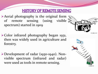
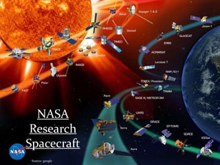
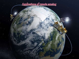
Remote means – far away ; Sensing
means – believing or observing or
acquiring some information.
Remote sensing means acquiring
information of things from a distance
with sensors. (without touching the
things)
 Sensors are like simple cameras except
that they not only use visible light but
also other bands of the electromagnetic
spectrum such as infrared, microwaves
and ultraviolet regions.
 Remote sensing
occurs at a distance
from the object or
area of interest. It
could be 1m, 1000m or
greater than 1 million
metres.
 Nowadays, remote
sensing is mainly
done from space using
satellites.
ENVISAT: Launched 1 March 2002
Source- google
 Remote Sensing is:
 “The art and science of obtaining information
about an object without being in direct
contact with the object” (Jensen 2000).
 India’s National Remote Sensing Agency (NRSA)
defined as : “Remote sensing is the technique of
deriving information about objects on the
surface of the earth without physically coming
into contact with them.”
Sea image, 26. Feb. 2000 by NASA (Source- google)
Sinnhuber & Bracher, Remote Sensing, University of Bremen, Summer 2008
Source- google
Photo taken
by crew of
Apollo 17
7 Dec 1972
(Source- google
(A) Energy Source or Illumination.
(B) Radiation and the Atmosphere.
(C) Interaction with the Target.
(D) Recording of Energy by the Sensor.
(E) Transmission, Reception, & Processing.
(F) Interpretation and Analysis.
(G) Application.
Source: Canadian Centre for Remote Sensing
Ground-based Airplane-based Satellite-based
(Source- CCRS pdf)
Ground-based sensors are often used to record
detailed information about the surface that is
compared with information collected from aircraft
or satellite sensors.
Aircrafts are often used to collect very detailed
images and facilitate the collection of data over
virtually any portion of the earth’s surface at any
time.
Satellite remote sensing is mainly used for digital
imaging technique.
Aerial photography is the original form
of remote sensing (using visible
spectrum) started in 1909
Color infrared photography began 1931,
then was widely used in agriculture and
forestry.
Development of radar (1930-1940). Non-
visible spectrum (infrared and radar)
were used as tools in remote sensing.
 After the first man-made satellite (Sputnik 1) was
launched on 4 October 1957 by Soviet Union, remote
sensing moved to outer space, ignited the Space
Race within the Cold War.
 The United States' Explorer 6 transmitted the first
space photograph of the Earth in August 1959.
 Hyperspectral remote sensing emerged (1980),
widely used in mineral, oil, etc. exploration
 Since then, a large number and advanced types of
remote sensing systems have been developed.
NASA
Research
Spacecraft
(Source- google
(Source- CCRS pdf)
Satellite and airborne images
are used as mapping tools to
classify crops, examine their
health and viability, and monitor
farming practices. Agricultural
applications of remote sensing
include the following:
 crop type classification
 crop condition assessment
 crop yield estimation
 mapping of soil characteristics
 mapping of soil management practices
 compliance monitoring (farming practices)
Canada Centre for Remote Sensing
In Forestry International and domestic
forestry applications where
remote sensing can be
utilized include
 sustainable development,
 biodiversity monitoring
 deforestation, reforestation monitoring
and managing,
 commercial logging operations,
 shoreline and watershed protection,
 biophysical monitoring (wildlife habitat
assessment) etc.
Canada Centre for Remote Sensing
 Remote sensing is used as a tool to
extract information about the land
surface structure, composition or
subsurface.
 Radar provides an expression of surface
topography and roughness. Geological
applications of remote sensing include
the following:
 surficial deposit / bedrock mapping
 lithological mapping
 structural mapping
 sand and gravel (aggregate) exploration/
exploitation
 mineral exploration
(KS Geological Survey)
Hydrology is the study of water on
the Earth's surface, whether
flowing above ground, frozen in ice
or snow, or retained by soil.
Examples of hydrological
applications include:
 wetlands mapping and monitoring,
 soil moisture estimation,
 measuring snow thickness.
 determining snow-water equivalent,
 river and lake ice monitoring,
 flood mapping and monitoring,
 glacier dynamics monitoring.
water on the Earth's surface
Sea Ice
Land use applications involve
both baseline mapping and
subsequent monitoring, since
timely information is required to
know what current quantity of
land is in what type of use and to
identify the land use changes
from year to year.
Land use applications of remote
sensing include the following:
 natural resource management
 wildlife habitat protection
 baseline mapping for GIS input
 urban expansion.
from maps.google.com
Agricultural
Efficiency
Air Quality
Water
Management
Disaster
Management
Carbon
Management
Aviation
Ecological
Forecasting
Invasive Species
Coastal
Management
Homeland
Security
Energy
Management
Public Health
Remote Sensing and GIS - B. Bhatt
Fundamentals of Remote Sensing - A Canada
Centre for Remote Sensing Remote Sensing
Tutorial.
Introduction to Remote Sensing - By Gregory
Vandeberg Assistant Professor of Geography (ND
GIS Users Workshop Bismarck).
Remote Sensing - Bjorn-Martin Sinnhuber and
Astrid Bracher
Remote Sensing and its Application

Remote Sensing and its Application

  • 2.
    Remote means –far away ; Sensing means – believing or observing or acquiring some information. Remote sensing means acquiring information of things from a distance with sensors. (without touching the things)  Sensors are like simple cameras except that they not only use visible light but also other bands of the electromagnetic spectrum such as infrared, microwaves and ultraviolet regions.
  • 3.
     Remote sensing occursat a distance from the object or area of interest. It could be 1m, 1000m or greater than 1 million metres.  Nowadays, remote sensing is mainly done from space using satellites. ENVISAT: Launched 1 March 2002 Source- google
  • 4.
     Remote Sensingis:  “The art and science of obtaining information about an object without being in direct contact with the object” (Jensen 2000).  India’s National Remote Sensing Agency (NRSA) defined as : “Remote sensing is the technique of deriving information about objects on the surface of the earth without physically coming into contact with them.”
  • 5.
    Sea image, 26.Feb. 2000 by NASA (Source- google)
  • 6.
    Sinnhuber & Bracher,Remote Sensing, University of Bremen, Summer 2008 Source- google Photo taken by crew of Apollo 17 7 Dec 1972 (Source- google
  • 7.
    (A) Energy Sourceor Illumination. (B) Radiation and the Atmosphere. (C) Interaction with the Target. (D) Recording of Energy by the Sensor. (E) Transmission, Reception, & Processing. (F) Interpretation and Analysis. (G) Application. Source: Canadian Centre for Remote Sensing
  • 8.
  • 9.
    Ground-based sensors areoften used to record detailed information about the surface that is compared with information collected from aircraft or satellite sensors. Aircrafts are often used to collect very detailed images and facilitate the collection of data over virtually any portion of the earth’s surface at any time. Satellite remote sensing is mainly used for digital imaging technique.
  • 10.
    Aerial photography isthe original form of remote sensing (using visible spectrum) started in 1909 Color infrared photography began 1931, then was widely used in agriculture and forestry. Development of radar (1930-1940). Non- visible spectrum (infrared and radar) were used as tools in remote sensing.
  • 11.
     After thefirst man-made satellite (Sputnik 1) was launched on 4 October 1957 by Soviet Union, remote sensing moved to outer space, ignited the Space Race within the Cold War.  The United States' Explorer 6 transmitted the first space photograph of the Earth in August 1959.  Hyperspectral remote sensing emerged (1980), widely used in mineral, oil, etc. exploration  Since then, a large number and advanced types of remote sensing systems have been developed.
  • 12.
  • 13.
  • 14.
    Satellite and airborneimages are used as mapping tools to classify crops, examine their health and viability, and monitor farming practices. Agricultural applications of remote sensing include the following:  crop type classification  crop condition assessment  crop yield estimation  mapping of soil characteristics  mapping of soil management practices  compliance monitoring (farming practices) Canada Centre for Remote Sensing
  • 15.
    In Forestry Internationaland domestic forestry applications where remote sensing can be utilized include  sustainable development,  biodiversity monitoring  deforestation, reforestation monitoring and managing,  commercial logging operations,  shoreline and watershed protection,  biophysical monitoring (wildlife habitat assessment) etc. Canada Centre for Remote Sensing Canada Centre for Remote Sensing
  • 16.
     Remote sensingis used as a tool to extract information about the land surface structure, composition or subsurface.  Radar provides an expression of surface topography and roughness. Geological applications of remote sensing include the following:  surficial deposit / bedrock mapping  lithological mapping  structural mapping  sand and gravel (aggregate) exploration/ exploitation  mineral exploration (KS Geological Survey)
  • 17.
    Hydrology is thestudy of water on the Earth's surface, whether flowing above ground, frozen in ice or snow, or retained by soil. Examples of hydrological applications include:  wetlands mapping and monitoring,  soil moisture estimation,  measuring snow thickness.  determining snow-water equivalent,  river and lake ice monitoring,  flood mapping and monitoring,  glacier dynamics monitoring. water on the Earth's surface Sea Ice
  • 18.
    Land use applicationsinvolve both baseline mapping and subsequent monitoring, since timely information is required to know what current quantity of land is in what type of use and to identify the land use changes from year to year. Land use applications of remote sensing include the following:  natural resource management  wildlife habitat protection  baseline mapping for GIS input  urban expansion. from maps.google.com
  • 19.
  • 20.
    Remote Sensing andGIS - B. Bhatt Fundamentals of Remote Sensing - A Canada Centre for Remote Sensing Remote Sensing Tutorial. Introduction to Remote Sensing - By Gregory Vandeberg Assistant Professor of Geography (ND GIS Users Workshop Bismarck). Remote Sensing - Bjorn-Martin Sinnhuber and Astrid Bracher